
Scan the QR code and open PeakVisor on your phone
The Boston Mountains include 1,041 named peaks. The highest is Turner Ward Knob at 748 m. Other notable peaks include Garrett Mountain, Isaac Knob and Reeves Mountain.
Located in the Ozarks, the Boston Mountains cover roughly 5,770 square miles (14,944 sq km) of rugged, mountainous terrain across the US states of Arkansas and Oklahoma. The portion of range that extends into Oklahoma is referred to as the Cookson Hills. There are 1041 named mountains in the Boston Mountains, the highest and most prominent of which is Turner Ward Knob (2,454 ft/748 m).
The Boston Mountains form the southernmost and highest part of the Ozark Plateau (also known as the Ozark Mountains or Ozarks), a heavily forested group of highlands that extend across five states – Missouri, Arkansas, Oklahoma, Kansas, and Illinois.
Geographically, the Boston Mountains extend northward from the Arkansas River Valley in a rectangular shape that’s about 20 to 35 miles (52 to 91 km) wide and 200 miles (518 km) long.
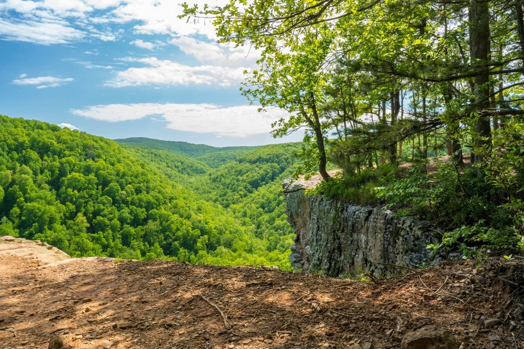
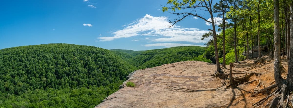
In northwest Arkansas, the Boston Mountains offer some of the greatest relief of any mountain range between the Appalachian Mountains and Rocky Mountains. They contain many peaks over 2,000 feet (610 m) in elevation, including Turner Ward Knob and Garrett Mountain, as well as several 500 to 1,550-foot-deep (152 m to 472 m) valleys.
Many of the tallest peaks in the Boston Mountains lie in the Ozark National Forest in northwest Arkansas. Together, the Ozark National Forest, in northwest Arkansas, and St. Francis National Forest, in eastern Arkansas, are managed as the Ozark-Saint Francis National Forest, which encompasses 1.2-million acres (4.9 million ha) of rugged terrain.
Several major waterways flow from the Boston Mountains. In Arkansas, the principal streams and rivers in the range include the Mulberry Creek, Big Piney Creek, Buffalo River, Little Red River, White River, and Kings River. To the south, the Arkansas River Valley separates the Boston Mountains from the Ouachita Mountains.
The Boston Mountains contain two state parks—Devil’s Den State Park and Lake Fort Smith State Park.
Though it’s not uncommon for the Boston Mountains to be referred to as a mountain range, they were not formed by a traditional mountain-building process. Unlike the nearby Ouachita Mountains, which serve as a prime example of traditional mountain building, very little folding and faulting has occurred in the Boston Mountains.
Rather, the Boston Mountains region is a deeply dissected plateau, in which numerous streams have cut deep, narrow valleys. The rocks that formed the Boston Mountains originated as sand, silt, and the remnants of marine animals laid down in a shallow sea at the beginning of the Paleozoic era, about 542 million years ago.
As the sea level and environment changed in the range over time, the sand layers became sandstone, silt layers became shale and siltstone, and shells and corals became limestone.
During the Late Paleozoic era, the region experienced a broad geologic uplift. The ancient coastline in the region was elevated high above sea level and a large, dome-shaped plateau was formed as a result.Over time, waterways have eroded the plateau, leaving behind the steep-sided mountains, sheer bluff faces, and impressive valleys that we see to this day.
The Boston Mountains lie in the Ozark Mountain Forests ecoregion, which is bounded by the Ozark Highlands Mixed Forests, the Mississippi Lowland Forests, the Piney Woods, the Cross-Timbers Savanna-Woodland ecoregions.
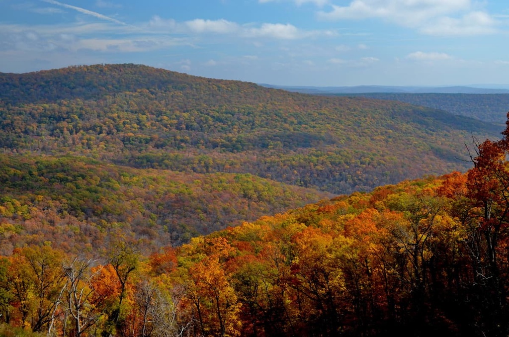
Red oak, white oak, and hickory remain the dominant vegetation types in this region, though shortleaf pine and eastern red cedar can also be found in lower elevation areas and on some south and west facing slopes.
The Boston Mountains sustain a variety of wildlife, including black bears, white-tailed deer, and elk. Small mammals known to frequent the area include mice, chipmunks, and squirrels. Otters, minks, beavers, and muskrats are also known to inhabit the region’s many waterways.
The Ozark Plateau region has been inhabited by a number of Indigenous communities for thousands of years. Hand tools and other artifacts found in the region provide evidence that people of the Paleo-Indian culture, which are regionally known as Bluff Dwellers, lived here during the last major glaciation between 12,000 to 14,000 years ago.
Though many Indigenous communities consider the Ozark Plateau region to be their ancestral homelands, when seventeenth-century Europeans first arrived in northern Arkansas, most of the area was considered Osage hunting territory. Though the Osage people generally lived in villages in what’s now southwest Missouri, the Osage were traditionally highly dependent on buffalo hunting and, as a result, they made frequent forays into northwest Arkansas.
Between the 1780s and 1840s, the Cherokee were forced to relocate to northern Arkansas and Oklahoma from Georgia, eastern Tennessee, and western North Carolina and South Carolina due to increasing expansion of Euro-American settlement and the passage of laws like the Indian Removal Act of 1830.
Early French and Spanish colonists initially established a reciprocal relationship with the Osage people. The Osage provided information about the land and commodities needed for survival. In return, Europeans supplied Osage hunters with horses, manufactured goods, and firearms.
This mutually beneficial relationship ended with the 1803 Louisiana Purchase. After the purchase, the US government immediately began removing Indigenous people from their homelands both to the east and west of the Mississippi River. Throughout the nineteenth century, the Cherokee, Choctaw, Delaware, Shawnee, Osage, and many others, were removed from their homelands in the region and were forced to relocate to reservations.
In the spring of 1862, the northern Boston Mountains were the site of a pivotal American Civil War battle, the Battle of Pea Ridge. The battle effectively changed the strategic outlook of the Civil War in the trans-Mississippi west and helped secure Missouri for the Union.
The Boston Mountains contain many miles of beautiful hiking trails and several outdoor recreation areas. Here are some of the top hiking areas to visit in the range.
Located in Lee Creek Valley, in the Boston Mountains, Devil’s Den State Park protects 2,500 acres (1,000 ha) of Washington County, Arkansas.
The park contains an 8-acre (3.2 ha) lake, miles of hiking and mountain biking trails, as well as several picnic areas, campsites, and cabins. Some of the park's most popular attractions include a rock dam that spans Lee Creek, the Devil’s Den and Yellow Rock hiking trails, and Moonshiners Cave.
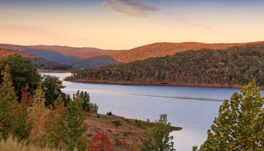
Located on the western banks of Lake Fort Smith, Lake Fork Smith State Park covers 260 acres (105 ha) of Crawford County, Arkansas.
The park is the western terminus of the 240-mile (386-km) Ozark Highlands Trail and is a popular destination for year-round recreation. The park offers 30 campsites, 10 cabins, a marina with boat rentals, and many miles of scenic hiking trails.
The Ozark National Forest covers 1.2 million acres of the Ozark Mountains in northern Arkansas. The park protects the tallest mountain in the state, Mount Magazine, as well as 11,000 acres of old-growth forest.
Several scenic byways travel through the forest, including the Scenic 7 Byway, which travels 60 miles (155 km) through the forest, the Ozark Highlands Byway, and the Mount Magazine Byway. The Ozark National Forest also contains an extensive cave system known as the Blanchard Springs Caverns.
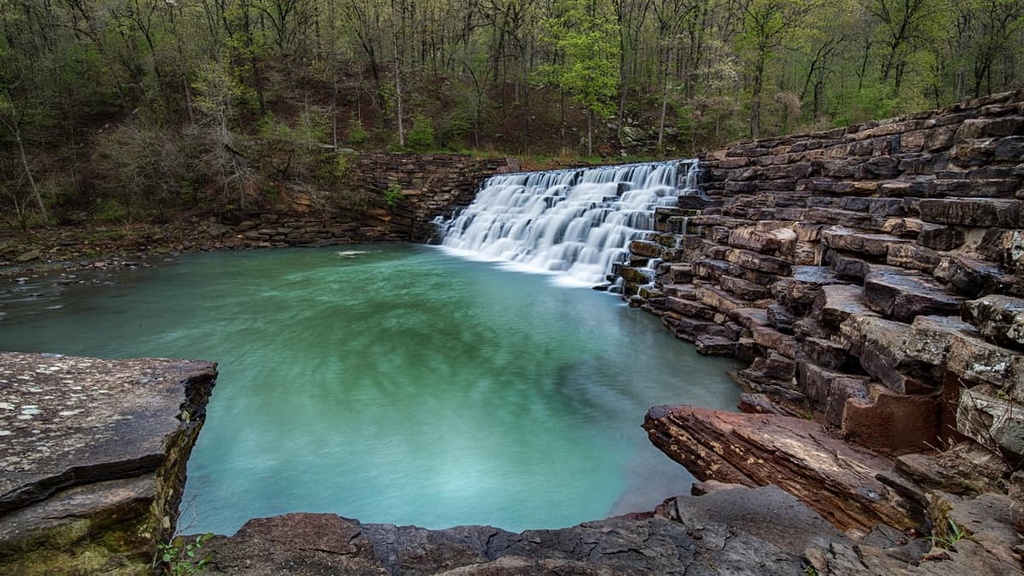
The Ozark Highlands trail extends for 165 miles (427 km) from the Buffalo National River to Lake Fort Smith State Park, making it the longest hiking trail in the region. Other popular hiking trails include Pedestal Rock, Alum Cove Natural Bridge, Whitaker Point, King River Falls, and Glory Hole Falls.
Looking for a place to stay in the Boston Mountains? Here are some of the best cities to check out in the region.
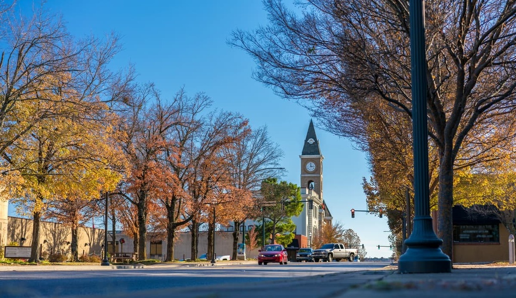
Known locally as the “entertainment capital of northwest Arkansas,” Fayetteville is the second-largest city in Arkansas. It lies on the outskirts of the Boston Mountains and offers visitors a wide variety of fantastic restaurants and lodging options.
Visitors to Fayetteville can explore nearly 100 miles (160 km) of trails, visit historic sites, or enjoy live music at one of many venues along famed Dickson Street. Located just minutes from downtown, Devil’s Den State Park, Kessler Mountain Regional Park, Millsaps Mountain, and Sequoyah Mountain all also offer outstanding outdoor recreation options.
Home to roughly 90,000 residents, Fort Smith lies on the Arkansas-Oklahoma state border at the confluence of the Arkansas and Poteau rivers. In 1817, Fort Smith was established as a military outpost by the US government to make it easier for the military to patrol neighboring tribal reservations.
Fort Smith was also an important center for outfitting miners heading west to join the California Gold Rush in 1848. Today, the city has many sites commemorating and preserving the history of the Trail of Tears, Civil War, and the historic route of the Butterfield Overland Mail Company.
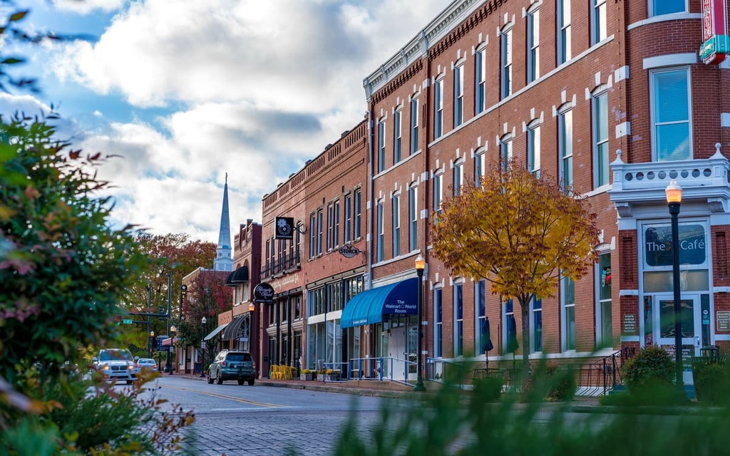
Located in the foothills of the Ozark Mountains, Bentonville is best-known as the birthplace of retail giant Walmart. Like Fort Smith, Bentonville was also a central community during the westward expansion of US settlers.
Two years after Arkansas received statehood in 1836, thousands of Indigenous people would pass through present-day Bentonville on the Trail of Tears, en route to the Indian Territory in Oklahoma.
Bentonville was also a staging point for the Confederate Army prior to the Battle of Pea Ridge. Today, visitors to Bentonville can learn about the region’s history at the Museum of Native American History, Rogers Historical Museum, and Pea Ridge Park. The community is also well-known for its excellent mountain biking trails, urban parks, and public art.


The highest peak in the Boston Mountains is Turner Ward Knob, at 748 m.
The Boston Mountains have 1,041 named peaks.


