Scan the QR code and open PeakVisor on your phone
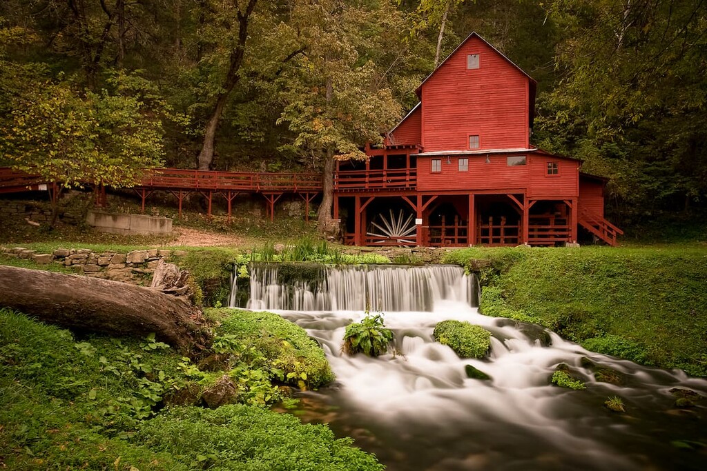
Also called the Show-Me State, Missouri is a state located in the Midwest region of the United States that’s known for its rich cultural history, fantastic food, and stunning Ozark Mountains. The state is home to 1060 named peaks, the highest of which is Taum Sauk Mountain (1,765ft/538m), and the most prominent of which is Mudlick Mountain (1,309ft/399m).
The state of Missouri is located in the central part of the Midwest region of the United States.
It shares a border with 8 states, which ties it with neighboring Tennessee as the state with the most bordering states. In particular, Missouri shares its borders with Iowa to the north, Nebraska, Kansas, and Oklahoma to the west, Arkansas to the south, and Tennessee, Kentucky, and Illinois to the east.
With a total area of some 69,715 square miles (180,560 square kilometers), Missouri is the 21st largest state in the union. Furthermore, it is the 18th most populous state in the country with a population of around 6.2 million people. This makes it the 30th most densely populated state in the US.
Missouri is currently divided up into 114 counties and one independent city (St. Louis). However, the state can also be informally categorized into 4 regions. While these regions do not hold any official standing, each of them has its own unique topography and regional culture.
The Northern Plains region of Missouri is generally regarded as the northern third of the state to the north of Jackson, Lafayette, Saline, Howard, Boone, Callaway, Montgomery, Warren, Saint Charles, Saint Louis, and Saint Louis City counties.

This region is known for being fairly flat, particularly when compared to the portion of the state that is located to the south of the Missouri River. However, there are rolling hills here, particularly in the eastern part of the region.
Within the Northern Plains of Missouri, there are a number of important recreation destinations, such as Gateway Arch National Park in St. Louis. Furthermore, there are many state parks in this region, including:
Located in just a small section of western Missouri, the Western Plains region is generally defined as including most of Jasper, Barton, Bernon, Bates, Cass, Jackson, Lafayette, Saline, Pettis, Benton, Johnson, Henry, Saint Clair, Cedar, and Dade counties.
This region stands in stark contrast to the more mountainous terrain located directly to the east in the Ozark Highlands. But, it blends in well with the rest of the area to the west, which includes parts of Kansas and northern Oklahoma.
Here, there are relatively few mountains and much of the land is used for agricultural purposes. However, you can still find a handful of parks and recreation areas here, such as:
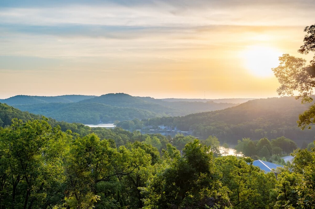
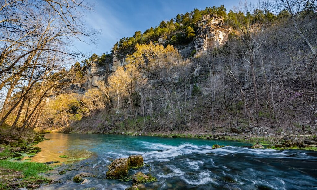
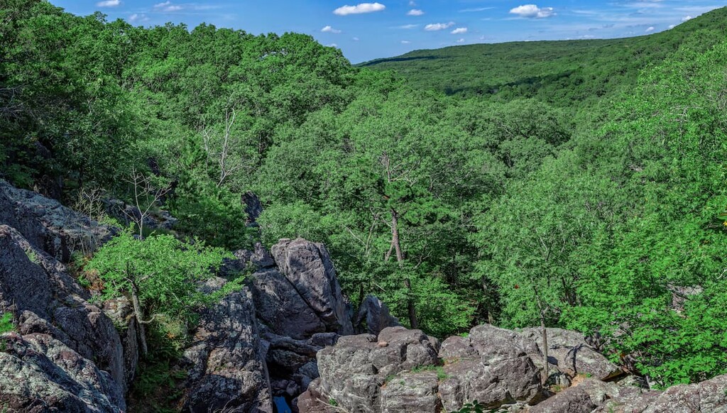
Easily the most rugged part of Missouri, the Ozark Highlands region is a continuation of the Ozark Highlands mountain range that stretches across parts of the southern Midwest. Within Missouri, this region encompasses much of the central and southwestern part of the state.
The Ozark Highlands region is effectively a massive eroded plateau. Here, there are plenty of superb high points and rugged forests to check out.
Furthermore, the Ozarks, as they’re known, have their own unique culture that’s distinct from other parts of the Midwest. The region has long had a strong logging, mining, and ranching-based economy.
Nowadays, a decent portion of the region is located on either federal or state land. This includes land within the popular Mark Twain National Forest, which is home to 7 wilderness areas:
The Ozark Highlands region also contains a truly fantastic array of state parks that are well worth checking out if you’re in the area. These include:
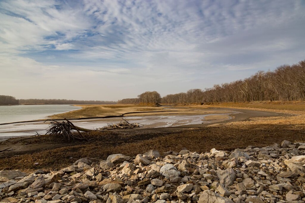
The fourth and final region in Missouri is the Southern Lowlands. Also known as the greater Missouri Bootheel Region, this region is dominated by low-lying terrain around the Mississippi River.
Technically speaking, the Bootheel contains just New Madrid, Pemiscot, and Dunklin counties. However, the greater region, which may also be called the Missouri section of the Mississippi Embayment, also includes Buffer, Stoddard, Cape Girardeau, Scott, and Mississippi.
When compared to other parts of the state, the Southern Lowlands are easily the flattest, warmest, and rainiest part of Missouri. This region is heavily agricultural with crops such as cotton and rice dominating the landscape.
Nevertheless, there are a few state parks in the region, including:
The state of Missouri has a unique and varied geology. For the most part, the bulk of the state is located on top of something called the North American Craton. This craton is effectively the basement rock a t the core of the continent of North America.
On top of this basement rock, Missouri boasts thick layers of mostly sedimentary rocks, such as limestones, shales, sandstones, and the like. There are some various metamorphosed layers in Missouri as well as some igneous intrusions, but the bulk of the state is dominated by rocks of sedimentary origin.
Furthermore, despite being located fairly far south in the North American continent, Missouri was heavily glaciated during the last major glaciation. During this time, glaciers covered much of the state, eroding away at the surface, carving out valleys, depositing erratics, and leaving behind sediments that would become loess hills.
That being said, the glaciers didn’t reach as far south as Missouri’s major topographic feature: the Ozark Highlands.
The Ozark Highlands, and their major Missouri subrange, the Saint Francois Mountains, are the major hills and mountains of the state. Interestingly, these hills didn’t form through a classic mountain-building event (called an orogeny), but rather, they formed through millions of years of erosion.
Major peaks in Missouri include Taum Sauk Mountain, Wildcat Mountain, Buford Mountain, Lead Hill, and Ketcherside Mountain.
Perhaps the most interesting geologic event to have happened in Missouri in the last few hundred years were the New Madrid Earthquakes of 1811 to 1812.
Despite the fact that Missouri is located in the middle of the North American plate, it experienced three major earthquakes over the course of just over one year. These earthquakes boasted a magnitude of 7.2 to 8.2 on the moment magnitude scale and are generally regarded as some of the most powerful in recorded US history.
It turns out that, despite the fact that Missouri is located in the middle of the North American continent, it is actually located near a number of faults, including the Cottonwood Grove Fault and the Reelfoot fault. It’s believed that movement in these ancient, subsurface faults, led to the earthquakes.
Missouri is a state that’s naturally rich in mineral resources. It ranks high among US stats for its total output of minerals such as copper, silver, lead, and zinc.
Furthermore, Missouri has a fairly large clay, sand, and gravel industry. It also has some sizable mines for lime and tripoli, the latter of which is a type of stone that’s used for metalsmithing and woodworking.
Missouri contains five distinct ecoregions, each with its own unique assortment of flora and fauna. Here’s what you need to know:
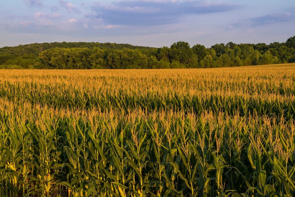
The Western Corn Belt Plains ecoregion is located in the extreme northwestern corner of Missouri. It was once almost exclusively tallgrass prairie, though it is now used primarily as cropland and for grazing of livestock.
Much of this region is fairly flat, with the occasional rolling hill or loess plain. The soils here are fertile and moist, which has helped this become one of the world’s leading regions for the production of soy and corn.
Covering much of the northern part of Missouri, the Central Irregular Plains are a mostly flat to hilly region that boasts a mix of different land use types. Here, the natural vegetation was likely a mix of woodlands and grasslands.
However, it is now used both for grazing, cropland, and urban development. That being said, there are still some patches of forest cover throughout the region.
The Ozark Highlands encompass the majority of the southwestern part of Missouri. This region is the most rugged region in the area as it is dominated by the hills and mountains of the Ozark Highlands.
Furthermore, this region is also one of the most heavily forested places in the southern Midwest. Oak-hickory forests are the norm around here, through there are also some croplands and grazing areas interspersed throughout.
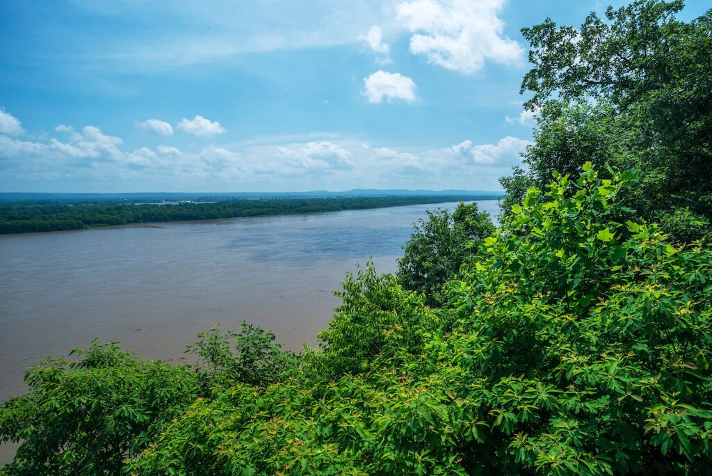
Located along the eastern border of Missouri, the Interior River Lowland is a small ecoregion that’s dominated by wide terraced valleys.
These valleys along the Mississippi River are generally regarded as fertile, though this region is less commonly used for agricultural purposes, such as growing corn and soy, than some neighboring regions. Much of this is due to the relatively high population density of the region, thanks to the establishment of major cities, such as St. Louis, along the Mississippi.
The final ecoregion in Missouri is the Mississippi Alluvial Plain. In Missouri, this ecoregion is located in the extreme southeastern corner of the state. It is very flat and it has very fertile soils, which make it a particularly productive agricultural area.
Nowadays, this ecoregion is dominated by croplands, particularly those that grow rice, soy, and cotton. However, before it was cleared for cultivation, this region was heavily forested with deciduous woodlands.
Humans have lived in the region that is now the state of Missouri for thousands of years. Indeed, archaeological evidence indicates that people of the Mississppian culture lived in the region as far back as about 9,000 BCE.
While there are currently no federally-recognized tribal nations within the state of Missouri, the state was home to countless Indigenous peoples at the time of European contact.
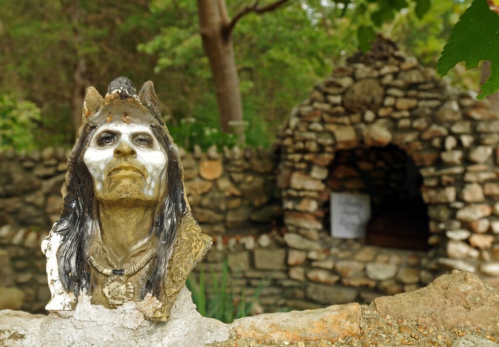
Furthermore, although there are no tribal reservations in the state of Missouri today, there are many tribal nations that are currently headquartered outside of the state that have ancestral ties to the area. This includes the Sac & Fox Nation, the Chickasaw Nation, the Shawnee Tribe, the Otoe-Missouria Tribe, the Osage Nation, and the Quapaw Nation.
The first peoples of European descent to visit what is now Missouri were likely fur traders and trappers from France. One of the first known accounts of French traders visiting the region is that of Jacques Marqueete and Louis Jolliet who travelled down the Mississippi River and ended up in what is now Missouri in the 1670s.
During the latter part of the seventeenth century, Missouri became a popular destination for French and French-Canadian trappers and traders. The French began establishing a number of forts and trading posts in the area to help support their mining operations in what they called “Louisiana.” Perhaps the most famous of these early forts was Fort Orleans, which was built in what is now the central part of the state.
However, after France’s defeat to the British during the French and Indian War, which left France severely weakened, France ceded control of the Territory of Louisiana to Spain as part of the Treaty of Fontainebleau. During this time, Missouri actually became a popular destination for French immigrants from what is now Illinois, which had been ceded to the British.
Soon enough, Spain returned Louisiana to France in 1800 in the Treaty of San Ildefonso. This second period of French rule over the region was short-lived, however, as Louisiana was sold by Napoleon to the United States in 1803 as part of the Louisiana Purchase.
Afterward, the region became the Louisiana Territory, which had its capital in St. Louis. It then became the starting point for the Lewis and Clark Expedition of 1803 to 1806, which sought to traverse the continent and reach the Pacific Coast. The territory was renamed the Missouri Territory in 1812.
Missouri formally petitioned for statehood in 1818. However, Missouri’s admission to the Union was very controversial as southern slave-holding states wanted Missouri to be a slave state while the northern states did not.
As a result, Congress passed the Missouri Compromise to admit Missouri as a slave state, leading to the fact that tens of thousands of people were enslaved in Missouri during the early part of the state’s history. However, all future states in the former Louisiana Territory to the north of 36°30′ were to be free states. Missouri became the 24th state in 1821.
During the 1820s, the state saw widespread immigration from other southern states. This led to the forced removal of tribal nations from their ancestral homelands, particularly during the 1820s and 1830s.
By the late 1840s, Missouri became an important departure point for travelers looking to immigrate to California. Many settlers started their trek in St Louis, which eventually led to the state’s nickname as the “Gateway to the West.”
During the Civil War, Missouri seceded from the Union to join the Confederacy and then lost. There were a number of important battles in the state, though the Battle of Westport was arguably the largest.
In the years after the Civil War, Missouri saw a drastic increase in its economy, particularly after the arrival of the railroads. The railroads helped spur major economic growth in Missouri as they provided a way to transport many of the state’s natural resources, such as coal.
Furthermore, the post-Civil War years saw a major increase in Missouri’s agricultural industry. The major crops at the time included corn and wheat, though cattle ranching and livestock grazing also became important economic drivers in the region.
The twentieth century was a tumultuous time in Missouri, particularly after a major economic downturn in the 1950s led to the loss of thousands of jobs in the state. However, the state’s economy has stabilized in recent years, particularly as it starts to diversify into different industries.
These days, Missouri is a bustling place. Tourists are drawn both to the state’s major cities for their nightlife and culture and to the state’s more rural destinations for their scenic beauty. Regardless of where you go in Missouri, however, adventure is sure to follow.
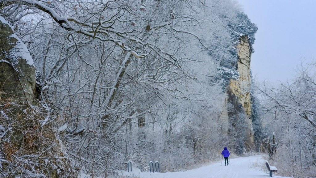
Missouri is home to some truly stunning outdoor recreation areas. These are some of the top hiking and adventure destinations to check out in the state:
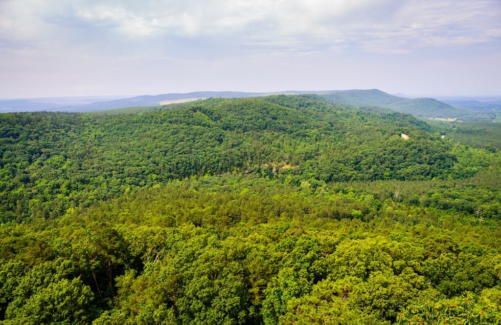
Missouri’s only national forest, Mark Twain National Forest is a patchwork collection of federally-managed woodlands located throughout the central and southern part of the state. In total, it contains 137 named mountains, the highest of which is Bell Mountain, and the most prominent of which is Matthews Mountain.
When compared to some of the other national forests in the US, Mark Twain is actually fairly small. Interestingly enough, however, it does include just over 10% of all of the land in the state. Furthermore, it is located in parts of 29 different counties, which is a record among national forests.

Mark Twain National Forest includes 7 different wilderness areas. It is also home to some fantastic hiking areas, including the massive Ozark Trail System. Some trails in the forest are also open to motorized vehicles, such as ATVs, so this is something to be mindful of as you hike.
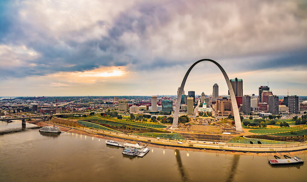
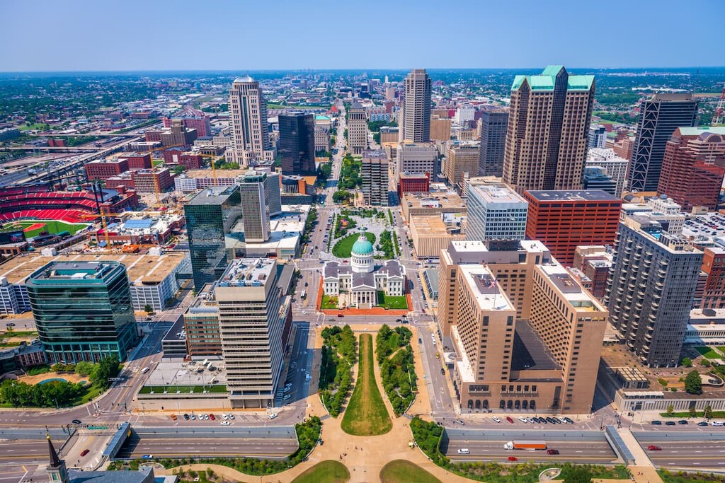
Although it’s perhaps not really a major hiking destination, Gateway Arch National Park is Missouri’s only national park. It is located in the city of St. Louis near the place where Lewis and Clark began their 1803 expedition.
Gateway Arch is home to its namesake arch, which was completed in 1965. It also contains the Old Courthouse and a small museum, the latter of which is located under the arch itself.
Interestingly enough, Gateway Arch National Park is by far the smallest national park in the United States. With a total area of just 192.83 acres (78 ha), the park is just a fraction of the size of the next two largest parks, Hot Springs in Arkansas and New River Gorge in West Virginia, which are 5,500 acres (2,225 ha) and 7,000 acres (2,830 ha), respectively.
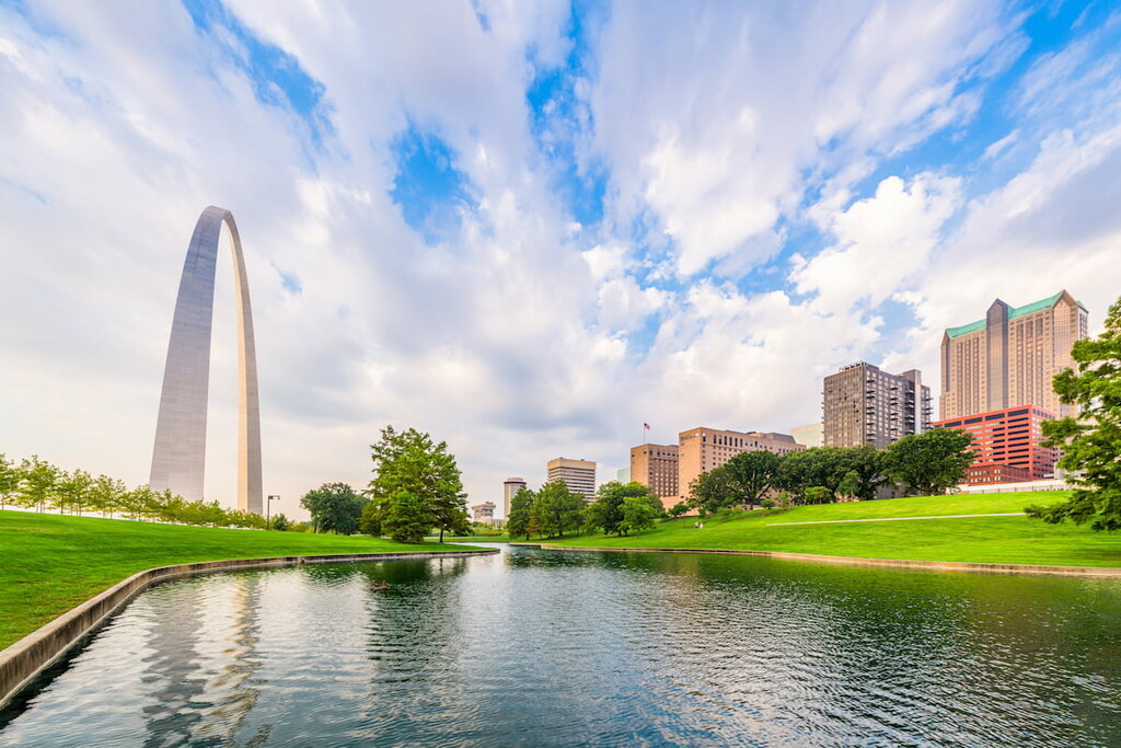
While there aren’t any major trails in Gateway Arch National Park, however, there are plenty of excellent places to go for a walk. You can pick up a map at the park visitor center and enjoy a stroll through the park grounds along the Mississippi River if you have a free day in St. Louis.
Located in southeastern Missouri, Taum Sauk Mountain State Park is one of the most popular state parks in the region. It contains 5 named mountains, the highest and most prominent of which is Taum Sauk Mountain.
The park is located within the Saint Francois Mountains, which are a subrange of the Ozark Highlands. Here, the land is fairly rugged and trails are plentiful.
Furthermore, the park is home to the tallest peak in the state, Taum Sauk Mountain, which makes it a popular place to visit for tourists and locals, alike. The park also contains Mina Sauk Falls—the highest waterfall in the state. So there’s something for everyone to enjoy in this fun state park.
For skiing and snowboarding enthusiasts, there are 2 small ski resorts in Missouri with up to 5 km (3 mi) of slopes and a few ski lifts. Hidden Valley Ski Resort near Saint Louis is the first one on the east of the state, and Snow Creek Ski Area near Kansas City is the second on the west.
Check the Missouri ski resorts map and the larger USA ski resorts map in the World Mountain Lifts section of the site. It includes information about open ski lifts / slopes in Missouri in real-time with opening dates and hours. There are also year-round cable cars, funiculars, cog railways, aerial tramways, and all other types of mountain lifts.
Looking for a place to stay during your trip to Missouri? Here are some of the best cities in the state to check out during your next visit!
Situated along the eastern edge of the state, St. Louis is the second-largest city in the state of Missouri with some 300,000 residents. The city is located on the western banks of the Mississippi River, just to the south of the river’s confluence with the Missouri River.
Widely recognized as a major center for commerce and industry in the region, St. Louis is a global city that serves as the headquarters of many multinational organizations. It is a hub for research, education, healthcare, and technology, as well as a cultural center for the Midwest.
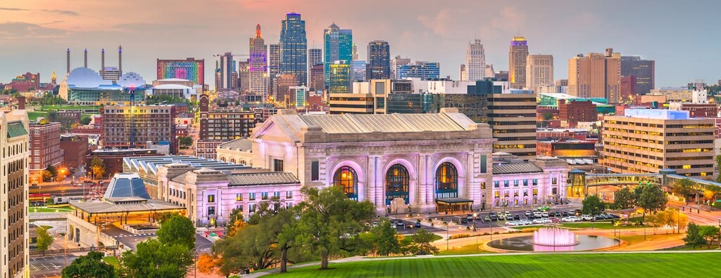
Despite its potentially misleading name, Kansas City is, indeed, in the state of Missouri. In fact, it’s the largest city in the state with a population of around 500,000 people. It is, however, located along the state’s border with Kansas, which only adds to the confusion.
Nevertheless, Kansas City is one of the largest metropolitan areas in the central Midwest. It is a major hub for commerce and business in the region, as well as one of the region’s most important cultural centers. It is home to some major arts institutions, superb restaurants, and an assortment of professional sports teams.
Located in southwestern Missouri, Springfield is a city of some 160,000 people, making it the third-largest metropolitan area in the state. Often called the “Queen City of the Ozarks,” Springfield is a major economic hub and tourist destination in the region.
In recent years, Springfield has established itself as a major player in the Missouri arts scene. It has a number of superb museums, theaters, operas, and musical venues. Furthermore, the city is the host for a slew of different festivals each year that are well worth checking out.
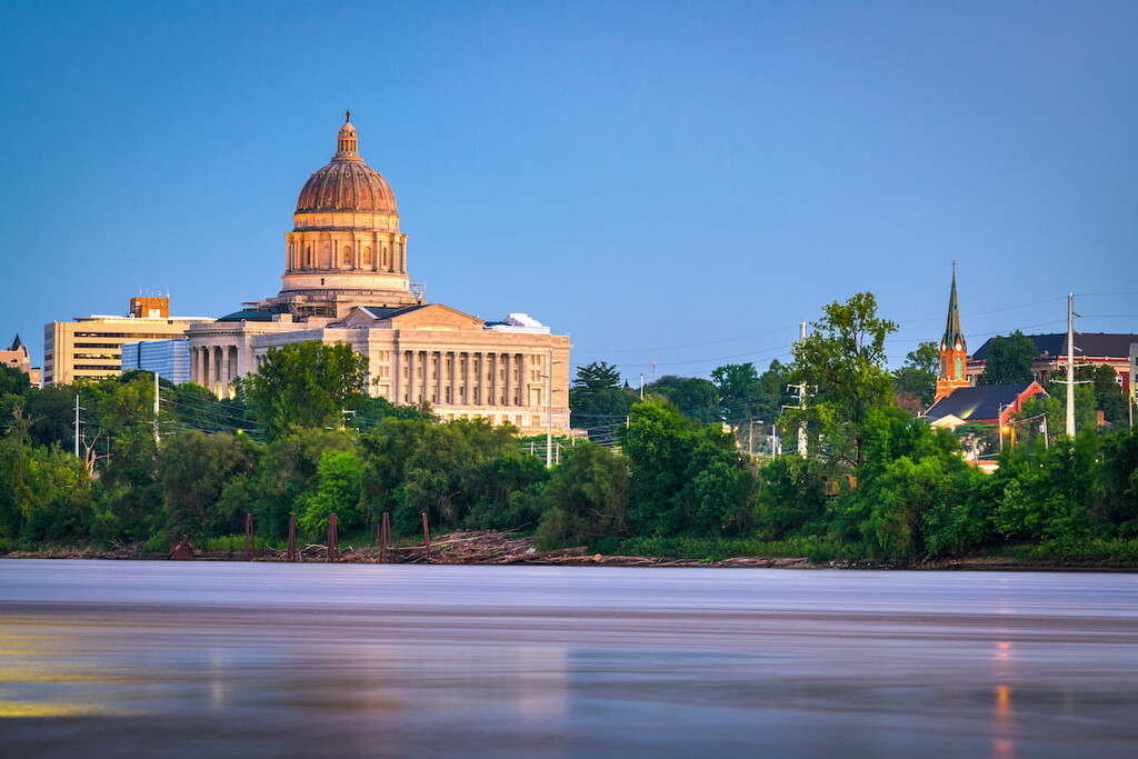
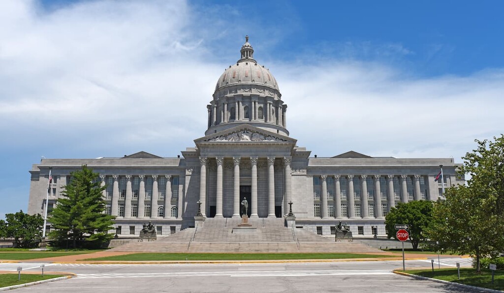
The capital of the state of Missouri, Jefferson City is a community of some 45,000 residents located in the central part of the state on the Missouri River. It is often considered to be a hub of the Mid-Missouri region, which is the area that’s about equidistant between Kansas City and Saint Louis.
As the state capital, much of Jefferson City’s economy is based on the state government. However, it is also a hub for health care, education, and manufacturing in the state. Jefferson City is also a popular tourist destination as people travel to the city to check out sites like the Missouri State Capitol, the old Missouri State Penitentiary, and St. Peter Church.