
Scan the QR code and open PeakVisor on your phone
Oklahoma is home to 766 named mountains. The highest is Black Mesa at 1,515 m.
Boasting great food, sprawling plains, and some ancient mountain ranges, Oklahoma is a state located in the south-central part of the United States. It contains 705 named mountains, the highest of which is Black Mesa (4,967ft/1,541m), and the most prominent of which is Sugar Loaf Mountain (2,556ft/782m).
The state of Oklahoma is located in the south central plains region of the United States. It shares a border with 6 other states, including Texas to the south, New Mexico and Colorado to the west, Kansas to the north, Missouri to the northeast, and Arkansas to the east.
Featuring a total area of 69,899 square miles (181,037 sq. km) of land, of which 1,304 square miles (3,377 sq. km) is water, Oklahoma is the 20th largest state in the country by area. But, it is just the 28th most populous state in the union and the 35th most population dense.
Although Oklahoma is a state within the US, it is also home to a number of large sovereign Indigenous nations, 39 of which are federally recognized by the US government. Among the largest of these nations are the Cherokee Nation, the Choctaw Nation, the Chickasaw Nation, and the Muscogee (Creek) Nation. The 39 federally recognized nations in Oklahoma are third only to the 200+ nations in Alaska and the 109 recognized nations in California.
That being said, it’s important to recognize that many of the nations currently headquartered in Oklahoma were not originally from that area. Indeed, many were forced to settle in the region after the Indian Removal Act of 1830.

Oklahoma has a bit of an unorthodox shape and, as a result, it can be categorized in a variety of different ways. Perhaps the easiest way to differentiate different parts of the state is to follow the 6 regions laid out by the Oklahoma Department of Tourism: Red Carpet Country, Great Plains Country, Green Country, Frontier Country, Chickasaw Country, and Choctaw Country.
Named after its red-colored soils, the Red Carpet Country of Northwest Oklahoma is a surprisingly rugged area that includes the northwesternmost 16 counties in the state. The region is roughly bounded by I-35 to the east, which separates it from the Green Country.
Counties located within Red Carpet Country include Cimarron, Beaver, Texas, Harper, Alfalfa, Kay, Grant, Major, Ellis, Woodward, Noble, Blaine, Dewey, Garfield, and Kingfisher.
Interestingly, the highest point in the state of Oklahoma, Black Mesa, is located within the Red Carpet Country. The high point of Black Mesa is located almost exactly on the border of New Mexico and Oklahoma, in the state’s panhandle region near both Colorado and Texas.

Within this region, the landscape is quite varied, with quite a few mesas dominating the topography. One of the most prominent mesas in the region is Raton Mesas, which also stretches into New Mexico and Colorado, though it is not technically part of the Southern Rocky Mountains nor the Colorado Plateau, which are both to the west.
Much of this large region is privately owned, though there are a few publicly-owned recreation areas to enjoy, such as:
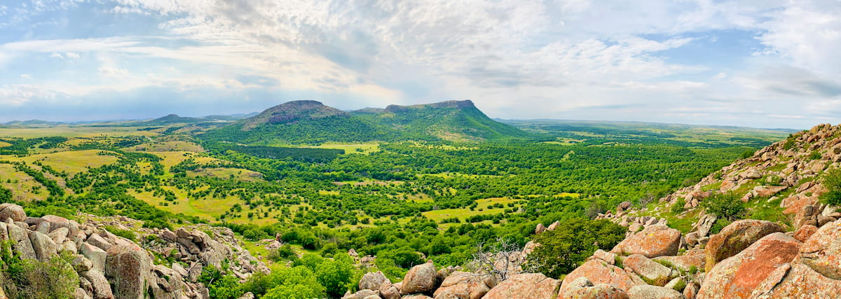
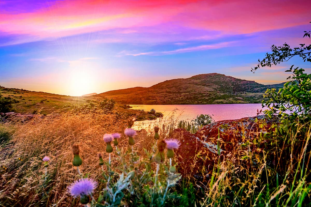
Aptly named, the Great Plains Country region of Southwest Oklahoma is mostly home to sprawling prairie. However, it also contains a handful of island ranges, such as the Wichita Mountains, which rise up dramatically above the lower lying landscape below.
The region by the boundaries of its 14 counties, which include Jefferson, Roger Mills, Stephens, Custer, Cotton, Beckham, Tillman, Washita, Comanche, Caddo, Kiowa, Harmon, Jackson, and Greer.
Due to the mostly flat topography of this area, the few peaks in the region tend to be quite prominent. Indeed, some of the most iconic peaks in this region, such as Mount Pinchot, King Mountain, Mount Scott, Soldiers Peak, and Mount Sheridan, are recognizable from miles away.
There are relatively few major parks in this part of Oklahoma, but 2 great places to visit include the Wichita Mountains National Wildlife Refuge and the Black Kettle National Grassland.
Central Oklahoma, also known as “Frontier Country,” is the most urban part of the state. It includes the Greater Oklahoma City Area, as well as the following 12 counties: Oklahoma, Grady, Logan, Canadian, Lincoln, McClain, Payne, Pottawatomie, Okfuskee, Hughes, Seminole, and Cleveland.
This part of Oklahoma is the commercial and cultural hub of the state, though it’s not known for being very mountainous. Indeed, many of the region’s counties have no mountains at all and relatively few high points in this region exceed 1,500 feet (457m) in height, though there are a handful here and there, such as Coyote Hill.
Frontier Country is mostly home to privately owned land, however, a nice park to check out in the region is Lake Thunderbird State Park.
Chickasaw Country includes most of south-central Oklahoma, in between the Great Plains Country to the west, the Choctaw Country to the east, and the Frontier Country to the north. However, the region's boundaries are somewhat amorphous, depending on who you ask, though many people agree that it refers to the 7 counties of Love, Carter, Garvin, Murray, Johnston, Pontotoc, and Marshall.

This region is also home to the Chickasaw Nation and much of the land in this area is their tribal territory.
Within Chickasaw Country, the topography is mostly rolling terrain as much of the region is actually part of an ancient mountain range. Although there aren’t many jagged peaks here, these mountains (locally called the Arbuckle Mountains) once rivaled the Alps in terms of height.
Popular recreation areas in the region include:
The northeasternmost part of Oklahoma is locally called the Green Country, thanks to its fairly widespread forest cover.
Depending on who you ask, the borders of the Green Country vary, but it generally refers to 18 counties, including McIntosh, Pawnee, Okmulgee, Washington, Muskogee, Nowata, Sequoyah, Ottawa, Adair, Delaware, Cherokee, Wagoner, Mayes, Tulsa, Rogers, and Creek. In fact, the Green Country is larger than the state of Maryland.

This region includes Tulsa and its major metropolitan area, so, after the Frontier Country, the Green Country is one of the most populous in the state. It is also home to the Osage Nation.
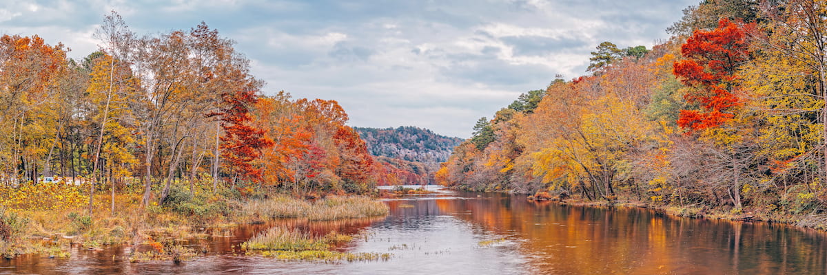
Like the Choctaw Country to the south, the Green Country is among the most mountainous in the state. It is home to the westernmost extent of the Ozark Highlands and a small portion of the Ouachita Mountains. Moreover, there are a handful of great recreation areas in this region, including:
The sixth and final region of Oklahoma is Choctaw Country, which is the southeastern part of the state. As the name suggests, Choctaw Country is home to the Choctaw Nation. It also includes 10 counties: Pittsburgh, Le Flore, Haskell, Latimer, Atoka, Coal, Choctaw, McCurtain, Pushmataha, and Bryan.
Alongside the Green Country, Choctaw Country is among the most mountainous in the state. It includes parts of the Ouachita Mountains of the Ozark Highlands as well as the only national forest in the state. This includes:
Geologically, Oklahoma is quite a complex place because it is located at the intersection of a number of different mountain ranges and physiographic regions.
The oldest rocks within the state are igneous in origin and are about 1.4 billion years old, having formed during the Precambrian. During the Cambrian, various, slightly younger igneous rocks, such as basalts, gabbros, granites, and rhyolites also formed, while widespread metamorphism also metamorphosed some ancient sedimentary rocks into some of the modern metamorphic rocks that we see today.
However, these ancient rocks all form the basement of Oklahoma rather than the surface topography. During the Paleozoic, much of the state was covered by a shallow sea, which deposited massive amounts of sediment over the landscape.

Eventually, much of these sediments consolidated into sedimentary rocks, such as limestones, dolomites, shales, and sandstones. Many of these Paleozoic sedimentary rocks can be seen in the Ouachita Mountains.
During the millions of years succeeding the Paleozoic, the region that is now Oklahoma experienced various periods of sedimentary deposition at the hands of ancient shallow seas. The sedimentary rocks that resulted from these periods are also home to a spectacular array of marine fossils.
By the Pennsylvanian Period, however, Oklahoma became quite geologically active. Various orogenies and periods of basin subsidence helped to build the Wichita and Ouachita Mountains. Moreover, many of the Pennsylvanian-aged rocks in the state contain massive oil and gas reserves, as well as fossilized plant and animal remains.
More recent parts of Oklahoma’s geologic history have seen the widespread erosion of the region’s mountain ranges. Indeed, one of the ranges that formed during the Pennsylvanian, the so-called “Arbuckle Range,” is now more a series of rolling hills than a proper mountain system. But, in the small section of this ancient range that still exists in Johnston County, you can see a modestly sized outcropping of the state’s oldest rocks.
Major high points in the state include Black Mesa, Robbers Roost Peak, Cavanal Hill, Sugar Loaf Mountain, Mount Pinchot, and Mount Scott.
Although Oklahoma has a reputation of being flat, prairie country, the state is home to a great diversity of different ecosystems. In fact, the state of Oklahoma contains a fantastic mix of different ecoregions, each with their own blend of flora and fauna.
Both the Central Great Plains and the Western High Plains are part of the larger Great Plains prairie ecoregion that covers much of the central portion of the United States and Canada. In Oklahoma, these 2 ecoregions include the majority of the western part of the state, with the exception of the region that’s part of the Southwestern Tablelands.
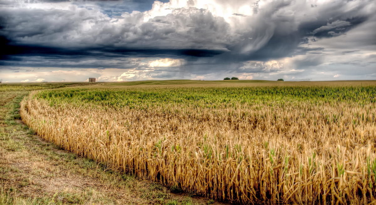
The traditional plant communities here include tallgrass prairie, shortgrass prairie, and scrub, though this is also a heavily agricultural part of the country. So, while the region was part of the historic range of many species, such as the American bison, most of it is now agricultural and very little of the natural vegetation remains.
Covering a small portion of the Oklahoma Panhandle, as well as parts of Colorado, Kansas, New Mexico, and northern Texas, the Southwestern Tablelands are a unique ecoregion that borders the Great Plains.
Unlike the plains regions that border it, the Tablelands are generally not the best for agriculture. This region is mostly home to grama-buffalo grass and mesquite-buffalo grass-covered grasslands. However, you can also find scattered stands of juniper and scrub oak woodlands, particularly around the Canadian River.
Encompassing much of Chickasaw Country, Frontier Country, and parts of western Green Country, the Central Oklahoma/Texas Plains are actually considered a transitional ecoregion between the prairie and the mountains of eastern Oklahoma.
Here, the land is not great for popular commercial crops, like corn and soybeans, though rangeland and pastureland are the most popular uses of this region. Meanwhile, native vegetation in these plains includes bluestem grasslands, blackjack oak, and post oak trees.
The Arkansas Valley surrounds the Arkansas River and it includes a small portion of eastern Oklahoma. In this region, the land is predominantly low-lying plains which were traditionally covered in forest, prairie, and savanna before the arrival of European and European-American settlers.
Much of the Arkansas Valley is now used for agriculture, thanks to the region’s fertile soils. Therefore, a substantial portion of the native vegetation has been clear cut for pastureland and hayland.
As you might surmise from the name, the Ouachita Mountains ecoregion surrounds the Ouachita Mountains. Although much of this ecoregion is located in neighboring Arkansas, it does include parts of eastern Oklahoma.
This rugged ecoregion is heavily forested and the traditional forest cover is oak, pine, and hickory. Since logging has long been an important industry in this region, much of the original forest has been clear cut over the years and it is now home to large stands of loblolly pine and shortleaf pine.
Oklahoma has a long history of human inhabitation that dates back thousands of years. The state is home to dozens of federally-recognized tribes and nations, including those with ancient ancestral ties to the land and those whose peoples were forcibly relocated to the region after the Indian Removal Act of 1830.
Some of the many peoples that call this land home include the Osage, the Wichita, the Caddo, the Kicahi, the Pawnee, the Cherokee, the Choctaw, and the Chickasaw.
Among the first Europeans to visit the region that is now Oklahoma were French fur trappers and traders who arrived in the 17th century. Along with the rest of western New France, the land was ceded to Spain after the Treaty of Fontainebleau, though it eventually came back under France’s control before being sold to the US during the Louisiana Purchase.
The land that is now Oklahoma was once part of the Arkansas Territory, though it was separated from Arkansas in1824 and 1838.
Oh, and if you’re wondering why Oklahoma has a panhandle, the answer lies in the 1819 Adams-Onís Treaty. This treaty between the US and Spain defined parts of the southwestern US as Spanish Territory, including the land that would later become the Oklahoma Panhandle under the land agreements detailed in the Compromise of 1850 when Texas was admitted to the Union in 1845.
The mid-1800s was a very tumultuous time for Oklahoma due to the passage of the 1830 Indian Removal Act, which saw the forced relocation of tens of thousands of Indigenous peoples from their ancestral lands in places like North Carolina, Florida, Alabama, and Mississippi, to Oklahoma along the Trail of Tears.
During and after the Civil War, Oklahoma became a major destination for would-be homesteaders under the 1862 Homestead Act and the Land Run of 1889. In 1907, Oklahoma also became the 46th state in the US.
Right around this time, Oklahoma’s oil fields started to gain quite a lot of attention, leading to a period of widespread prosperity in the 1920s. However, as the Great Depression dropped farm and oil prices to a mere fraction of their historic value, Oklahomans struggled greatly during the 1930s and during the subsequent Dust Bowl.
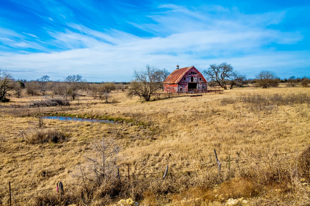
To this day, much of Oklahoma’s economy relies on agriculture, oil, and natural gas production, though the state now has a booming aeronautical industry. Oklahoma’s mountains and tablelands also make for an excellent adventure if you’re looking to get off the beaten path.
Looking for an adventure in Oklahoma? These are some of the most popular hiking destinations to check out:
Black Mesa Nature Preserve is situated along the westernmost edge of Oklahoma’s Panhandle near its border with Colorado and New Mexico. The preserve is most famous for being home to the tallest point in the state, Black Mesa, which visitors can hike to the top of.
This nature preserve is home to a mix of rare and endangered species as well as some great wildlife, like black bears, mountain lions, mule deer, antelope, bighorn sheep, and bobcats. It’s also an excellent place to go stargazing due to the very dark night skies.
The Ouachita National Forest encompasses parts of eastern Oklahoma and western Arkansas. It is home to 228 named mountains, the highest of which is Black Fork Mountain in Arkansas.
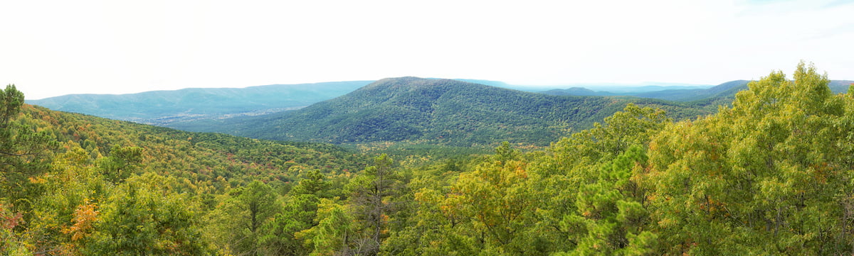
Ouachita is known for being one of the oldest national forests in the southern United States as it was officially designated in 1907. It is now famous for its old growth forests, which are rare in this part of the country. Moreover, there are hundreds of miles of hiking trails in the forest to enjoy, both within Oklahoma and in Arkansas.
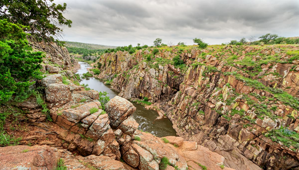
Home to the majority of the Wichita Mountains, the aptly named Wichita Mountains National Wildlife Refuge is located in the southwestern part of Oklahoma near the city of Lawton. It is home to 41 named mountains, the highest and most prominent of which is Mount Pinchot, which was named after the first chief of the US Forest Service, Gifford Pinchot.
The refuge has been protecting threatened wildlife in Oklahoma since 1901, which makes it one of the oldest refuges in the country.
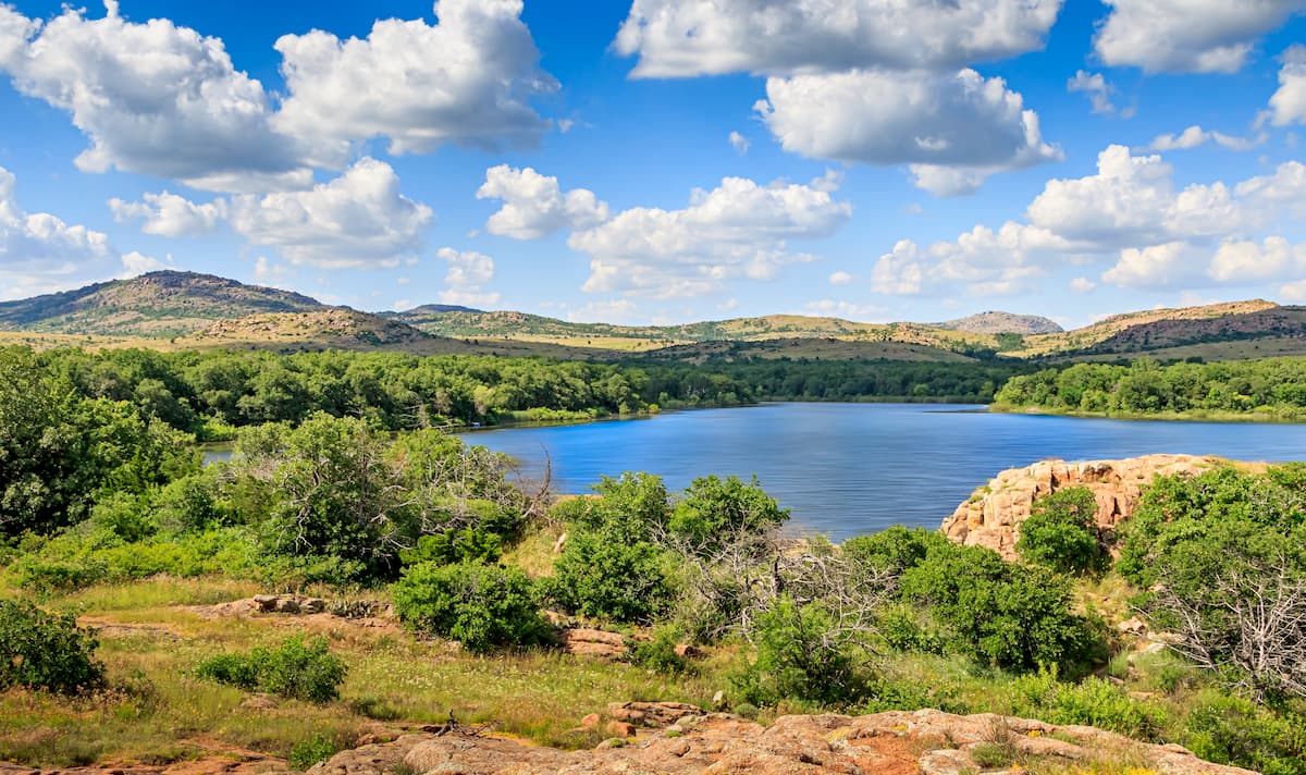
It also contains one of the last undisturbed mixed grass prairie ecosystems in the state, which are home to some fantastic animal species, such as plains bison, elk, and prairie dogs. You can also find some Texas longhorn cattle in the refuge, though these are an introduced species that’s actually descended from cattle that are native to Spain.
The Wichita Mountains National Wildlife Refuge is one of the most popular recreation areas in Oklahoma. There are plenty of hiking trails to enjoy, as well as great fishing opportunities, and even some great rock climbing crags on Mount Scott.
Here are some of the best places to stay in Oklahoma:
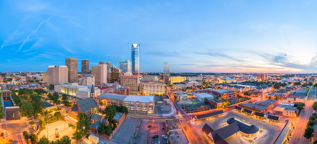
The capital and largest city in the state, Oklahoma City is located near the geographic center of Oklahoma and is home to nearly 1.4 million people. Due to its location within the Great Plains, Oklahoma City, or OKC, is home to a major livestock market and trade industry.
Oklahoma City is easy to get to by road, thanks to the nearby I-35 and I-40. It also has the busiest airport in the state, Will Rogers World Airport.
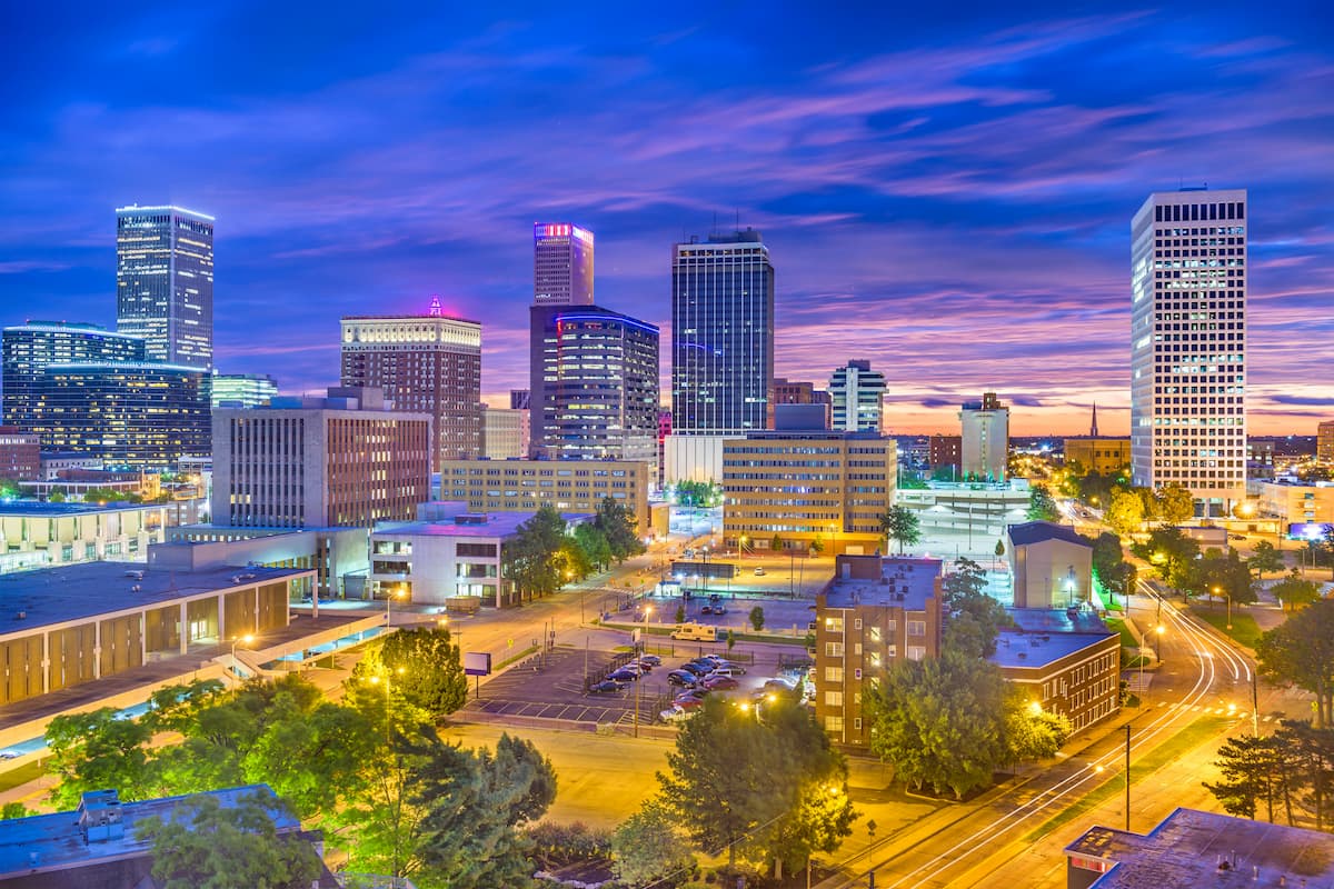
Tulsa is the second largest city in the state with about 400,000 residents. The city is situated in the Green Country of northeastern Oklahoma and it is a major commercial hub of the region, thanks to its strong oil industry. Much of the land in the city is part of the Muscogee (Creek) Nation territory.


Yes. Oklahoma has 766 named mountains. The highest is Black Mesa at 1,515 m.
The highest mountain in Oklahoma is Black Mesa, at 1,515 m.
Oklahoma has 766 named mountains.


