Scan the QR code and open PeakVisor on your phone
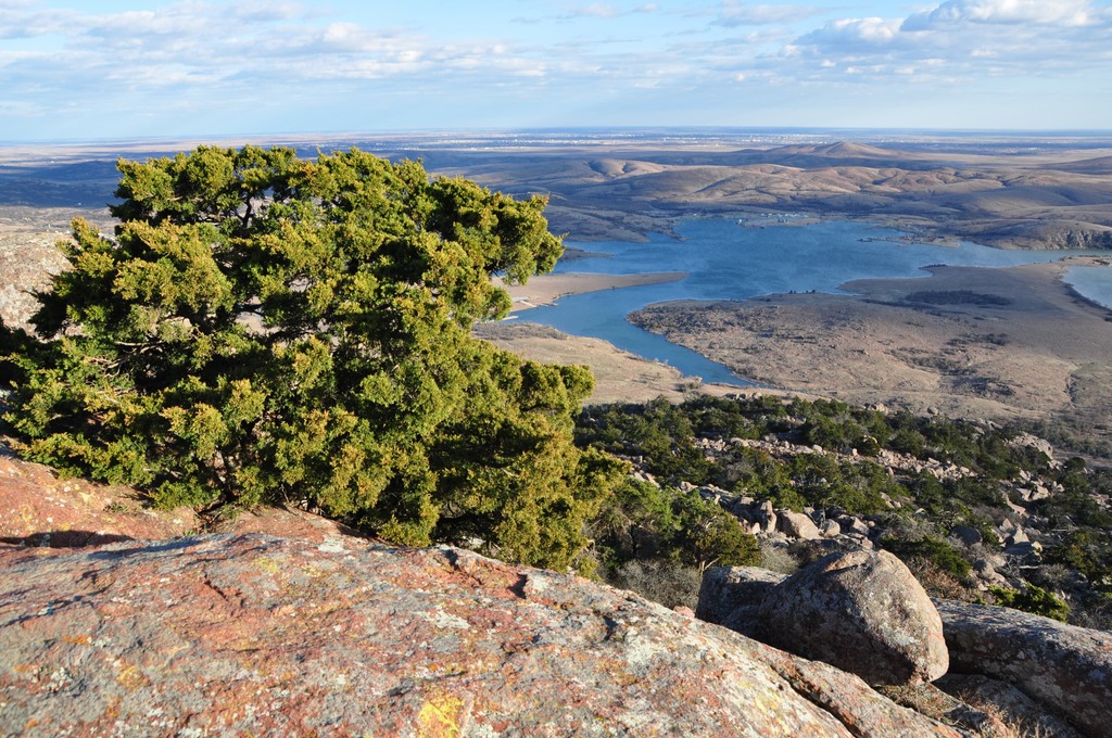
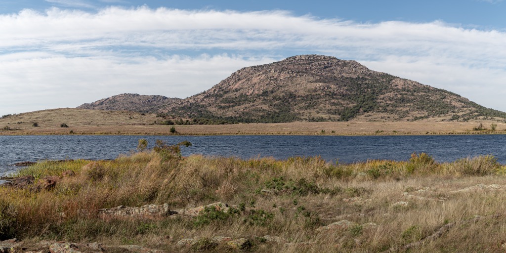
The Wichita Mountains stretch across southwestern Oklahoma in the United States. The ancient mountains rise an average of 400 to 1,000 ft (120 to 305 m), but some peaks exceed 2,000 ft (610 m), such as Mount Pinchot (2,467 ft/752 m) and Mount Scott (2,464 ft/751 m). Of the 135 mountains in the range, Mount Pinchot is the tallest and the most prominent (935 ft/285 m). A portion of the range is encompassed by the Wichita Mountains National Wildlife Refuge, protecting ecosystems and iconic wildlife like bison and longhorn cattle.
Mount Pinchot (2,467 ft/752 m) is the tallest peak in the Wichita Mountains, an ancient range extending through part of southwestern Oklahoma. The mountains, which uplifted hundreds of millions of years ago, have since worn down so that the tallest peaks fall near 2,000 ft (610 m).
The main range runs northwest-southeast and lies adjacent to a lower range to the west called the Quartz Mountains. The range lies within Comanche, Jackson, Kiowa, and Greer Counties.
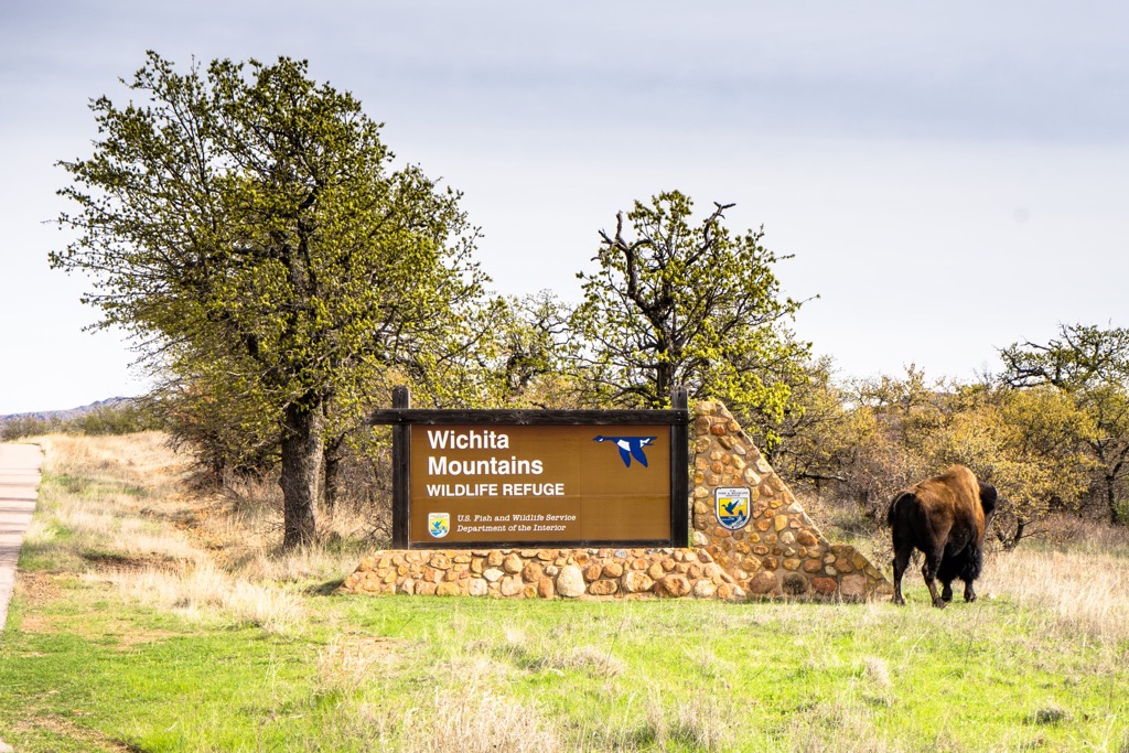
The Wichita Mountains National Wildlife Refuge encompasses a portion of the range, in addition to grasslands and lakes. Portions of the wildlife refuge are considered Special Use areas and closed to the public. Some of these places can be accessed through booking a private tour through the refuge management. Other sections of the refuge are open to the public for hiking, wildlife viewing, and camping and backpacking. Although Mount Pinchot is closed to the public, special wildlife tours bring guests near the mountain base.
Also located within the refuge are the Wichita Mountains Wilderness and Charon’s Garden Wilderness Area. The Wichita Mountains Wilderness is for special use only but the Charon's Garden Wilderness unit is open to the public and popular for hiking and camping.
The Wichita Mountains are made up primarily of granite, rhyolite, and gabbro. These rocks solidified under the earth’s surface 525 million years ago and make up one of the few locations in Oklahoma where igneous rocks are found above the earth’s surface.
Between 330 and 290 million years ago, there was uplift in the region that raised the Wichita Mountains. Millions of years of erosion and weathering took their toll on the range and lowered the peaks to 400 to 1000 ft (120 to 305 m) in elevation. Several standouts, Mount Pinchot and Mount Scott included, are over 2,000 ft (610 m).
The range contains a decent supply of mineral wealth including granite, limestone, dolomite, sand, gravel, and iron ore deposits. The range also holds the distinction of being the site of one of the last gold rushes in the United States between 1901 to 1904.
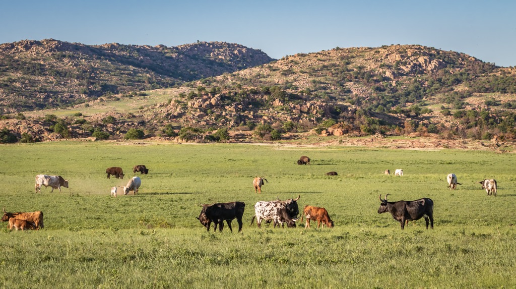
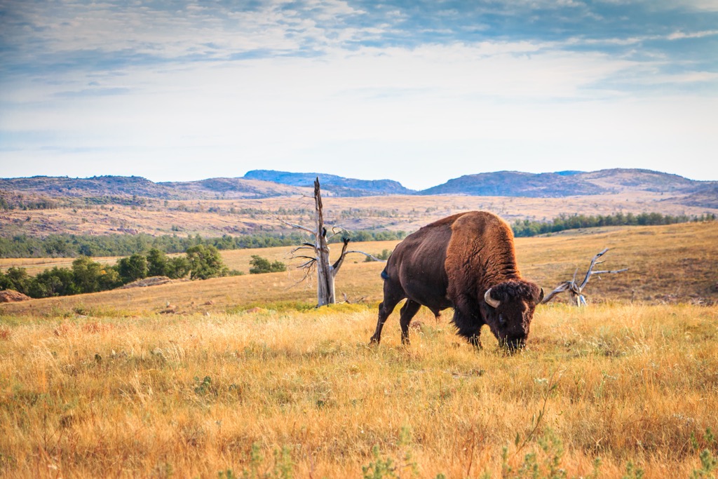
Much of the Wichita Mountains falls within the Wichita Mountains Wildlife Refuge – a 59,000 wildlife haven protecting important mixed grass prairie, lake, and riparian ecosystems. The refuge supports herds of bison, longhorn cattle, elk, and white-tailed deer. Racoons, coyotes, bobcats, mountain lions, owls, and bald eagles also make their home here, along with other small mammals, reptiles, amphibians, and fish.
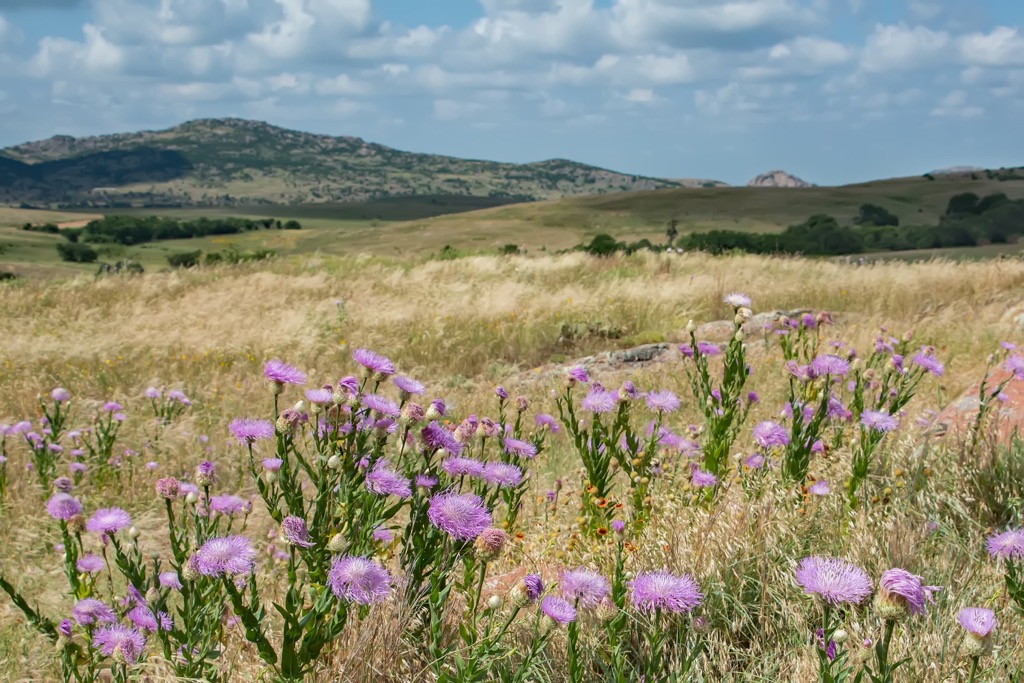
The range sees an annual average rainfall of 30 in (76 cm) along the eastern edge and 25 in (63 cm) on the western side. The mixed prairie along the base has buffalo grass, grama grass, bluestems, Indian grass, and switch-grass. A number of the lakes in the refuge are man-made. Lost Lake was the first to be constructed in 1926, and many more were made by the Civilian Conservation Corps in the 1930s.

The land that is now the Wichita Mountains Wildlife Refuge falls in the territory of the Kiowa Indian Tribe, Comanche Nation, Apache Tribe, and Fort Sill Apache Tribe – a Native American reservation that was disbanded in 2021.
The Comanche began to migrate into the region in the late 1600s and early 1700s. Horses were an integral part of their culture, in part helping them expand their range. The Comanche were not a highly centralized tribe but rather lived in smaller groups with shared culture.
Around the same time, the Apache and Kiowa also moved into the area. The arrival of European explorers and settlers, beginning in the 1540s, marked a period of disease and competition for land and resources. Many Native Americans died and others were forced off their territory and onto reservations.
The wildlife refuge first came to be protected in 1901 as a forest reserve and there was a gold rush in the mountains from 1901 to 1904 that brought 20,000 miners to the area for the brief boom. In 1905 Theodore Roosevelt designated it a “forest and wildlife preserve” with the mission of preserving habitat for the benefit of wildlife.
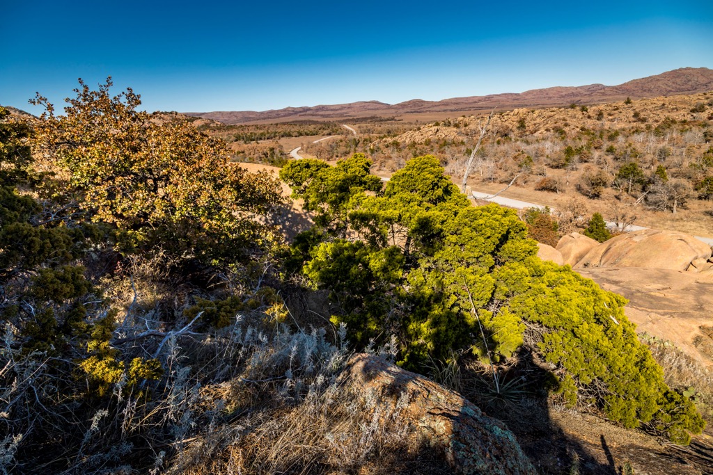
Although some sections of the mountains are part of the wildlife refuge and closed to the public, there are a handful of hikes, a campground, and dispersed camping throughout the range.
Located near the Fort Sill Military Reservation and within the Wichita Mountains National Wildlife Refuge, the Mount Scott overlook is widely accessible. A three mile (4.8 km) paved road leads to the summit making it possible to arrive via car, bike, or on foot.
The road climbs 1,025 ft (312 m) to the summit with great views along the way. Dogs are allowed on leash but hikers should know that there are no official trails besides the paved road so they will be sharing the road with cars. The mountain is also a popular rock climbing spot.
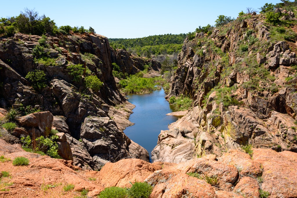
The Charon’s Garden Trail through the Charon’s Garden Wilderness is 2.4 mi (3.9 km) point to point and changes in elevation from 1,525 to 1,765 ft (465 to 540 m). The trail crosses through a canyon with a large rock garden – the perfect outdoor playground for climbing, scrambling, and boulder hopping.
The trail passes several meadows and along creek beds, some of which may be flowing depending on the time of year. The Sunset Picnic Area is the common start to this trail.
The trail up Elk Mountain (2,270 ft/692 m) measures 1.2 mi (1.9 km) out and back. It climbs 580 ft (177 m) on rocky steps and through scrub brush. From the top, views take in the Charon’s Garden Wilderness and French Lake, with the possibility of spotting bison too.

Although not leading into the mountains themselves, the Bison Trail is a popular 6.1 mi (9.8 km) loop trail that crosses varied terrain and several lakes near the base of the mountains. There is only about 400 ft (122 m) elevation gain and it is an ideal path for birding, walking, and running.
The Doris Campground is located in the wildlife refuge and backcountry camping is allowed in the Charon’s Garden Wilderness Area. Several smaller towns lie around the refuge’s periphery, Lawson being the closest.
Oklahoma City is 90 mi (145 km) northeast of the mountains. The population is 650,000 and the city has a strong cowboy influence. Make the most of it by visiting the National Cowboy & Western Heritage Museum or Stockyards City with cattle auctions every Monday and Tuesday and shopping outlets for all western needs.

Those looking to get some fresh air while in the city can stop by the Stinchcomb Wildlife Refuge and Lake Overholser for hiking, fishing, and bird watching. An option closer to town is Martin Nature Park with trails running through grasslands and forested patches.
The city offers a wide range of cuisines from fine dining to food trucks, and lots of hearty American meals such as burgers, steaks, and barbecues. There is also a good selection of hotels and motels throughout the city that accommodate all budgets and locations.
Dallas, Texas lies 220 mi (355 km) southeast of the range and has a population of 1.34 million people. There are diverse cultural and ecological activities to do in the city such as stopping by the African American Museum, the Crow Museum of Asian Art, or the Dallas Arboretum and Botanical Garden.
The city has a lot of live music, in particular country music. Nearby is Fort Worth, a city rich in cowboy culture where you can visit stockyards or watch rodeos.
The dining scene in Dallas has a big emphasis on Tex-Mex and barbecue, but also offers a range of international cuisines and a variety of pizza shops, cafes, delis, and steakhouses. There are many hotels to stay in around the city and campgrounds and RV parks on the quiet outskirts.