
Scan the QR code and open PeakVisor on your phone
Alabama is home to 1,227 named mountains. The highest is Cheaha Mountain at 734 m.
Boasting beautiful shorelines, fantastic food, and a true passion for collegiate football, Alabama is the heart and soul of the United States’ Deep South. Alabama, while not particularly known for its mountains, does contain 987 named high points, the tallest and most prominent of which is Cheaha Mountain (2,405ft/733m).
The state of Alabama is situated in the Deep South of the United States. It shares a border with 4 other states, including Mississippi to the west, Tennessee to the north, Georgia to the east, and Florida to the south.
Although it’s technically located along the Gulf Coast, the state of Alabama has only 60 miles (96.6km) of shoreline as the majority of the region’s coast is taken up by the Florida Panhandle.
That being said, Alabama has a total land area of 52,419 square miles (135,765 sq. km), of which 1,675 square miles (4,338 sq. km) of that is water. This makes Alabama the 30th largest state in the Union in terms of area, though it is the 24th largest in terms of population.
Alabama is a tricky state to categorize into regions as it contains a number of different physiographic and cultural boundaries. Perhaps the most commonly used regional distinction in the state is political, which roughly breaks Alabama into 5 geographic areas.
As the name suggests, north Alabama refers to the northernmost part of the state near its border with Tennessee. This region historically includes the state’s 16 northernmost counties and it is home to about 1/4 of Alabama’s population, many of whom live in Huntsville. It is a heavily industrial region with a large number of high-tech industries, including regional locations for General Electric, 3M, NASA, and Boeing.
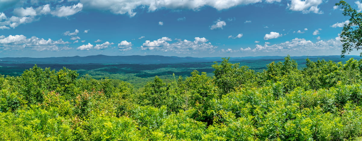
The northern part of Alabama is one of the more mountainous parts of the state. It’s home to the Cumberland Plateau of the Appalachian Plateaus and the Appalachian Mountains as well as a handful of major public land areas, including:
Central Alabama occupies a substantial portion of the state of Alabama to the east and west of the Greater Birmingham region. The borders of the region are generally marked at the north with Cullman County and at the south with Autauga County. It is a heavily industrial area that’s home to large deposits of valuable resources, including limestone, coal, and iron ore.
In Central Alabama, one can find mountains associated with the Cumberland Plateau and the Appalachian Ridges, as well as a handful of protected areas, such as:
The Greater Birmingham Region includes the city of Birmingham in the central part of the state and its 7 surrounding counties: Blount, Cobb, Jefferson, Chilton, St. Clair, Walker, and Shelby. This region is very urbanized and it is home to relatively few mountains, though there are a handful of hills that are part of the Cumberland Plateau.
Since the Greater Birmingham area is mostly metropolitain, there are just a few protected natural areas, including:
Alabama’s Black Belt is located just south of the Central and Greater Birmingham Regions and just north of the Lower South. It historically includes 18 of the state’s counties, though some draw the boundaries to include a total of 24 counties.
The region’s name is actually a reference to the area’s very rich black-colored topsoil, though the racial connotations of the name can’t be overlooked. Indeed, the region was home to some of the largest cotton plantations in the state, many of which had hundreds, if not thousands of slaves in the years leading up to the American Civil War.
Within the Black Belt, there are relatively few high points, but the region is part of the Cumberland Plateau. You can find a handful of parks and recreation areas in this region, such as:
Finally, the southernmost region in Alabama is the aptly named Southern Region, which is sometimes split up into the “South” and the “Lower South.” This area of Alabama is very low-lying and it is mostly flatish wetlands, marshes, beaches, and coastal plains.
The few high points that do exist in this part of the state are part of the Piedmont-Southeast Coast mountains of the Appalachian Mountains. There are a few different protected areas here, including:
The majority of the mountains and high points within the state of Alabama are part of the Appalachian Mountains, which stretch north from the state all the way to the province of Newfoundland and Labrador in Canada.
However, the state itself is very geologically complex, with a wide range of different rock types and physiographic regions. Indeed, Alabama owes its current topography to a complex series of geologic events which have sculpted the region that we see today.
Technically speaking, the state can be broken up into 5 distinct physiographic sections: the East Gulf Coast, the Piedmont Upland, the Valley and Ridge, the Highland Rim, and the Cumberland Plateau.
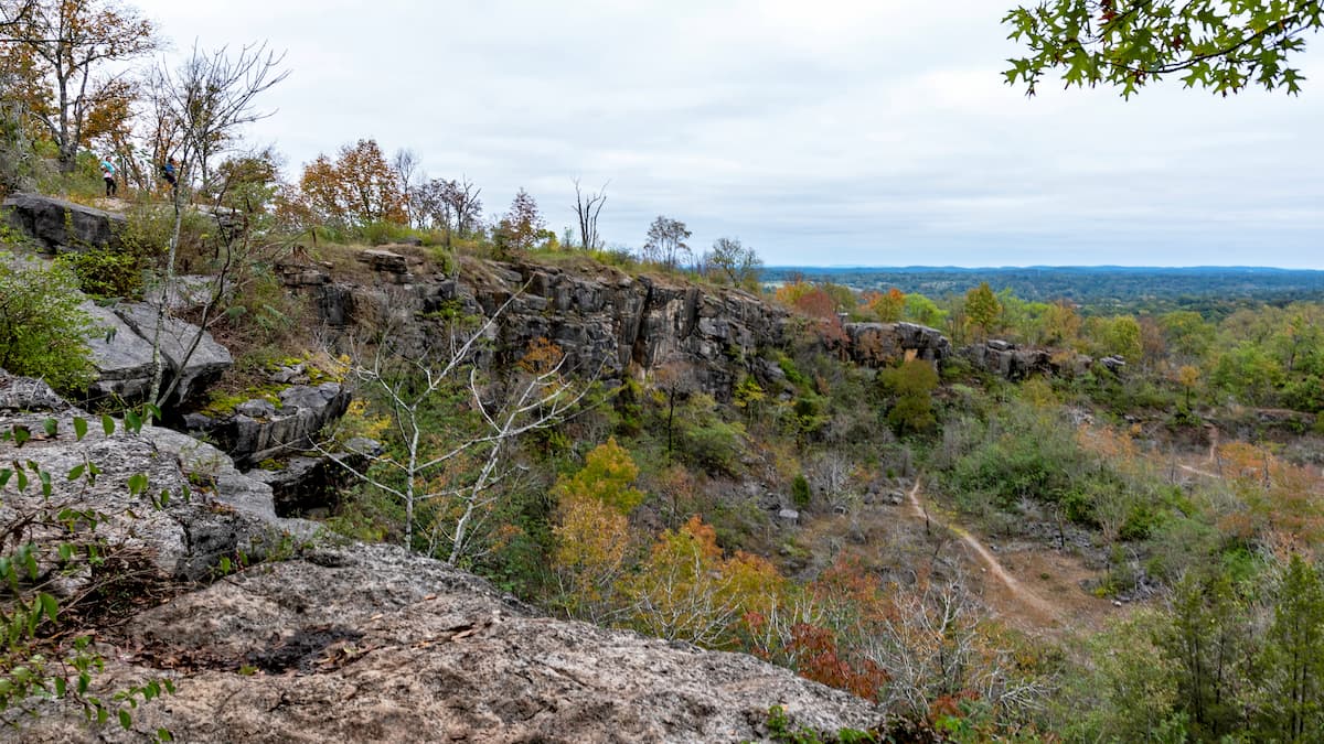
Covering much of northeastern Alabama, including parts of Walker, Winston, Cullman, Marshall, DeKalb, Blount, and Jackson counties, the Cumberland Plateau represents the most southerly part of the main crest of the Appalachian Mountains.
It is known for its high-elevation, flat-topped plateaus, which are bordered by steep river-carved valleys. Most of the bedrock in the region is Paleozoic in age and sedimentary in origin, including shales, dolomites, and limestones. Moreover, the Cumberland Plateau contains large deposits of bituminous coal, which has been mined heavily over the years.
The Highland Rim is situated in the north-central and northwestern parts of the state, around Morgan, Lawrence, Colbert, Madison, Limestone, and Lauderdale counties. This region, like the Cumberland Plateau, is mostly home to Paleozoic-aged sedimentary rocks, though Hartselle Sandstone, Tuscumbia Limestone, and Bangor Limestone are the most common.
Much of the Highland Rim’s current topography is the result of widespread, yet differential erosion rates of the underlying bedrock. The region is home to a number of plateaus, known as cuestas, which slope steeply to one side. There are also quite a few limestone quarries in this region.
Forming the southernmost part of the Appalachian Ridges, the Valley and Ridge region of Alabama includes Etowah, Talladega, Bibb, Jefferson, St. Clair, Shelby, Calhoun, and Cherokee counties in the central part of the state.
Here, the landscape is mostly Paleozoic-age sedimentary rock that has been thrust-faulted and formed into a number of curving ridges. This region is dominated by steep-sided valleys, which have been eroded and thrust faulted into their current shape.
Iron ore was a major mineral resource in this region throughout the 19th and 20th century, which helped to drive the area’s strong iron and steel industries.
The Piedmont Uplands are located in the east-central portion of Alabama and they include Clay Cleburne counties. This area is mostly a large, sloping plateau that slowly bottoms out at the Coastal Plain to the south.
Within this region, you can find a number of different ancient rock layers, some of which date back to the Precambrian. They are often highly metamorphosed and deformed, which is a stark contrast to the sedimentary bedrock to the north. You can find a variety of metamorphosed rocks in the Piedmont Uplands, including slates, marbles, gneisses, schists, and quartzites.
Overall, this region, although considered an “upland,” is mostly flat, though the northernmost part of the Piedmont Uplands is home to the highest mountain in the state, Cheaha Mountain. This region was also a major source of natural resources during the 19th and 20th centuries as it once contained a number of sizable gold veins which helped spur a minor gold rush.
Encompassing the majority of the southern part of the state of Alabama (about 60% of its total land area), the Coastal Plains are a massive physiographic region that features mostly flat topography and some slight rolling hills.
Unlike the regions to the north, the Coastal Plains are composed of much younger bedrock, some of which dates back only as far as the Mesozoic. This area is predominately sedimentary rock and unconsolidated sediments, including various sands, clays, and silts.
There are a few minor cuestas and hills in this region, though there are also quite a large number of wetlands and coastal lowlands in the southernmost parts of the state.
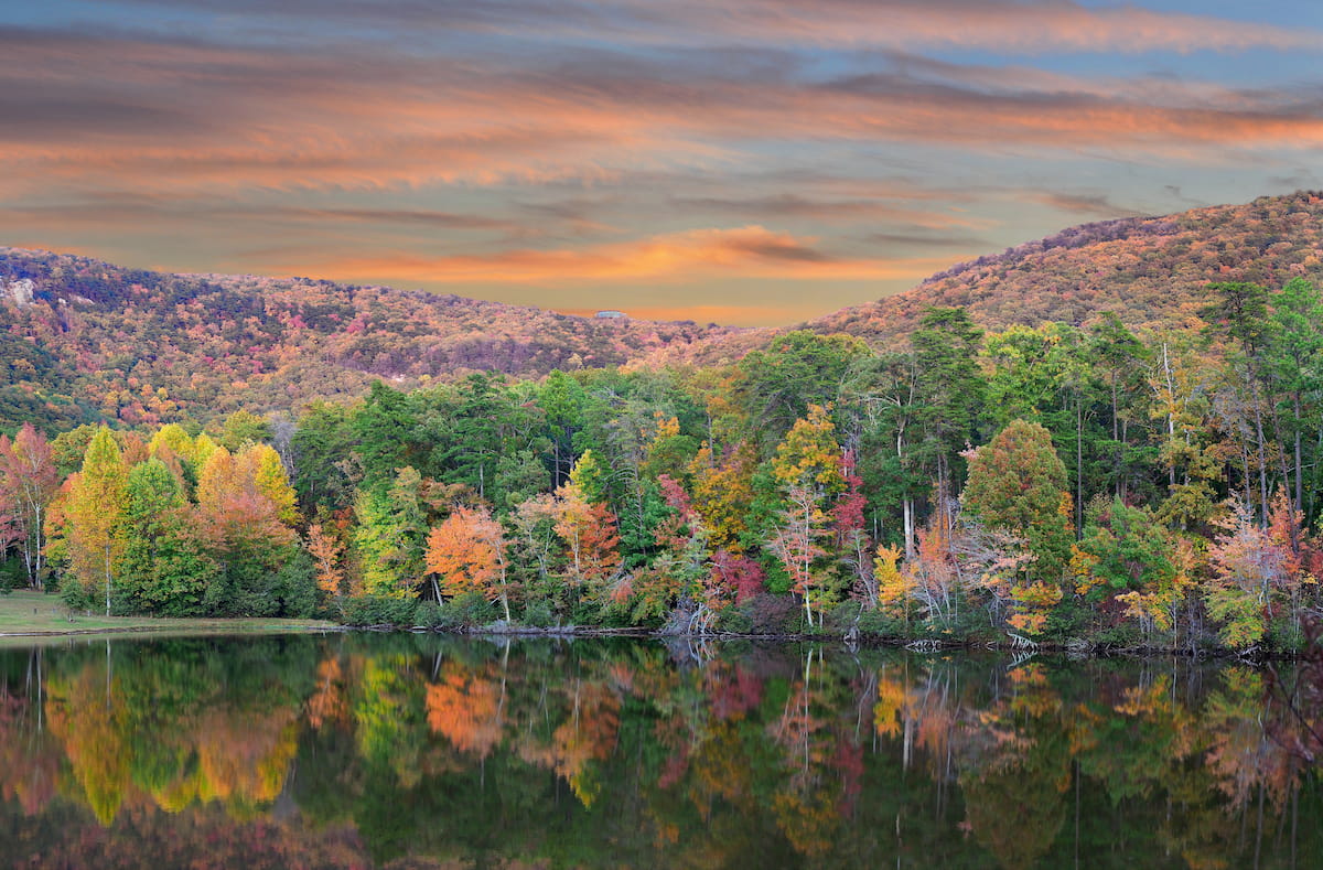
The ecology of the state of Alabama is fairly typical of that of its neighbors. While most of the state is included within the Southeastern Plains ecoregion, the northeasternmost part of Alabama, which is home to the crest of the Appalachian Mountains, has an ecology more typical of the range.
For the most part, Alabama has hot, humid summers, and mild winters. Summers bring plenty of rain, particularly around hurricane season, which can also see massive amounts of rainfall and very high winds, particularly on the Coastal Plains.
The state’s forest is predominantly pine, though one can also find large stands of eastern red cedar, populous, cypress, oak, ash, holly, hackberry, and hemlock. Toward the coast, Alabama also has a sizable population of both palmetto and palm trees.
Wildlife in the state of Alabama includes a number of medium and large-sized mammals, including white-tailed deer, black bears, bobcats, opossums, grey foxes, weasels, muskrats, and beavers. In the past, the state was also home to populations of mountain lions, black bear, plains bison, and elk, though these were mostly extirpated from the region.
Introduced wildlife in the state includes nine-banded armadillo and coypu, the later of which is native to South American countries, such as Argentina, Chile, and Uruguay.
Additionally, Alabama has a wide diversity of bird species, including the yellowhammer and the wild turkey, both of which are the state birds. Other bird species in the state include ospreys, golden eagles, and bald eagles.
Alabama has a long and rich history of human inhabitation that dates back at least 12,000 years. The region that is now known as Alabama was home to a number of different groups at the time of European colonization, including the ancestors of the modern-day Muscogee (Creek) Nation, the Eastern Band of Cherokee Indians, the Choctaw Nation, and the Chickasaw Nation.
Some of the first Europeans to visit Alabama were Spanish colonizers who arrived in the 16th century. Hernando de Soto was perhaps the first to extensively travel the region when he arrived in 1539.
However, by the 17th and 18th centuries, Spain, Britain, and France all laid claim to the region, which, of course, was already home to tens thousands of Indigenous peoples.
The French were among the first to establish a permanent European city in the state, having built a fort at the mouth of the Mobile River, near what is now the city of Mobile. In the aftermath of the Seven Years’ War, France ceded its claimed territories in North America to Britain, transferring control of Alabama to the English Crown.
Interestingly, in 1783, on the same day after losing the American Revolutionary War, the English then ceded control of West Florida to the Spanish and the region that is now Alabama to the newly-formed United States. After a number of somewhat complex land swaps and boundary drawing events, Alabama eventually became its own territory, distinct from the Mississippi Territory to the west.
At the same time, future President Andrew Jackson helped lead a very violent campaign against the Indigenous peoples of Alabama, which eventually led to the forced concession of most Choctaw, Chickasaw, and Cherokee land to the United States and the establishment of Alabama as the 22nd state in the union in 1819.
Two decades later, as president, Andrew Jackson helped pave the way for the Indian Removal Act which started the forced and violent removal of the region’s Indigenous peoples, including the Seminole, Chickasaw, Choctaw, Cherokee, and Creek peoples.
Meanwhile, antebellum Alabama saw a massive increase in the number of large cotton plantations in the state’s Black Belt. Alabama became a center of the slave trade in the region, particularly after the invention of the cotton gin.
In the 1860s, Alabama became one of the first states to succeed from the Union, joining the Confederacy in 1861 at the start of the Civil War. The state went through a difficult post-war Reconstruction period and a long period of Jim Crow legislation.
After the war, the state of Alabama, particularly around Birmingham, became particularly industrialized, which helped spur the state’s economic growth. The state later became a central part of the Civil Rights Movement, particularly with respect to the Selma to Montgomery marches.
These days, Alabama has a rapidly diversifying economy, thanks to the influx of major corporations and organizations, such as Boeing, Airbus, Mercedes-Benz, and NASA. Its economy is also heavily reliant on agriculture, mineral extraction, manufacturing, health care, and education.

Although Alabama isn’t known for being particularly mountainous, it is home to some great hiking areas. Here are some of the best places to check out in the state.
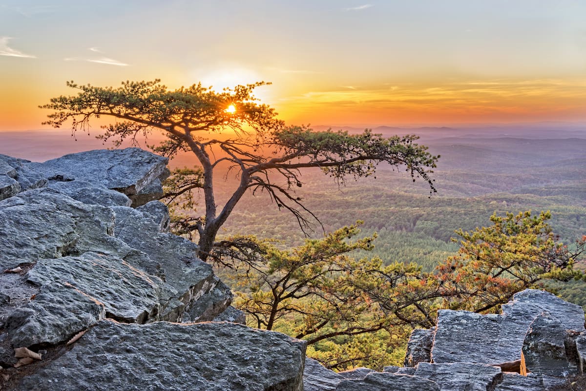
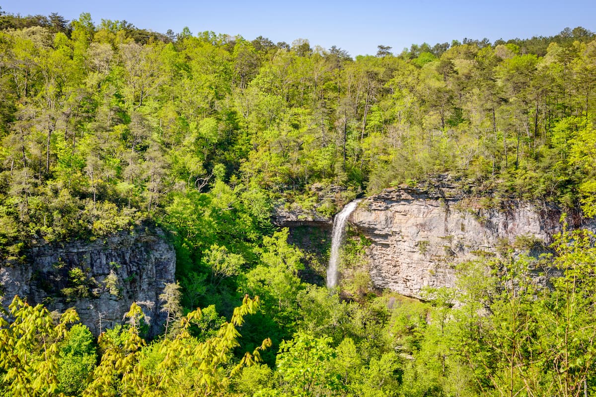
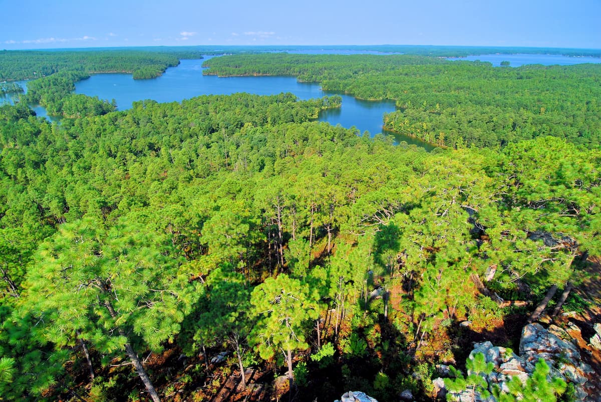
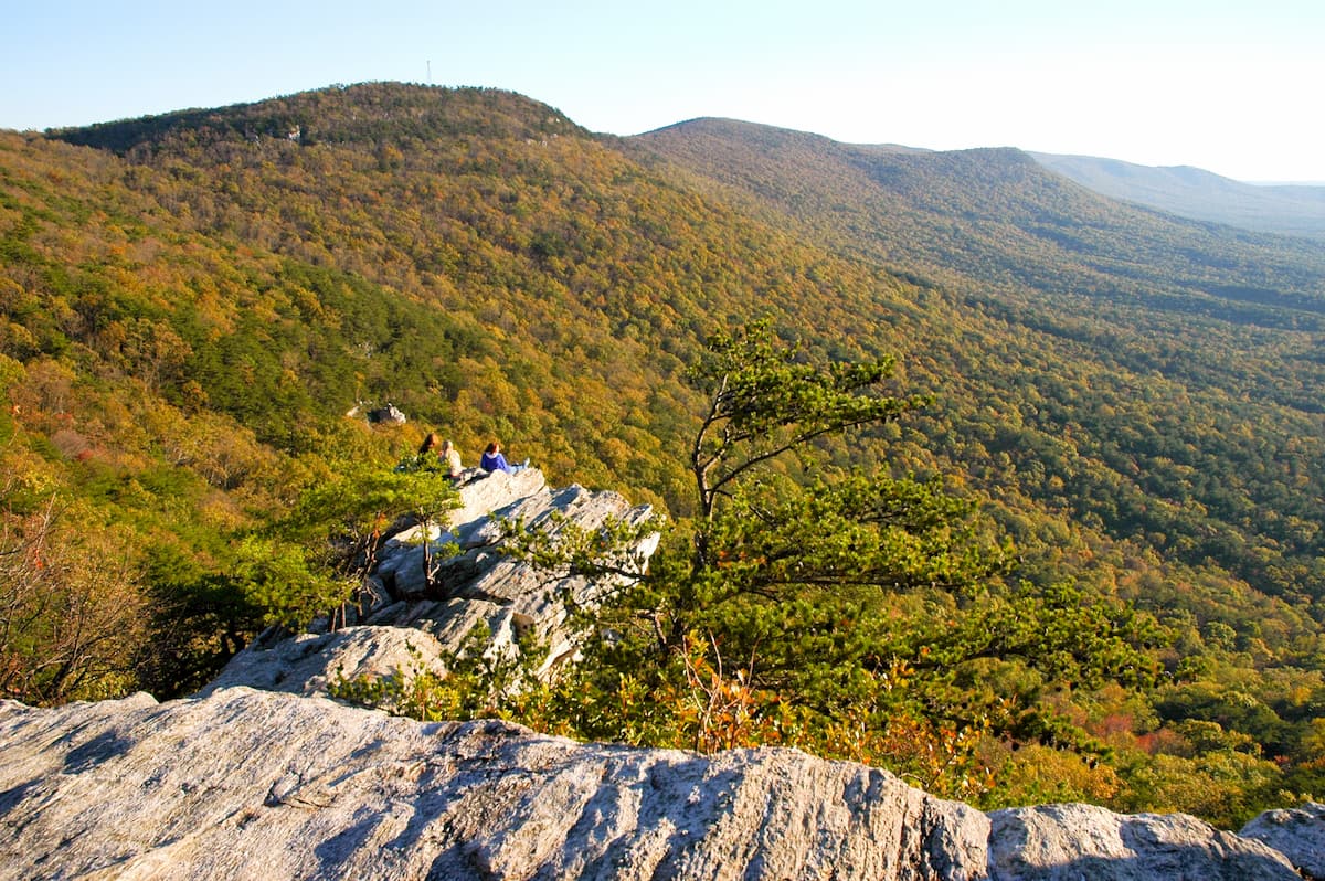
Talladega National Forest is split up into 2 distinct areas, which include 3 ranger districts - the Shoal Creek and Talladega Districts and the Oakmulgee District. Combined, they have 50 named mountains, the highest and most prominent of which is Cheaha Mountain in the Talladega District.
Talladega is known for its dense forests which are almost all second growth pine that replaced the once heavily logged woodlands of Alabama. The forest remains an important refuge for wildlife, including black bears, coyotes, deers, wild turkeys, and even the gopher tortoise.
There are plenty of great trails to check out in the forest, including the Cheaha Falls Trail, the Skyway Loop Trail, and the Pinhoti Trail.
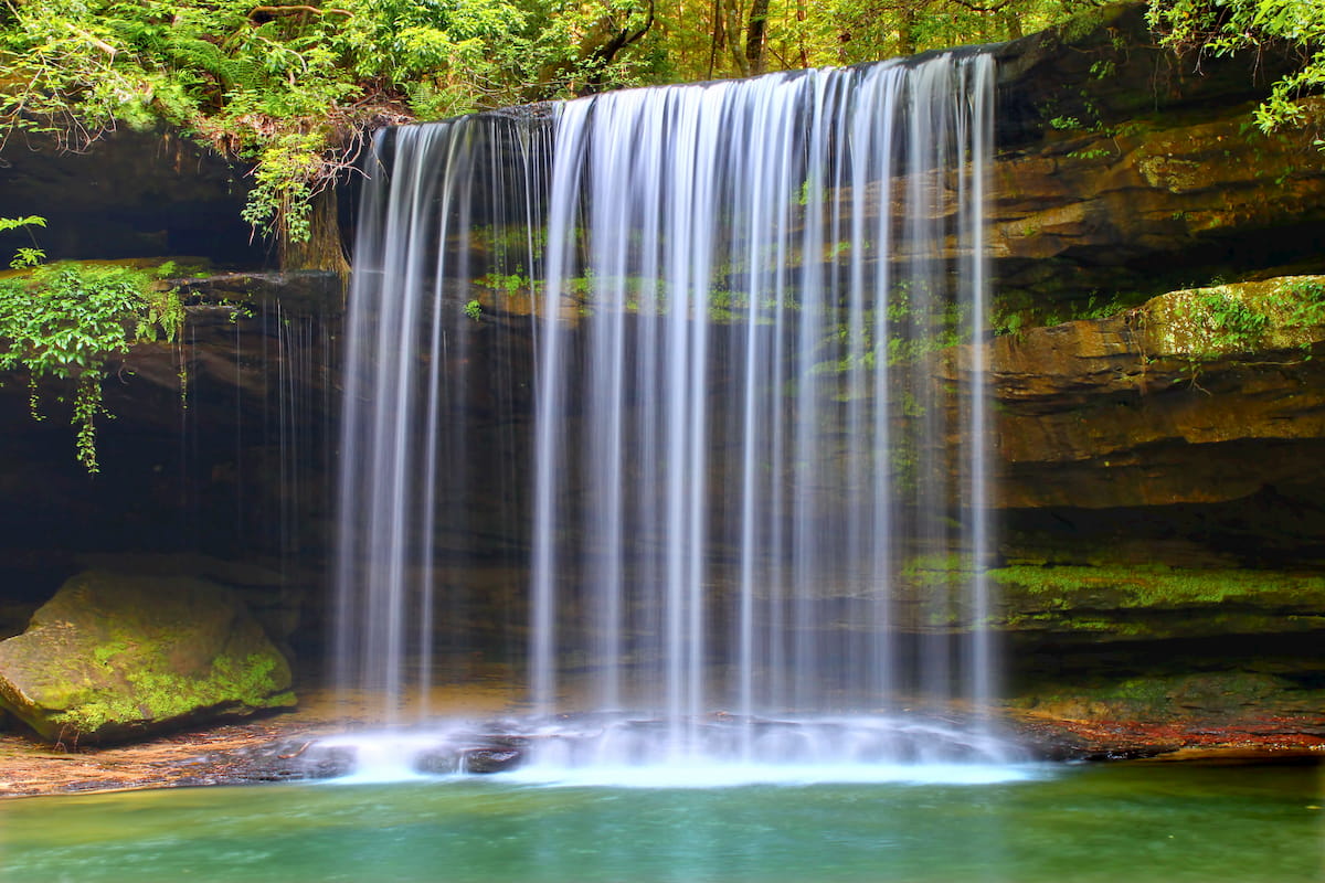
William B. Bankhead National Forest is located in the northwestern part of the state of Alabama, between Huntsville and Birmingham. It contains 21 named mountains, the highest of which is Penitentiary Mountain and the most prominent of which is Millstone Mountain.
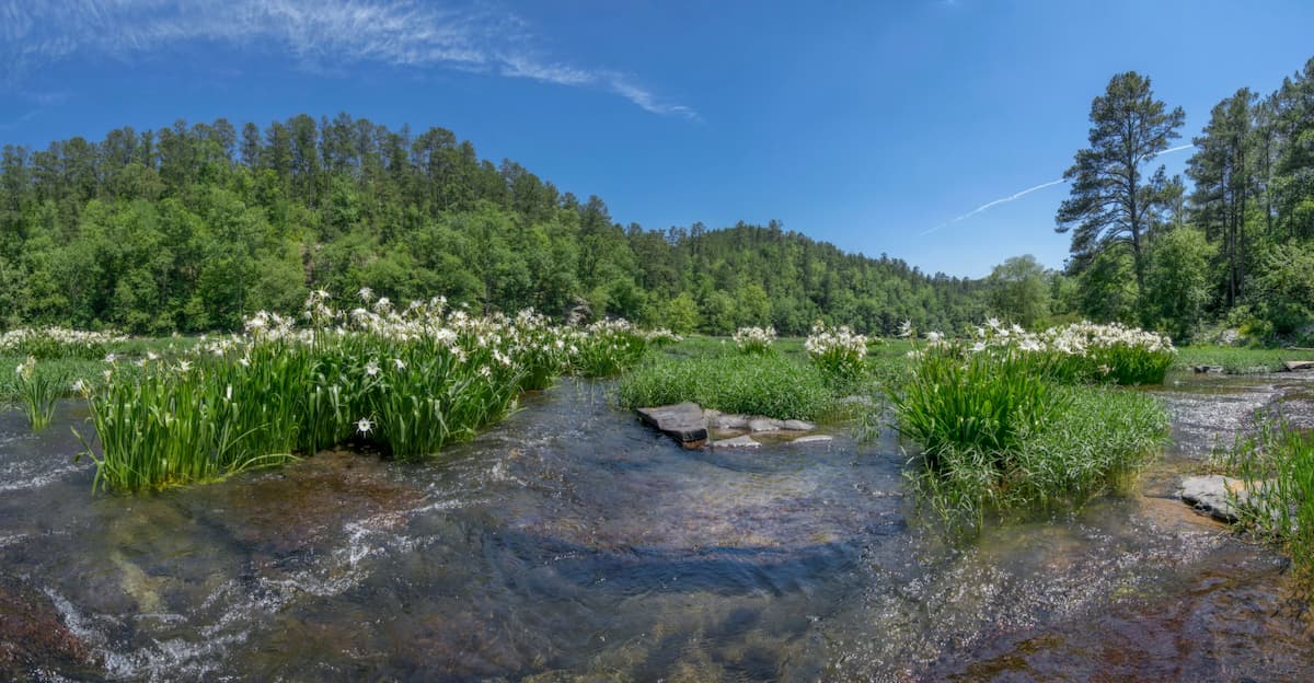
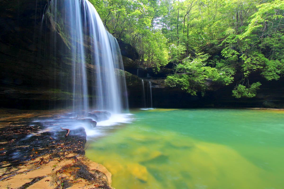
The forest is home to the only National Wild and Scenic River in Alabama, the Sipsey Fork of the Black Warrior River. It is well-loved for its many waterfalls, rivers, and hiking trails. Popular trails include the paths to the Sougahoagdee Falls, Kinlock Falls, and Shangri-La Falls.
Alabama is home to a number of major cities, each of which are well worth a visit. Here are some of the best places to stay if you’re in the area:
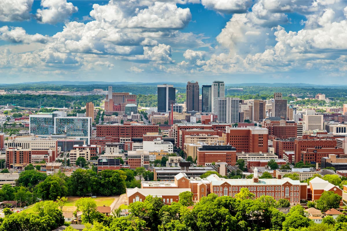
The city of Birmingham is located in the central part of the state of Alabama. It is home to about 1.2 million people, which makes it the largest city in the state. Birmingham was actually founded during Reconstruction and it has since become one of the state’s major economic hubs.
Birmingham is accessible via road on I-20 and I-65, and it is home to the largest airport in the state, Birmingham-Shuttlesworth International.
Montogmery is situated in the south-central part of Alabama. It is home to about 200,000 residents and it was an important location during the Civil Rights Movement. The city is home to a number of large universities, including Alabama State and Auburn. It is accessible via both I-85 and I-65, which provide great access to the surrounding region.
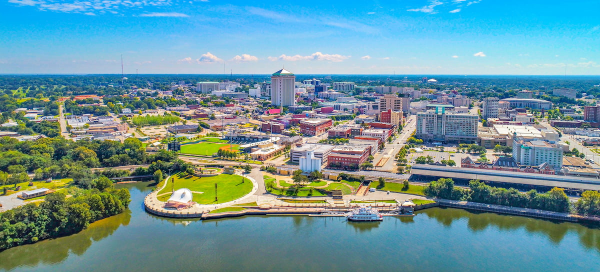
The city of Mobile is located in the southernmost region of Alabama, at the mouth of the Mobile River. It has over 195,000 residents, though about 1.1 million people live in the greater Mobile area. Mobile is a cultural center of the Gulf Coast and southern Alabama, as well as a major shipping and transport hub.
Tuscaloosa is a city of about 100,000 residents located in west-central Alabama. It is a center of commerce and industry for the region and it is also the location of the main campuses of both Stillman College and the University of Alabama.


Yes. Alabama has 1,227 named mountains. The highest is Cheaha Mountain at 734 m.
The highest mountain in Alabama is Cheaha Mountain, at 734 m.
Alabama has 1,227 named mountains.


