
Scan the QR code and open PeakVisor on your phone
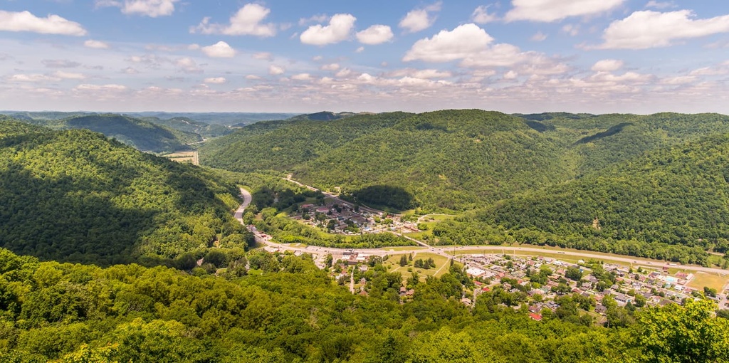
Located in the southern reaches of the Appalachian Plateau, the Cumberland Plateau extends through eastern Kentucky and eastern Tennessee as well as portions of northern Alabama and northwest Georgia. There are 3923 named mountains in the Cumberland Plateau, the highest and most prominent of which is Hinch Mountain (3,054 ft/931 m).
The Cumberland Plateau is the southernmost section of the larger Appalachian Plateau province, a series of rugged dissected plateaus that extend into parts of New York, Pennsylvania, Ohio, Maryland, West Virginia, Virginia, Kentucky, Tennessee, Alabama, and Georgia. It is contiguous with the Allegheny Plateau, and the only real difference between the two plateaus is local naming conventions.
Additionally, Cumberland Plateau is located in eastern Kentucky and Tennessee, as well as in parts of northern Alabama and northwest Georgia. The Allegheny Plateau, on the other hand, occupies western and central New York, northern and western Pennsylvania, northern and western West Virginia, and eastern Ohio.
Both plateaus lie to the west of the Appalachian Mountains and serve as a boundary between the Appalachian Plateau and Valley and Ridge physiographic region.
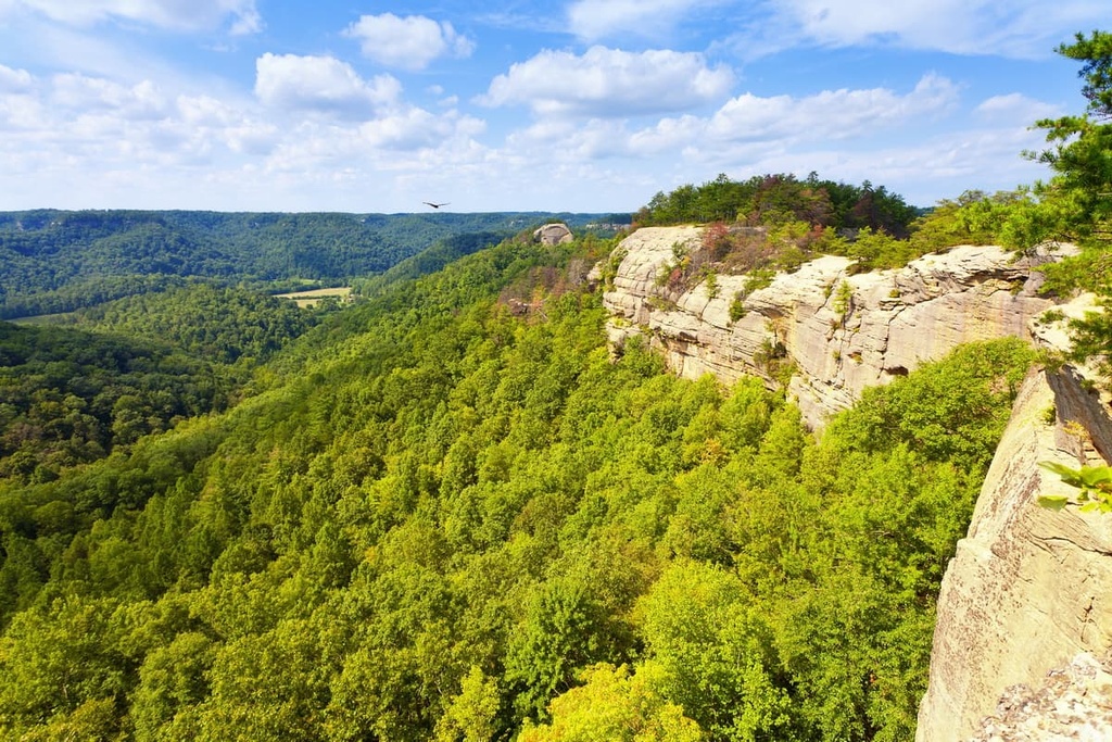
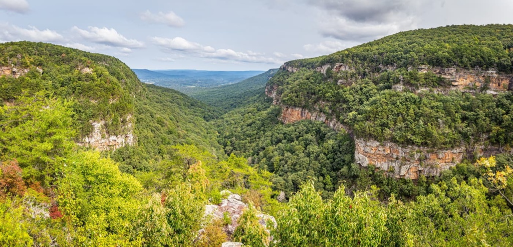
The Cumberland Plateau is generally described as a tableland bordered to the east and west by sheer rock cliffs or escarpments. Elevations on its surface range from about 1,700 to 2,000 feet (518 m to 610 m) above sea level, but they decline as you move southward toward Alabama.
The highest elevations on the plateau are located at the northern end of the Sequatchie Valley and in the Crab Orchard Mountains. Here, several peaks, including Hinch Mountain and Big Fodderstack, reach over 3,000 feet (914 m) in elevation.
In eastern Kentucky, the Cumberland Plateau lies in an area known as the Eastern Kentucky Coal Field. The plateau extends westward to the eastern Knobs, a series of conical, isolated hills that separate eastern Kentucky from the Bluegrass region.
The eastern border of the Cumberland Plateau is shaped by the Pottsville or Cumberland Escarpment, a sandstone belt of cliffs and steep-sided, narrow crested valleys. Knobs and ridges of the escarpment rise about 410 ft (125 m) above the lowlands.
Elevations on the plateau rise as you move from northwest to southeast, with the westernmost areas of the plateau having a relief of about 200 feet (61 m) and the easternmost areas having a relief of over 2,000 feet (610 m).
The Cumberland Plateau in Kentucky is also unique because it contains a massive network of caves. Though most of Kentucky’s commercial caves, like those found in Mammoth Cave National Park, lie in the Dripping Springs Escarpment within the Pennyroyal Plateau, more than 2,000 documented caves have been identified in the Cumberland Plateau.
Major protected areas in the Cumberland Plateau of Kentucky include:
In Tennessee, the Cumberland Plateau is bound by the Highland Rim to the west and Walden Ridge to the east. Walden Ridge extends into Alabama as Sand Mountain and is separated from the main part of the Cumberland Plateau by the Sequatchie Valley.
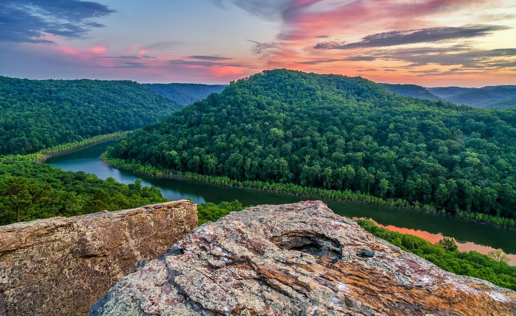
Sequatchie Valley is one of the most unique natural features of the lower Cumberland Plateau in Tennessee. From its northern end to its geological southern end at Browns Valley, it’s almost perfectly straight. It stretches for more than 65 miles (105 km) through Tennessee and it terminates, according to some definitions, in Alabama.
At the northern end of the Sequatchie Valley, just to the west of the easternmost escarpment of the Cumberland Plateau, lies the Crab Orchard Mountains, a rugged, detached range of the southern Cumberland Mountains. The Crab Orchard Mountains contain many peaks over 3,000 feet (914 m) in elevation, including Frozen Head and Big Fodderstack.
Major protected areas in the area include:

In Alabama, the Cumberland Plateau is generally divided into eight physiographic districts – Sand Mountain, Lookout Mountain, Blount Mountain, Warrior Basin, Jackson County Mountains, Murphrees Valley, Wills Valley, and Sequatchie Valley. Each of these areas boasts a variety of natural features and superb outdoor recreation opportunities.

Located at the southern end of the Appalachian Mountains, the Sand Mountain district stretches in a diagonal northeast-southwest direction for roughly 90 miles (145 km) from the Alabama-Tennessee-Georgia border to near Cleveland, Alabama. It is about 15 miles (24 km) wide at its widest point, and it reaches 1,959 ft (594 m) at its highest point, Fox Mountain.
In northwestern Georgia and southeastern Tennessee, Sand Mountain is also referred to as Raccoon Mountain or Elder Mountain, respectively. Geologically, Sand Mountain is a continuation of Walden Ridge (also referred to as Cumberland Escarpment), a mountain ridge in Tennessee that marks the eastern edge of the Cumberland Plateau.
Protected areas in the Sand Mountain district include Sand Mountain Park, Bucks Pocket State Park, High Falls Park, and Lake Guntersville State Park.
Situated to the east of Wills Valley, Lookout Mountain is a mountain ridge that stretches from the northwest corner of Georgia and through the northeast corner of Alabama before reaching Chattanooga, Tennessee.
Lookout Mountain forms the southwestern ridge of the Cumberland Plateau and, at just 50 miles (80 km) long and 10 miles (16 km) wide, it’s much shorter and narrower than Sand Mountain. Many peaks along the ridge rise to 2,000 feet (610 m), including High Point, which sits near La Fayette, Georgia.
In Alabama, the ridge is largely centered around Little River Canyon National Preserve and the DeSoto Falls in DeSoto State Park. The caves of Ruby Falls, the Lookout Mountain Incline Railway, and Noccalula Falls Park are also popular attractions in Lookout Mountain.
Located at the southern end of the Cumberland Plateau, the Blount Mountain district separates the Murphrees Valley district from the southern end of the Wills Valley district. Blount Mountain is about 35 miles (56 km) long and is generally considered a southwestern extension of Sand Mountain. Elevations in the Blount Mountain district range from about 1,000 to 1,300 feet (305 m to 396 m).
Chandler Mountain, one of the most scenic natural attractions in the Blount Mountain area, rises to over 1,400 feet (427 m) and extends from southwest to northeast for about 10 miles (16 km).
Located in central and western Alabama, the Warrior Basin makes up most of the Cumberland Plateau in the state. It extends from just south of the Tennessee River in Morgan County to Tuscaloosa, Alabama.
The Warrior Basin is more mountainous along its northern boundary where it abuts the Jackson County Mountains district. To the west lies a scarp of the Moulton Valley and to the east, you’ll find Sand Mountain and Murphrees Valley. Moulton Valley separates the Warrior Basin from Little Mountain in Tennessee.
Protected areas in the Warrior Basin include the Bankhead National Forest, Black Warrior Wildlife Management Area, and Wheeler National Wildlife Refuge.
Murphrees Valley is the smallest of three nearly parallel valleys that run northeast to southwest through the Cumberland Plateau. It stretches for roughly 30 miles (48 km) from Mountainburg, in Etowah County, to Pinson, in Jefferson County.
The Murphrees Valley is bound by Straight Mountain, a narrow ridge off the northwestern shoulder of Blount Mountain, and Red Mountain, in the Valley and Ridge physiographic region. It lies south of the Sand Mountain district and the Warrior Basin district, and to the north of Blount Mountain.
The Wills Valley district extends for roughly 65 miles (105 km) from northeast Dekalb County, near the Georgia border to Gadsden in Etowah County. It separates Sand Mountain to the northwest from Lookout Mountain, to the southeast.
Wills Valley varies in width from less than 2 miles (3 km) to about 6 miles (10 km) across. Two parallel sandstone ridges split the valley laterally into three parts.
The Sequatchie Valley originates in east-central Tennessee and it enters Alabama at its northeast corner in Jackson County. It extends for about 85 miles (137 km) to the southwest toward Blount County and eventually merges with the Warrior Basin district.
A large part of the Sequatchie Valley is submerged beneath the Guntersville Reservoir. To the south of Guntersville, the valley is divided by the Dividing Ridge. Big Springs Valley lies to the east of the Dividing Ridge and Brown Creek Valley lies to the west.
In Alabama, the Sequatchie Valley is bound by Sand Mountain, to the east, and Gunters Mountain, to the west. Sitting at over 1,100 feet (335 m) in elevation, Taylor Mountain is one of the most prominent features in the Sequatchie Valley.
Though some of the tallest peaks in Alabama lie in the Piedmont Upland, in east-central Alabama, the Jackson County Mountains district is the most mountainous area in the state. In fact, the vertical relief between the valley floor and some of the area’s tallest summits reaches almost 1,100 ft (335 m) in the area.
Mountains in this district include Johnson Top, Putman Mountain, and McCoy Mountain.
A very small part of the Cumberland Plateau extends into northwest Georgia before it continues into Tennessee.
Geographically, northwest Georgia is separated from the rest of the states’ mountain ranges by the Cartersville-Great Smoky Fault. Unlike the variability of peaks and valleys found in the Blue Ridge Mountains, the Cumberland Plateau is generally characterized by linear ridges with long, alternating valleys.
The three principal features of the Cumberland Plateau in Georgia are Sand Mountain (also known as Raccoon Mountain), Pigeon Mountain, and Lookout Mountain. A vast network of caves can be found at Lookout Mountain, including Ellison’s Cave, which is the deepest cave to the east of the Mississippi River.
The Cumberland Plateau is a physiographic section of the larger Appalachian Plateau, which contains a series of dissected plateaus on the western side of the Appalachian Mountains. The Appalachian Plateau stretches from New York to Alabama and was formed by regional uplift during the Paleozoic Era.
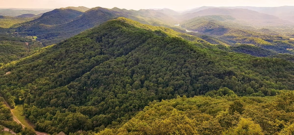
Rising over 1,000 feet (305 m) above the surrounding landscape, the Cumberland Plateau is a deeply dissected plateau with roughly 400 feet (122 m) of topographic relief and many sandstone outcroppings and bluffs. Several north-northeasterly trending valleys intersect the plateau, including Lookout Valley, Mclemore Cove, Sequatchie Valley, and Wills Valley.
The rocks in these areas date back to the Cambrian through Devonian periods (542-359 million years ago), which make them some of the oldest rocks exposed in the plateau.
Furthermore, the rocks that form the cap of the plateau were laid down in an ancient shallow sea over 350 million years ago during the Mississippian and Pennsylvanian periods. Beginning about 285 million years ago, the entire area was slowly lifted over 2,000 feet (610 m) above sea level.
Many of the region's natural features and landforms were shaped by differential erosion of the underlying Paleozoic rocks, which range from Cambrian to Pennsylvanian in age. Rocks that are more resistant to erosion, like sandstone, form the region’s dramatic ridges and cliffs.
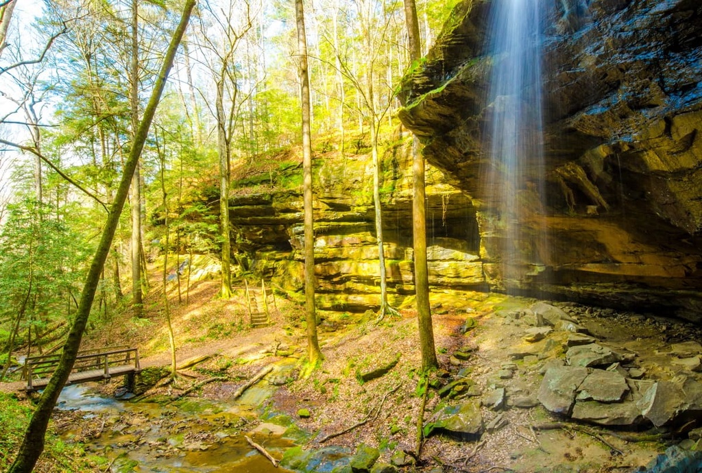
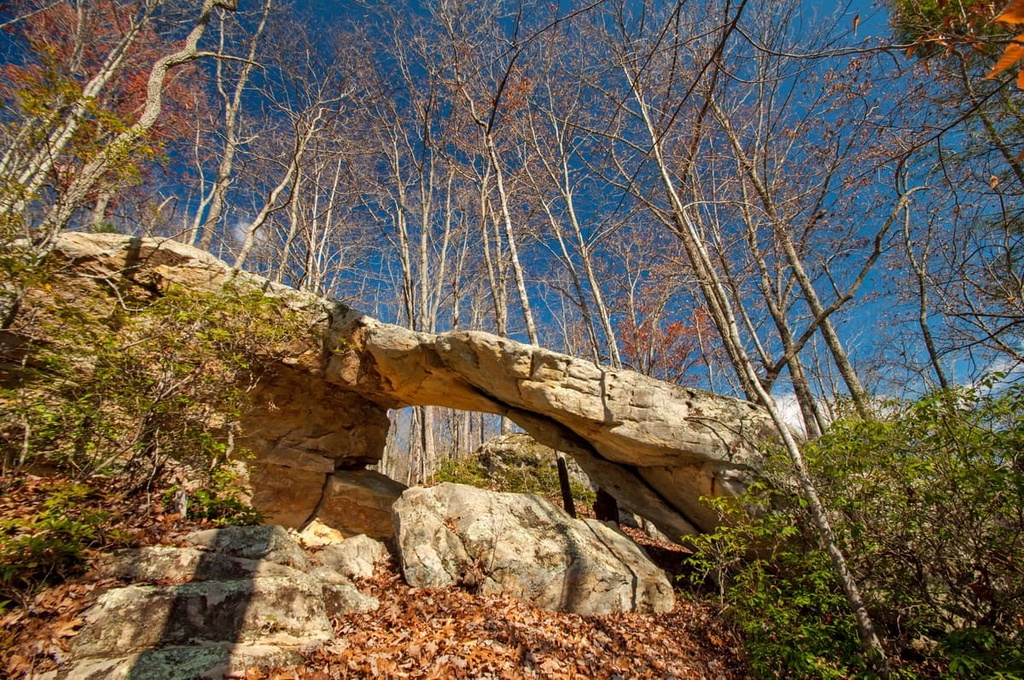
While conglomerate rock is resistant to erosion, the underlying rock is far softer and more easily eroded. Many of the region’s striking natural arches, like those found in the Big South Fork National River and Recreation Area, are formed when resistant sandstone can support its own weight, but the underlying rock erodes away.
Historically, coal mining was an important economic industry in Cumberland Plateau. Most of the coal mined in Kentucky and Tennessee comes from the Cumberland Plateau. It’s known to have some of the richest coal reserves outside of Pennsylvania.
Though coal mining declined on the plateau due to the passage of the Surface Mining Control and Reclamation Act of 1977, several permits have been submitted in recent years to strip mine coal on the plateau and in the Cumberland Mountains. Other mineral commodities mined in the plateau include limestone and iron ore.
The Cumberland Plateau lies in the Southern Appalachians ecoregion, which is located to the west of the main crest of the Appalachian Mountains.
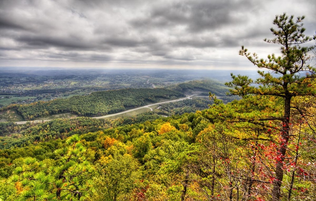
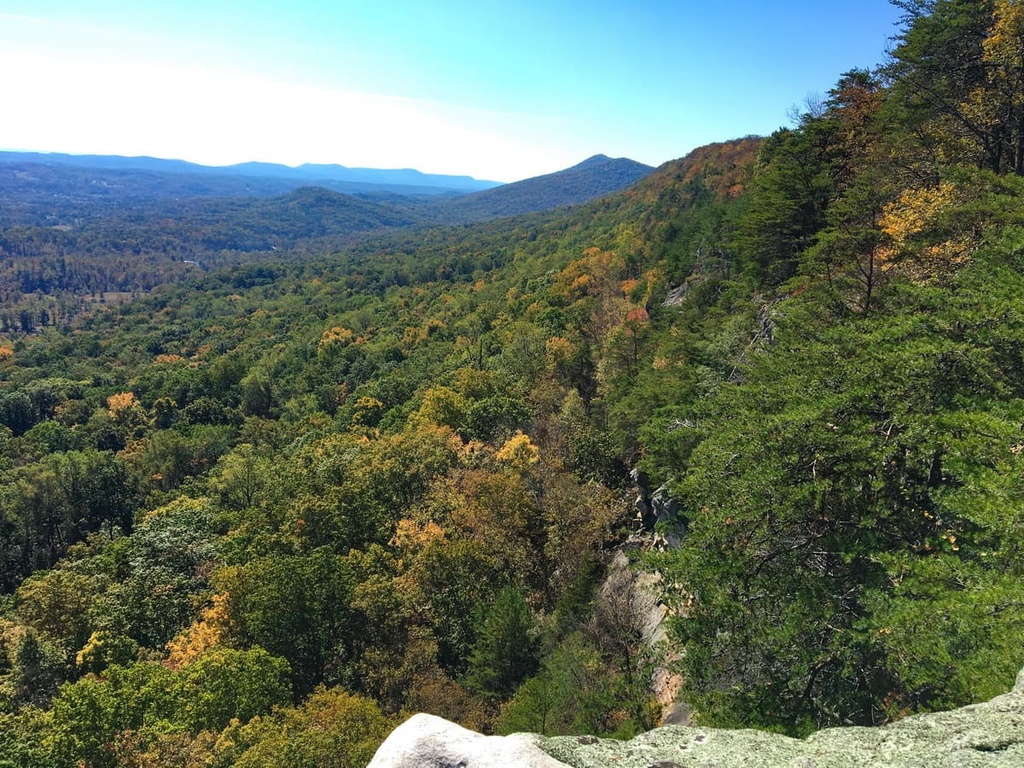
Mixed oak forests dominate the tableland and mountains. Here, shortleaf pine, white oak, and chestnut oak are interspersed with sugar maple, basswood, buckeye, and beech along ridgetops and can be found in ravine forests growing in the gorges of the upper Cumberland Plateau.
In Tennessee, the Cumberland Plateau contains some of the largest remaining tracts of contiguous temperate deciduous forest left in the United States. Shortleaf pine and oak forests are interposed with open woodlands and grasslands, welcoming a variety of bird species, including the prairie warbler, brown-headed nuthatch, and Bachman’s sparrow.
More than sixty one percent of the Cumberland Plateau in northern Alabama is also forested with loblolly-shortleaf pine, oak-hickory, and oak-pine types. Additionally, Appalachian oak forests cover the majority of northwest Georgia, including the Lookout Mountain and Sand Mountain regions.
The region’s mixed oak woods and sandstone cliffs attract a variety of animal species, including turkey, gray squirrel, white-tailed deer, eastern spotted skunk, Allegheny wood rat, and bobcat. The gray fox, skunk, racoon, barred owl, red-shouldered hawk, and Eastern chipmunk also thrive in the lower slopes of the ravine forest.
Archeological evidence suggests that humans have occupied the Cumberland Plateau since the last retreat of the ice sheet in the region during the last major glaciation, which took place, roughly 12,000 to 15,000 years ago.
Indigneous peoples in the region did not typically build permanent settlements on the plateau. Rather, the plateau served primarily as a seasonal hunting ground for Cherokee and Shawnee Tribes in the area..
Early European immigrants were also deterred by the region’s harsh winters, lack of water, infertile soils, and rugged terrain. Traveling to the plateau required traversing the Cumberland Gap or navigating the volatile Cumberland or Tennessee Rivers. Though a handful of European settlers ventured into the Cumberland Plateau as early as the 1700s, it remained mostly unsettled by people of European descent until after the Revolutionary War.
When Europeans first arrived at the Cumberland Plateau, most of the land was used as hunting grounds by the Chickasaw, Cherokee, and Shawnee. Over the course of generations, the Cherokee had largely driven out the Creek, Yuchi, and Shawnee, taking control of vast expanses of the Appalachian Plateau, including the Cumberland Plateau region in eastern Tennessee.
Through a series of treaties, the Cherokee were slowly displaced from their native homelands and the Cumberland Plateau was surrendered to the US government. One of the most notable treaties, the Third Treaty of Tellico, was signed in 1805 and relinquished all Cherokee land in the Cumberland Plateau in Tennessee. Though few immigrants had initially settled on the plateau, the removal of the Cherokee greatly influenced expansion into the area.
Almost immediately, the area saw an influx of English, Welsh, and German settlement. When the industrial revolution hit the Cumberland Plateau in the early 1900s, timber harvesting, tobacco production, and coal mining quickly became the principal economic activities. The introduction of railroads also expanded logging to the once-inaccessible Cumberland Plateau.
By the end of World War II, the area’s coal and timber resources were mostly depleted, and once-booming logging camps and mines turned into ghost towns. As a result, many parts of the Cumberland Plateau have struggled economically in recent decades. However, the region is becoming an increasingly popular destination for outdoor recreation.
The Cumberland Plateau contains hundreds of excellent parks, natural attractions, and recreation areas. These are some of the best places to check out:
These are a few of the best places to explore the Cumberland Plateau region in Kentucky.
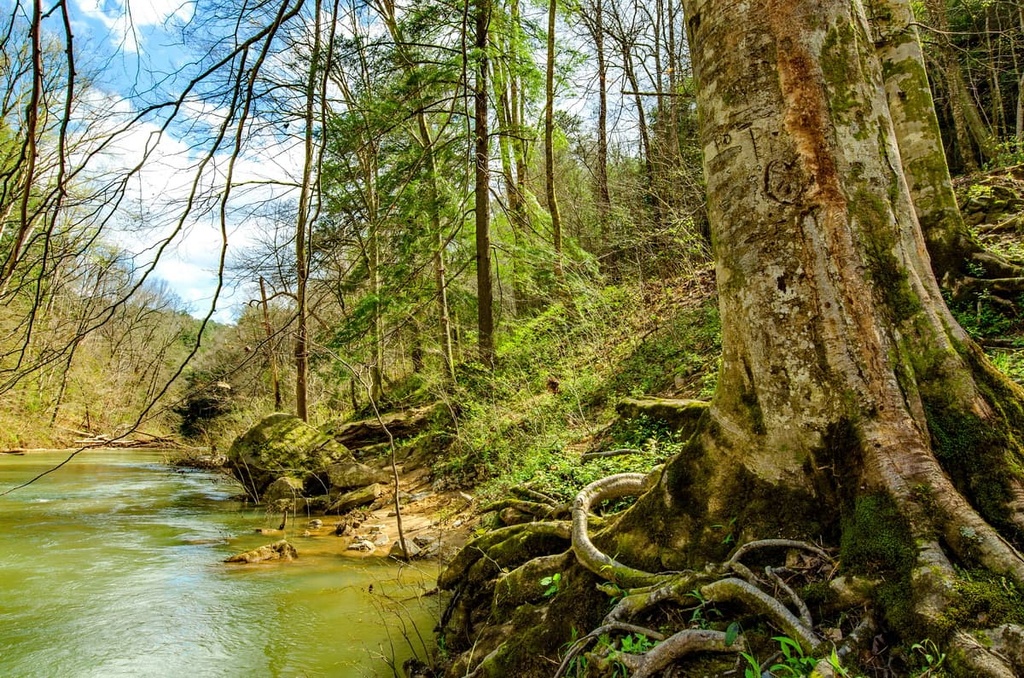
The Big South Fork National River and Recreation Area protects about 125,000 acres (50,586 ha) of the Cumberland Plateau in portions of Tennessee and Kentucky. The park preserves the Big South Fork of the Cumberland River, a designated Kentucky Wild River, as well as one of the highest concentrations of natural bridges in the eastern US.
Hiking is one of the most rewarding ways to experience the area’s natural treasures. Popular trails include Twin Arches, Needle Arch, Sunset Overlook, Angel Falls, Bear Creek Overlook, and the Yahoo Falls Loop.
The Daniel Boone National Forest encompasses 708,000 acres (286,517 ha) of federally owned land within a 2.1 million (850,000 ha) proclamation boundary. Though some of the land remains in private hands, visitors are welcome to explore more than 600 miles (966 km) of scenic hiking trails spread across four districts – Cumberland, London, Redbird, and Steams.
The forest also contains five wildlife management areas, dozens of striking natural features, and several wilderness areas. Some of the most popular attractions include Cave Run Lake, Laurel River Lake, Clifty Wilderness, Beaver Creek Wilderness, the Red River Gorge Geological Area, and the Natural Arch Scenic Area.
Known as the great gateway to the west, Cumberland Gap is a natural mountain pass that slices through the Cumberland Plateau near the point where Kentucky, Virginia, and Tennessee meet. Long before it was discovered by Europeans in 1750, the pass was used by the Cherokee and Shawnee as a gateway through the Allegheny Mountains.
Visitors to the Cumberland Gap National Historical Park can walk in the footsteps of Native Americans, western settlers, and Civil War Soldiers along Wilderness Road. The park also contains 24,000 acres (9,712 ha) of scenic hiking trails and many historic features.
Situated at 2,700 feet (823 m), Kingdom Come State Park lies at the crest of Pine Mountain and protects 1,283 acres (519 ha) of Kentucky wilderness.
Visitors to the park can admire expansive views from several mountaintop overlooks, explore 14 hiking trails, or access Little Shepherd Trail, a 38-mile (62 km) road that’s used for mountain biking. Other features of the park include Raven Rock, Log Rock, and a 3.5-acre (1.4 ha) fishing lake.
Kentucky’s first state park, the Pine Mountain State Resort Park, is idyllically located on the Pine Mountain ridge in the Appalachian Mountains.
The park features 12 miles (19 km) of hiking trails, several picnic areas, an 18-hole golf course, a 30-room lodge, and nine cabins built by the Civilian Conservation Corps in the 1930s. Popular attractions in the park include Honeymoon Falls, Rock Hotel, Timber Ridge, Chained Rock, and the Hemlock Garden.
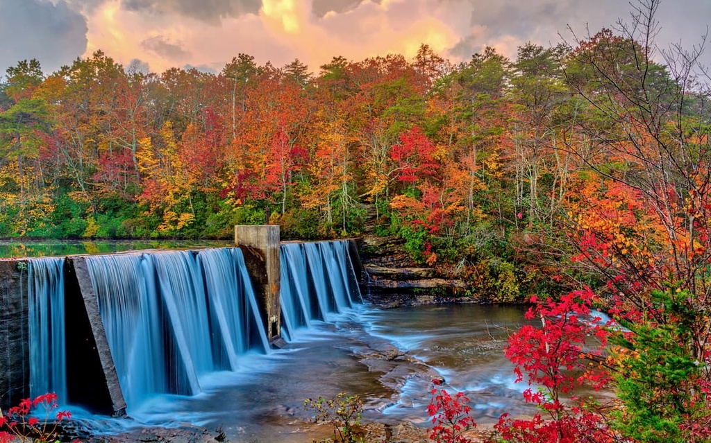
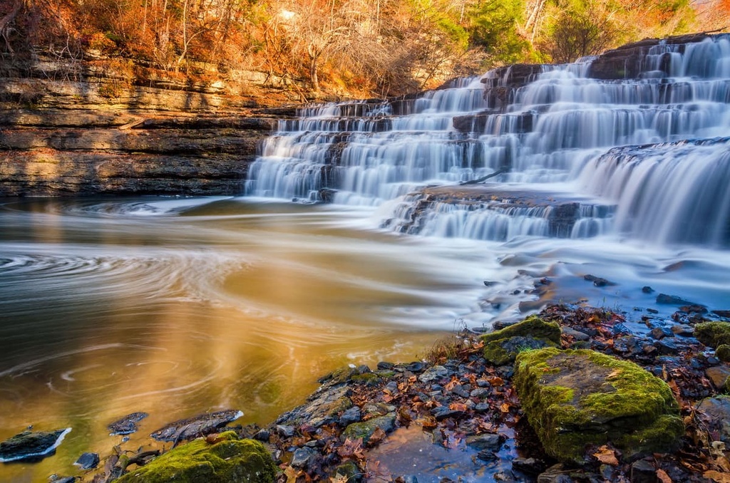
Known as the “Niagara of the South,” Cumberland Falls measures 68 feet (21 m) tall and 125 feet (38 m) wide, making it the largest waterfall in Kentucky.
An impressive 3,600 cubic feet (102 cubic meters) of water spills over the Cumberland’s sandstone edge every second. At night, during a full moon, the mist from the waterfall often creates a magical moonbow, a rare phenomenon that appears when the moonlight reflects off the water vapor from the falls.
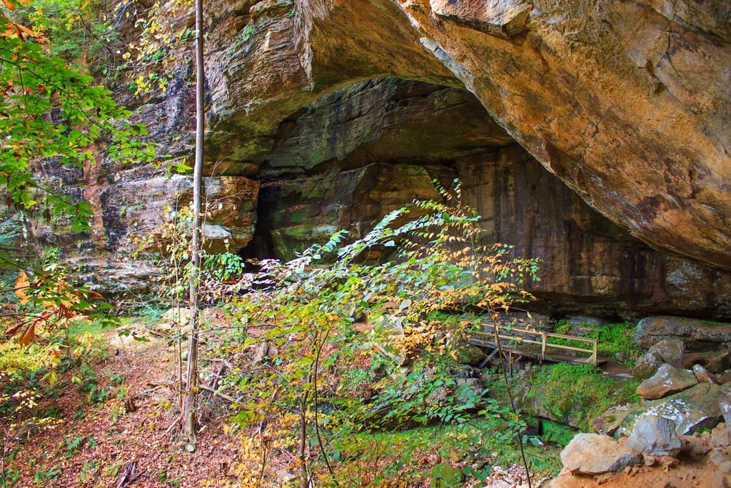
Carter Caves State Resort Park protects about 2,000 acres (809 ha) of land around the Carter and Cascade Cave system. The park features more than 30 miles (48 km) of wooded nature trails, year-round cave tours, a lodge, and a full-service campground. Visitors are also encouraged to stop by the Carter Caves Gem Mine to search for colorful gemstones and fossils.
Each cave in the park has distinct features that represent its unique geological past. For example, Cascade Cave, the largest cave in the park, features an underground lake room and a 30-foot (9.1 m) underground waterfall.
The Blue Ridge Mountains and Great Smoky Mountains draw most of the visitors to Tennessee, but the Cumberland Plateau region of the state is also packed with scenic value and natural treasures. Here are some of the most popular parks and outdoor recreation destinations to check out.
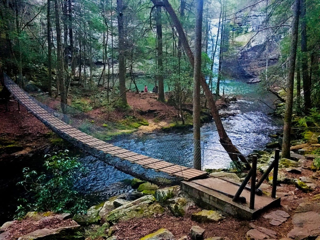
Established in 1978, South Cumberland State Park is a collection of nine noncontiguous tracts of land that cover over 30,800 aces (12,460 ha) across four Tennessee counties—Grundy, Franklin, Marion, and Sequatchie.
The park protects a variety of terrain, including the ravines of the southern Cumberland Plateau. A dozen trails traverse the landscape, leading through lush forests to cascading waterfalls, spectacular rock formations, craggy gorges, and natural sandstone arches.
Centered around Byrd Lake, Cumberland Mountain State Park covers 1,720 acres (696 ha) of the Cumberland Plateau. The park began in 1934 as a part of the greater Cumberland Homesteads Project, an initiative that helped poverty-stricken farmers, coal miners, and factory workers relocate to small farms in the Cumberland Homestead community during the Great Depression.
Today, the park maintains 37 rustic cabins, a lodge, 147 campsites, several picnic pavilions, an Olympic-size swimming pool, and a golf course. Several miles of hiking trails meander through hemlock forest, following Byrd Creek and the shoreline of Byrd Lake.
One of Tennessee’s largest and most visited state parks, Fall Creek Falls State Park encompasses more than 29,800 acres (12,060 ha) of the Cumberland Plateau. The park boasts 56 miles (90 km) of scenic hiking trails centered around the Cane Creek Gorge, an area known for its cascading waterfalls, rugged gorges, and lush stands of virgin hardwood timber.
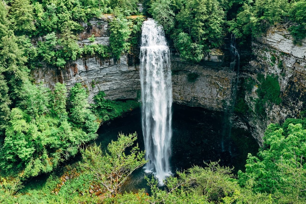
The park’s namesake waterfall, Fall Creek Calls, plummets an impressive 256 feet (78 m) into a gorge below, making it one of the highest waterfalls in the eastern US. Other waterfalls in the park include Piney Falls, Cane Creek Falls, Rockhouse Falls, Coon Creek Falls, and Cane Creek Cascades.
Located at the eastern edge of the Highland Rim adjacent to the Cumberland Plateau, the Burgess Falls State Natural Area encompasses 217 acres (88 ha) of mixed forest, sheer bluffs, narrow ridges, and cascading waterfalls. The main attraction in the area is Burgess Falls, which plunges 126 feet (38 m) into a large limestone gorge below.
The Virgin Falls State Natural Area encompasses about 1,157 acres (468 ha) of unique geological features, caves, and spectacular waterfalls in White County, Tennessee.
The park’s most popular attraction, Virgin Falls, was formed by an underground stream that emerges from a cave, before plummeting over a 110-foot (34 m) cliff and disappearing into another cave below. Other waterfalls in the area include Big Laurel, Sheep Cave Falls, and Big Branch Falls.
The Cumberland Plateau region of Alabama is one of the more scenic areas of the state. From sandstone plateaus and ridges to vast canyons and valleys, the beauty in Alabama’s plateau region is hard to beat. These are some of the more popular parks and recreation areas to check out in the region.
The Walls of Jericho tract protects about 12,500 acres (5,059 ha) of the James D. Martin-Skyline Wildlife Management Area in Alabama and about 750 acres (304 ha) of the Bear Hollow Mountain Wildlife Management Area in Tennessee.
The main attraction in the area is the Walls of Jericho hiking trail, which descends more than 1,000 feet (305 m) into a box canyon. The trail highlights several impressive geological features, including a natural limestone amphitheater.
Located along the banks of the Tennessee River, Lake Guntersville State Park encompasses over 6,000 acres (2,428 ha) of natural woodlands and boasts 36 miles (58 km) of hiking and biking trails.
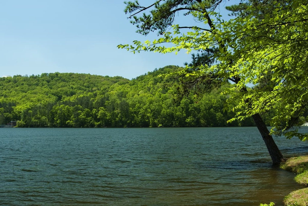
The park is home to Alabama’s largest lake, Lake Guntersville, which stretches 75 miles (121 km) from Guntersville Dam to Nickajack Dam.
Home to Alabama’s only National Wild and Scenic River, the Sipsey Fork, the Bankhead National Forest protects over 180,000 acres (72,843 ha) of wilderness. It is lovingly known as the “land of a thousand waterfalls,” and is a popular destination for hiking, boating, fishing, canoeing, and horseback riding.
The most frequented area of the forest is the Sipsey Wilderness, which covers almost 25,000 acres (10,117 ha) of land and contains dozens of waterfalls and many Indigenous artifacts. Popular trails in the area include Kinlock Falls, Caney Creek Falls, Feather Hawk Falls, and Sougahoagdee Falls.
Established in 1992, the Little River Canyon National Preserve protects over 15,000 acres (6,070 ha) of the southern Cumberland Plateau in Alabama.
Together with the adjacent Desoto State Park, the preserve protects the remarkable Little River Canyon, Little River, and a wide variety of rare and threatened plant and animal species. The preserve offers many recreational opportunities, including hiking, swimming, fishing, climbing, and world-class whitewater paddling.
Located on Lookout Mountain, adjacent to the Little River Canyon National Preserve, DeSoto State Park protects over 3,500 acres (1,416 ha) of northeast Alabama wilderness. The park’s main attraction is DeSoto Falls, which plunges 104 ft (32 m) into a rock amphitheater below.
The heavily forested Cumberland Plateau region of Georgia is one of the least visited areas in the state for outdoor recreation. That said, there are many great hiking and outdoor recreation areas to explore. These are some of the best places to check out in northwest Georgia.
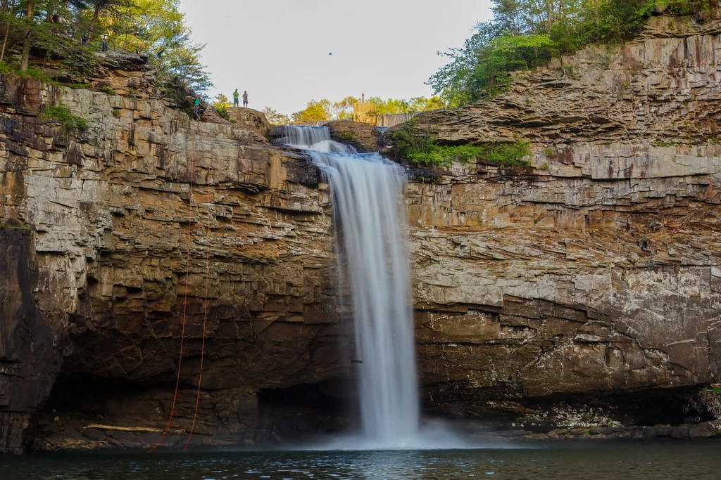
Home to deep canyons, sandstone cliffs, wild caves, cascading waterfalls, and dense woodland, Cloudland Canyon is arguably the most scenic state park in Georgia.
The park protects roughly 3,485 acres (1,410 ha) of the Cumberland Plateau in Georgia and straddles a massive gorge cut into the west side of Lookout Mountain. One of the best views into the canyon is a short walk from the picnic area. However, visitors are also encouraged to explore the park via 64 miles (103 km) hiking trails and 30 miles (48 km) of biking trails.
The Lula Lake Land Trust is a privately owned property dedicated to preserving the Rock Creek Watershed.
It boasts over 8 miles (13 km) of trails leading through beautiful hardwood forest to stunning waterfalls and overlooks. The most popular attraction in the area is 120-foot (37 m) Lula Falls. However, the Lula Lake trail system is only open to the public on select dates and reservations are required.
There are thousands of major cities, bedroom communities, rural towns, chic resorts, and modest vacation rentals scattered throughout the Cumberland Plateau. These are some of the best places to visit during your trip to the Cumberland Plateau.
Known as the “Horse Capital of the World,” Lexington is the second-largest metro area in Kentucky after Louisville.

Lexington is well-known for its natural beauty. Just minutes from the center of town are acres of manicured pastureland and over 450 horse farms. The city boasts a wide variety of dining options and lodging options, as well as parks, theaters, art galleries, and shopping malls. It is also just 65 miles (105 km) from the Daniel Boone National Forest.
Nestled between the Cumberland River and the Daniel Boone National Forest, Williamsburg is lovingly referred to as the “Gateway to the Cumberlands.”
Boasting a population of just over 5,200 people, Williamsburg is a much smaller community than Lexington. However, it’s centrally located near many of Kentucky’s most prized natural features, including Cumberland Falls State Resort Park and Big South Fork of the Cumberland River. Williamsburg also hosts the Sally Gap Bluegrass Festival, one of the top bluegrass festivals in the state.
Nicknamed the “Scenic City,” Chattanooga lies at the foothills of the Appalachian Mountains along the Tennessee River. It offers an incredible combination of scenic beauty, rich history, charming accommodations, and delightful restaurants.

Chattanooga is also surrounded by premier outdoor recreation destinations, including the Prentice Cooper State Forest, Cumberland Mountain State Park, North Chickamauga Creek Gorge State Park, South Cumberland State Park, Bledsoe State Forest, and Fall Creek Falls State Park.
Often referred to as the “Country Music Capital of the World,” Nashville is a lively city whose culture and identity is largely centered around the music scene. The city was founded on Christmas Eve in 1779, and has a history of creating celebrated storytellers, artists, musicians, and entertainers.
In addition to the many musical attractions scattered throughout the city, Nashville is home to a thriving art scene, a variety of museums, plenty of wonderful restaurants, and many miles of walking and biking trails.

Located on the Black Warrior River, Tuscaloosa is a vibrant community filled with extraordinary history. The city is named after legendary chief Tuskaloosa (Black Warrior) who was killed in an encounter with Spanish conquistador Hernando de Soto.
Though it’s much smaller than Atlanta, Tuscaloosa offers a variety of entertainment, dining, and lodging options. It’s also central to several parks, including Lake Lurleen State Park, Moundville Archeological Park, and Tannehill Ironworks State Park.
Home to about 1.2 million people, Birmingham was founded through the merger of three existing farm towns during the post-Civil War Reconstruction period. It has since become one of the primary industrial centers of the South.
Birmingham sits in Jones Valley and is flanked by several long mountain ridges. Sand Mountain borders the city to the north and contains several protected areas, including Sand Mountain Park, Bucks Pocket State Park, High Falls Park, and Lake Guntersville State Park.

Before and during the Civil War, Huntsville was a center for railroad and river-based trade and commerce. Today, the city boasts a wide range of historic landmarks and features, including one of the nation’s oldest existing railroad depots and one of the largest concentrations of antebellum homes in the South.
Huntsville is surrounded by several plateaus that are locally known as ‘mountains.’ For example, to the east of the city, you’ll find Monte Sano Mountain, which is home to Monte Sano State Park, a 2,140-acre (866 ha) recreation area. Visitors to Huntsville can also participate in outdoor activities in and around Chapman Mountain, Huntsville Mountain, Wade Mountain, Brindley Mountain, and the Green Mountains.

LaFayette is a small community located in the extreme northwest corner of Georgia. Despite its modest size, however, LaFayette is rich in Indigenous and Civil War history, and it sits near some of the most beautiful valleys in the region.
Visitors to LaFayette can see the oldest brick school in the state of Georgia, hike to Keown Falls, visit one of the tallest and deepest underground waterfalls in the US, or learn about the region’s fascinating history at the Marsh House.


