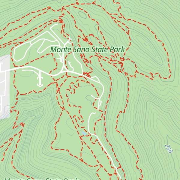
Monte Sano Mountain is a mountain located in Huntsville, Alabama. The name Monte Sano is Spanish for "Mountain of health". The mountain was given its name by Dr. Thomas Fern, who along with his two brothers, founded a small colony on the mountain during an epidemic of yellow fever, malaria, and cholera. The location on the mountain was chosen because of its cool air and medicinal springs.
The top is relatively flat and lies just under 500 meters above sea level. This elevation is about 300 meters higher than the floor of the Tennessee Valley, which surrounds it. A residential neighborhood occupies the western portion of the top. The eastern portion and slopes of the mountain are occupied by Monte Sano State Park. Monte Sano is connected to Round Top (Burritt) Mountain by a col to the south.
We use GPS information embedded into the photo when it is available.
3D mountains overlay
Adjust mountain panorama to perfectly match your photos because recorded by camera photo position might be imprecise.
Move tool
Rotate tool
Zoom
More customization
Choose which peak labels should make into the final photo and what photo title should be.
Next
Photo Location
Satellitte
Flat map
Relief map
Latitude
Longitude
Altitude
OR
Latitude
°'''
Longitude
°'''
Apply
Register Peak
Peak Name
Latitude
Longitude
Altitude
Register
Teleport
PeakVisor
This 3D model of Sagarmatha National Park in Nepal was made using the PeakVisor app topographic data. The mobile app features higher precision models worldwide, more topographic details, and works offline. Download PeakVisor maps today.
Download OBJ model
PeakVisor
The download should start shortly. If you find it useful please consider supporting the PeakVisor app.
PeakVisor for iOS and Android
Be a superhero of outdoor navigation with state-of-the-art 3D maps and mountain identification in the palm of your hand!