
Scan the QR code and open PeakVisor on your phone
Pennsylvania, also known as the Keystone state for its geographic location and importance in relation to the thirteen original U.S. colonies, spans 44,817 square miles, many of which are covered by forest. The Appalachian mountain range crosses the entirety of the state, surrounded by the subranges of the Allegheny and Pocono mountains. Pennsylvania boasts 121 state parks (the 8th highest number in the US) and 20 state forests containing an abundance of wildlife, biodiversity, and opportunities for outdoor recreation. Pennsylvania’s vast wilderness areas are popular among hikers, backpackers, birders, campers, leaf peepers and all outdoor enthusiasts who enjoy the many scenic overlooks and viewpoints the Keystone state has to offer. The highest point in Pennsylvania is Mount Davis, a 3,213-foot mountain located in the southern portion of the state. Though not particularly mountainous, Pennsylvania offers its own unique views, most notably river valleys and beautiful gorges.
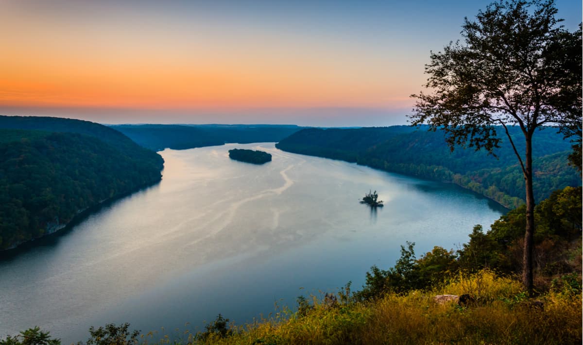
About 100 miles southeast of Erie, PA is the Allegheny National Forest (ANF). The forest spans over 500,000 acres and across four Pennsylvania counties. There are fifteen trail systems that can be found in ANF, one of which is the North Country Trail, a National Scenic Trail that travels from Upstate New York to North Dakota through seven (soon to be eight) states. In the winter, these trails act as cross country skiing trails, which is yet another excellent way to enjoy the majesty of this national forest. There are also many beautiful viewpoints within ANF, including Jakes Rock Overlook which shows off the natural beauty of the Allegheny River and Western Pennsylvania.
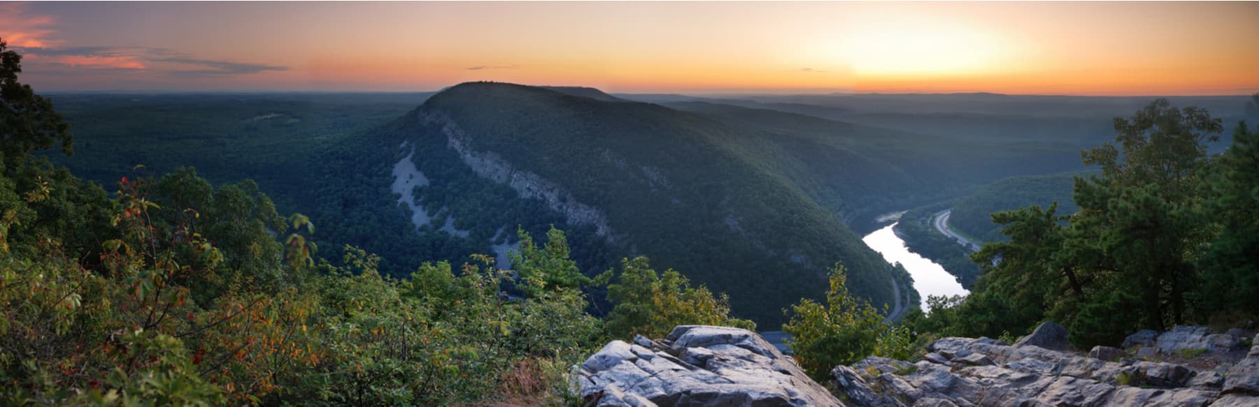
Pennsylvania is home to 299 miles of the Appalachian National Scenic Trail and is nicknamed “Rocksylvania” by many AT hikers for its abundance of rocky terrain. The southern portion of the AT in Pennsylvania is characterized by smooth, rolling farmland, which gives way to the rocky trail that gave it its nickname north of the Susquehanna River. The midpoint of the Appalachian Trail is found in Pennsylvania, as well as the Appalachian Trail Museum in Pine Grove Furnace State Park. Near the Pennsylvania- New Jersey border, northbound Appalachian trail hikers pass through the small town of Delaware Water Gap (DWG). Delaware Water Gap is easily accessible by road or bus and is a popular starting point for weekend hikes and backpacking trips.
Although less well-known than the Pennsylvania section of the Appalachian Trail, the Mid-State Trail is Pennsylvania’s longest and most remote footpath. Extending from Maryland in the south to New York in the north, the MST is currently 585.67 kilometers long. Interestingly, all MST guidebooks published since 1973 have exclusively used the metric system. The trail loosely follows the Appalachian and Allegheny mountain ranges as it traverses the length of the state and is known as “The Wildest Trail in Pennsylvania”.
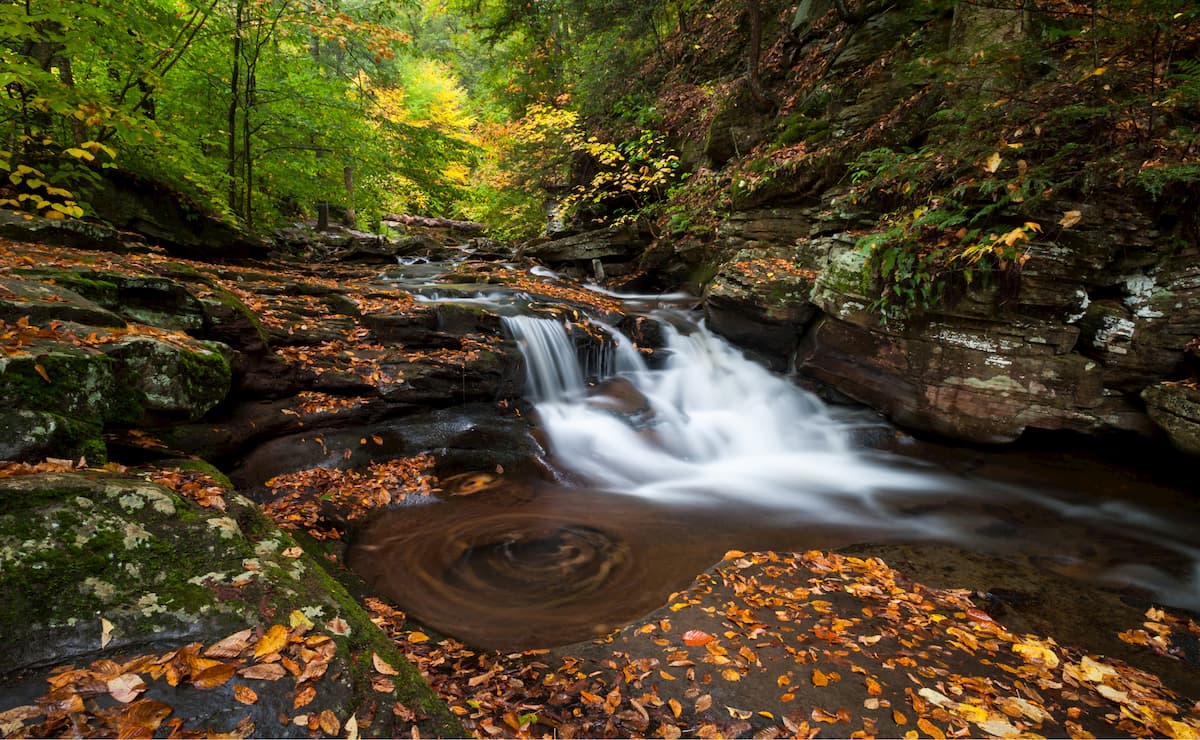
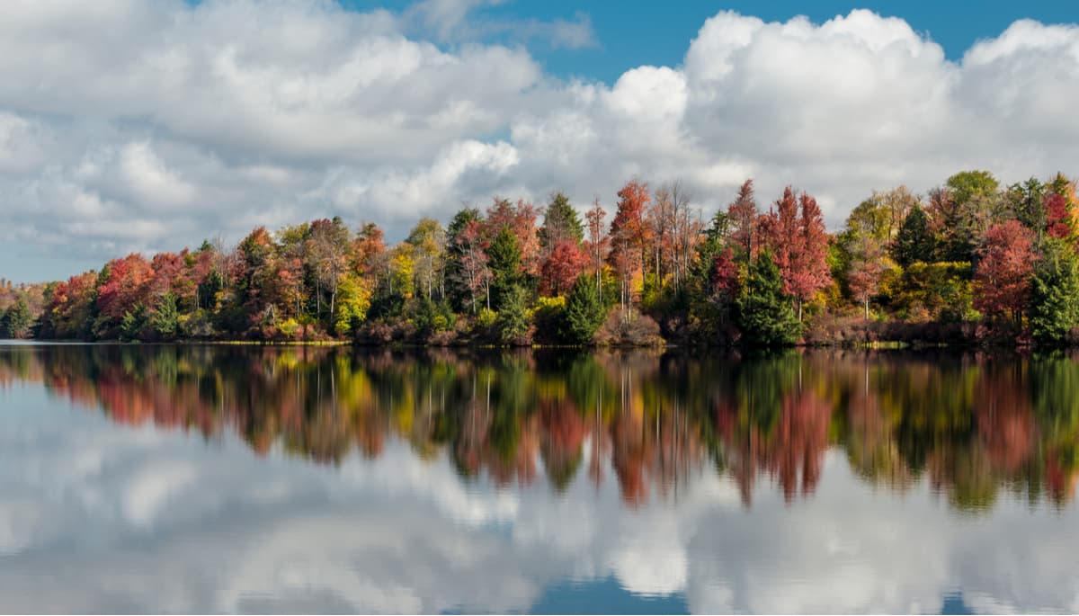
Ricketts Glen State Park (RGSP) is less than fifty miles west of Scranton, PA in Luzerne County. One of the highlights of RGSP is the Falls Trail, which features twenty-one waterfalls over a 7.2-mile hike, with the tallest waterfall being 94 feet high. There are a total of 26 miles of trails to hike, and cabins and campgrounds at which you can stay the night. In the summer and fall the campground often sells out as this park is one of the most popular and well-loved in the state. Located just outside RGSP is Red Rock Mountain which can be seen from RGSP and is especially beautiful when it is painted with the different colors of the autumn foliage.
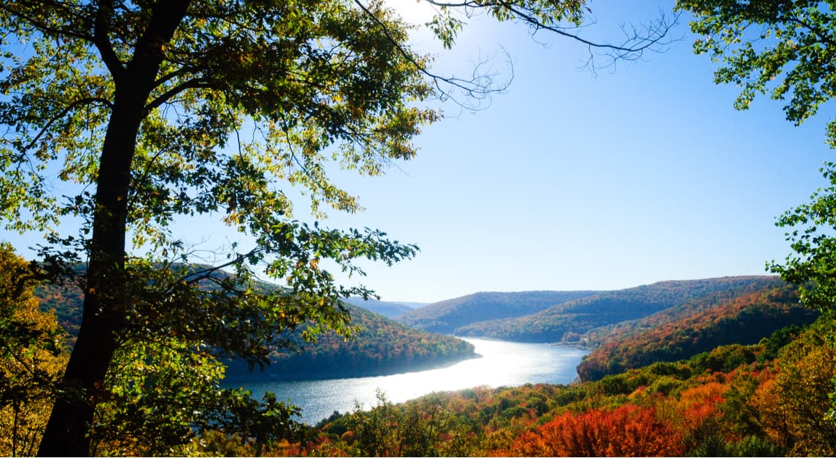
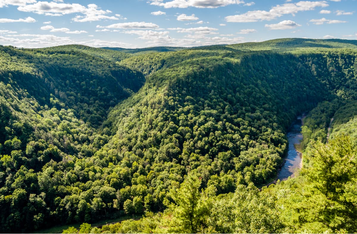
Pine Creek Gorge, located in Tioga State Forest, is known as the Grand Canyon of Pennsylvania for its dramatic views and steep glacially carved walls. The gorge extends 47 miles with a 12-mile section designated as a National Natural Landmark. Its deepest point is 1,450 feet below the rim. The Pine Creek Gorge area offers camping, hiking, snowmobiling, biking, and boating. The area is especially popular in the fall when Pennsylvania’s deciduous trees display their autumnal colors.
Blue Knob State Part (BKSP) is just north of the intersection of Interstates 76 and 99 near Bedford, PA. BKSP is home to the second highest mountain in Pennsylvania (aptly named “Blue Knob”) and has eighteen miles of hiking within the park. There is also a downhill ski resort that offers T-Bar lift services as well as tubing.
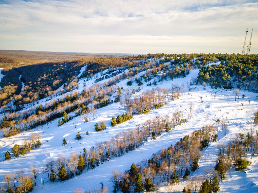
For skiing and snowboarding enthusiasts, there are more than 25 ski resorts in Pennsylvania, which are located mostly in its eastern and southern parts.
The largest is Camelback Mountain Resort with more than 30 km (19 mi) of slopes and more than 10 ski lifts. Other major areas for skiing in Pennsylvania include Bear Creek Mountain Resort, Montage Mountain Resorts, Shawnee Mountain Ski Area, and others.
The largest ski resort near Philadelphia is Spring Mountain Adventure and the main ski resort near Pittsburgh is Seven Springs Mountain Resort.
Check the Pennsylvania ski resorts map and the larger USA ski resorts map in the World Mountain Lifts section of the site. It includes information about open ski lifts / slopes in Pennsylvania in real-time with opening dates and hours. There are also year-round cable cars, funiculars, cog railways, aerial tramways, and all other types of mountain lifts.
Bedford located just off I-76 in the center of Southern Pennsylvania offers many great hikes and is nearby to some PA state parks. Bedford is a lovely little city with a quaint downtown scene, sure to make any travelers to feel right at home.
Jim Thorpe, PA is named for one of the finest all-around athletes the state has ever produced. Nicknamed the “Gateway to the Poconos,” Jim Thorpe is a home to the Lehigh Gorge Scenic Railway, which shows just a taste of what the region has to offer. Jim Thorpe is also a short distance away from the Glen Onoko Falls Trail and Flagstaff Mountain, both of which are short, but rewarding hikes.

Although Philadelphia is mainly known for being the largest city in Pennsylvania, it also offers some of the best maintained trails in the area. Wissahickon Park in Northwest Philadelphia is home to over 40 miles of hiking trails, including Forbidden Drive, which won Trail of the Year in PA in 2018 because of its popularity among locals and tourists. Within Wissahickon Park is the Valley Green Inn, which is a restaurant with delicious food and a walk-up snack bar that can be accessed for those on the go on Forbidden Drive, or one of the many trails that winds through the beautiful Philadelphia wilderness.


