Scan the QR code and open PeakVisor on your phone
Home to rolling hills, miles of multi-use forest trails, and the highest elevation ski resort in the US state of Pennsylvania, Blue Knob State Park is a year-round outdoor destination. The highest point in the area is Blue Knob, the second-highest peak in the state.
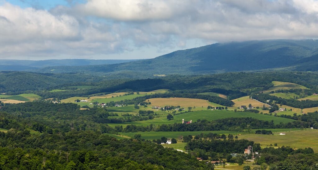
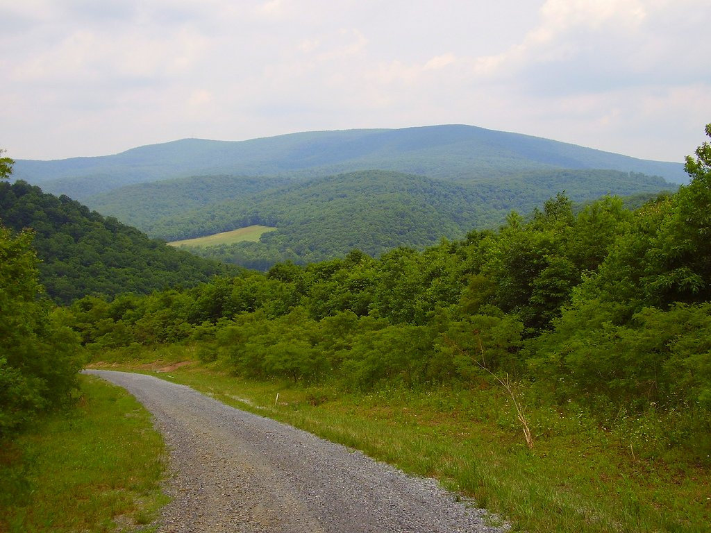
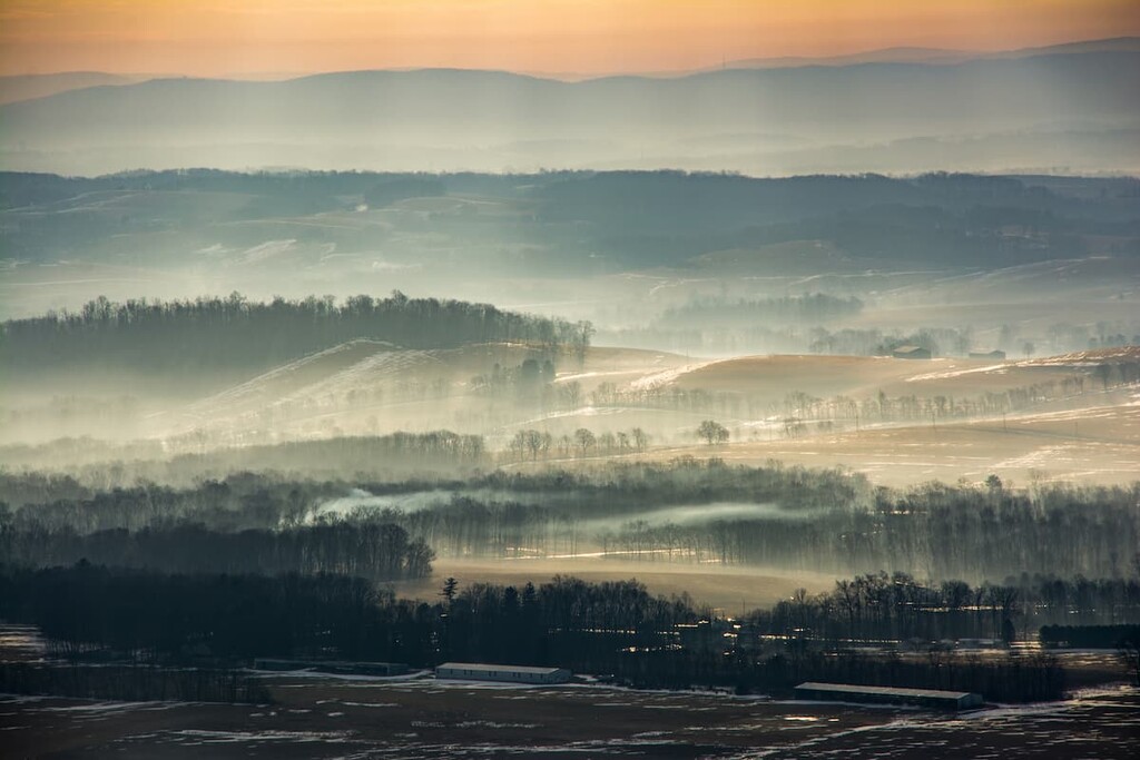
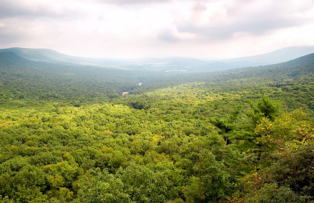
Blue Knob State Park covers 6,000 acres (2,428 ha) of land in south-central Pennsylvania, across Kimmel, Lincoln, and Pavia townships in Bedford County. The park is located on the western edge of the Appalachian Mountains, offering spectacular views of the Ridge and Valley Province to the east.
The highest point in the park is Blue Knob, a wide dome-shaped mountain that reaches 3,143 ft (958 m) in elevation. Blue Knob is the highest skiable mountain in Pennsylvania and it is only 67 ft (20 m) lower than Mount Davis, the highest peak in the state.
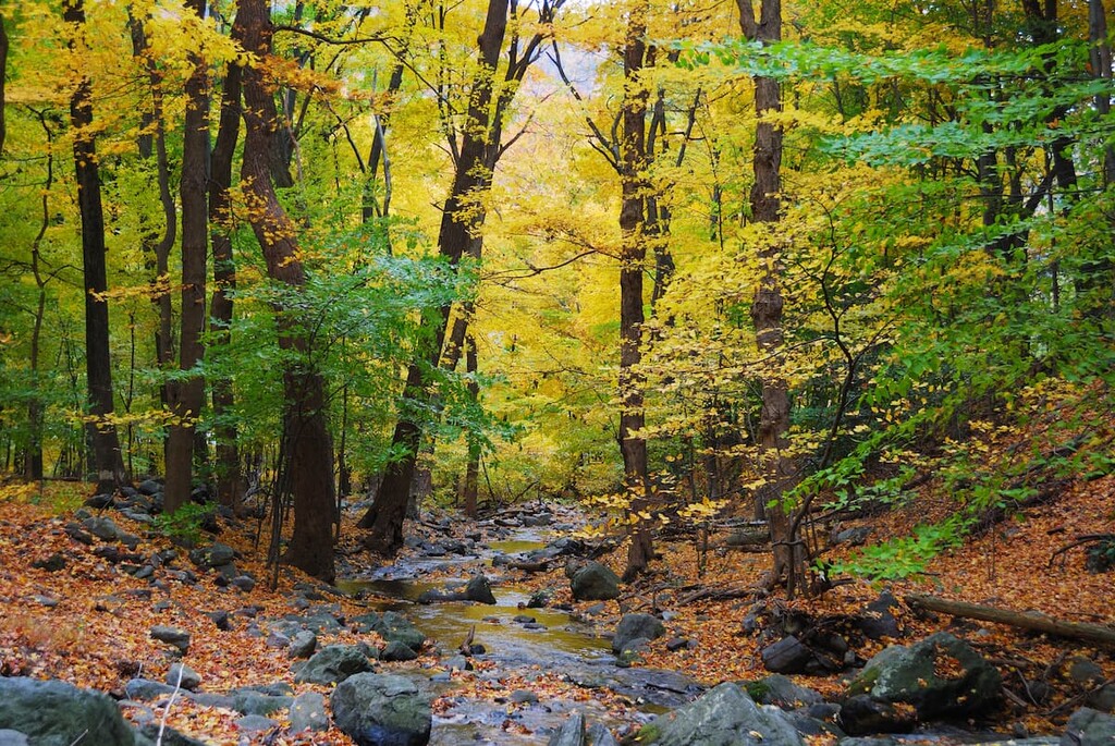
There are 18 miles (29 km) of hiking trails in the park, many of which are open for multiple uses like skiing, snowmobiling, mountain biking, and horseback riding. Blue Knob State Park is known for sweeping views from overlook points on the trails throughout the area. There’s also a large developed campground in the park that offers hookups, showers, and a swimming pool.
Because of its high elevation, Blue Knob State Park can be several degrees colder than the surrounding area. The park receives an average of 12 ft (365 cm) of snow per year, which skiers and snowboarders can enjoy at Blue Knob Ski Resort. The resort leases land on the slope of Blue Knob from the park.
Located on the Allegheny Front, Blue Knob State Park is close to lots of other hiking opportunities in the Appalachian and Allegheny Mountains, including Rothrock State Park, Gallitzin State Forest, and Tuscarora State Forest.
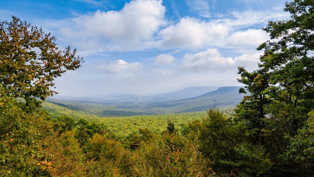
Blue Knob State Park is part of the Appalachian Mountains, which run 1,500 miles (2,400 km) from the US state of Alabama all the way into eastern Canada. The park sits on the Allegheny Front, a 180 mile (290 km) escarpment that covers parts of Pennsylvania, Maryland, and West Virginia.
The Allegheny Front divides the Ridge and Valley Province of the Appalachians in the east from the Allegheny Plateau to the west. It formed during the Alleghenian Orogeny some 320 to 250 million years ago when the North American and African tectonic plates collided, uplifting and folding the crust in this region.
There are various types of bedrock present in the area. In the valleys of Blue Knob State Park, the bedrock is part of the Catskill Formation, which is mostly composed of red sandstone, siltstone, and shale from the Upper Devonian period.
The mountains in the park are part of the Pocono bedrock formation, topped by Mississippian Burgoon Sandstone. They’re underlain by the Rockwell Formation, which is a Devonian-Mississippian bedrock consisting of argillaceous sandstone crossbedded with shale.
The highest point in Blue Knob State Park is Blue Knob at 3,143 ft (958 m), followed by Herman Point and Conrad Ridge. Blue Knob is the northernmost peak above 3,000 ft (914 m) in the Allegheny Mountains and Herman Point is the only other peak in the park above 3,000 ft (914 m).
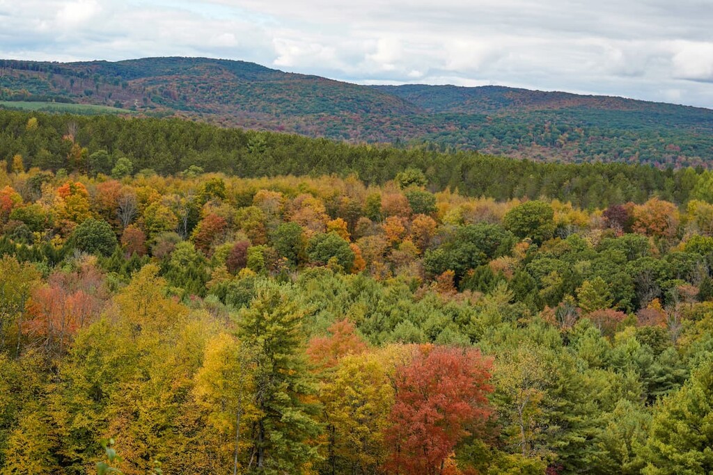
Blue Knob State Park is covered by northern hardwood forests that feature sugar maple, red maple, and oak trees. There were once stands of old-growth Hemlock trees in the park, but they were clear cut for timber before the lands were preserved.
Blue Knob State Park is a popular area for wildlife viewing. The largest animals in the park are bears, white-tailed deer, and coyotes. The forests are also home to foxes, porcupine, turkeys, grouse, and red-tailed hawks.
People have lived in Pennsylvania for thousands of years. In fact, some of the oldest dated evidence for human inhabitation of North America was found at the Meadowcroft Rockshelter site about 130 miles (210 km) from Blue Knob State Park. If dated correctly, the site could be between 14,000 and 17,000 years old.
More recently, before European contact, the area was home to both Iroquois and Algonquian-speaking groups, including the Seneca, Oneida, Lenape, and Shawnee tribes. Members of the Haudenosaunee (Iroquois) Confederacy controlled the northwestern portion of the state, while Algonquian tribes were more dominant in the southeast.
After the arrival of European and American settlers, many groups were pushed out of their original homelands and forced to move north or west over the Appalachians. One of these groups was the Shawnee Tribe, one of the most prominent groups in the area around Blue Knob State Park. Members of all of these First Nations experienced serious violence and incursion by white settlers and many were forced to move west to Ohio and beyond or north into Canada.
By the 1800s, most of the Indigenous peoples of central Pennsylvania had fled or had been forced to leave their land. The Indian Removal Act of 1830 finalized this process, forcing the remaining First Nations to move to reservations west of the Mississippi River.
The first White settlers in the area of Blue Knob State Park were Pennsylvania Germans (also known as Pennsylvania Dutch—they immigrated to the region from what is now Germany, Switzerland, and the Netherlands), who arrived in the early 1800s and farmed near the town of Pavia, just south of the present-day park. There was a log mill, a gristmill, and several distilleries in the area at this time.
By the second half of the century, logging companies based out of South Fork were beginning to clear-cut the area. The timber was removed by steam railroads that climbed the steep hillsides with multiple switchbacks. Some of these old railroads are still in use today as hiking trails in the park.
Blue Knob State Park began as a recreation area under the National Park Service in 1935. The roads, hiking trails, cabins, and other recreational facilities were built by the Works Project Administration and then the Civilian Conservation Corps. After World War II, the National Park Service transferred the area to Pennsylvania and it became a state park.
The summit of Blue Knob was home to an Air Force surveillance station during the 1950s. After it was deactivated in 1961, the area became Blue Knob Ski Resort. One of the original military buildings still serves as a ski lodge.
There are lots of great day hikes in Blue Knob State Park, from easy walks to challenging all-day trails. Here are some of the best hikes to enjoy in the park:
The Mountain View Trail is one of the most challenging trails in the park, with lots of steep ascents and descents. It’s open to both hikers and mountain bikers, and it features beautiful views.
This trail starts a short distance down the Three Springs Trail and travels the “Look Out” loop before heading for more challenging terrain. Because much of the loop is at high elevation, it can be foggy in inclement weather and should be avoided. Parking is at the curve on the access road approaching Blue Knob Ski Resort.
The Lost Turkey Trail is a backpacking trail that starts from the Babcock State Forest Ranger station and travels northeast through several parcels of state land to finish near Blue Knob. The path, which was cut by the Youth Conservation Corps in 1976, follows many logging roads and old narrow gauge railroads in the area
This is a challenging, minimally trafficked hike recommended for well-prepared hikers and backpackers.
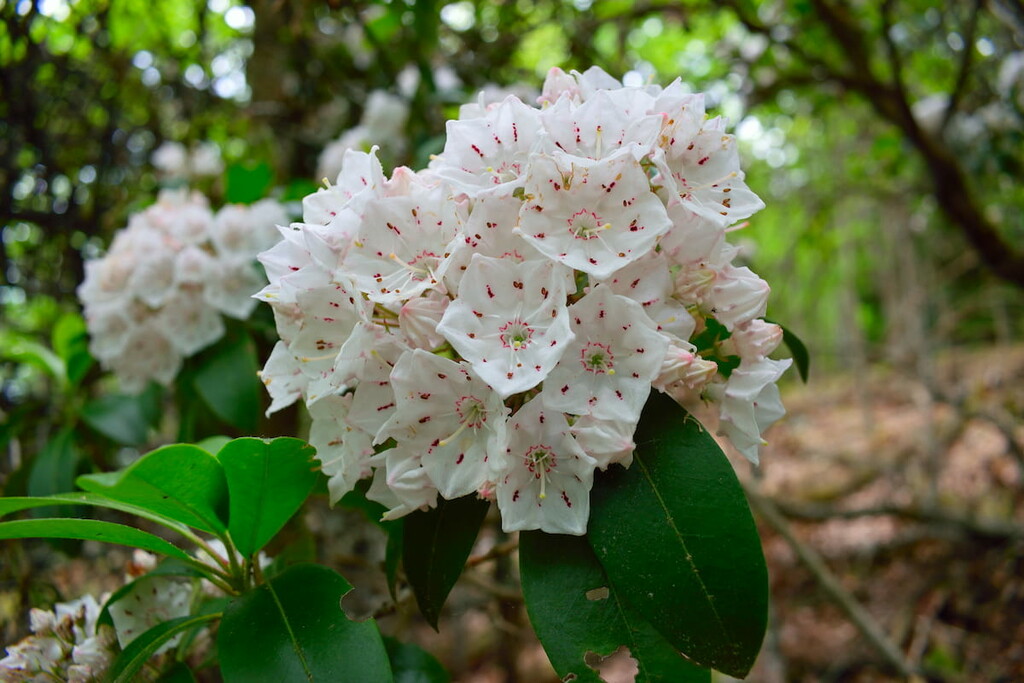
The Rock and Ridge Trail is a beautiful loop trail that takes hikers past some historic landmarks and a couple of views. It’s particularly scenic in June, when Pennsylvania’s state flower, the mountain laurel, is in bloom. The hike finishes at the Mowery Picnic area, just across from the Blue Knob public pool, so you can go for a swim after your hike if you’d like.
The Sawmill Trail is a relatively flat trail bisects the park and provides access to other trails in the area. It starts on Ickles Hill and connects to the lower segment of the Rock and Ridge Trail.
The Chappell’s Field Trail is a moderate loop trail accessible from points on the Knob Road and campground areas. The Chappell’s Field trail has some of the best views in the whole park over Blue Knob and the valley below it.
The Homestead Trail is a wide, gentle loop trail that features some moderate climbing. It passes through a section of the park with rolling valleys, old homestead sites, and great birding opportunities. This trail starts off the road to Willow Springs Picnic area.
Looking for a place to stay near Blue Knob State Park? Here are some of the best towns and cities to check out:
Claysburg is the closest town to Blue Knob State Park that offers hotels, restaurants, and other basic amenities. The town of 1,600 residents is a good base for exploring the park and Blue Knob Ski Resort. Other nearby attractions include a model train museum, an antique depot, and the Chimney Rocks park, which features a beautiful scenic viewpoint.
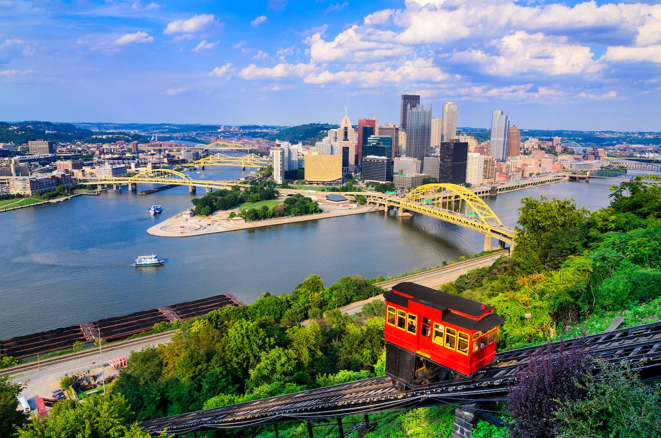
Located about 100 miles (160 km) west of Blue Knob State Park, Pittsburgh is the second-largest city in Pennsylvania and the largest population center in all of Appalachia. The city, which straddles the Allegheny River, is home to approximately 2.3 million people.
Pittsburgh is known as a historic center of the steel industry. Today, it’s a cultural capital and home to numerous museums, a botanical garden, and Carnegie Mellon University. The parks along the riverfront are particularly popular, offering 24 miles (39 km) of trails.