Scan the QR code and open PeakVisor on your phone
Tuscarora State Forest is an outdoor recreation destination featuring dense forests and steep valleys located in the US state of Pennsylvania. The forest is characterized by alternating ridges and valleys, and it contains 26 named mountains. The tallest and most prominent peak in Tuscarora State Forest is Eckenrode Knob at 2,261 ft (689 m) tall with 702 ft (214 m) of prominence.
Tuscarora State Forest encompasses 96,025 acres (38,860 ha) of terrain, and it is located in central Pennsylvania. The rugged landscape features densely forested valleys and ridgelines within Cumberland, Franklin, Huntingdon, Juniata, Mifflin, and Perry counties.
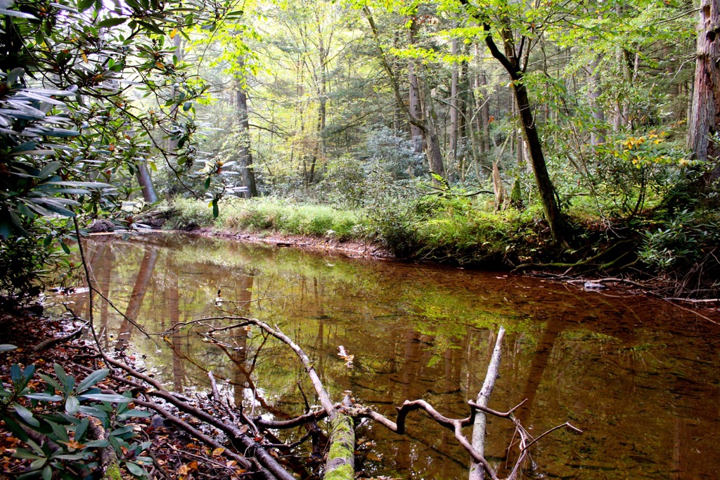
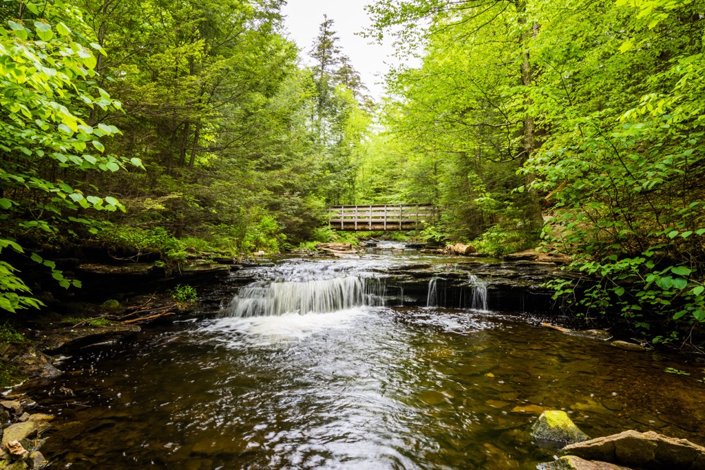
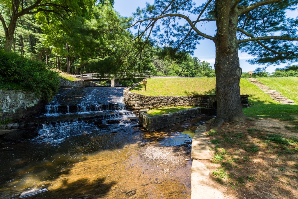
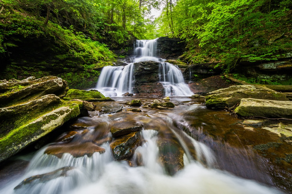
While there are numerous seasonal creeks and streams within the forest, major waterways lie just outside the forest boundaries. The Conodoguinet Creek lies to the south, Sherman’s Creek extends to the east, and Tuscarora Creek is situated to the north. Further east lies the Susquehanna River.
The forested landscape lies within the ridge and valley region of the larger Appalachian Mountains. Parts of the surrounding landscape lie within the Allegheny Mountains, another subrange of the Appalachian Mountains.
Tuscarora State Forest is part of a large network of state forests and game lands in Pennsylvania, that extend throughout the central region of the state. The rugged ridgelines in the forest are primarily forested, though some sections feature rocky buttes with viewpoints.
There are also numerous natural areas located within the forest, such as:
These natural areas help protect sections of old-growth forest within the region. The Hoverter and Sholl Box Huckleberry Natural Area also contains a Box Huckleberry that is estimated to be over 1,300 years old.
Additionally, Tuscarora State Forest lies near numerous other parks and forests for outdoor recreation. Michaux State Forest lies to the south while Buchanan State Forest and Rothrock State Forest lie to the west. Both Trough Creek State Park and Canoe Creek State Park are situated to the northwest while Bald Eagle State Forest is to the north.
The geological history of Tuscarora State Forest consists of two major geological features; the Allegheny Mountains and the Susquehanna Valley.
Land within the state forest, along with much of central Pennsylvania, is part of the Susquehanna River Basin. The Susquehanna River, which lies east of the state forest, is thought to be one of the oldest rivers in all of North America. Over the course of millions of years, the various waterways have carved out the landscape that is visible today.
The peaks and ridges in the forest lie on the outskirts of the Allegheny Mountains, a subrange of the Appalachian Mountains. This subrange, along with the rest of the Appalachian Mountains, began forming around 480 million years ago. Tectonic shifting and thrust faults slowly thrust the peaks upwards, changing the direction of the Susquehanna River to a southeastern flow.
Over the next 150 million years, the Susquehanna River carved out a wide sweeping valley. During the last glacial maximum, a large ice sheet covered much of present-day Pennsylvania. Glacial retreating further carved out the landscape, leaving behind sediment that slowly filled in the vast valley.
The Appalachian Mountains span from the US state of Alabama to the province of Newfoundland and Labrador in Canada, marking one of the oldest major mountain ranges in the world. Bedrock in the region primarily consists of quartzites and sandstone formed during the Appalachian orogeny.
Major peaks located within Tuscarora State Forest include Eckenrode Knob, Sherman Mountain, Flat Rock, Shultz Ridge, and Big Knob.
Tuscarora State Forest is home to a variety of flora and fauna commonly found throughout the state of Pennsylvania. Though the forest covers less than 100,000 acres (40,469 ha), the surrounding state forests and game lands provide a vast network for these species to thrive.
The majority of the forest is covered in groves of oak and hemlock. Other common species include sugar maple, black birch, beech, hickories, basswood, and tuliptree. Flowering plants such as dogwoods, goldenrod, asters, and mountain laurel bloom during the warmer months. Sections of old-growth Eastern hemlocks can be found in the Hemlocks Natural Area that covers 120 acres (49 ha) of land.
Some of the most commonly spotted mammals in the state forest include cottontail rabbits, squirrels, and white-tailed deer. Larger animals such as bobcats also inhabit the region though they are rarely spotted by hikers.
Porcupines and wild turkeys thrive in the forested landscape while nearby wetlands provide an ideal habitat for black crappie, great blue heron, and snapping turtles.
Tuscarora State Forest, and other surrounding forests, are known for their incredible bird-watching opportunities. Common species include northern mockingbirds, wood ducks, finches, cardinals, northern shrieks, and sparrows.
The land in central Pennsylvania marks part of the ancestral homelands of the Susquehannock Tribe, along with various others. The Susquehannock traditionally lived in the Northeastern Woodlands and are part of the Iroquoian people.
For thousands of years the Susquehannock and other Indigneous peoples lived harmoniously with the land. Many of their settlements were located near the fertile lands surrounding the Susquehannock River. Though most of the tribe lived in central Pennsylvania, some bands traveled and settled as far west as present-day Ohio.
Settlers of European descent began inhabiting the region during the early seventeenth century. The Susquehannock people united with many of these early settlers, constructing trade deals and treaties. Uniting with the Swedish and Dutch settlers in the region helped the Susquehannock Tribe resist joining the Haudenosaunee (Iroquois Confederacy) in the early seventeenth century.
As more settlers began arriving in the region, they also brought diseases such as measles and smallpox. Since the Indigenous people had no natural immunity to these illnesses, their numbers were drastically reduced by the end of the seventeenth century.
The remaining members of the Susquehannock tribes were eventually overtaken by the Hudenosaunee. Many of the remaining Susquehannock people migrated to present-day New York, around the territory of the Oneida Nation. Decades later, during the eighteenth century, some of the Susquehannock people were able to return to their ancestral lands.
As the Susquehannock fought to protect and preserve the land, settlers backed by the US government forced them from the region and began widespread timber harvesting during the nineteenth century. Conservationists, such as Dr. Joseph Rothrock, fought to preserve the remaining landscape.
In the final years of the nineteenth century, the State Forest system was created, leading to the establishment of numerous protected regions across the state. In the following decades, the protected forested regions continued to grow. Today the forest is best known for hiking and bird-watching.
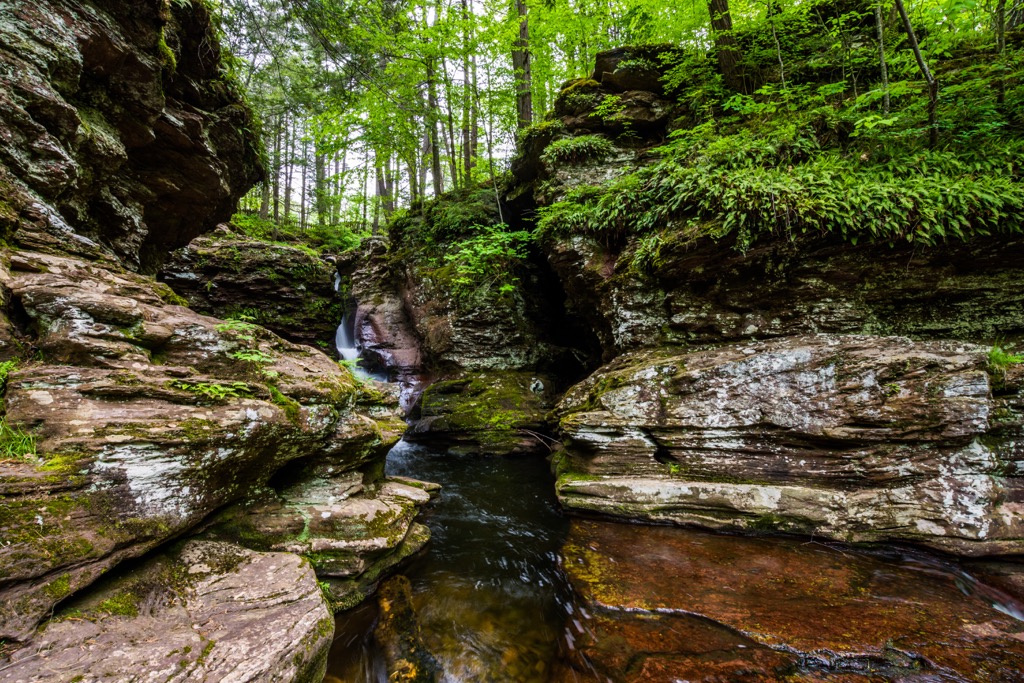
Tuscarora State Forest is home to a number of excellent trails for outdoor recreation. Here are a few of the trails that you can find within the forest that are worth checking out during your next visit to the region.
The Tuscarora Trail Loop is one of the most popular trails in the forest. The trailhead lies on the border between the forest and Colonel Denning State Park. This route climbs steadily throughout, through the densely forested hillside.
Sections of the trail contain loose rocks and roots so hikers should wear proper footwear. After climbing steadily, the trail reaches Flat Rock which offers sweeping views of the flat plains down below. This loop trail is 5 miles (8 km) round trip with 1,509 feet (460 m) of elevation gain.
This longer route is a point to point trail that begins in Tuscarora State Forest. After passing Flat Rock, the trail travels east towards the city of Harrisburg. The entire route features technical trails and viewpoints, along with numerous small climbs and descents.
This route is commonly used for backpacking with numerous campsites throughout. The trail can be completed in either direction and spans 28.2 miles (45.4 km) in length with 5,154 feet (1,571 m) of elevation gain.
This loop trail follows along both the Iron Horse Trail and Tunnel Trail. The trail begins by gradually descending through the forested landscape before reaching the Tunnel Trail which leads to the base of a gaping cave.
Hikers can complete the loop in either direction, though counterclockwise features less steep climbing. The loop is 9.9 miles (16 km) in length and features 1,000 feet (305 m) of elevation gain.
Looking for a place to stay near Tuscarora State Forest? Here are some of the best cities and villages to check out in the region.
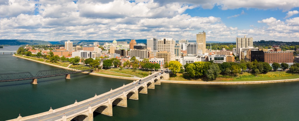
Harrisburg is the capital city of Pennsylvania and the closest major city to the forest. Situated on the banks of the Susquehanna River, Harrisburg is home to around 50,000 residents making it the ninth-most populous city in the state.
Within the city lies a historic downtown region along with the National Civil War Museum and the State Museum of Pennsylvania. Tourists can also take a river cruise along the Susquehanna River for stunning views of the surrounding scenery and city.
Just east of Harrisburg lies the city of Hershey, Pennsylvania, the namesake for the world-famous Hershey’s chocolate. Those visiting Hershey can explore attractions such as Hershey’s Chocolate World and Hershey Park.
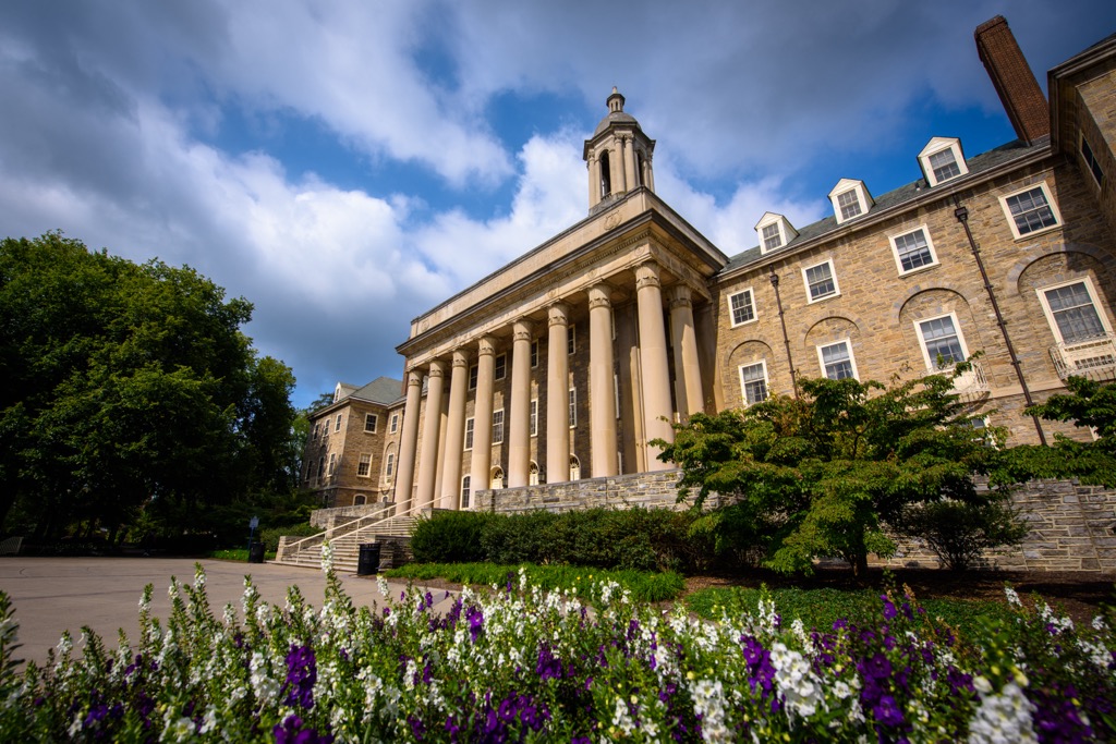
State College lies north of the state forest and is home to Pennsylvania State University. The region is home to around 42,000 residents, making State College the largest designated borough in the state of Pennsylvania.
Every year the city hosts the Central Pennsylvania Festival of the Arts. Surrounded by state forest, State College is often referred to as “Happy Valley” or “Lion County.” Local cafes, shops, galleries, and bakeries line the downtown streets of State College. The quiet streets offer the ideal way to unwind after a long day exploring the surrounding trails.