Scan the QR code and open PeakVisor on your phone
Michaux State Forest is an outdoor recreation destination situated in the south-central region of the US state of Pennsylvania. The forest is in the process of being restored after a period of extensive logging in the nineteenth century. There are 60 named peaks in the state forest, the highest and most prominent of which is Snowy Mountain (2,090 ft/ 637 m)
Michaux State Forest lies in south-central Pennsylvania and encompasses 85,500 acres (34,601 ha) of terrain. The rolling forested hillsides of the region span into three counties: Cumberland, Franklin, and Adams.
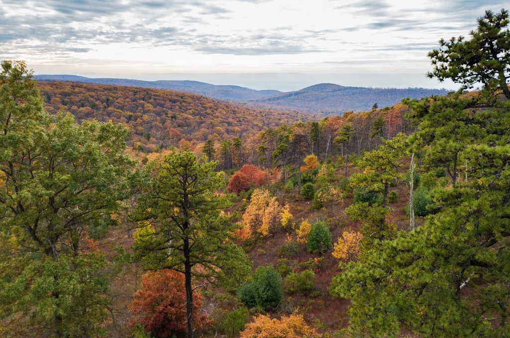
The forested landscape of Michaux State Forest was heavily logged throughout the nineteenth century and no sections of old-growth forest remain in the region today. Efforts to protect the forest have allowed the landscape to slowly return to its natural state.
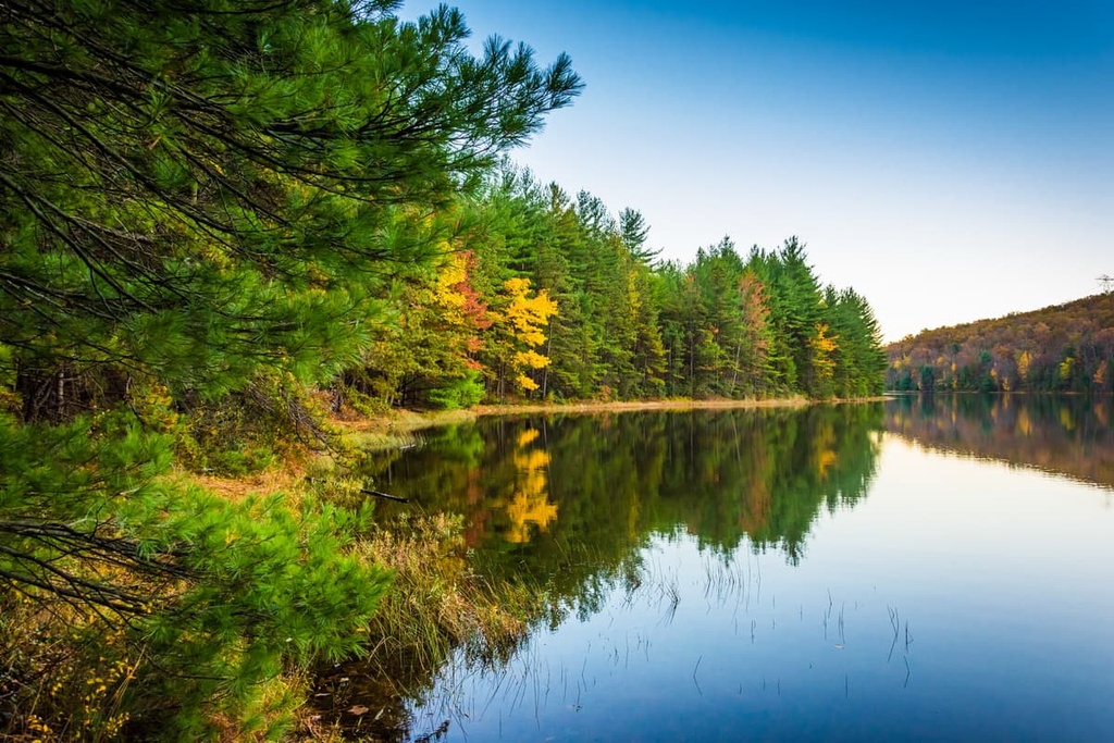
Various creeks and streams cut across the rolling hillsides of Michaux State Forest. Dominant water features in the state forest include Conococheague Creek, Rocky Mountain Creek, Long Pine Run, and West Branch Antietam Creek. The Long Pine Run Reservoir lies near the center of the forest and is the largest body of water in the park.
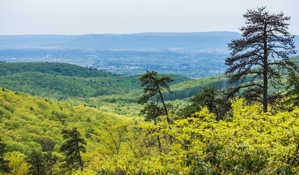
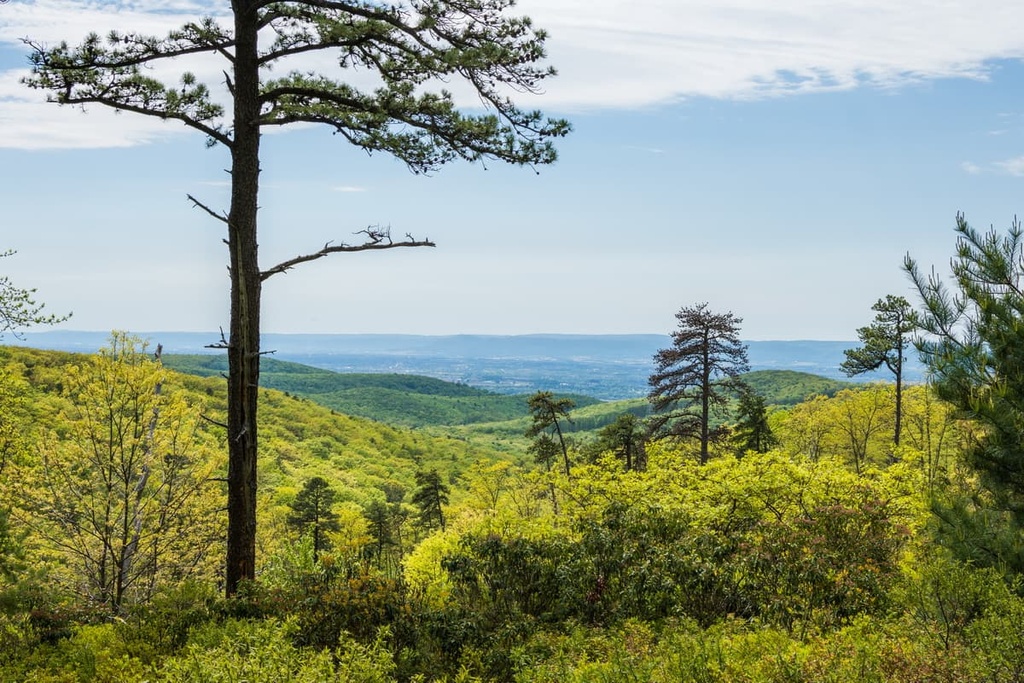
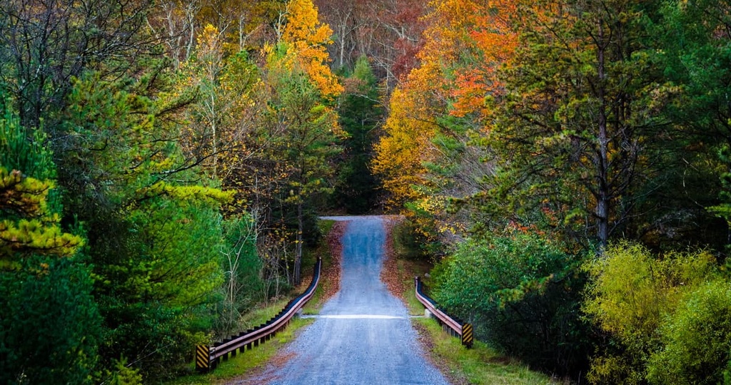
Rolling hillsides and forested ridgelines are common throughout the forest. In fact, Michaux State Forest is located in the northern stretches of the Blue Ridge Mountains as they transition into the Allegheny Mountains. Various trails for hiking and mountain biking run through the forest, including a portion of the Appalachian Trail.
Additionally, Michaux State Forest lies near numerous other parks and forests for outdoor recreation. Buchanan State Forest and Tuscarora State Forest lie to the west while Weiser State Forest is situated to the northeast. Other nearby parks include Caledonia State Park, Pine Grove Furnace State Park, and Mont Alto State Park.
The geology of Michaux State Forest is often categorized based on the major geologic feature of the region: the Blue Ridge Mountains.
The peaks in the state forest are part of a subrange of the Appalachian Mountains that spans from the US state of Georgia northward to the province of Newfoundland and Labrador in Canada. Though the peaks in the forest mark the northern edge of the range, the region is part of the larger Blue Ridge Mountain physiographic province.
The land directly to the east of the range is relatively flat and is part of the Piedmont region of the eastern US. To the west of the range and the Michaux State Forest lies the Valley and Ridge region, which features less dramatic changes in elevation.
Rocks found within the Blue Ridge Mountains date back to the Precambrian and Paleozoic eras. The peaks began forming during the Grenville and Alleghenian orogenies when the region was slowly thrust upwards.
Geologically, the Blue Ridge Mountain system is far older than many other mountain ranges in the world. While these peaks started to form nearly 1 billion years ago, other major ranges such as the Alps and the Himalaya formed around 65 million years ago during the Alpine orogeny.
Though the ridges and valleys in the forest began forming nearly a billion years ago, they did not start taking their current shape until around 100 million years ago. Millions of years of erosion by the various rivers, creeks, and streams, carved out the landscape, leaving behind the varied landscape that’s visible in the region today.
The land that is now Michaux State Forest was previously owned by iron companies who were interested in extracting the large amounts of iron ore in the region. This iron was used to make stoves, kettles, and tools until the iron ore deposits ran out and the mining companies sold the land.
Major peaks within Michaux State Forest include Snowy Mountain, Methodist Hill, Curve Mountain, Little Rocky Ridge, and Mount Newman.
Michaux State Forest is primarily home to densely forested hillsides that feature creeks, streams, valleys, and wetlands.
Oak trees dominate the slopes within the state forest. Common tree species in the state forest include chestnut oak, scarlet oak, northern red oak, black oak, and white oak. Other tree species in the region include black gum, red maple, black birch, hickory, pine, and tuliptree.
The forest’s close proximity to other parks and forests allows for a wide range of fauna to thrive in the region. Larger mammals that live in the forest include white-tailed deer, red fox, and black bear. The North American porcupine, American beaver, skunk, raccoon, fox squirrel, and eastern gray squirrel are also common in the region.

Bird watching is a popular activity in the forest due to the large population of songbirds in the region. A few of the species that inhabit the region include the scarlet tanager, pine warbler, pileated woodpecker, black-throated green warbler, indigo bunting, and northern parula. Wild turkeys, broad-winged hawks, and barred owls are also present in the region.
Finally, the creeks and reservoirs in the state forest provide the ideal habitats for a variety of fish, including largemouth bass, spotted bass, and bluegill.
The land surrounding Michaux State Forest is part of the ancestral homelands of the Susquehannock people. The Susquehannock people traditionally lived in the Northeastern woodlands of the US, and are an Iroquoian people.
Prior to the arrival of European settlers, the Susquehannock traveled throughout the region as their territory extended as far west as present-day Ohio. They worked harmoniously with the land and they hunted, gathered, and fished throughout their travels. The tribe lived primarily around the Susquehanna River, which runs just north of Michaux State Forest and cuts across the state of Pennsylvania.
The first recorded contact between Europeans and the Susquehannock people was in the year 1608 when Captain John Smith traveled up the Susquehanna River. At the beginning of the seventeenth century, the Susquehannock people resisted an alliance with the Haudenosaunee and instead formed alliances with the Swedish and Dutch settlers who were also living in the region. These alliances proved beneficial as the Susquehannock united to fight back against the colony of Maryland in the mid-seventeenth century.
The introduction of infectious diseases that were brought over by Europeans led to a drastic decline in the Susquehannock population during the 1670s. This decrease in population weakened the tribe and those who remained were overwhelmed by the Haudenosaunee who eventually forced them to relocate to the Oneida territory in what is now New York. It wasn’t until the early eighteenth century that some of the Susquehannock people were able to return to their ancestral homelands that surrounded the Susquehanna River.
As iron production and timber harvesting grew more popular in the region, the population of European settlers began to rapidly grow in and around what is now the Michaux State Forest. Many of the Susquehannock people who had remained in the region were forcibly removed and massacred as they fought to protect their ancestral lands.
Timber harvesting decimated the landscape, leaving behind nothing but barren stumps. Eventually, the vast depletion of resources in the region forced the timber and iron companies to sell their landholdings to the state of Pennsylvania.
Conservationists feared that if action was not taken, the land would not be able to support regeneration, an idea that ultimately led to the region’s protection. As a result, the forest is home to the state’s oldest nursery at Mont Alto, which was established in 1902. The region is also home to the oldest forestry school in the state, which is now Penn State Mont Alto.
The forest was named after André Michaux, a French botanist. Today, the region is home to a thriving second-growth forest, and it features numerous trails for hiking and mountain biking as well as a portion of the Appalachian Trail.
Michaux State Forest is home to a number of wonderful trails for outdoor recreation. Here are a few of the trails in the forest that are worth checking out during your visit.
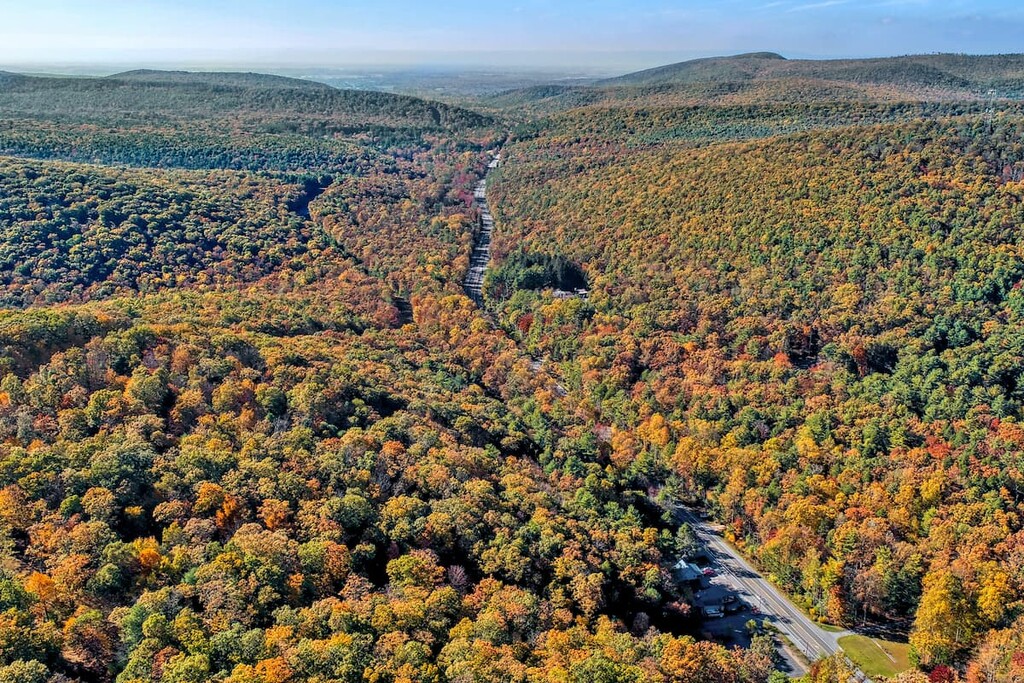
The Chimney Rocks loop trail is the most popular hiking route in the entire forest. This trail climbs through the forested landscape before crossing Tumbling Run. The route then climbs up to the summit of Buzzard Peak, where you can find Chimney Rocks.
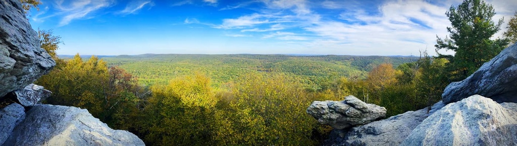
Though many peaks in the forest are densely forested, hikers on this trail can get panoramic views from the summit of Buzzard Peak. The rolling forested hillsides span out in all directions along this portion of the Appalachian Trail. Hikers can also extend the route to reach the summit of Monument Peak. The trail is 4.8 miles (7.7 km) long and it has 1,007 ft (310 m) of elevation gain.
The Rocky Knob Trail lies just to the north of the Long Pine Run Reservoir. It is 4.2 miles (6.8 km) long round trip and it has 603 ft (184 m) of elevation gain.
After leaving the trailhead, this loop trail drops slightly in elevation while following along Knob Run en route to the reservoir. The route then climbs past Rocky Knob before climbing to the top of Sier Hill.
From the summit, hikers can enjoy views of the reservoir in the distance. This route can be completed throughout the year, though it contains some rocky sections, so good footwear is necessary for a comfortable hike.
The Beaver Trail and Yellow Ridge Trail route is a loop that circles around Long Pine Run Reservoir. The first half of the loop follows along the shores of the reservoir and is relatively flat while the second half of the loop ventures into the forested hillsides that surround this body of water.
Birdwatching and fishing are both common along the route. Hikers will cross over both Long Pine Run and Birch Run along this trail. This loop is 6.2 miles (10 km) long and it has 547 ft (167 m) of elevation gain.
Looking for a place to stay near Michaux State Forest? Here are some of the best cities and villages to check out in the region.
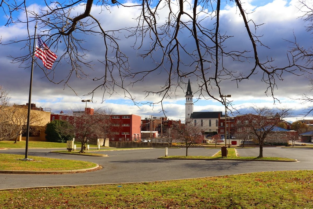
The city of Hagerstown, Maryland lies just to the southwest of Michaux State Forest near Antietam Creek, Conococheague Creek, and Upper Potomac River. Home to around 44,000 residents, Hagerstown is the largest city in the panhandle region of Maryland. The region has a long and rich history, especially with regards to the American Civil War.
The downtown region of Hagerstown is home to the Washington County Museum of Fine Arts, Hager House and Museum, Hagerstown Roundhouse Museum, and Discovery Station. The Maryland Theater is located in the city and it hosts the Maryland Symphony Orchestra. Each year, the city also hosts the Quad State Beer Festival, which features craft beer, local food, and rock music.
The Appalachian Trail runs near the city before it enters Pennsylvania. The surrounding mountains, rivers, and parks provide visitors with ample opportunities for hiking, trail running, mountain biking, fishing, and kayaking.
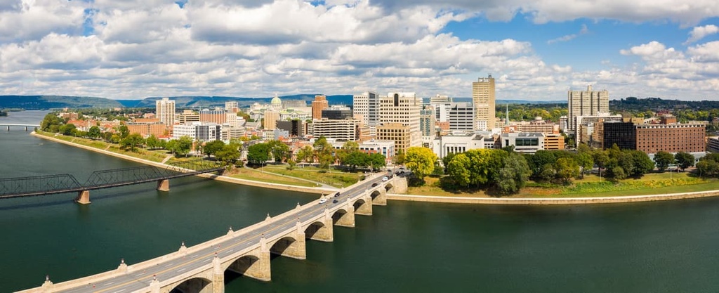
Harrisburg, the capital city of Pennsylvania, lies to the northeast of Michaux State Forest. Situated along the Susquehanna River, Harrisburg is home to around 50,000 residents, which makes it the ninth-largest city in the state. Visitors to Harrisburg can learn more about the region by visiting the State Museum of Pennsylvania or the National Civil War Museum, both of which are located in the city.
Historical buildings line the downtown streets of Harrisburg while riverboat tours showcase the surrounding landscape. The city of Hershey, Pennsylvania, home to the famous chocolate company that bears the same name, lies just 10 miles (16 km) outside of Harrisburg and is well worth a visit. Besides hiking and mountain biking, visitors to Harrisburg can plan a trip to explore Hershey Park and Hershey’s Chocolate World.