
Scan the QR code and open PeakVisor on your phone
Ohio is home to 733 named mountains. The highest is Campbell Hill at 471 m.
Admiringly known as the Buckeye State, Ohio is a US state located in the northern part of the country’s Midwestern region. Known for its strong agricultural tradition and long legacy of aviation, Ohio may not be the most mountainous state in the union, though it is home to 733 named high points, the tallest and most prominent of which is Campbell Hill (1,545ft/471m).
The state of Ohio is located in the northeastern part of the United States’ Midwest region, representing a transition area between the Northeastern and Mid-Atlantic states to the east and the Great Plains to the west.
It shares a border with a number of different states, including Pennsylvania and West Virginia to the east, Kentucky to the south, Indiana to the west, and Michigan to the north. Moreover, Ohio is a short drive from New York, which is just 76 miles (122km) away.
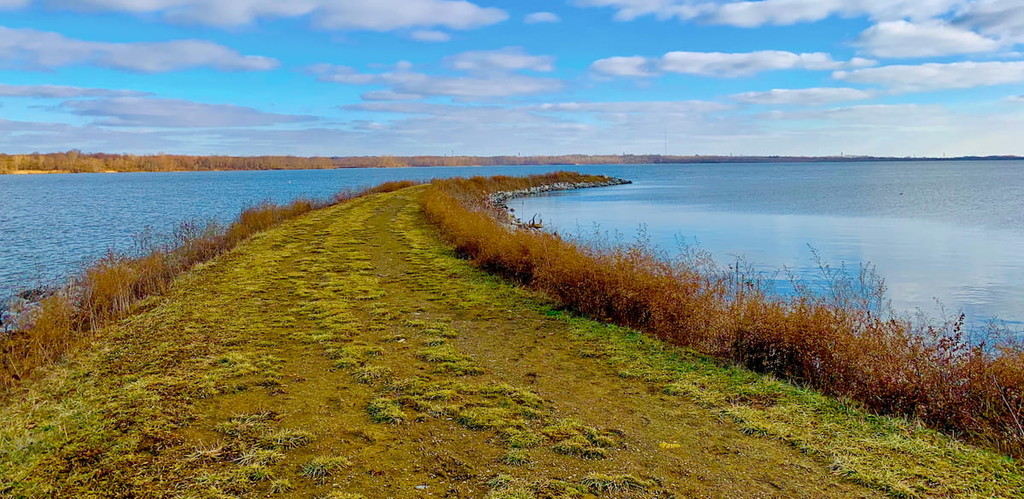
The state also shares an international maritime border with the province of Ontario in Canada on Lake Erie, though the closest major land border crossing to Ohio is the Detroit-Windsor Tunnel in Michigan, which is 58 miles (93km) away from Toledo.
With a total land area of 44,825 sq. miles (116,096 sq. km), Ohio is the 34th largest state in the country. However, it has a population of about 11.8 million people as of 2021, which makes it the 7th most populous and the 10th most densely populated state in the country.
Although Ohio is topographically a fairly flat state (except the southeastern region), its geographic location along Lake Erie and between the Northeastern part of the country, Appalachia, and the Midwest region has given it strategic importance. Indeed, the state has one of the largest highway networks in the country despite its small size, as well as a number of major cargo ports along Lake Erie.
That being said, although there are many different ways to define and describe Ohio’s geography, the state is often informally broken down into 5 large regions:
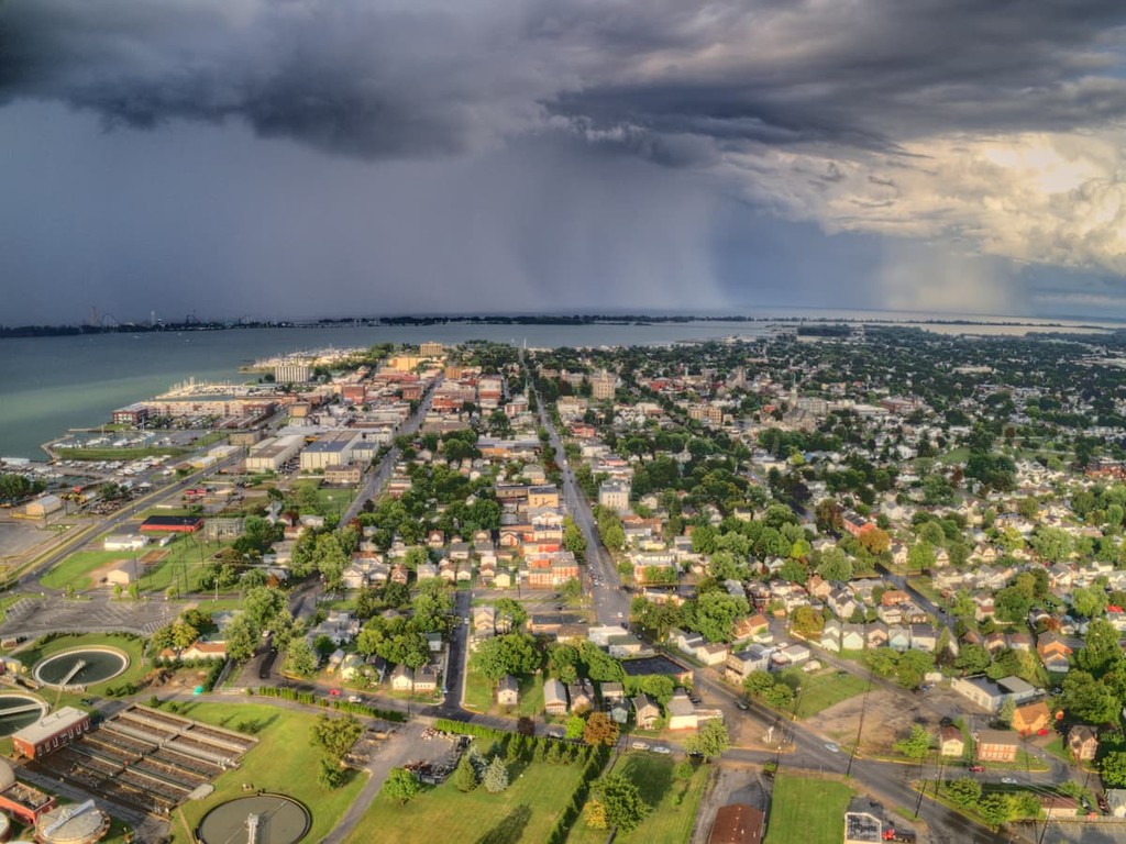
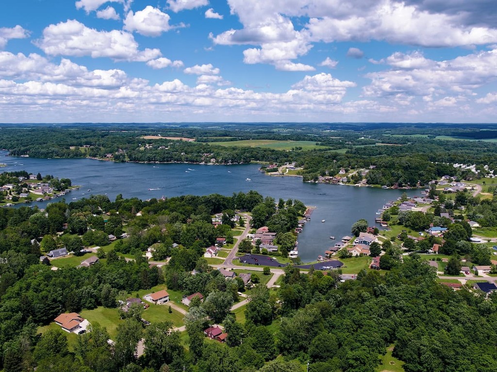
Aptly named, the northeast region of Ohio encompasses all of its northeasternmost counties. It includes Ashtabula, Lake, Geauga, Cuyahoga, Lorain, Medina, Summit, Portage, Trumbull, Wayne, Stark, and Mahoning counties, as well as the city of Cleveland.
Northeast Ohio is easily the most heavily populated part of the state. In fact, it includes 6 major metropolitan areas (Cleveland-Elyria, Canton-Massillon, Youngstown-Warren, Akron, Weirton-Steubenville, and Mansfield), as well as nearly half of the state’s population.
Additionally, Northeast Ohio is home to a truly impressive array of higher education institutions, which include everything from Kent State University to Ohio State, Oberlin College, and Kenyon College.
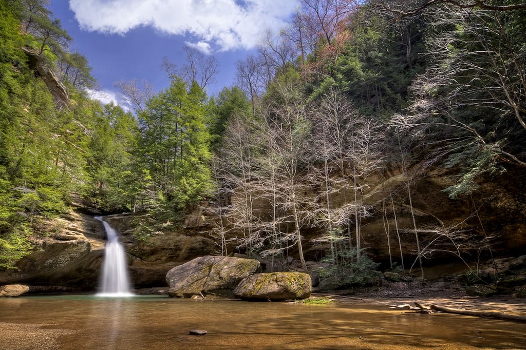
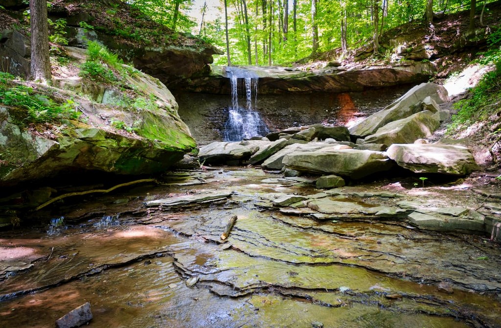
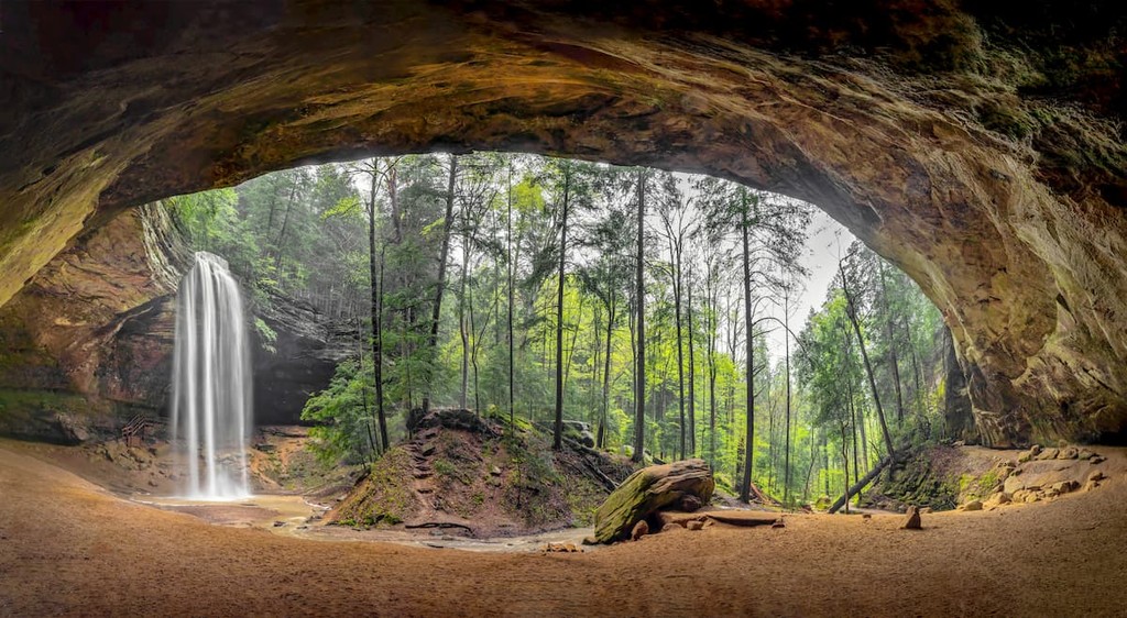
The northeastern part of the state also contains Ohio’s only national park – Cuyahoga Valley National Park – as well as a number of state parks and forests, such as:
One of the least populated regions in the state, Northwest Ohio includes Williams, Fulton, Lucas, Wood, Ottawa, Sandusky, Erie, Huron, Seneca, Hancock, Henry, Defiance, Paulding, Putnam, Van Wert, Allen, Mercer, and Auglaize counties near the state’s border with Michigan and Indiana.
Toledo is the largest city in the region, though much of the area is agricultural rather than metropolitain. However, Northwest Ohio was the birthplace or home of a number of major figures in US history, including astronaut Neil Armstrong and President Rutherford B. Hayes.
The northwestern part of the state also contains 3 national wildlife refuges, including Cedar Point National Wildlife Refuge, Ottawa National Wildlife Refuge, and West Sister Island National Wildlife Refuge. It also contains a great array of state parks and forests, such as:

Central Ohio includes all of the central most counties in the state, such as Hardin, Wyandot, Crawford, Richland, Ashland, Marion, Morrow, Knox, Delaware, Union, Madison, Franklin, Locking, Fairfield, Pickaway, and Fayette counties. Depending on who you ask, Central Ohio can also be defined as the Columbus Metropolitan Area, though this isn’t universally accepted.
The second most populous region in the state after the Northeast, Central Ohio is a major financial, manufacturing, retail, healthcare, tech, and public sector hub. It is also noted for its great collection of museums, cinemas, fairs, and performing arts institutions, which makes it a cultural hub for the state.
Although Central Ohio is fairly flat, it does have a number of lakes, forests, and parks, including the Wayne National Forest - Athens Unit and a handful of state parks, such as:
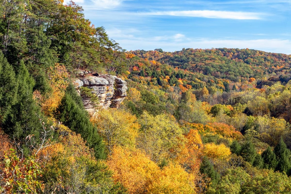
Southeast Ohio, which also comprises part of Appalachian Ohio, is the largest region in the state. It includes Columbiana, Carroll, Tuscarawas, Holmes, Coshocton, Harrison, Jefferson, Belmont, Guernsey, Muskingum, Perry, Morgan, Noble, Monroe, Washington, Athens, Hocking, Vinton, Meigs, Jackson, Ross, Highland, Pike, Gallia, Lawrence, Scioto, and Adams counties.
Due to the region’s location within the northwestern part of the Appalachian Mountains, it has strong cultural ties to Appalachia.
Although it’s less populated than Central, Southwestern, and Northeastern Ohio and it lacks a major metropolitan area like Columbus or Cincinnati, Southeast Ohio does have a number of sizable cities and towns, such as Steubenville. Moreover, the region has strong ties to other nearby cities, such as Parkersburg, West Virginia.
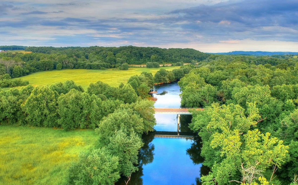
Nevertheless, the region’s lack of major metropolitan areas and proximity to the Appalachian Mountains means that it’s a great place for outdoor recreation. In particular, the region contains the Wayne National Forest - Marietta Unit as well as the following state parks:
Southeast Ohio also has a number of popular state forests, such as:
Encompassing the southwestern corner of the state, Southwest Ohio contains the state’s largest metropolitan area and third-largest city, Cincinnati. It also includes Logan, Shelby, Darke, Miami, Champaign, Clark, Greene, Montgomery, Preble, Butler, Warren, Clinton, Hamilton, Clemont, and Brown counties.
The region has long had ties with the rest of the Midwest and it was a major transportation and shipping region until the increase in reliance on railroads drew freight traffic away from the Ohio and Licking rivers.
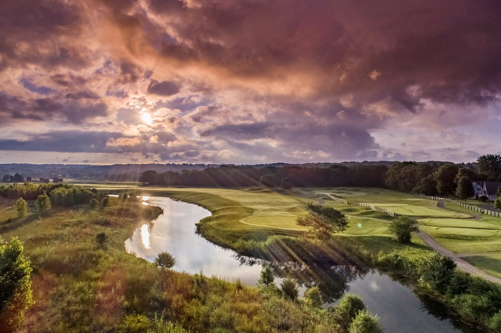
That being said, Southwest Ohio remains a popular tourist destination within the region. It also contains a selection of great parks and recreation areas, such as:
Despite being a relatively small state, Ohio has a complex geologic history that dates back more than 1 billion years. Nevertheless, the geologic history of the oldest parts of the state are poorly understood due to the difficulties involved in accessing Ohio’s deep basement rock.
The oldest rocks in the state date back to the Precambrian and they are often referred to as part of a geologic section known as the Grenville Province. It’s believed that this province actually collided with the Superior Province which was part of Proto-North America about 1 billion years ago, a collision that led to the Grenville orogeny.
Additionally, the Grenville orogeny partially resulted in the formation of a number of mountain ranges within the Appalachian Mountains, such as the Blue Ridge Mountains in Virginia and North Carolina as well as the Long Range Mountains in the Canadian Appalachians of Newfoundland and Labrador. The orogeny also helped build the Adirondacks in Upstate New York as well as an ancient mountain range in what is now Ohio which has since eroded away.
During the latter part of the Cambrian, the state of Ohio was actually covered under a fairly shallow sea, which led to widespread sediment deposits on top of the region’s Precambrian-aged basement rock.
Throughout the Ordovician, Ohio was actually heavily glaciated, though during the Silurian, the region was once again under a shallow sea. Not long afterward, during the Devonian, the region experienced the Acadian orogeny, which was a major mountain building event that helped to create the Appalachian Mountains.
In much more recent years, Ohio has been heavily eroded. In particular, it was extensively glaciated during the Pleistocene, leading to the formation of large valleys and other post-glacial features. The state also contains a decent number of fossilized remains, including those of mastodons and other now-extinct Ice Age mammals.
Ohio also contains a sizable amount of natural resources, which include limestone, dolomite, coal, gravel, sand, clay, and shale.
Although there are no major mountain ranges in the state of Ohio, the easternmost part of the state can be considered to be part of the Appalachian Mountains. Major high points in the state include Campbell Hill, Round Knob, Hulse Hill, Rocky Knob, Durrell Mountain, and Jasper Knob.
Within Ohio, there are 4 primary ecoregions, each of which boasts its own unique collection of flora and fauna.
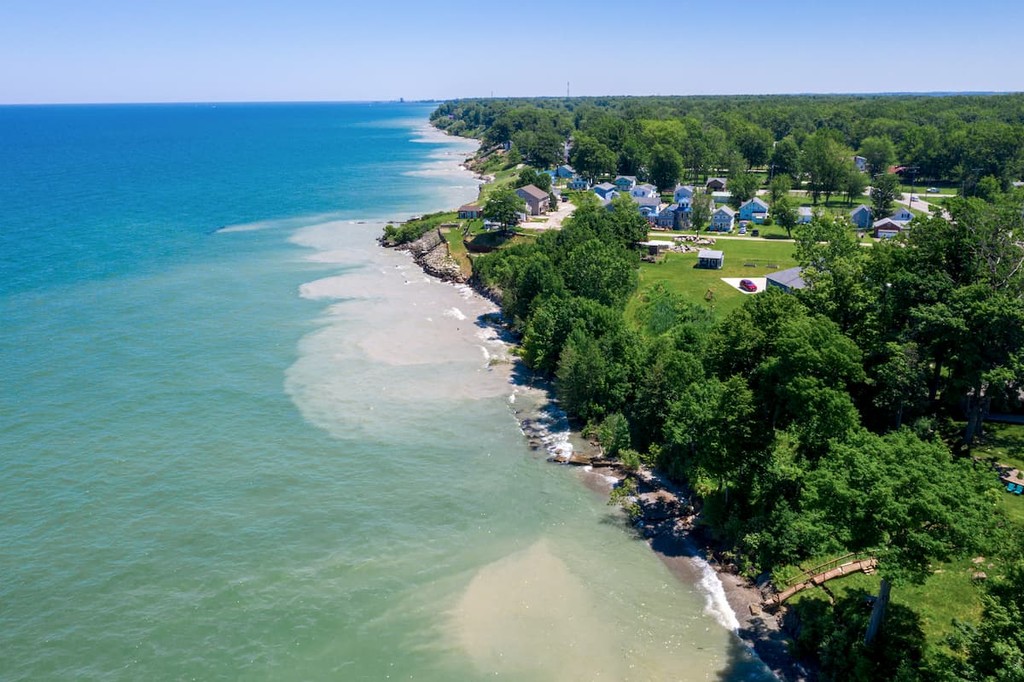
Covering the northwestern most corner of the state, the Huron/Erie Lake Plains are a mostly flat region. The ecoregion is dominated by poorly-drained clay soils and some smaller areas of fertile soil.
Before colonization, the region was covered with beech forests, mixed oak forests, open oak savannas, and some elm-ash swamp. However, there is relatively little of the original land cover left as much of the ecoregion is now used for agriculture or is heavily developed.
Major crops now grown in the region include corn and soybeans, though livestock raising is also a sizable industry. In some areas closer to Lake Erie, there are also places that can support fruit cultivation.
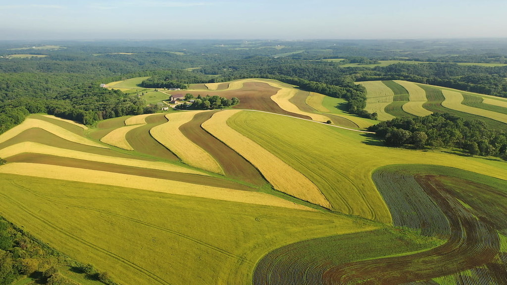
Encompassing a wide swath of western Ohio, the Eastern Corn Belt Plains are a major ecoregion that is now heavily agricultural.
Although the region was once covered with forests of elm-ash and American beech, it is now predominantly used to raise livestock, and grow crops such as corn and soy. That being said, there are still some small patches of forestland that remain.
The northeasternmost ecoregion in Ohio, the Erie Drift Plain is a fairly hilly area, thanks to the many terminal moraines within the region.
Before colonization, the area was fairly forested, with maple-beech forests, mixed oak, mixed mesophytic, and elm-ash forests dominating the landscape. Major tree species included shagbark hickory, white oak, red oak, yellow birch, American beech, eastern hemlock, and even sugar maple.
Nowadays, the region’s fertile soils make it a suitable place for agriculture. Therefore, much of the region has been cleared for the production of grain and the raising of dairy cows as well as for urban development.
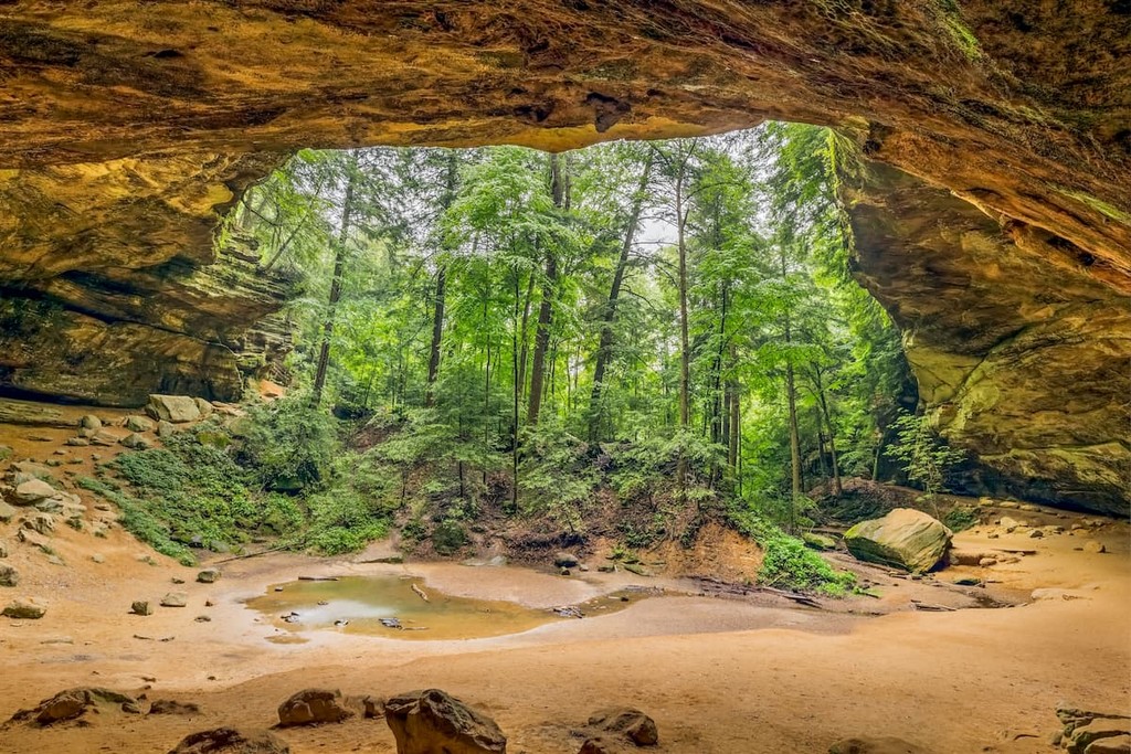
Ohio’s final major ecoregion, the Western Allegheny Plateau includes much of the southeastern region of the state, though it also encompasses parts of Pennsylvania, West Virginia, and Kentucky.
This broad ecoregion is fairly hilly with large dissected plateaus to the south, though these are fairly mild by the time the ecoregion reaches Ohio.
It used to be heavily forested with mixed mesophytic forests and Appalachian oak forests. Dominant tree species used to include black oak, buckeye, eastern hemlock, sugar maple, tulip tree, American beech, chestnut oak, and red oak.
Like much of the rest of Ohio, the Western Allegheny Plateau ecoregion has seen its fair share of forest clearing in exchange for agriculture. Some of the major agricultural products of the region include tobacco, small grains, hay, and corn, as well as dairy products.
Nevertheless, the region is actually the most forested part of the state and it contains much of Wayne National Forest.

The area that is now the state of Ohio has long been home to humans. Indeed, the state is part of the traditional territory of many peoples who lived in the region long before the arrival of European colonizers.
Some of the many tribes and nations that lived in the region and that continue to recognize the area as part of their traditional homelands include the Peoria Tribe of Indians of Oklahoma, the Meskwaki Nation, the Citizen Potawatomi Nation, the Miami Tribe of Oklahoma, the Shawnee Tribe, and the Osage Nation.
The earliest Europeans to have arrived in the region were likely French fur trappers who travelled through the area in the 1600s and 1700s, though other nations, such as England and the Netherlands also had trappers in the region.
Around this time, the French also started to colonize the region, claiming it as part of New France in the 1660s. They later set up a number of trading posts throughout what they called Ohio Country in order to control the follow of trade in the region.
Not long afterward, British traders started to arrive in larger numbers. Their arrival, alongside a number of other factors, eventually led to the outbreak of the French and Indian War, which ended with massacre of many of the region’s Indigenous peoples and the territory being ceded to the British.
After the American Revolutionary War, the region became more heavily settled by settlers from the newly formed United States. It became known as part of the Northwest Territory, which included the modern-day states of Ohio, Michigan, Indiana, Illinois, Wisconsin, and parts of Minnesota. Interestingly, slavery was prohibited in the territory and, even after the parts of the territory gained staithood, they remained Free States.
In 1803, Ohio became the 17th state in the union after reaching the requisite population numbers of 45,000 people. Not long after, they plunged into the War of 1812 in which Ohio played a key role due to its position on the front line of the Western Theater.
Although it’s not often considered part of the Trail of Tears, after the passage of the Indian Removal Act of 1830, the vast majority of Ohio’s Indigenous tribes and nations were forcibly and violently removed from the region. As a result, many of the state’s tribes and nations now have headquarters in other areas, such as Oklahoma.
During the latter part of the 1800s, the state of Ohio rapidly industrialized, especially after the discovery of coal in parts of the state. The state later became a major player for manufacturing, having been the birthplace of a number of companies such as Dow Chemical, Goodyear Tire, Firestone Tire, Goodrich Corporation, Play-Doh, and Procter & Gamble.
The state is also considered the birthplace of aviation as the Wright brothers invented their first airplane in Dayton.

Over the years, Ohio became increasingly urbanized as cities such as Cincinnati and Cleveland grew in size. Manufacturing and industry remained a major part of the state’s economy throughout the early 1900s, though financial services and education also started to dominate the scene by the end of the 1800s.
These days, Ohio remains a major player in the Us’s economy, contributing to its agricultural, industrial, and financial sectors. It is currently positioning itself as a key part of the renewable energy sector after reinventing itself in the years since the Great Recession. Additionally, Ohio is a big hub for aerospace research and defense as well as a center for technological development.
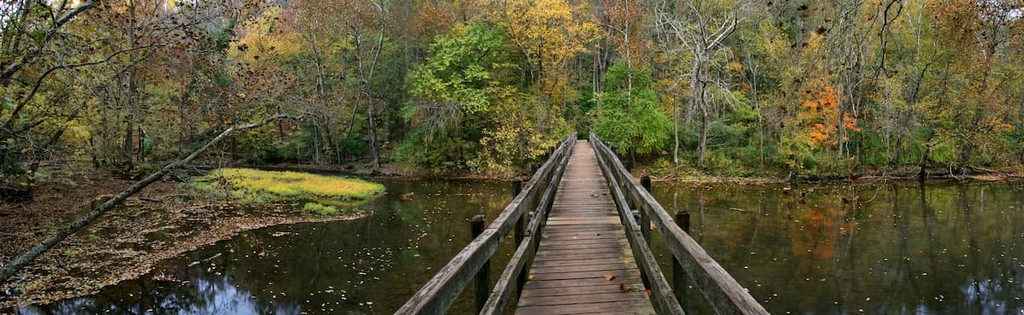
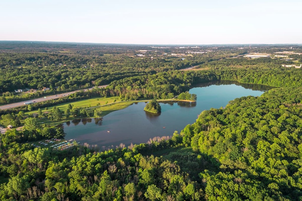
Although Ohio isn’t known for its mountains and hiking opportunities, it is a fantastic place to visit if you’re looking to check out some of the state’s many parks and forests. From hiking and biking to paddling and watersports, there are plenty of opportunities for adventure in the Buckeye State.
Looking for a great place to hike and adventure in Ohio? Here are some of the best parks and forests to check out:
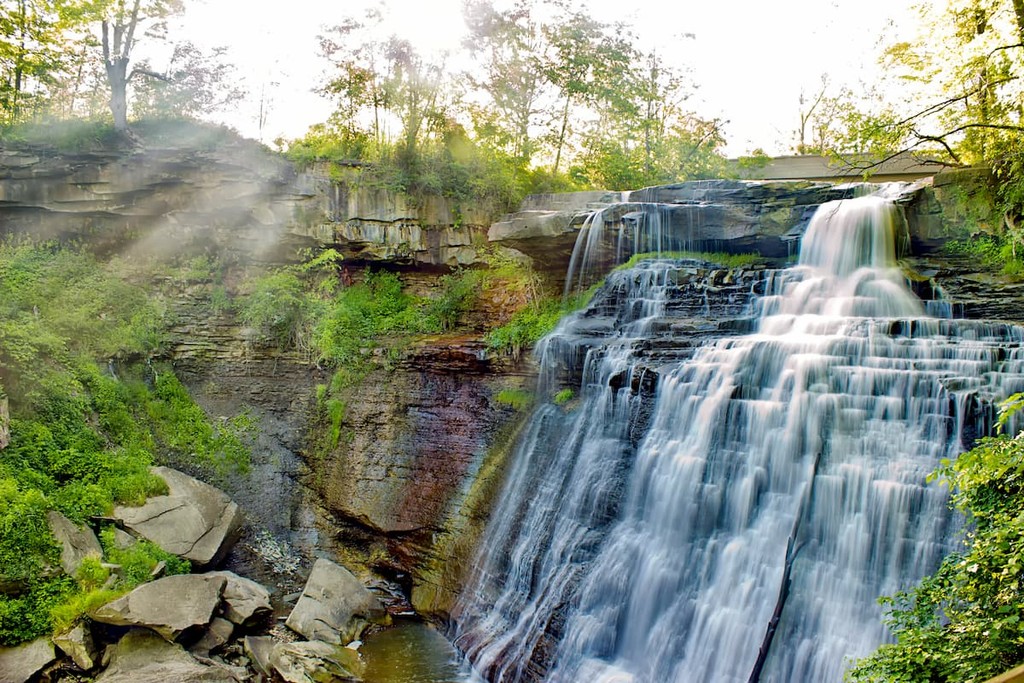
Ohio’s only national park, Cuyahoga Valley National Park is a small federally-managed area just outside of Akron and Cleveland. Home to some truly stunning forests, hills, wetlands, and rivers, the park is also well-known for its many waterfalls.
One of the most popular trails in Cuyahoga Valley is the Towpath Trail, which is a 20mi (32km) footpath that follows along the old Ohio and Erie Canal. There are also plenty of backpacking, biking, fishing, paddling, and horseback riding opportunities within the park.
A patchwork of public land located in Central and Southeast Ohio, Wayne National Forest (Ironton, Marietta, and Athens units) contains a large swath of the Appalachian foothills. The forest is actually the result of a major reforestation effort, which helped to rejuvenate landscapes that had been clear-cut for agriculture and mining.
These days, the forest is home to dozens of different trails, some of the most popular of which are the Archers Fork Trail, the Scenic River Loop, the Kinderhook Trail, and the Ohio View Trail.
For skiing and snowboarding enthusiasts, there are more than 5 ski resorts in Ohio.
The two largest are Mad River Mountain and Snow Trails with more than 5 km (3 mi) of slopes and more than 5 ski lifts each. These are also the main ski resorts near Columbus on the west of the state. Other main areas for skiing in Ohio include several ski resorts near Cleveland on the north: Brandywine, Boston Mills, and Alpine Valley Ohio.
Check the Ohio ski resorts map and the larger USA ski resorts map in the World Mountain Lifts section of the site. It includes information about open ski lifts / slopes in Ohio in real-time with opening dates and hours. There are also year-round cable cars, funiculars, cog railways, aerial tramways, and all other types of mountain lifts.
As one of the most populous states in the country, Ohio is home to its fair share of cities. Here are some of the best places to check out during your visit:
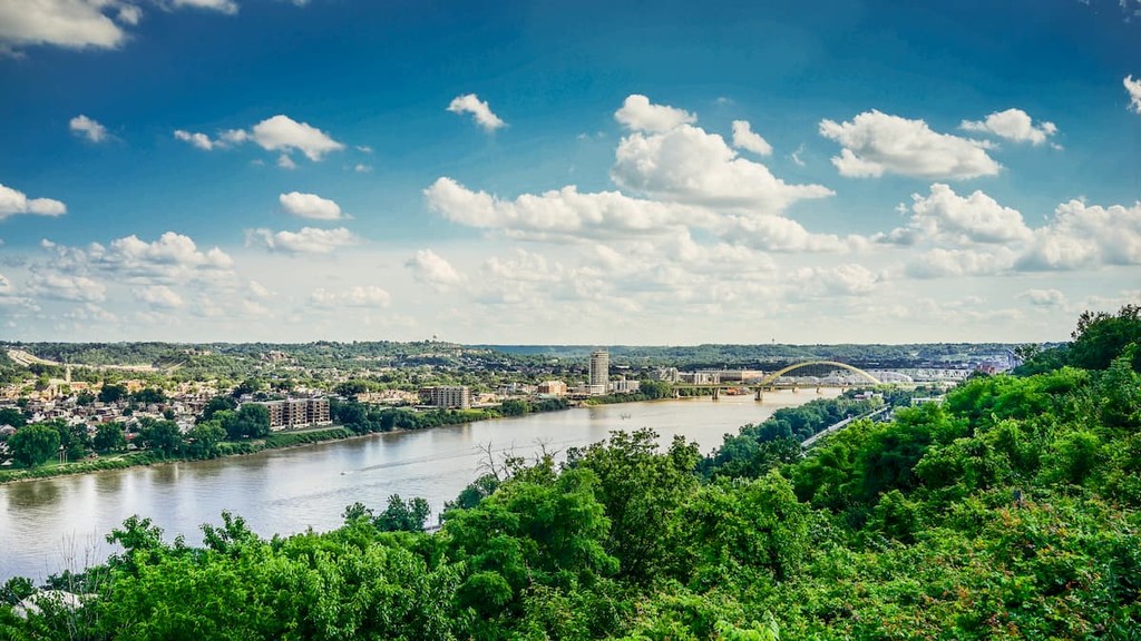
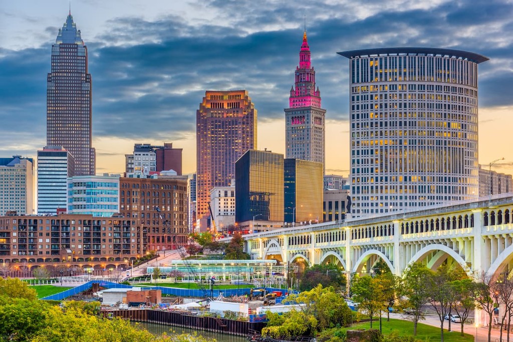
Located along Lake Erie, Cleveland is a city of some 380,000 people, though about 3.6 million people live in its greater metropolitan area. The city is a major player in the state’s economy and it is a cultural hub of the region. Cleveland is well-connected by road, rail, and air, so it’s easy to get to from other cities around the country.
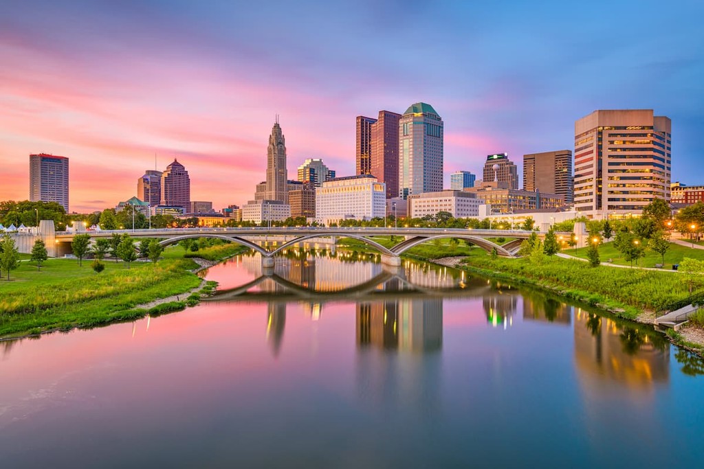
The capital and largest city in the state of Ohio, Columbus is home to about 900,000 residents, which makes it one of the 20 largest cities in the United States. Its location along the Scioto River made it an important trading hub and it has since become a major center for commerce and development. Like Cleveland, Columbus is relatively easy to get to by road and air, though it does not have passenger rail service.
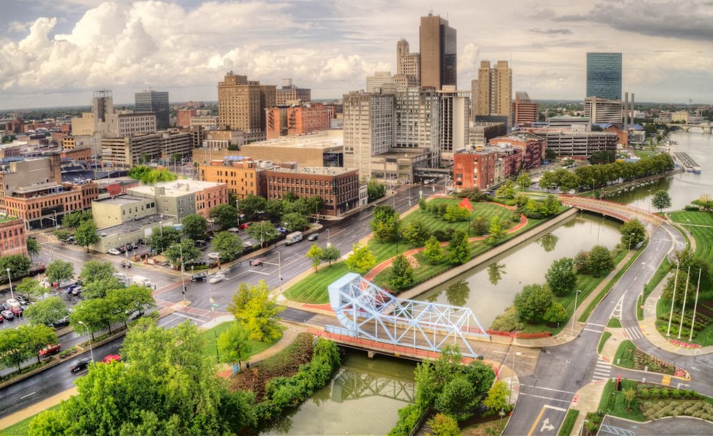
Not to be confused with the city of Toledo in Spain, Toledo, Ohio is located in the northwestern part of the state near its border with Michigan. Toledo is home to about 275,000 residents and it now has a bustling entertainment industry and district known as the Warehouse District. There are also tens of thousands of acres of greenspaces within Toledo, which makes it an excellent place to walk around and explore.
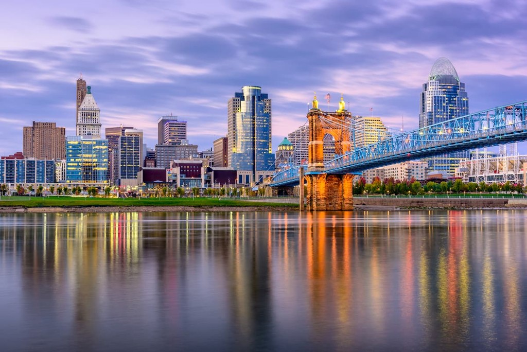
Home to about 300,000 people, Cincinnati is one of the largest cities in Ohio. It is located in the southwestern part of the state near Indiana and Kentucky and it is a hub of commerce for the region. Cincinnati is also known for having a number of major sports teams and for its unique architecture, which makes it a popular tourist destination.


Yes. Ohio has 733 named mountains. The highest is Campbell Hill at 471 m.
The highest mountain in Ohio is Campbell Hill, at 471 m.
Ohio has 733 named mountains.


