
Scan the QR code and open PeakVisor on your phone
Wisconsin is home to 717 named mountains. The highest is Timms Hill at 594 m.
Also known as the Badger State, Wisconsin is a US state located in the northern part of the country’s Midwestern Region. Although it’s not known as a particularly mountainous state, the rolling hills, sprawling plains, and many lakes of America’s Dairyland are well worth a visit. Wisconsin contains 717 named high points, the highest of which is Timms Hill (1949ft/594m)), and the most prominent of which is Blue Mounds (1,713ft/522m).
The state of Wisconsin is located in the United States’ northern Midwest Region. With a total area of some 65,498 square miles (169,640 sq. km), Wisconsin is the 23rd largest state in the union, though it is the 20th in terms of population as of 2021.
Wisconsin’s location in the northern Midwest means that it shares a border with quite a few other states. In particular, Wisconsin is located to the north of Illinois, to the northeast of Iowa, and to the west of Minnesota. Furthermore, Wisconsin is located to the west of Michigan’s Upper Peninsula.
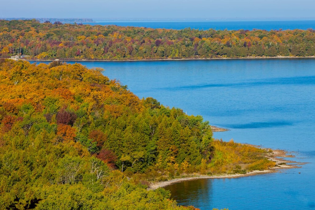
It is separated from the Lower Peninsula of Michigan by Lake Michigan and from the province of Ontario in Canada by Lake Superior, though it does not have a Canadian border, whether terrestrial or maritime.
Wisconsin is divided into 72 counties, though it can be more broadly divided up into 5 geographic areas. Although these geographic regions have no official designation, they do encompass areas of similar topographic features.
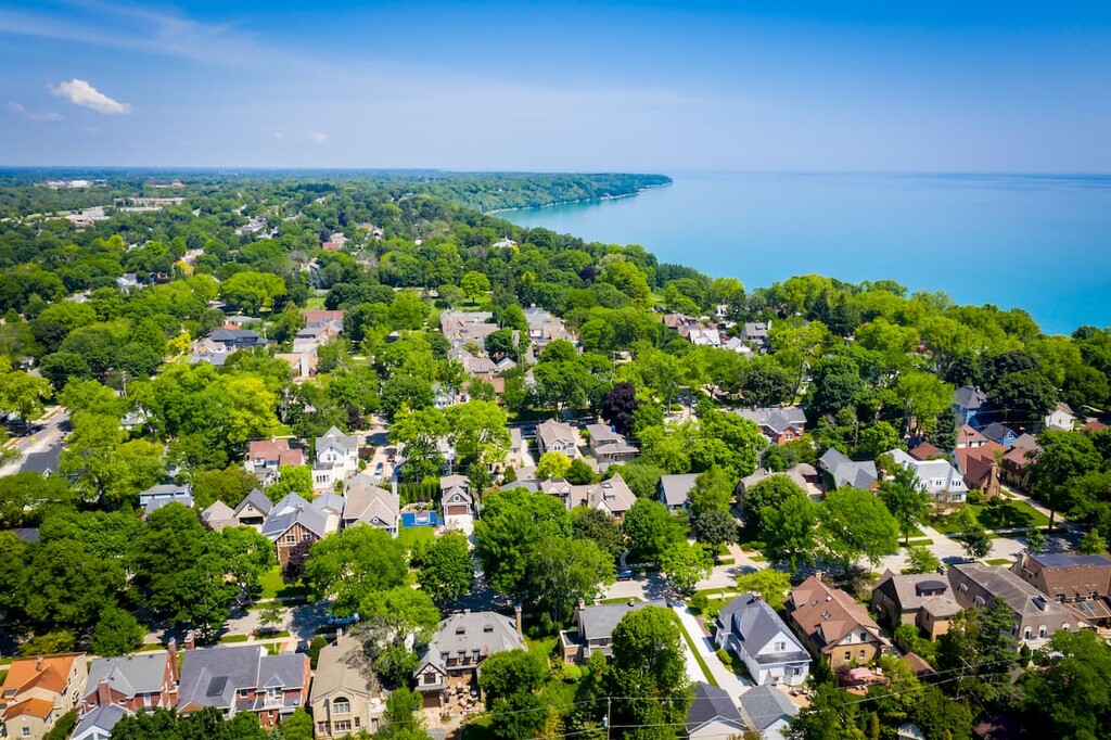
Encompassing all of the eastern shore of Wisconsin along Lake Michigan, the Eastern Ridges and Lowlands is a low-lying plain and coastal region. It contains Brown, Winnebago, Calumet, Waukesha, Columbia, Washington, Dane, Walworth, Dodge, Sheboygan, Door, Shawano, Fond du Lac, Rock, Green Lake, Racine, Jefferson, Ozaukee, Kenosha, Outagamie, Kewaunee, Oconto, Manitowoc, Milwaukee, and Marinette counties as well as some of the state’s largest cities.
Some of the major cities in the Eastern Ridges and Lowlands include Green Bay, Milwaukee, Madison, Oshkosh, and Kenosha. Furthermore, the region is home to the reservation of the Oneida Nation.
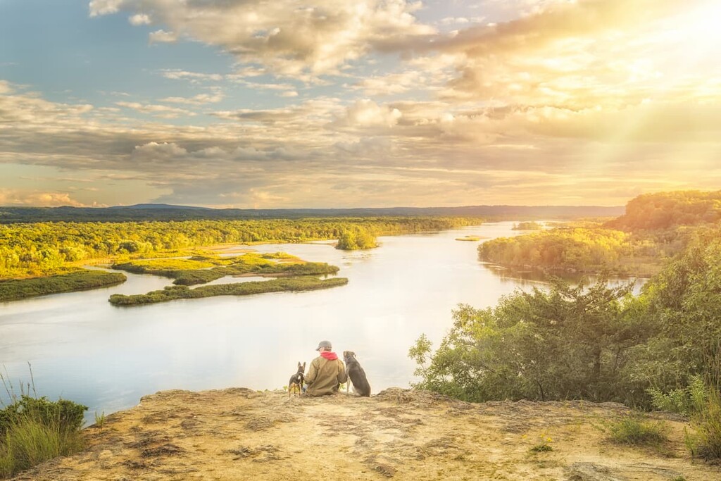
Although the Eastern Ridges and Lowlands are, by far, Wisconsin’s most populous region, it also contains a great collection of outdoor recreation areas. This includes:

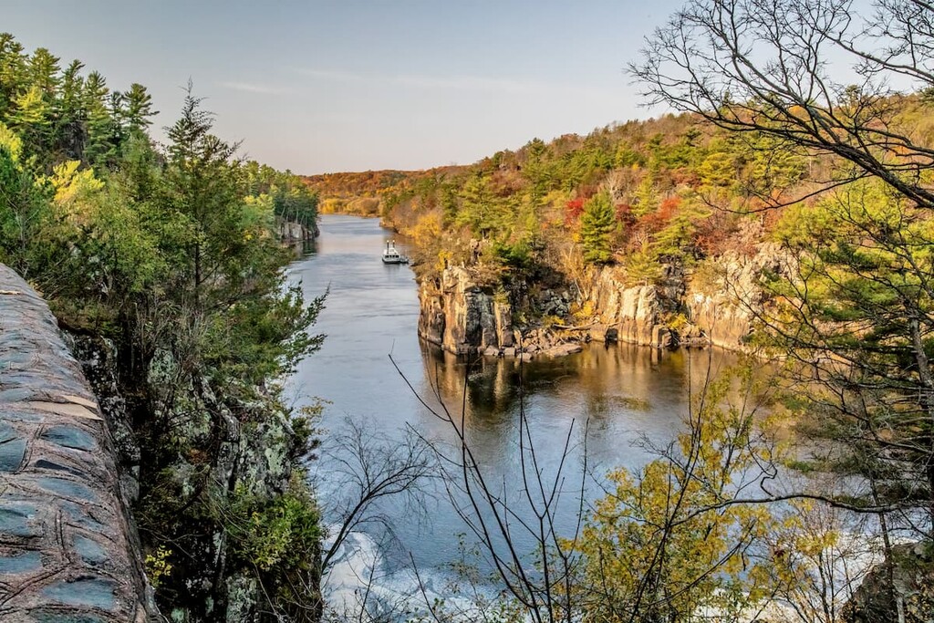
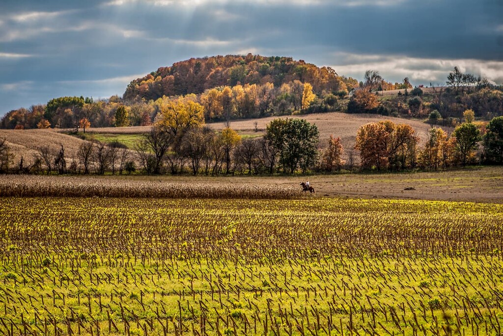
Running along much of the state’s southwestern border, the Western Upland is one of the most rugged parts of the state, though this is more due to its rocky outcroppings, many rivers, and numerous caves.
This region contains Buffalo, Vernon, Crawford, Trempealeau, Dane, St. Croix, Eau Claire, Sauk, Grant, Rock, Green, Richland, Iowa, Polk, Jackson, Pierce, Juneau, Monroe, La Crosse, Pepin, and Lafayette counties, as well as the reservations of the Ho-Chunk Nation and the Stockbridge-Munsee Band of Mohican Indians.
While the Western Upland is a highly agricultural area, there are also many, many wonderful parks in the region, including:

Forming a V-shaped belt that criss-crosses much of the state, Wisconsin’s Central Plain is a mostly flat, sandy area with relatively little by the way of mountains.
It contains Adams, Wood, Barron, Waushara, Burnett, Waupaca, Chippewa, Washburn, Clark, Shawano, Columbia, Sawyer, Dunn, Sauk, Eau Claire, Portage, Green Lake, Polk, Jackson, Outagamie, Juneau, Oconto, Marinette, Menominee, and Marquette counties as well as the cities of Eau Claire and Chippewa Falls. The Central Plain of Wisconsin is also home to the reservation of the Saint Croix Chippewa Indians of Wisconsin.
The Central Plain is predominately farmlands and small forests, so much of the region is privately owned. However, there are a number of parks and outdoor recreation areas in the Central Plain, such as:
Covering the vast majority of Northern Wisconsin, the Northern highlands is one of the largest geographic regions in the state. It includes all or part of Ashland, Wood, Bayfield, Washburn, Burnett, Vilas, Chippewa, Taylor, Douglas, Shawano, Florence, Rusk, Forest, Price, Iron, Portage, Langlade, Oneida, Marathon, Lincoln, Menominee, Oconto, and Marinette counties as well as the towns of Rhinelander and Wausau.
The Northern Highland region of Wisconsin is home to the reservations of quite a few nations and tribes, including those of the Menominee Indian Tribe of Wisconsin, Mole Lake Band of Lake Superior Chippewa (Sokaogon Chippewa Community), Forest County Potawatomi, Lac du Flambeau Band of Lake Superior Chippewa Indians, and the La Courte Oreilles Band of Lake Superior Chippewa Indians.

Out of all of Wisconsin’s regions, the Northern Highlands are perhaps the most mountainous, though the region is mostly dominated by the hills of the Superior Upland. In fact, although the region is now mostly rolling hills, it is home to the remnants of an ancient mountain range.
The Northern Highland region is also heavily forested and it is home to a great collection of lakes. There are many parks and recreation areas in the region including some that are federally-managed, such as:

Furthermore, the region contains a number of state and county-managed parks and forests, such as:
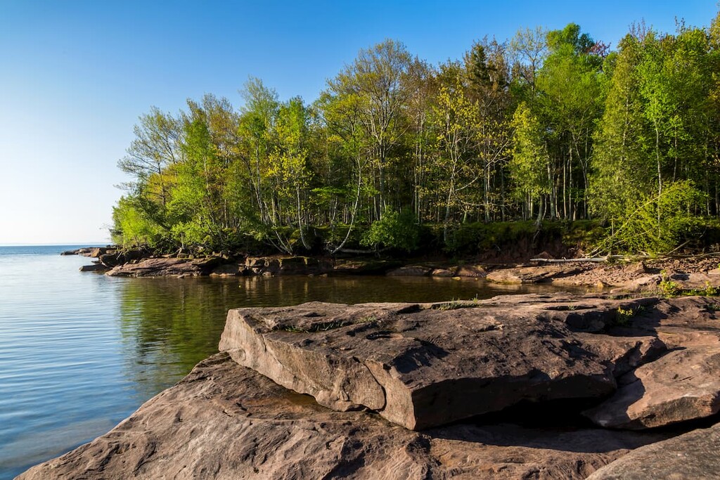
The final, smallest region of Wisconsin, the Lake Superior Lowland (also called the Superior Coastal Plain) includes all of the low-lying areas in northern Wisconsin that border Lake Superior. It includes Ashland, Iron, Bayfield, and Douglas counties, as well as the towns of Superior, Ashland, and Washburn.
The Lake Superior Lowlands are also home to the reservations of the Bad River Band of Lake Superior Chippewa and the Red Cliff Band of Lake Superior Chippewa.
Despite being Wisconsin’s smallest region, the Lake Superior Lowland does contain both the Apostle Islands National Lakeshore and the Chequamegon-Nicolet National Forest (Washburn District). It is also home to Big Bay State Park, Amnicon Falls State Park, and Pattison State Park.
Wisconsin has a unique and complex geologic history that dates back billions of years.
Indeed, the oldest rocks in Wisconsin date back to the Precambrian and some of the basement rock in the state is believed to be late Archean metamorphic rocks that are around 3 billion years old.
Above this ancient bedrock, the state is a mix of different rock types, though sedimentary rock layers are dominant throughout Wisconsin. With the exception of some quartzites found in the north-central and southern parts of the state and some other Proterozoic granites and gneisses, much of the state is shales, dolomites, limestones, sandstones, and conglomerates.
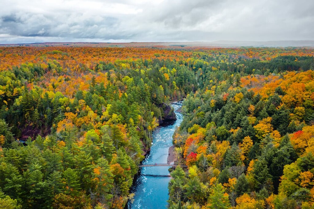
However, the most dominant geological process in Wisconsin’s recent geologic history is easily its period of extensive glaciation. Although you won’t find any permanent ice in the state today, Wisconsin was covered by a massive ice sheet for tens of thousands of years, particularly during the Wisconsinan Glaciation.
This extensive glaciation helped to carve out many of the land features that we now see in Wisconsin, such as its moraines, kettle lakes, and till plains.
Nevertheless, while Wisconsin is not known for its mountains, it does contain many of the hills of the Superior Upland. Major high points in the state include Timms Hill, Sugarbush Hill, Lookout Mountain, Rib Mountain, Blue Mounds, and Mount Whittlesey.
Within Wisconsin, there are 4 primary ecoregions, each taking up about one-quarter of the state. Here’s what you need to know:
The Southeastern Wisconsin Till Plains encompass the southeastern part of the state near Lake Michigan. Although it is now mostly covered by agricultural land and urban developments, the ecoregion was once home to fairly large forests.
These forests were a bit of a transitional area between tallgrass prairie to the south and the hardwood forests to the north. Although the exact ecosystems depend on where you are in the ecoregion, it was mostly dominated by forests of oak, maple, and beech, with various plots of oak savanna dispersed throughout.
Located throughout southwestern Wisconsin, as well as parts of Iowa, Minnesota, and Illinois, the Driftless Area is a unique region that’s known for its rolling terrain, forested ridges, and river valleys.
This ecoregion more closely resembles the ecology of the land located in New England and around the Great Lakes than it does its neighboring prairie. While much of the land has since been converted for agriculture, prior to European settlement, it was home to a mix of tallgrass prairie, sugar maple-basswood-oak forests, and bur oak savanna.
Found in the central part of Wisconsin, the North Central Hardwood Forests ecoregion is, as the name suggests, home to mostly hardwood forests. Nevertheless, agriculture is also prominent in the area, so much of the original forest has been replaced by agricultural fields or new growth woodlands. Tree species in the region include cherry, elm, maple, beech, and oak.
The northernmost of Wisconsin’s ecoregions, the Northern Lakes and Forest covers all of the northern part of the state, as well as much of Minnesota and Michigan. Within this ecoregion, the forests are mixed and they include both coniferous and northern hardwoods deciduous trees.
While much of this forest cover is not old growth, some of the many species found here include sugar maple, beech, and white ash.
The area that is now part of the state of Wisconsin has been inhabited by people since time immemorial.
Many different tribes and nations consider the region to be part of their ancestral homeland, including the Ojibwe (Chippewa), the Menominee, and the Potawatomi. Furthermore, many Indigenous peoples who now call the area in Wisconsin home came to the region after being displaced (in many cases violently) from their ancestral homelands in the eastern part of the North American continent.
Perhaps the first person of European descent to visit the regions was Jean Nicolet of France, who traveled extensively around the Great Lakes, particularly around Green Bay, in the 1630s. France later claimed the region as part of New France in the 1670s.
In the 1670s, the missionary Jacques Marquette (of what is now Quebec) also visited what is now Wisconsin after having established neighboring Michigan’s first European town, Sault Ste. Marie.
In the aftermath of the French and Indian War, France ceded their territory in Wisconsin and elsewhere on the continent to Great Britain. However, British control over the region was short-lived as the land was ceded once again, this time to the new United States, after the end of the American Revolutionary War.
Wisconsin then became part of the Northwest Territory in the 1780s until it became its own territory in the 1830s. Not long after, the territory had a large enough population to apply for statehood, which was granted in 1848.

During this time, the region actually became quite popular among immigrants from Western Europe, including from Germany and Luxembourg. The state sided with the Union during the Civil War and they sent tens of thousands of soldiers to fight alongside other Union troops.
Throughout the 19th century, Wisconsin cemented itself as a highly agricultural area, especially when it came to wheat production. This also led to a fairly strong beer brewing industry, particularly in Wisconsin, where companies such as Miller and Pabst once brewed their beer (Miller still operates in the state).
During the 19th and 20th century, Wisconsin also had a fairly strong logging industry which led to a rise in the paper mill industry. Many of the laborers in the state were actually immigrants from Scandinavia, especially Norway and Sweden.
In more recent years, Wisconsin has also cemented itself as a major producer of dairy products, particularly cheese. However, although the state is still highly agricultural, it also has a diversified manufacturing-based economy, as well as strong tourism, education, and healthcare industries.
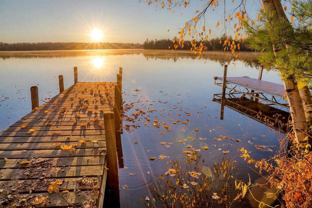
America’s Dairyland is home to an excellent collection of outdoor recreation areas. Here are some of the best places to check out if you’re visiting the Badger State:
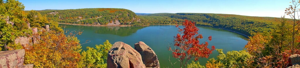
Located in Sauk County, Devil’s Lake State Park is the largest park in Wisconsin’s state park system. It contains some 9,217 acres (3,730ha) of land, much of which is the remnants of a massive terminal moraine.
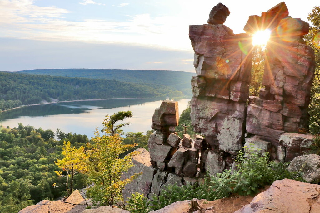
However, the main attraction of the park for many visitors, besides the lake itself, is the park’s 500-foot (150m) high quartzite cliff which runs along the edge of Devil’s Lake. Since Wisconsin is not known for its exceptional topographical relief, this cliff really stands out in the landscape. As a result, it’s also the state’s most popular rock climbing destination.
Moreover, Devil’s Lake State Park is an excellent place to see fall foliage, so it’s worth a visit if you’re in the region. It also contains parts of the Ice Age Trail, which is a long-distance trail that stretches across much of Wisconsin.
Wisconsin’s only national forest, Chequamegon-Nicolet National Forest covers some 1.5 million acres (600,000 ha) of land throughout the northern part of the state. Split between its 3 districts (Washburn, Lakewood-Laona, and Great Divide), the forest contains 5 named mountains, the highest of which is Military Hill.

Although the woodlands in both forests have been heavily logged over the years, they have since experienced exceptional growth of their natural ecosystems. These days, the forest is a haven for wildlife and they are popular destinations for hiking, camping, fishing, and even cross-country skiing during the winter months.
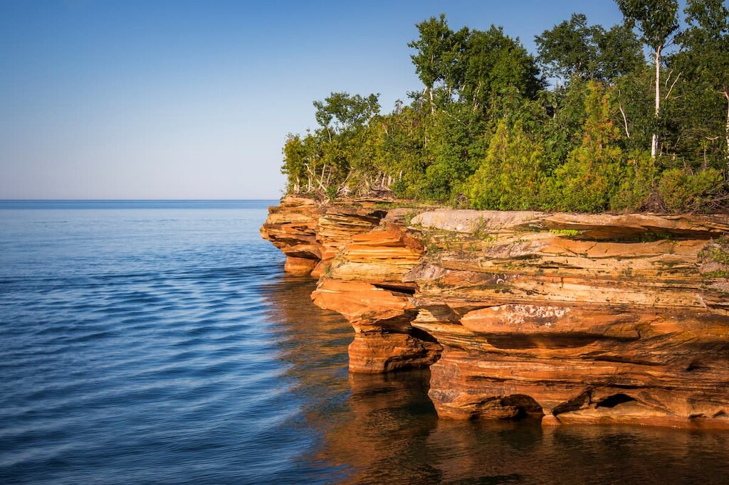
Encompassing a group of islands located right off the northern tip of Wisconsin, the Apostle Islands National Lakeshore is a stunning natural area that’s known for its old-growth forests. The islands contain 1 named high point, Clay Banks.
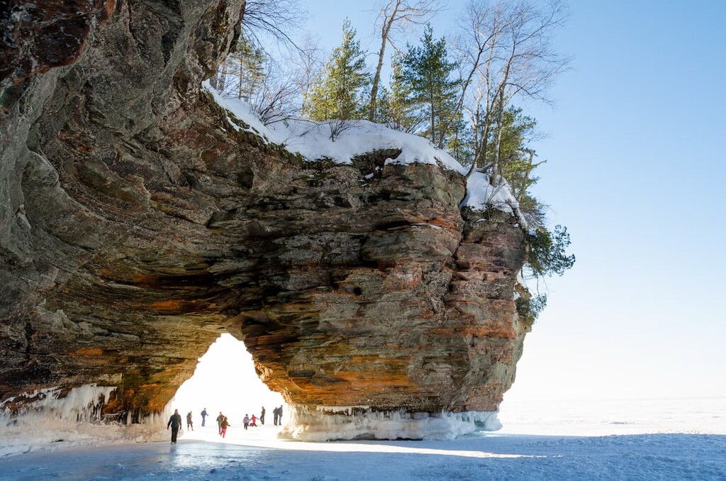
Considered to be some of the best outdoor recreation destinations in the state of Wisconsin, the Apostle Islands are accessible either by ferry in the summer or by ice road in the winter months. Most of the islands have facilities for public docking and there are a plethora of historic sites scattered throughout.
Furthermore, there are a number of camping areas available for overnight visitors, many of whom come on kayak. There are also plenty of opportunities to hike, scuba dive, and fish throughout the park.
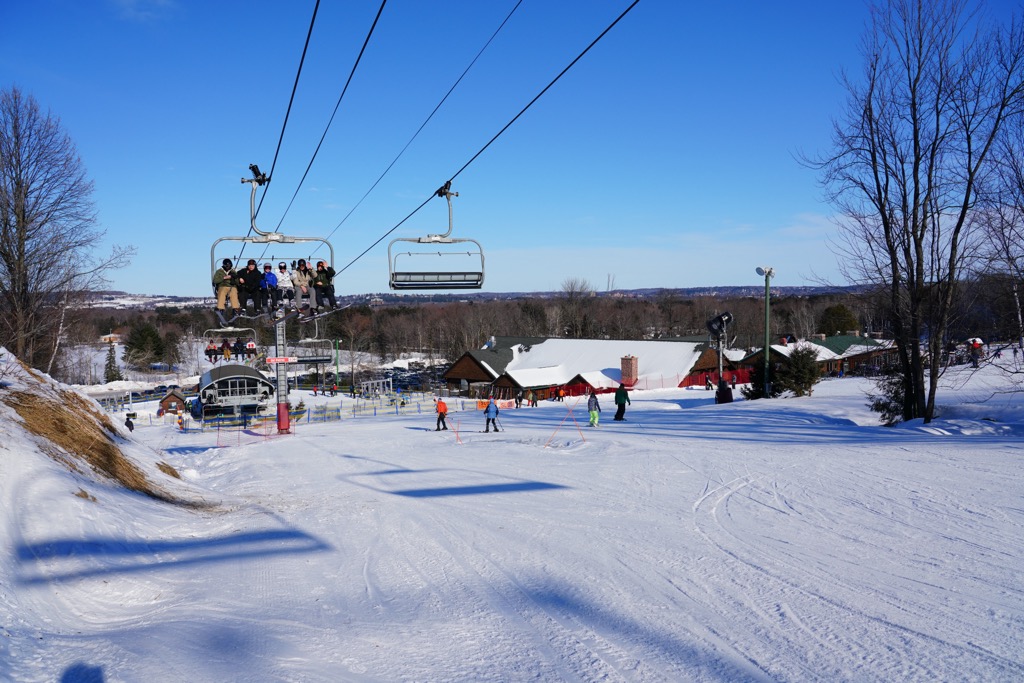
For skiing and snowboarding enthusiasts, there are more than 30 ski resorts in Wisconsin located all over the state.
The largest is Granite Peak Ski Area with more than 20 km (12 mi) of ski slopes and 5 ski lifts. Other major areas for skiing in Wisconsin include Cascade Mountain, and Devil’s Head Inn, as well as many smaller ones such as Nordic Mountain, Sunburst Winter Sports Park, and others.
The largest ski resorts near Milwaukee are the following three: Alpine Valley Resort, Little Switzerland Ski Area, and the Rock Snowpark.
Check the Wisconsin ski resorts map and the larger USA ski resorts map in the World Mountain Lifts section of the site. It includes information about open ski lifts / slopes in Wisconsin in real-time with opening dates and hours. There are also year-round cable cars, funiculars, cog railways, aerial tramways, and all other types of mountain lifts.
Looking for a place to stay during your visit to Wisconsin? Here are some of the Badger State’s best cities to check out:
The largest city in the state of Wisconsin and one of the largest in the entire Midwest, the city of Milwaukee is home to nearly 600,000 people who live in the southeastern corner of the state. Milwaukee has a varied economy that happens to have a long history of beer brewing.
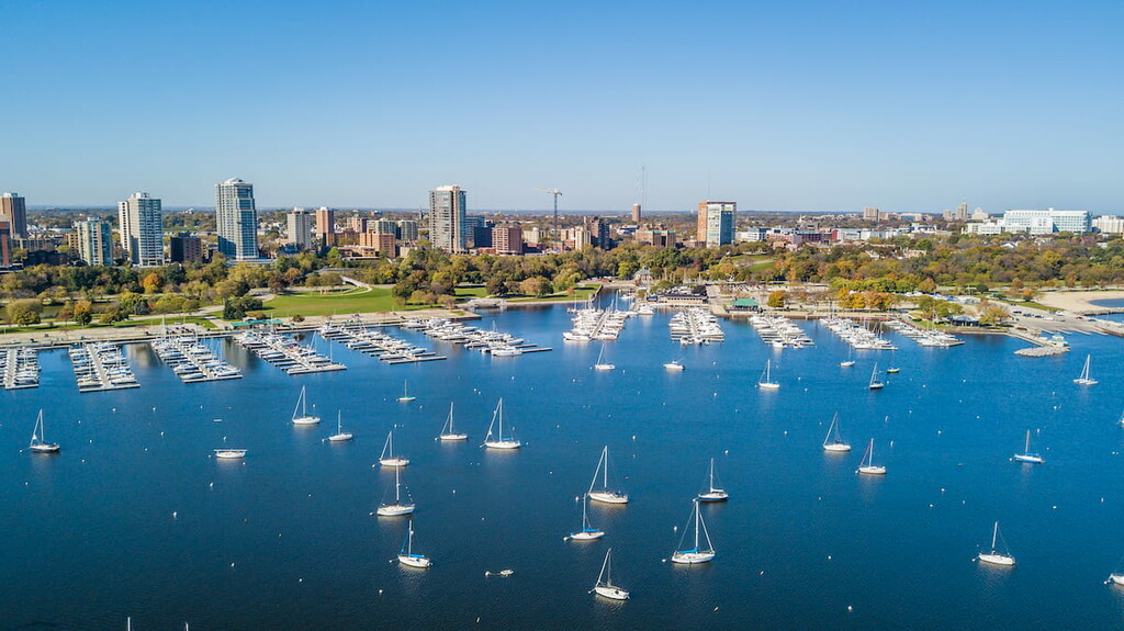
More recently, Milwaukee’s economy has become more diversified, with a number of Fortune 500 companies and other major corporations calling the city home. Furthermore, Milwaukee is a popular destination for outdoor recreation, especially for watersports on Lake Michigan. It’s also the host city for a number of annual festivals and cultural events.
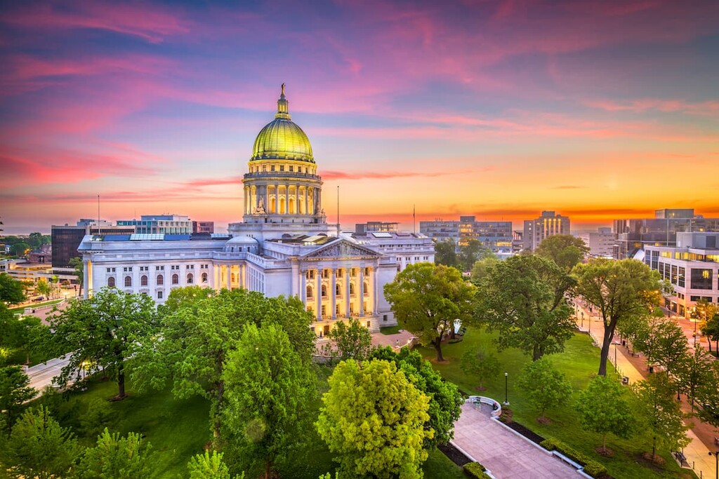
Both the second largest city and the capital of the state of Wisconsin, Madison is a bustling university town with some 260,000 residents that’s located in the south-central part of the state. Madison is situated on the shores of a number of different lakes and it is home to a UNESCO World Heritage Site—the Herbert and Katherine Jacobs House, which was designed by architect Frank Lloyd Wright.
Madison is also the home of the University of Wisconsin-Madison campus, which is the university’s flagship campus with over 40,000 students. The city is known for being a hub of culture and commerce for the region and it is a popular tourist destination.
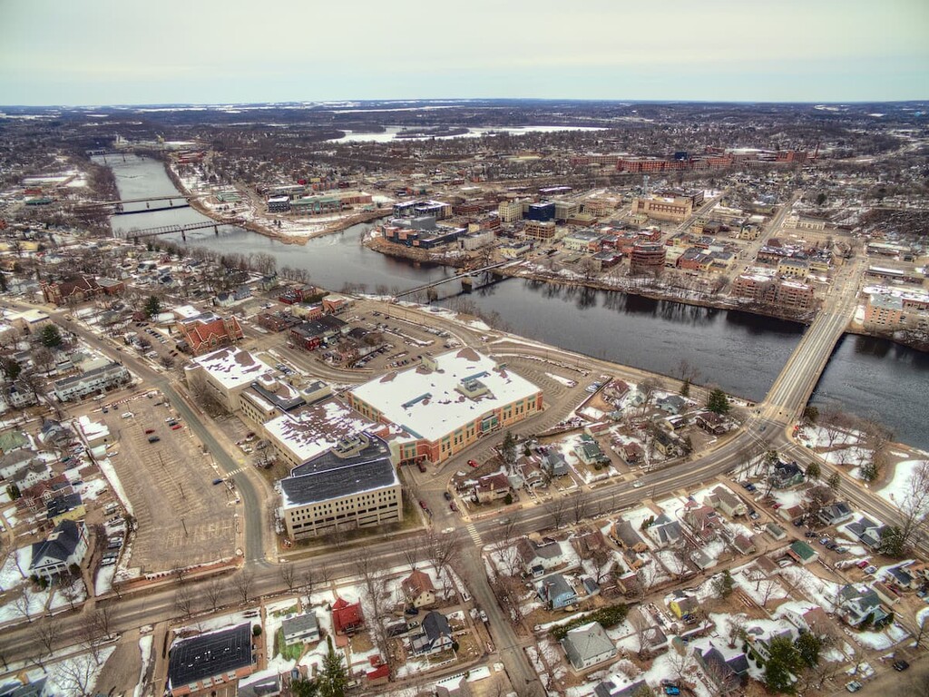
Located in northwestern Wisconsin, Eau Claire is a city of some 70,000 people. It has a burgeoning performing arts community and it serves as the host of a number of annual music festivals.
While Eau Claire is only the 9th largest city in the state, its interior location makes it a commercial hub for many smaller communities in the region. Furthermore, there are quite a few small parks, trails, and recreation areas in the city that are popular among residents and visitors, alike.
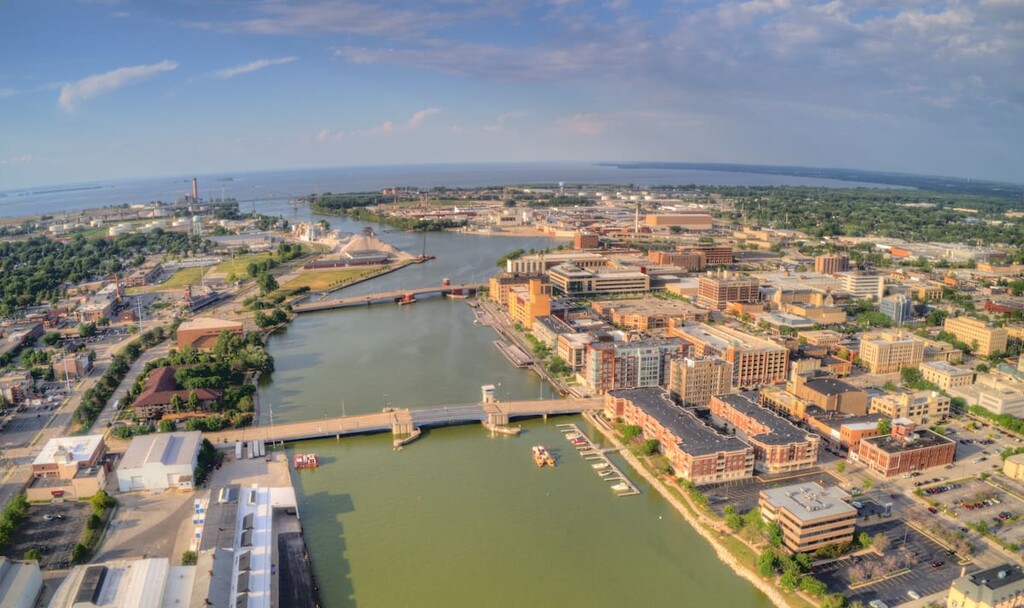
Located at the head of Green Bay on Lake Michigan, the city of Green Bay is home to some 100,000 people, which makes it the state’s third-largest city. The city has long been a major hub for commercial cargo on the Great Lakes.
However, Green Bay is perhaps best known for its American football team—the Green Bay Packers. Interestingly enough, the Packers date back to 1919 and they are the only non-profit, community-owned professional sports team in any of the United States’ major professional sports leagues.
The team name is actually a reference to the now-defunct Indian Packing Company, which was a meat canning company with a facility in Green Bay. When Curly Lambeau, the team’s founder, wanted to fund his new football team, he needed a financial sponsor to make an investment.
So, he asked his bosses at the Indian Packing Company and Labeau named the team the Packers. The rest, as they say, is history.


Yes. Wisconsin has 717 named mountains. The highest is Timms Hill at 594 m.
The highest mountain in Wisconsin is Timms Hill, at 594 m.
Wisconsin has 717 named mountains.


