
Scan the QR code and open PeakVisor on your phone
Luxembourg is home to 172 named mountains. The highest is Kneiff at 561 m.
Luxembourg is a hidden gem for hikers thanks to its extensive trail network and diverse landscape. There are 172 named mountains in Luxembourg. Kneiff (561 m/1,840 ft) is the highest point. The most prominent mountain is Ginzebierg (443 m/1,453 ft).
Luxembourg (Lëtzebuerg), officially the Grand Duchy of Luxembourg, is a small country in western Europe.
Luxembourg is the seventh smallest country in Europe, encompassing an area of roughly 2,586 sq km (998 sq mi). Luxembourg is entirely landlocked, with Belgium to the north and west, France to the south, and Germany to the east.
The northern third of Luxembourg is known as the Oesling (Éislek). The Oesling is part of the Ardennes, a hilly forested region that stretches across Belgium and Luxembourg and partly into Germany and France. Many of Luxembourg's highest mountains and hills are located in the Oesling, including its highest point, Kneiff (561 m/1,840 ft).
The southern two-thirds of Luxembourg are known as the Gutland. The Gutland is more densely populated and geographically diverse than the Oesling. The Gutland can be split into five sub-regions:

Several significant rivers meander across Luxembourg. Three rivers, the Moselle, the Our, and the Sauer, form a natural border between Luxembourg and Germany. Other notable rivers include the Alzette River, the Clerve River, and the Wiltz River.
The 544 km (338 mi) long Moselle is Luxembourg's longest river. The Upper Sûre Lake (Stauséi Uewersauer) in northwestern Luxembourg is the country's largest lake, with a surface area of 3.8 sq km (1.5 sq mi).
Luxembourg City is the capital and most populous city in Luxembourg. With a population of over 120,000 people, Luxembourg City is three times larger than Luxembourg's next biggest settlement. Other significant towns and cities in Luxembourg include Esch-sur-Alzette, Dudelange, and Differdange.
Luxembourg is underlain by Early Devonian shale and sandstone from the Givonne Anticlinorium, a geological event that is linked to the Hercynian Orogeny.
The Oesling is overlaid by rocks from the Triassic period as a result of Late Tertiary differential uplift, which exposed an unconformity zone between Devonian and Triassic rocks.
The Oesling falls below the Hercynian fold line. Most rocks within the Oesling are formed from sandy sediment deposited in the Devonian epicontinental sea. These rocks originate from the Larussia supercontinent.
Over time, these layers of sediments were transformed into schists, slates, and quartzites. During the Hercynian Orogeny around 200 million years ago, these rocks were folded in a northeast-southwest trend.
By the start of the Mesozoic Era, the Hercynian mountain belt was relatively flat. The region was strongly affected by the Eifel Depression, which created a North to South trending subsidence zone between the Ardennes and the Rhenish Shield within the Rhenish Massif.
Much of north Luxembourg remained underwater until the Mid Jurassic. Sedimentary deposits from the Early Triassic to Mid Jurassic can reach over 1,000 m (3,280 ft) in thickness.
The plateaus and escarpments of the Gutland are formed primarily of red sandstones from the Triassic and limestones from the Jurassic. This area is sometimes called the Luxembourg Gulf and has been cut into valleys by several minor rivers.
Luxembourg has a historically strong steel industry due to the extraction of Cenozoic iron ores and oolithic ores from Jurassic basins around Dudelange and Esch. However, these ore deposits ran dry during the twentieth century.

Today, Luxembourg is a small country with a complex geological structure. Luxembourg's mountains are modest, and no summit exceeds 570 m (1,870 ft) in elevation. Most of the highest summits are located in the Oesling, including Buurgplaatz (559 m/1,834 ft), Napoléonsgaart (549 m/1,801 ft), and Ronnebësch (545 m/1,788 ft).
Luxembourg is very biodiverse for its size and has one of the highest percentages of protected areas in Europe. Read on to find out about Luxembourg's wildlife.
Some of Luxembourg's most common wild mammals include Central European boars, red deer, red foxes, and Eurasian wolves. Other notable mammals include American beavers, European hamsters, hedgehogs, European moles, and polecats.
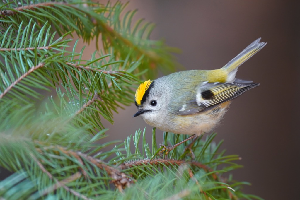
The national bird of Luxembourg is the goldcrest, a small bird belonging to the kinglet family. Over 320 bird species have been recorded in Luxembourg, such as nightingales, ortolan buntings, golden orioles, and Eurasian jays. Notable birds of prey in Luxembourg include hen harriers, ospreys, Egyptian vultures, and greater spotted eagles.
Luxembourg is home to over 2,000 insect species, including European peacock butterflies, great green bush crickets, European striped shield bugs, European hornets, and Eurasian hummingbird hawkmoths. Over 150 arachnid species are also present, such as noble false widows, shaded orbweavers, and zebra jumping spiders.
A small selection of reptiles and amphibians inhabit Luxembourg, numbering around 25 species. Notable reptile and amphibian species in Luxembourg include adders, green whip snakes, fire salamanders, great crested newts, and agile frogs.
In Luxembourg's rivers and lakes are approximately 30 fish species, including brook trout, European carp, chub, northern pike, and wels catfish.
Approximately 1,246 vascular plant species grow within Luxembourg's borders. Luxembourg is heavily wooded, with roughly 33 percent of the country carpeted in forests. Beech is Luxembourg's most common tree species, followed by oaks, hornbeams, pines, and chestnuts.
Roses are the national flower of Luxembourg, with Luxembourg City nicknamed the "City of Roses." Notable flowering plants found within Luxembourg include pyramidal orchids, lady orchids, purple foxgloves, wild carrots, scarlet pimpernels, marsh thistles, and hyacinths.

Luxembourg's fungi population is surprisingly varied and vibrant, with fly agarics, chicken of the woods, turkey-tails, and mica caps growing across the country's landscape.
The human history of Luxembourg dates back to 5140 BCE; however, very little is known about the people who first inhabited the region. The Treveri and Mediomatrici, two Belgic tribes, inhabited Luxembourg until the arrival of the Romans in 53 BCE.
The Franks ruled the country from the fifth century CE. Saint Willibrord played a key role in Luxembourg's Christianization in the seventh century with the construction of the Benedictine Abbey of Echternach.
Luxembourg then became a part of the Frankish kingdom of Austrasia and then the Holy Roman Empire under Charlemagne before gaining independence in 963. Luxembourg gained independence when Siegfried, the Count of Ardennes, traded his lands for a small castle on the Azette River.
The castle, called Lucilinburhuc (Little Fortress), is where the name ‘Luxembourg’ originates. The castle became the country's basis, with Siegfried's heirs expanding the lands through various means, including marriages, treaties, and conquests.
In the eleventh century, Siegfried's ancestor, Conrad, became the first to take the title Count of Luxembourg. In the fourteenth century, Holy Roman Emperor Charles VI made Luxembourg a duchy.
After the Duchess of Luxembourg, Elizabeth of Görlitz, was forced to give control of Luxembourg to Philip the Good, Duke of Burgundy, the duchy eventually passed down to the Habsburgs.
In the sixteenth century, Luxembourg came under the control of the Spanish Habsburgs as a part of the Spanish Netherlands after the Habsburg empire split following Emperor Charles V's abdication.
During the early seventeenth century, Luxembourg avoided participating in the Thirty Years' War until France became involved. The resulting conflict was severe for Luxembourg. Following the war's end, French King Louis XIV conquered Luxembourg, only to return it to the Spanish in 1697.
After the War of the Spanish Succession, Luxembourg changed hands once more, becoming a part of the Austrian Habsburg Empire. Just before the French Revolution, Luxembourg joined France again, resulting in a bloody peasant rebellion against the French known as the Klëppelkrich (Klöppelkrieg).
After the fall of Napoleon in 1814, France ceded control of Luxembourg, with the Congress of Vienna deciding its future. Luxembourg was raised to a grand duchy and given to the King of the Netherlands, William I.
At this time, large parts of modern Luxembourg were a part of Prussia, and it had a complex status as an independent country owned by the King of the Netherlands. It was also considered part of the German Confederation.
William I levied huge taxes on Luxembourg, which led to economic ruin. As a result, Luxembourg supported a Belgian revolt against William I, leading Belgium to claim Luxembourg. Luxembourg was subsequently split, with Belgium controlling the French-speaking part and the Netherlands the Luxembourgish-speaking half.
From 1839 to 1867, William I first ruled Luxembourg autonomously from the Netherlands. His successor, William II, enacted a more liberal constitution for Luxembourg, and following the collapse of the German Confederation, Luxembourg became a sovereign state.
William III of the Netherlands attempted to sell Luxembourg to Napoleon III of France but failed due to Prussian chancellor Otto von Bismarck's disapproval. As a result, an agreement was reached that Prussia would withdraw its garrisons from Luxembourg, and it would become an entirely independent grand duchy.
Luxembourg was meant to stay neutral during conflict, but Germany violated this agreement during World War I. Grand Duchess Marie Adélaïde did not interfere with the German occupation of Luxembourg, for which the Allied Powers criticized her.
Marie Adélaïde was forced to abdicate her position following the war, with her sister Charlotte becoming the Grand Duchess of Luxembourg. Charlotte was the final agnatic member of the House of Nassau.
Germany invaded Luxembourg again during World War II, forcing the Grand Duchess into exile. Following victory in World War II, Luxembourg joined the North Atlantic Treaty Organization (NATO), abandoning its neutrality.
When the European Union (EU) was formed in 1993, Luxembourg hosted administrative offices. Two former Prime Ministers of Luxembourg Jacques Santer and Jean-Claude Juncker, have been Presidents of the European Commission.
Modern Luxembourg is a diverse country with a strong economy and a high standard of living. In recent years, it has been criticized for being a tax haven for private bankers and financial services.
Luxembourg is a hiker's paradise thanks to its dense trail system. Luxembourg has no shortage of hiking options, from hilly walks in the Ardennes to relaxing woodland strolls in Mullerthal.
Ensure you're well-prepared before setting off on a hike in Luxembourg. Map out your route carefully, wear appropriate clothing, and bring plenty of food and water. Check the weather forecast and inform others of your intended itinerary.
Read on to learn about some of the best hikes in Luxembourg.
The Éislek Pad Hoscheid is one of the Éislek Paths (Éislek Pied), a selection of 18 circular hiking trails that take in some of the best viewpoints and landmarks in the Oesling.
This trail will take you through scenic Schlindertal, a valley where the quaint St Michel Chapel (Chapelle Saint-Michel) stands alone, surrounded by nature. The best reason to explore this trail is to discover one of Luxembourg's finest ridges, the Molberlee. This exposed craggy ridge provides stunning vistas of the Schlindertal.
The Éislek Pad Hoscheid starts and ends at the Lisseneck Church in Hoscheid. The trail is approximately 11.6 km (7.2 mi) in length and takes roughly 4 hours to complete.
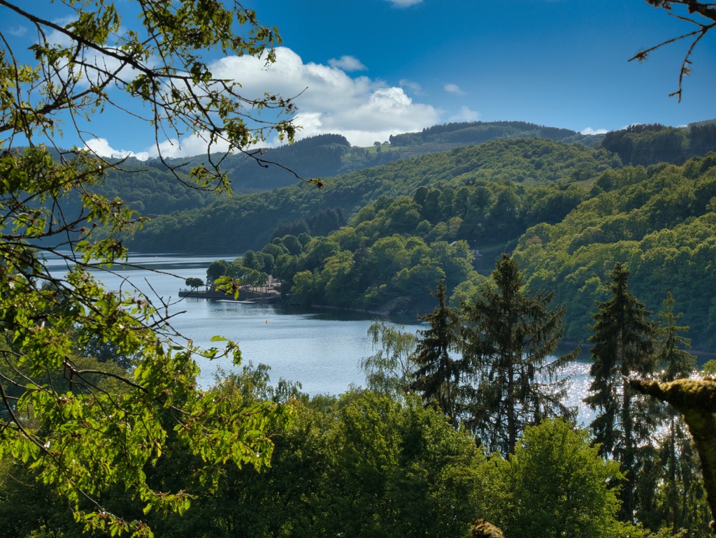
Luxembourg's largest body of water, the Upper Sûre Lake, is one of the country's top hiking destinations. Of the several hiking trails that skirt the edge of the Upper Sûre Lake, the Éislek Pad Bavigne is one of the most rewarding.
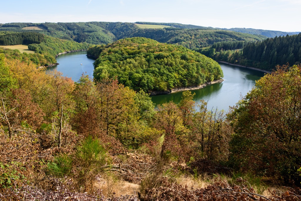
This trail explores the northern side of the Upper Sûre Lake, offering several striking viewpoints. The hike's highlight is the Schäsbierg, which offers one of the best panoramas of the lake as it snakes off into the distance.
The Éislek Pad Bavigne starts and ends at the village street (doerfstrooss) in Bavigne. The trail is approximately 9.9 km (6.1 mi) in length and takes around 3 hours to complete.
The Éislek Pad Kautenbach is one of the longest and most difficult Éislek Pied trails. This route will take you along the Bomm ridge to three viewpoints: Ueweschleed, Hof, and Hockslee. The view from Hockslee of the valley below is especially magical.
After passing the village of Fridbësch, you'll be able to visit a well-preserved World War II bunker used by people hiding from the Nazis. This trail is rugged and steep in places, so bring a good pair of hiking boots.
The Éislek Pad Kautenbach starts and ends at the duerfstrooss in Kautenbach. The trail is approximately 14.5 (9 mi) km in length and takes around 5 hours to complete.
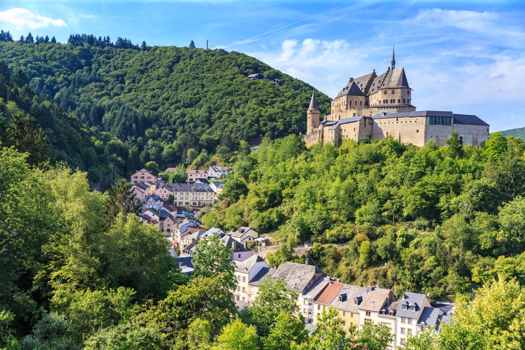
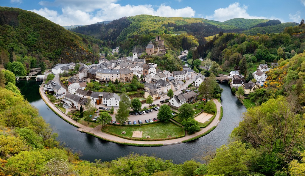
The Éislek Pad Vianden affords gorgeous views of the Our Valley as it stretches across the Luxembourg-Germany border. The trail takes you up into the hills to the north of Vianden between the Bassins Supérieurs reservoir and the Our River.
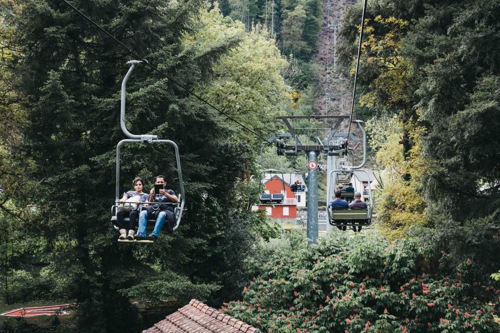
From atop the ridge, you'll be treated to panoramas of the tenth-century Vianden Castle (Veianer Schlass), one of the largest castles in Luxembourg. You'll also be able to spot Falkenstein Castle (Burg Falkenstein) just across the German border. There's a chairlift from the ridge back to Vianden if you don't feel like walking back down. The chairlift is open from April to October.
The Éislek Pad Vianden starts and ends at the car park on the Rue du Vieux Marché towards Biven in Vianden. The trail is approximately 9.2 km (5.7 mi) in length and takes around 3 hours to complete.
The Éislek Pad Insenborn is arguably the finest lake hike in Luxembourg. Along this trail, you'll explore the southern shores of Upper Sûre Lake with a peaceful walk through the woods.
The highlight of this walk is the Belvédère Burfelt, a viewing platform that hangs over the edge of a hill and provides unmatched views of the Upper Sûre Lake. Looking to learn more about the lake? Stop by the Bufelt Forest Discovery Center (Centre de découverte de la forêt Burfelt).
The Éislek Pad Insenborn starts and ends in the center of Insenborn. The trail is approximately 10.2 km (6.3 mi) in length and takes around 3 hours to complete.
The Mullerthal Trail is the best long-distance trail in Luxembourg and has been designated as a 'Leading Quality Trails – Best of Europe" by the European Ramblers Association (ERA). This 112-km trail will lead you through the finest areas of Luxembourg's Little Switzerland.

The Mullerthal Trail is composed of three loops between 36 km (22 mi) and 38 km (23 mi) in length. Route 1 and 2 start and end in Echternach, the oldest town in Luxembourg. Route 3 starts and ends in the village of Mullerthal.
Route 1 leads along the Sûre River past some unique rock formations to Rosport-Mompach past the Tutor Museum (Musée Henri Tudor). Then the path heads south to Moersdorf, where you'll pass the fourteenth-century Girsterklaus, a chapel complete with remarkable frescoes.
Next, you'll walk through a valley and then for several miles through tranquil woodlands. You can stop for a break in the villages of Born and Moersdorf. The path leads through the forests of Herborn and back to Echternach, where you'll end your hike with views of Echternach Lake (Echternacher See).
Route 2 heads west to Berdorf, where there's a steep climb to the Trooskneppchen viewpoint. The area around Berdorf boasts many of this trail's best sights, like the Perekop rock and Huel Lee (Hohllay) caves. With its many unique rock formations, Berdorf is an excellent hiking destination.
The trail continues through the Schnellert forest towards Mullerthal village. Mullerthal was once home to one of Luxembourg's most important mills. It's been recently renovated and is now a tourist attraction. The path then follows the Black Ernz brook to the picturesque Schéissendëmpel waterfall.

You'll then pass three more fascinating rock formations: Eilebuerg, Goldfralee, and Goldkaul. After Consdorf village is the Kuelscheier, a 100 m (328 ft) long dark rock crevice that hikers can walk through. After passing Scheidgen village, you'll arrive back in Echternach.
Route 3 is the only route that starts in Mullerthal instead of Echternach. The trail begins with a stroll along the Black Ernz brook before crossing the sublime valley of Halerbaach. You'll soon reach the eleventh-century Castle of Beaufort, which is still impressive despite being in ruins.
Route 3 continues along the Halerbaach to Medernach and then Larochette. In Larochette, there's another castle ruin worth visiting. Then, follow the White Ernz brook to Blumenthal, where there are some wonderful views from atop the plateau. On the way back to Mullerthal, you'll pass the Schéissendëmpel waterfall.
Luxembourg has lots to offer tourists with its beautiful landscape, well-preserved history, and diverse culture. Read on to learn about some of Luxembourg's main cities and towns.
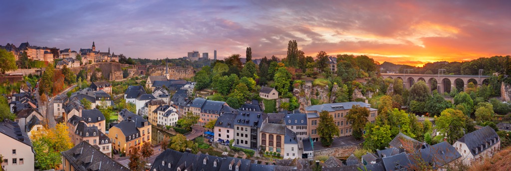
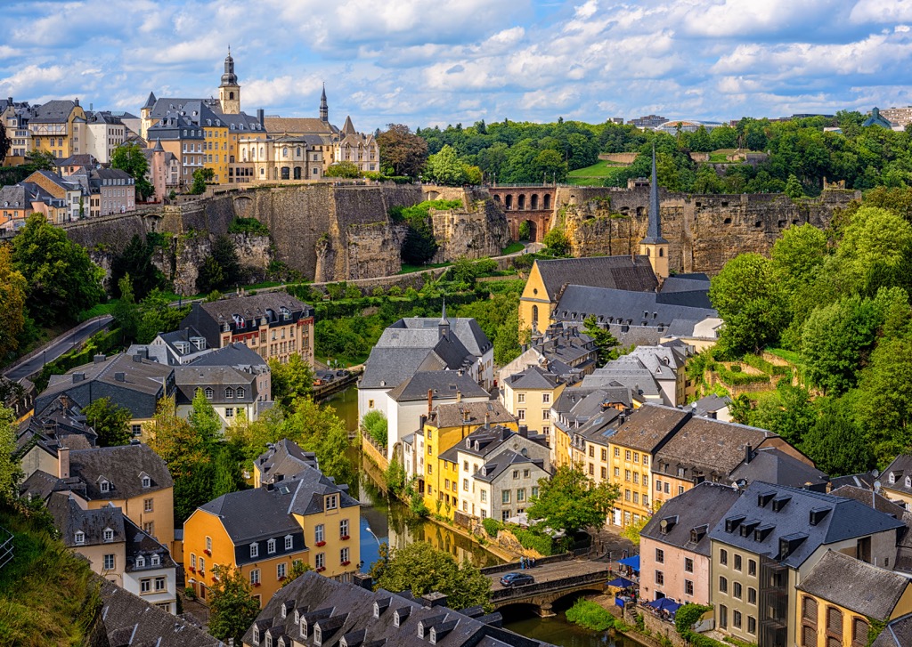
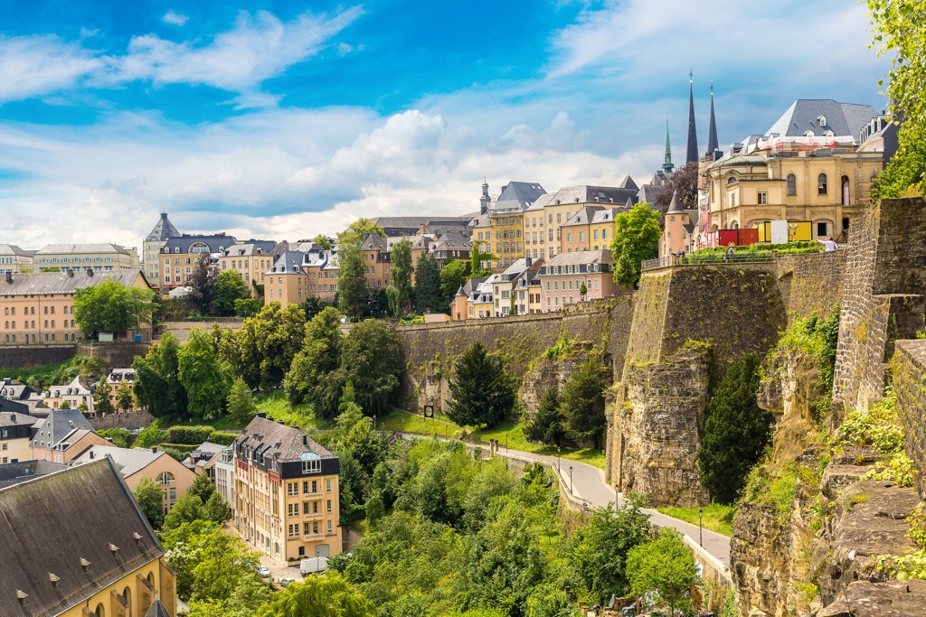
Luxembourg City is the capital and largest city in Luxembourg. This vibrant city is home to people from over 170 countries, making it a melting pot of culture. Luxembourg is an attractive city with its UNESCO-protected Old Town and the Corniche, considered one of Europe's most beautiful promenades.
You won't get bored during your stay in Luxembourg City with world-class attractions like the seventeenth-century Notre-Dame Cathedral (Kathedral Notre-Dame), the medieval Place Guillaume II, and the spectacular Pfaffenthal Panoramic Elevator.
Thanks to Luxembourg's size, nothing is too far from the capital — most popular hiking trails are within 75 km (46 mi) of the city. Popular hotels in Luxembourg include Le Grand Ducal Hotel, the Park Inn, and Grand Hotel Cravat.
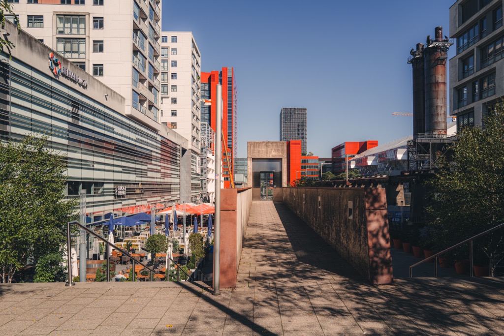
Straddling the French border, Esch-sur-Alzette is the second largest city in Luxembourg. Selected as one of the European Capital of Culture for 2022, Esch is known for its unique architecture, shopping opportunities, and industrial history.
Esch-sur-Alzette is home to some interesting attractions, like the Escher Tier Park (Escher Deierepark), the National Museum of Resistance and Human Rights (Musée National de la Résistance et des Droits Humains), and the Konschthal Esch art museum.
Esch-sur-Alzette is located around 10 km (6 mi) from Luxembourg City and 25 km (15 mi) from Luxembourg Airport. Popular hotels in Esch include the Seven Hotel, Residhome Luxembourg Esch-Belval, and Hotel Acacia.
Situated within 20 km (12 mi) of Esch, Dudelange, and Luxembourg City is Differdange. Differdange is the third-largest city in Luxembourg, with a population of around 26,000 people. It's an economic hub that is at the center of Luxembourg's steel industry.
Despite its industrial history, Differdange is home to some historical sites, like Differdange Castle, which dates back to 1310. You'll also find some attractions documenting Differdange's modern history, like Fond-de-Gras open-air mining museum.
Popular hotels in and around Differdange include Le Presbytère and Hotel No151.
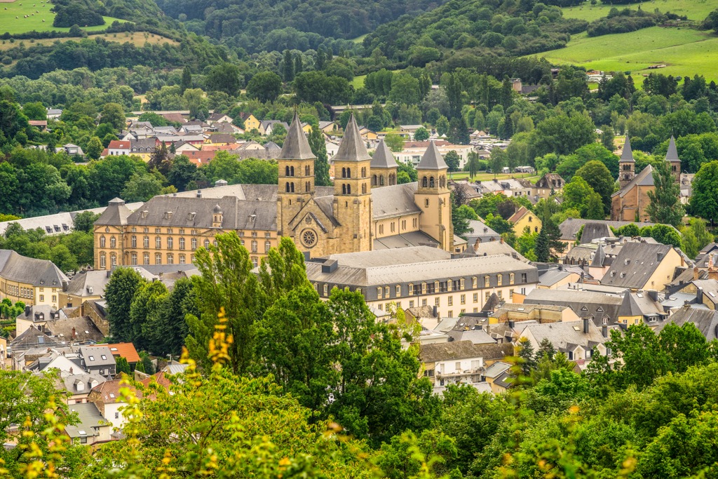
Echternach is the perfect destination for hikers looking to escape the heavily populated south of Gutland. Located on the eastern border with Germany, Echternach is the oldest town in Luxembourg. The town grew around the Abbey of Echternach, built by Saint Willibrord in 698.
The Abbey of Echternach is still intact and is one of the town's top attractions. During your stay in Echternach, you'll be well-placed to explore the Mullerthal Trails and the rest of Little Switzerland. You'll also be within touching distance of Berdorf, with its amazing caves and rock formations.
Popular hotels in and around Echternach include Hotel Bel Air, Eden Au Lac, and Restaurant-Hôtel Au Vieux Moulin.
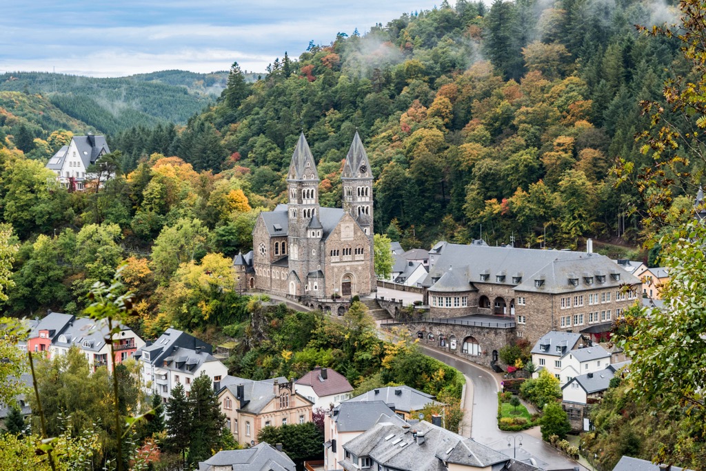
Consider Clervaux if you’re searching for accomodation in the far north of Luxembourg. Clervaux is regarded as one of the prettiest towns in Luxembourg, and with a population of around 1,500 people, it's a peaceful place to stay while exploring the Oesling.
Despite its size Clervaux is home to several popular attractions, like the twelfth-century Clervaux Castle and beautiful Abbey of St. Maurice and St. Maurus of Clervaux (Benediktinerabtei hellege Moritz).
Popular hotels in Clervaux include Hotel Koener and Hotel du Commerce.


Yes. Luxembourg has 172 named mountains. The highest is Kneiff at 561 m.
The highest mountain in Luxembourg is Kneiff, at 561 m.
Luxembourg has 172 named mountains.


