Scan the QR code and open PeakVisor on your phone
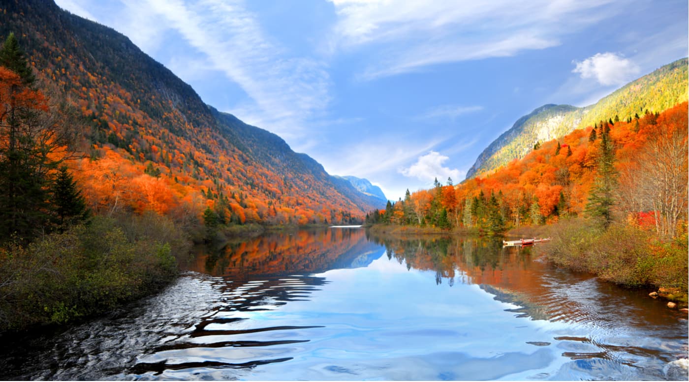
Known for its stunning mountains, beautiful cities, and rich cultural heritage, Quebec is a province located in the eastern part of Canada. It is the largest province in the country by total area and the second-largest by population. Quebec is also the heart of French-speaking Canada as it is the only majority Francophone province or territory in the country. There are 3484 named peaks in Quebec, the highest of which is Mont D’Iberville (1,576 m/) and the most prominent of which is Mont Jacques-Cartier (1,268 m/5,171 ft).
The province of Quebec (Québec) is located in the eastern region of Canada. It is a particularly interesting place in Canada due to its geographic size, population size, linguistic traditions, and cultural heritage.
The province of Quebec has an area of 1,542,056 sq. km (595,391 sq. mi), which accounts for about 15% of Canada’s total area.
This makes Quebec the largest province in the country. Nunavut is larger than Quebec (it encompasses 21% of Canada), though it is a territory, not a province. By total area, Quebec is actually around three times the size of the US state of Texas and it is more analogous in size to the state of Alaska.
In fact, the size of Quebec is so impressive that it’s actually the tenth-largest administrative subdivision in the world. It is surpassed in size only by the Sakha Republic/Yakutia (Russia), Western Australia (Australia), Krasnoyarsk Krai (Russia), Greenland (Denmark), Nunavut (Canada), Queensland (Australia), Alaska, (USA), Xinjiang (China), and Amazonas (Brazil)
Quebec is also the second-largest province or territory in Canada in terms of population. As of the 2021 Canadian Census, Quebec had a population of around 8.5 million people, which accounts for nearly 23 percent of the entire population of Canada.
It is second only to Ontario in terms of population, yet it has nearly the same population as Nunavut, Yukon, Northwest Territories, Prince Edward Island, Newfoundland and Labrador, New Brunswick, Nova Scotia, Saskatchewan, Manitoba, and Alberta combined.
But due to its large size, Quebec ranks only sixth in the country in terms of population density. In fact, the vast majority of the province’s population lives in its southern regions. Over 4.5 million people live in Montreal and Quebec City alone. Meanwhile, the entire northern third of the province (which is part of Nunavik/ᓄᓇᕕᒃ) is home to around 14,000 people.
Geographically, Quebec is bordered by Ontario to the west and south, New Brunswick to the southeast, and the Labrador Peninsula of Newfoundland and Labrador to the northeast. It also shares maritime borders with Prince Edward Island, Nova Scotia, and Nunavut.
Additionally, Quebec is located along Canada’s international border with the US. It shares its borders with the states of New York, Vermont, New Hampshire, and Maine.
Interestingly, the Government of Quebec does not officially recognize its land and maritime borders with Newfoundland and Labrador. A 1927 Privy Council decision on the issue ruled in Newfoundland and Labrador’s favor, but the Quebec Government has yet to recognize the ruling.
This dispute continues to have issues to this day, particularly when it comes to economic ties between border communities and the construction of large-scale hydroelectric projects in the region.
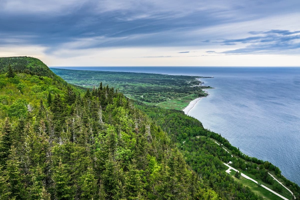
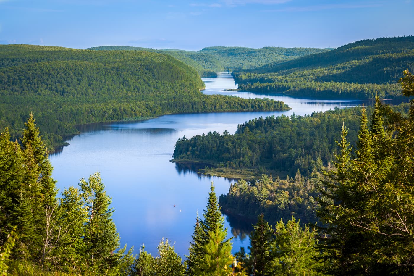
Beyond its administrative borders, Quebec has a number of notable topographical features. The first most notable feature is the Saint Lawrence River (Fleuve Saint-Laurent) which effectively splits the province into two regions. To the south of the river, there’s also the Gaspé Peninsula (Gaspésie), which extends into the Gulf of St. Lawrence (Golfe du Saint-Laurent).
The northwestern parts of Quebec are bordered by James Bay (Baie James) and Hudson Bay (Baie d'Hudson) to the west. Meanwhile, the Hudson Strait (Détroit d'Hudson) and Ungava Bay (Baie d'Ungava) form Quebec’s northern maritime borders.
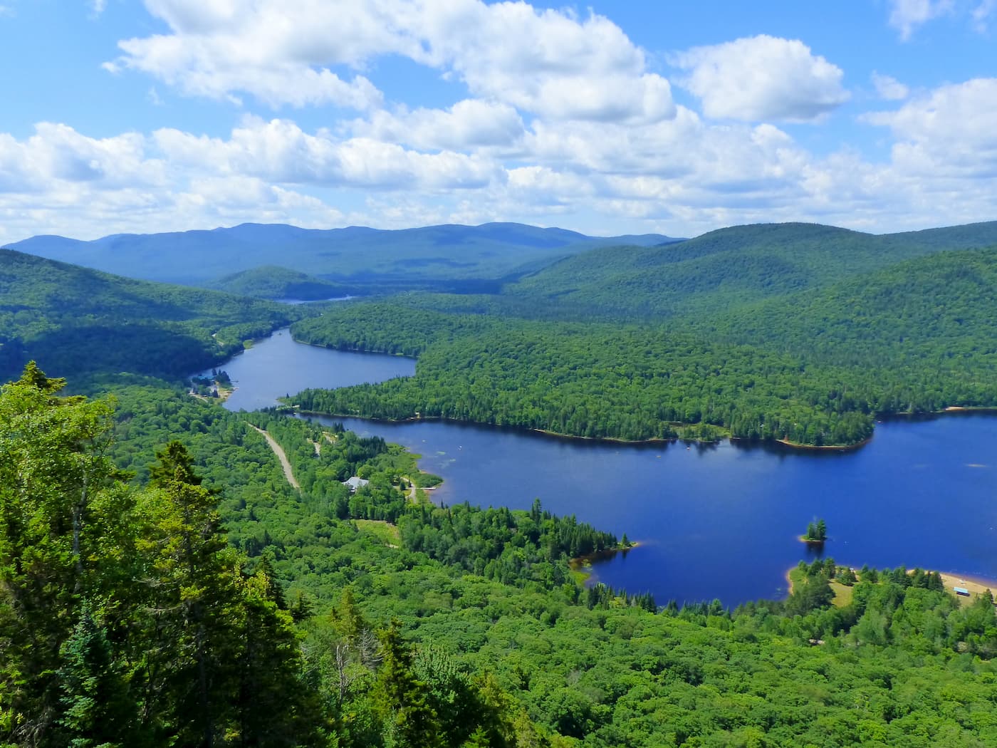
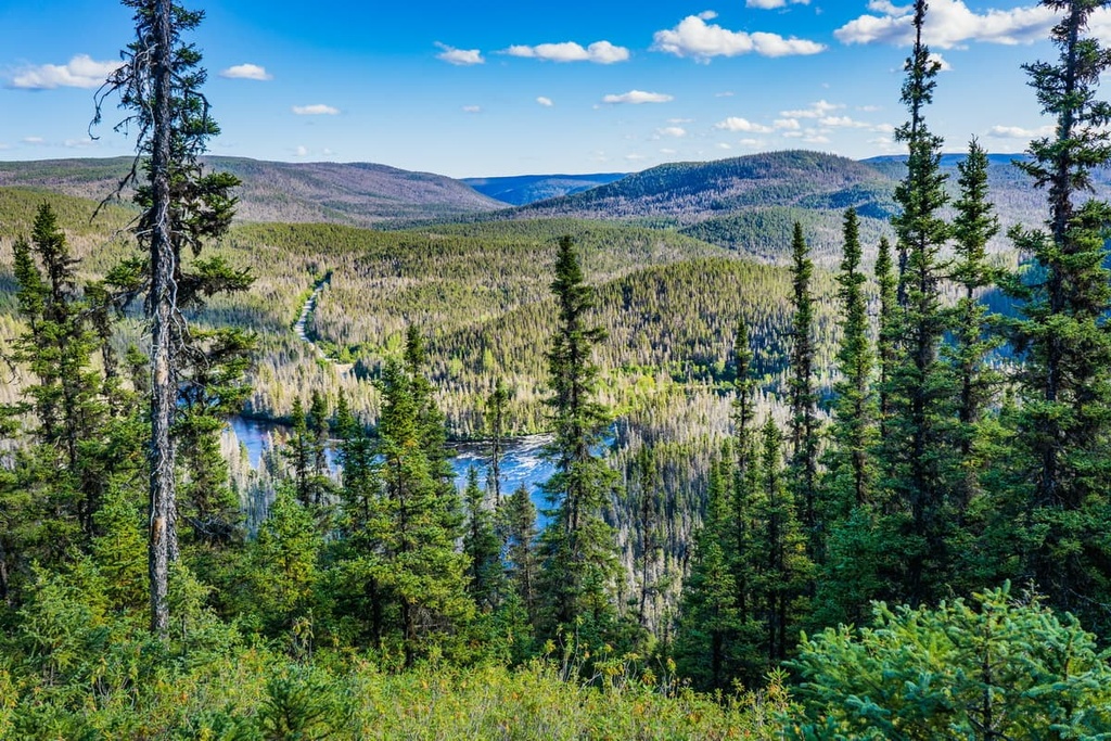
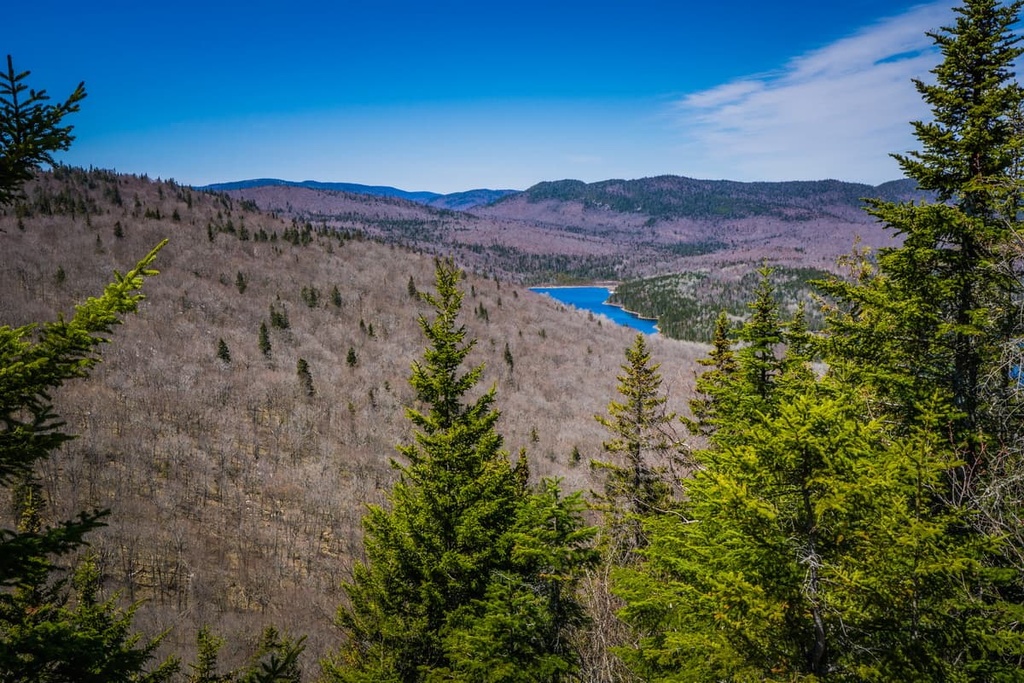
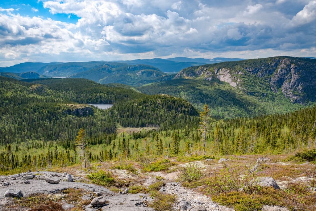
Most of Quebec’s mountains are located either in the very southern part of the province or the very northern part of the province. While there are hills in the central part of Quebec, this area is better known for its lakes, rivers, and taiga.
The province of Quebec is divided up into 17 administrative regions. These regions do not have their own governments, but they’re used to organize the distribution of government services. Within these regions, there are regional county municipalities/municipalités régionales de comtés (RCM/MRCs) and equivalent territoires/territoires équivalents (TEs), which have their own local governments.
The regions of Quebec and their respective MRCs/TEs are as follows:

The province of Quebec has a unique and varied geologic history. Quebec is also home to a number of mountain ranges, including parts of some of the largest ranges in eastern Canada. Here’s a quick look at the geology of the province.
Much of the land that is now part of Quebec is underlain by bedrock that’s part of the Canadian Shield. In fact, around 90 percent of the province’s bedrock is Precambrian rock that’s part of the Canadian Shield, particularly to the north of the Saint Lawrence River. Meanwhile, the rest of Quebec’s bedrock is primarily Paleozoic in age, especially in the Appalachian Mountains, which are located to the south of the St. Lawrence River.
That said, Quebec can also be divided up into approximately seven geological provinces, including:
It’s also worth mentioning that the bulk of what is now Quebec was heavily glaciated during the last major glaciation. These glaciers helped to carve out the landscape that we now see in the province by creating the region's large U-shaped valleys and rounding off its jagged peaks.
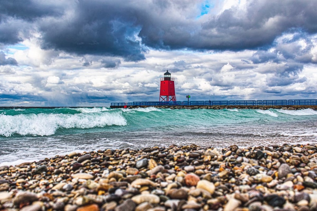
The province of Quebec has also experienced a number of interesting geologic events, including multiple meteorite strikes. Two important meteorite impact locations in the province include one in Grands-Jardins National Park that you can see from the summit of Mont du Lac des Cygnes and another at what is now René-Levasseur Island (Île René-Levasseur).
René-Lavasseur Island is of particular interest because researchers believed it formed as a result of a meteorite impact more than 200 million years ago. The crater that this meteorite formed is around 100 km (60 mi) in diameter and is now centered around the island itself.
This area wasn’t an island before, but it was turned into an island as a result of the damming of the Manicouagan River. Now that the Manicouagan Reservoir exists, René-Lavasseur Island is the second-largest lake island in the world after Manitoulin Island in Ontario's Lake Huron.
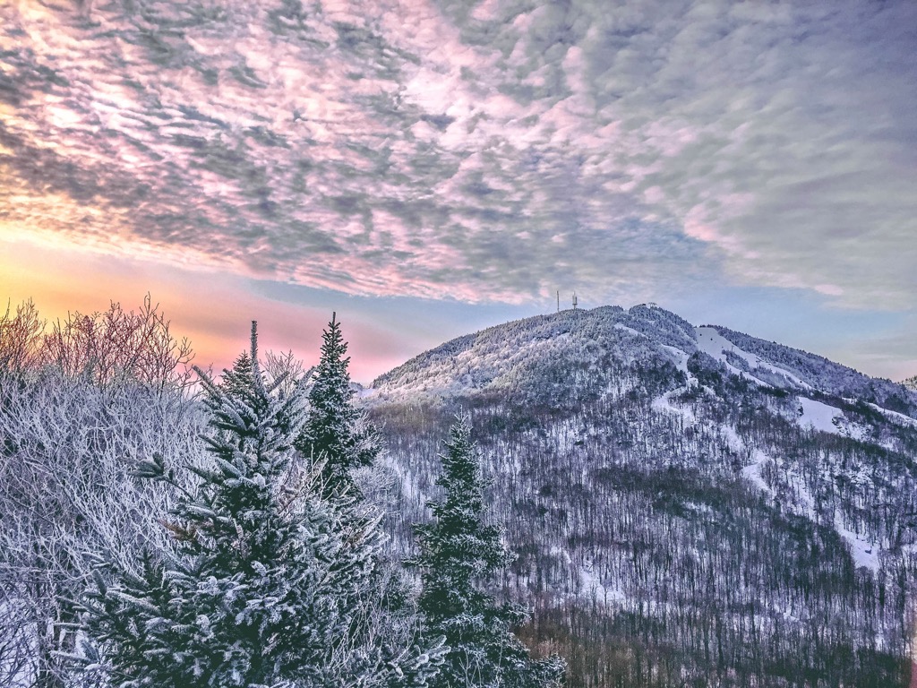
Quebec is a particularly mountainous province, especially when compared to other parts of eastern Canada. The province is home to a number of notable mountain ranges, including:
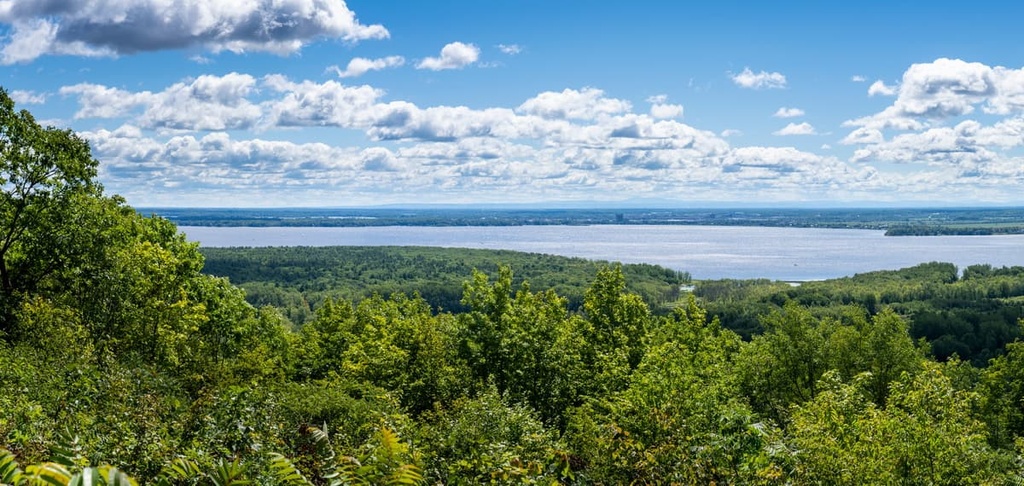
Due to its size and location, Quebec contains a great diversity of plant and animal species. The ecosystems that you’ll find in the province vary substantially from the south to the north as Quebec covers an area that spans nearly 20 degrees of latitude.
According to the government of Quebec, the province is roughly divided up into three vegetation zones from south to north: northern temperate, boreal, and Arctic. Here’s a quick look at what you can expect in each of these zones.
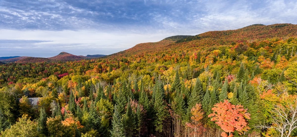
The northern temperature zone is found in the southernmost parts of Quebec. It is dominated by stands of mixed hardwood forests that are typical of southeastern Canada and the northeastern US.
Within this zone, there are two main subzones:
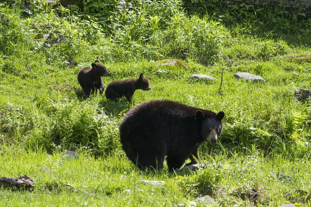
In this vegetation zone, you can find a wide range of animal species, including Canada lynx, bobcats, coyotes, eastern wolves, red foxes, black bears, northern river otters, moose, elk, and white-tailed deer.

The boreal zone is located in the central part of the province of Quebec. It features primarily coniferous trees that are typical of the boreal forests of Canada.
Within this zone, there are three main subzones:
The wildlife in the boreal forests of Quebec is similar to that of the northern temperate zone, however, only more cold-tolerant species can survive in this region. Caribou are also more likely to be found in the province in the boreal zone and northward.
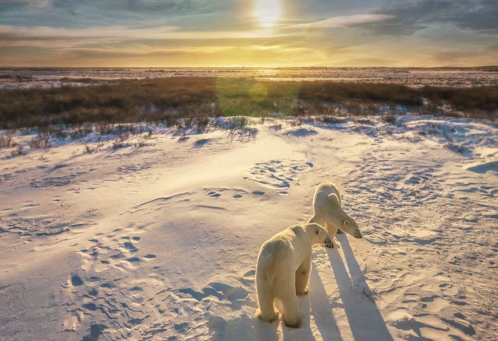
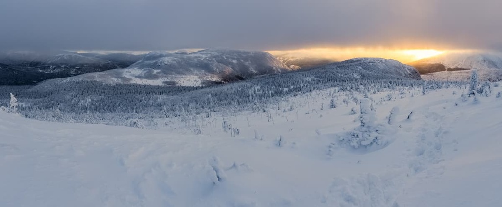
The Arctic zone is the northernmost vegetation zone in Quebec. It is located north of the 58th parallel and it is a mostly tree-free area that’s dominated by permafrost landscapes.
There are two main domains in the Arctic zone:
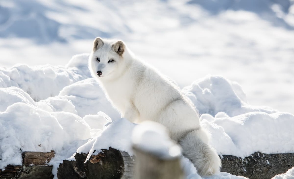
The wildlife found in Quebec’s Arctic zone is typical of that found in other northerly latitudes in Canada. In northern Quebec, you can find Arctic hares, Arctic foxes, muskoxen, and even polar bears.
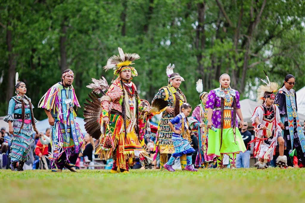
The land that is now Quebec has been home to humans for thousands of years. The region is part of the traditional territory and ancestral homelands of many Indigenous people, including the Mi'kmaq, Wəlastəkwewiyik (Maliseet), Innu, Huron-Wendat, Cree, Haudenosaunee Confederacy, Abenaki, Atikamekw, and Inuit among others.
People of European descent first started arriving in the area that is now Quebec around the early sixteenth century. In 1534, Jaques Cartier of France sailed to the continent that’s now called North America and made landfall on the Gaspé Peninsula where he planted a cross and claimed the region for the King of France.
One year later, Cartier sailed up the Saint Lawrence and made landfall at a number of villages that were home to the St. Lawrence Iroquoians who lived near what is now Quebec City and Montreal. Cartier is attributed with coining the term ‘Canada’ during this voyage, and it’s said that the name comes from kanata, a word used by the St. Lawrence Iroquoians to describe the region.
Although French colonization of the region that’s now Quebec didn’t start in earnest until the seventeenth century, Basque and Breton fishermen frequented the area in the decades after Jacques Cartier’s expeditions. Many of these fishermen came to the region to fish for cod and to hunt whales but they eventually started a fur trade with the Indigenous people in the area.
The true start of the French colonization of Quebec is often attributed to Samuel de Champlain’s arrival in the region in 1608. That year, de Champlain established a fort at Cap Diamant that would later become Quebec City.
Throughout the seventeenth century, France greatly expanded its colonial efforts in the region. In addition to establishing colonies and settlements in what’s now Quebec, the French traveled through much of eastern North America and established colonies in other parts of eastern Canada. The French were also particularly active in the North American fur trade for centuries.
Eventually, after the War of the Spanish Succession, France surrendered its territories in Canada (with the exception of the area that is now Quebec) to the British. This led to the expulsion of many Acadians from the area. However, Quebec remained under French control until the end of the Seven Years’ War when it was also surrendered to the British.
Even under British rule, Quebec retained a relatively large amount of autonomy when compared to other parts of British Canada, in part as a result of the Quebec Act of 1774. However, the following century was a turbulent time in the region as Quebec gained and lost various aspects of self-governance.
In 1867, Quebec became one of the Dominion of Canada’s founding members alongside Ontario, New Brunswick, and Nova Scotia.
However, throughout the period of confederation and beyond, Quebec retained a distinct level of autonomy when compared to the other provinces. Quebec was and continues to be the only majority French-speaking area in Canada. Even during confederation, it was one of the most populous provinces in the country and it was one of the region's economic powerhouses.
In the 1960s through 1980s, Quebec experienced a period known as the Quiet Revolution where the province underwent a series of reforms. This included a number of educational reforms, which saw the development of institutions like Cégeps (junior colleges) among other things. Quebec also developed more social welfare institutions during this time and nationalized a number of formally private companies that provided essential public services.
Over the past few decades, Quebec has continued to be a bastion of francophone life in Canada and one of the country’s biggest economic contributors, though there are also movements in the province that advocate for Quebec sovereignty from the rest of the country.
Quebec is also a major tourist destination for both international and domestic travelers. The province’s bustling cities and gorgeous natural landscapes are major draws for visitors from around the world.
The province of Quebec boasts a large and complex network of protected areas and public lands. There are many different kinds of protected areas in the province, each of which has its own management mandate. Here’s what you need to know about the protected areas of Quebec.
Quebec is home to two national parks of Canada (Parcs nationaux du Canada), which are federally designated protected areas. These two national parks (Forillon and La Mauricie) are typically managed by Parks Canada (Parcs Canada), though they may be jointly administered by a provincial body known as Sépaq.
National historic sites of Canada (Lieux historiques nationaux du Canada) are federally designated protected areas with unique historical features. These sites are typically managed by Parks Canada.
There are more than 190 national historic sites in Quebec, most of which are fairly small. Many of these sites are situated around buildings, battlefields, and other locales that have played significant roles in the history of Canada.
National marine conservation areas (Aire marine nationale de conservation) are federally designated regions that are protected and managed to promote the sustainability of maritime areas. These conservation areas include coastlines, wetlands, estuaries, open water, rivers, and other such locales.
Parks Canada is tasked with managing national marine conservation areas, though the organization may work with other stakeholders in its conservation efforts. Quebec is home to one national marine conservation area (Saguenay–St. Lawrence Marine Park), which is jointly managed by Parks Canada and Sépaq.
National wildlife areas (Réserve nationale de faune) are special conservation areas in Canada that only allow for limited human activity. Unlike many other federally protected areas, national wildlife areas are primarily managed by the Canadian Wildlife Service—not Parks Canada.
Quebec is home to a number of national wildlife areas, including:
National parks of Quebec (referred to just as national parks or parcs nationaux in Quebec) are provincially designated protected areas.
While they share a similar name to national parks of Canada, national parks of Quebec are protected under a different law than the Canadian national parks. In particular, Quebec national parks are designated through the Loi sur les parcs (Parks Act) of 1977. National parks of Canada are protected by the Loi sur les parcs nationaux du Canada (Canada National Parks Act) of 2000.
The management of national parks of Quebec also differs from that of Canadian national parks. While Parks Canada manages or co-manages most federal parks, the agency typically isn’t involved with the administration of Quebec national parks.
Rather, most national parks of Quebec are managed by Sépaq (Société des établissements de plein air du Québec/Quebec Outdoor Establishments Company). However, a few parks in the northern part of the province are managed by Nunavik Parks (Parcs Nunavik) and some are jointly managed by Sépaq and Parks Canada.
There are nearly 30 national parks of Quebec, including:
Quebec is home to a number of regional and municipal parks (parcs régionaux and parcs municipaux). Regional parks are established and managed by regional county municipalities (MRCs) in Quebec based on their own by-laws. Municipalities can also establish their own parks in Quebec for recreation or conservation purposes.
The management of these areas varies widely, though the regulations surrounding recreation activities are typically more flexible in regional and municipal parks when compared to national ones.
There are many regional parks in Quebec, but some of the most notable include:
Controlled Exploitation Zones (zone d’exploitation contrôlée), more commonly referred to as ZECs, are a type of public land in Quebec. The ZEC system was formally established in 1978 in order to manage private hunting and fishing clubs that were acquired by the province.
ZECs serve a number of purposes in Quebec including the promotion of both wildlife conservation and outdoor recreation within their borders.
Unlike many other areas of public land in Quebec, however, ZECs are not managed by a single organization. Rather, each ZEC is self-managed, though most ZEC organizations are members of the Fédération québécoise des gestionnaires de zecs (FQGZ), or the Quebec Federation of ZEC Managers.
There are more than 80 ZECs in Quebec, so we won’t list them all here. Some of the largest and most notable ZECs include:
Quebec’s ecological reserves (réserves écologiques) are protected areas designed to promote conservation, research, and education. Many of these reserves are closed to the public, but some are open to limited outdoor recreation.
The more than 70 ecological reserves in Quebec are given some of the highest levels of protection in the province. In fact, these reserves ban a large number of activities including hunting, fishing, mining, logging, and even road construction.
Biodiversity reserves (réserves de biodiversité) are areas in Quebec that are established in order to protect the biodiversity of the province’s natural regions.
To date, relatively few biodiversity reserves exist in Quebec. However, the provincial government plans to add over 75 such reserves in the coming years. These reserves are managed by the Ministry of Sustainable Development, Environment, Wildlife and Parks, and some of the current reserves include:
Quebec’s aquatic reserves (réserves aquatiques) are very similar to its biodiversity reserves, but they are specifically designed to protect marine environments. There are only a few such reserves in the province, including Estuaire-de-la-Rivière-Bonaventure Aquatic Reserve, though more reserves are in the works and may be established in the coming years.
Quebec boasts a number of wildlife refuges, habitats, and reserves. The exact mandates of each of these types of protected areas can vary as some allow for controlled hunting and others do not. Most of these areas are managed by the Ministry of Forests, Wildlife, and Parks (Ministère des Forêts, de la Faune et des Parcs), though there are some exceptions to this rule.
Some of Quebec’s wildlife refuges include:
Quebec contains a number of internationally recognized biosphere reserves and Ramsar sites, including:
These sites are either recognized by UNESCO as biosphere reserves or by the Ramsar Convention, which is a UNESCO-promoted intergovernmental environmental treaty regarding wetlands.
It’s worth noting that most of these sites are part of other protected parks in Quebec. As a result, the rules and regulations regarding activities in each of these areas usually depend on what organization is tasked with managing any given biosphere reserve or Ramsar site.
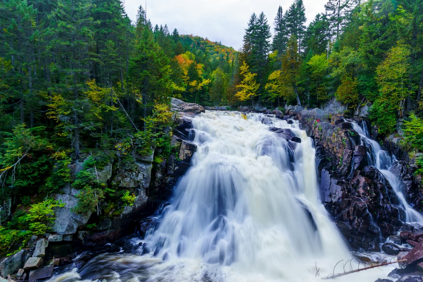
Quebec is a true hiker’s paradise. Here’s a look at some of the most popular hiking areas in the province so you can start planning your next trip to the region.
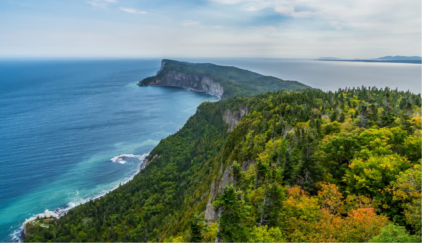
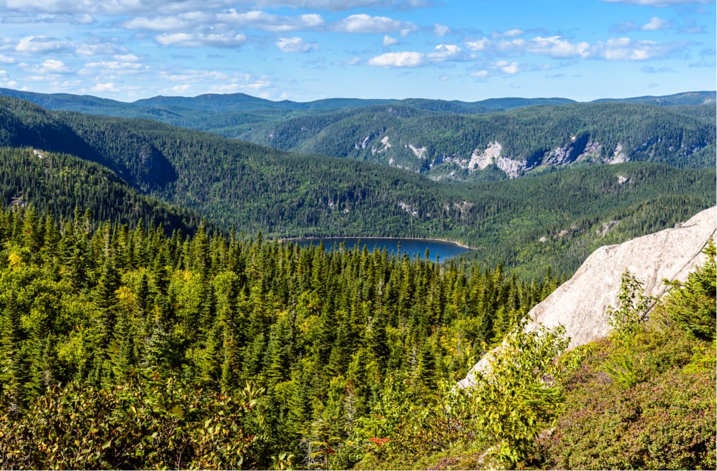
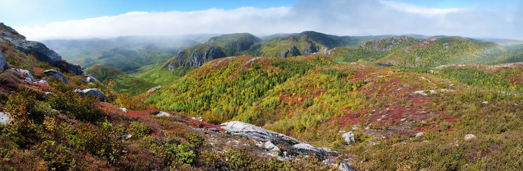
Gaspesie National Park (Parc national de la Gaspésie) was created in 1981 to protect the caribou of the Gaspe Peninsula and two of Quebec’s most extraordinary mountain ranges: the Chic-Chocs and McGerrigle Mountains.
Today, this 802 square kilometer (310 sq. mi) park contains more than 140 km (87 mi) of hiking trails, 25 summits over 1,005 m (3,300 ft) in elevation, including Mont Jacques-Cartier, and is a hub for outdoor recreation. The park is also a hotspot for wildlife viewing, and it contains incredible arctic-alpine flora.
Some of the best trails in the park include hikes to Mont Olivine, Pic-de-l’Aube, Mont Richardson, Mont Albert, Mont Jacques-Cartier, and Mont Joseph-Fortin.
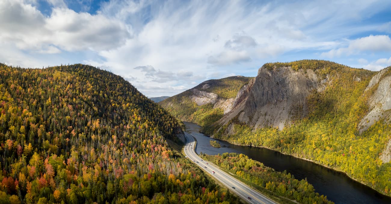
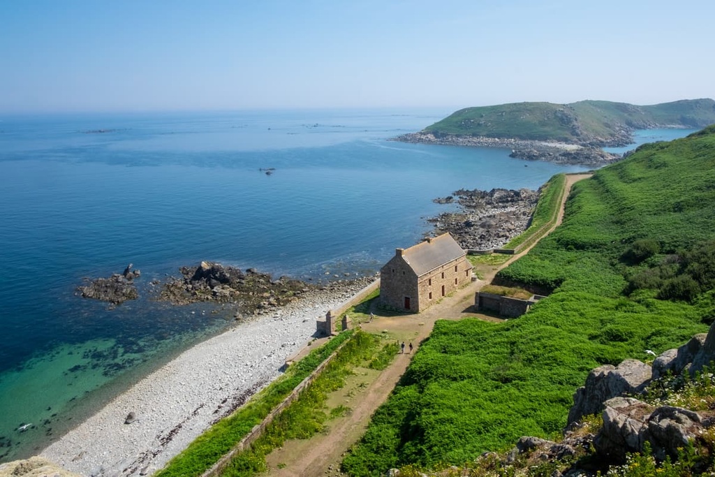
Located in the UNESCO-designated Charlevoix region, Grands-Jardins National Park (Parc national des Grands-Jardins) has been a popular destination for fishing for over 100 years. Today, the “Great Gardens” is appreciated by anglers, hikers, campers, and skiers alike.
This 310 sq. km (120 sq. mi) park houses an amazing ancient boreal forest, stunning Arctic vegetation, and a variety of wildlife. It also contains several popular ski slopes including Mont du Lac des Cygnes and La Chouenne.
Grands-Jardins is located on the Canadian Shield, so you can expect to be impressed with the park’s impressive peaks, including Mont du Lac à Moïse, Mont René-Richard, and Mont Jean-Palardy. Popular hikes in the park include the Le Pioui and Mont du Lac des Cygnes Loop and the hike to Mont du Lac des Cygnes.
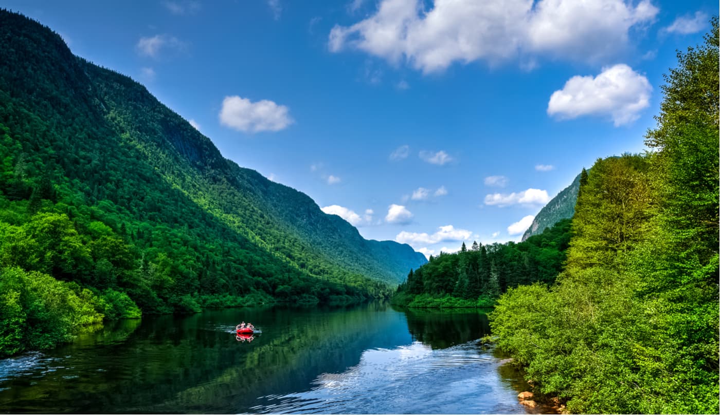
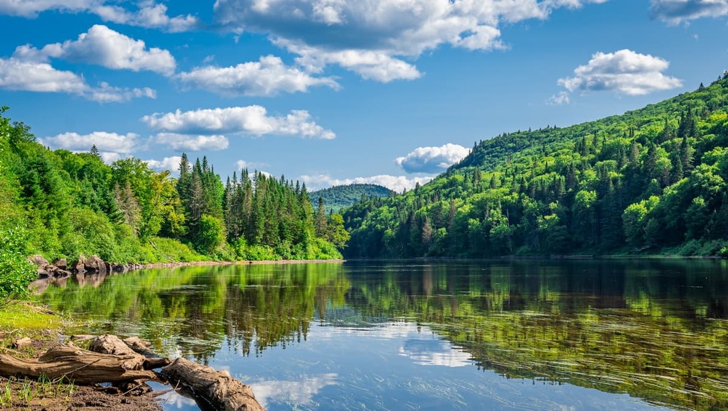
Jacques-Cartier National Park (Parc national de la Jacques-Cartier) is a 600 sq. km (230 sq. mi) wilderness park located just outside of Quebec City in the Laurentian Mountains.
Jacques-Cartier is best-known for its deep glacial valleys, lush rolling hills, and glacial moraines. The U-shaped Jacques-Cartier Valley, in particular, is known as one of the most beautiful glacial valleys in the province.
There is also plenty of adventure available on the water in the park, including whitewater kayaking, canoeing, and rafting down the Jacques-Cartier River, which has cut a 550-meter (1,800 ft) deep channel into the surrounding plateau. Popular trails in Jacques-Cartier include Les Loups, Les Cascades, Le Scotora, and L'Eperon.
Another gem tucked within the Laurentian Mountains, La Mauricie National Park (Parc national de la Mauricie) covers more than 500 sq. km (193 sq. mi) of terrain between Montreal and Quebec City and is home to more than 150 stunning lakes.
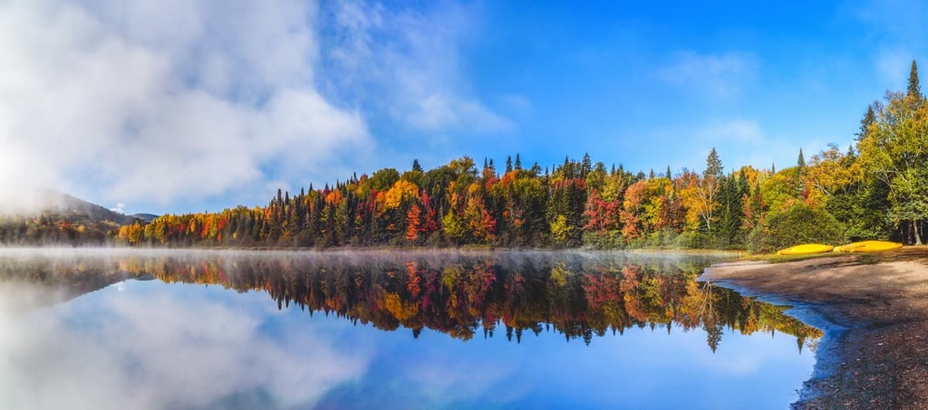
La Mauricie is best-known for its magnificent display of fall foliage but is also a spacious outdoor playground for hikers, paddlers, fishers, swimmers, and cyclists. Scenic trails in the park include Les Cascades Trail and the hikes to Lac Solitaire, Lac du Pimbina, Les Chutes Waber, and Lac Reid.
Tucked away in Montreal’s backyard, Mont-Tremblant National Park (Parc national du Mont-Tremblant) is an extraordinary 1,510 sq. km (583 sq. mi) wilderness area packed with rivers, streams, lakes, and sprawling Laurentian summits. The park features 18 designated hiking trails, so there are plenty of adventure opportunities in the region for all to enjoy.
The park is generally divided into four sectors: La Diable, Pimbina–Saint-Donat, L’Assomption, and La Cachée. Some of the best hikes in Mont-Tremblant National Park include La Coulée, La Chute-du-Diable, and Johannsen-Sommets-Grand Brûlé. There are also a number of other outdoor activities available in the park including opportunities for via ferrata, paddling, and skiing.
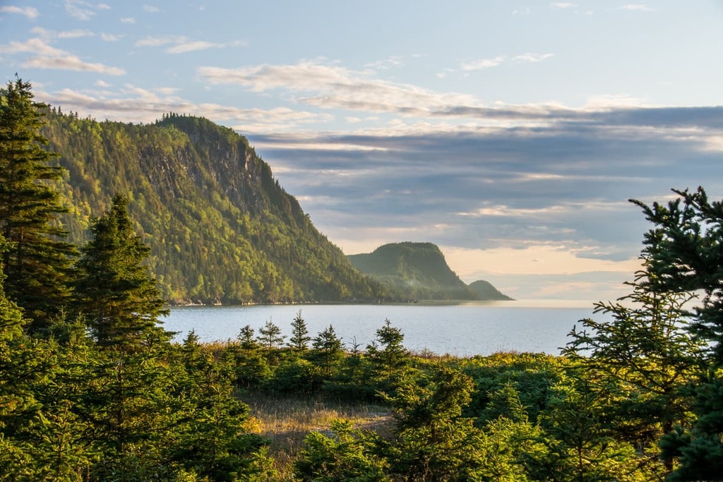
Forillon National Park (Parc national de Forillon) is one of the few federally protected areas in Quebec. It is situated on the easternmost tip of the Gaspé Peninsula and it encompasses an area that’s rich in both biodiversity and human history.
The area of Forillon National Park has been home to the Mi’kmaq for thousands of years and it was also the site of one of the earliest moments in French colonial history in what is now Canada. In 1534, Jacques Cartier and his crew made landfall in the harbor near the park and claimed possession of the region for the King of France.
Nowadays, Forillon National Park is a popular hiking area for those willing to make the trek to the eastern end of the Gaspé Peninsula. There are many great hiking trails in the park, including the Du Banc, Mont-Saint-Alban, Les Parages, and Les Crêtes trails, as well as opportunities for kayaking, fishing, and cycling.
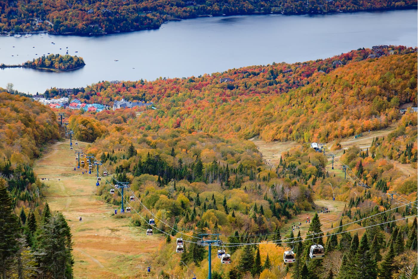
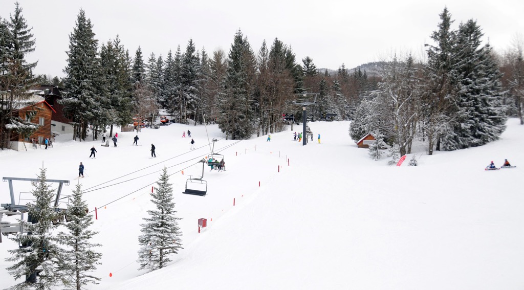
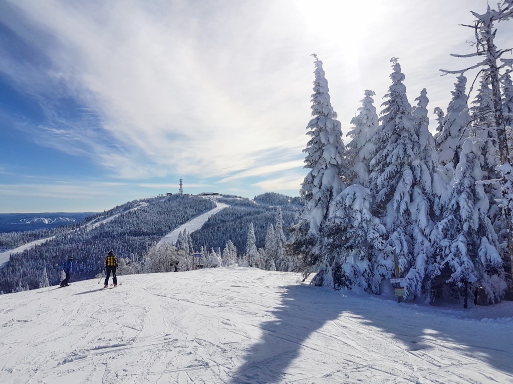
For skiing and snowboarding enthusiasts, there are more than 80 ski resorts in Quebec, which are located in the south of the region. Given a large number of resorts as well as their size, it is also one of the main areas for skiing in the Canada mountains.
The largest ski resort in Quebec is Tremblant with more than 80 km (50 mi) of slopes and more than 10 ski lifts.
Other major areas for skiing in Quebec with more than 20 km (12 mi) of slopes and more than 5 ski lifts each include the following in descending order of size:
The main ski resort near Montreal, the largest city of Quebec, is Mont Saint-Bruno to the east of it with more than 10 km (6 mi) of slopes and more than 5 ski lifts. However, the largest resorts from the list above—Sommet Saint-Sauveur, as well as Tremblant, are located to the west of the city. The nearest ski resort near Quebec City, the namesake capital of the region, is Mont-Sainte-Anne, Le Massif de Charlevoix, and Stoneham, also from the list above, as well as smaller Le Relais–Lac Beauport, which has more than 15 km (9 mi) of slopes and more than 5 ski lifts. The main ski resorts near Ottawa, the third largest city in the region, are Camp Fortune and Mont Cascades.
Nestled within the Laurentian Mountains, the famous Mont Tremblant Ski Resort is a charming five-star resort packed with fresh powder and stunning scenery. Mont Tremblant is home to around 100 trails, 13 lifts, and 306 ha (755 acres) of skiable terrain.
In the summer, the resort is a popular destination for hiking, camping, fishing, and paddling. A chalet and cafeteria are located at the mountain while an open-air gondola carries visitors to and from the nearby pedestrian village.
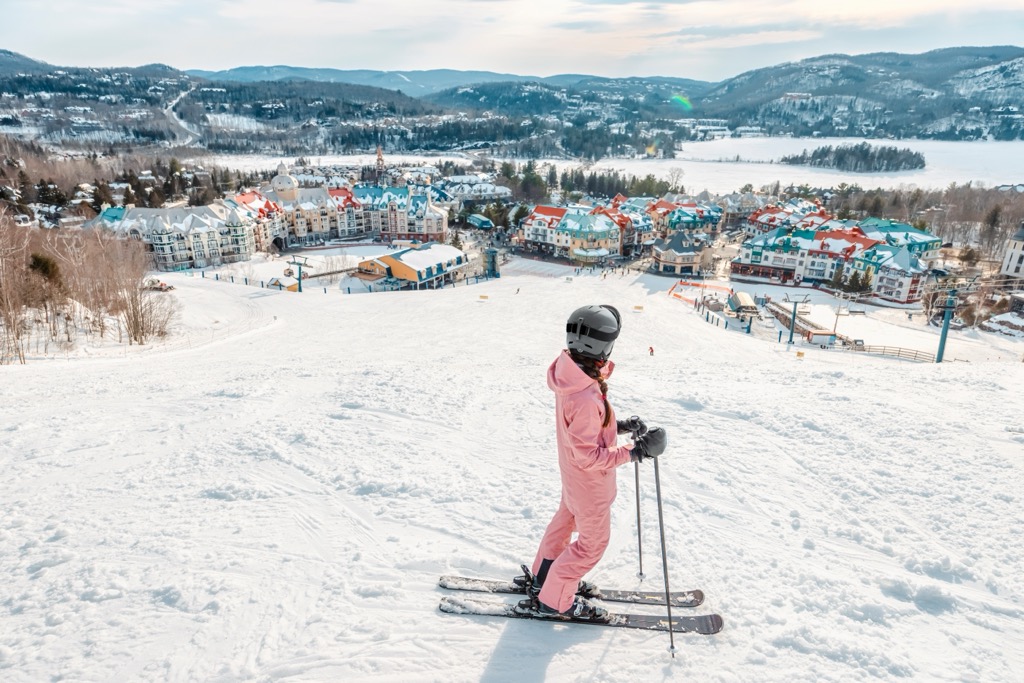
There are plenty of hotels and condos situated near the mountain for visitors to enjoy. Mont Tremblant is also located close to Montreal, making it easy to commute from the city to the slopes.
Known for housing some of the best glades in Canada, Mont Sutton is a ski resort located in the town of Sutton in the southernmost part of the province. The resort features a 457 m (1,500 ft) vertical drop, 93 ha (230 acres) of skiable terrain, and 60 trails ranging from easy to expert in difficulty.
The ski area has been family-owned and operated since the 1960s and has 4 mountain chalets for rent each season. There is also a small hotel located at the foot of the mountain and a variety of accommodations scattered throughout the Eastern Townships for visitors to check out.
Monte-Sainte-Anne is a ski resort situated close to the town of Beaupré in southern Quebec, just to the north of Quebec City. It has a vertical drop of around 625 m (2,051 ft) as well as more than 70 downhill skiing trails, so it offers a lot to love for skiers in the area.
The ski resort at Mont-Sainte-Anne offers both daytime and nighttime downhill skiing. It also has more than 200 km (124 mi) of cross-country ski trails, including some that are dedicated for skate skiing.
During the summer months, Monte-Sainte-Anne offers a number of outdoor recreation activities, too, including camping, hiking, golfing, and mountain biking.
Le Massif de Charlevoix is one of the most popular ski areas in Quebec. Also known simply as Le Massif, the resort has a vertical drop of around 770 m (2,526 ft), more than 50 ski trails, and some of the steepest slopes in the province.
Due to its proximity to Quebec City, Le Massif is a very popular destination for skiers in the province’s capital region. It has some of the highest annual snowfall rates in eastern Canada, too, so it’s often able to stay open from December to April of each year.
Check the Quebec ski resorts map as well as the larger Canada ski resorts map in the World Mountain Lifts section of the site. It includes information about open ski lifts / slopes in Quebec in real-time with opening dates and hours. There are also year-round cable cars, funiculars, cog railways, aerial tramways, and all other types of mountain lifts.
Looking for a place to stay or visit in Quebec? Here’s a look at some of the major cities and towns in the province.
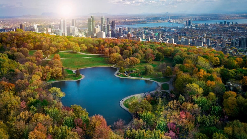
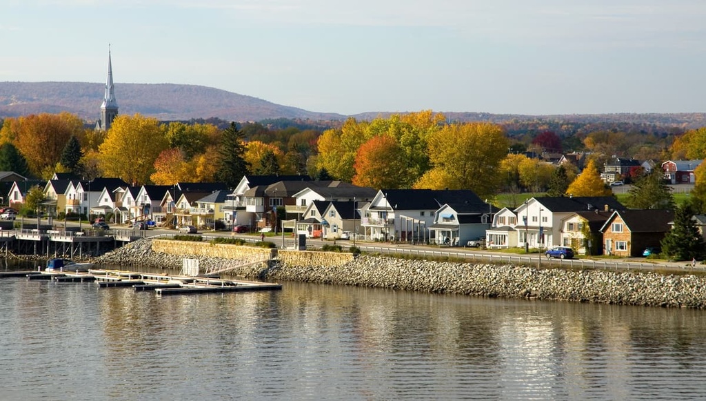
Quebec’s largest city, Montreal (Montréal) is a cosmopolitan hub and a center for culture and tourism in the province. With an urban population of over 1.7 million people, Montreal is also the second-largest city in Canada after Toronto.
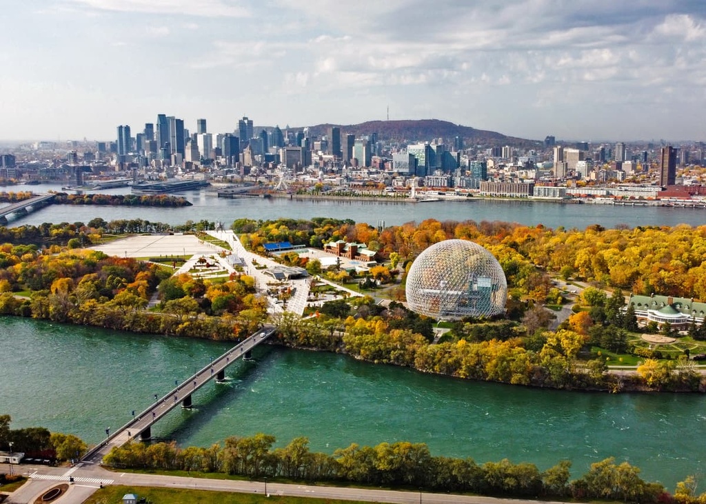
Montreal is located in the southwestern part of the province on the island of Montreal. Its urban area also expands outward and encompasses much of the surrounding coastal areas of the Saint Lawrence River.
The city of Montreal is one of the most bilingual cities in Canada as over half of the community can speak both French and English. It is also one of the province’s major commercial centers and it’s also a popular tourist destination.
Montreal is easy to get to both from elsewhere in Canada and from international destinations. It has good road, rail, and bus links to major cities in Canada and the US. The city’s international airport is also one of the busiest in Canada.
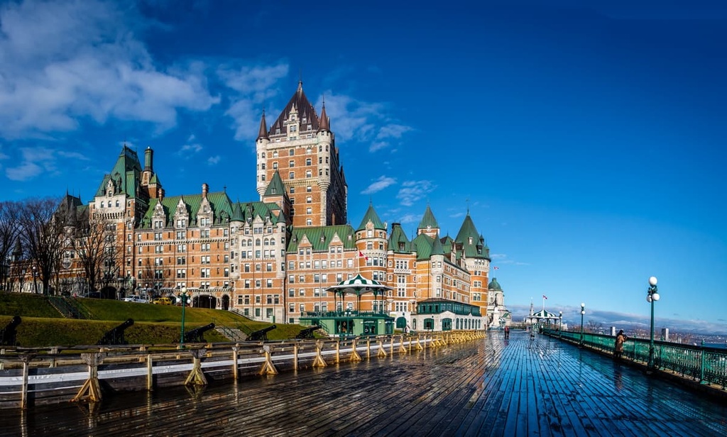
Quebec City (Ville de Québec) is the capital of the province of Quebec. It’s situated in the southern part of the province to the northeast of Montreal along the banks of the Saint Lawrence River.
The area that is now Quebec City has been home to humans for thousands of years, including many Algonquian-speaking peoples. It was also the site of one of the earliest successful French colonies in the region, which was founded by Samuel de Champlain in 1608.
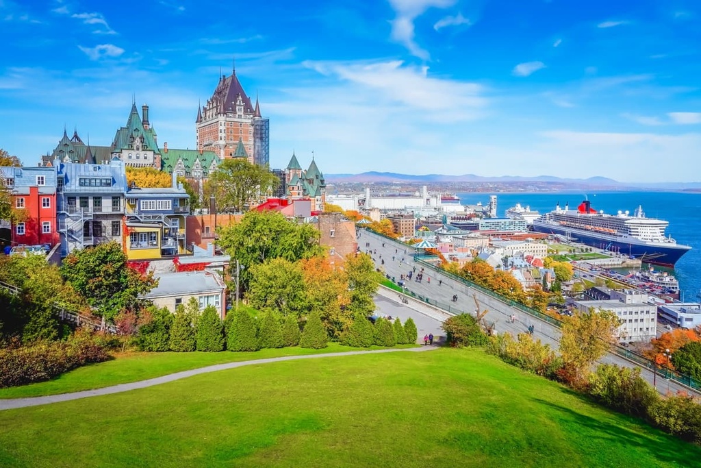
Although Quebec City is only a fraction of the size of Montreal (it has around 530,000 residents), it is a worthwhile destination in its own right. The city’s old town is a UNESCO World Heritage Site and it is home to the only surviving fortified city walls in North America to the north of Mexico.
Quebec City is relatively easy to get to as it has reliable road, rail, and bus connections to elsewhere in Quebec and eastern Canada. The city also has an international airport, which has service to major destinations in Quebec and Canada as well as the Americas and Europe.
Sherbrooke is a community of around 150,000 residents that’s located in the southern part of Quebec, close to the province’s border with the US. It is one of the largest cities in the province and it is the commercial center of the Estrie region.
The city of Sherbrooke is one of the educational hubs of Quebec as it is home to multiple institutions of higher education, including the Université de Sherbrooke. It is also located within driving distance of a number of excellent destinations for outdoor recreation, including Mont-Bellevue Park (Parc du Mont-Bellevue).
You can get to Sherbrooke via road from Montreal and Quebec City. The city also has good road connections to the US as it is located less than an hour by road to the nearest border crossing at Stanstead.
The city of Rimouski is a major population center that serves as the gateway to the Gaspé Peninsula. Rimouski is home to around 50,000 residents, making it a commercial hub for the region.
Geographically, Rimouski is situated at the mouth of the Rimouski River along the southern coast of the St. Lawrence River. It is located just a short distance from many of eastern Quebec’s best hiking and outdoor recreation areas. The city itself is well worth checking out as it has a number of museums and it is the host of a handful of annual festivals.
You can get to Rimouski fairly easily by road, rail, ferry, and bus from other areas of Quebec. The Mont-Joli Airport (YYY) is also located just to the east of the city and it offers regular flights to destinations around Quebec and eastern Canada.
Saguenay is a city in central Quebec that’s home to around 150,000 residents. It is located along the banks of the Saguenay River, not far from its confluence with the St. Lawrence River.
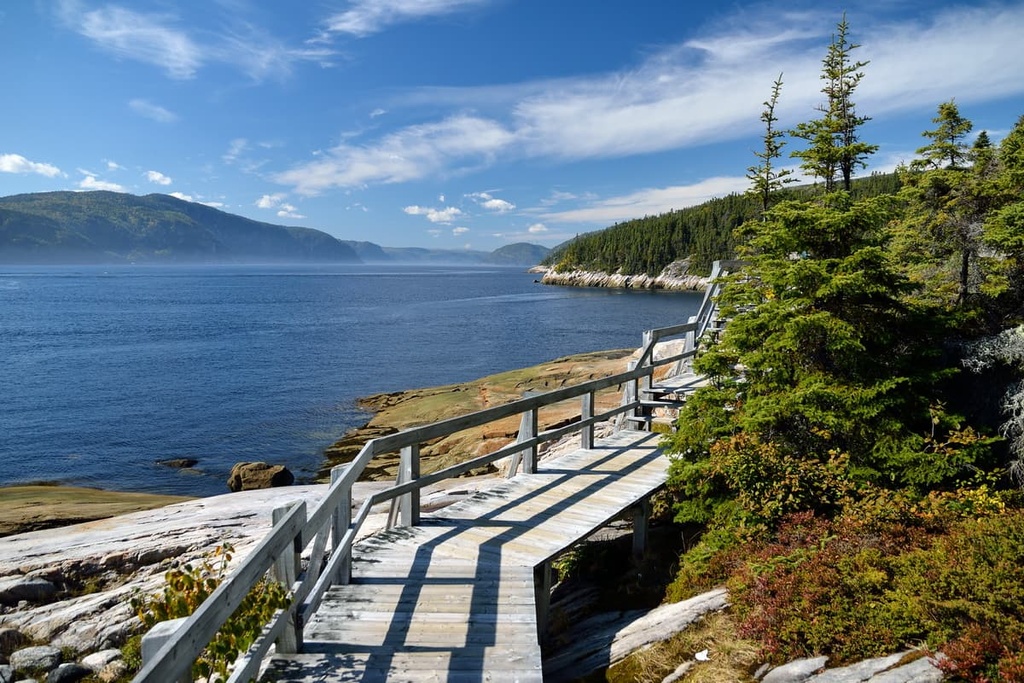
Despite its modest population, Saguenay is a superb destination for visitors to Quebec thanks to its plethora of outdoor recreation opportunities. It is located just a short distance from Fjord-du-Saguenay National Park and there are many ski areas situated in the region around the city, such as Mont-Eduoard, Mont-Fortin, Mont-Bélu, and Mont Grand-Fonds.
The easiest way to get to Saguenay is by road from Quebec City or Montreal. Additionally, the city also has limited passenger train service to Montreal on Via Rail and it is serviced by the small Saguenay-Bagotville Airport (YBG).
Fermont is a town located in the northeastern part of Quebec near the province’s border with Labrador. It is home to around 2,500 people, making it one of the larger communities in the area besides Labrador City, which is located in Newfoundland and Labrador.
The city of Fermont is particularly interesting because it is home to a huge structure called The Wall (Le Mur), which is about 1.3 km (0.80 mi) long. In addition to providing protection from the wind, The Wall also features a number of self-contained areas, including facilities like apartments, schools, hotels, restaurants, supermarkets, and stores. As a result, many of the city’s residents don’t have to go outside during the winter months if they don’t want to.
Fermont is accessible by road on Route 389, which leads to the border with Labrador and connects to the Trans-Labrador Highway (Route 500). Due to its proximity to Labrador City, you can also get to Fermont by air via Wabush Airport (YWK).
One of the northernmost communities in Quebec with paved road access to the rest of the province, Sept-Îles is a city of around 30,000 people situated in the Côte-Nord region along the banks of the St. Lawrence River. Sept-Îles is a major mining town as it is home to a number of iron mines that are operated by the Cleveland-Cliffs mining company and the Iron Ore Company of Canada.
Although most of the city’s economy is based on the mining industry, there are plenty of excellent things to do in Sept-Îles, including visits to Grande Basque Island and the region’s many historic sites. The city is also rapidly becoming a popular destination for cruise ships in eastern Canada.
You can get to Sept-Îles by road on Route 138, which leads directly to Quebec City, Montreal, and the US border near Constable, New York. Sept-Îles is also accessible via train on the Tshiuetin Rail network and by air via the Sept-Îles Airport (YZV).
Kuujjuaq (ᑰᑦᔪᐊᖅ) is the largest northern village in Quebec’s Nunavik region. It is situated along the banks of Ungava Bay at the mouth of the Koksoak River and it serves as the administrative capital of the regional government of Kativik.
The community of Kuujjuaq has a population of around 2,600 people and most of its residents identify as Inuit. One of the community’s most notable past residents is Mary Simon (ᒥᐊᓕ ᓴᐃᒪᓐ), the 30th governor general of Canada and the first Indigenous person to hold the office.
Even though it’s a relatively small community by international standards, Kuujjuaq is a bustling village that offers a lot to love for both residents and visitors. If you’re visiting Kuujjuaq, you can go camping and see the northern lights with the help of a local guide service.
There are no roads that lead to Kuujjuaq from outside the region, though Kuujjuaq (YVP) offers regular passenger flights to Montreal, Quebec City, and many northern communities in the province.
Kuujjuarapik (ᑰᔾᔪᐊᕌᐱᒃ) and Whapmagoostui (ᐙᐱᒫᑯᔥᑐᐃ) are two of the largest communities located in the northwestern part of Quebec. Combined, the communities have a population of around 2,000 people. Kuujjuarapik is a primarily Inuit village while most of the residents of Whapmagoostui identify as Cree.

Both Whapmagoostui and Kuujjuarapik are located at the mouth of the Great Whale River (Grande rivière de la Baleine), which empties out into Hudson Bay. Both Inuit and Cree communities have lived in the region and fished in the region around Hudson Bay since time immemorial. However, the contemporary towns of Kuujjuarapik and Whapmagoostui were built near the site of a nineteenth-century Hudson’s Bay Company trading post.
There is no road access to either community, though you can get to both villages by boat during the late summer months. There are also regular flights to Kuujjuarapik Airport (YGW) from Montreal and other northern communities in Quebec.