Scan the QR code and open PeakVisor on your phone
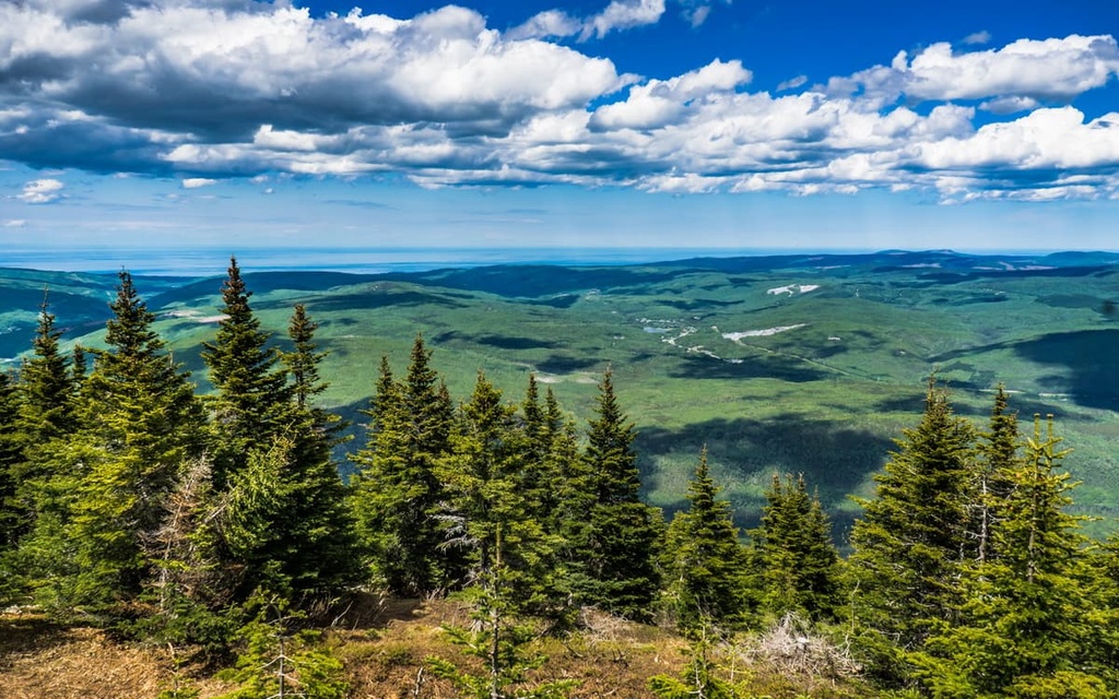
La Haute Gaspésie is a regional county municipality (MRC) located in the eastern part of the Canadian province of Quebec. The MRC encompasses the northern part of the Gaspé Peninsula including part of parc national de la Gaspésie (Gaspésie National Park), which is a popular and rugged hiking area. There are 121 named mountains in La Haute Gaspésie, the highest and most prominent of which is Mont Jacques-Cartier (1,268 m/4,138 ft).
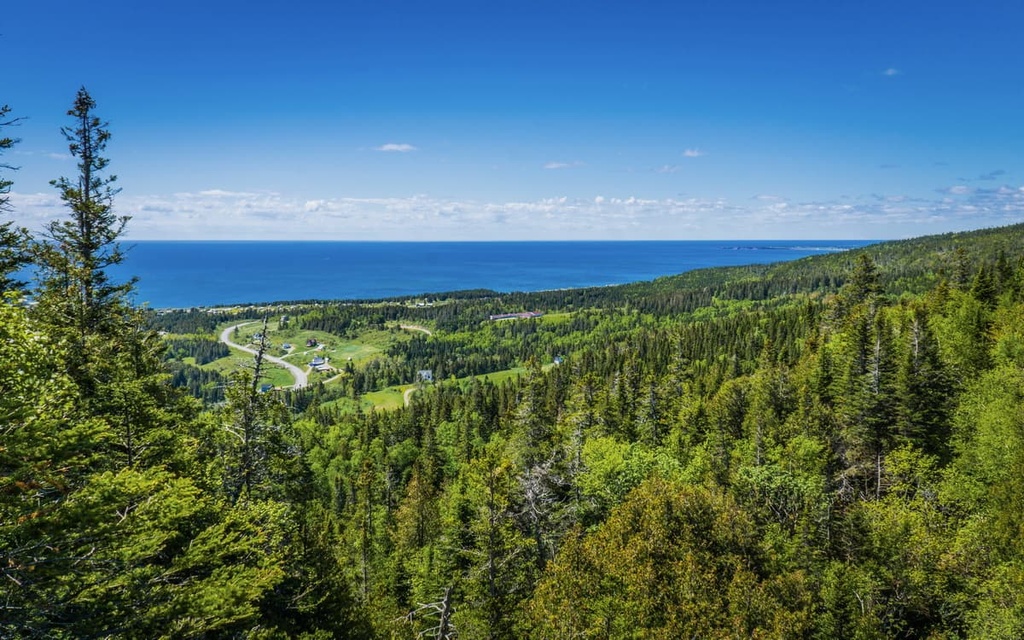
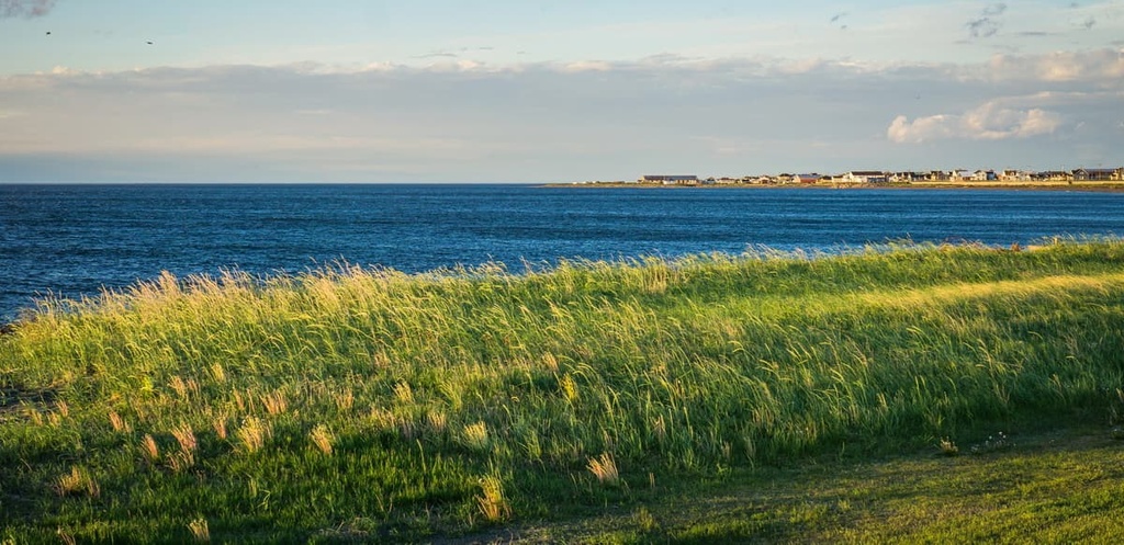
La Haute Gaspésie is an administrative subdivision that’s located in the eastern part of the Canadian province of Quebec. The region contains a total area of 5,139 sq. km (1,984 sq. mi). However, fewer than 15,000 people live in La Haute Gaspésie and most of its communities are located along its northern coastline.
The region is officially classified as a municipalité régionale de comté (MRC), which translates in English to ‘regional county municipality.’ MRCs are similar to regional municipalities in other Canadian provinces like Alberta and are similar in function to a county in the US.
La Haute Gaspésie is located in the Gaspésie-Îles-de-la-Madeleine administrative region, which is one of 17 such regions in the province. These administrative regions have no local government structure, but they’re used to help organize provincial government services. La Haute Gaspésie is one of five MRCs in its administrative region alongside:
Gaspésie-Îles-de-la-Madeleine also contains two independent municipalities (Grosse-Île and Les Îles-de-la-Madeleine) as well as the reserve of the Micmacs of Gesgapegiag and the reserve of the Listuguj Mi'gmaq First Nation, both of which are part of the Mi'gmawei Mawiomi Secretariat.
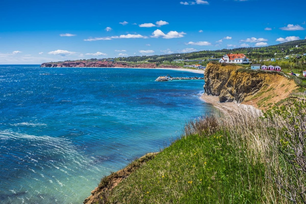
La Haute Gaspésie gets its name from that of the Gaspé Peninsula. The MRC is situated along the northern coast of the peninsula, which forms the southern shore of the Saint Lawrence River The name Gaspé derives from the Miꞌkmaq word gespe'g, which means ‘end.’
There are a number of protected areas and outdoor recreation destinations located in La Haute Gaspésie. These include:

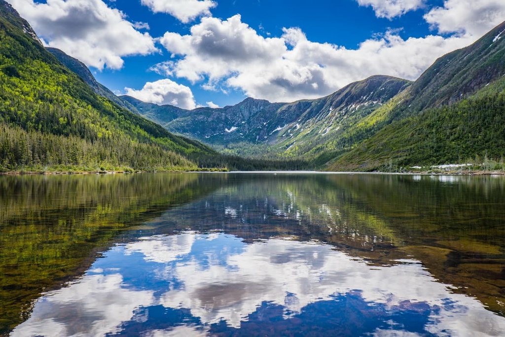
Parc national de la Gaspésie (Gaspésie National Park) and réserve faunique des Chic-Chocs deserve a special mention in this list as they are two of the most popular outdoor recreation destinations on the peninsula. They are particularly great hiking destinations in the summer and they make for excellent backcountry ski areas in the winter.
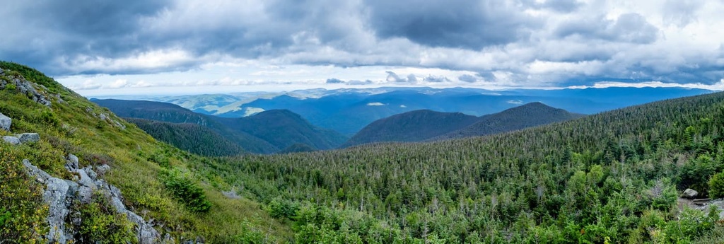
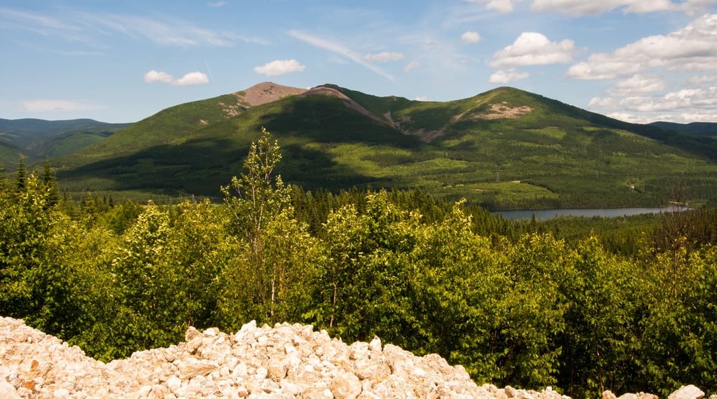
The mountains in La Haute Gaspésie are primarily part of the Chic-Chocs (monts Chic-Chocs) and the McGerrigle Mountains (monts McGerrigle).
Both of these ranges are actually subranges of the Notre Dame Mountains (monts Notre-Dame). The Notre Dame Mountains encompass a broad swath of the Gaspé Peninsula, though they also run south toward Canada’s border with the US state of Vermont. They end where the Green Mountains begin in the northern part of Vermont.
Additionally, the Notre Dame Mountains are themselves a subrange of the Canadian Appalachians, which is the part of the mighty Appalachian Mountains that extends into Canada.
The Canadian Applachians run from southern Quebec into New Brunswick, Prince Edward Island, and Nova Scotia before terminating in the northern part of the island of Newfoundland in Newfoundland and Labrador. The Appalachians as a whole, however, begin in the US state of Alabama and continue northward along the eastern part of the country before entering Canada.
That said, despite the different names that we give to these ranges and subranges, they all share a roughly similar geologic history, particularly with respect to the peaks in the Notre Dame Mountains and the Green Mountains.
In particular, the peaks that make up the bulk of La Haute Gaspésie began to form during the Taconic orogeny, which was a mountain building event that was also responsible for the creation of much of what is now New England in the US and eastern Canada. Other subsequent mountain building events, including the Acadian orogeny, also played a big role in the creation of the Gaspé Peninsula.
Furthermore, the rocks in La Haute Gaspésie are primarily sedimentary and igneous in origin.
The region is home to sizable igneous intrusions, which are the result of many events, including tectonic collisions between the continental craton of Laurentia and the microcontinent of Avalonia.
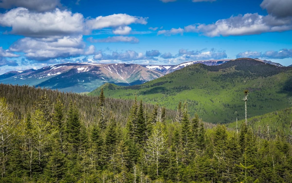
Some of the oldest rocks in the region, particularly in the Chic-Chocs, are about 600 years old and they formed when a volcanic island arc existed in the area. Meanwhile, the rocks in the McGerrigle Mountains primarily formed as a result of a granitic intrusion that occurred about 380 million years ago.
But despite the region’s complex geologic past, the events that have had the largest impact on the current shape of the mountains in La Haute Gaspésie happened much more recently.
Indeed, the Gaspé Peninsula, like much of eastern Canada, was covered in a large ice sheet throughout sizable periods of the Pleistocene. These Pleistocene glaciations helped to carve out many of the valles and rounded peaks that we see in the region today. Although there aren't any glaciers left in the region, these icy giants have clearly left their mark on the topography of the Gaspé Peninsula.
Finally, La Haute Gaspésie is one of the most mountainous parts of the Gaspé Peninsula. It is home to the peninsula’s highest peak, Mont Jacques-Cartier, which is one of the 1,000-meter peaks in Quebec. It also happens to be the highest peak in southern Quebec and the Canadian Appalachians as a whole.
Other major peaks found in the MRC include Monts Dos-de-Baleine, Mont de la Passe, Mont Comte, Mont Rolland-Germain, Les Cônes, Sommet Albert Sud, and Mont de la Table.
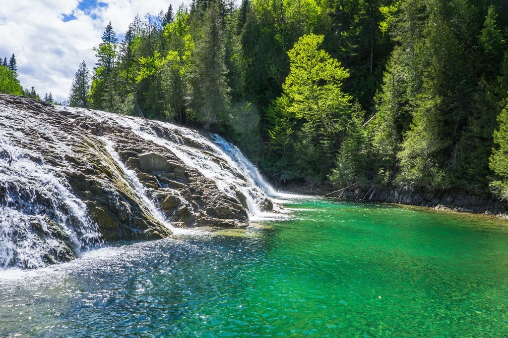
La Haute Gaspésie is home to a diversity of ecosystems thanks to the variety of landscapes found within its borders. The MRC includes both coastal and mountain areas, so it has no shortage of unique flora and fauna.
For the most part, the MRC is dominated by dense forests that receive a lot of year-round moisture. This part of the peninsula is also known for its exceptionally high snowfall as it gets more snowfall than most other places in the southern part of the province.
The forest cover of La Haute Gaspésie includes a mix of coniferous and deciduous trees such as black spruce, white birch, and balsam fir. There are also a handful of commercial sugar bushes in the MRC, so sugar maples are relatively abundant in the region, too.
At higher elevations in La Haute Gaspésie, the landscape is dominated by alpine ecosystems, particularly on the upper reaches of the Gaspésian massif around Mont Jacques-Cartier. Here, the land is dominated by smaller shrubs and wildflowers.
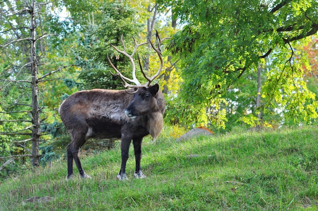
As far as wildlife goes, the MRC is a truly amazing place. It is home to one of the last remaining herds of woodland caribou in the region that’s located to the south of the Saint Lawrence River. Additionally, La Haute Gaspésie is the ideal habitat for moose and black bears, among other large mammals.
The region is also well-known for its fishing opportunities. There are a number of fish species found in the rivers and lakes of the MRC including Atlantic salmon, speckled trout, lake trout, and Arctic char.
You can also find a diversity of bird species in the MRC, including Bicknell’s thrush, golden eagles, white-throated sparrows, harlequin ducks, and horned larks.
The land that is now part of the MRC of La Haute Gaspésie has been inhabited by humans for countless generations. As is the case with the rest of the peninsula, the region is part of the traditional territory of a number of Indigenous communities including the Mi'kmaq First Nations and, in particular, the members of the Mi'gmawei Mawiomi Secretariat.
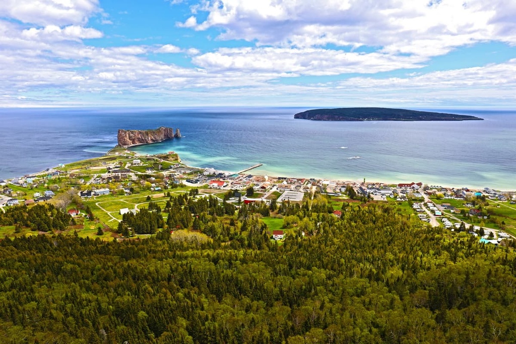
In 1534, Jacques Cartier of France likely became the first person of European descent to arrive in what is now Quebec when he landed at what is now the town of Gaspé in the eastern part of the Peninsula.
Cartier’s arrival instigated a long history of European colonization and settlement of the region that also saw the forced removal of many First Nations from their homelands. However, widespread French colonization of the region didn’t begin until after Samuel de Champlain arrived at what is now Quebec City in 1608.
Many of the European-established coastal communities in La Haute Gaspésie were founded in the eighteenth and nineteenth centuries by French fishermen and hunters. For example, Sainte-Anne-des-Monts was formally established in 1815 while Marsoui was permanently settled in the 1830s.
In the 1840s, scientists made their first forays into the Chic-Chocs to learn more about the area. During the 1920s, mining activity in the region started to increase, particularly after the discovery of copper ore in Murdochville, which is situated just to the east of the boundaries of La Haute Gaspésie.
The region started to gain recognition as an excellent place for hiking and relaxing in nature during the early part of the twentieth century. By 1950, the famous Gîte du Mont-Albert, a luxury hotel and lodge, had started operations, heralding a new age of tourism in the region.
Around this same time, conservation efforts in La Haute Gaspésie started to increase.
The Chic-Chocs Wildlife Reserve (réserve faunique des Chic-Chocs) was founded in 1949 while Gaspésie National Park (parc national de la Gaspésie) was created in 1981. Both areas are managed by Sépaq, which is the administrative body that’s tasked with overseeing many of Quebec’s outdoor recreation destinations.
La Haute Gaspésie is home to an abundance of excellent hiking trails and opportunities for outdoor adventure. Whether you’re looking for a short day hike or a longer backpacking trip, here are some of the best outdoor destinations to visit during your next journey to the region.
Parc national de la Gaspésie (Gaspésie National Park) is arguably the crown jewel of hiking in La Haute Gaspésie. The park encompasses the highest elevations of the peninsula and it features some of its most incredible terrain.
There are dozens of excellent hiking trails in the park for you to enjoy. Some of the most popular include:
Additionally, there are a number of opportunities for backpacking in the park. There are a handful of established backpacking circuits that you can check out, each of which brings you to a remote part of Gaspésie National Park. That said, you will need to make reservations for overnight stays before your trip.
If you’re looking to truly immerse yourself in the stunning natural beauty of La Haute Gaspésie, a trip to réserve faunique des Chic-Chocs (Chic-Chocs Wildlife Reserve) is one opportunity that you just can’t miss.
The reserve features a handful of hiking trails include:
The Chic-Chocs Wildlife Reserve also offers a whole host of other outdoor activities. For example, the reserve is one of the best areas for backcountry skiing in the northeastern part of North America and it draws visitors from both the US and Canada.
Most of the backcountry skiing in the park is situated around Vallières-de-Saint-Réal and the Hog’s Back. There are four cabins available for rent around Lac Sainte-Anne during the winter months, however reservations are required.
Also note that this region is prone to avalanches, so backcountry skiing is only recommended for experienced skiers that are confident in their avalanche rescue skills. All other visitors are highly encouraged to hire a guide or to head out on a group ski tour.
Looking for a place to stay during your next trip to La Haute Gaspésie? Here are some of the best cities, towns, and villages to check out in the MRC:
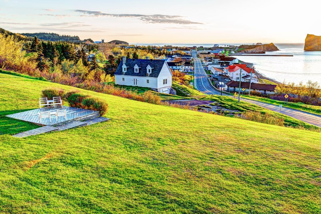
Sainte-Anne-des-Monts is one of the largest communities on the Gaspé Peninsula. The city is home to around 7,000 residents and it is one of the most important economic and cultural hubs in the region.
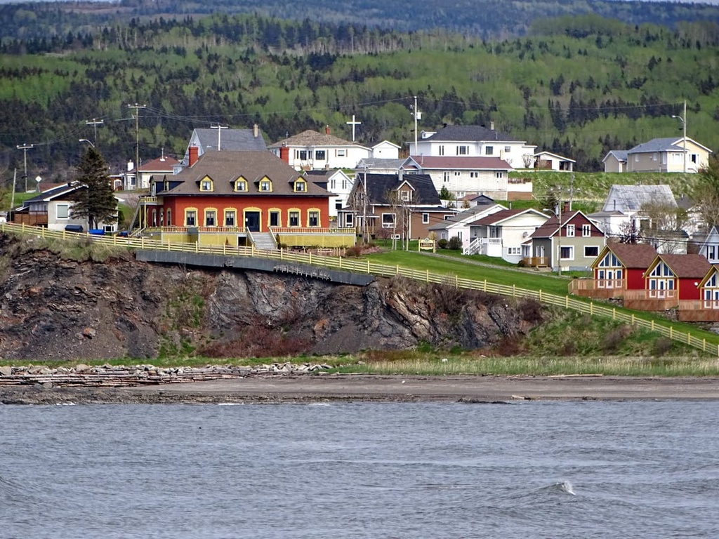
One of the biggest industries in Sainte-Anne-des-Monts is tourism. It is among the most popular starting points for trips to Gaspésie National Park due to its convenient location on Quebec Route 132 and its scenic landscapes.
Sainte-Anne-des-Monts is a worthwhile destination in its own right as it features superb vistas of the Saint Lawrence River and good access to the Chic-Choc Mountains. The city is also home to a small aquarium (the Exploramer Aquarium) that’s worth a visit if you’re in the area.
Marsoui is a village of approximately 350 people that’s located along the coast of the Gaspé Peninsula, just a short drive to the east of Sainte-Anne-des-Monts. The village started out as a settlement for people who worked in the beluga and cod fishing industry in the seventeenth century.
However, it is now perhaps best known for being one of the largest communities of Jèrriais (Jersey Norman/Jersey French) speakers located outside the Channel Island of Jersey. Many of the cod fisheries during the nineteenth century employed workers from Jersey, which is why it continues to be one of the relative strongholds of the language.
Nowadays, Marsoui is still a relatively small community, but it’s worth stopping by if you’re in the area. Marsoui has a growing tourism industry with great vacation rental cottages and excellent opportunities for swimming, hiking, skiing, fishing, and biking throughout the year.
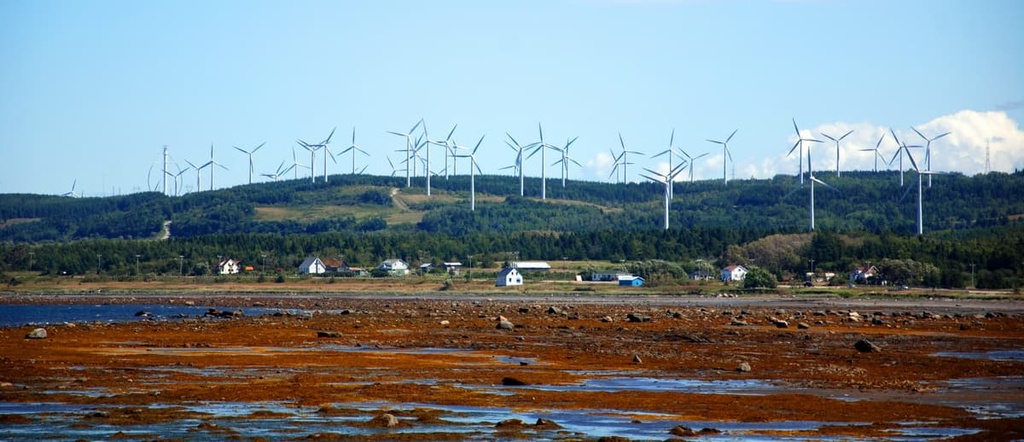
Cap-Chat is a town of around 3,000 people that’s located in the westernmost part of the La Haute Gaspésie. It is situated along the coast of the Saint Lawrence along Quebec Route 132, so it’s one of the first major communities you’ll drive through if you’re traveling to the region from Quebec City or Rimouski.
The major industry in Cap-Chat is the production of renewable energies, particularly wind energy. Cap-Chat boasts a wind farm that produces a substantial amount of energy for the region. It also features an interpretive center where you can learn more about wind energy.
Cap-Chat offers a lot to offer to tourists, too. The town features great hiking trails and it has ample opportunities for hunting and fishing. During the winter months, the town is also home to a ski resort called the Centre De Plein Air de Cap-Chat. The resort is quite small but it offers a selection of trails and lifts as well as night skiing for all to enjoy.
In addition to Sainte-Anne-des-Monts, Marsoui, and Cap-Chat, there are a handful of smaller communities located along the coast of La Haute Gaspésie. These include:
The vast majority of the communities in La Haute Gaspésie are located along the coast of the MRC. However, there are a few very small communities located away from the coast in La Haute Gaspésie. These include:
Most of these communities have fewer than 200 residents and they may or may not have amenities available for sale to the public. If you’re planning on heading inland within La Haute Gaspésie, it’s wise to fill up on fuel and get all the supplies you need in one of the MRC’s larger communities, like Sainte-Anne-des-Monts.
That said, if you’re heading inland from the eastern part of the peninsula, consider checking out Murdochville.
Although it is technically located in the MRC of La Côte-de-Gaspé, Murdochville is one of the only major inland communities on the Gaspé and it is situated just across the La Haute Gaspésie border. Murdochville started out as a copper mining town, but it has since reinvented itself as a tourist destination and a hub for renewable energies. It is also home to the Mont Miller Ski Hill.