
Scan the QR code and open PeakVisor on your phone
Known for its sandy beaches, excellent seafood, and rich culture, Prince Edward Island is a province located in the eastern part of Canada. It is the smallest province by total land area and it is also one of Canada’s least mountainous areas, though it has no shortage of natural beauty. Prince Edward Island contains 14 named high points, the highest and most prominent of which is Jones Hill (85 m/279 ft).
Prince Edward Island is a province located in eastern Canada. It is one of the country’s 13 provinces and territories. Prince Edward Island is also considered to be one of the four Atlantic provinces, alongside Newfoundland and Labrador, Nova Scotia, and New Brunswick. It is also part of the Maritimes region, which contains nearby New Brunswick and Nova Scotia.
The province of Prince Edward Island contains just 5,660 sq. km (2,190 sq. mi) of territory, which makes it the smallest of the country’s provinces. In total, the island represents just 0.10% of Canada’s total territory. The province is also the smallest by population (approximately 170,000 residents as of 2022), though it is the most densely populated.
As its name suggests, Prince Edward Island is, indeed, an island, so it has no land borders with its neighboring provinces. However, the province, which is locally known as PEI, shares most of its maritime borders with New Brunswick and Nova Scotia. It also technically shares a maritime border with Quebec, thanks to the nearby Îles-de-la-Madeleine.
Prince Edward Island is connected to the mainland of Canada by a handful of ferries and two airports. There is also the famous Confederation Bridge, which opened in 1997 and spans the 12.9 km (8 mi) distance between Cape Jourimain, New Brunswick and Borden-Carleton, Prince Edward Island over the Northumberland Strait.
Prince Edward Island has historically been divided up into three counties: Kings, Queens, and Prince.
These counties no longer serve any administrative purpose, though they are used as census divisions by Statistics Canada. Each of these counties is also divided into four or five parishes and a handful of areas called ‘lots,’ but these also no longer serve a formal administrative purpose.
Rather, the administrative regions of Prince Edward Island are called municipalities. There are 72 municipalities on the island, and they are classified as either cities, towns, rural municipalities, or resort municipalities.
Despite its small size, Prince Edward Island is home to a sizable number of protected areas. These include the following federally administered sites:
In Kings County, you can also find the following provincial parks:
Meanwhile, Prince County contains the following provincial parks:
Finally, Prince Edward Island’s Queens County is home to the following provincial parks:
The geologic history of Prince Edward Island is complex and diverse. Much of the island’s current bedrock is formed out of sediments that were deposited into what is now the Gulf of Saint Lawrence around 250 and 300 million years ago.
For much of the succeeding 250 million years, the land that would later become PEI was covered by ice. However, as the last glaciers started to retreat from the region during the Pleistocene, they exposed the land that is now PEI. They also left behind sizable amounts of glacial till and scoured away at the landscape.
During this time, the nearby Northumberland Strait, which separates PEI from Nova Scotia and New Brunswick, was actually exposed as a shallow plain, which allowed people and animals to migrate to the island. This plain existed as a result of both lower sea levels at the time and the fact that the massive glaciers pushed down on the surrounding landmasses.
Eventually, as the glaciers melted, they started to cover up the Northumberland Strait, too. By about 5,000 years ago, the island started to take on its current shape with its rugged coastlines and tidal inlets.
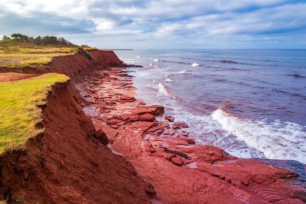
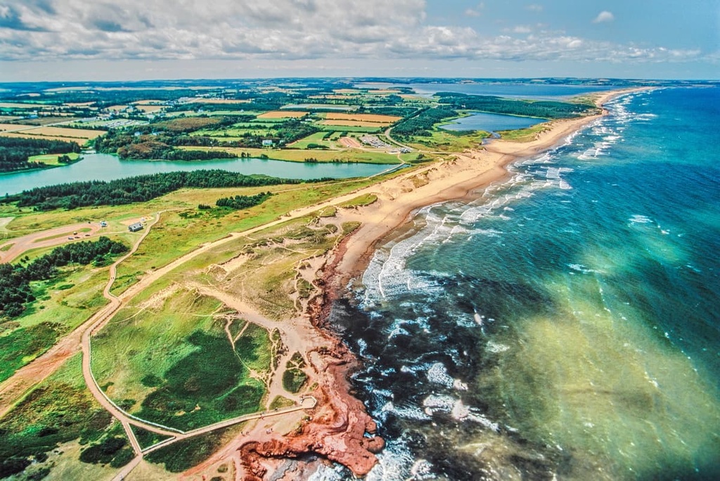
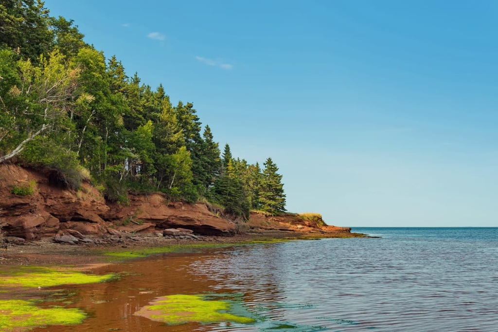
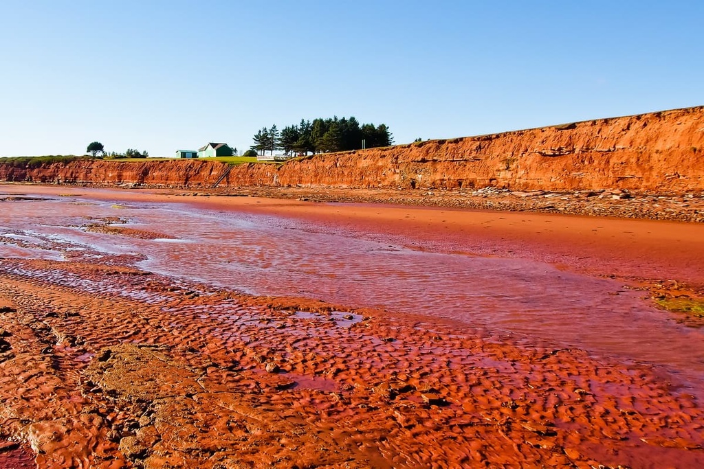
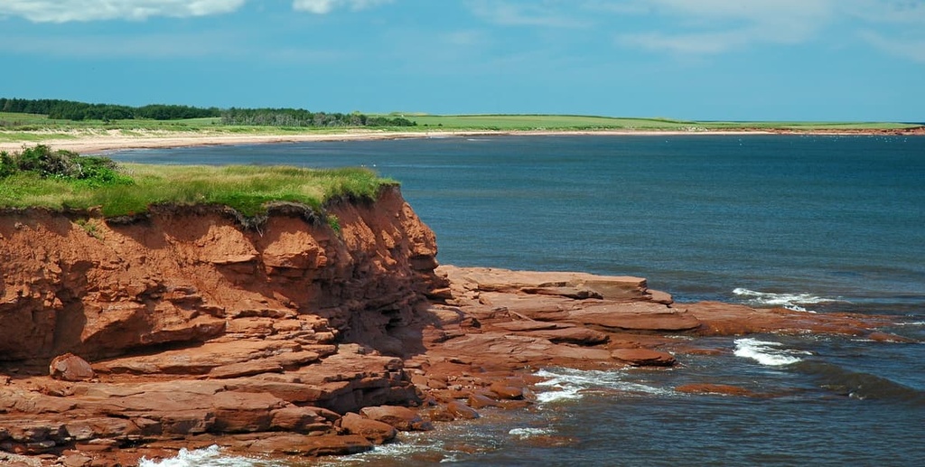
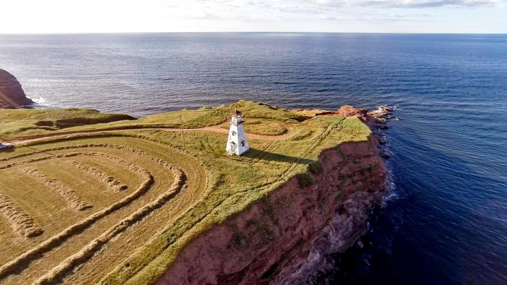
Geologically, much of the bedrock on the island is a red sandstone that is part of the Pictou Group. The Pictou Group is a rock stratum that formed during the Late Carboniferous and Permian periods and it's the reason why PEI features its famous red sand beaches and sandstone cliffs.
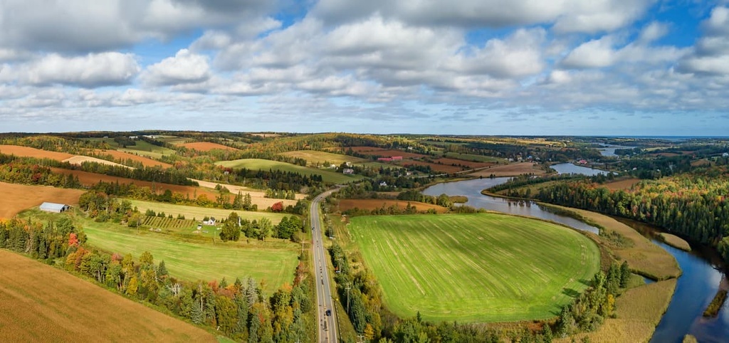
That being said, Prince Edward Island isn’t very mountainous, especially when compared to its neighboring provinces. Technically, one could consider the hills on the island to be part of the Canadian Appalachians, which are themselves a subrange of the much larger Appalachian Mountains.
Overall, Prince Edward Island has a relatively moderate climate given its latitude. The island has fairly long winters, though they tend to be mild while its summers are generally cool. It also receives an average of 1,126 mm (44 in) of rain and 318.2 cm (125 in) of snowfall each year.
As far as ecosystems go, the vast majority of Prince Edward Island’s original forests have long since been cut down. The island’s forests were cut down over the course of three centuries for various purposes, such as clearing the land for agriculture and harvesting trees for shipbuilding.
Prior to this deforestation, much of the island was home to tree species such as white pine, beech, maple, yellow birch, and oak. The forests that exist on the island today primarily contain red maple, spruce, and balsam fir.
Conservation is of particularly large concern for the provincial government of PEI because centuries of land use have led to widespread erosion of some of the island’s most fertile soils.
As far as wildlife goes, Prince Edward Island was once home to sizable populations of moose, caribou, wolves, and black bears. However, over-hunting and habitat loss mean that these species no longer live on the island.
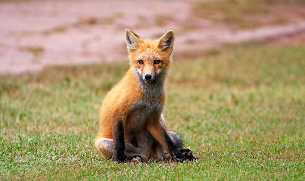
Some of the animals that still live on PEI include red foxes, coyotes, skunks, beavers, minks, and raccoons. The island is also home to at-risk and endangered species such as piping plovers, little brown bats, bobolinks, and American eels. In the waters around the island, researchers have also noticed an increase in the number of North Atlantic right whales in recent years.
The land that is now part of the province of Prince Edward Island is part of the traditional territory of the Mi’kmaq First Nations. Archeological evidence and cultural knowledge suggest that the ancestors of the Mi’kmaq lived on the island as early as 10,000 years ago.
It’s likely that the earliest residents of the island arrived via the low plain that is now under the waters of the Northumberland Strait. However, evidence suggests that people did not permanently inhabit the island at this time.
It’s more likely that the ancestors of the Mi’kmaq came to the island seasonally to hunt and fish, though the Mi’kmaq themselves have lived on the island for at least the last 2,000 years. The Mi’kmaq call the island Abegweit, a name that is often translated to something along the lines of ‘cradle in the waves.’
There are four reserves on Prince Edward Island that are held by two First Nations: the Abegweit First Nation and the Lennox Island First Nation, both of which are Mi’kmaq First Nations.
The first person of European descent to make a recorded visit to what is now Prince Edward Island was Jacques Cartier of France who landed on the island during his 1534 voyage. Over the subsequent few centuries, Europeans never established a permanent settlement on the island, but both Basque and French fisherman frequented its bays and harbors.
European settlers started to arrive in the 1720s. At the time, the French called the island Île-St-Jean and they claimed it as part of their colony of Acadia. However, the French didn’t settle the island with much gusto and the colonist population of the region grew very slowly.
At the height of the Seven Year's War, Prince Edward Island was caught up in the conflict between the French and the British. Eventually, the British claimed control of the island after the 1763 Treaty of Paris.
Around this same time, thousands of Acadians were expelled from the Maritime provinces and sent either back to France or to the 13 British Colonies (which would later become the US). Many of these Acadians from what is now PEI made their way to Louisiana where they eventually became known as the Cajuns.
After Britain claimed control over PEI in the late 1700s, they anglicized the name of the island to Saint John. Soon afterward, Surveyor General Samuel Holland created his maps that divided the island into the counties and parishes that are still in use to this day.
Most of the land on the island was then granted to various military officers and other British government officials, despite the fact that there were still Mi’kmaq and Acadians living on the island (though most were forcibly removed not long afterward).
Eventually, the island saw an influx of Loyalists who fled the newly formed US after the American Revolutionary War. There were also many immigrants to PEI from Ireland and Scotland during the late 1700s and early 1800s.
During this time, the island was managed as part of Nova Scotia. However, landowners on the island made a push for more local governance. The island eventually got its own administrative organization alongside its own governor.
In 1799, the island also changed its name to Prince Edward Island in honor of one of the sons of King George III. Interestingly enough, Prince Edward’s only legitimate child would later go on to become Queen Victoria. Edward was also likely the first member of the British Royal Family to live in North America for an extended period of time and he is credited with coining the modern usage of the term Canadian.
In 1864, the Charlottetown Conference was held on PEI. It was arguably the first in a series of different meetings and conferences that led to the formation of the Dominion of Canada.
The Dominion of Canada was officially established on July 1, 1867, though it did not initially include PEI due to some internal disputes over whether the island should ally itself with Canada or even the United States (it eventually decided to just remain a British Colony for the time being).
A few years later, in 1873, PEI joined the confederation as the seventh province of Canada. This was done in part because the Government of Canada offered a number of benefits to PEI, such as an absorption of the colony’s debt and increased links to the mainland. However, Canada itself also wanted to avoid US expansionism into the area, so Prime Minister John Alexander Macdonald eagerly helped to negotiate PEI’s entrance into the Dominion of Canada.
The years following Confederation were arguably quite difficult on PEI economically even though the province’s population continued to rise until around the time of the Great Depression.
Economically, PEI’s main industries have historically included farming and fishing. In more recent years, the island has sought to cement its status as a tourist destination by promoting its many beaches and golf courses.
Prince Edward Island might not be the largest or the most mountainous of Canada’s provinces, but it has no shortage of stunning natural beauty and scenic outdoor adventures for the keen visitor to enjoy.
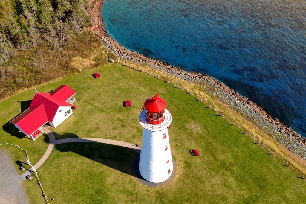
There are around two dozen provincial parks on the island as well as one national park and a selection of long-distance hiking trails. Here are some of the best hikes on Prince Edward Island to check out during your next trip to the Maritimes.
Prince Edward National Park is the only national park in the province. It is located in the northern part of the island near the town of North Rustico.
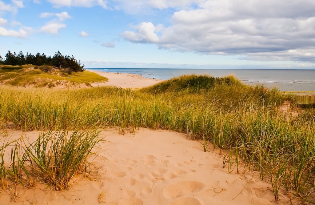
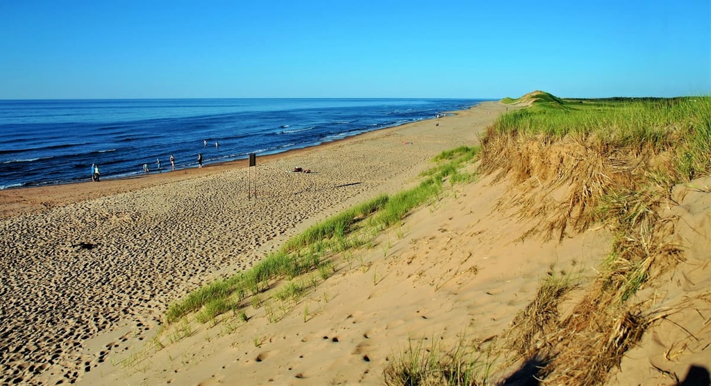
The park encompasses a sizable swath of PEI’s northern coastline, including many of its stunning red sand and rocky beaches. It is a particularly important area for birdlife as it protects a nesting habitat for the endangered piping plover. The national park also protects a regionally important collection of sand dunes.
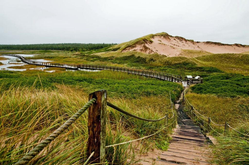
Inside the park, there are a number of excellent hiking trails for visitors to enjoy. This includes walks like the Clark’s Lane Trail and the many loops of the Robertson Island Trail System. Alternatively, you could walk to the Greenwich Dunes or you could check out the Farm Lands and Bubbling Springs Trails while visiting the national park.
The Confederation Trail is a 449 km (280 mi) long collection of walking routes that stretch across Prince Edward Island from east to rest. Much of the trail coincides with the Trans-Canada Trail, especially between Elmira and Tignish.
For the most part, the trail is built on decommissioned railway lines, so it features a casual grade that’s great for a wide range of different hikers. The trail also boasts hundreds of interpretive panels and it’s also a very popular place for geocaching.
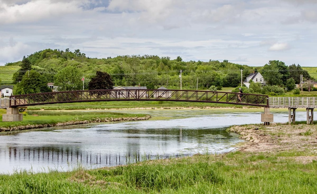
Although you can walk the entire trail in one long thru-hike, most people opt to day hike sections of the Confederation Trail. It passes through dozens of small towns and communities and it even traverses the heart of the city of Charlottetown, so it’s a fun hiking option regardless of where you’re staying on the island.
If you love long-distance hiking and the Confederation Trail just isn’t quite long enough for your needs, the Island Walk just might be what you’re looking for.
Often called Prince Edward Island’s premier long-distance trail, the 700 km (435 mi) Island Walk circumnavigates the entire island, offering the chance for a true adventure in the province. Like the Confederation Trail, the Island Walk follows along mostly flat paths, so it’s a nice option for hikers of all ability and experience levels.
This hike takes you across beaches and to some of the most remote parts of PEI, making it a great way to see all that the province has to offer. You can hike short sections of the trail or you can hike the whole thing in about a month. Check out the official Island Walk website for more information about trip itineraries and accommodation options.
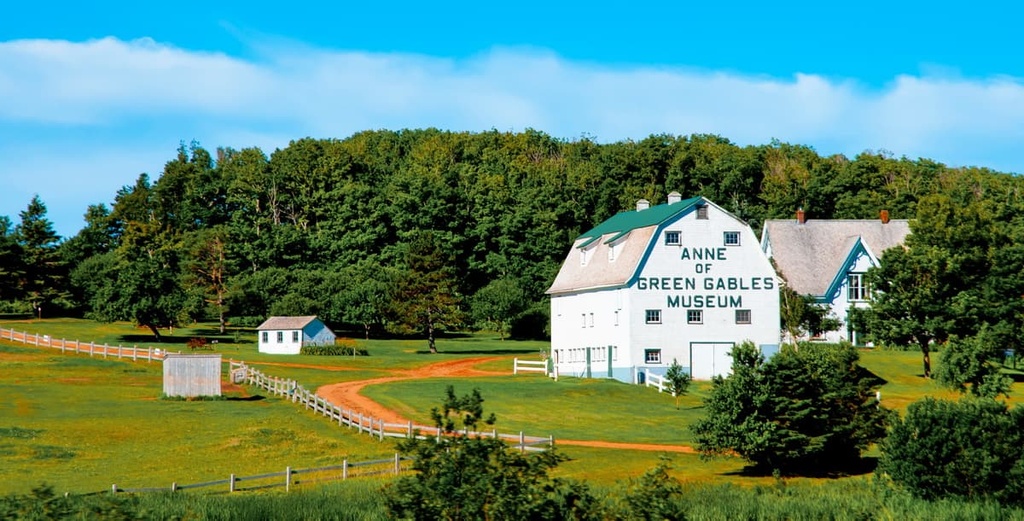
The Green Gables Heritage Place is technically located within Prince Edward Island National Park, but it is a national historic site in its own right. It was the original setting of the Anne of Green Gables novels, which were written by Lucy Maud Montgomery.
At the historic site, you can learn more about the history of the region and the background of the novels. The historic site also offers a selection of hiking trails for visitors to enjoy, including the Balsam Hollow Trail and The Haunted Woods.
Prince Edward Island is a bit of an anomaly in Canada in that wild camping, or camping outside of designated areas, is generally not allowed in the province. This is primarily a result of the fact that nearly 90% of the province is privately owned, so finding suitable free places to camp outside of designated sites is nearly impossible.
That being said, you can camp on PEI, so long as you stay in a designated campground. The national park has two campgrounds for visitors to choose from and there are many privately owned campgrounds across the island, particularly along its long-distance hiking routes.
Additionally, even though PEI is the smallest province by population, it is home to a plethora of small towns and communities, many of which offer a variety of lodging options. You can find hotels, Airbnbs, rental cottages, and an assortment of other accommodation options throughout the province.
Some accommodations on PEI also offer luggage storage, transfer, and shuttle options to trailheads along the Island Walk and the Confederation Trail. But be sure to call ahead and inquire about these services before you book your stay.
Looking for a place to stay during your next trip to PEI? Here are some of the best cities and towns in the province to check out.
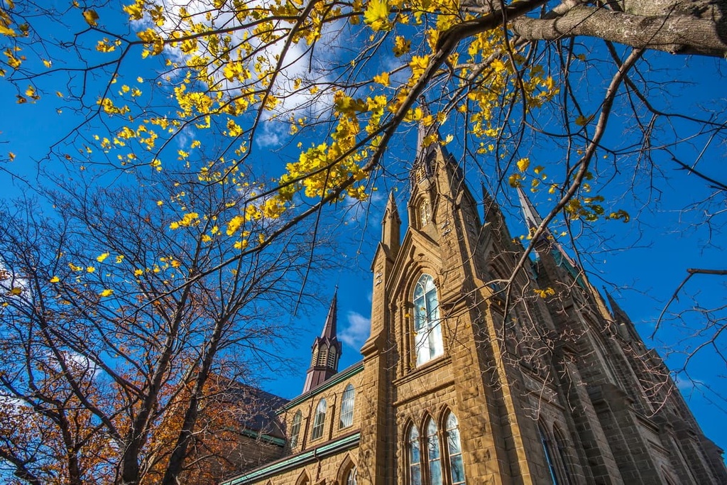
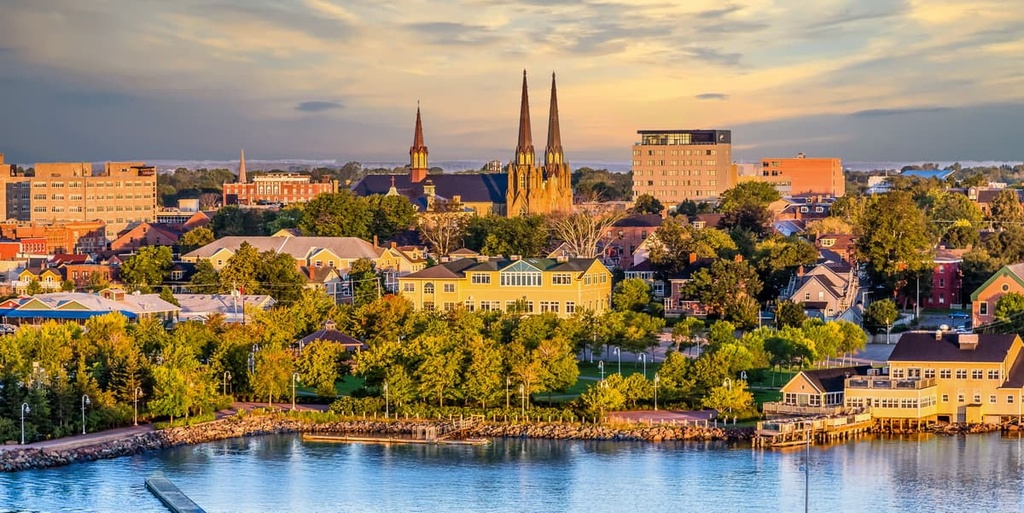
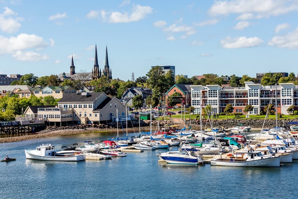
Charlottetown is both the largest city and the capital of Prince Edward Island. It is located in the central part of the island and is home to around 40,000 people in its urban core.
The city of Charlottetown is known as being the “Birthplace of Confederation” as it hosted one of the first meetings that ultimately led to the creation of the Dominion of Canada. Nowadays, Charlotte features a lively downtown area that’s filled with historic sites, so it’s well worth a visit if you’re in the area.
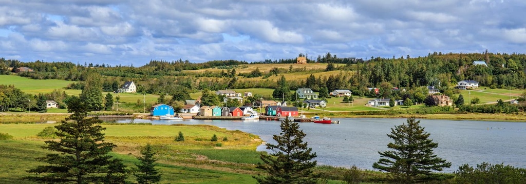
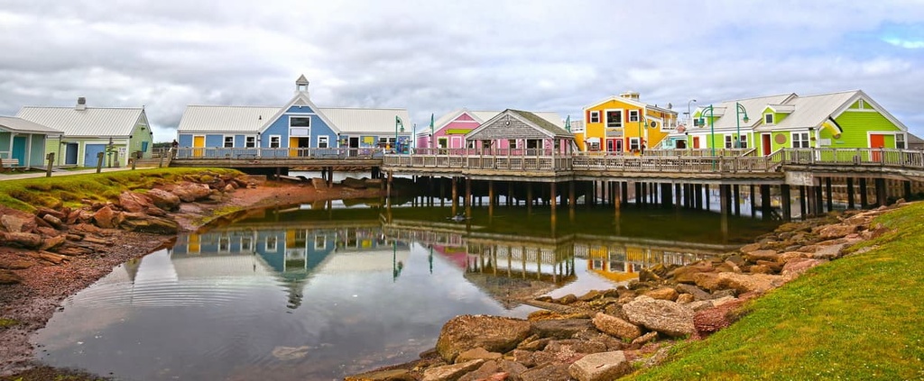
Summerside is a community of approximately 15,000 people that’s located in west-central PEI. It is the second-largest city in the province and it is a commercial hub for the western part of the island.
The city’s economy is powered by a range of different industries, though government services, manufacturing, and food processing are all major economic sectors in Summerside. Visitors to Summerside can check out its many excellent restaurants, theaters, museums, and attractions. You can also take a stroll down the 6.5 km (4 mi) long Summerside Baywalk, which travels along the city’s coastline.
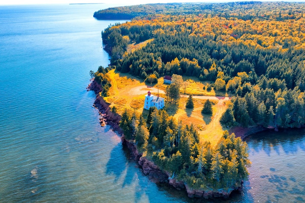
Three Rivers is a town located in the eastern part of PEI in Kings County. It is home to approximately 8,000 people and it is the largest community in the eastern section of the island.
Although Three Rivers is a relatively small community, it’s an excellent palace to visit if you’re looking to see more of PEI outside Charlottetown. The area around the town features a number of historic sites, including the Three Rivers National Historic Site, the Gulf Museum, and the Lighthouse at Panmure Island.


