Scan the QR code and open PeakVisor on your phone
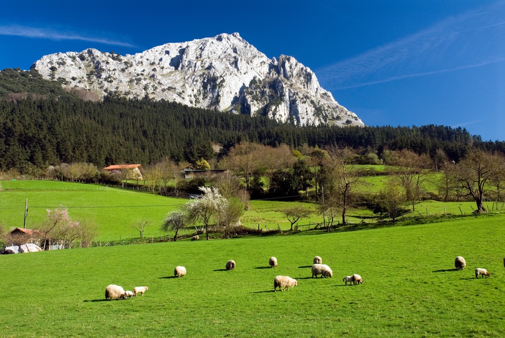
Basque Country is one of 17 regions or autonomous communities of Spain, located in the north of the country. The main natural feature of the region is the relatively rare combination on a global scale of high mountains and the beautiful ocean coast. Add to that the distinctive culture of the Basque people, known far away outside of Spain, and you have just the perfect destination for travel and outdoor recreation in the center of Europe. There are 3483 named mountains in Basque Country. The highest and the most prominent mountain is Aitxuri (1,551 m / 5,089 ft).
The word "Basque" is the name of the peoples (Basques) who historically inhabited this area. They are distinguished by their very unique language and culture: traditions, costumes, cuisine, and the way of life in general. The name of the country in Basque language is Euskal Herria or Euskadi, where "Herria" means at once "country, land, territory", and the like. The Basque language itself is “euskara”. To my ear, it sounds the same as it is spelled, that is like abracadabra even to speakers of other European languages: Spanish, French, and others. Below you will see why.
Due to its location, the country is also known as País Vasco in Spanish and Pays Basque in French.
The word "Basque" itself is the English version of the word "Vasco". The latter, in turn, is the singular from the Latin word "Vascones" in the plural. This is what the Basque tribe was called by the Romans. The name of the Basques in their native language, "euskaldunak", means "those who know the Basque language", so that the Basques themselves define the boundaries of their territories by language.
As a result, the exact translation of the country's name is "The country of the Basque language speakers".
Today the Basque is spoken by about 800,000 to a million people. However, this is only about 28% of the total Basque peoples, the number of which reaches 3 million in the world, of which 2.4 million live in the Basque Country, and the rest in France, the United States, and Canada.
The Basque Country, as a region of Spain, is located in the northeast of the Iberian Peninsula and covers an area of 20.947 sq km (8.088 sq mi). In this respect, it is the fourth from the end by size region.
The natural boundaries of the country are the Bay of Biscay of the Atlantic Ocean, which washes its shores from the north, and the western part of the Pyrenees, which bound it from the east. The Cantabrian Mountains (Cordillera Cantábrica) form its geographical boundaries to the west and the vast Ebro Valley to the south, formed by the river of the same name.
The central part of the Basque Country is a high mountain plateau known as the Álava Plains (Llanada Alavesa), located between two large ranges of the Basque Mountains, which nevertheless cover almost the entire region.
On a geographical map of Spain, the Basque Country is also the easternmost part of the natural region known as Green Spain, stretching along the Atlantic coast from the border with Portugal to the border with France. As its name implies, it differs from the rest more arid part of the country in its more humid and pleasant climate and, as a consequence, its more lush nature.
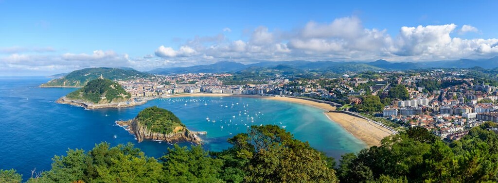
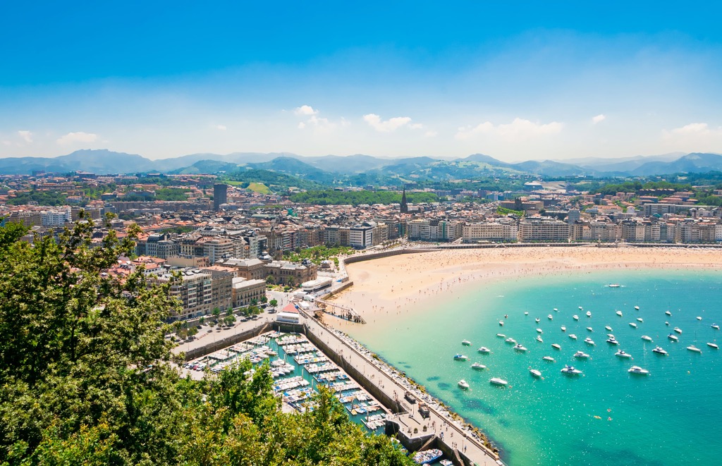
On the administrative map, it is bordered by the four other autonomous communities: Cantabria, Castilla y León, La Rioja and Navarre. Internally it includes three provinces with the following capitals: Álava (Vitoria-Gasteiz), Biscay (Bilbao), and Gipuzkoa (Donostia-San Sebastián).
Culturally, the Basque Country is a much greater region. It includes the whole neighboring Navarre region, where the majority of the population is also Basque, and the western part of the Pyrénées-Atlantiques department in the Nouvelle-Aquitaine region in France, where three historic provinces are also distinguished with the following capitals: Labourd (Bayonne), Lower Navarre (Saint-Jean-Pied-de-Port) and Soule (Mauléon-Licharre), so they are not on the modern administrative map of the country.
From here, the part of the Basque Country in France is known as the French Basque Country (Spanish: País Vasco francés) or the Northern Basque Country (Basque: Iparralde, Spanish: País Vasco norte). Respectively, the larger Spanish part is also called the Southern Basque Country (Basque: Hegoalde, Spanish: País Vasco y Navarra, País Vasco peninsular).
The Basques are unique peoples, whose exact origin is still unresolved. Perhaps because they are considered to be the oldest or even first Europeans, living in the same territory, which they inhabited for about 5,000 years, even before the arrival of the first Indo-Europeans.
As I just said before, they are most closely associated with the inhabitants of the modern Navarre region, a former kingdom, the majority of whose population is also Basque peoples (47%). At different periods of history, these two parts of Spain have formed a single country.
Like today, throughout history, their main neighbors were the Cantabri tribe in the west, after which the mountains are named, and the Aquitani in the east, after which the region in France is named.
But, unlike their neighbors, already in those ancient times Basques were more independent and were better able to negotiate with the Romans in their favor. That is why throughout history the Basques succeeded in creating and preserving an autonomous country, even though it is on the territory of modern Spain today.
The emigration of the Basques, despite their commitment to their homeland, also contributed to the spread of fame about them outside Spain. In particular, the largest Basque community outside Europe is in California, USA.
In addition to their language, the Basques are known for their culture, traditions and lifestyle. The main ones include:
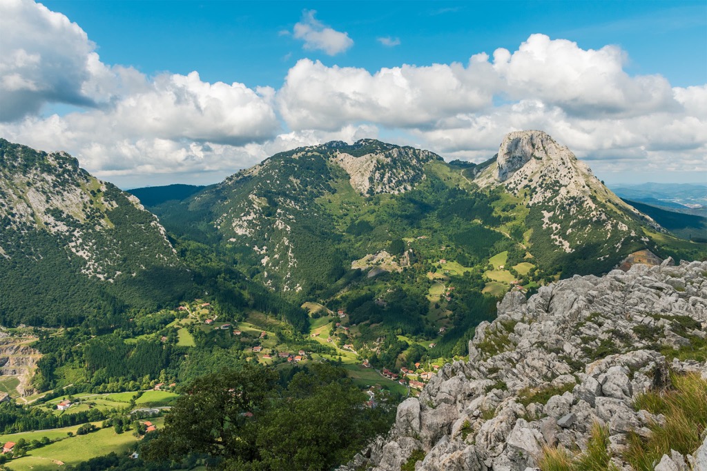
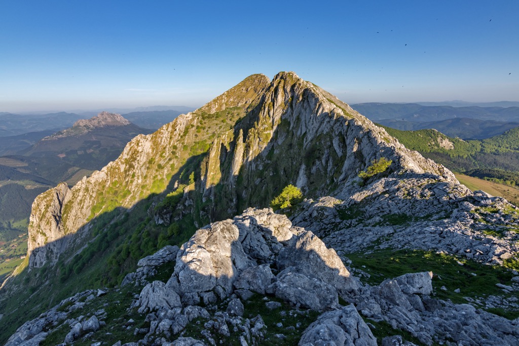
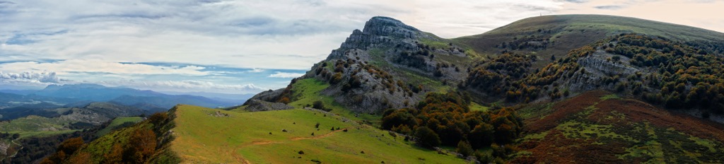
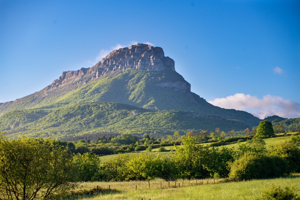
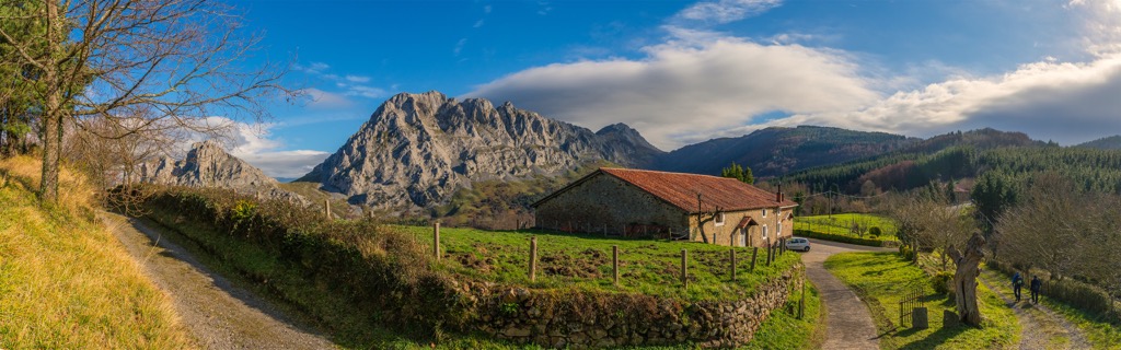
Almost the entire territory of the Basque Country is evenly covered by 3,483 named mountains up to 1,551 m (5,088ft) of the summit of Aitxuri. At a relatively low altitude, the mountain is also characterized by a great prominence of 944 m (3,097 ft). Aitxuri is the highest peak of the mountain massif of Aizkorri, which is located in the center of the province of Gipuzkoa (Donostia / San Sebastián) next to the town of Zegama. There are several easy trails to the top from the parking lots at the nearest roads.
The mountain can be climbed all year round, but be careful with the weather forecast: Rainfall makes it very difficult to climb even such a low mountain, besides, in winter it may snow (but it usually melts quickly). For example, during the two winter months, January and February, that I spent in the French Basque Country it snowed only a couple of times. But it rained nonstop and didn't end until March.
Anyway, you're more likely to end up somewhere in Bilbao areas on the coast of the Bay of Biscay than in the center of the Basque Country. So the major mountains near the city (and in order of distance from it) are Ganekogorta (998 m / 3,274 ft); Oiz (1,026 m / 3,366 ft) with a series of wind turbines on its top, which looks just fantastic; and Hernio (1,078 / 3,536 ft).
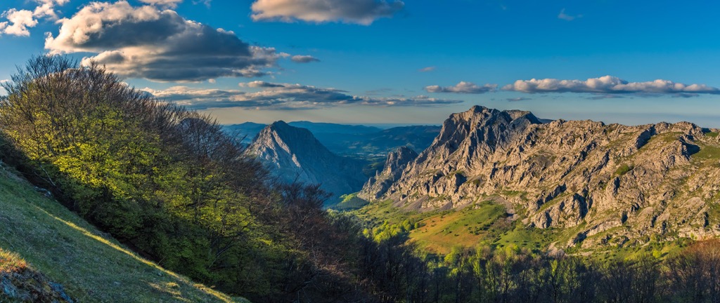
These and other peaks of the region belong to the mountain range with the same name—Basque Mountains (Basque: Euskal Herriko arkua—"Basque arc", Spanish: Montes vascos, French: Montagnes basques), which in turn are the third and eastern part of the larger Cantabrian Range or Cantabrian Mountains (Cordillera Cantábrica)—one of the main ranges in Spain, which stretches almost along the entire north of the country. Two other parts of these mountains are the Asturian Massif in the west and the Picos de Europa (Peaks of Europe) in the center.
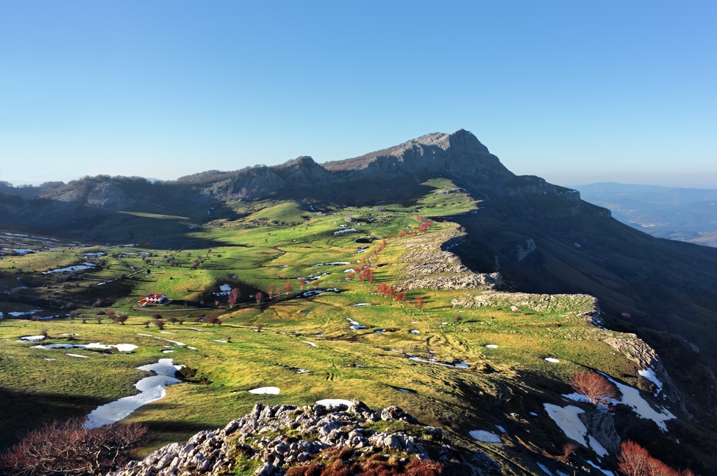
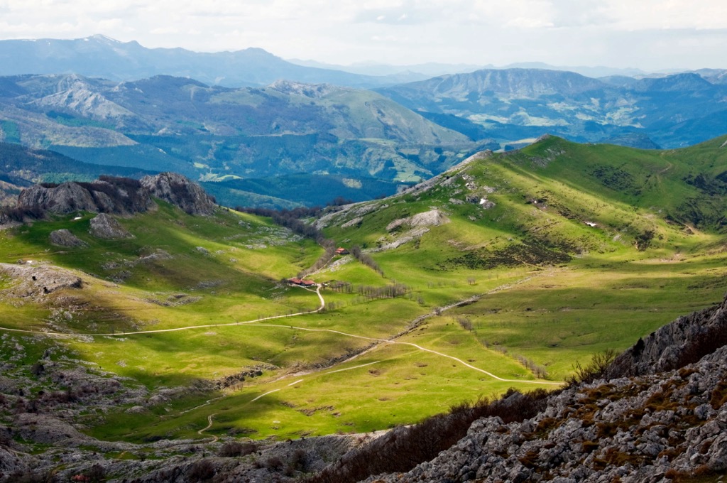
Inside the Basque Mountains, there are two parallel sub-ranges running from west to east, each with smaller mountain ranges: the coastal one with the aforementioned peaks and the inner one. The first is much larger than the second in area and it is located not literally along the coast but between the Biscay Bay and the inner land. As I already told you, between them is Alava Plains (Llanada Alavesa) about 500 m (ft) high. Given their great variety, in this guide I will list only a few of the five main ones in each sub-range next:
Major coastal ranges of the Basque Mountains
Major inner ranges of the Basque Mountains
Of particular note is the Peñas de Aya (Basque: Aiako Harria) massif on the northeastern border of the Basque Country east of the town of Oiartzun, whose three main summits, including the highest Erroilbide (837 m / 2,746 ft), and the following Txurrumurru (828 m / 2,716 ft) and Irumugarrieta (811 m / 2,660 ft), belong to the Pyrenees and are the westernmost peaks in this large mountain range.
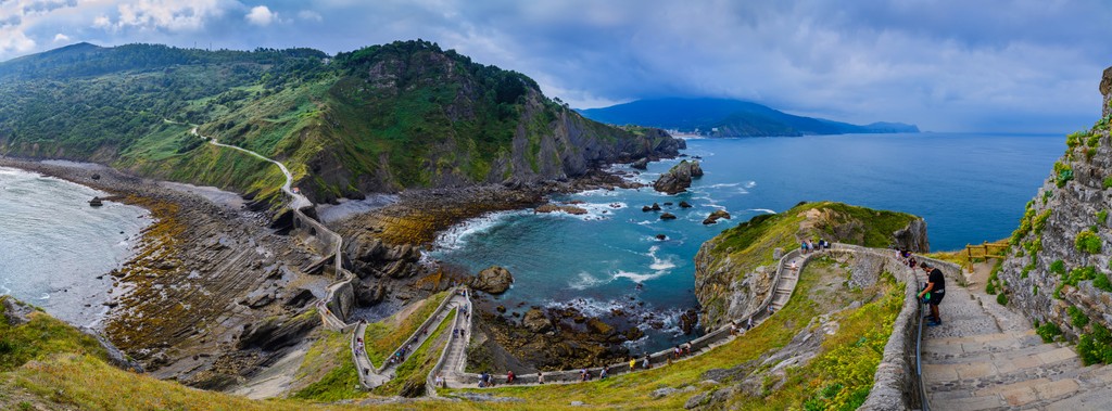
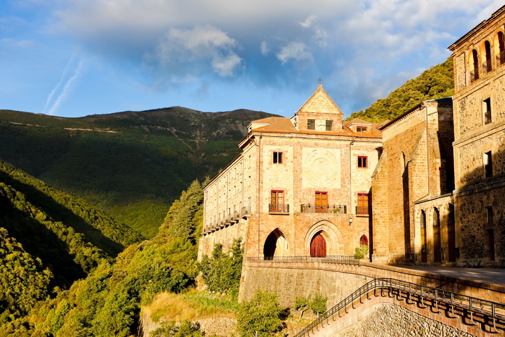
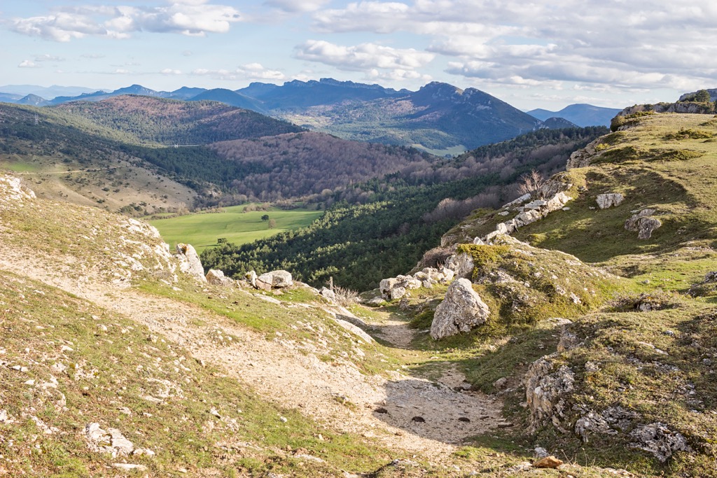
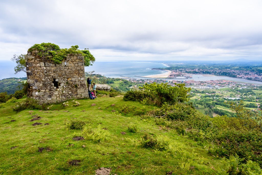
The main hiking areas in the Basque Country are seven nature parks and one nature reserve. In each of them, you will find marked hiking routes of varying lengths, from a few kilometers (miles) to multi-day trails. In addition, several very famous long hiking trails pass through the region.
The nature parks are located across its entire territory of the region within the boundaries of the mountain ranges listed above and bear roughly the same names:
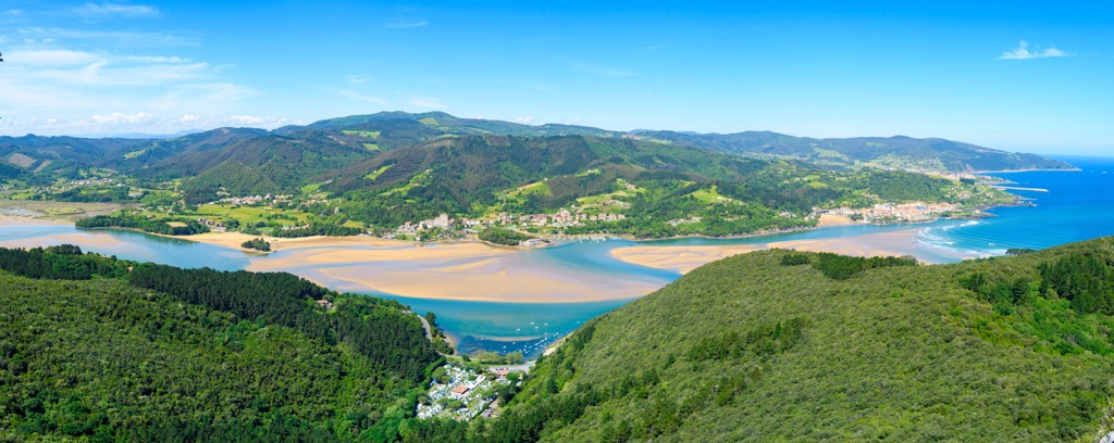
Another natural area could be found by hiker in the west of the region right on the shore of the Bay of Biscay—UNESCO Urdaibai Biosphere Reserve (UNESCO Urdaibai biosferako erreserba, Reserva de la Biosfera de Urdaibai). According to UNESCO itself, "the territory is characterized by a hydrographic basin that ends creating a great salt marsh and a coastal landscape with high sheer cliffs and capes."
The ninth nature park is nor exactly in the Basque Country but on its southwestern borders in the neighboring province of Burgos in the autonomous community of Castile and León. It is called the Obarenes Mountains-San Zadornil Nature Park (Parque Natural de Montes Obarenes-San Zadornil) and covers the mountains of the same name. It is a separate long range of 30 km (18.6 mi). The park continues to the east in the Basque province of Álava where it is called Montes Obarenes-Sierra de Cantabria and includes the homonymous hilly area.
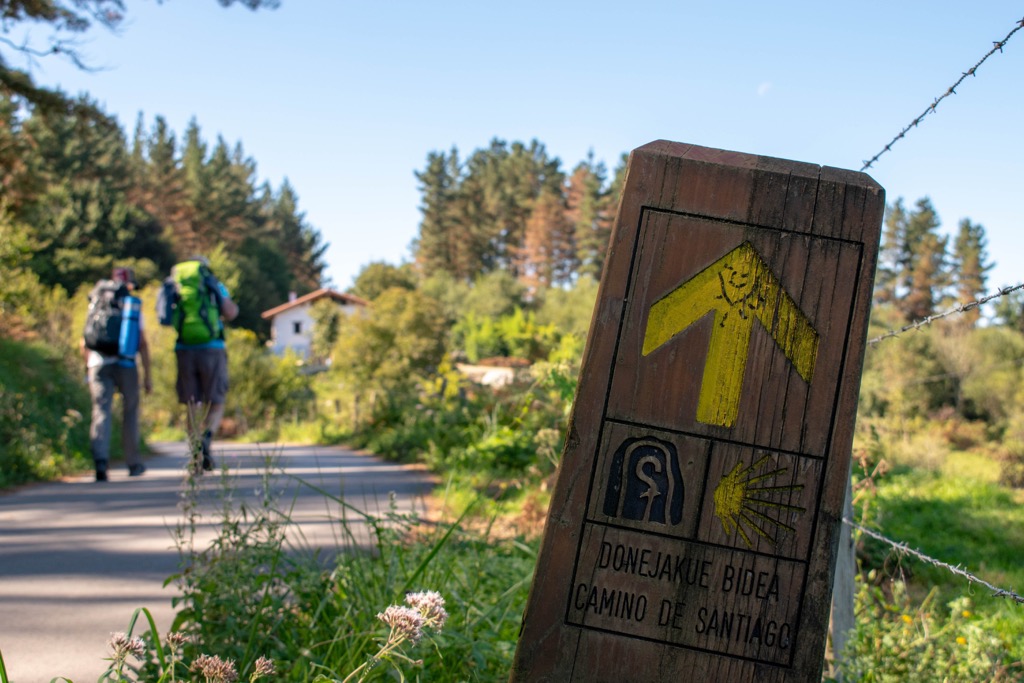
The most famous long hiking trail in the Basque Country, as well as in the whole north of Spain, is undoubtedly the coastal or northern route of the Way of St. James (Camino Norte de Santiago / Camino de la Costa). It is one of many variants of the world-famous pilgrimage route described in many popular books and films. As the name itself implies, this route runs along the northern coast of Spain. Its length is 214 km (mi) on 9 stages through the towns of Hondarribia, San Sebastián, Zarautz, Deba, and others.
Another famous but less known outside of Spain trail—the Ignatian Way—runs inland from the coast. It is the route from the town of Loiola to the town of Navarrete, which recreates the journey of a Spanish Catholic priest Ignacio de Loiola, which he made in 1522. The full route is 675 km (419 mi) and the part that runs through the Basque Country is 150 km (93.2 mi).
The region is also rich in a series of so-called "Greenways", relatively easy paths for the whole family through different locations: Arditurri Greenway, Arrazola Greenway, Urola Greenway, Atxuri Greenway, Bidasoa Greenway, Itsaslur Greenway, and others. These paths can be hiked, but are better done by bicycle.
You can also hike to some great waterfalls in Basque Country, like the 100-m (ft) Gujuli Waterfall in Gorbea Natural Park and the even bigger 222-m (728 ft) Nervión River Falls (Salto del Nervión), which turns into the river of the same name on the border with the Castilla and León region between Gorbeia and Valderejo nature parks.
And of course, you can climb almost all of the above-mentioned individual peaks in the individual mountain ranges of the region. Thanks to the maximum altitude of only 1,500 m (4,921 ft) it is accessible to less prepared hikers, which of course does not diminish the beauty of the mountains.
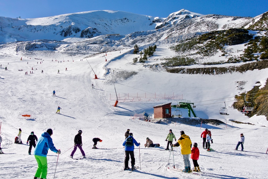
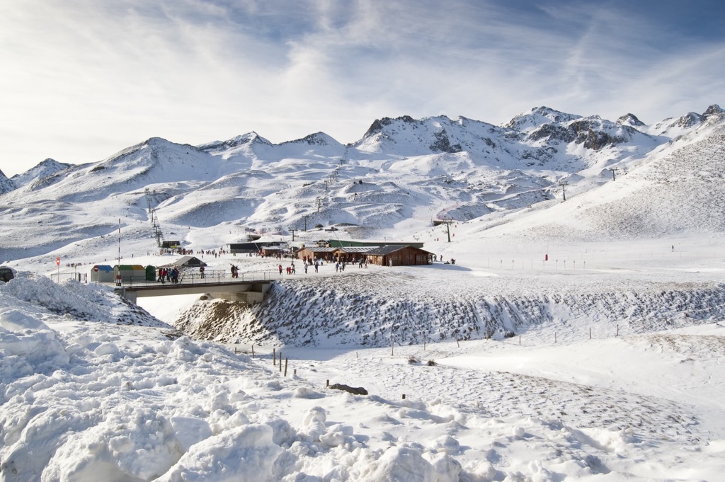
The Basque Country is not the first destination for skiing in Spain due to the fact that it has no major ski resorts. However, you can find at least a dozen of them in its neighboring regions, if you also consider the country within the boundaries of a greater cultural region. In particular, the ski major resorts are located in the regions of La Rioja to the south of Basque Country, Cantabria and Castilla y León to the west, but most of all in the Pyrenees in the region of Aragon, including the largest nearest resort Formigal.
La Rioja
Cantabria
Castilla y León
Aragon
Find more ski resorts in Spain and elsewhere in Europe and the world, including open and closed elevators in real time at World Mountain Lifts on PeakVisor.
Before or after hiking the Basque Mountains, visit one of the official tourist offices located in all major cities and towns, starting with the most famous Bilbao:
Bilbao-Bizkaia Tourist Office
Plaza Circular, 1, 48001, Bilbao, Basque Country, Spain
General opening hours: 9 am to 5 pm
+34944795760
informacion@bilbaoturismo.bilbao.eus
In Basque Country, you will find absolutely all kinds of accommodation from hostels in the city's centers to luxury hotels on the ocean's coast.
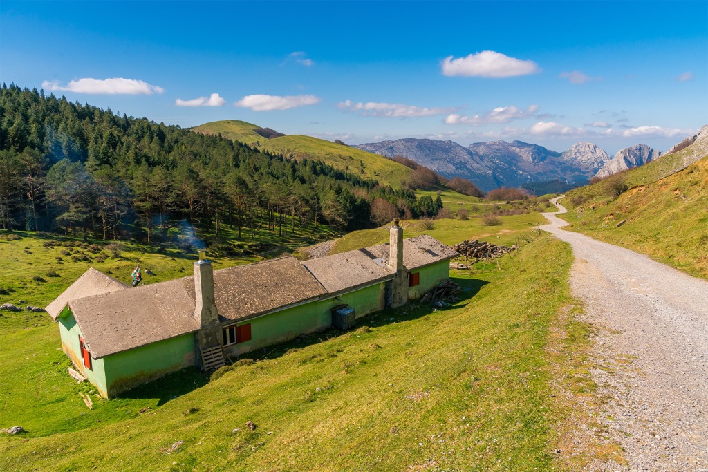
However, if we are talking about hiking, like everywhere, the main options are mountain huts (cabaña en la montaña, refugio) and bivouacs (vivacs). In my experience, the huts are ok, but some bivouacs look very harsh compared to those in the Dolomites and other regions of the Alps—many of them are literally four stone walls without insulation, so bring a warm sleeping bag with you.
The most popular lodging option on the Way of Saint James (Camino de Santiago) is the so-called "albergues" or the "pilgrim's hostels," where you can stay in a shared room (sometimes for 50–70 or even 100 people) for a small fee. You can find their list in special guidebooks.
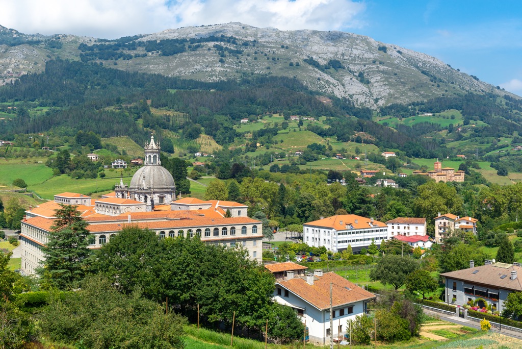
The main cities of the Basque Country are the capitals of the three constituent provinces: Álava— Vitoria-Gasteiz, Biscay—Bilbao, and Gipuzkoa—Donostia-San Sebastián.
Among other less obvious options for overnight stays and holidays on the coast, I would name Irun on the eastern borders of the region, which is easily accessible from the French part of the Basque Country (and vice versa); Zarautz, one of the local surfing capitals; and Mundaka in the aforementioned UNESCO reserve.
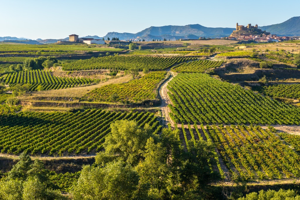
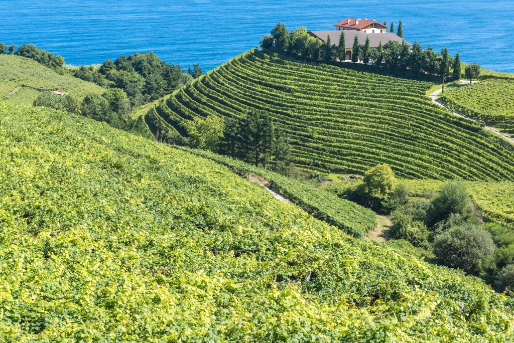
In general, the region is characterized by the fact that almost all the cities here are small except maybe Bilbao, so, at the same time, many of them are resorts with the only difference that on the coast you will find beaches and inland you can expect mountain settlements surrounded by pastures and wineries in the more flat part of the country.