
Scan the QR code and open PeakVisor on your phone
Pyrénées-Atlantiques is home to 1,038 named mountains. The highest is Pic Palas at 2,974 m.
Pyrénées-Atlantiques is one of the 101 departments of France, including its overseas territories. The main feature of the region is its geographical location in the southwest of the country between the Bay of Biscay of the Atlantic Ocean and the Pyrenees mountains, as well as belonging to the Basque Country, whose main and larger part is in Spain. All this makes the department a unique place in France and one of the few on the planet with such a combination of nature and culture. In other words, it is a must-hike. There are 1038 named mountains in Pyrénées-Atlantiques. Pic Palas (2,974 m / 9,757 ft) is the highest point. The most prominent mountain is Pic du Midi d'Ossau (2,884 m / 9,461 ft).
The name of the department consists of two words that describe its two main natural features: the Pyrenees Mountains at their western tip and the Bay of Biscay of the Atlantic Ocean.
The name of the range most likely comes from the Basque word “pyren”, which means the same— mountain. According to another version it is of Greek origin: from the name of the goddess Pyrene or from the word “πῦρ” (py:r), which means “fire”.
The name of the bay comes from the province of Biscay in the Spanish part of the Basque Country. In France, the bay is known as the Golfe de Gascogne, named after the historic province of Gascony, which is now the department of Pyrénées-Atlantiques. In turn, the word Biscay (Spanish: Vizcaya, Basque: Bizkaia) is a cognate of “bizkar” meaning “low ridge” or “prominence” in Basque language.
The department of Pyrénées-Atlantiques is one of the 12 administrative divisions of the French region Nouvelle-Aquitaine (New Aquitaine), one of the 18 in the country, including its overseas territories.
The department has an area of 7.645 sq km (2.952 sq mi), but all 101 similar units are roughly equal in size.
It is bordered on the north by the department of Landres (with the capital city Mont-de-Marsan), and on the east by Gers (Auch) and Hautes-Pyrénées (Tarbes) of the Occitania region. To the south, it is bordered by the Pyrenees Mountains, behind which are the Spanish regions of Navarre (the third part of the Basque Country as a cultural region) and Aragon.
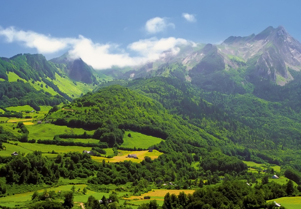
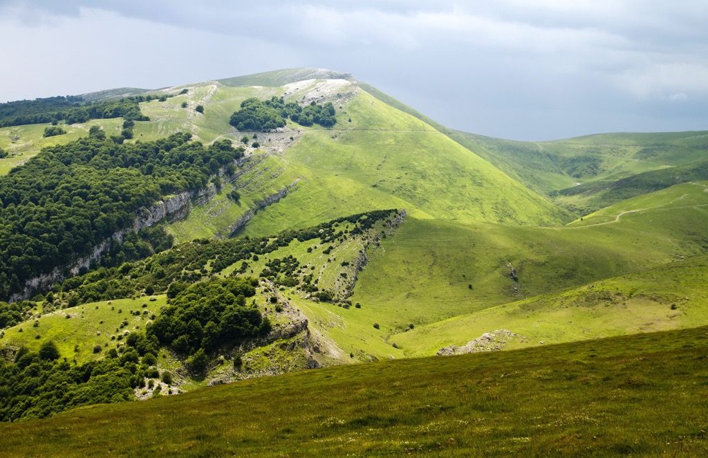
In terms of landscape, the department can be divided into five main parts, which is quite a lot for such a relatively small territory:
The human history of the department of Pyrénées-Atlantiques is as varied and perhaps even more interesting than its landscape.
For example, the current name of the department is relatively new and has not yet managed to stick in the minds of all the locals, let alone travelers. Historically, the area is known more as Gascony. It covers almost the entire region, going far north into the neighboring department of Landres. Gascony is known, among other things, as the birthplace of d'Artagnan, the main character in the book The Three Musketeers by the French writer Alexandre Dumas.
Then within the region, there are two historic regions with their own unique features: Béarn, with its capital in Pau, which is actually associated with Gascony; and the French Basque Country, which is also called the North Basque Country. More: the latter is also divided into three other historical provinces: Labourd (Bayonne / Baiona), Lower Navarre (Saint-Jean-Pied-de-Port) and Soule (Mauléon-Licharre). The name of the Basque Country in French is Pays Basque.

Accordingly, the French Basque Country is one of the three parts of this great cultural region located between the two countries, along with the autonomous communes of the Basque Country and Navarre in Spain. The essence of the region is the Basque language. At least that is how the Basques themselves delineate the borders of their state, which is what its name also means.
As a result, a trip to Pyrénées-Atlantiques is a trip to three countries at once, if not more: not quite the expected France different from Paris with mountains and ocean; the country of the unique European Basque peoples, who are considered the oldest inhabitants of this part of the world; and Spain as their modern home.
The mountains of Pyrénées-Atlantiques belong to the Pyrenees, one of the major mountain systems of Europe on a par with the Alps, the Apennines, the Scandinavian Mountains, the Ural Mountains, the Caucasus Mountains, and others. Its length is almost 500 km (310.6 mi), making it the top 100 longest mountain ranges in the world. No wonder that such a long system serves as a natural boundary between the two major European states: France and Spain. More: it includes the whole small country of Andorra.
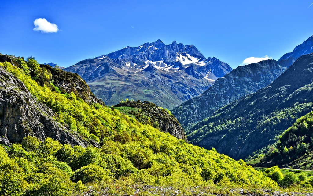
The mountains in the departmental territory begin almost immediately from the Atlantic Ocean where you can find the closest peaks to the shore: Elorrimendi (144 m / 472 f), Larreko Gurutzea (166 m / 544 ft), and Gaztelu Zahar (198 m / 649 ft), and then stretch southeastward covering nearly all of the Western Pyrenees, one of the three large parts of this system.
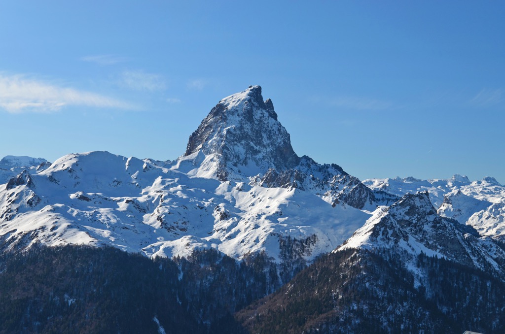
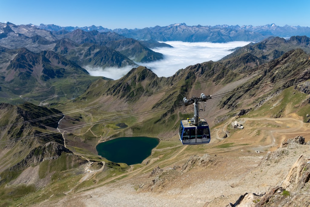
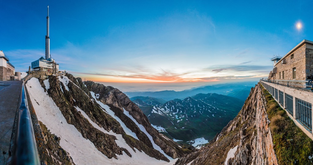
The cluster of peaks with the highest altitude in Pyrénées-Atlantiques is also located on the southeastern borders of the department on the border with Spain. Here are both the highest mountain Pic Palas (2,974 m / 9,757 ft) and the most prominent Pic du Midi d’Ossau (1,090 m / 3,576 ft), which is also the second highest (2,884 m / 9,461 ft). Both peaks are also on the list of “Top 50 Peaks of the Pyrenees”. Eight other highest mountains are located in the vicinity of these two.
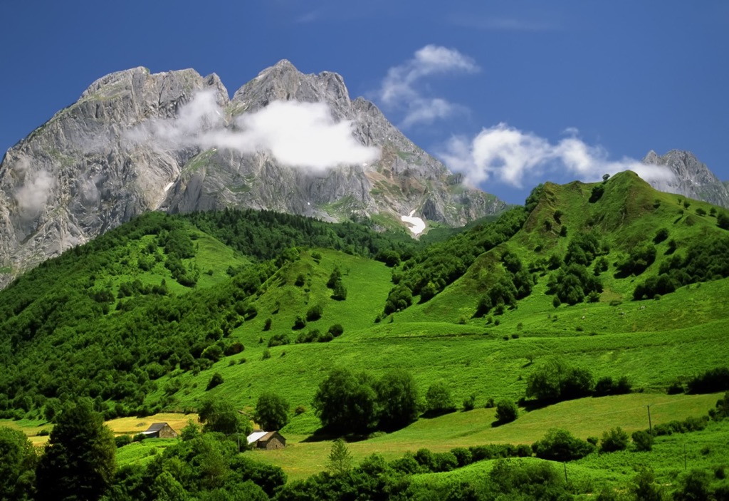
For those who want to visit the mountains of the region, but are not ready to go that far in the range, go to the heart of the French Basque Country. For example, around one of the main towns in this part of the Basque Country, Saint-Jean-Pied-du-Port, there are many low hills to climb to admire the typical landscape of the region: Pic d’Arradoy (660 m / 2,165 ft), Munhoa (1,021 m / 3,349 ft), Handiagamendi (639 m / 2,096 ft), and others.
However, the town is quite famous (I will explain why right away), so you will follow the example of many. For an even less touristy experience, I can recommend going to another smaller typical Basque village of Hélette, where I spent two months in the winter of 2014. It has relatively high Mont Baïgura (897 m / 2,943 ft), which can be climbed from the village in a couple of hours with the same purpose.
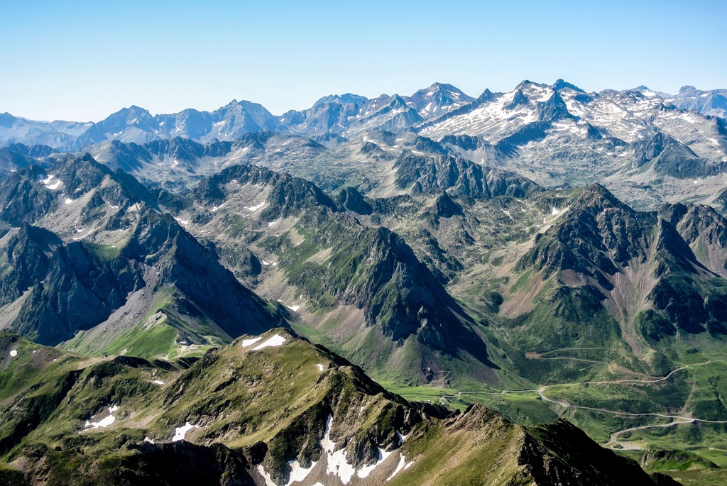
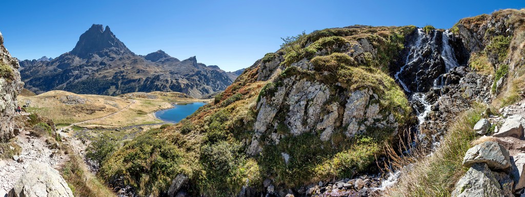
The main hiking areas in the Pyrénées-Atlantiques is the huge Pyrénées National Park (Parc national des Pyrénées), one of 11 French national parks, which covers the entire southwestern part of the department on the border with Spain. Its main and highest peaks are located in this park, also full of marked hiking trails.
At the borders of the region, on the Spanish side, there are also two Spanish natural areas: the large Valles Occidentales Nature Park (Parque natural de los Valles Occidentale—Western Valleys), located next to the aforementioned national park, and, if returning to the coast of the Atlantic Ocean—Aiako Harria Nature Park (Aiako Harria parke naturala, Parque natural Aiako Harria).
But in the department, you can find smaller natural areas that do not require serious preparation and planning before the hike.
The most famous long trail, which partly covers the Pyrénées-Atlantiques department, is undoubtedly the French Way of St. James (Camino de Santiago Francés), the world’s most popular pilgrimage hiking route, which you probably already know. To be precise, the route begins in Saint-Jean-Pied-du-Port.
The total distance to Santiago de Compostela in Spain is about 800 km (497 mi). You can walk it in 38–40 stages of about 20 km (12.4 mi) each. But you don’t need to walk it all, which is just incredible.
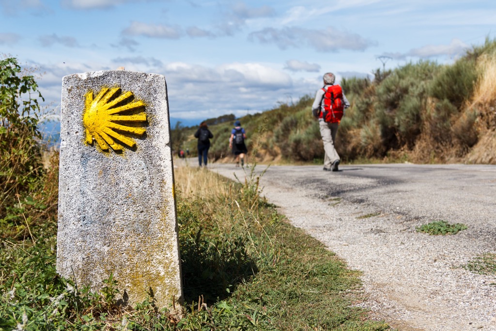
As the route starts in the Pyrenees, the very first three stages are the most beautiful (and challenging) on the route. On the first day, you go to the town of Roncesvalles in Spain across the namesake Roncesvalles Pass. On the second, across two more mountain passes—Alto de Mezquiriz and Alto de Erro to the village of Zubiri. On the third, following the river Arga, you reach the Basque capital city Pamplona, from where you can easily travel to other parts of Spain or back home.
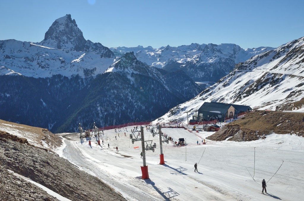
There are at least three large ski resorts in New Aquitaine region: Artouste with 31 ski slopes of 9.9 km (6.1 mi) and 11 ski lifts; La Pierre Saint Martin with 28 ski slopes of 16.4 km (10.1 mi) in total and 10 ski lifts; and Gourette (Eaux Bonnes) with 4 ski slopes of 3.8 km (2.3 mi) in total and 11 ski lifts.
Find more ski resorts in France and elsewhere in Europe and the world, including open and closed ski lifs and cable carts in real time at World Mountain Lifts on PeakVisor.
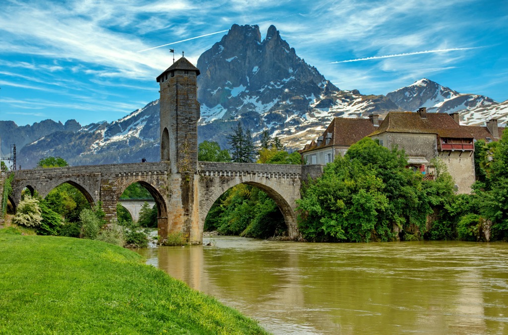
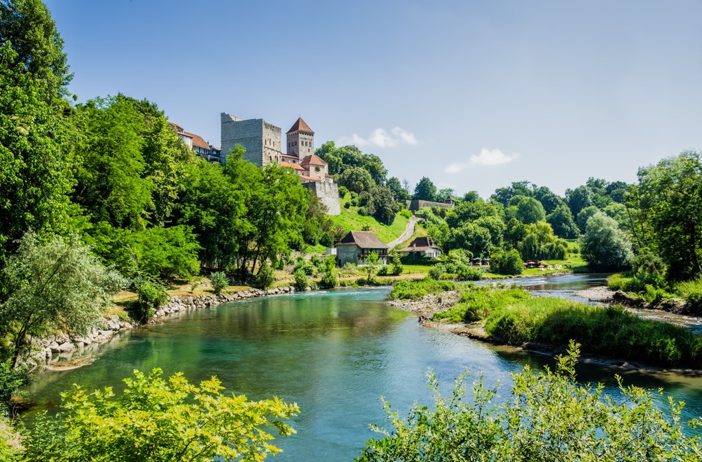
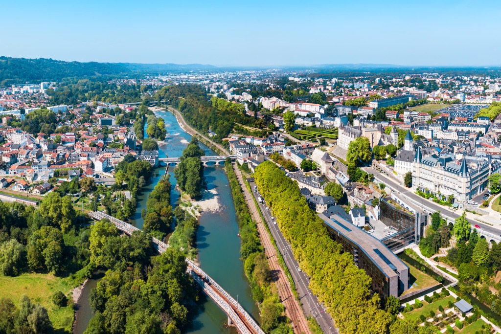
Before or after hiking in the mountains and other landscapes of the region, visit the official tourist office in one of its two main cities, Bayonne, capital of the French Basque Country, and Pau, capital of the historic region of Gascony:
Tourist Office of Bayonne
25 Pl. des Basques, 64100, Bayonne, France
+33559460900
Us.france.fr/en/biarritz-basque-country
Office de Tourisme Pau Pyrenees
Pl. Royale, 64000, Pau, France
+33559272708
In French Basque Country, you will find absolutely all kinds of accommodation from hostels in the city's centers to luxury hotels on the ocean's coast. However, if we are talking about hiking, like everywhere, the main options are mountain huts (refuge) and bivouacs.
For example, a few kilometers from the most prominent and the second-highest mountain in Pyrénées-Atlantiques, Pic du Midi d’Ossau, you will find Refuge Pombie, located at an altitude of 2,032 m (ft), which is owned by CAF de Pau (Club Alpin Francais—French Alpine Club of the city of Pau).
It is a small building with two floors but with 55 beds, including 15 beds in winter. It is open from June 1 to September 30 and on weekends in May and October when the weather is good, which, first of all, means no precipitation. It can be accessed by an easy trail from the nearest parking lot at the Col du Pourtalet pass (1,794 m / 5,886 ft) on the border point between France and Spain, where, however, nobody will check your documents, of about 4 km (m) long with an ascent of 700 m (2,296 ft).
Before and after the hike, I also recommend staying in one of the traditional houses somewhere in the middle of the French Basque Country, such as the "Santa Maria Helette" in the aforementioned village of Helette. It is the 13th-century Basque Manor House, "which noble families were present at Navarran coronations, fighting in wars, and constructing roads until the French revolution". Today, the house rents three separate apartments all year round. As part of local cultural association Soropila, during the summer season, the house hosts events including music concerts, readings, language courses, and more.
As in Europe as a whole, wild camping is not practiced, and in some places, it’s even illegal, which doesn’t stop you from pitching (and putting away early in the morning) your tent in any less-touristy place if the night catches you off guard and you need shelter.
As it has become clear, the main cities and resorts of the region are Pau and Bayonne, which are also two capitals of the two main parts of Pyrénées-Atlantiques.
In addition to these towns, among the main and most interesting I would also include Saint-Jean-de-Luz on the shores of the Bay of Biscay, west of the more famous and popular Biarritz; Irun a little further in Spain, to visit which you only need to cross the invisible border; and the surroundings of the capital Pau, full of unexplored settlements by travelers: Serres-Castet, Morlaàs, Monein, Lasseube, and others.
If you head a little further east beyond the region's border you will find yourself back in another famous town, Lourdes. It's known for the Sanctuaries Notre-Dame de Lourdes, an important Catholic pilgrimage site. Each year, millions of people visit the place where in 1858, as it is believed, the Virgin Mary appeared to a local woman.


Yes. Pyrénées-Atlantiques has 1,038 named mountains. The highest is Pic Palas at 2,974 m.
The highest mountain in Pyrénées-Atlantiques is Pic Palas, at 2,974 m.
Pyrénées-Atlantiques has 1,038 named mountains.


