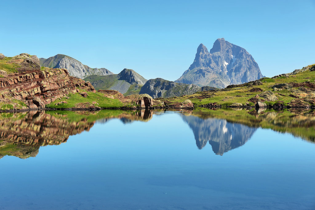
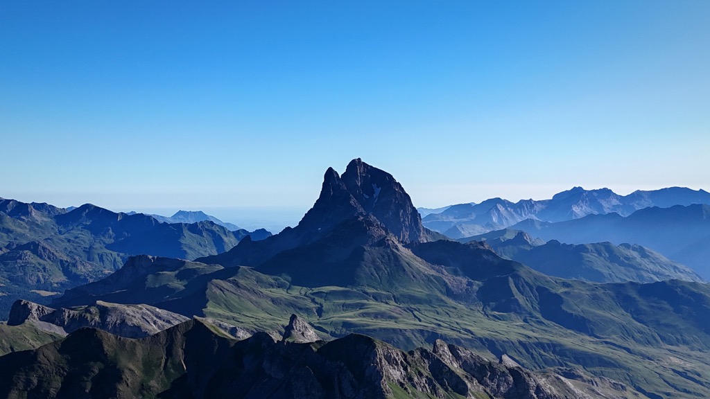
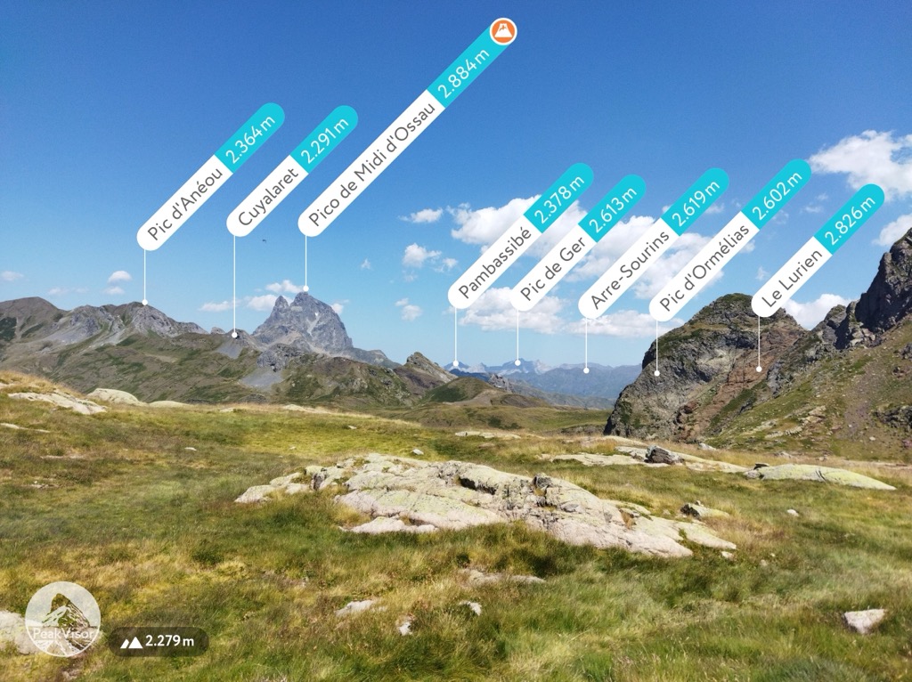
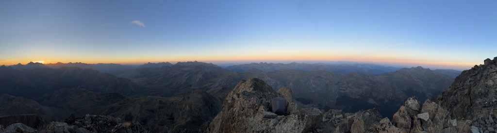
The Pic du Midi d'Ossau (French pronunciation: [pik dy midi dɔso]; Occitan: Pic de Mieidia d'Aussau; 2,884 m) is a mountain rising above the Ossau Valley in the French Pyrenees. Despite possessing neither a glacier nor, in the context of the range, a particularly high summit, its distinctive shape makes it a symbol of the French side of the Pyrenees. This familiar shape also makes it easily recognisable from afar, and it is particularly distinctive from the Boulevard des Pyrénées in Pau, some 55 km to the north.
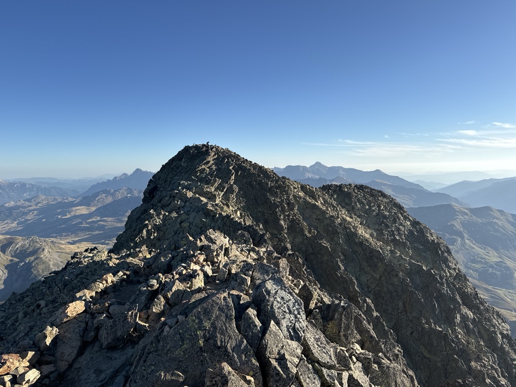
There's an alpine trail (T4) leading to the summit.
The nearest mountain hut is Refuge de Pombie located 1 243m/4 077ft SE of the summit.
By elevation Pic du Midi d'Ossau is
# 81 out of 413 in Parc national des Pyrénées Occidentales (cœur) # 2 out of 2688 in New Aquitaine # 2 out of 1032 in Pyrénées-Atlantiques
By prominence Pic du Midi d'Ossau is
# 7 out of 18724 in the Pyrenees # 1 out of 413 in Parc national des Pyrénées Occidentales (cœur) # 39 out of 35442 in France # 1 out of 2688 in New Aquitaine # 1 out of 1032 in Pyrénées-Atlantiques
We use GPS information embedded into the photo when it is available.
3D mountains overlay
Adjust mountain panorama to perfectly match your photos because recorded by camera photo position might be imprecise.
Move tool
Rotate tool
Zoom
More customization
Choose which peak labels should make into the final photo and what photo title should be.
Next
Photo Location
Satellitte
Flat map
Relief map
Latitude
Longitude
Altitude
OR
Latitude
°'''
Longitude
°'''
Apply
Register Peak
Peak Name
Latitude
Longitude
Altitude
Register
Teleport
PeakVisor
This 3D model of Sagarmatha National Park in Nepal was made using the PeakVisor app topographic data. The mobile app features higher precision models worldwide, more topographic details, and works offline. Download PeakVisor maps today.
Download OBJ model
PeakVisor
The download should start shortly. If you find it useful please consider supporting the PeakVisor app.
PeakVisor for iOS and Android
Be a superhero of outdoor navigation with state-of-the-art 3D maps and mountain identification in the palm of your hand!