
Scan the QR code and open PeakVisor on your phone
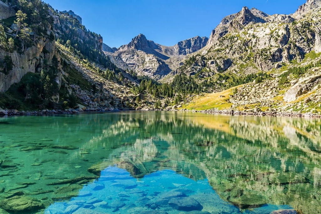
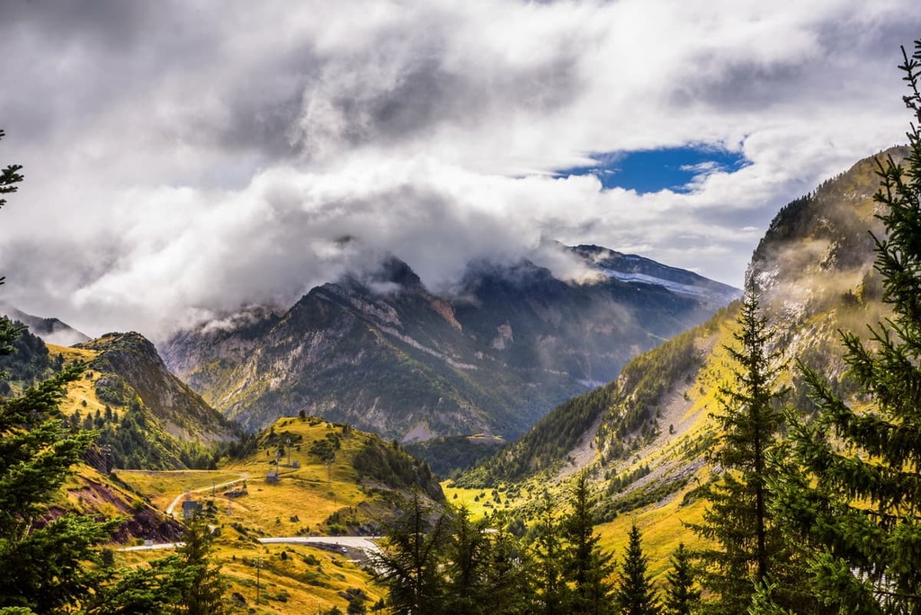
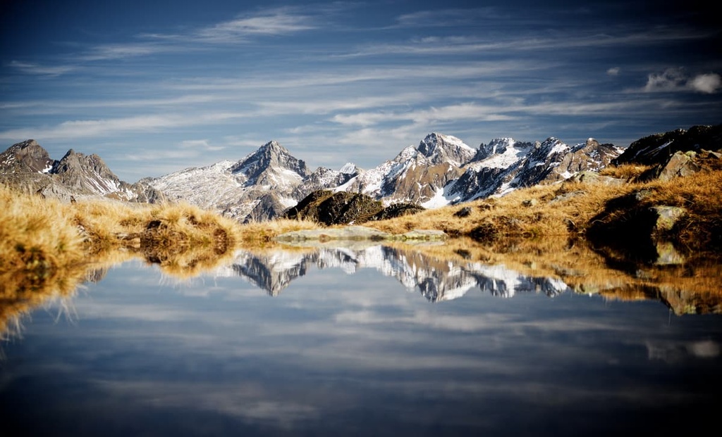
Home to the highest waterfall in France and the finest mountains in the French Pyrenees, Pyrénées National Park is a must-visit destination for keen adventurers. There are 413 named mountains in Pyrénées National Park (Parc National des Pyrénées). Vignemale (3,298 m/10,820 ft) is the highest mountain in the park while the most prominent mountain is Pic du Midi d'Ossau (2,884 m/9,462 ft).
Stretching for 100 km (62 mi) along the Franco-Spanish border is Pyrénées National Park. The park’s core covers an area of 457 sq. km (176.5 sq. mi) and there is an additional 2,000 sq. km (772 sq. mi) adhesion zone that borders it to the north. It’s located entirely within the French departments of Hautes-Pyrénées and Pyrénées-Atlantiques.
Pyrénées National Park centers around the Western Pyrenees, which is part of the Pyrenees mountain range. The Pyrenees are a 430-km (270 mi) long flat-topped mountain chain that forms a natural border between France and Spain. It runs from the Mediterranean Sea in the east to the Cantabrian Mountains near the Bay of Biscay to the west.
Pyrénées National Park is the French counterpart of Spain’s Ordesa y Monte Perdido National Park (Parque Nacional de Ordesa y Monte Perdido).
Six valleys define the landscape of Pyrénées National Park. From east to west, these valleys are:
Each of these valleys has unique features that make them noteworthy. The Aure Valley, which is part of the Néouvielle National Nature Reserve (Réserve Naturelle Nationale du Néouvielle), is home to the highest pine forest in Europe, which is located at an elevation of around 2,600 m (8,530 ft).
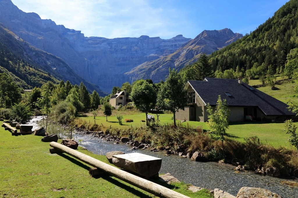
The Luz-Gavarnie Valley covers an area of 23 sq. km (14 sq. mi) along the Franco-Spanish border and is known for its limestone cirques.
The most famous cirque in the Luz-Gavarnie Valley is the Cirque de Gavarnie. This cirque boasts some of the highest limestone cliffs in Europe, many of which reach heights of 1,500 m (4,921 ft). The Cirque de Gavarnie also features La Grande Cascade de Gavarnie, the highest waterfall in mainland France with a drop of 423 m (1,388 ft).
Near the Luz-Gavarnie Valley, you can find the Cauterets Valley. The Cauterets Valley culminates in Vignemale (3,298 m/10,820 ft), the highest mountain in the French Pyrenees.
Equally impressive is the Azun Valley, which is technically three valleys: Arrens-Marsous, Estaing, and Ouzom. The Azun Valley is varied, as it contains everything from the jagged Pic du Balaïtous (3,146 m/10,322 ft) to lush rolling pastures.
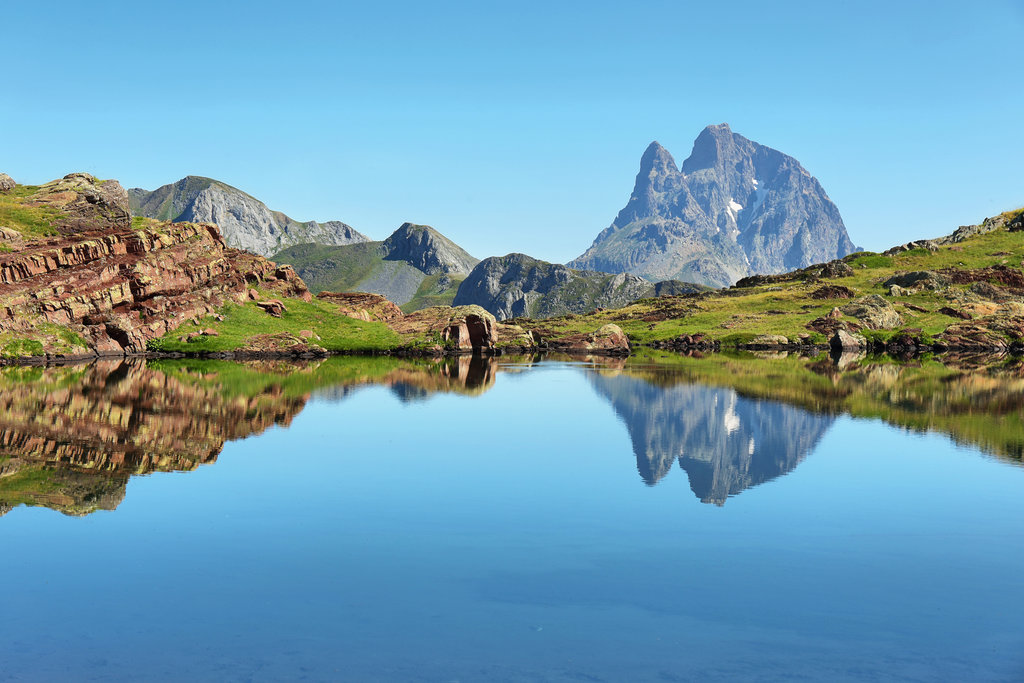
At the park's western end is the 50-km (31 mi) long Ossau Valley, which is one of the only areas of the Pyrenees with brown bears. Here, hikers will find one of the park's most fascinating mountains, the ancient extinct volcano of Pic du Midi d'Ossau (2,884 m/9,462 ft). Thanks to its distinctive pyramidal summits, Pic du Midi d'Ossau is considered to be a symbol of the French Pyrenees.
Finally, the westernmost valley of the Pyrenees, the Aspe Valley, is famed for its dense forests. The valley is also a stop along the Santiago de Compostela pilgrimage route. It's one of the most populated valleys of the park, as many shepherds occupy the valley's pastures in the summer months.
Pyrénées National Park shares a 15 km (9.3 mi) long border with its Spanish sibling Ordesa y Monte Perdido National Park. It also shares a 30 km (18.6 mi) border with Spain's Western Valleys Natural Park (Parque Natural de los Valles Occidentales).
Located approximately 15 km (9.3 mi) to the southeast of Pyrénées National Park across the Franco-Spanish border is Posets-Maladeta Natural Park (Parque Natural Posets Maladeta).
Meanwhile, around 40 km (25 mi) to the east of Pyrénées National Park on the French side of the border is the Regional Natural Park of the Ariège Pyrenees (Parc Naturel Régional des Pyrénées Ariégeoises).
Numerous small villages, spa towns, and ski resorts can be found across Pyrénées National Park. Notable examples include Cauterets, Argelès-Gazost, Saint-Lary-Soulan, and Barèges.
The town of Lourdes, home to the famed pilgrimage site, the Sanctuary of Our Lady of Lourdes, is located approximately 10 km (6.2 mi) to the north of the park. Nearby cities within 30 km (18.5 mi) of Pyrénées National Park include Pau, which is a prefecture of Pyrénées-Atlantiques, and Tarbes, which is a prefecture of Hautes-Pyrénées.
The Pyrenees are unique compared to many of Europe's other major mountain ranges, such as the Alps, as they formed from the geological renewal of an older range.
The Variscan Orogeny was a mountain-building event that occurred between the late Devonian period and early Permian period (370 to 290 million years ago). This orogeny created the Hercynian mountain belt, laying down the folded foundations of the modern Pyrenees.
Over the next several million years, the Pyrenees region of the Hercynian range was eroded and submerged beneath an unstable area of the Earth's crust.
This area of unstable Earth's crust was active around 225 million years ago, folding sediment over a granite base to create pre-Pyrenean ridges, which are now some of the highest spurs in the range.
Pressure and heat from the Earth's crust turned sediment from the Hercynian range into igneous rocks, primarily plutonic granites and metamorphic gneisses. These granites and gneisses now form the heart of the Western Pyrenees. Meanwhile, limestones and sandstones are more common on the surface of the range to the north and south.

The collision of the Iberian and European tectonic plates created the Pyrenees between 100 million to 66 million years ago. However, most of the major mountains in the range were formed later, between 56 million and 23 million years ago. Furthermore, glacial erosion shaped the modern north to south trend of the valleys within the Pyrenees.
Today, Pyrénées National Park is home to many of the highest and most prominent summits in the Pyrenees. In particular, it contains over 50 peaks that exceed 3,000 m (9,842 ft) in elevation.
Aside from those previously mentioned, notable summits in Pyrénées National Park include Pic Long (3,192 m/10,472 ft), Pic du Taillon (3,144 m/10,315 ft), and Pic du Midi de Bigorre (2,877 m/9,439 ft).
Despite its unforgiving appearance, Pyrénées National Park is one of the most biodiverse areas of France. Read on to find out more about Pyrénées National Park's wildlife and its incredible landscapes.
Pyrénées National Park is home to 4,000 animal species. Of these species, approximately 250 are vertebrates and 40 species are endemic to the region.
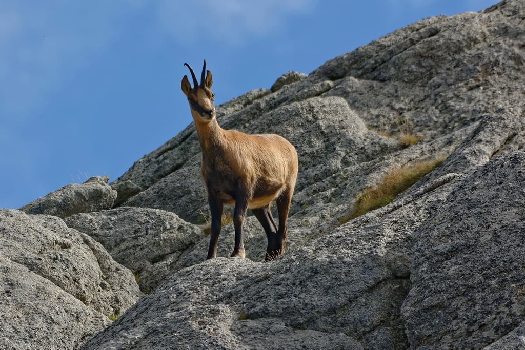
Notable mammal species in the park include Pyrenean chamois, Iberian ibex, and stoats. The Pyrenees are one of the last strongholds for brown bears in southern Europe. There are thought to be just over 40 brown bears left in the Pyrenees, around four of which live in Pyrénées National Park.
Marmots, which disappeared from the Pyrenees at the end of the last glacial period approximately 15,000 years ago, were successfully reintroduced to the park in 1948 and are now found in all its major valleys.
One of the rarest sights in the park's waterways is the endangered rat-like Pyrenean desman, whose range in France has decreased by 50 percent over the last 30 years.
The high mountain slopes of the Western Pyrenees provide refuge for a number of rare bird species. In the forested valleys, hikers may hear the distinctive call of the capercaillie or a black woodpecker boring into a beech tree. Overhead, bearded vultures, Egyptian vultures, and short-toed eagles ride warm wind currents.
Numerous amphibian and lizard species inhabit the valleys and rivers of Pyrénées National Park. Prominent species include Pyrenean mountain lizards, midwife toads, and Pyrenean brook salamanders.
Of the thousands of insect species found within Pyrénées National Park, important specimens include Apollo butterflies, Gavarnie blue butterflies, and rosalia longicorns.

The flora of the Pyrenees is highly diverse. In the park, you can find over 2,500 plant species, which account for 40 percent of the plant species in metropolitan France. Approximately 160 of these plant species are endemic to the range.
Forests cover roughly 63 sq. km (24.3 sq. mi) of the park’s core. Oak and chestnut forests dominate the landscape at elevations below 900 m (2,952 ft) before giving way to Scots pines and beeches.
At subalpine levels above 1,600 m (5,249 ft), the forests aren't as dense and they consist of mountain pines, firs, and mountain ash. Between 2,300 m (7,546 ft) to 2,700 m (8,858 ft), the only trees in the park are dwarf willows interspersed between alpine moorlands.
Of the flowers and plants found in Pyrénées National Park, some of the rare and endemic species include Pyrenean violets, English iris, Pyrenean lilies, and Pyrenean pheasant's eyes.

The earliest evidence of human occupation of the Western Pyrenees dates back around 7,000 to 8,000 years. Several of the region's valleys, including the Marcadau Valley (Vallée du Marcadau) and Ossau Valley, are home to ancient dolmens and cromlechs.
During the Roman occupation of France between the first century BCE and the fifth century CE, Romans discovered the thermal springs around modern-day Cauterets and Bagnères-de-Bigorre, which had therapeutic uses. This tradition of hydrotherapy carried on through to the nineteenth and twentieth centuries and is still popular today.
Several civilizations have inhabited the Pyrenees over the past two thousand years and continue to do so today, including Andorrans, Catalans, and Basques. Each of these cultures has left its mark on the region, helping shape the unique traditions of the Pyrenean people.
The unique experience of the Pyrenees has given way to the idea of Pyreneism. Coined in the seventeenth century by author Henri Beraldi, Pyreneism is a concept that suggests the physical experience of the Pyrenees is inseparable from its historical, cultural, and scientific significance. For example, Pic du Midi d'Ossau (2,884 m/9,462 ft), is emblematic of the park and shares all the qualities of Pyreneism.
Farming and agriculture form the basis of much of the human history of Pyrénées National Park. The park's rich biodiversity means many villages in the region have been able to create cured meats and cheeses that are completely unique from what you’d find in the rest of France and Spain.
The Western Pyrenees is one the few places where Occitan, an ancient Romance language, is still spoken. It's especially common in the Aran Valley, where locals speak a dialect called Aranese. There's a strong Occitan oral tradition in Pyrénées National Park, and the area is home to myths and legends like “Le serpent d'Isaby” and “La légende de Pyrène.”
Pyrénées National Park was established in 1969, making it one of the oldest national parks in France. The eastern portion of the park was put on the UNESCO World Heritage List in 1997.
Pyrénées National Park is harsh and unforgiving, with most mountain climbs only suitable for expert mountaineers.
Hikers should note that snow completely covers the park most years between November and May. Snowshoes make short hikes possible, but long mountain hikes are usually not possible at this time of year. Skiing is the best way to get around in the winter months, but doing so requires a lot of experience with backcountry skiing and avalanche risk management.
Anyone planning a hike in Pyrénées National Park should carefully map out their route, including the location of refuges. Bring along appropriate hiking gear, GPS trackers, topographic maps, and plenty of food and water. Hikers should also inform others of their planned itinerary and consult weather reports before setting off.
There are several visitor centers in major settlements across the park, including Laruns, Tarbes, Cauterets, and Gavarnie. Additional information about these visitor centers can be found on the park's website. as can a selection of downloadable informational leaflets.
Trails within Pyrénées National Park are rated according to the Swiss Alpine Club (SAC)'s hiking scale.
Read on to find out more about some of the best hiking areas in Pyrénées National Park.
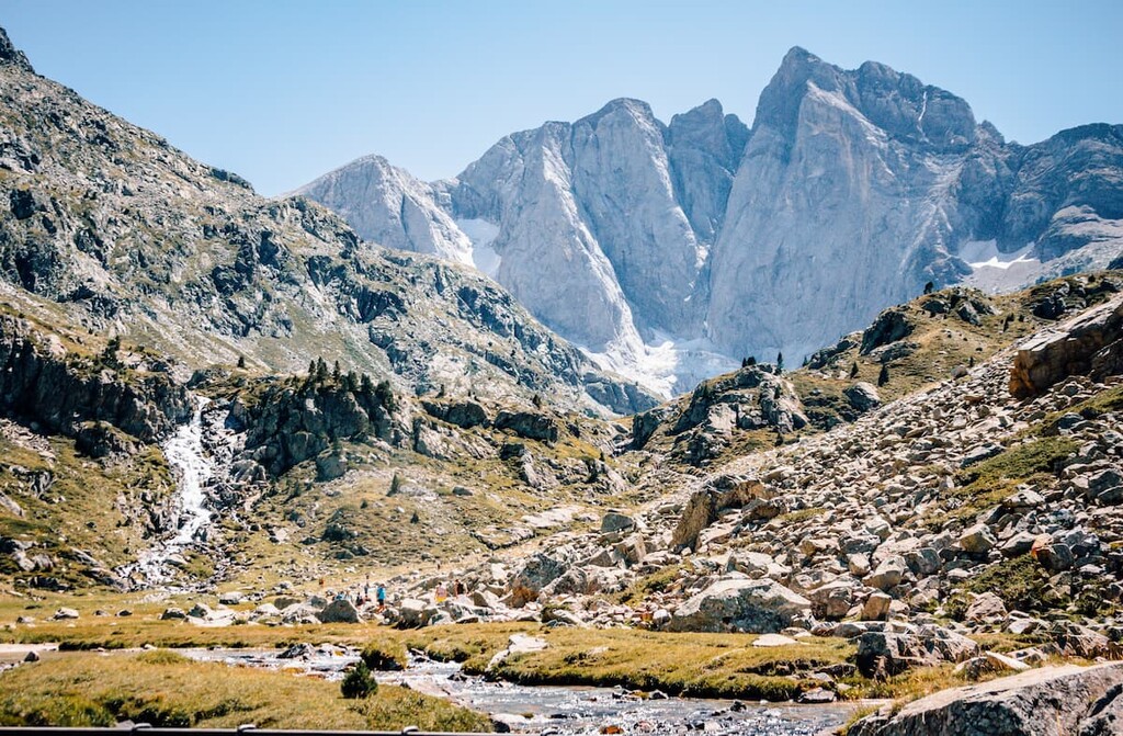
Straddling the border between Spain and France is the Vignemale massif. It's home to the Vignemale (3,298 m/10,820 ft), the highest summit in the French Pyrenees and one of the ten highest summits in the entire Pyrenees range. The main summit of the massif is sometimes referred to as Grand Vignemale or Pique Longue.
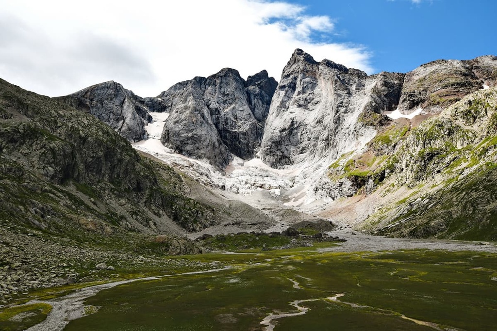
The Vignemale massif forms a semi-circle that’s flanked by lower peaks, including Pointe Chausenque (3,204 m/10,512 ft), Piton Carré (3,197 m/10,489 ft), and Petit Vignemale (3,032 m/10,489 ft). The U-shaped Glacier d'Ossoue, the second largest glacier in the Pyrenees, encircles the Vignemale massif.
Vignemale is one of the most famous summits in the Pyrenees, due partly to the adventures of the explorer Count Henry Russell. Russell was fascinated by Vignemale, and he spent many nights in numerous caves on its slopes between 1881 and 1893. The first officially documented ascent of Vignemale was made by English landowner and diarist Anne Lister and her three guides in 1838.
The North Face of Vignemale is one of the most dramatic cliff faces in the French Pyrenees, and it requires immense skill to scale. Located on a small plateau just below the summit to the north is the picturesque Refuge des Oulettes de Gaube (2,151 m/7,057 ft).
Scaling the summit of Vignemale is hugely challenging and requires lots of commitment and preparation. The T4 voie normale (normal route) to ascend Vignemale starts from the Refuge de Bayssellance (2,651 m/8,697 ft), and it takes approximately 6 hours round trip to complete depending on the weather conditions.
The Pic du Midi d'Ossau (2,884 m/9,462 ft) towers over the Ossau Valley and is one of the French Pyrenees' most iconic mountains. The mountain is easy to spot from far away, and it’s even visible from the Boulevard des Pyrénées in Pau, some 55 km (34 mi) to the north.
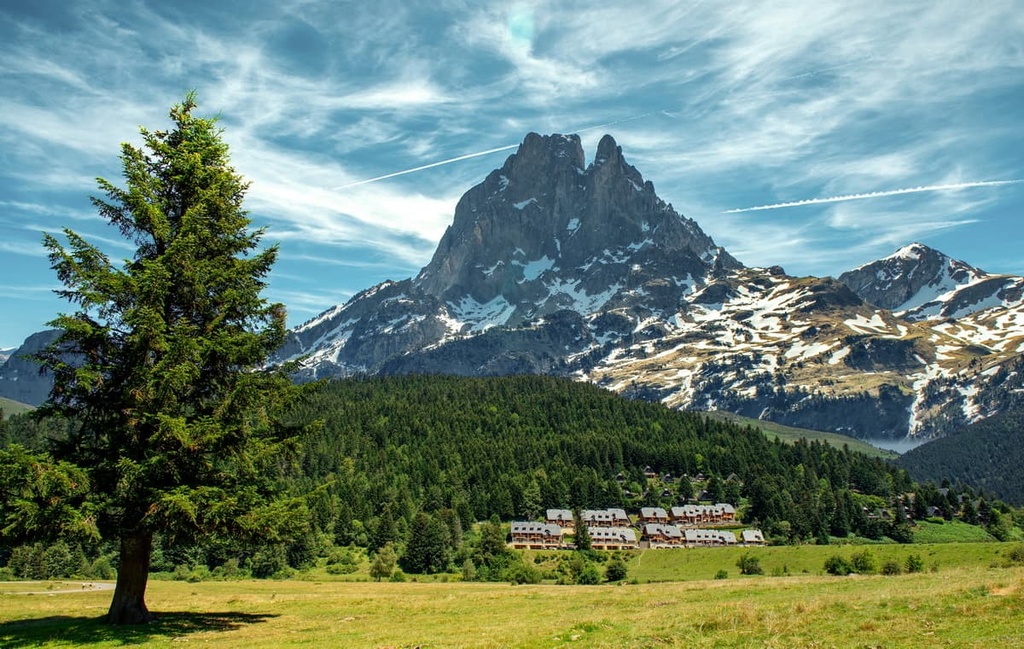
Pic du Midi d'Ossau is actually the remnants of an ancient volcano, the Volcan d'Ossau, which formed over 285 million years ago. The first attempts to scale the mountain’s highest summit were made in 1582 and 1591. Pic du Midi d'Ossau's summit cairn was built in 1787.
With a prominence of over 1,000 m (3,280 ft), Pic du Midi d'Ossau is a truly imposing and challenging mountain. Hikes to its summit shouldn't be undertaken lightly.
The voie normale to ascend Pic du Midi d'Ossau is via the Refuge de Pombie (2,032 m/6,667 ft). This route involves a II+ rock climb, as graded by the International Climbing and Mountaineering Federation (UIAA). This route takes most of a day to complete depending on a hiker's rock-climbing ability.
The Cirque de Gavarnie is a must-visit destination for tourists and hikers in Pyrénées National Park. The cirque is sublime as it features sheer cliffs that rise up to 1,500 m (4,900 ft) above the valley floor. French novelist Victor Hugo once described it as “the Colosseum of nature.”
The Cirque de Gavarnie is home to the Grande Cascade de Gavarnie, the highest waterfall on the French mainland at 423 m (1,388 ft).

One of the most popular ways to experience the Cirque de Gavarnie is via a 13 km (8 mi) loop trail from the Hôtel du Cirque de Gavarnie. Note that while this hike isn't a mountain trek, it’s strenuous and is unsuitable for young children.
Alternatively, you can plan a hike to the Pic du Taillon (3,144 m/10,315 ft) if you'd prefer to view the Cirque de Gavarnie from above. Taillon is popular as it's considered the easiest of the 3,000ers surrounding the Cirque du Gavarnie to climb. Additionally, while steep in places, Taillon isn't a technical climb.
The best way to climb Taillon is from the Refuge des Sarradets (2,587 m/8,487 ft). The walk to the summit takes less than two hours to complete from the refuge.
The views from the Pic du Taillon are breathtaking. From the top, the Cirque de Gavarnie, Monte Perdido (3,355 m/11,007 ft), Pic du Midi de Bigorre (2,877 m/9,439 ft), and the Néouvielle massif all visible on a clear day.
Néouvielle National Nature Reserve (Réserve Naturelle Nationale du Néouvielle) is a 23 sq. km (8.8 sq. mi) nature reserve located in the northwest of Pyrénées National Park.
It's famous for its biodiversity and it is home to the northern half of the Néouvielle massif, which is known as the Néouvielle Group. The Néouvielle Group is a collection of glaciated granite peaks culminating in Pic de Néouvielle (3,091 m/10,141 ft).

Due to its challenging ascent and beautiful panoramas, Pic de Néouvielle is one of Pyrénées National Park's most popular mountains.
While not quite as high as nearby Pic Long (3,192 m/1,0472 ft), Pic de Néouvielle is much easier to scale. That said, the ascent of Pic de Néouvielle is still confusing in places, and a high level of hiking experience is needed for the climb.
The voie normale to scale Pic de Néouvielle starts from Lac d'Aubert. This T3 out and back route is approximately 7.5 km (4.6 mi) long and takes roughly 3 and 30 minutes to complete.
The summit of Pic de Néouvielle affords panoramas of neighboring peaks, including Trois Conseillers (3,039 m/9,970 ft) and Turon de Néouvielle (3,035 m/9,957 ft), as well as Pic Long-Campbieil group to the south.
Located just outside Néouvielle National Nature Reserve is the southern half of the Néouvielle Massif, which is known as the Pic Long-Campbieil Group.
The highest summit in the group, Pic Long (3,192 m/10,472 ft), is considered legendary among hikers in the region due to its tremendous difficulty. Pic Long's easiest route is a T6 trail that features grade II and II+ rock climbs. Pic Long is widely considered one of the hardest mountains to scale in the entire Pyrenees.
Its traditional voie normale no longer exists as it used to lead over a glacier that has shrunk over time. Today, the most popular approaches to the summit are from the southeast ridge of Pic Badet (3,160m/10,367 ft) and the northeast ridge at Dent D' Estibère Male (3,017 m/9,898 ft)
The group's secondary summit, Campbieil (3,173m/10,410 ft), is a much easier climb. It's one of the most popular mountains in the Néouvielle Massif, perhaps only surpassed by Pic de Néouvielle.
Campbieil's voie normale starts from the Lac de Cap-de-Long trailhead. This out-and-back T2 trail is approximately 8 km (5 mi) in length and takes around 4 hours to complete. The view from atop Campbieil is one of the finest in the massif, as it provides vistas of Pic Long to the northwest.
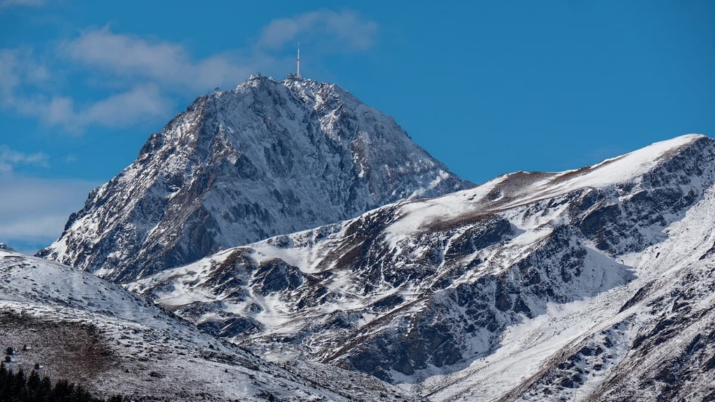
Located in Pyrénées National Park's adhesion zone is the famed Pic du Midi de Bigorre (2,877 m/9,439 ft).
This evocative mountain is known for being home to the Pic du Midi Observatory, one of the highest observatories in Europe. Pic du Midi de Bigorre is also an International Dark Sky Reserve, so tourists often stick around on the peak until nightfall to appreciate one of the finest starry nights in France.
A cable car leads to the Pic du Midi Observatory from La Mongie ski resort, but hiking to the summit is a much more rewarding experience. There are several popular ways of scaling Pic du Midi de Bigorre, including from the Lesponne Valley (Vallée de Lesponne) and La Monge ski resort.
Probably the best way to climb Pic du Midi de Bigorre is from the famous Col du Tourmalet, which is used during the Tour de France. This hike is approximately 15 km (9.3 mi) long and takes roughly 6 hours to complete.
The views from atop Pic du Midi de Bigorre are breathtaking. At the summit, you can check out the mountains’ glass viewing platforms, which afford visitors views of areas that are up to 300 km (186.4 mi) away across the Pyrenees.
Home to postcard-perfect ski resorts and villages with sublime mountain vistas, Pyrénées National Park is an idyllic vacation destination. Read on to learn about some of the best towns and villages in Pyrénées National Park.
Hikers looking to explore a city during their visit to Pyrénées National Park should consider Pau. Located 45 km (28 mi) north of the park, Pau is the cultural center of the Pyrénées-Atlantiques and is famous for its views of the Pyrenees.
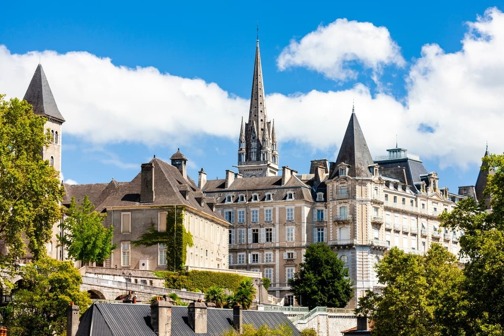
During your stay in Pau, be sure to stroll down the Boulevard des Pyrénées and enjoy views of Pic du Midi d'Ossau. Or, take a tour of the historic Château de Pau, where King Henry IV was born. Popular hotels in Pau include Quality Hotel Pau Centre Bosquet, Hotel de Gramont, and Hôtel Le Roncevaux.
Lourdes is one of the most famous towns in the Pyrenees. Situated 15 km (9.3 mi) to the north of Pyrénées National Park, Lourdes is known for its association with the Sanctuary of Our Lady of Lourdes, one of the world's most famous pilgrimage sites.
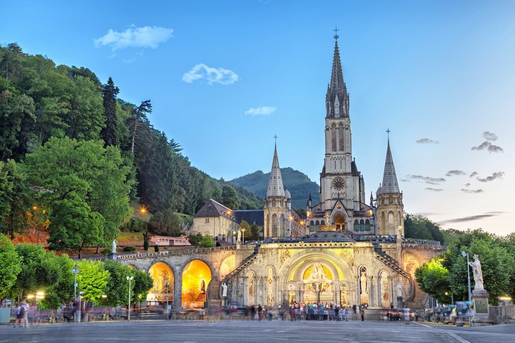
On top of its religious significance, Lourdes is home to many historic buildings. The best of them is the historic hilltop Château Fort de Lourdes, which dates back to the eleventh century. Popular hotels in Lourdes include Hôtel Paradis and Hôtel Saint Etienne.
Pyrénées National Park boasts several world-class ski resorts, and Cauterets is one of the finest. This picturesque alpine town is known for its chilly microclimate, which makes it one of the snowiest resorts in the world. The town has a unique personality, as many of the village's hotels were built during the “Belle Époque.”
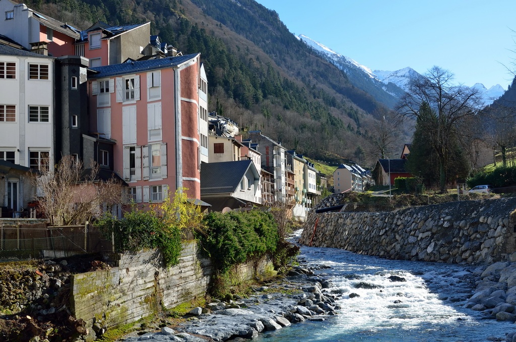
When not skiing, visitors to Cauterets will want to hike through the magical Pont D'Espagne, which features snowy pine forests and frozen waterfalls. After a day out in the cold, visitors can relax and warm up at the Les Bains du Rocher spa. Popular hotels in Cauterets include Hôtel-Résidence Le Lys and Hôtel Le Bois Joli.
Resting on Pyrénées National Park's eastern boundary is Saint-Lary-Soulan. Saint-Lary-Soulan is one of the largest ski resorts in Europe, with over 100 km (62 mi) of downhill slopes to enjoy.
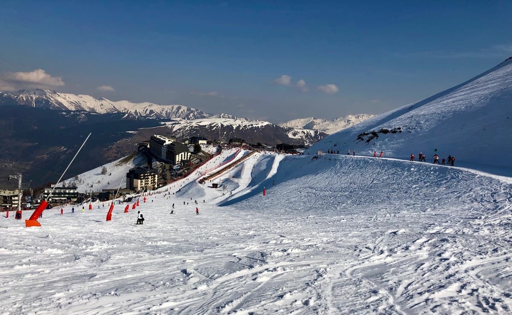
Saint-Lary-Soulan is also ideally placed to explore the best of the Néouvielle National Nature Reserve. Popular hotels in Saint-Lary-Soulan include Hôtel Mir and Hôtel Les Arches.
The tiny village of Barèges is the perfect base for discovering Pyrénées National Park. Barèges is located on the north edge of the Néouvielle National Nature Reserve and is situated less than 10 km (6 mi) away from Pic du Midi de Bigorre (2,877 m/9,439 ft).
Keen cyclists won't want to miss out on visiting Barèges. The town sits at the foot of the Col du Tourmalet, one of the highest mountain passes in the French Pyrenees and a famous stage on the Tour de France. Popular hotels in Barèges include Hôtel Alphée and Hôtel La Montagne Fleurie.
Hikers who can't get enough of the stunning Cirque de Gavarnie should book a place to stay in Gavarnie-Gèdre. Located less than 10 km (6 mi) from the Cirque de Gavarnie, Gavarnie-Gèdre is perfect for hikers planning to visit the Grande Cascade de Gavarnie or for anyone who wants to scale Taillon (3,144 m/10,315 ft).

Gavarnie-Gèdre also provides great access to Roland's Breach (La Brèche de Roland). Located at an elevation of 2804 m (9,199 ft), Roland’s Breach is a 40 m (131 ft) wide gap in the Pyrenees that’s one of the most popular hiking destinations in Ordesa y Monte Perdido National Park.
Popular hotels in Gavarnie include Hôtel Restaurant La Brèche De Roland and Le Campbieilh.


