
Scan the QR code and open PeakVisor on your phone
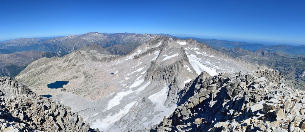
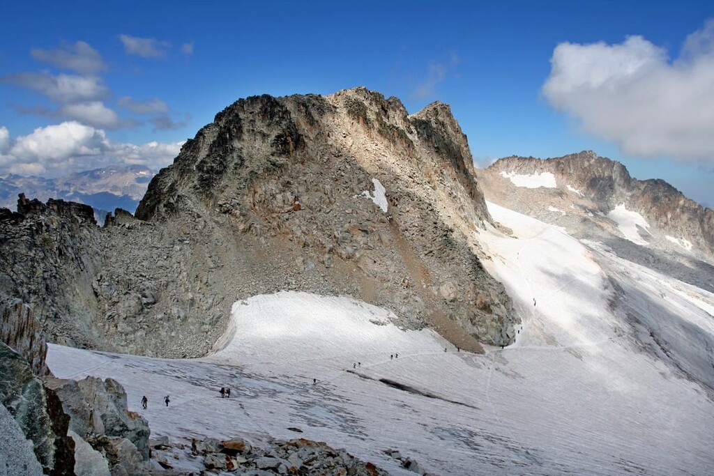
Nestled in northeastern Spain, Posets-Maladeta Natural Park (Parque nacional de Posets-Maladeta) is a stunning outdoor recreation destination known for its abundance of peaks within the Pyrenees. The park contains 279 named mountains, the highest and the most prominent of which is Pico de Aneto (Mount Aneto) at 3,404 m (11,168 ft) with 2,812 m (9,226 ft) prominence.
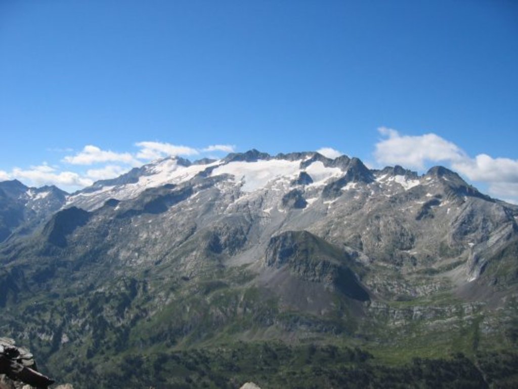
Posets-Maladeta Natural Park is situated in the northeastern region of Spain along the country’s border with France. Pico de Aneto is not only the tallest peak in the park, but the tallest in the entire Pyrenees. Elevations in the Posets-Maladeta Natural Park range from 1,500 m (4,900 ft) up to the summit of Pico de Aneto.
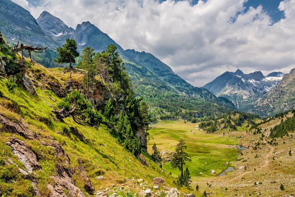
The park lies within the province of Huesca within the autonomous community of Aragon, and it was established in 1994. Posets-Maladeta Natural Park spans 33,440 ha (82,632 acres). Some of the distinct features of the park are the rugged peaks, with Pico de Aneto and Pico de Posets being the most iconic. The Benasque, Estós, and Vallibierna valleys comprise the lower elevations of the park.
Additionally, Posets-Maladeta Natural Park is located near a large number of other popular outdoor recreation areas. This includes the D'aigüestortes i Estany de Sant Maurici National Park (Parc Nacional d'Aigüestortes i Estany de Sant Maurici) and Alt Pirineu Natural Park (Parc Natural de l'Alt Pirineu) to the east, the Ordesa and Monte Perdido National Park (Parc Nacional de Ordesa y Monte Perdido) to the west.
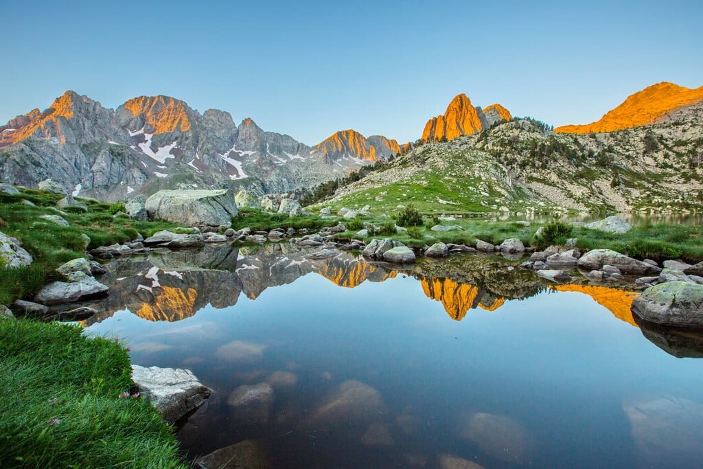
The peaks within the park form the largest concentration of peaks above 3000 meters (9,842 ft) within all of the Pyrenees. The park is home to 13 distinct glaciers that span just under 350 hectares (864 acres) in size. These glaciers are what remain of what was once the largest glaciers in all of the Pyrenees, once spanning hundreds of meters in depth.
The mountains and valleys within the park are part of the Maladeta massif. Much of the visible rock formations date back to the Paleozoic Era.
Major peaks within the park include Pico de Posets, Perdiguero, Punta Culfreda, and Bachimala.

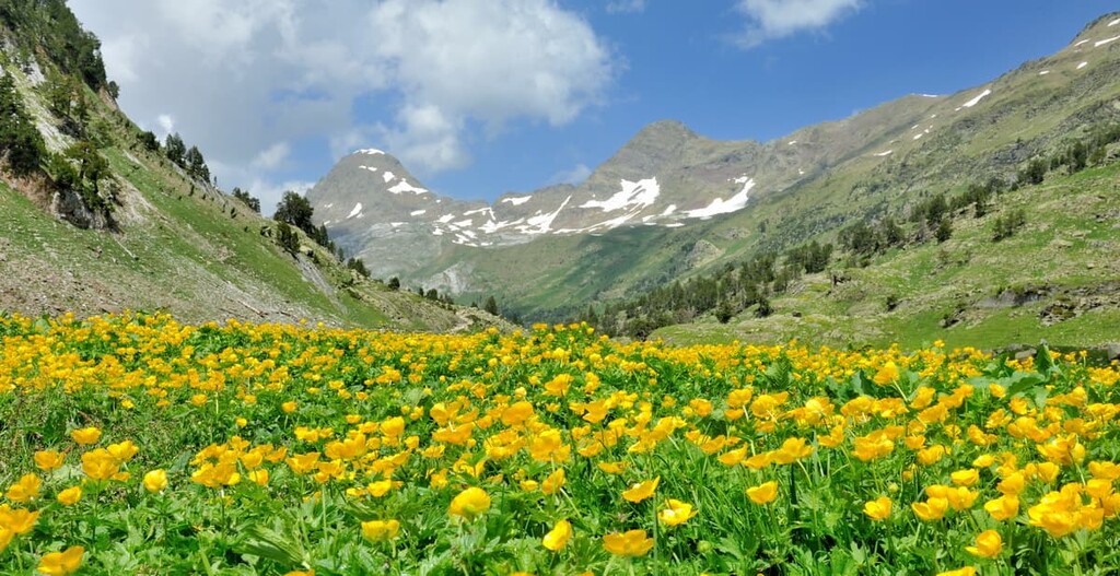
The flora of the park is similar to much of the rest of the Pyrenees. Various species of orchids, gentians, lilies, and butterworts can be found blooming throughout the summer months.
Lower elevations in the park are heavily forested with birch, hazelnut, and rowan trees. As the elevation increases, the forest transitions into pine, fir, and beech trees. Black pine make up the forest at even higher elevations before giving way to sparse grasses and native flowers.
Most visitors hiking through the park can often spot wild boar, marmots, and chamois. Other animals that inhabit the park include Pyrenean newt, griffon vulture, bearded vulture, golden eagle, and ptarmigan.
The park was established in June of 1994. Like much of the land in the Pyrenees, Posets-Maladeta Natural Park was created in an effort to preserve and protect the delicate ecosystems of the region. The park’s formation also helps ensure that local communities can continue to rely on its natural resources.
Livestock and farming has been an integral part of the native populations. The western and central regions of the Pyrenees, where this park is located, traditionally planted potatoes, sweet corn and other crops. Though humans had been living in the region for thousands of years, the first recorded ascent up Pico de Aneto wasn’t until 1842 by Platon de Tchihatcheff.
Posets-Maladeta Natural Park is home to numerous trails. Here are some of the top hiking areas to visit in the park:
The trail to the summit of Pico de Aneto is one of the most popular routes in all of the park. The trail is 13.8 km (8.5 miles) with 1,482 m (4,862 feet) of elevation gain. Crampons and an ice axe are needed in order to summit the tallest peak in all of the Pyrenees. Sparse forests with rolling fields give way to the rugged peaks and snow fields before reaching the summit.
The route to the summit of Pico de Posets is 15.2 km (9.5 miles) long with 1,696 m (5,564 feet) of elevation gain. Though the peak is the second highest in the Pyrenees, it is often less visited than Aneto or Monte Perdido. Hikers are strongly encouraged to carry crampons and hikes for this steep and difficult climb.
Located in the Benasque Valley lies the Ibón de Escarpinosa trail, the 13 km (8 mi) Ibón de Escarpinosa trail offers stunning views throughout its length. Despite being located in a valley, the trail winds through the forest before, passing waterfalls that feed into the Canal de Marsal. The crystal clear waters offer a place to swim as the rugged peaks tower above.
Looking for a place to stay near Posets-Maladeta Natural Park? Here are some of the best cities and villages to check out in the region:
Located just south of the park lies the city of Jaca. The city sits within Huesca province at the base of the Pyrenees. Jaca has a population of around 13,000 people and it acts as the main city center for many of the surrounding villages.
Jaca is a tourist destination during both the summer and winter months which started in the 1970s. Today the city is known for its close proximity to winter resorts and national parks. Besides outdoor activities, Jaca is also home to numerous sites dating back to the eleventh century, offering a look into the city’s rich history.

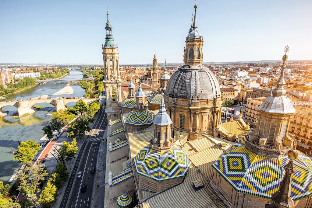
Located in eastern Spain, the city of Zaragoza has a population of over 700,000 people, making it the fifth most populous city in the entire country. Zaragoza is the capital of the Zaragoza province along the Ebro River.
Zaragoza is known for its long history, historical sites, cuisine, and folklore. Each year, the city hosts the Fiestas del Pilar, which is a week-long festival that celebrates the patron saint of Zaragoza. Besides its close proximity to much of eastern Spain, Zaragoza is known for its many important monuments, such as the Basilica del Pilar, and the Aljaferia Palace.


top10
ultra
glacier
pyrenees-3000ers
spain-ultras
top10
ultra
glacier
pyrenees-3000ers
spain-ultras


