Scan the QR code and open PeakVisor on your phone
Nestled in northeastern Spain, Ordesa y Monte Perdido National Park (Parque nacional de Ordesa y Monte Perdido) is a stunning outdoor recreation destination known for its abundance of peaks within the Pyrenees. The park contains 84 named mountains, the highest and the most prominent of which is Monte Perdido at 3,348 m (10,984 ft) with 974 m (3,196 ft) prominence.
Ordesa y Monte Perdido National Park is situated in the northeastern region of Spain in the autonomous community of Aragon. The park was established in 1918 and it spans 156 square kilometers (60.2 square miles) along the country’s border with France. After the land was officially protected in 1918, it became the first national park in the entire country.
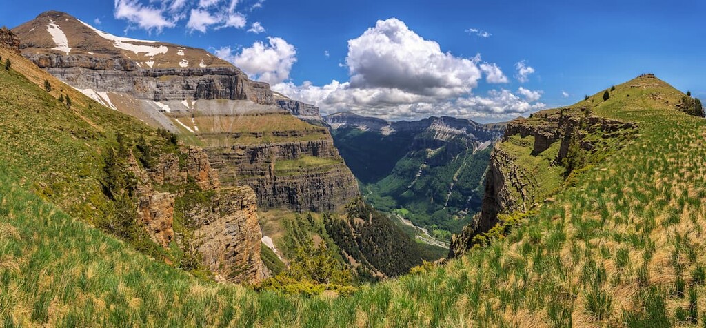
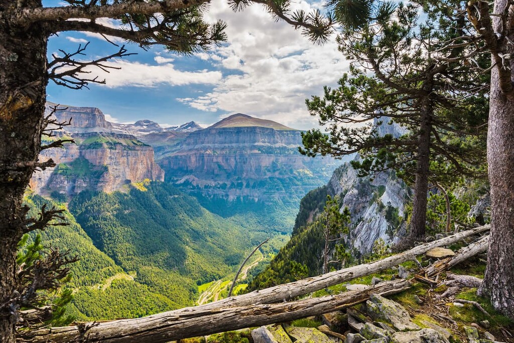
Elevations in the park range from 1,000 meters (3,280 ft) up to the summit of Monte Perdido at 3,348 meters (10,984 ft), which also happens to be the third tallest peak in all of the Pyrenees. The park is also contiguous with another protected area across the French border that is known as Pyrenees National Park (Parc national des Pyrénées).
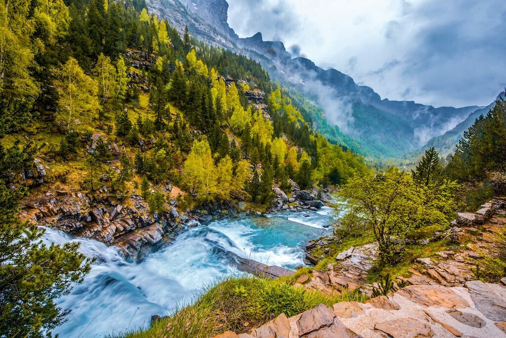
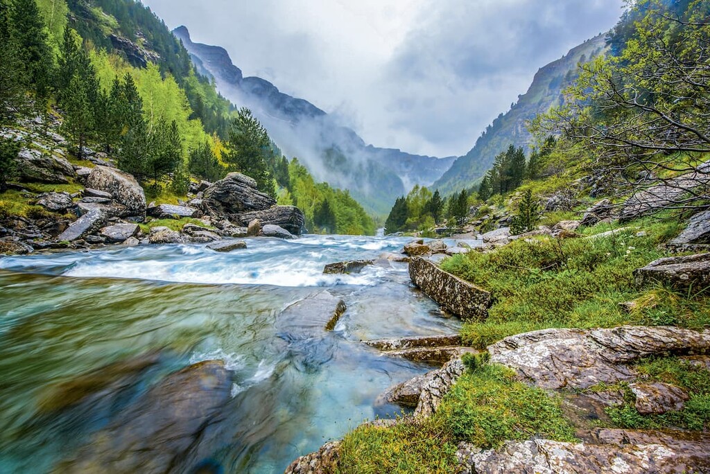
While the peak of Monte Perdido towers above the landscape, the rest of the park is defined by four major valleys. These include Ordesa (the park’s namesake) along with Anisclo, Escueta, and Picuain valleys. The Río Arazas travels through the Ordes Valley as mountains from the surrounding massifs tower above the lush terrain.
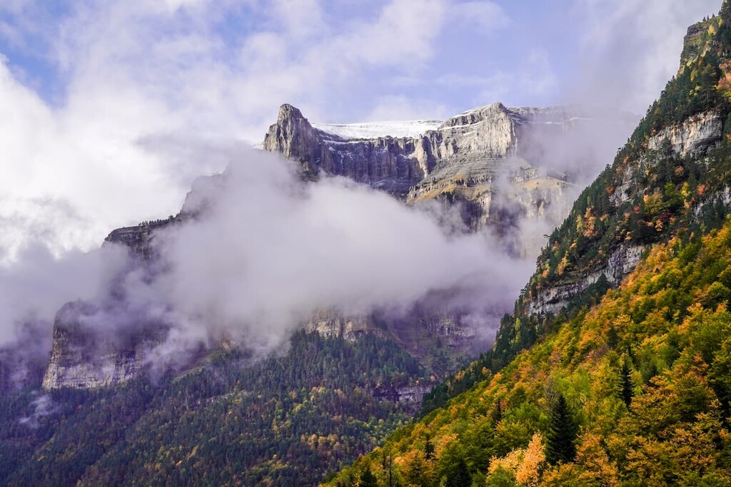
Atop Monte Perdido lies the Monte Perdido Glacier, which is known for being the largest glacier both in the park and in all of the Pyrenees.

Additionally, Ordesa y Monte Perdido National Park is located near a large number of other popular outdoor recreation areas. This includes the Pyrenees National Park (Parc national des Pyrénées) in France, the Posets-Maladeta Natural Park (Parque Natural Posets-Maladeta) to the northeast, and the Sierra y los Cañones de Guara Natural Park (Parque Natural de la Sierra y los Cañones de Guara) to the south.
Monte Perdido dominates the landscape as the third tallest peak in all of the Pyrenees. Located along the northern region of the Huesca province, the peak is part of the Monte Perdido Range, a subrange within the Pyrenees.
The iconic peak is the tallest limestone mountain in all of Europe and its foothills straddle both Spanish and French territory. Geologists believe that the sea covered what is now the Pyrenees around hundreds of million years ago, leading to the deposition of sediments that eventually became the limestone that we see today.
However, over time, the Iberian microplate moved northward and eventually came in contact with the European plate. As the two plates met, they formed the Pyrenees. The crust from the Iberian plate was pushed upward, and the newly formed sedimentary rock became the mountain range we know today.
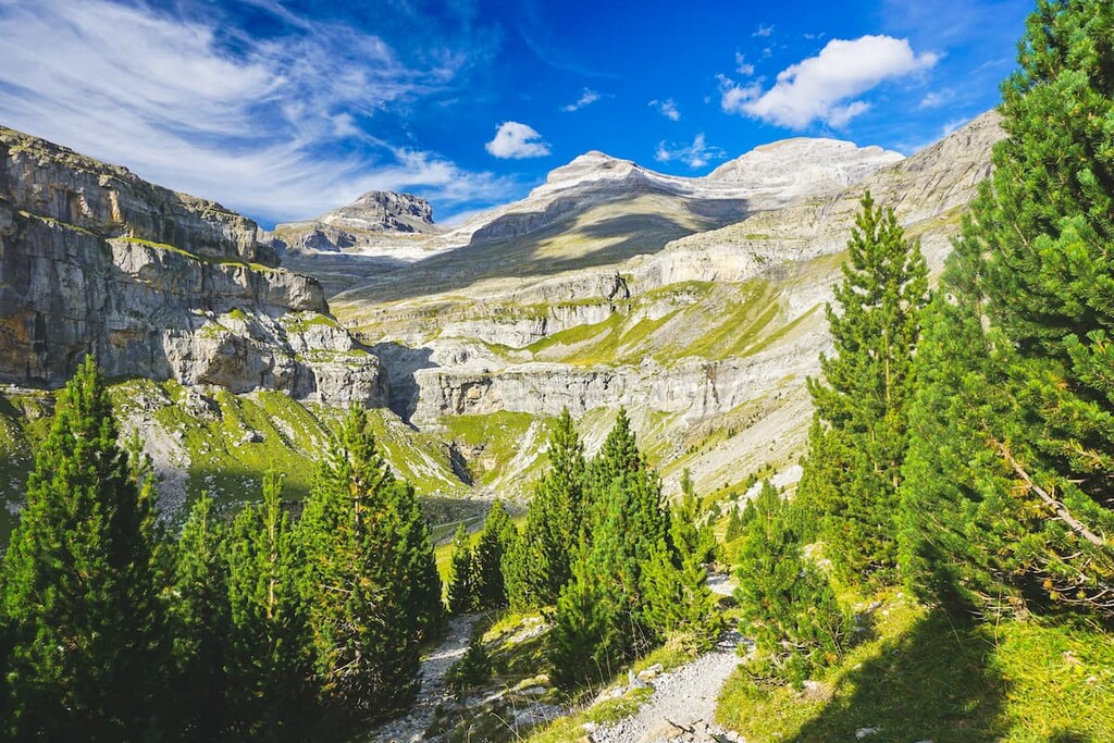
The lower elevations in the park are covered in dense forests made up primarily of European beech, silver fir, Scots pine, and downy oak. Elevations above 1,700 meters (5,580 ft) are home to forests predominantly made up of mountain pine.
The highest elevations in the park, where flora is still found, consists of numerous endemic species. This includes earleaf bell flowers, pyrenean violet, long-leaved butterwort, and the Edelweiss.
The park is home to a wide variety of species. The Pyrenean ibex, also known as the bucardo, went extinct in 2000. Its extinction led to an increased effort to protect the animals that inhabit the region.
Visitors to the park are somewhat likely to see Pyrenean chamois, brown bear, boar, alpine marmot, and deer. The skies are also home to bearded vulture, golden eagle, griffon vulture, eagle owl, among other bird species.

The land that makes up the Ordesa y Monte Perdido National Park has been inhabited for thousands of years. However it wasn’t until the early 1900s that scientists thoroughly mapped out the region and learned more about the geological history of the landscape.
The park was originally established in 1918 and was later expanded in 1982 to the size that it is today. In 1997 the park, along with the adjoining national park on the French side of the border, was declared an International Biosphere Reserve by UNESCO.
Ordesa y Monte Perdido National Park is home to numerous trails that span 380 kilometers (236 miles) across the region. Here are some of the top hiking areas to visit in the park:
The Senda de los Cazadores is one of the most popular trails in the park. The route provides expansive views of the Ordesa valley along with views of waterfalls such as El Cotaruelo. The trail totals 18.35 km (11.4 mi) round trip with 1,097 m (3,600 ft) of elevation gain.
The loop trail can be accessed a short drive outside of Torla. After passing the Calcilarruego viewpoint, the trail offers views of the valley along with numerous waterfalls along the Arazas River.
For an easier route through the park, visitors can trek the Canon de Anisclo Trail. At just 5.5 km (3.4 miles), the route follows a gentle path along the Arazas River. Viewpoints are available throughout, as the trail crosses over the river. The deep valleys and wide river beds allow for sweeping views of the surrounding forest and mountains above, despite being at a lower elevation.
Faja Racón is a 9km trail (5.7 miles) with 853 m (2,800 ft) of elevation gain. Much of the loop trail travels just above the treeline. Hikers get views of the riverlands, forests, and rock fields as they walk along the narrow edge beneath the rugged peaks.
Looking for a place to stay near Ordesa y Monte Perdido National Park? Here are some of the best cities and villages to check out in the region:
Located just south of the park lies the city of Jaca. The city sits within Huesca province at the base of the Pyrenees. Jaca has a population of around 13,000 and acts as the main city center for many of the surrounding villages.
Jaca is a tourist destination during both the summer and winter months which started in the 1970s. Today the city is known for its close proximity to winter resorts and national parks. Besides outdoor activities, Jaca is also home to numerous sites dating back to the eleventh century, offering a look into the city’s rich history.

Located an hour and a half southwest of Jaca is the city of Zaragoza. Located in eastern Spain, the city has a population of over 700,000, making it the fifth most populous city in the entire country. Zaragoza is the capital of the Zaragoza province along the Ebro River.
Zaragoza is known for its long history, historical sites, cuisine, and folklore. Each year, the city hosts the Fiestas del Pilar, which is a week-long festival celebrating the patron saint of Zaragoza. Besides its close proximity to much of eastern Spain, Zaragoza is known for its important monuments, such as the Basilica del Pilar, and the Aljaferia Palace.