
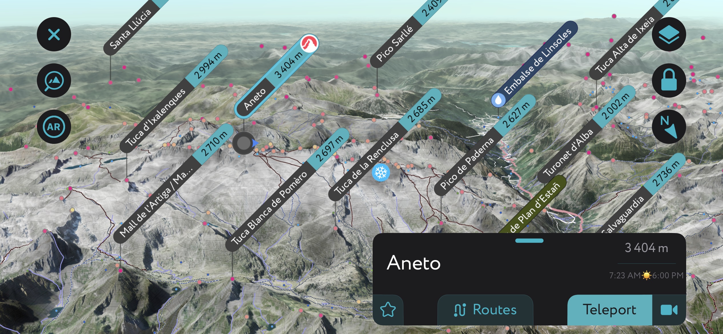
Scan the QR code and open PeakVisor on your phone
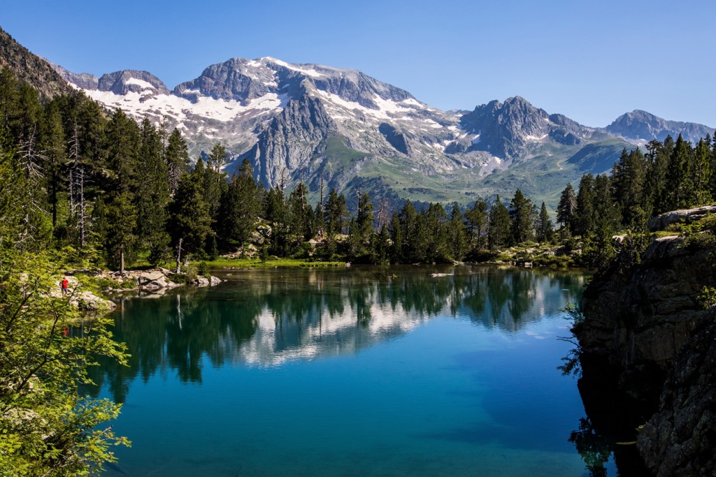
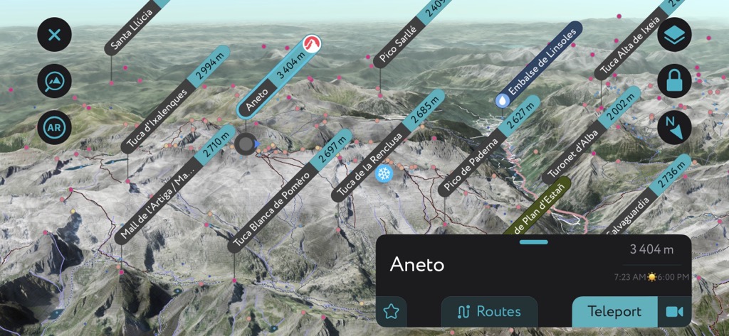
Aragon (Aragón) is Spain's 4th-largest autonomous community, encompassing an area of approximately 47,720 sq km (18,420 sq mi). Aragon's diverse landscape includes sweeping valleys, dry steppes, and the highest mountains in the Pyrenees. Its natural beauty makes it a hotspot for hikers. There are 6022 named peaks in Aragon; the highest and most prominent is Pico de Aneto (3,404 m / 11,168 ft).
Aragon is a landlocked autonomous community located in the northeastern corner of the Iberian Peninsula. It's bordered by the Nouvelle-Aquitaine and Occitanie of France to the north, with the Pyrenees acting as a natural boundary. Within Spain, six autonomous communities encircle Aragon: Castile-La Mancha, Castile and León, Rioja, and Navarre to the west, Catalonia to the east, and the Valencian Community to the southeast.
Modern Aragon mostly follows the original boundaries of the medieval Kingdom of Aragon and consists of three provinces. From north to south, these provinces are Huesca, Zaragoza, and Teruel.
The northern province of Huesca covers an area of roughly 15,626 sq km (6,033 sq mi). Most of Huesca is mountainous. Its most famous feature is the Aragonese Pyrenees, home to many of the Pyrenees' highest summits, including Pico de Aneto, Monte Perdido (3,355 m / 11,007 ft, and Maladeta (3,312 m / 10,866 ft).
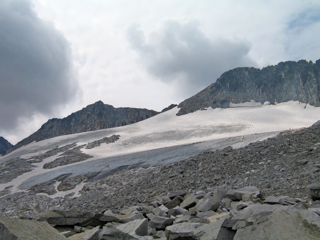
Aneto is home to the Pyrenees' largest glacier, with an area of 0.48 sq km (0.18 sq mi). What’s left of this glacier is rapidly disappearing as Europe’s climate has warmed exceptionally fast compared with the rest of the globe. The Pyrennees, once home to several impressive glaciers, is expected to be ice-free before 2050.
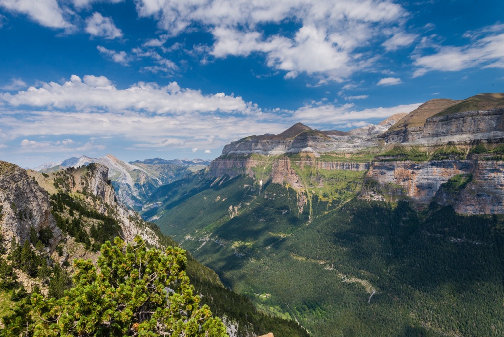
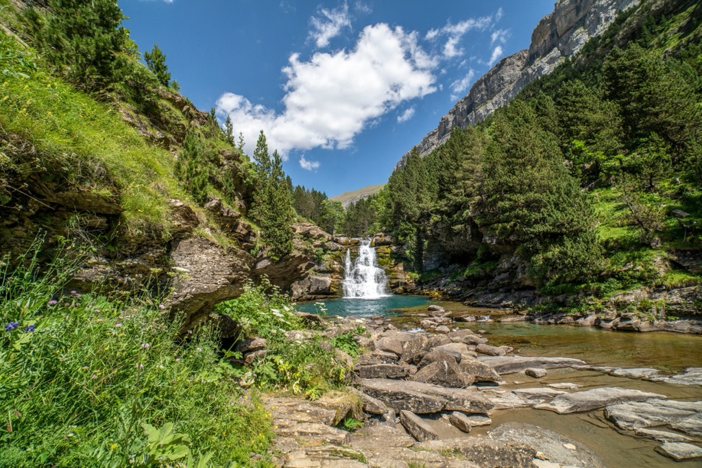
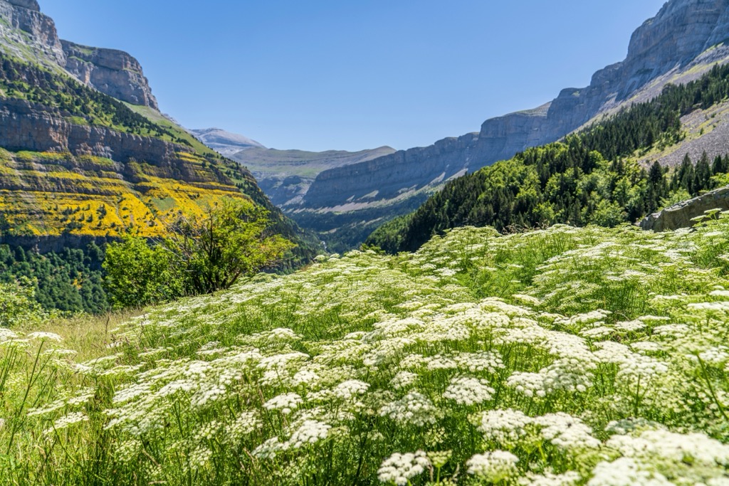
Aragon's only national park, Ordesa y Monte Perdido National Park (Parque Nacional de Ordesa y Monte Perdido), is located in Huesca.
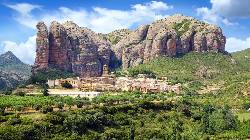
To the south of the Aragonese Pyrenees are the Pre-Pyrenees. These foothills are lower than the Pyrenees but are home to intimidating peaks, such as Tozal de Guara (2,078m / 6,818ft). Huesca has over 219,000 people, over a quarter of which live in its capital, Huesca.
Zaragoza is Aragon's largest province, covering an area of 17,274 sq km (6,670 sq mi). It's also its most populous — over half of Aragon's 1.3 million population live in the capital city, Zaragoza.
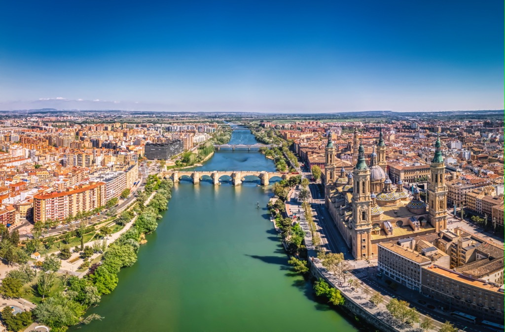
Zaragoza consists mainly of an arid valley formed by the Ebro River. The Ebro cuts diagonally across Zaragoza from west to east and is the longest river entirely in Spain, with a length of 930 km (580 mi).
But Zaragoza isn't completely flat, with mountain ranges on either side of the Ebro depression. To the north is the Sierra de Alcubierre, a low mountain range culminating in Monte Oscuro (822 m / 2,697 ft).
Straddling Zaragoza's borders to the south and west is the Sistema Ibérico, one of Spain's largest mountain ranges at over 500 km (310 mi) in length. Moncayo (2,316 m / 7,598 ft), the Sistema Ibérico's highest summit, is at the eastern edge of Zaragoza.
The Mar de Aragón, a reservoir of the Ebro, is Aragon's largest body of water, with a surface area of 75.4 sq km (29.1 sq mi).
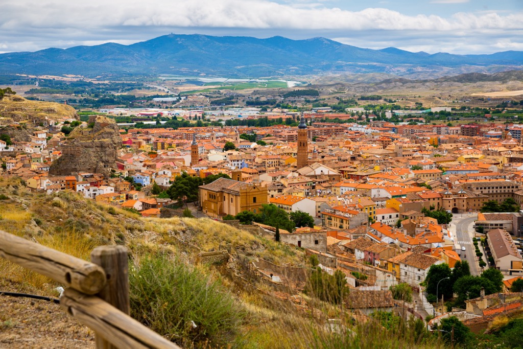
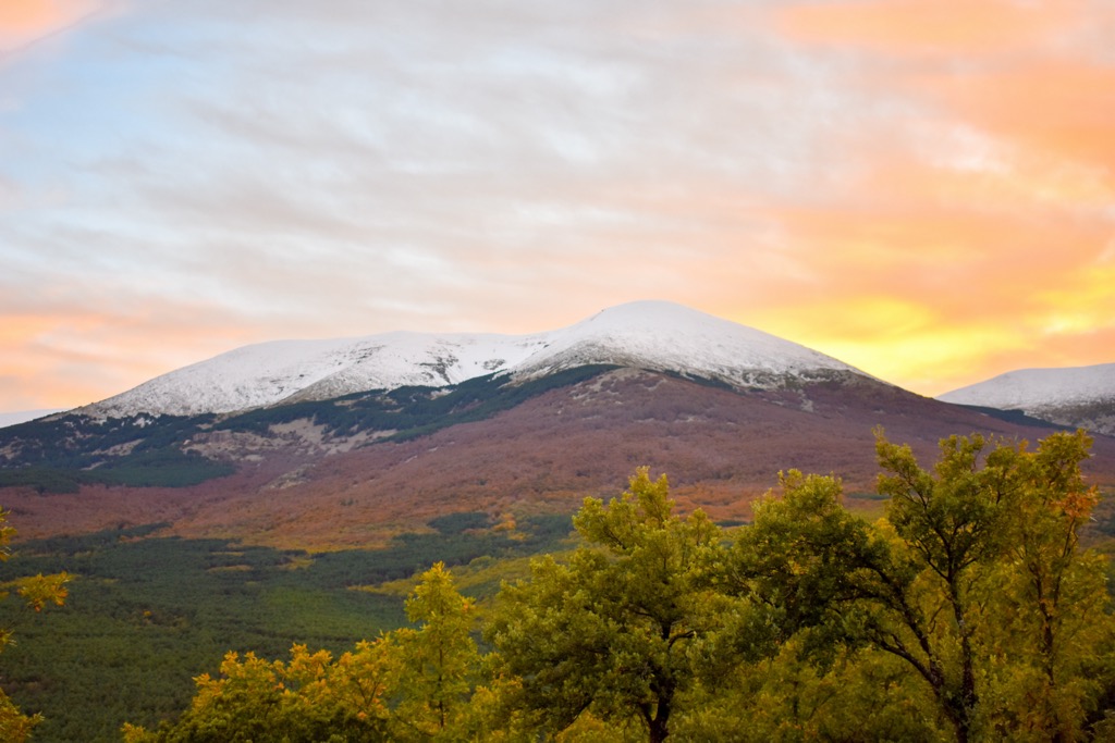
Aragon's southmost province, Turuel, covers an area of approximately 14,809 sq km (5,718 sq mi). It's Spain's second-least populated province, with just over 134,500 people, a quarter of whom live in the capital, Teruel.
The Sistema Ibérico dominates the province and is home to many notable ranges, including the Sierra de la Virgen, Sierra de Albarracín, and Sierra de Santa Cruz. Peñarroya (2,028 m / 6,654 ft) in the Sierra de Gúdar is Teruel's highest mountain.
Along with the rest of the Iberian Peninsula, Aragon sits on the Iberian Plate, which used to be part of the African Plate but is now adjoined to the Eurasian Plate. The geology of the peninsula is complicated and spans over 600 million years.
The Pyrenees formed during the Alpine Orogeny, an ongoing mountain-building event that was most active between about 65 and 2.5 million years ago. The African, Arabian, and Indian Plates collided with the Eurasian Plate to the north, pushing the Iberian Peninsula into its current position.
Convergent movements between the plates helped create many of the world's most famous mountain ranges, including the Alps, the Himalayas, the Carpathians, and the Pyrenees. The Aragonese Pyrenees, also known as the axial Pyrenees, are the highest and oldest mountains in the range, composed of limestones, granites, quartzites, and slates.
Central Aragon, including Zaragoza, is diverse geologically, with rocks from all geological eras of the last 200 million years. Most of the rocks in central Aragon are limestones from the Mesozoic and Cretaceous, but sandstones and mudstones are also present.
The Sistema Ibérico is arguably Aragona's most complicated geological feature, with no singular event able to describe its formation. It's a mismatch of plateaus, mountain massifs, and depressions composed primarily of limestone, marble, and sandstone.
From the highest Pyrenean summits to the arid Ebro Valley, Aragon boasts an array of environments where flora and fauna thrive.
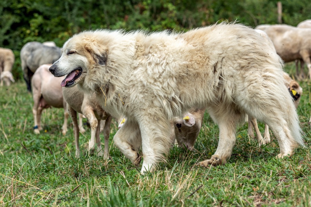
Aragon is home to over 300 mammal species, including large animals like wild boars, roe deer, and brown bears. Brown bears were nearly extirpated from the Pyrenees in the 1990s; there are now thought to be around 15 individuals in the mountains.
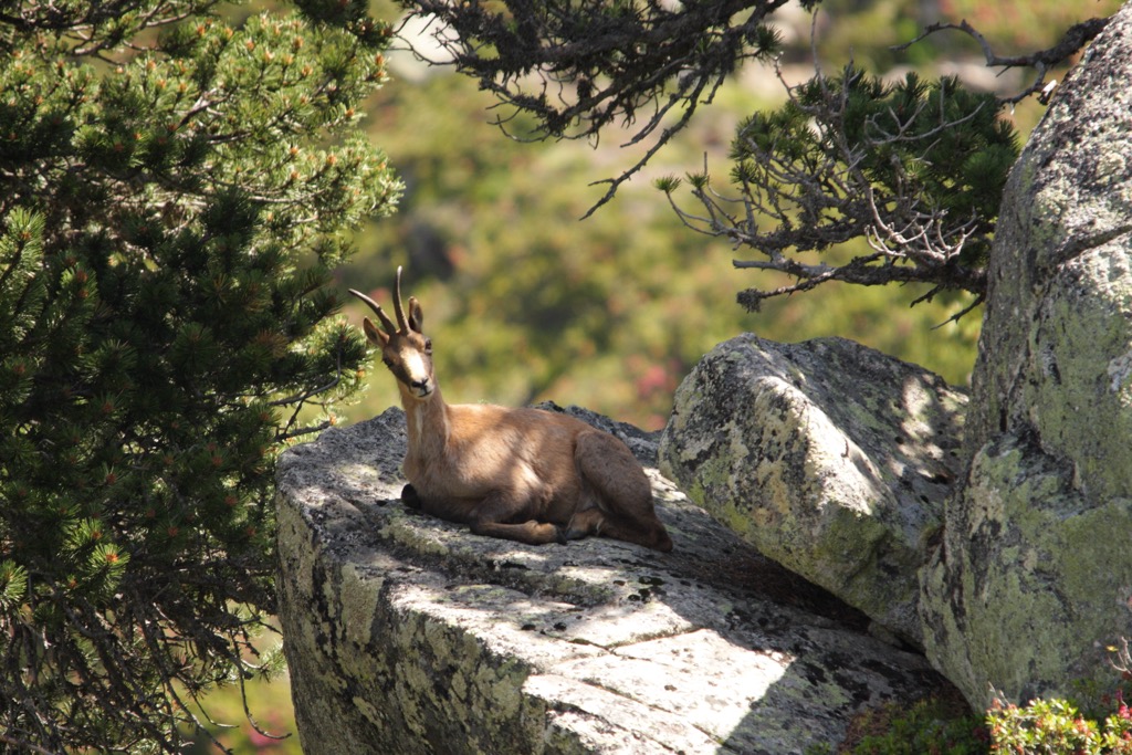
High in the Pyrenees are several species specially adapted to mountain life, like Iberian ibex and Pyrenean chamois. Other notable mammals in Aragon include badgers, squirrels, pine martens, and otters.
Endemism is high in the Pyrenees, with notable species like the Pyrenean brook salamander and the endangered Pyrenean desman, one of only two desman species globally. The asp viper is Aragon's most common venomous snake and is usually found in the Pyrenees. Other reptile species include Montpellier snakes, fire salamanders, and Pyrenean frogs.
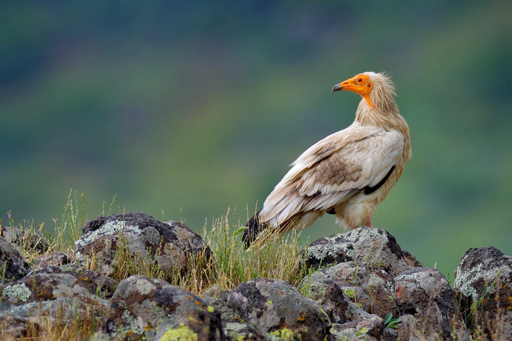
Aragon is a birdwatcher's paradise, with over 370 species spotted in the region and over 200 confirmed nesting or migratory species. Notable species include Egyptian vultures, peregrine falcons, eagle owls, great bustards, bitterns, and genets.
With semi-arid and Oceanic climates, as well as several microclimates, Aragon's flora is diverse. As with its fauna, endemism is high in the Pyrenees, with over 100 endemic species present, including Pyrenean larkspurs, parsley of chamois, and Asplenium (Seelosii catalaunicum).
Aragon's vegetation diversity is on full display high up in the Pyrenees, where the vegetation changes with altitude. In the montane zone, around 1,800 m (5,905 ft), downy oak, beech, and Scots pine carpet the mountain slopes.
Higher up between 2,300 m (7,545 ft) and 2,400 m (7,874 ft) is the subalpine zone. Here, fir and pine forests are common. In the alpine zone, at the highest points in the mountains, forests give way to alpine pastures. Grasses, herbs, and shrubs flourish in these areas, like gentians, Pyrenean buttercups, and fescue. In the Ebro Valley, evergreen oaks and junipers are among the most common trees.
Home to the highest mountains in the Pyrenees and Spain's third-highest summit, Pico de Aneto, Aragon has a mountaineering history spanning over 200 years.
Aneto, one of the Pyrenees' most famous summits, didn't have an officially recognized Spanish name until 1898.
French cartographers had used "Netou" and several variants for over a century before Aneto got its current name, despite the summit being entirely within Spanish territory. It was until renowned Pyreneanist Émile Belloc's work on the Pyrenees that Aneto received its current name, taken from Aneto village on its southeastern side.
The first successful summiting of Aneto was by Russian explorer Platon Chikhachyov in 1842, who scaled many mythical Pyrenean mountains during the same period, including Vignemale (3,298 m / 10,820 ft), Midi d'Ossau (2,884 m / 9,462 ft), and Monte Perdido. Two guides, two hunters, and a botanist joined him on his expedition.
Mountaineers initially took a greater interest in Maladeta than Aneto, believing Monte Perdido and Maladeta were higher summits. Despite Aneto being taller, Maladeta is the massif's namesake.
Maladeta was successfully scaled before Aneto in 1817. Doctor and naturalist Friedrich Parrot and famed guide Luchon Barrau climbed the mountain via the Col de Rimaya on 28 September.
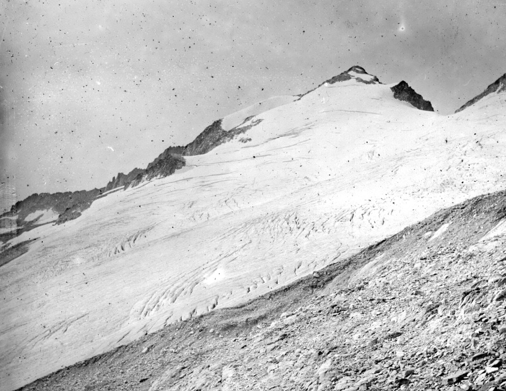
Much of the difficulty climbing Aneto and Maladeta was due to large summit glaciers. Chikhachyov's chosen ascent of Aneto involved a long detour to La Renclusa (2,685 m / 8,809 ft) to avoid Aneto's fearsome north face.
Initial mountaineering interest in the Maladeta Massif quickly dissipated following several glacial tragedies, leading locals to believe the mountains were cursed. This superstition culminated in the death of Luchon Barrau, one of the area's leading guides, who fell into a crevasse on Maladeta.
Aragon's only national park is also one of the oldest in Spain. Ordesa y Monte Perdido National Park was established on 16 August 1918 by a Royal Decree, less than a month after Spain's first national park, Covadonga National Park, now named Picos de Europa National Park (Parque Nacional de Picos de Europa).
There are four natural parks in Aragon: Posets–Maladeta Natural Park, Moncayo Natural Park, Sierra y Cañones de Guara Natural Park, and Valles Occidentales Natural Park. Along with Ordesa y Monte Perdido National Park, they are managed by the Red Natural de Aragón.
Ordesa y Monte Perdido National Park is part of the UNESCO World Heritage List partly due to the Pyrenees' transhumance agricultural system. One of the most historically significant parts of rural Pyrenean life, transhumance, is a nomadic farming system that involves moving livestock from valleys to higher ground in the summer. The practice allows farmers to keep large herds year-round.
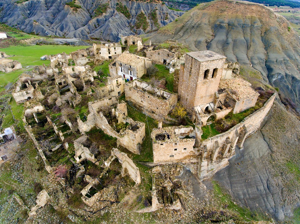
Home to the bulk of the Sistema Ibérico, southern Aragon underwent widespread depopulation in the 20th century. Very few populated towns still exist, especially within Teruel, which has one of the lowest population densities of any Spanish province. Ghost towns and villages are prevalent.
The abandonment of rural mountain areas was due partly to the Spanish Government's 1959 Stabilization Plan, which saw mass migration to urban areas. Depopulation was also partly due to the young people abandoning traditional agricultural living in favor of industrial urban environments with more career and socio-economic mobility.
From the Sistema Ibérico to the lofty Pyrenees, Aragon is one of Spain's most popular hiking destinations. Despite its popularity, many of Aragon's highest summits are isolated and potentially dangerous.
Before setting off on a hike in Aragon, plan your route carefully, inform others of your itinerary, and check local weather forecasts. Bring appropriate hiking gear, plenty of food and water, and a GPS if necessary.
Better yet, use the PeakVisor mobile app to find hundreds of trails in Aragon. You can also upload .gpx files if we don't already have a trail on our servers. The PeakVisor app is available for iOS; give it a shot and discover our visually stunning 3D Maps, adding a new dimension to your alpine adventures.
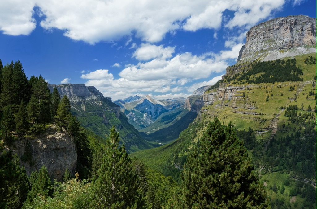
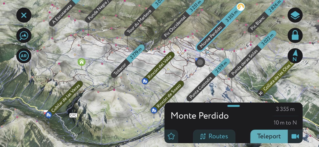
Ordesa y Monte Perdido National Park is Aragon's only national park, covering an area of roughly 156 sq mi (60 sq mi). One of only two national parks in the Spanish Pyrenees, Ordesa y Monte Perdido National Park centers around the stunning Ordesa Valley and Monte Perdido, the Pyrenees' third-highest summit.
With its remarkable geological formations, sweeping valley, and breathtaking summits, Ordesa y Monte Perdido National Park boasts some of the finest sights in the Pyrenees. It shares a boundary with France's Pyrénées Occidentales National Park (Parc national des Pyrénées), which is home to natural wonders such as the Cirque de Gavarnie.
It's possible to scale Monte Perdido on a multi-day hike. Also known by the French name Mont Perdu, Monte Perdido is a steep and treacherous climb only suitable for experienced mountain climbers.
Monte Perdido is snow-covered well into summer, with crampons and an ice-axe essential most of the year. It's easier to scale from Spain than France, with Refugio Goriz (2,200 m / 7,218 ft) the mountain's best refuge. A booking is required to stay at Refugio Goriz.
A popular, more accessible hike in Ordesa y Monte Perdido National Park is the Senda de los Cazadores. The "Hunter's Path" leads through the Ordesa Valley, with the likes of Monte Perdido, Tobacor (2,779 m / 9,117 ft), and Pueyo de Mondicieto (2,384 m / 7,822 ft) providing an idyllic backdrop.

Part of the Senda de los Cazadores follows the GR 11 long-distance trail. One of this route's highlights is the Calcilarruego viewpoint (Mirador de Calcilarruego), which offers views across the Ordesa Valley. You can pick up this looped trail from Pradera de Ordesa. The walk is approximately 19 km (12 mi) in length.
Other mountains in Ordesa y Monte Perdido National Park include Cilindro de Marboré (3,328 m / 10,909 ft), Pico de Pineta (2,861 m / 9,386 ft), and Mondoto Norte (1,959 m / 6,427 ft).
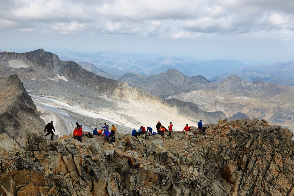
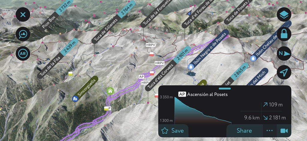
Posets–Maladeta Natural Park (Parque Natural Posets-Maladeta) is another Pyrenean park in Aragon, covering an area of approximately 334.4 sq km (129 sq mi). Perched on the French border, Posets–Maladeta Natural Park centers around the Maladeta Massif and includes the Pyrenees' two highest summits, Aneto and Pico Posets (3,371 m / 11,060 ft).
Aneto is a strenuous trek but is more straightforward than you would expect from the roof of the Pyrenees. Regardless, Aneto is only suitable for experienced mountaineers. Crampons and an ice axe are essential equipment when hiking Aneto.
The most popular route crosses the glacier north of Pico de Aneto. You start this hike from the Párking de La Besurta before stopping at the Refugio de la Renclusa (2,138 m / 7,014 ft) at the foot of the Maladeta Massif.
The view from Aneto's summit is sublime, with the Maladeta massif to the northwest and the Alto Aragon to the south. This looped trail is approximately 14 km (8.5 mi) in length.
Towering over the Añes Cruces Valley, Posets is another must for seasoned mountain climbers. With its unique shape, it's one of the most striking mountains in the Maladeta Massif. The high slopes are frequently snow-covered, even in summer, so bring appropriate equipment.
You should approach Posets from the southeast, starting at the Cascada de la Espigantosa. The Refugio Angel Orus (2,150 m / 7,053 ft) sits along the route. This out-and-back trail is approximately 15.2 km (9.4 mi) in length.

Other popular mountains in Posets–Maladeta Natural Park include Perdiguero (3,222 m / 10,571 ft), Pic de Sacroux (2,676 m / 8,780 ft), and Pic Schrader (3,177 m / 10,423 ft).
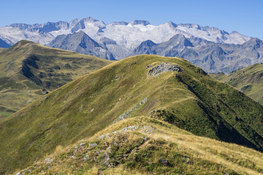
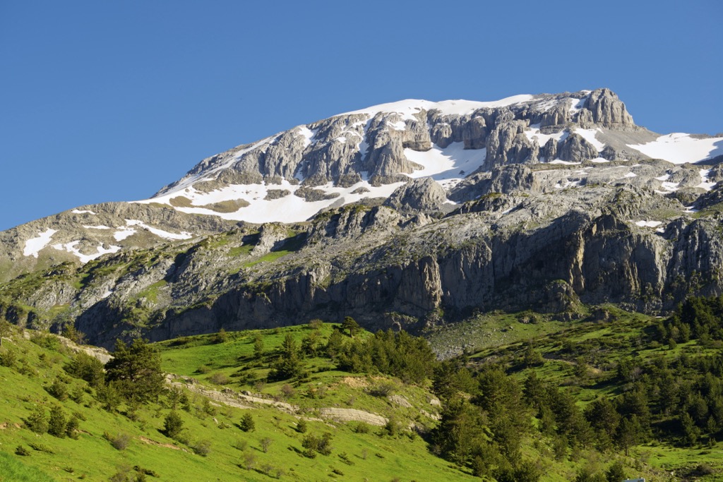
Moncayo Natural Park (Parque Natural del Moncayo) is located in western Zaragoza, covering an area of approximately 110 sq km (42.5 sq mi). It centers around the Moncayo Range within the Sistema Ibérico.
Moncayo is one of Spain's most popular hiking destinations and is home to Moncayo, the second most prominent mountain in Aragon after Aneto. Due to its popularity, Moncayo is well-connected with regular buses to and from the park.
The most popular way to climb Moncayo is from the Restaurante Santuario del Moncayo via Fuente de la Jarra. This route is challenging, so bring appropriate hiking equipment.
From atop Moncayo, it's possible to see the highest summits in the Pyrenees on a clear day. This out-and-back trail is approximately 7.5 km (4.5 mi) in length.
Other popular summits in Moncayo Natural Park include Peña Negrilla (2,118 m / 6,949 ft) and Cerro Morrón (1,731 m / 5,679 ft).
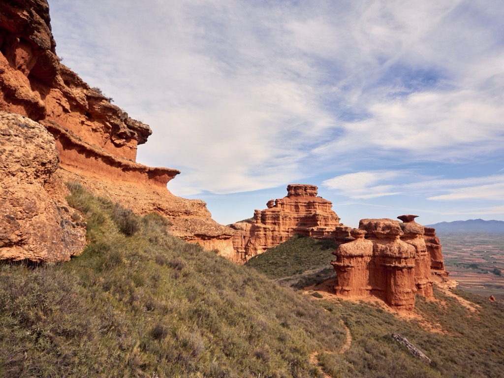
Sierra y Cañones de Guara Natural Park (Parque Natural de la Sierra y los Cañones de Guara) is located in Huesca, covering an area of approximately 474.5 sq km (183 sq mi). The park's main feature is the Sierra de Guara mountain massif, part of the Pre-Pyrenees.
Several rivers run through this limestone massif, eventually flowing into the Ebro. These rivers have created dramatic gorges, the most famous of which is the Rio Vero Canyon, home to the infamous Ruta de las Pasarelas. The picturesque village of Alquézar sits on a stone outcrop just west of the gorge.
The Ruta de las Pasarelas is a series of footbridges that weave along the gorge's rock face following the final length of the Rio Vero. The footpath is terrific for birdwatching and provides beautiful views of the Colegiatte of Alquézar church.
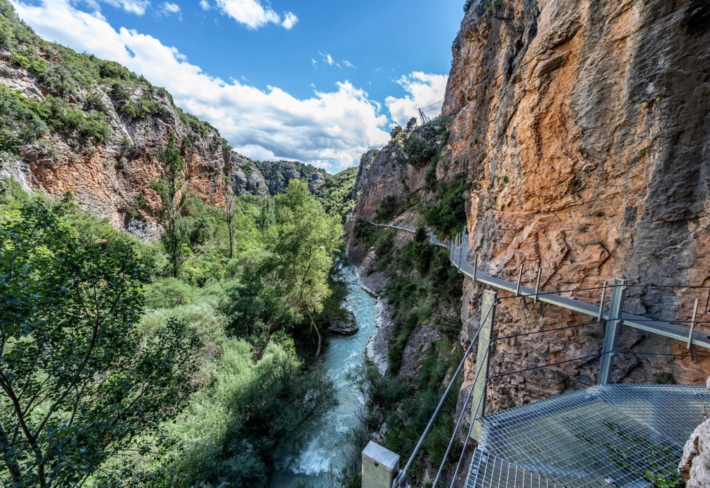
Note that the Ruta de las Pasarelas is a ticketed attraction for anyone over the age of 12. The starting point is the Plaza Rafael Ayerbe, where you can purchase tickets. This out-and-back trail is approximately 3 km (1.8 mi) in length.
Consider climbing Tozal de Guara if you're searching for a serious mountain hike in Sierra y Cañones de Guara Natural Park. The park's highest summit, Tozal de Guara, is the roof of the Pre-Pyrenees and is considered a challenging hike due to its gradient and inaccessibility.
The "normal" route to Tozal de Guara is the easiest and presents no genuine difficulties, but it is the longest way to the summit. You can pick up this trail to the mountain's south, starting from Santa Cilia de Panzano. The trail leads along the massif's ridge over Punta Vallemona (1,873 m / 6,145 ft). This walk is a 23 km (14 mi) round-trip.
Other popular mountains in Sierra y Cañones de Guara Natural Park include La Gabardiella (1,696 m / 5,564 ft) and Punta Sur (1,640 m / 5,381 ft).
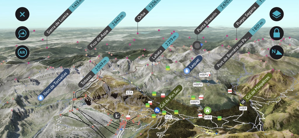
Valles Occidentales Natural Park (Parque Natural de los Valles Occidentales) is located at the western edge of the Aragonese Pyrenees, encompassing an area of approximately 270 sq km (104 sq mi). The park's Atlantic climate makes it unique, with a diverse range of fauna and verdant widespread forests.
Valles Occidentales Natural Park's highest summit is Bisaurín (2668 m / 8893 ft). The highest point in the Hecho Valley, Bisaurín, is the first summit over 2,600 m (8,530) between the Bay of Biscay and the Midi d'Ossau. As a result, it affords some of the finest views of the Pyrenean western valleys.
You can pick up the trail to Bisaurín from Refugio de Lizara (1,540 m / 5,052 ft). The initial stretch of this hike follows the well-marked GR 11. This out-and-back trail is approximately 11 km (7 mi) in length.
One of the more straightforward, popular mountains to climb from within Valles Occidentales Natural Park is Petrechema (Pic d'Ansabère) (2,371 m / 7,779 ft).
Located in the upper Ansó Valley, Petrechema has a well-established trailhead, and its summit offers views across the Pyrenees, with Midi d'Ossau and Peña Collarada (2,886 m / 9,459 ft) visible. You can pick up the trail to Petrechema from Refugio de Linza (1,330 m / 4,364 ft). This looped trail is approximately 14.5 km (9 mi) in length.

Other popular mountains in Valles Occidentales Natural Park include Pic des Moines (2,349 m / 7,707 ft), Mesa de los Tres Reyes (2,428 m / 7,966 ft), and Castiello d'Acher (2,384 m / 7,822 ft).
Experience the best of Aragonese culture, cuisine, and architecture during your hiking adventure by visiting one of Aragon's memorable cities and towns.
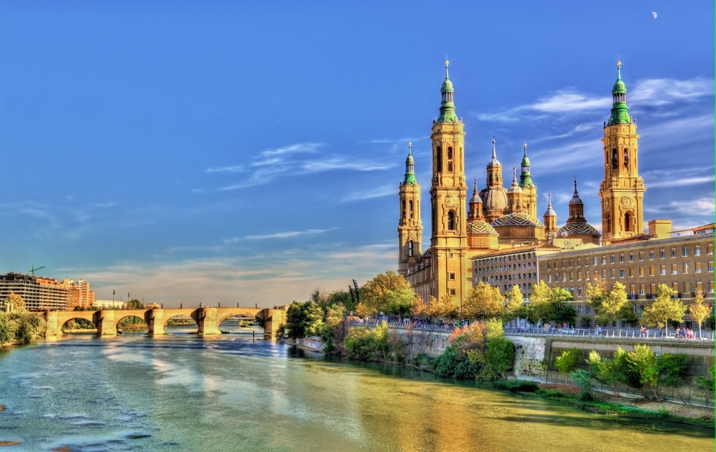
Zaragoza is Aragon's capital and largest city. It's Spain's fifth-largest city, with a population of over 670,000. Perched on the Ebro River, Zaragoza is known for its local cuisine, Spanish Islamic architecture, and revival of the Aragonese language. Some of the best sights in Zaragoza include the Basílica de Nuestra Señora del Pilar, Aljafería Palace, and the Catedral del Salvador de Zaragoza.
Zaragoza is an excellent base to explore the Pre-Pyrenees and the Sistema Ibérico, with Moncayo Natural Park and Sierra y Cañones de Guara Natural Park around 130 km (81 mi) away. Zaragoza Airport is an international airport located 16 km (10 mi) west of downtown Zaragoza.
Huesca is the capital of the Province of Huesca and the second-largest city in Aragon.
With a population of just over 52,000, it's one of Spain's smallest provincial capitals. It's famous for the Fiestas de San Lorenzo and its many historic religious landmarks. While in Huesca, ensure you visit Huesca Cathedral and the Abbey of San Pedro el Viejo.
It's one of the best places to stay if you plan excursions to the Pre-Pyrenees, with Sierra y Cañones de Guara Natural Park less than 35 km (21 mi) to the northwest. Ordesa y Monte Perdido National Park is less than 95 km (59 mi) north of Huesca. Huesca is around 80 km (50 mi) northwest of Zaragoza Airport.
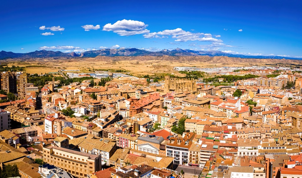
Teruel is the smallest Spanish provincial capital, with a population of just over 35,000. One of Aragon's most unique cities with its lavish Moorish architecture earned it the nickname the "town of Mudéjar."
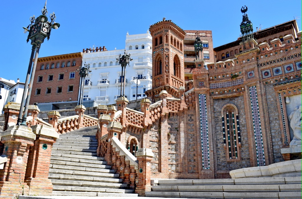
Teruel has superb, family-friendly attractions like the Escalinata del Óvalo, Torico Square, and Dinópolis. Situated at the southern tip of Aragon, Teruel is close to several natural parks, including Puebla de San Miguel Natural Park (Parque Natural de la Puebla de San Miguel), which is 60 km (37 mi) to the south.
Valencia Airport is the nearest major international airport to Teruel, located 109 km (68 mi) to the southeast.
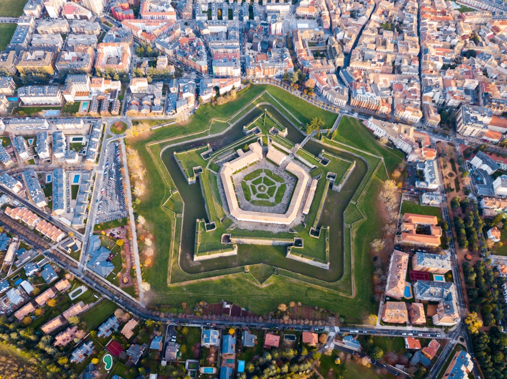
Jaca is a city in Huesca and one of Aragon's most popular vacation destinations for outdoor recreation. Jaca is considered one of the birthplaces of the Kingdom of Aragon and was its capital until 1097. One of the top attractions in Jaca is the 11th-century Jaca Citadel, protected by medieval walls and fortifications.
Jaca is one of the most convenient places to explore the Pyrenees, with Ordesa y Monte Perdido National Park and Valles Occidentales Natural Park less than 60 km (37 mi) away. Candanchú ski resort is also just 30 km (18.5 km) from Jaca.
Zaragoza Airport is the nearest international airport to Jaca, located 150 km (93 mi) to the south.


top10
ultra
glacier
pyrenees-3000ers
spain-ultras
top10
ultra
glacier
pyrenees-3000ers
spain-ultras


