Scan the QR code and open PeakVisor on your phone
Located in northern Spain lies Picos de Europa National Park (Parque nacional de Picos de Europa) is a stunning park known for its rugged mountain range. The park contains 626 named mountains, the highest and the most prominent of which is Torre Cerredo at 2,649 m (8,691 ft) with 1,932 m (6,339 ft) prominence.
Picos de Europa National Park spans across through the autonomous communities of León, Asturias, and Cantabria and Castile. The park covers 67,127 square kilometres (25,918 square miles). Established in 1918 the park originally only covered about half of the land that it does today. However, the park boundaries were expanded in booth 1995 and 2014.
Elevations in the park range from 75 m (246 ft) along the Deva River, up to the summit of Torre Cerrdo. The main feature throughout the park is the Cantabrian Mountains that run from east to west.
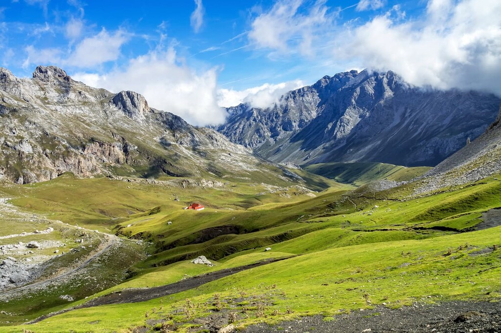
The three main ranges in the park are characterized as the western, central, and eastern sections. The western section contains the Asturian Massif and is also hope to deep canyons along the Cares River. This region is also home to the tallest peak in the park.
A majority of the mountains can be found in the central section of the park. The lower elevations in this section are marked by grasslands, with some notable sections being the Paramo de Masa and La Lora. The eastern section comprises the Basque mountains and its foothills.
Additionally, Picos de Europa National Park is located near a large number of other popular outdoor recreation areas. This includes the Redes Natural Park (Parque Natural de Redes) and Somiedo Natural Park (Parque Natural de Somiedo) to the west and the Saja-Besaya Natural Park (Parque Natural Saja-Besaya) to the east.
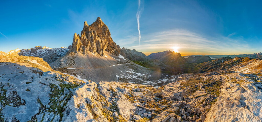
The park and it’s iconic peaks have been shaped overtime by glaciers and various geological folds. Powerful glaciers carved the mountains into the rugged limestone peaks of the region. Today the three main massifs of the park show traces of the immense erosion that once occurred.
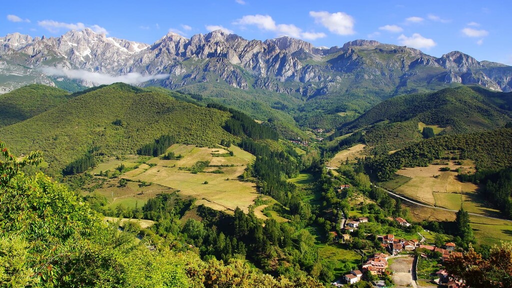
The Cantabrian Mountains of the park create a divide between two distinct Spanish landscapes. To the north of the park lies “Green Spain” with its lush rolling hills. To the south lies the central plateau of Spain, which is much drier and less fertile.
The vast part is abundant with flora and fauna. Because the park has numerous types of landscape, biodiversity flourishes.
Chamois, also known as rebeco, are found throughout the park though most often they live at higher elevations. The elusive brown bear lives in the park though it’s population is quite small. Other animals include bats, golden eagles, red deer, and even the endangered wolf of the region. The fields of wildflowers allow for 124 species of butterflies to thrive within the park.
The coline habitat of the park is home to dense woodlands interspersed with grasslands which are recovering from deforestation. Naitve flora includes white asphodel, orchids, asterwort, and lundwort. The forests of the park are home to ash, lime, chestnut, walnut, elk, oak and various other tree species. The higher elevations in the park are scattered with beech trees and smaller native grasses.
Longer before a park was ever established, the region was home to the Battle of Covadonga around 718 AD. Due to the significance of this battle, and the legend that Virgin Mary appeared, the park was established to protect the region. In 1918 the park was named Covadonga Mountains National Park but was later changed in 1995 when the other sections of the park were added.
Picos de Europa National Park is home to numerous trails that span across the region. Many of the trails are remnants of long standing pathways that were once inhabited. Here are some of the top hiking areas to visit in the park:
The Cares Trail (Ruta del Cares or Garganta del Cares) is one of the most popular routes in the entire park. The out and back trail totals (13.3 miles) with an immense (6,715 ft) elevation gain. This route followed along the Cares River, passing waterfalls and caves while the rugged and steep limestone cliffs tower above.

The route to the summit of Pico de Posets is 15.2 km (9.5 miles) with 1,696 m (5,564 feet) of elevation gain. Though the peak is the second highest in the Pyrenees, it is often less visited than Aneto or Monte Perdido. Hikers are strongly encouraged to carry crampons and hikes for this steep and difficult climb.

This point to point trail is located within the central region of the park. The trail is 14 km (8.9 miles) with 333 m (1,095 ft) elevation gain. The high elevation of the trail is showcased while the route passes through pastures, fields, before dipping into the lush forests.
Named after the park itself, this multi-day loop travels 125 km (77.5 miles) with 10,450 m (34,284 ft) elevation gain. There are numerous refuge stops along the trail allowing for hikers to start at any location. The route travels through all three sections of the park with spectacular views of the diverse landscapes, rugged peaks, and deep river valleys.

Looking for a place to stay near Picos de Europa National Park? Here are some of the best cities and villages to check out in the region:
Located just north of the park lies the municipality of Llanes. The various commutes span for 30 km (18 miles) along the northern coast of Spain. The region has a population of around 14,000 and was traditionally a fishing port.
The city is nestled between the foothills of the park and the Atlantic Ocean. The valleys in the region are full of fertile soil, unlike many that lie within the park boundaries. Llanes is also home to a distinct network of caves which are also home to ancient art.

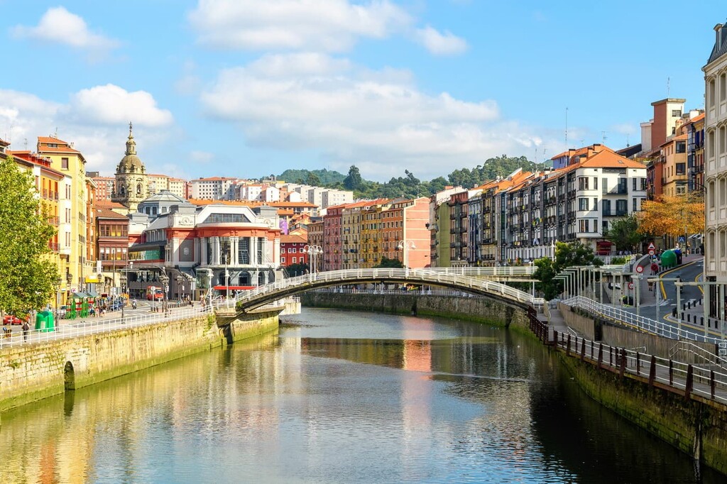
Northeast of the park lies the city of Bilbao. With a metro population of over 1 million, the city is the largest in all of the Basque Country and northern Spain. Though the city is outside of the park, it is also home to two small mountain ranges that help give Bilbao its moderate climate.
Because Bilbao is the largest city in the region it acts as a cultural hub. Basque is spoken throughout the city and surrounding region and is home to its unique style of cuisine. The city also has over a dozen museums, many dedicated to Basque cultural and heritage.