Scan the QR code and open PeakVisor on your phone
There are 729 named mountains in New Aquitaine. Pic du Midi d'Ossau is the highest point. The most prominent mountain is Pic d'Anie.
New Aquitaine
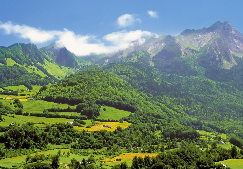
New Aquitaine, or Nouvelle Aquitaine in French, is the largest region in France covering 84,061 km2, 1/8th of the country. It is located in the southwest of the country and shares its southern border with Spain. As a result of its size there is a large geographical variety across the region. From the beaches and the sand dunes on the western coast, to the forests in the north of the region, to the mountainous southern area.
The region contains the following 12 departments:
Bayonne - In the Pyrénées Atlantiques, just inland of the coast and in close proximity to the smaller towns of Anglet and Biarritz.
Biarritz - A city on the Atlantic Coast in the French Basque Country. Biarritz is well known internationally as the historic surfing capital of Europe.
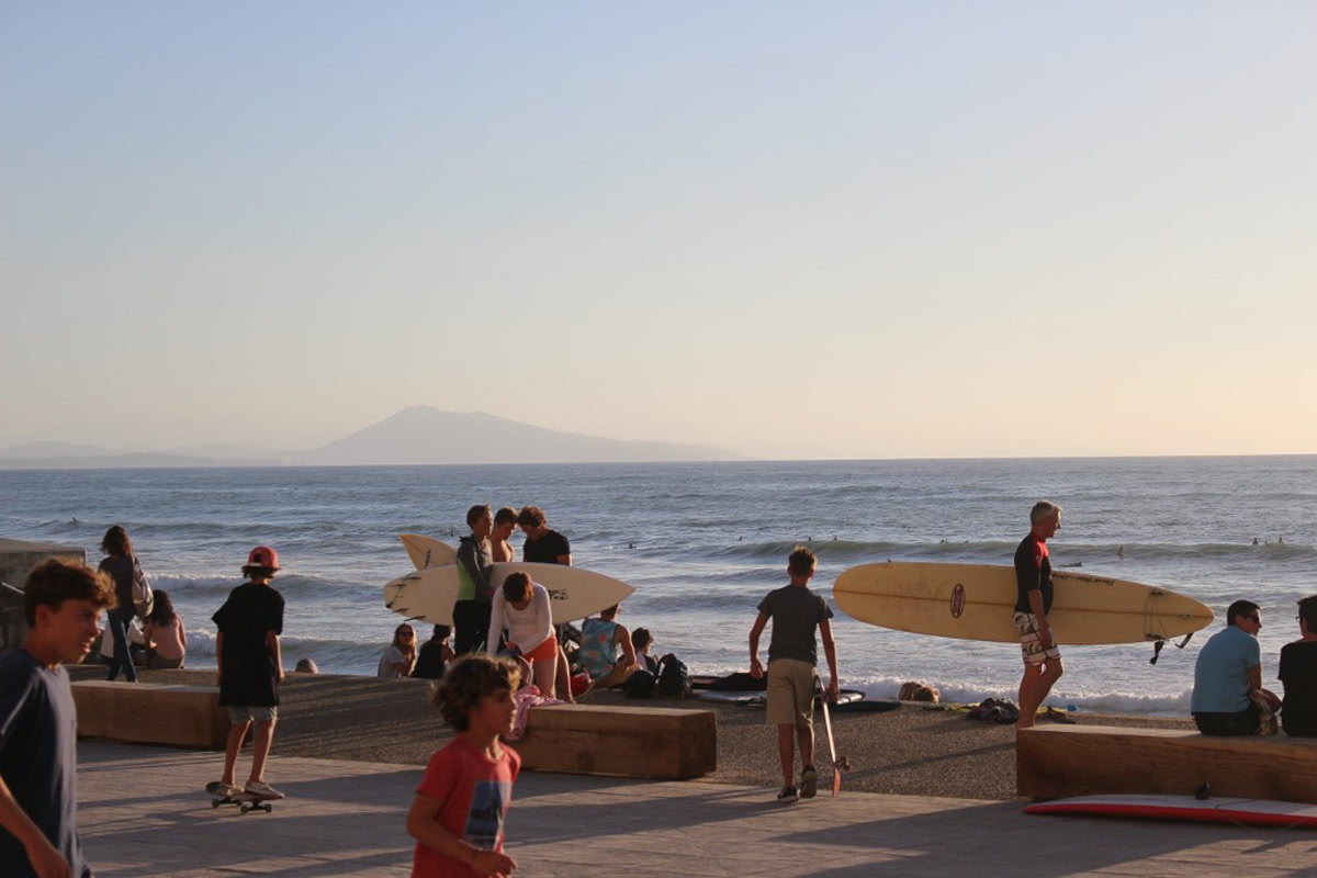
Biarritz
Bordeaux - A port city (Bay of Biscay) on the Garonne in the Gironde department, located centrally within the region. Bordeaux is one of the largest wine producing regions in France.
Limoges - The capital of the department of the Haute-Vienne, Limoges is situated in central France. It is in close proximity to the Regional Nature park of Périgoud Limousin.
Pau - The Capital of the Pyrénées-Atlantiques and at the foothills of the western Pyrenean mountain range, Pau is an excellent base camp for an excursion into the mountains.
Poitiers - The capital of the Vienne department, Poitiers is situated in between the Armorican massif to the north west and the Massif Central to the south east.
Nouvelle Aquitaine has a number of large airports and a substantial train network. The main airports are that of Bordeaux (whose central location is optimal) and Biarritz (ideal for visiting the western Pyrénées and the southern French coastline.
As a result of the large area that the region covers, the climate can be quite varied. The majority of the region has an oceanic climate. The major exception being that of the Pyrénees Atlantiques which has a mountainous climate.
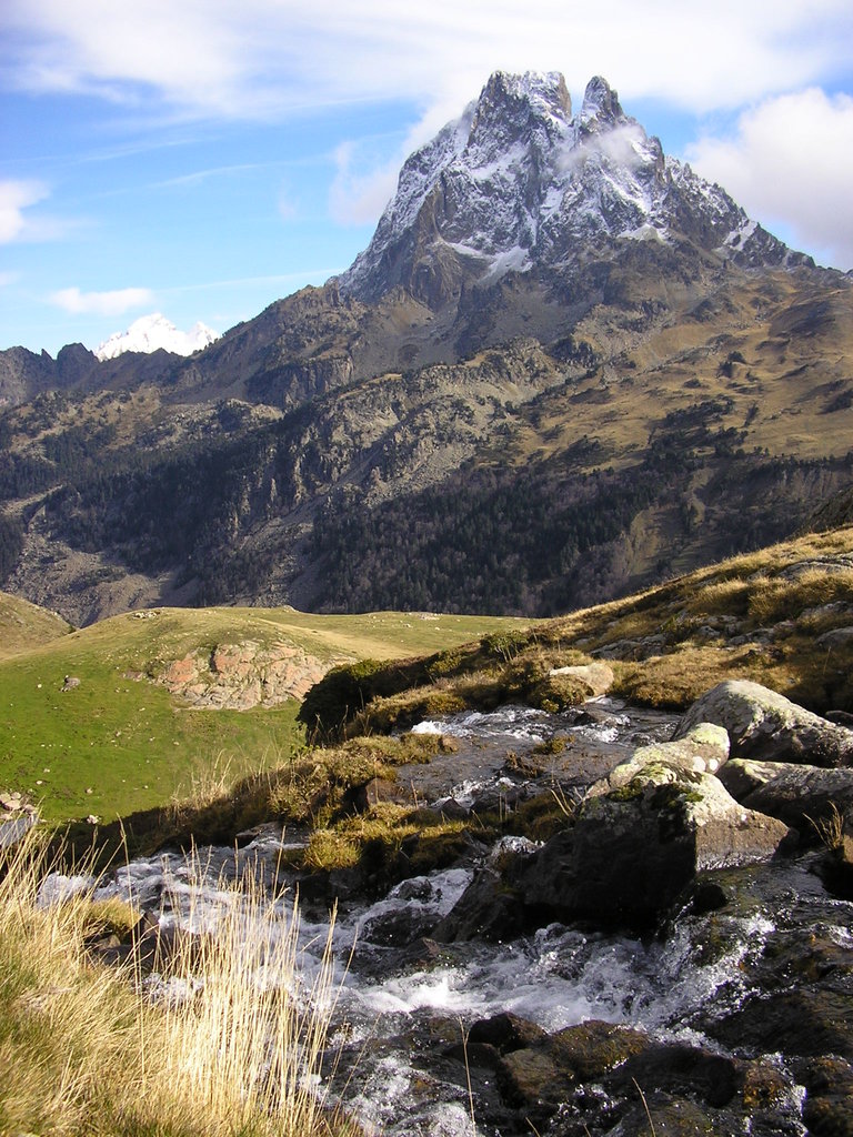
The Pyrenees are situated in the south of France forming a natural border with Spain. The foothills begin in the eastern coastal town of Saint-Sébastien in Spain before becoming very prominent in the Haute-Pyrenees region in France and the Huesca region in Spain. The highest peak in the Pyrenees, found in the central Pyrenees, is the peak of Aneto at 3404m. The range continues west through Andorra, an independent principality surrounded by mountains, and down towards the western shores of Perpignan. The high mountain passes of the Pyrenees from part of the natural border between France and Spain which winds its way through the range. Not only a natural border between countries, the Pyrenees separates the Iberian Peninsula from the rest of continental Europe.
Haute-Pyrenees
There are several important features which distinguish the Pyrénees from the Alps:
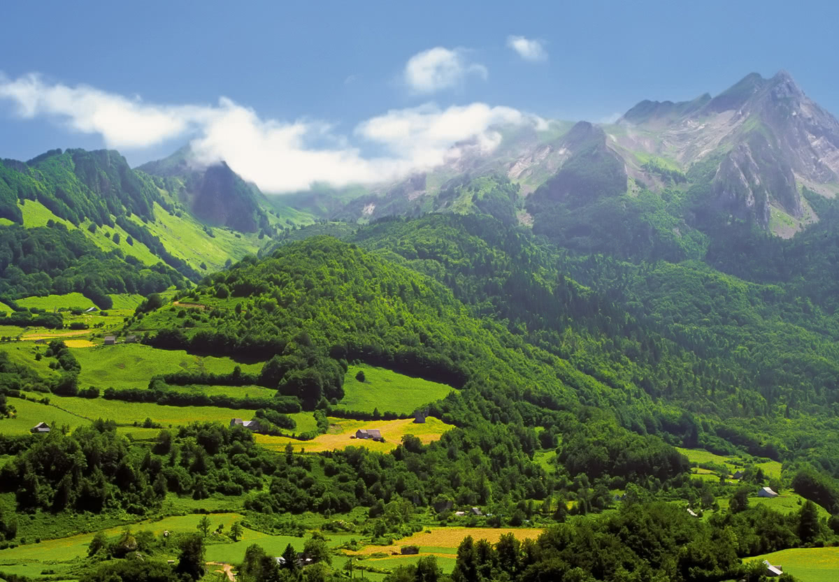
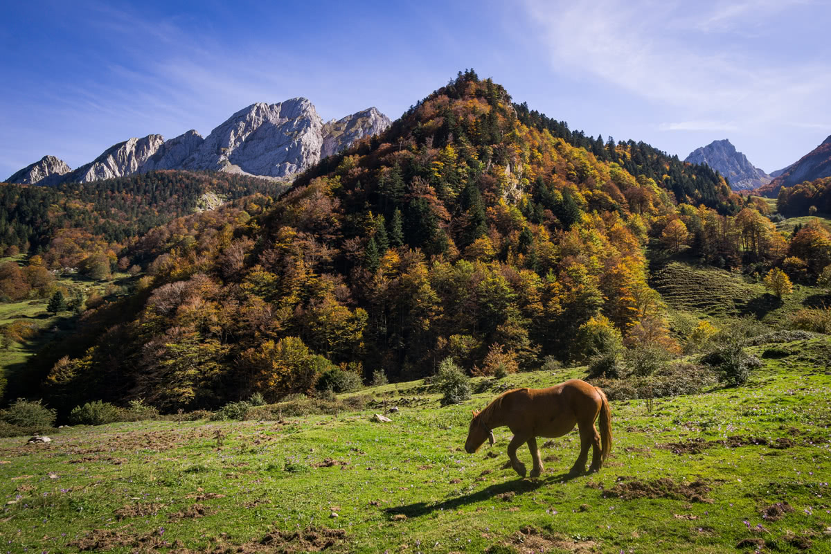
Nouvelle Aquitaine’s flora and fauna is an excellent example of France as a whole. There is a lot variety throughout the region, partly due to its large size. There are oak forests in the north, pine forests in the south.
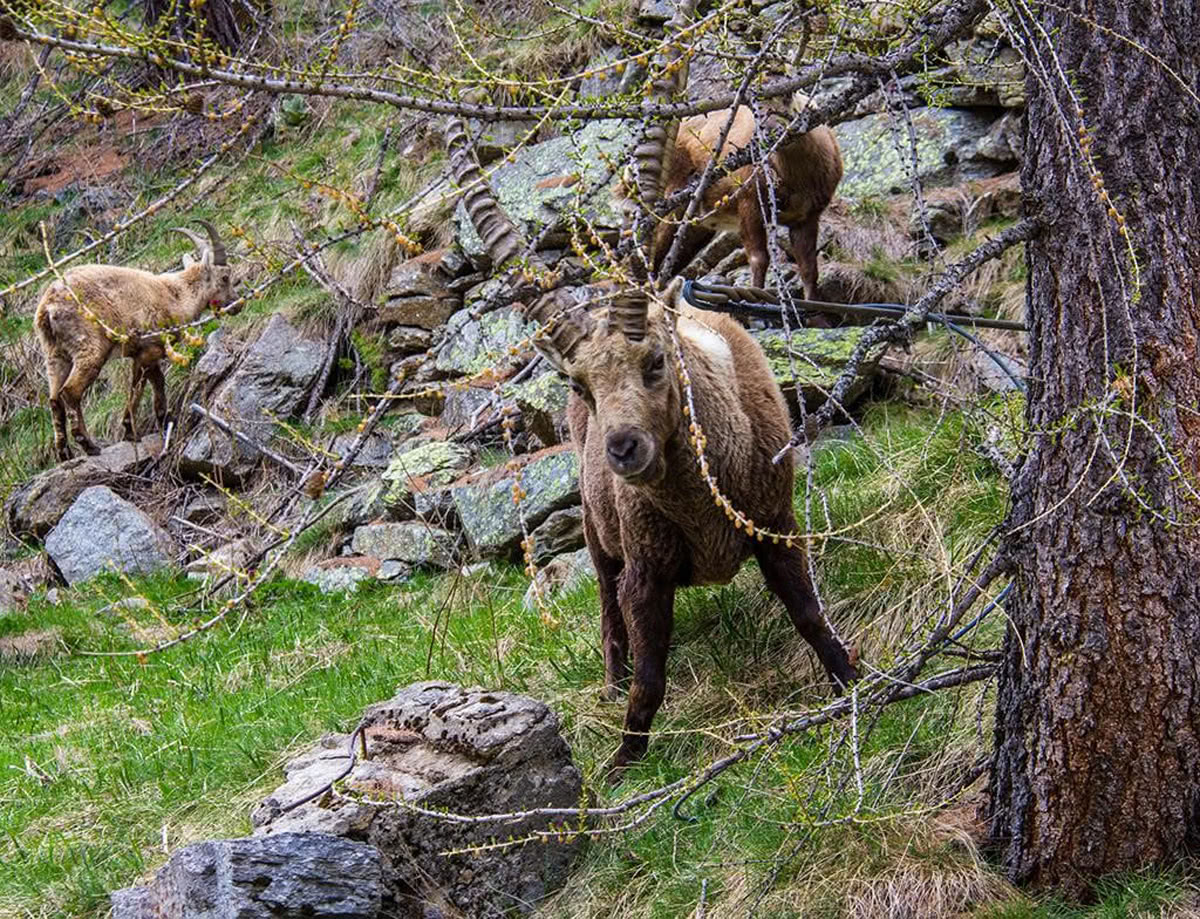
The Pyrénées Atlanriques have some of the most diverse fauna and fauna in Europe. The animals specific to the Pyrénées are the bearded vulture, the Pyrenean desman and the brown bear. In the high mountains the marmottes and ibex can be found, the latter being recently reintroduced into the area.
There are two principal mountainous areas within the region: The Pyrénées Atlantiques which contains the highest peak and the mountains found in the Creuse, Corrèze and Haute-Vienne departments.
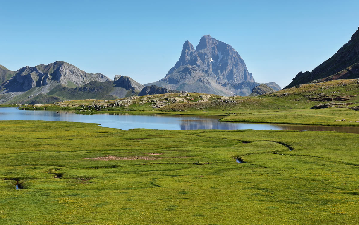
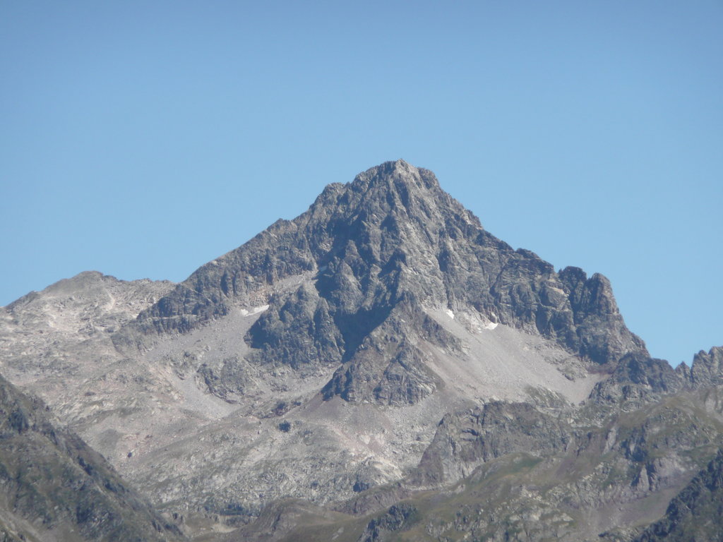
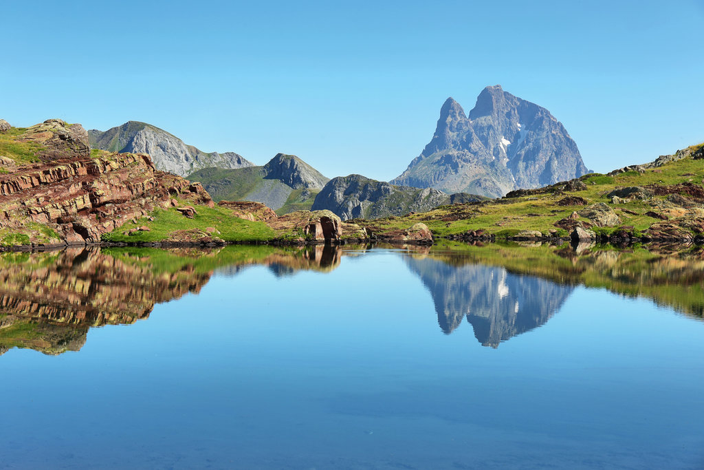
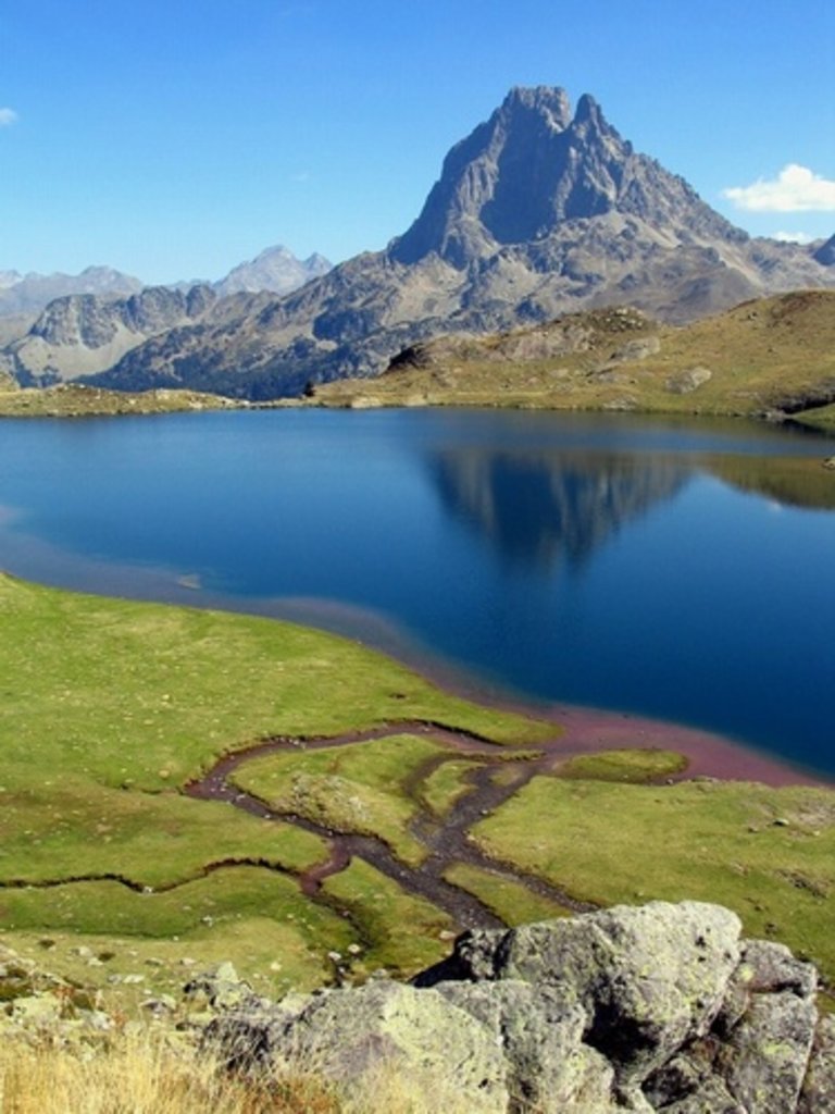
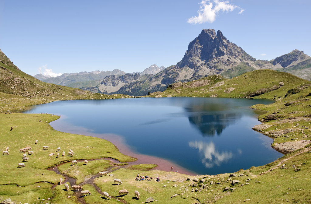
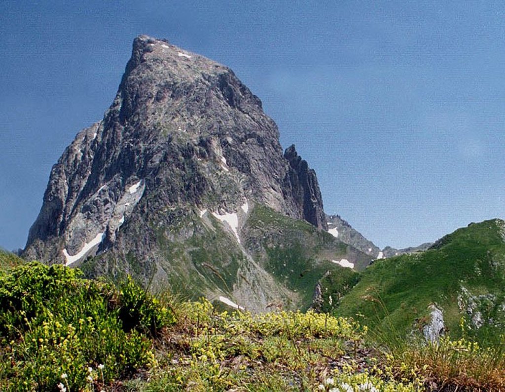
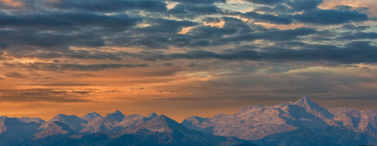
Pic du Midi d’Ossau
The highest point is the Pic du Midi d’Ossau at 2884m of elevation. It is made recognisable by its distinctive arrowhead shape of its peak. It is one of the principal mountains that can be seen from Pau, 55 km to the north. The mountain was supposedly first climbed in 1552 by François de Foix-Candale. There are several routes of ascent. The most frequented route via the ‘Voie Normale’, which features a rock climb section.
Pic du Midi d’Ossau 2884m - This is a classic Pyrenean hike and one of the best in the Pyrénées Atlantiques for lovers of high mountains, lakes and nature. Be sure to keep your eye open to glimpse the Pyrenean chamois and marmots that occupy the region. This hike is best suited for experienced mountaineers.
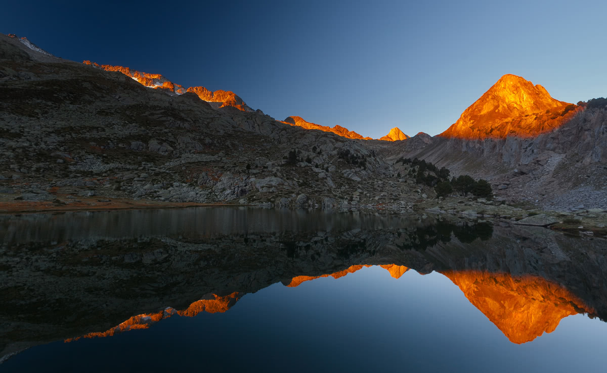
Tour Pic du Midi d’Ossau
Starting from the parking by the northern shores of the Lac de Bious Artigues, follow the signs for the Tour du Pic d’Ossau. At kilometer 4, you have the choice of climbing up to the summit - or continuing the tour around. If you continue to the summit return the same way back to the Lac de Bious Artigues to give a total distance of 13km with 1360m of elevation. If you decide not to climb to the summit, you can to continue clockwise around the base of the mountain, returning back to the start point by the lake. This route is 15km is length with 1000m of elevation. The estimated time for either route is 5-6 hours.
Pic d’Arlas 2044m - Another excellent hike in the Pyrénées Atlantiques, the Pic d’Arlas is at the heart of a Natural reserve and just above the ski resort of La Pierre Saint-Martin. Starting in the resort there is a steady 5km climb to the summit. Once here you will experience spectacular views of the surrounding peaks in France and in Spain, such as the Pic d’Anie 2504m. The total distance is 10km with 315m of vertical elevation. The estimated time taken is around 4 hours.
Mont Bessou 997m - Whilst not as elevated as the mountains in the Pyrénées Atlantiques, Mont Bessou is the highest point in the department giving an excellent vantage point across the surrounding area. The peak is situated in the Parc Naturel Régional Millevaches en Limousin and is also part of the expansive Massif Central mountain range which spans the central regions of France.
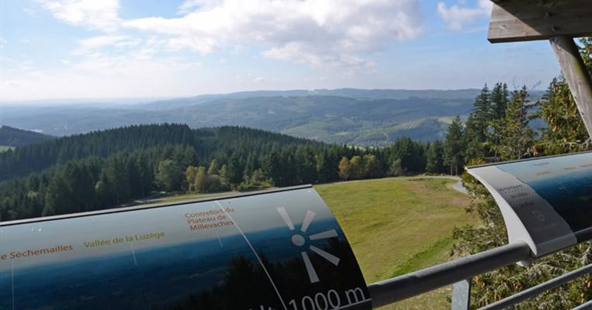
Parc Naturel Régional Millevaches en Limousin
There is a great hike, starting in Lontrade, which takes you through the forest of the natural park. This is not only an excellent route for beginners and families, but for everyone wanting to enjoy the wonderful local wildlife. By starting at a height of 800m, there is only around 120m of vertical elevation before you are at the peak. Once here there is an observation tower which has a 360 degree panoramic view across the forest canopy. The total distance for this tour is 8km with a total of 250m of vertical elevation. Estimate time 3hrs.