Pico d'Arriel / Punta dero Saldiecho (2 824m/9 265ft a.s.l.) is a mountain in the Pyrenees on the border of Spain, France. The prominence is 381m/1 250ft.
There's a demanding alpine trail (T5) leading to the summit.
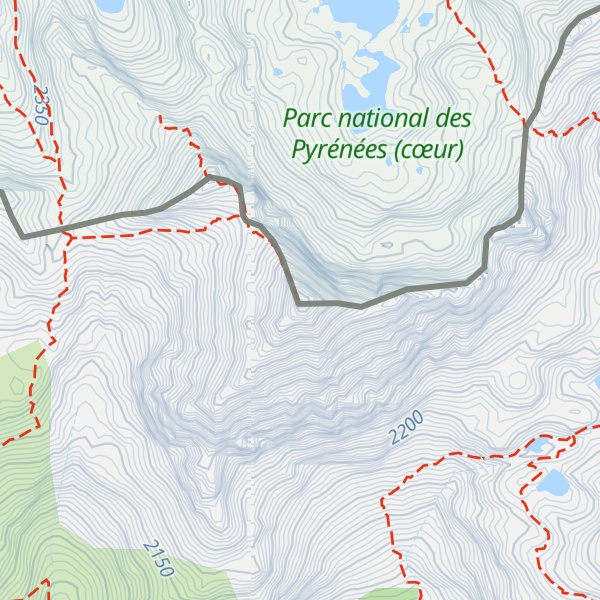
The nearest mountain hut is Refuge d'Arrémoulit located 1 327m/4 355ft N of the summit.
By elevation Pico d'Arriel / Punta dero Saldiecho is
# 100 out of 413 in Parc national des Pyrénées Occidentales (cœur) # 5 out of 2688 in New Aquitaine # 5 out of 1032 in Pyrénées-Atlantiques
By prominence Pico d'Arriel / Punta dero Saldiecho is
# 10 out of 413 in Parc national des Pyrénées Occidentales (cœur) # 52 out of 2258 in Huesca # 63 out of 5955 in Aragon # 21 out of 2688 in New Aquitaine # 21 out of 1032 in Pyrénées-Atlantiques
We use GPS information embedded into the photo when it is available.
3D mountains overlay
Adjust mountain panorama to perfectly match your photos because recorded by camera photo position might be imprecise.
Move tool
Rotate tool
Zoom
More customization
Choose which peak labels should make into the final photo and what photo title should be.
Next
Photo Location
Satellitte
Flat map
Relief map
Latitude
Longitude
Altitude
OR
Latitude
°'''
Longitude
°'''
Apply
Register Peak
Peak Name
Latitude
Longitude
Altitude
Register
Teleport
PeakVisor
This 3D model of Sagarmatha National Park in Nepal was made using the PeakVisor app topographic data. The mobile app features higher precision models worldwide, more topographic details, and works offline. Download PeakVisor maps today.
Download OBJ model
PeakVisor
The download should start shortly. If you find it useful please consider supporting the PeakVisor app.
PeakVisor for iOS and Android
Be a superhero of outdoor navigation with state-of-the-art 3D maps and mountain identification in the palm of your hand!