
Scan the QR code and open PeakVisor on your phone
Andorra is home to 175 named mountains. The highest is Alt de Comapedrosa at 2,944 m.
Andorra, officially the Principality of Andorra, is a landlocked independent European nation in the Pyrenees Mountains, bordered by Spain to the south and France to the north. Spanning just 468 sq km (181 sq miles), Andorra is one of the smallest geographical countries in Europe and the 17th smallest in the world. This mountainous nation has 175 named peaks, the tallest being Alt de Comapedrosa (2,943 m / 9,656 ft) and the most prominent being Pic de l'Estanyó (2,915 m / 9,564 ft).

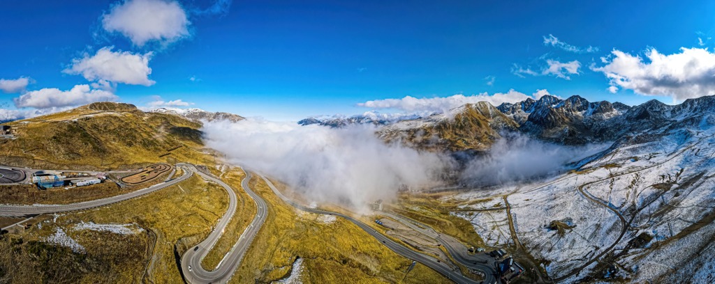
Andorra is in the heart of the Pyrenees, bordered by Spain to the south and France to the north. The country is surrounded by the rugged cliffs of the Pyrenees, which define the geography of the entire region.
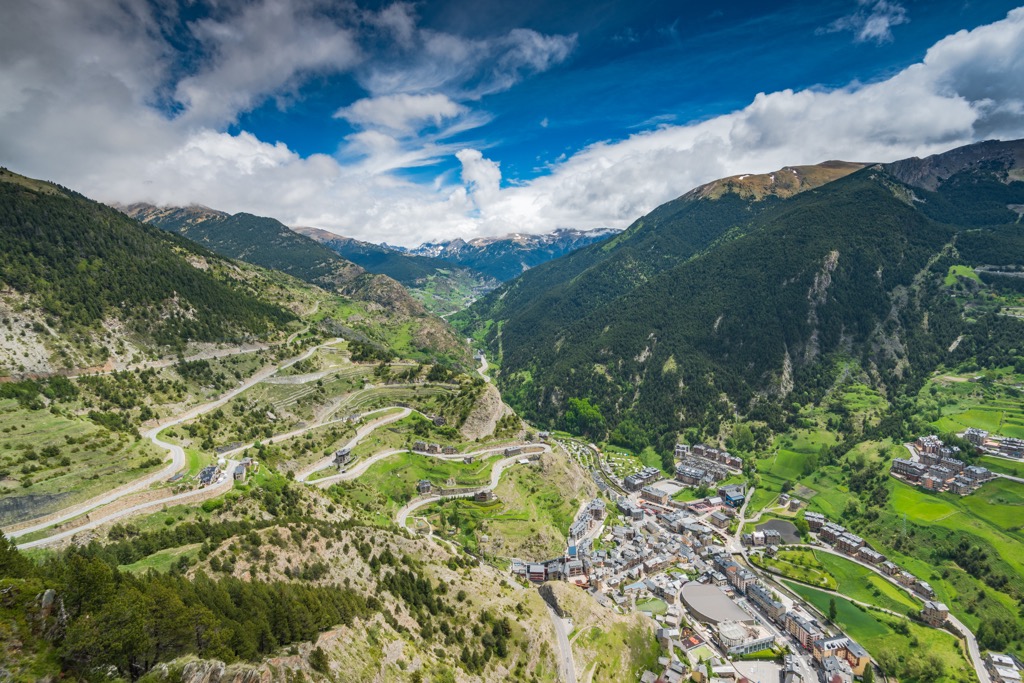
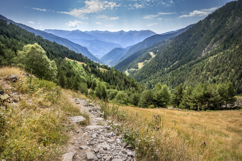
Peaks and ridgelines tower above Andorran towns and villages while mountain streams trickle through the valleys. These clusters of streams combine to form the Valira River, the largest in Andorra. The Valira flows through the capital city, Andorra la Vella, before turning south into Spain. Some prominent streams leading into the Valira are Valira d’Orient, Valira del Nord, and Madriu.
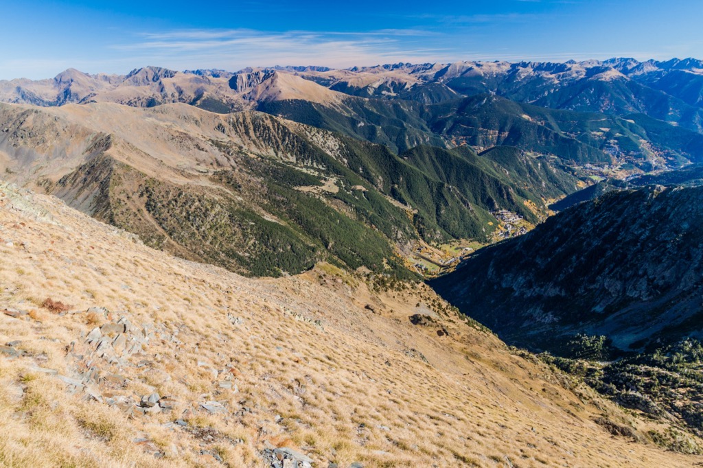
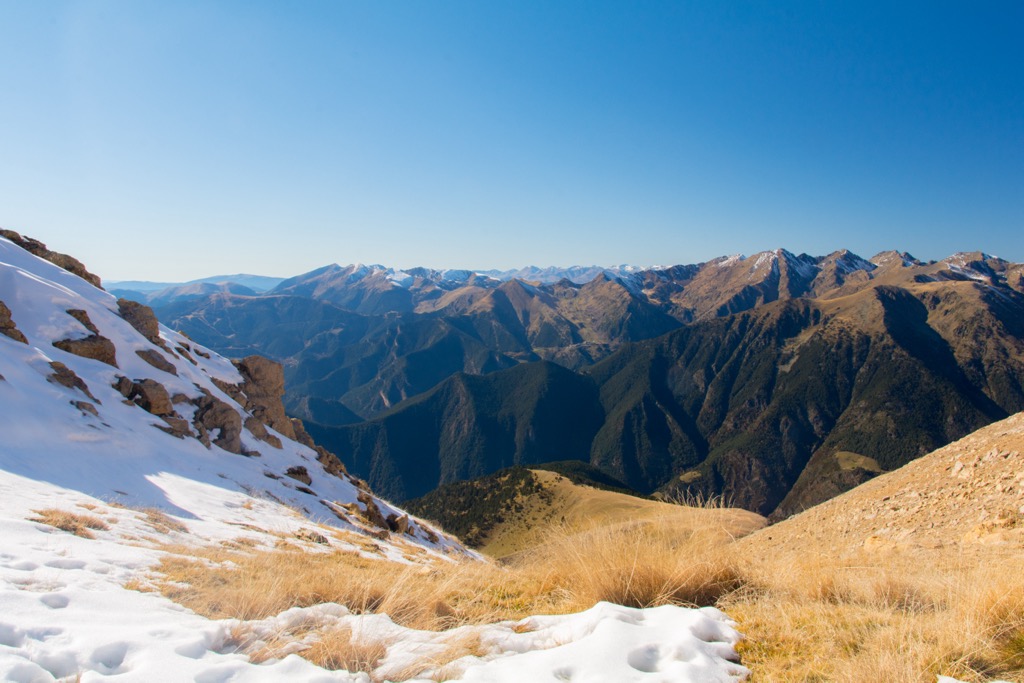
Andorra's elevation ranges from 840 m (2,756 feet) to the summit of Alt de Comapedrosa at 2,943 m (9,656 ft), while the average elevation is 1,996 m (6,549 ft). Amidst the peaks of the Pyrenees lie three main narrow valleys that roughly form a Y shape across the landscape.
The Madriu-Perafita-Claror Valley covers roughly one-tenth of Andorra. Here the terrain is marked by steep valleys, sweeping pastures, and remnants of a glacial landscape. While many peaks and ridgelines are alpine and devoid of plant life, most hillsides are densely forested.
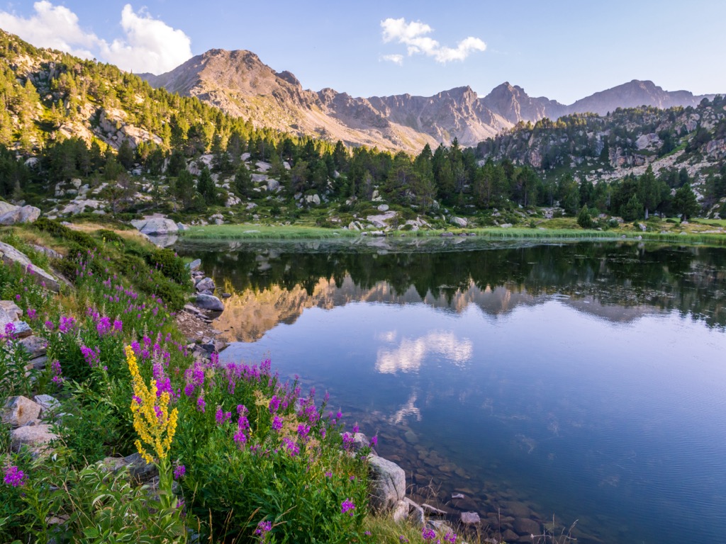
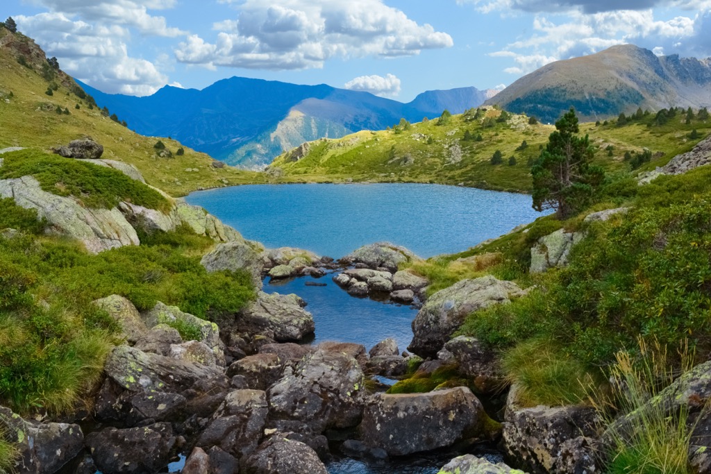
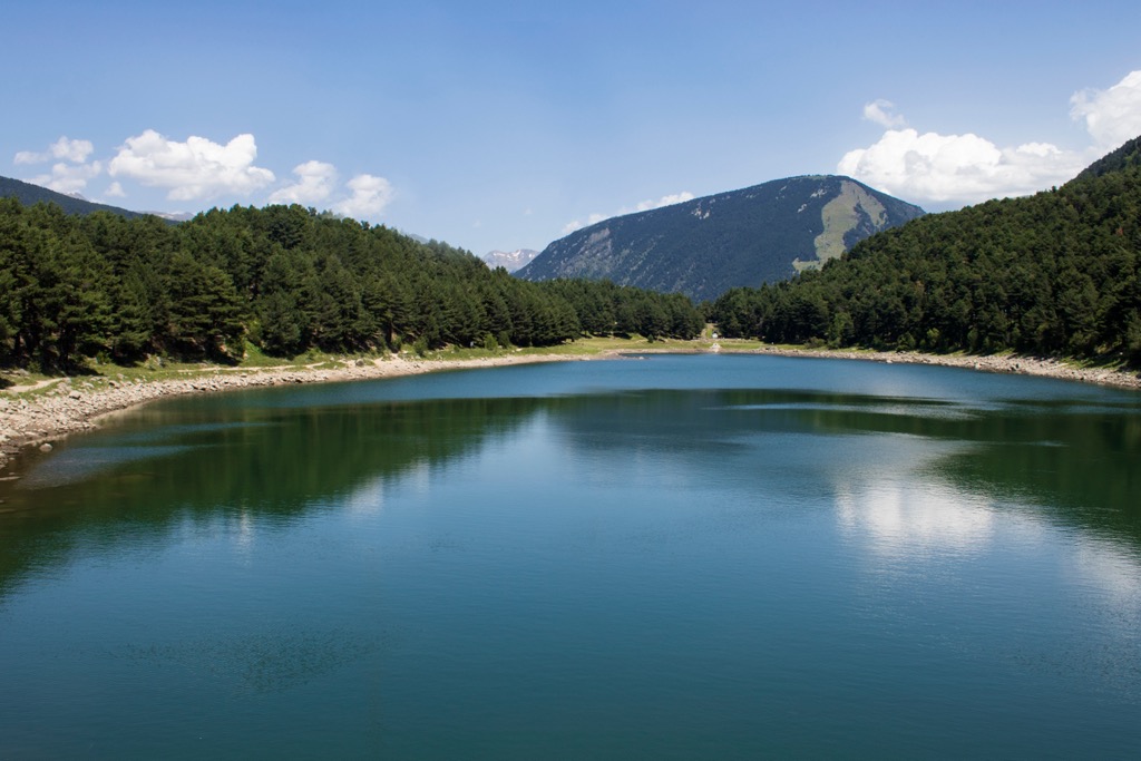
Amidst the mountainous terrain lie over 150 lakes, most relatively small. The largest lake in Andorra is Estanys de Juclar, which covers 23 hectares (57 acres) and is situated in the country's northeastern region.
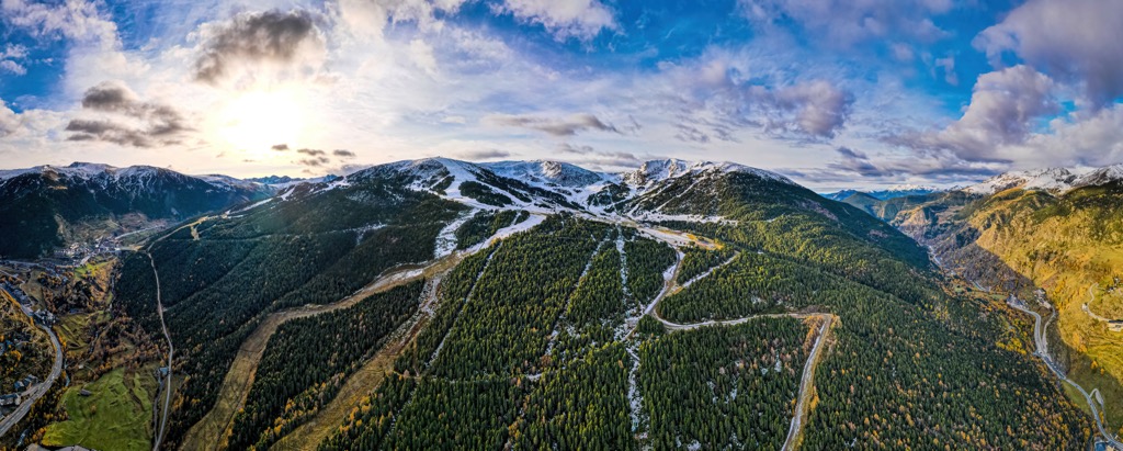
The terrain of Andorra has allowed it to thrive as a ski resort destination. Grandvalira boasts 210 km (130.4 mi) of slopes and 74 lifts, making it the largest resort in the Pyrenees and surpassing the largest resorts in Spain.
Additionally, Andorra is located near many other popular outdoor recreation areas, including the Parc Natural Comunal de les Valls del Comapedrosa in the north and Vall del Madriu-Perafita-Claror in the south. To the west, in Spain, lies the Alt Pirineu Natural Park, while the Ariége Pyrenees Regional Nature Park is to the north in France.
Andorra is in the heart of the Central Pyrenees mountains. The entire range extends 500 km (310 miles), far beyond the borders of Andorra.
Sediments that would later form the Pyrenees were initially deposited in coastal basins that developed during the Paleozoic and Mesozoic eras. In the Lower Cretaceous Period, roughly 100 to 150 million years ago, present-day France and Spain were pushed into one another.
The immense pressure caused by this tectonic shifting forced the landscape upwards and formed the eastern portion of the range. Over the course of millions of years, the rest of the Pyrenees mountains pushed skywards.
This range, including present-day Andorra, was heavily glaciated during the Quaternary. As these glaciers advanced and retreated several times, they carved out the landscape, leaving glacial cirques, basins, and river valleys behind.
While there are some small glaciers left in the western and central sections of the range, there are no longer glaciers found in the eastern Pyrenees. Common types of rock found in Andorra include limestone, slate, phyllite, quartzite, and conglomerate. The core of the region's peaks consists of schist and gneiss.
The southeastern section of Andorra is also home to an alkaline granite formation from the Mt-Louis-Andorra-Batholith. This batholith extends south into Spain for a total area of 600 square km (230 sq miles).
Despite its relatively small size, Andorra supports a variety of flora and fauna within its alpine environment. Similar to other nearby Mediterranean climates, Andorra is home to numerous microclimates.
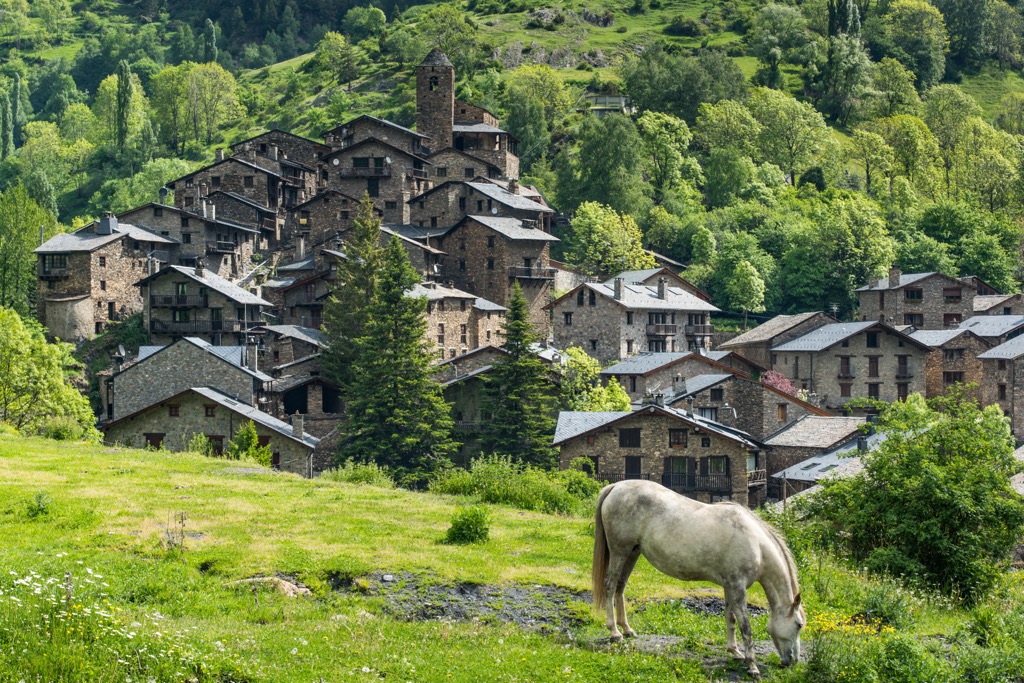
Lower elevations near the village of Sant Julía de Lòria are populated with walnut and chestnut trees. As the elevation increases, the forested landscape primarily features evergreen oak, firs, and pines.
The highest peaks in Andorra are alpine, populated by scrub brush and grasses. Common wildflowers include bellflowers, violets, carnations, wild strawberries, and flowering moss.
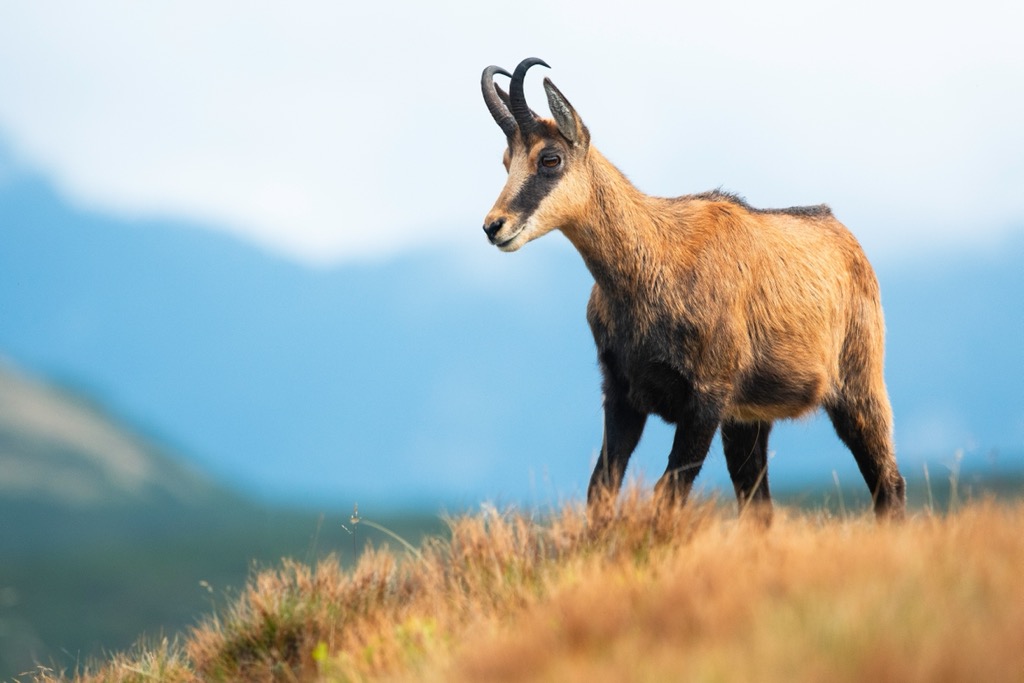
The vast forested landscape is home to many large mammals, including Pyrenean chamois, bears, wolves, and foxes. Smaller mammals include spot rabbits, hares, and martens.
Crystal-clear mountain streams and rivers are home to trout, brochet, and crayfish species. BirdLife International recognizes Andorra as an Important Bird Area, supporting species such as the rock bunting, citril finch, red-billed chough, eagles, and vultures.
Humans have inhabited the land that is part of present-day Andorra for thousands of years. Evidence suggests that southern Europe is second only to Africa in the duration of human settlement in the region. Neanderthals have likely stalked the mountains for at least 400,000 years, while our direct sapiens ancestors arrived about 30,000 years ago.
As far back as 9,500 BCE, these prehistoric peoples built a passage connecting the two sides of the Pyrenees. Throughout the Neolithic Age, the forested mountains were used for hunting and gathering, especially near the region’s streams and rivers.
Prehistoric people slowly evolved into semi-modern tribes like the Celts, eventually conquered by the Roman Empire. The Romans occupied the region from the second to the fifth century CE. Following the fall of the Empire, the Visigoths, the Kingdom of Toledo, and the Diocese of Urgell established kingdoms of various duration and success.
During the Middle Ages, Andorra was ruled by Charlemagne, the French leader at the time, to act as a buffer state. Those living in Andorra were expected to fight the Moors, occupiers of the Spanish peninsula, who were trying to enter France. Numerous other buffer states were created during the time though Andorra is the only one that is still a country.
Over the following centuries, Andorra had numerous rulers, sometimes passed down by marriage and other times given as a gift or reward. During the 13th century, following a dispute between the Count of Foix and the bishop of Urgell, the first paréage was signed. This ultimately led to the French head of state and the bishop of Urgell from Catalonia sharing Andorra’s sovereignty.
An imperial decree passed in 1814 led to reestablishing Andorra’s independence. More than France, the people of Andorra are strongly associated with Catalonia's people and culture, located in northern Spain.
By the twentieth century, Andorra had adopted Western capitalism, which led to an economy centered around tourism and the country becoming a tax haven for the rich.
Today, Andorra has three ski areas: Grandvalaira, Ordino Arcalis, and Pal-Arinsal. The Parc Natural Comunal de les Valls del Comapedrosa in western Andorra was established in 2003 while Vall del Madriu-Perafita-Claror was declared a UNESCO Heritage of Mankind in 2004. Andorra is home to roughly 80,000 residents and is ruled by the French President and the Bishop of Urgell from Spain.
There are a plethora of hiking trails throughout the country of Andorra, many of them within the country’s parks.
This out-and-back trail is located near the center of the country. The hike begins near the community of Ordino and climbs steeply. After passing through the forested hillside, the route opens to reveal panoramic views of the mountains. From the summit, hikers can see quaint villages below, while Parc Natural de la Vall de Sorteny lies to the north. The trail is 7.4 km (4.6 miles) long and features 745 m (2,444 feet) of elevation gain.
This shorter hiking trail lies in the northern stretches of Andorra, near the French border. The route begins by climbing steeply amidst the rocky cliffs. The route passes numerous lakes, including Estany del Mig and Estany de Més Amunt. Hikers should note that the lack of tree coverage results in minimal shade. This hike is 3.7 km (2.3 miles) roundtrip and features 177 m (580 feet) of total elevation gain.
This loop begins along the southern shores of Lac d’Engolasters. The route features numerous short climbs and descents through the densely forested hillsides before looping back toward the lake. The trail is 4.8 km (3 miles) long and features 323 m (1,059 feet) of elevation gain.
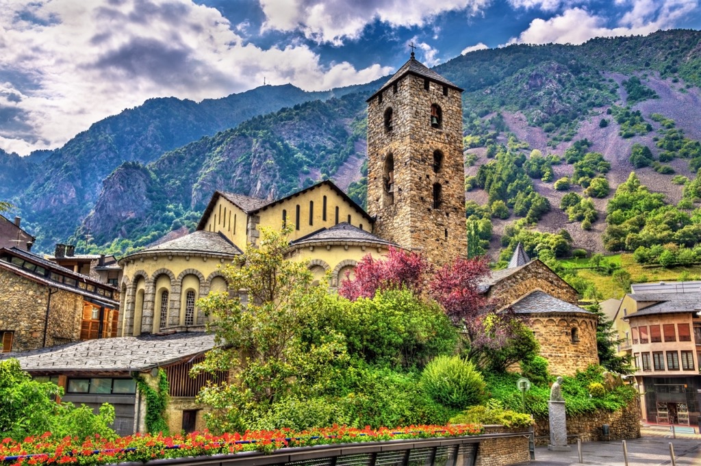
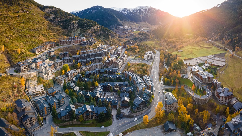
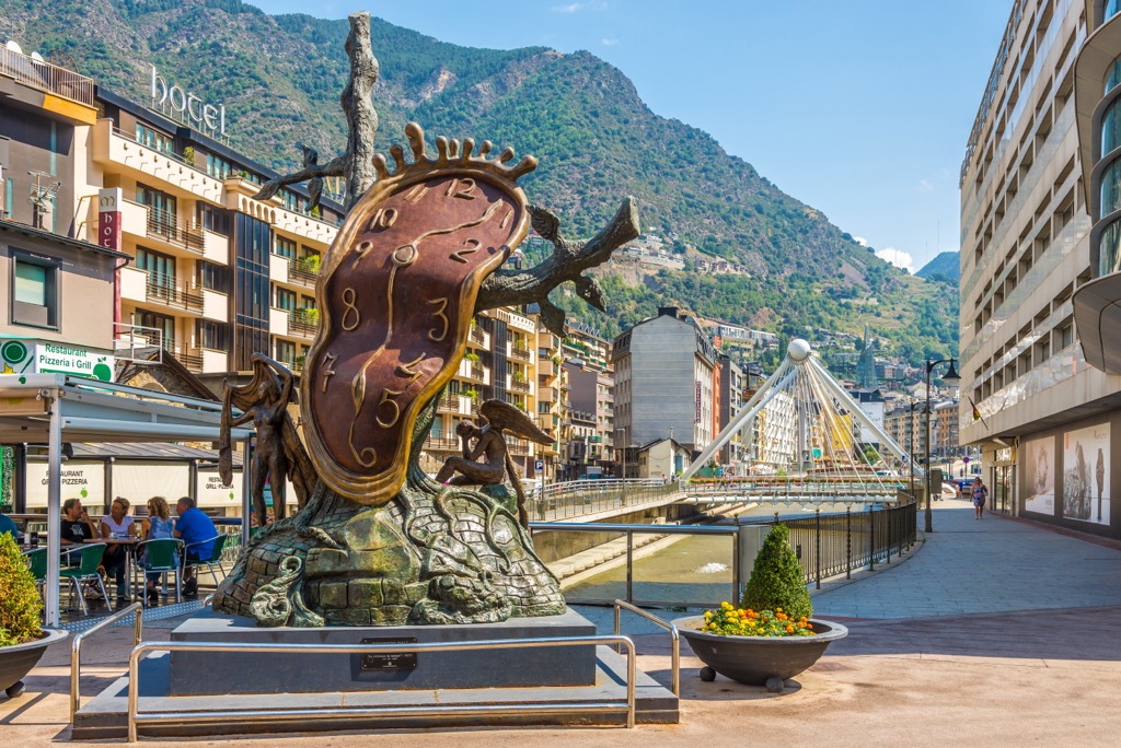
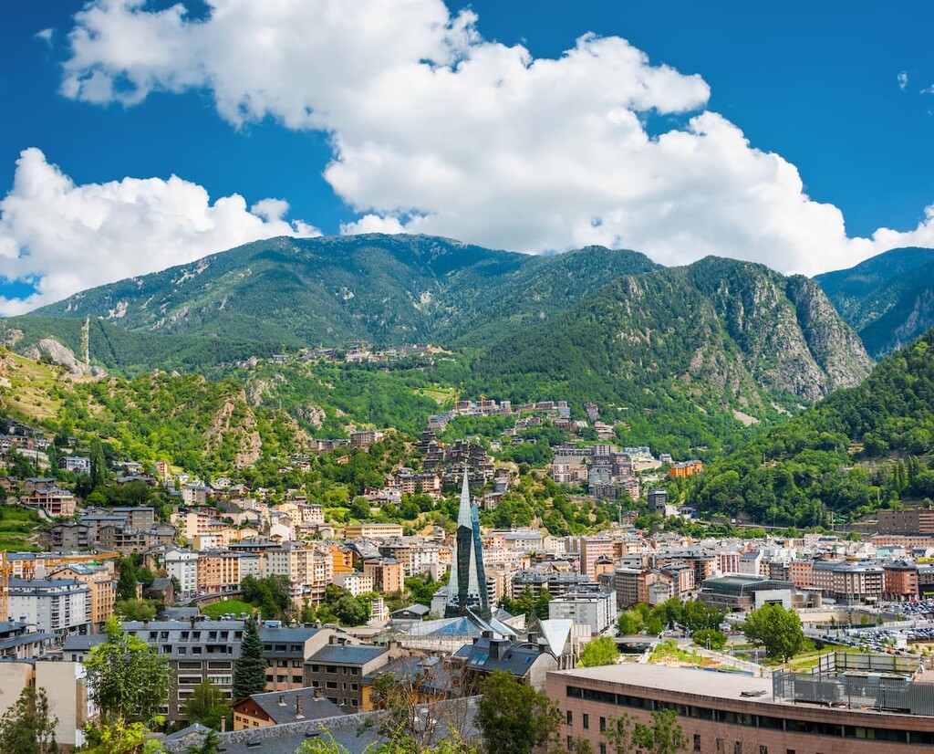
Andorra la Vella is the capital city of Andorra and is located near the center of the country. Along with the neighboring Escaldes-Engordany, the city has roughly 40,000 residents. Surrounded by rolling, forested hills and peaks, Andorra la Vella is the region's cultural hub. Downtown streets are lined with shops, as the city is a duty-free hub.
Situated at 1,023 m (3,356 feet), visitors can stay in Andorra la Vella and easily access other parts of the country with a short car ride. Amidst the narrow streets lies the twelfth-century Sant Esteve church and murals from the sixteenth and seventeenth centuries. Vallnord Ski Resort lies just a fifteen-minute drive north of the capital.
Due to the small size of Andorra, the capital is the only ‘major’ city in the region. However, there are numerous small communities, villages, and purpose-built resort towns to stay in. Roads run throughout the rolling hills and surrounding mountains providing visitors quick access to the rest of the country.


Yes. Andorra has 175 named mountains. The highest is Alt de Comapedrosa at 2,944 m.
The highest mountain in Andorra is Alt de Comapedrosa, at 2,944 m.
Andorra has 175 named mountains.


