Scan the QR code and open PeakVisor on your phone
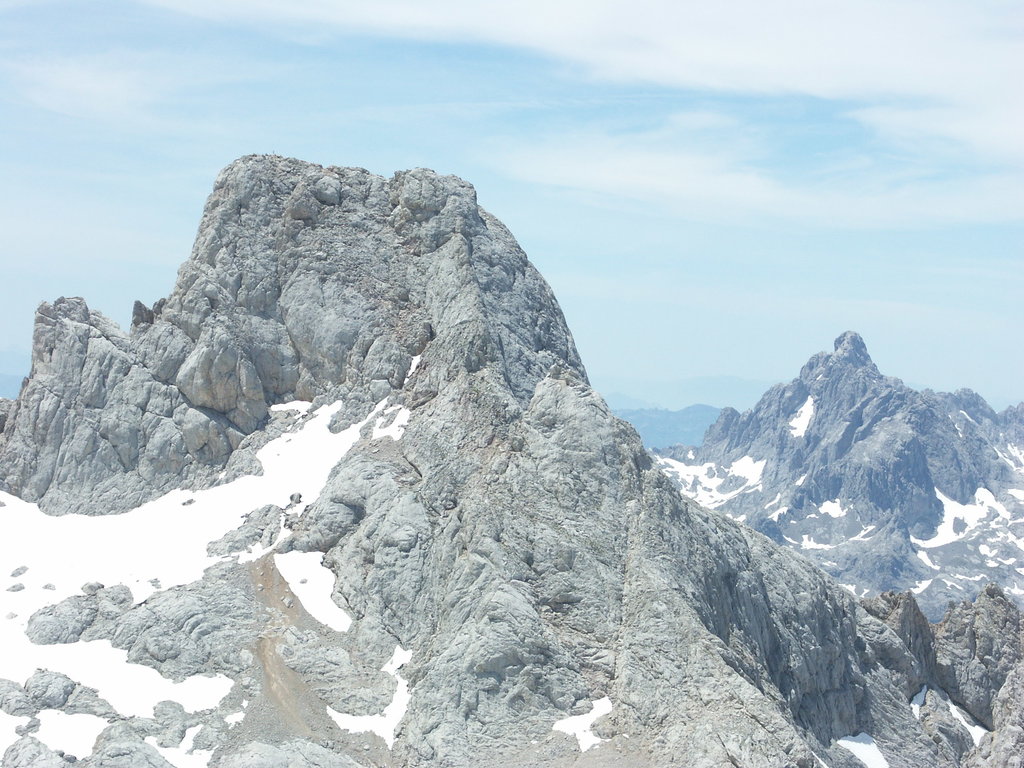
The Cordillera Cantábrica (Cantabrian Mountains) is a stunning mountain range that extends throughout nearly all of northern Spain. The range contains 14,515 named mountains. The tallest and most prominent peak in the range is Torre Cerredo at 2,649 m (8,691 ft) in elevation and with 1,932 m (6,339 ft) of prominence.
Cordillera Cantábrica is situated in the northern region of Spain, extending throughout the autonomous communities of Asturias, Cantabria, Castile and Leon, and the Basque Country. The range spans over 300 km (180 miles) across the northern coast of the country. The eastern edge of the range marks the western limit of the Pyrenees, when run through eastern Spain.
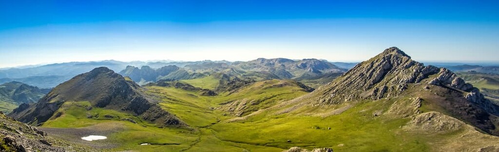
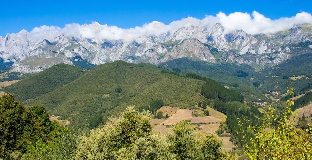
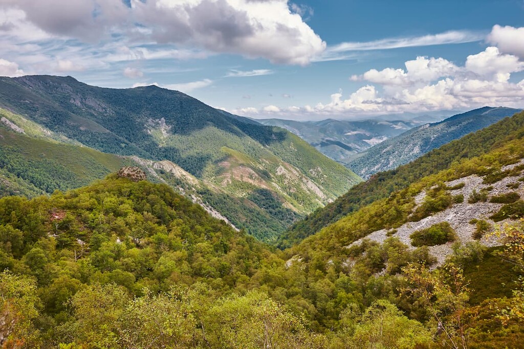
This range is often broken down into three major sections: the western range, central range, and the eastern range. These mountains run nearly parallel to the Bay of Biscay, which lies to the north of the range. A common feature of each of the subranges is that they consist of two distinct ridgelines. The ridgeline that is closer to the coast has gentler slopes while the inland ridgeline is defined but its steeper and more rugged peaks.
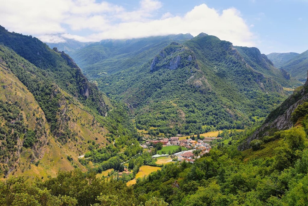
Besides the iconic peaks of the range, there are numerous valleys within the Cordillera Cantábrica. These fertile lands set within valleys are either forested or characterized as grasslands. The range makes a sharp divide between what is known as “Green Spain” and the much drier plateau to the south.
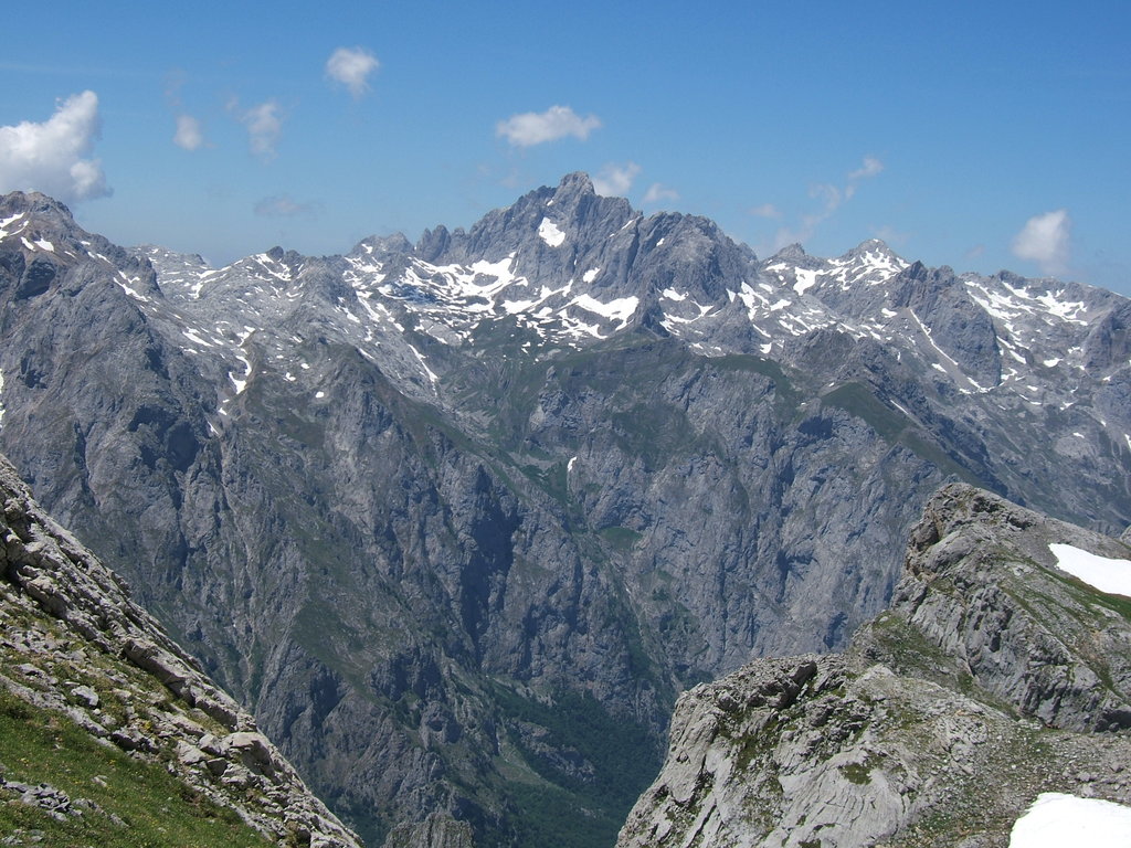
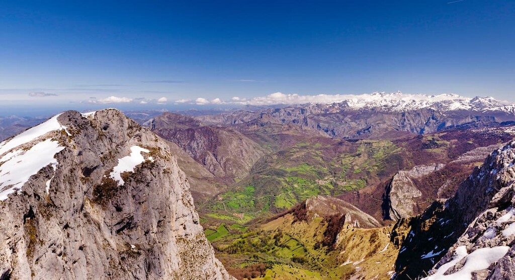
The western section of the range is home to the Asturian massif and is an extension of the Galaic massif. The central peaks are home to the Picos de Europa and the Rudron Valley. Finally, the eastern peaks of the range are referred to as the Basque Mountains which begin to travel northeast towards the sea.
Additionally, the Cordillera Cantábrica is full of popular outdoor recreation areas. Within the mountain range lies Picos de Europa National Park (Parque nacional de Picos de Europa), Fuentes del Narcea, Degaña e Ibias Natural Park (Parque natural de Fuentes del Narcea, Degaña, e Ibias), Redes Natural Park (Parque natural de Redes), Somiedo Natural Park (Parque natural de Somiedo), among others.
Similar to much of the mountains in Spain, the Cantabrian Mountains consist of limestones that date back to the Carboniferous period. The peaks formed around 350 million years ago and are part of the larger Alpide belt which also includes ranges such as the Alps and the Himalayas. This large belt of peaks was created through the collision of the Afriacan, Indian, and Eurasian tectonic plates.The range runs parallel to the coastline that lies to the north.
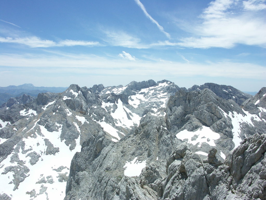
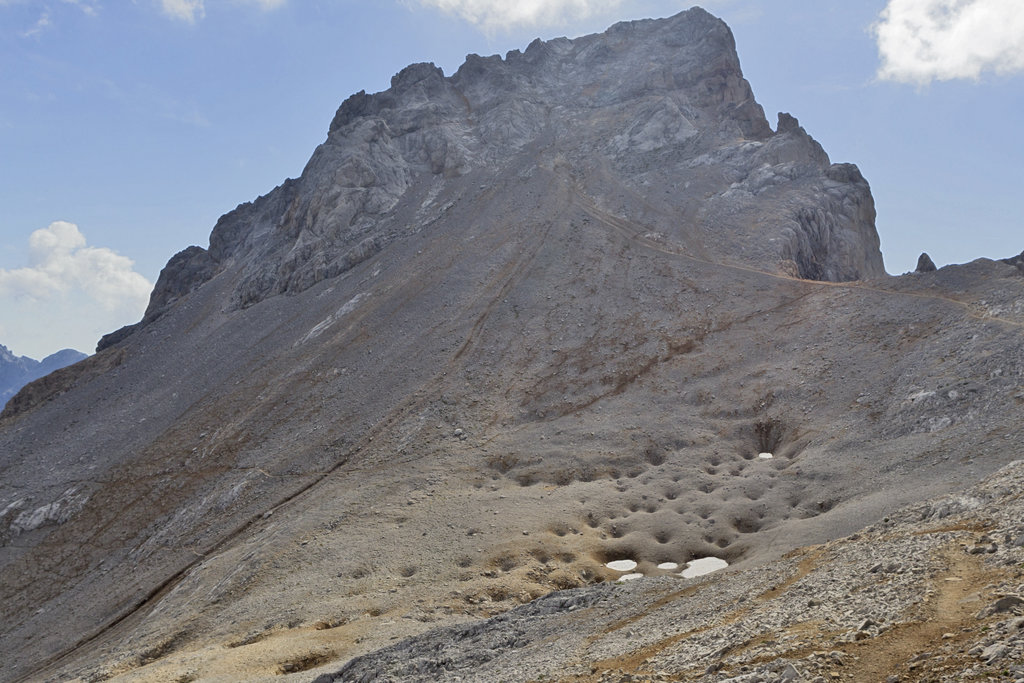
The western sections of the range showcase Paleozoic folds. Over millions of years, these folds helped form the east-west canyons in the range. The central mountains consist primarily of Carboniferous limestone and marl. The relatively soft stone is largely responsible for the jagged peaks that we see today.
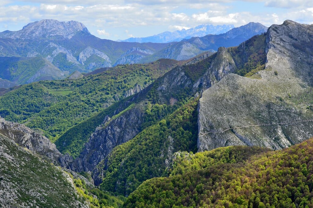
Meanwhile, the eastern stretches of the range showcase eroded Mesozoic folds. The elevation in the peaks is lower than those in the western and central regions.
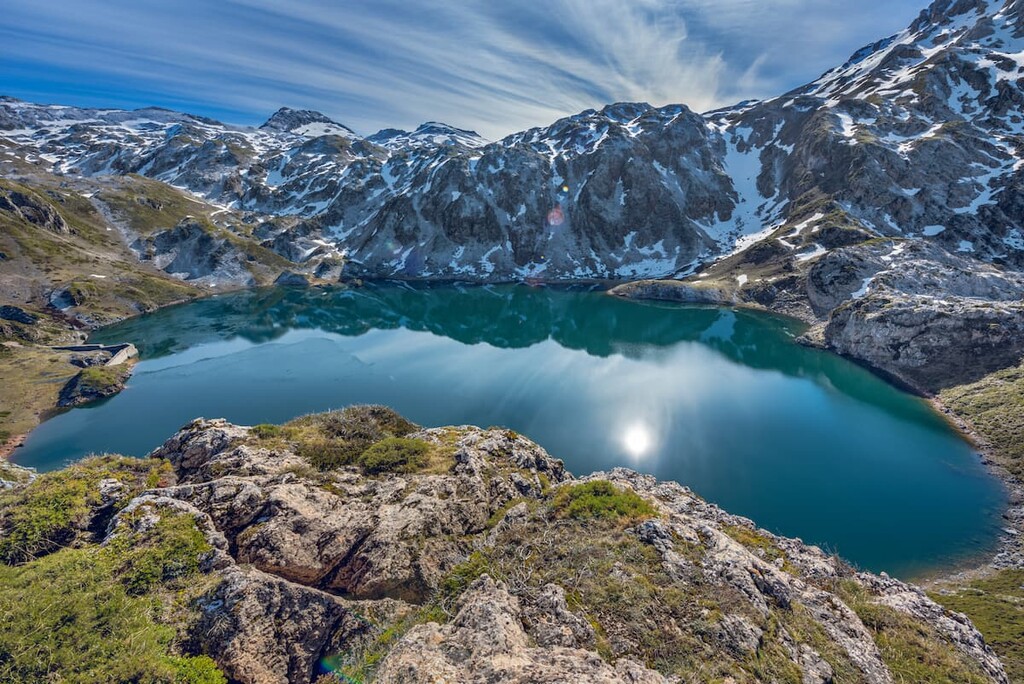
The range’s limestone composition has left behind karst formations along with caves, though they are often found at higher elevation. The steep slopes in the central range have resulted in numerous lakes forming along the valley’s floors.
Major peaks within the range include Torre Cerredo, Torre de Llambrión, Tiro Tirso, Peña Vieja, and Aitxuri.
The entire range is known for its vast amounts of biodiversity, which has led to much of the region being protected through a network of parks and biorserves. Besides its rugged mountain peaks, the range is home to numerous species of flora and fauna.
Some regions of the mountains are home to dense forests interspersed with grasslands that are recovering from deforestation. Native flora includes white asphodel, orchids, asterwort, and lundwort.
The forests of the park are home to ash, lime, chestnut, walnut, elk, oak and various other tree species. The higher elevations in the park are scattered with beech trees and smaller native grasses.
One of the most iconic animals of the range is the Cantabrian brown bear. The species is threatened and the range, along with its network of parks, are working to restore its population.
Other important animal species in the range include the Iberian wolf and Cantabrian chamois, as well as multiple species of deer, bats, and birds of prey. Many of the lakes and rivers in the park are home to multiple species of trout.
The Ibias municipality, which is located within the range,is particularly rich in human history. Evidence shows the region has been inhabited since the Stone Age. Rock structures called dolmens date back to this time period and offer a glimpse into what life was like back then.
Today historic remnants, including the remains of stone houses and thatched cabins, can be found in the foothills of the Ibias region and other sections of the mountain range.
The mountain range was named after the Cantabri people, also known as Ancient Cantabrians. This pre-Roman group of people inhabited much of the northwestern region of ancient Iberia during the second half of the forest millennium BC.
Due to their close proximity to what is now the Cantabrian mountains, the term Cantabri has been translated to “Highlanders”, derived from the root word cant- meaning mountains.
Long before a park was ever established, the region was the site of the Battle of Covadonga, which took place around 718 CE. Legend claims that the Virgin Mary statue in the nearby caves brought Christian victory over the Moors during their invasion of Spain, resulting in a shrine surrounding this statue all the way to present day.
Throughout the 1900s, many of the parks were established within the range. Many went on to later become protected as UNESCO Biosphere Reserves, such as the Muniellos Biosphere Reserve.
These days, the range is sparsely populated with most of the population living on the outskirts of the mountains. While agriculture and logging opportunities in the range are very limited, some of the land is used for transhumance herding. This process allows for local communities to graze cattle at lower elevations during winter months and higher elevations during the summer months.
Cordillera Cantábrica is home to numerous parks and trails. Here are some of the top hiking areas to visit in the range:
The trail to Lago del Valle is one of the most popular in Parque natural de Somiedo (Somiedo Natural Park. The 11.9 km (7.4 mi) trail has 358 m (1,177 ft) of elevation gain. This route takes hikers on a loop to one of the most iconic lakes in the park and in the Cantabrian Mountains.
The trail climbs steadily through the valley while the rugged peaks rise up on either side. The snow capped peaks surround the beautiful lake before the trail descends back down through the valley.
The route to the tallest peak in Parque Natural de las Fuentes del Narcea Degaña e Ibias (Fuentes del Narcea Degaña e Ibias Natural Park) passes through the Natural Reserve of Cueto de Arbas, which also runs through the park.
The route starts at the Port of Leitariegos before climbing steadily up to El Puerto lake and then Laguna de Arbas before reaching the summit of Cueto Arbás.
After reaching Fanentina pass, the trail continues along the ridge line up to the summit. From the highest point in the park, visitors can enjoy panoramic views of the Naviego valley and the park below. The trail totals 7.4 km (4.6 miles) with 560 m (1,900 ft) elevation gain.
This trail to the summit of La Xamoca is located at the northeastern section of Parque Natural de Redes (Redes Natural Park).
This loop trail route totals (7.7 m) with (2,742 ft) of elevation gain and it takes visitors up to the summit of La Xamoca. The route travels through the chestnut tree forests in the foothills before reaching the summit and viewpoints of the rolling hills and steep peaks to the south.
Looking for a place to stay near Cordillera Cantábrica? Here are some of the best cities and villages to check out in the region:
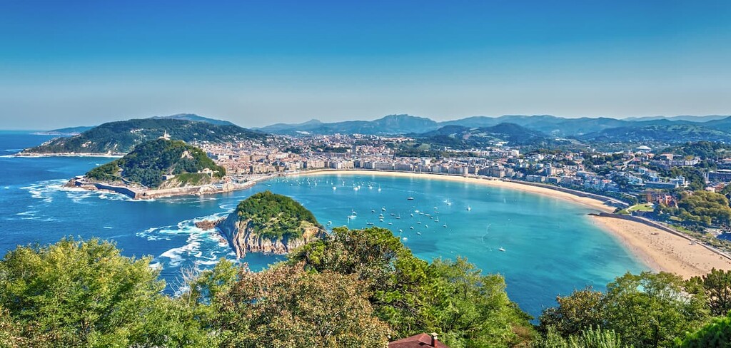
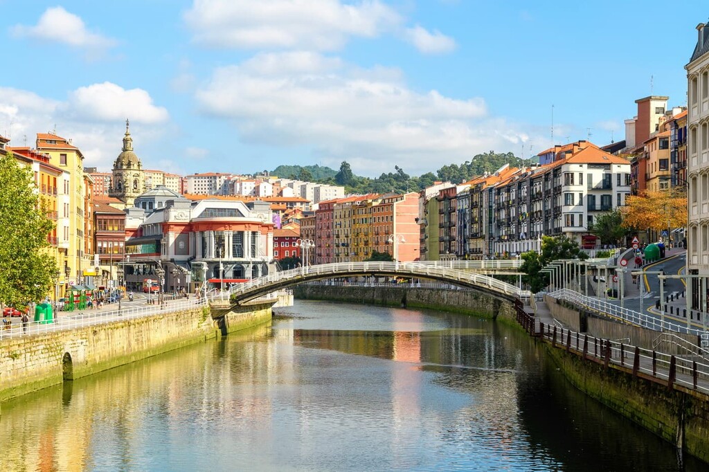
At the northeastern edge of the range lies the city of Bilbao. With a metro population of over 1 million, the city is the largest in all of the Basque Country and northern Spain. Though the city sits in the foothills of the Cordillera Cantabrica, it is also home to two small mountain ranges that help give Bilbao its moderate climate.
Bilbao is the culture hub of the region. Since the city is located in the Basque Country, it is home to its own unique cuisine and traditions, different from other regions of Spain. Bilbao is known for its pintxos (small plates), seafood dishes, and its sagardotegi cider.
Located just to the southwest of the range lies León. The city is the capital of the province of León and has a population of around 125,000 people. The formation of the city dates back to 29 BCE, when it was founded as a military encampment.
Today, León is known for its rich architectural history, regional gastronomy, and diverse tapas scene. Rayonnant Gothic Cathedral, the Roman Walls and MUSAC museum are just a few of the sites to see while staying in León. The city is also known for its festivals and celebrations during Holy Week.
Located in the western region of the range lies the city of Lugo, the capital of the province of Lugo. Lugo is the most populous city in Galicia with a population or around 100,000. Completely intact Roman walls surrounded the city, the only city in the world to claim that title.

Lugo is close to many of the range’s parks. Fuentes del Narcea, Degaña e Ibias Natural Park (Parque natural de Fuentes del Narcea, Degaña, e Ibias), Redes Natural Park (Parque natural de Redes), Somiedo Natural Park (Parque natural de Somiedo), can all be reached by car in under three hours.
The city of Vigo is located along the west coast of Spain, just north of Portugal. Located in the province of Pontevedra in the autonomous community of Galicia, the city has a population of around 296,000 people. The city grew rapidly in the twentieth century, becoming an industrial hub for the region.
Vigo’s location along the coast allows it to have a Mediterranean climate with a dry trend during the warmer months. The high rainfall during the winter months often leads to it being compared to the Pacific Northwest in North America. Its close proximity to the ocean allows for an abundance of seafood restaurants and cafés.