
Scan the QR code and open PeakVisor on your phone
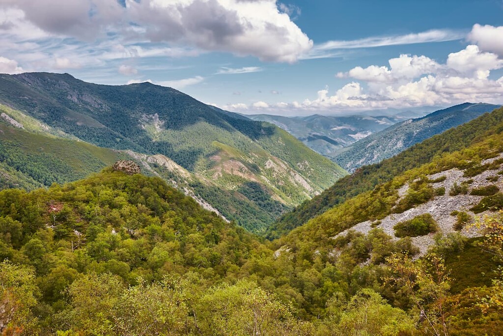
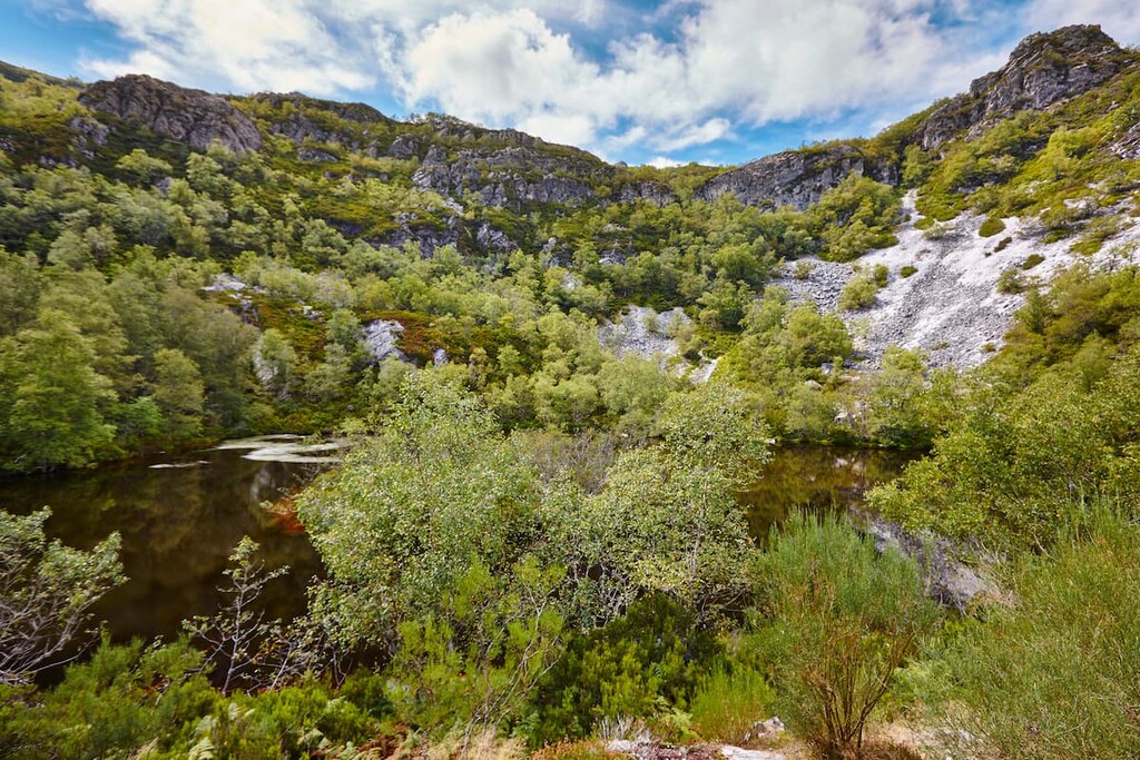
Located in northwestern Spain, Parque Natural de las Fuentes del Narcea Degaña e Ibias (Fuentes del Narcea, Degaña and Ibias Natural Park) is a stunning outdoor recreation destination known for its mountainous landscape and rich flora. The park contains 251 named mountains. The tallest peak in the park is Cueto Arbas at 2,002 m (6,568 ft) in elevation and the most prominent peak is Bóveda with 555 m (1,820 ft) of prominence.
Parque Natural de las Fuentes del Narcea Degaña e Ibias (Fuentes del Narcea, Degaña and Ibias Natural Park) is situated in the northwestern region of Spain in the autonomous community of Asturias.
The park spans 555 square kilometers (214 square miles) across northern Spain and it is located within parts of the municipalities of Cangas del Narcea, Ibias, and Degaña, each of which has its own unique landscape and iconic features.
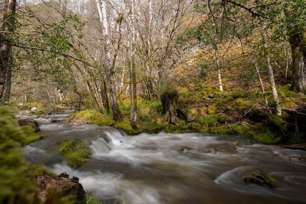
In particular, the northern part of the park is located within the municipality of Cangas del Narcea, which is characterized by steep terrain and rugged mountains. This region is also home to the River Narcea, which. Amidst the rugged peaks of this region also lies the Muniellos Forest, which is heavily restricted in order to preserve the delicate ecosystem.
The second municipality found in the park is Degaña, and it consists of mountainous regions intermixed with vast and lush valleys. This municipality is centered in the Cantabrian Mountains (Cordillera Cantábrica) with rugged peaks surrounding deep canyons and high plateaus. Here there are fewer restrictions on outdoor recreation than you might find in other parts of the park as this area is home to the regional game reserve.
The third municipality found within the park is Ibias. Boasting lower elevations than other parts of the park, this section features a landscape that’s dominated by rolling hills and that’s known for its biodiversity. The River Ibias also winds through the municipality, as do its many tributaries.
Additionally, Parque Natural de las Fuentes del Narcea Degaña e Ibias is surrounded by other popular outdoor recreation areas.
Directly west of the park lies the Parque Natural de Somiedo (Somiedo Natural Park) and the Parque Natural de Las Ubinas-La Mesa (Las Ubinas-La Mesa Natural Park). Meanwhile, Espacio Natural de los Ancares Leoneses y Alto Sil (Ancares Leoneses y Alto Sil Nature Space) is located to the south and Os Ancares Lucenes y Montes de Cervantes, Navia y Becerrea Bioshpere Reserve is situated to the southwest.
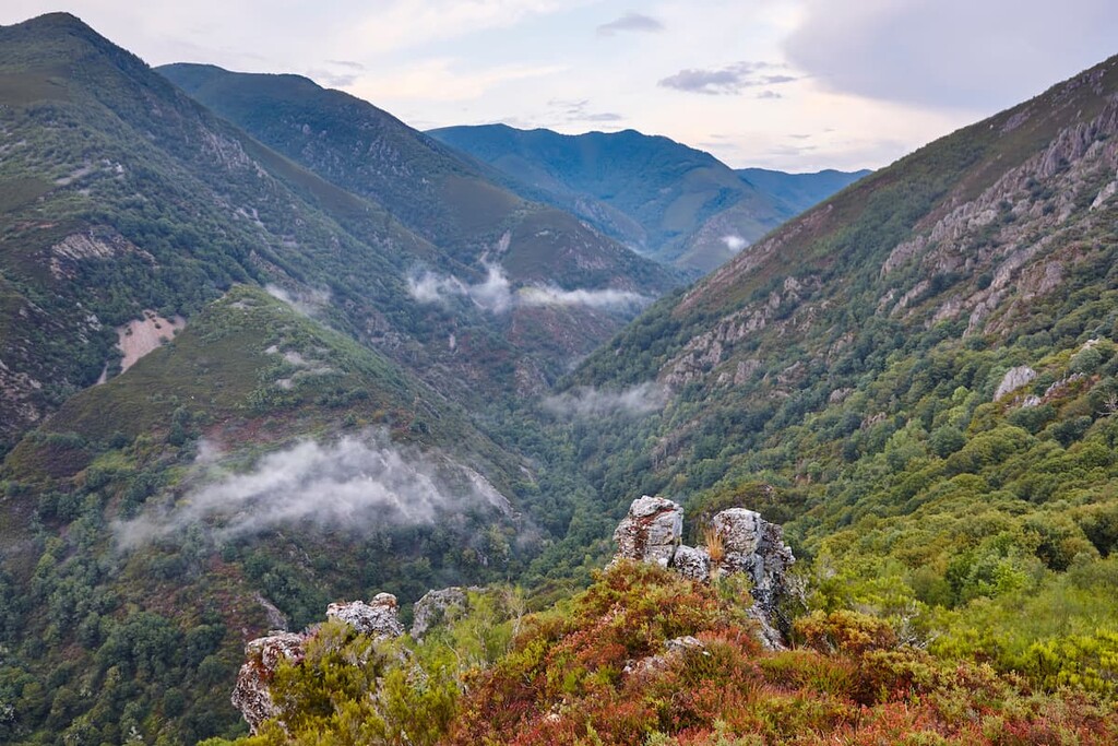
The park encompasses the western subrange of the Cantabrian Mountains. Here, the Asturian Massif and foothills are much less jagged than the peaks found in eastern stretches of the range. But, even though the peaks in the western region of the range are slightly shorter than those to the east, they are still one of the most prominent topographic features in northern Spain.
Similar to much of the mountains in Spain, the Cantabrian Mountains consist of limestones that date back to the Carboniferous period. The park’s limestone composition has also allowed for the formation of karst topography. Indeed, the park contains a number of caves, though they are often found at higher elevation.
The peaks formed around 350 million years ago. This makes them about the same age as the nearby Alps, which also formed during the Alpine orogeny. In fact, the Alps and the Cantabrian Mountains are both part of the Alpide belt, which is a long stretch of mountain ranges across southern Europe, northern Africa, the Middle East, and southern Asia that share a similar geologic history, including the Himalaya and the Caucasus.

Major peaks within the park include Cueto Arbas, Bóveda, Alto de la Ferradura, Pico Turrunteira, and Redondo.
The park is dominated by vast areas of forested land. Oak and beech forests can be found throughout the park, though one of the most iconic forests is located in the El Hermo Valley. Here, the beech forest spans 10 square kilometers.
Other major forested sections can be found near the headwaters of both the Ibias and Molin rivers. Oak trees are found throughout the park, especially in the forest of Muniellos. Birch trees are also fairly common, particularly in the municipality of Degaña and on the slopes of El Connion.
Parque Natural de las Fuentes del Narcea Degaña e Ibias is home to a thriving population of brown bears. The relatively minimal amount of human activity in the region, along with the vast network of forests in the area, have created the ideal habitat for the brown bear.
However, local bear populations have started to decrease in recent years for a number of reasons. But, the brown bear is still an iconic feature of the park and the surrounding region.
Other animals found throughout the park include wolves, deer, and chamois, all with healthy populations. The skies are also home to the endangered capercaillie, while the waterways create habitats for otter, trout and salmon.
The municipality of Ibias contains a superb record of human history, especially when compared to some of the other regions of the park. Evidence suggests that the region was inhabited during the late Paleolithic period. In particular, the region contains a number of rock structures called dolmens, which are Neolithic funeral monuments that offer a glimpse into ancient ways of life.
Today a number of cultural remnants, including the remains of stone houses and thatched cabins, can be found in the foothills of the Ibias region. The park was established in 2002 and later became a part of the UNESCO Muniellos Biosphere Reserve in 2003.
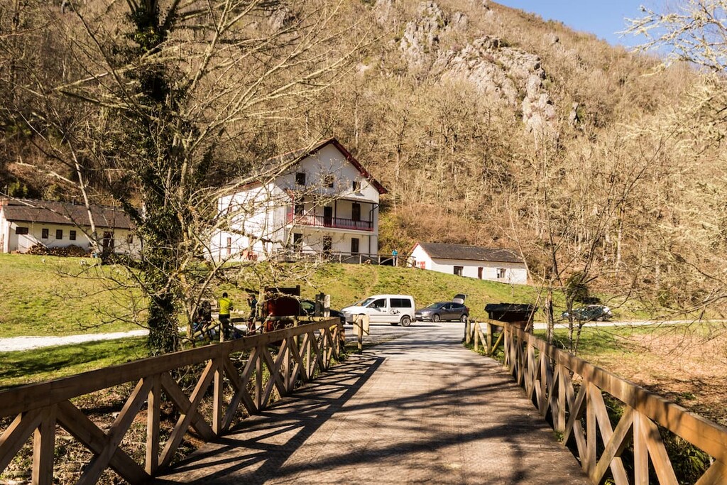
Though some sections of the park have several layers of protection against human development or activity, small scale agriculture is allowed in several regions. However, the park itself is sparsely populated and most inhabited areas are located along the outskirts of the protected area.
Parque Natural de las Fuentes del Narcea Degaña e Ibias is home to numerous trails. Here are some of the top hiking areas to visit in the park:
This trail is a 16 km (10 miles) loop trail with 885 m (2,903 ft) of elevation gain. The trail passes through Ibias within the Bustelin Gorgeand vast oak forests. Along the way, hikers can pass through abandoned villages showcasing the history of the region. The route usually takes around 6 hours to complete.

The route to the tallest peak in the park passes through the Natural Reserve of Cueto de Arbas that runs through the park. The route starts at the Port of Leitariegos before climbing steadily up to El Puerto lake and then Laguna de Arbas.
After reaching Fanentina pass, the trail continues along the ridge line up to the summit. From the highest point in the park, visitors can enjoy panoramic views of the Naviego valley and the park below. The trail totals 7.4 km (4.6 miles) with 560 m (1,900 ft) elevation gain.
This route is 10.5 km (6.5 miles) with 424 m (1,391 ft) elevation gain. This trail follows along the Pomar river with many crossings before arriving at the town of Pomar de las Montañas. From the town the trail leads up to the viewpoint known as Pozo de las Montañas.
Looking for a place to stay near Parque Natural de las Fuentes del Narcea Degaña e Ibias? Here are some of the best cities and villages to check out in the region:
The city of Oviedo is located to the northeast of the park. This city is the capital of the autonomous community of Asturias, and it has a population of around 220,000 people. Oviedo is known for its rich architectural history, as it is home to multiple buildings that date back to as early as 800 CE.
Many Spanish writers and artists have been inspired by this city, and it is home to numerous cathedrals, museums, and theatres. Despite being located slightly inland, the city has a temperate oceanic climate, which makes it perfect for visiting throughout the year.

Located west of the park lies the city of Lugo, the capital of the province of Lugo. With a population of around 100,000, Lugo is the most populous city in Galicia. One of the most unique features of Lugo is that it is the only city in the world that is still completely surrounded by intact Roman walls.
The walls in the city stand around 10-15 meters (33-49 ft) tall and visitors can walk along the top for sweeping views of the city down below. Besides the impressive walls, the Roman Bridge, which stretches over the Minho river is a popular site to see. The Rato, Minho, and Chanca rivers flow near the city.

Located just south of the park lies the small town of Fabero. Situated in the province of Leon, Fabero has a population of around 5,000. The town is known for its history of farming and coal mining. In the town center is a famous statue of a barefoot miner.
Today a local museum showcases the town’s history. Fabero’s close proximity to numerous natural parks within the Cantabrian Mountains makes it a popular stop amongst tourists.


