
Scan the QR code and open PeakVisor on your phone
Saskatchewan is home to 137 named mountains. The highest is Highest Point in Saskatchewan at 1,392 m.
Known as the Land of the Living Skies, Saskatchewan is a landlocked province located in the Prairies of west-central Canada. Although it’s not known for its towering mountainscapes, beautiful Saskatchewan does contain 137 named high points, the highest of which is the Saskatchewan High Point (1,392m/4,566ft), and the most prominent of which is Brockelbank Hill (814m/2,617ft).
The province of Saskatchewan is located in the central part of Canada. It shares a border with 4 other provinces and territories, including Manitoba to the east, the Northwest Territories to the north, and Alberta to the west. Furthermore, it shares a border with the states of North Dakota and Montana to the south in the United States.
The province technically shares a border with Nunavut at the Four Corners of Canada, which is the country’s only quadpoint. However, this was actually a point of some contention for many years due to some ambiguity as to the precise location of Nunavut’s boundaries when it became its own territory in 1999. However, this issue was fixed in 2014 and Nunavut and Saskatchewan do officially share a quadpoint border.
With a total area of some 651,900 square kilometers (251,700 square miles), Saskatchewan is the 7th largest province or territory in Canada after Nunavut, Quebec, Northwest Territories, Ontario, British Columbia, and Alberta with about 6.5% of the country’s total area within its borders.
Additionally, with a population of around 1.2 million people, Saskatchewan is the 6th most populous and 6th most densely populated province or territory in the country with about 4% of the total population. That being said, the vast majority of Saskatchewanians live in the southern portion of the province near Saskatoon, Regina, Moose Jaw, and Swift Current.
Interestingly, in addition to being one of only 2 completely land-locked provinces (alongside Alberta), Saskatchewan is also the only province or territory that doesn’t have a natural feature as part of its borders. While other provinces and territories rely at least partially on rivers, mountain ranges, lakes, or coastlines as part of their boundaries, Saskatchewan’s trapezoid-like borders were defined when it became a province in 1905.
When it comes to administrative divisions, Saskatchewan does not have counties like many other provinces. Rather, it has different types of municipalities, which include cities, towns, resort villages, northern towns, northern hamlets, and rural municipalities.
The province also has 18 census divisions, which were created by Statistics Canada. These divisions don’t really have any formal organizational purpose outside of statistical record-keeping, though they can be used to roughly further divide up the province into 5 main geographic regions, including:

Located in the southwestern corner of the province in the area around the city of Swift Current, Southwest Saskatchewan is home to sprawling grasslands. The southwestern region of the province includes part or all of Census Division No. 8, Census Division No. 7, Census Division No. 4, and Census Division No. 3.
Southwestern Saskatchewan is home to many First Nations, including the Wood Mountain Lakota First Nation and the Nekaneet First Nation.
This region is dominated by agriculture, so fields of grain are abundant. However, there are also plenty of superb parks and recreation areas to check out, including Grasslands National Park. Other popular parks in the region include:
Home to beautiful prairie landscapes and bustling towns, southeastern Saskatchewan is a small but fun region to check out in the southeastern corner of the province around the city of Regina. It includes all or most of Census Division No. 6, Census Division No. 2, Census Division No. 5, and Census Division No. 1.
Southeastern Saskatchewan is home to many First Nations, including the Pasqua First Nation, the Pheasant Rump Nakota, the White Bear First Nations, and the Standing Buffalo Dakota Nation.
Here, the landscape is also dominated by prairie and both ranching and resource extraction are major industries. Like the southwestern part of the province, however, there are a number of fantastic recreation and historic areas to check out in this part of Saskatchewan, including:
Situated around the city of Saskatoon, west-central Saskatchewan is one of the most populous parts of the province. It includes Census Division No. 17, Census Division No. 16, Census Division No. 13, Census Division No. 12, and most of Census Division No. 11.
This region has long played an important role in the history of the province. Like the rest of Saskatchewan, the west-central region of the province has been inhabited since time immemorial by First Nations people. Some of the many First Nations in this part of Saskatchewan include the Mosquito, Grizzly Bear’s Head, Lean Man First Nations, the Whitecap Dakota First Nation, and the One Arrow First Nation.
It is home to one of the most important heritage sites in the province, Wanuskewin Heritage Park, which is a National Historic Site of Canada. The park currently protects countless archaeological sites and cultural remains that date back millennia.
Other important parks and recreation areas in this part of the province include:
Featuring prairie, farmland, and forests, the East Central region around the city of Yorkton is a hidden gem within Saskatchewan. It contains Census Division No. 15, Census Division No. 14, Census Division No. 9, Census Division No. 10, and part of Census Division No. 11.
The east-central part of Saskatchewan is home to many First Nations, including the Key First Nation, the Fishing Lake First Nation, the George Gordon First Nation, and the Kinistin Saulteaux Nation.
While it might not be as populous as some of its neighbors, east-central Saskatchewan is a fantastic place to visit if you’re looking to get outside. It contains a number of popular mineral spas, some fantastic lakes, and plenty of parks for visitors to enjoy.
Some of the most popular parks in the region include:
The final region of Saskatchewan is also its largest: the North. Northern Saskatchewan, which is roughly defined as the area to the north of Prince Albert or the entirety of Census Division No. 18, is the most remote part of the province.
Northern Saskatchewan is the homelands of many First Nations, including the Fond Du Lac Denesųłiné First Nation, the Black Lake Denesuline First Nation, the Birch Narrows First Nation, the Buffalo River Dene Nation, the Lac La Ronge Indian Band, and the Sturgeon Lake First Nation.
Here, beautiful natural landscapes reign supreme as the land transitions away from prairie into boreal forest. Although travel throughout the northern part of the province can be tricky, especially in the winter months, visitors can expect superb hiking, camping, paddling, and fishing opportunities if they’re willing to venture off the beaten path.
There are plenty of large parks and recreation areas within northern Saskatchewan, such as the stunning Prince Albert National Park. Other notable recreation destinations include:
Geologically, Saskatchewan can be divided up into 2 primary regions: the Canadian Shield and the Western Canada Sedimentary Basin.
The northernmost part of the province is dominated by the Canadian Shield, which is a massive area of Precambrian igneous and metamorphic rocks that are part of the core of the North American Craton.
Meanwhile, the southernmost part of the province is part of an area called the Western Canadian Sedimentary Basin, which also covers parts of the Northwest Territories, Manitoba, Alberta, and British Columbia. This region is home to mostly sedimentary rocks which form a transition zone between the Canadian Rockies to the west and the Canadian Shield to the east.
Interestingly, the Western Canadian Sedimentary Basin is one of the most mineral resource-rich regions of Canada, with large reserves of petroleum and natural gas, particularly in the Alberta tar sands.
Furthermore, although Saskatchewan isn’t known for its mountains, it is known for having a number of disable meteor/comet impact craters. There are a number of verified meteor impact craters in the province, including those at Deep Bay, Maple Creek, Carswell, and Gow Lake.
Saskatchewan is also rich in natural resources. These include potash, salt, gold, zinc, cobalt, coal, silica sand, uranium, copper, and nickel, as well as gas and oil.
Some of the primary high points in the province include Bald Butte, Old Baldy, Cypress Hills, Jones Peak, Brockelbank Hill, and Pasquia Hills.
Within Saskatchewan, there are 4 primary ecozones: the prairie, the boreal shield, the boreal plain, and the taiga shield.
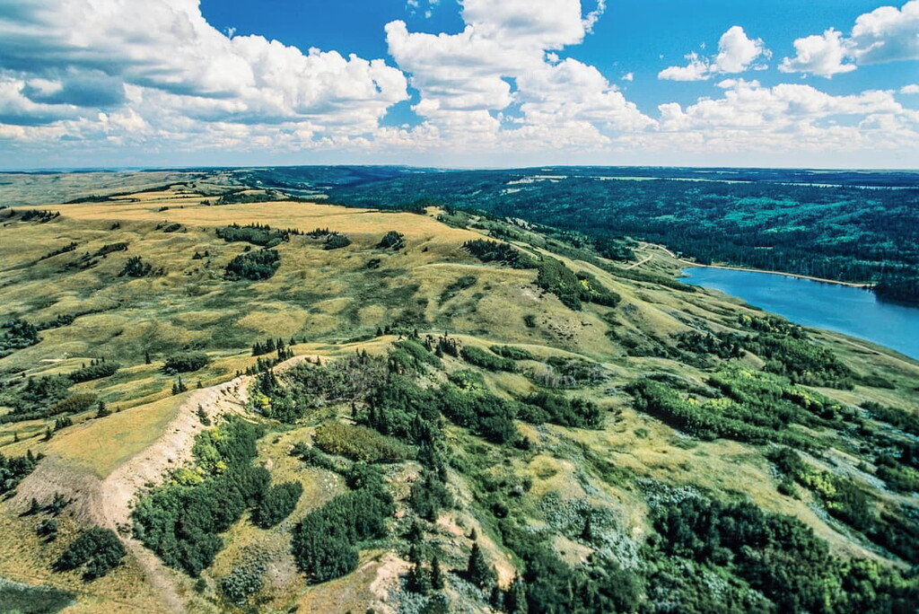
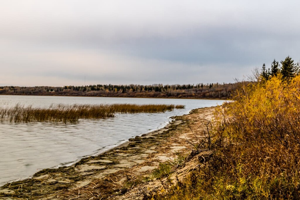
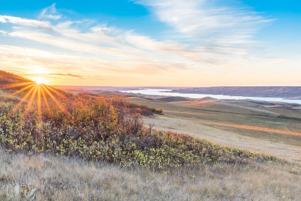
Covering the southern third of the province, the prairie ecozone is Saskatchewan’s section of the massive grasslands that span the center of North America. This region is home to rolling plains and highly eroded uplands.
Here, the landscape is naturally dominated by grasslands, though much of the land has since been converted for agricultural use or resource extraction. As this region is also the most populous part of the province, there is relatively little uncultivated or developed grassland left, except in Grasslands National Park.
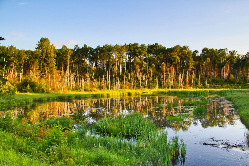
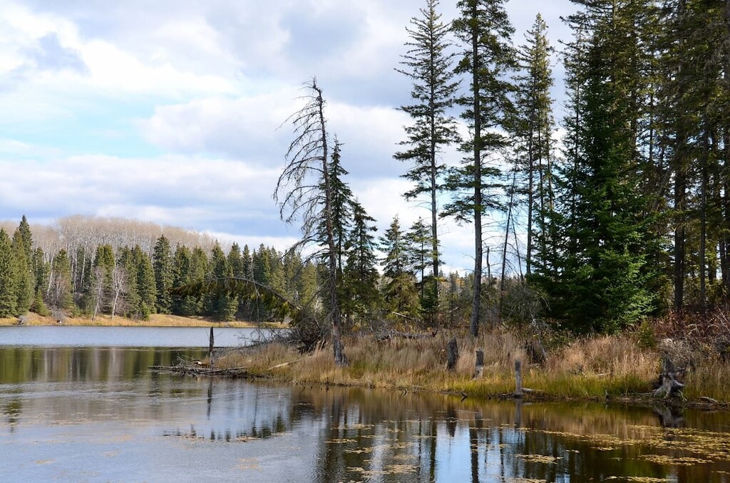
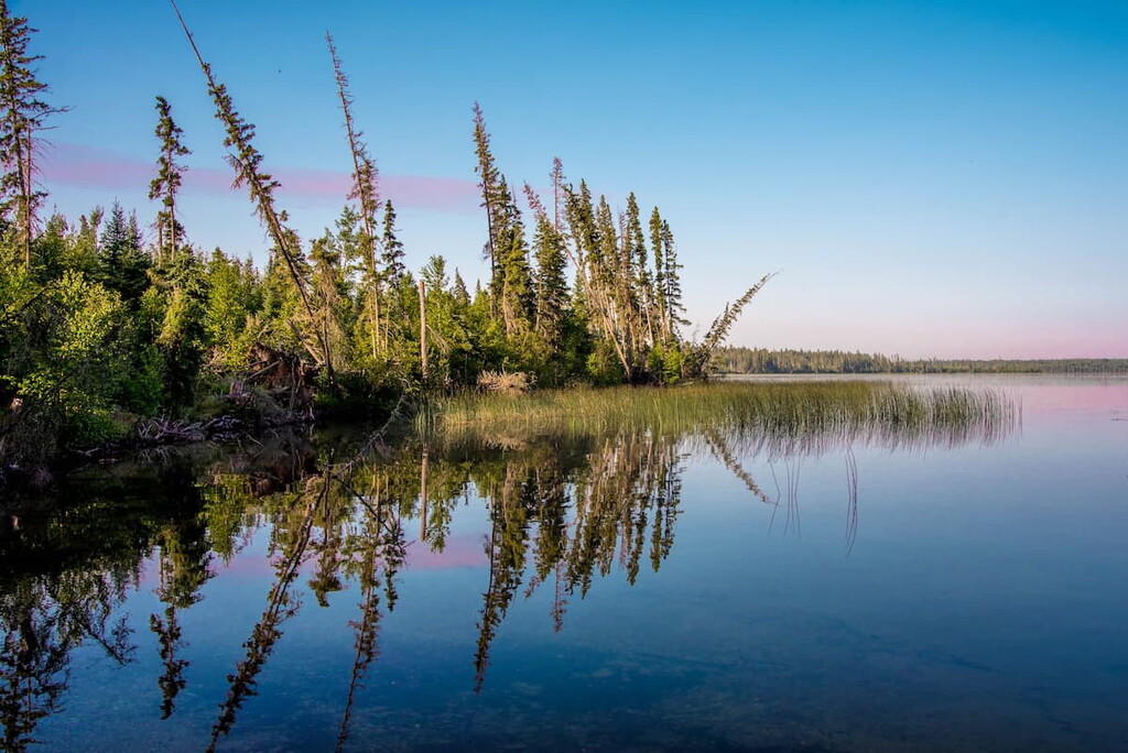
Located just to the north of the prairie, the boreal plain ecozone is another mostly flat, rolling area. In this region, the landscape contains some grasslands, though there are more mixed forests of black spruce, white spruce, aspen, balsam poplar, and jack pine.
The boreal plain ecozone is one of the most biodiverse parts of the province with hundreds of different bird, mammal, and fish species calling this area home. Furthermore, while there is some agriculture here, much of it is located along the southern portion of the ecozone, so much of the northern ecosystems are relatively intact.
The largest ecozone in the province, the boreal shield is located adjust to the north of the boreal plain. This area, as the name suggests, is home to a sprawling boreal forest.
These forests are dominated by black spruce, though there are also stands of jack pine, tamarack, balsam poplar, and various birch species, too. Due to the northerly location of this ecoregion, it is relatively sparsely populated when compared to the southern part of the province. So, this is a great palace to visit if you’re looking to see wildlife, like black bears.
Situated in the northernmost edges of the province, the taiga shield ecozone extends throughout the Northwest Territories, Newfoundland and Labrador, Nunavut, and the northernmost parts of Quebec, Alberta, Manitoba, and Saskatchewan.
In this ecozone, the terrain is mostly flat with large lakes that dominate the landscape. Vegetation is limited throughout the ecozone due to the harsh climate. However, this is the only part of Saskatchewan where northerly species such as the caribou and the arctic fox roam the landscape.
The land that is now part of the province of Sasktachewan has been home to humans since time immemorial. Countless peoples have lived in this region for generations and it is considered the ancestral homelands and traditional territories for many First Nations.
There are currently 70 First Nations within the province of Saskatchewan, each of which has its own unique culture and heritage. Most of the First Nations within the province are part of 1 of 5 primary linguistic groups, which includes Cree, Dene, Nakota, Saulteaux, and Dakota.
Although Indigenous peoples have been living in what is now Saskatchewan for at least the last 10,000 years, the first people of European descent did not arrive in the region until around the seventeenth century.
It is believed that one of the first people of European descent to visit the region was Henry Kelsey of Great Britain who traveled up the Saskatchewan River in the 1690s. However, people of European descent did not establish a permanent settlement in the region until the Hudson’s Bay Company established Cumberland House in 1774.
While the British and the private Hudson’s Bay Company claimed much of the region as part of their territory during the eighteenth century, the southern portion of what is now Saskatchewan was actually part of the Louisiana Territory held by France, then Spain, and later France again, before it was sold to the United States. The US later ceded the region that is now southern Saskatchewan to the British in the early 1800s.
After Canada became a self-governing dominion in 1867, it soon gained control of Rupert’s Land, which was the Hudson’s Bay Company territory in the region. It also gained control of the former North-West Territories, which once included vast swaths of western Canada.
During this time, the Crown signed many treaties with First Nations throughout the country, many of which are known as the Numbered Treaties.
These are, for the most part, still in place, and many of these treaties provided for the re-acquisition of ancestral lands by many First Nations. However, some promises in the treaties have not been upheld to various degrees by the Canadian government, which has been the source of both contention and legal dispute throughout the years.
Around this same time, the Dominion Lands Act of 1872 encouraged homesteaders to move out to the western territories in exchange for a small parcel of land for them to homestead. This led to a fairly large influx of immigrants to the region and the establishment of the North-West Mounted Police.
Throughout the nineteenth century, the population of what is now Saskatchewan increased dramatically. Eventually, by 1905, the region achieved provincial status after the signing of the Saskatchewan Act. This act was signed on the same day as the Alberta Act, which designated neighboring Alberta as a province, too.
During the early part of the province’s history, it became a fairly popular place for immigrants from various parts of Europe, including Germany, Norway, Sweden, and Ukraine.
By this time, the province had cemented its highly agricultural economy, which flourished during the early twentieth century. This tradition has continued to this day, though other industries, such as resource extraction, have also become major parts of the province’s economy.
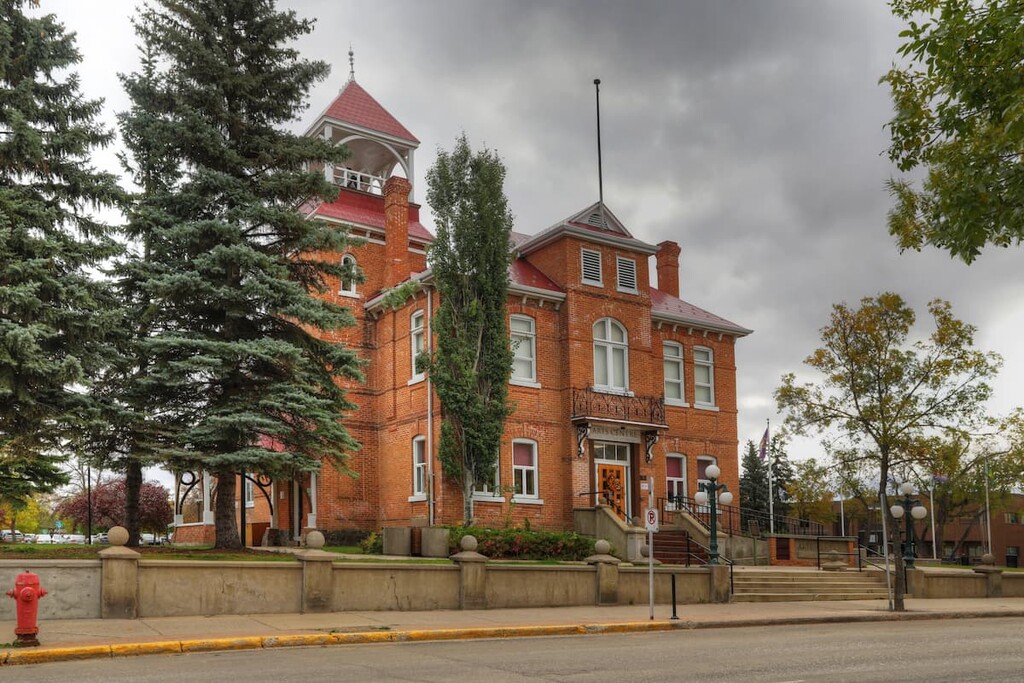
These days, Saskatchewan is known for its beautiful prairie, its unique architecture, friendly people, and regional cuisine. So, it’s a great place to visit if you’re looking to check out Canada’s prairie firsthand.
Whether you like to hike, paddle, camp, or fish, there are plenty of great ways to get outside in Saskatchewan. Here are some of the most popular parks to check out in the province:
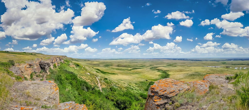
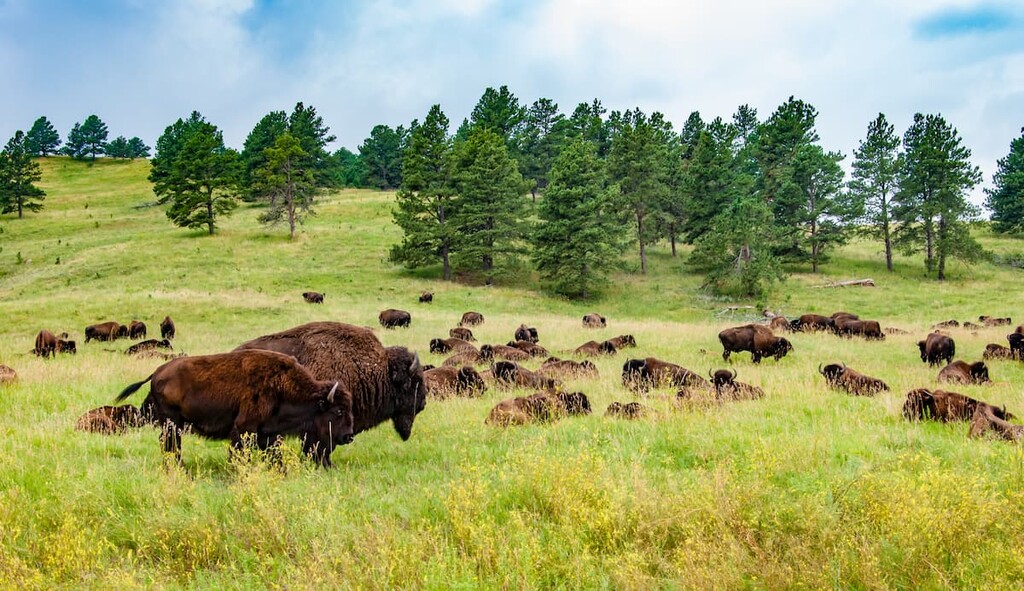
Located in southwestern Saskatchewan, Grasslands National Park is a popular national park that boasts beautiful prairie scenery. It contains just 1 named high point, Wood Mountain.
Grasslands National Park was originally established as a way to protect some of the last remaining undisturbed shortgrass prairie in the region. The park is also famous for having been the refuge for Sitting Bull and his followers after the Battle of Little Bighorn in the 1870s.

These days, the park is a popular place to see plains bison, who were reintroduced to the region in the early 2000s from a herd in Alberta’s Elk Island National Park. The park also contains a newly reintroduced colony of black-tailed prairie dogs. It is also a great place to go stargazing due to the region’s fantastically dark night skies.
Established in 1927, Prince Albert National Park encompasses 3,874 square kilometers (1,496 square miles) of central Saskatchewan. The park spans the thin transition zone between the northern boreal forest and the southern aspen parkland. It contains 3 named mountains, the highest and most prominent of which is Nimrod Hills.
Prince Albert is best-known for its incredible bison herd that roams freely along the park’s southwestern border. However, there are also plenty of opportunities to hike, camp, and explore the park’s many lakes and backcountry trails.

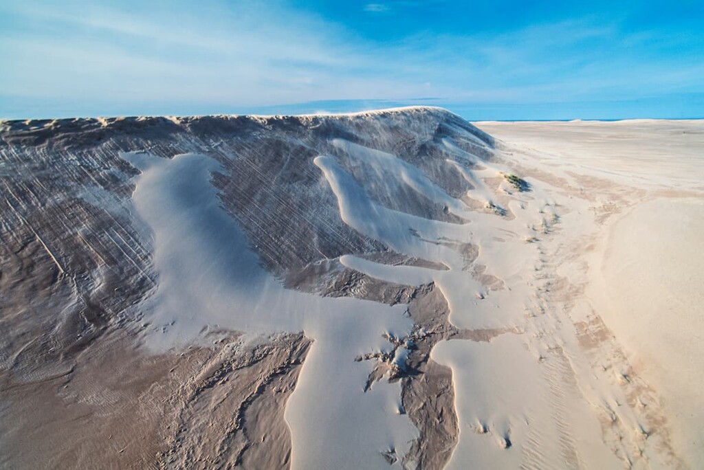
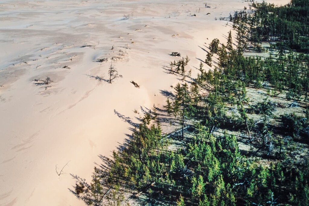
One of the largest provincial parks in Saskatchewan, Athabasca Sand Dunes Provincial Park is a truly stunning natural area located in the northern part of the province. While the park doesn’t contain any named mountains, it does have some of the most northerly and active sand dunes in the world.
Athabasca Sand Dunes Provincial Park is located along the shores of Lake Athabasca. There are a number of dunes in the park, some of which are up to 30 meters (98 feet) high. Additionally, since the park is located along the lake, it offers plenty of superb boating and fishing opportunities.
It is worth noting, however, that Athabasca Sand Dunes Provincial Park is not accessible by road. Rather, you’ll need to take a boat or a float plane to access the park from Stony Rapids, Fond du Lac, or Uranium City.
For skiing and snowboarding enthusiasts, there are more than 5 ski resorts in Saskatchewan, which are located mainly in the south of the region.
The largest ski resort in Saskatchewan is Ochapowace with more than 10 km (6 mi) of slopes and more than 5 ski lifts. Other major areas for skiing in Saskatchewan with more than 5 km (3 mi) of slopes and several ski lifts each include Wapiti Valley, Table Mountain, Mission Ridge, and Duck Mountain–Kamsack. These are also the main ski resorts near Regina, the largest city in Saskatchewan.
Check the Saskatchewan ski resorts map as well as the larger Canada ski resorts map in the World Mountain Lifts section of the site. It includes information about open ski lifts / slopes in Saskatchewan in real-time with opening dates and hours. There are also year-round cable cars, funiculars, cog railways, aerial tramways, and all other types of mountain lifts.
Looking for a place to stay in Saskatchewan? Here are some of the best cities to check out:
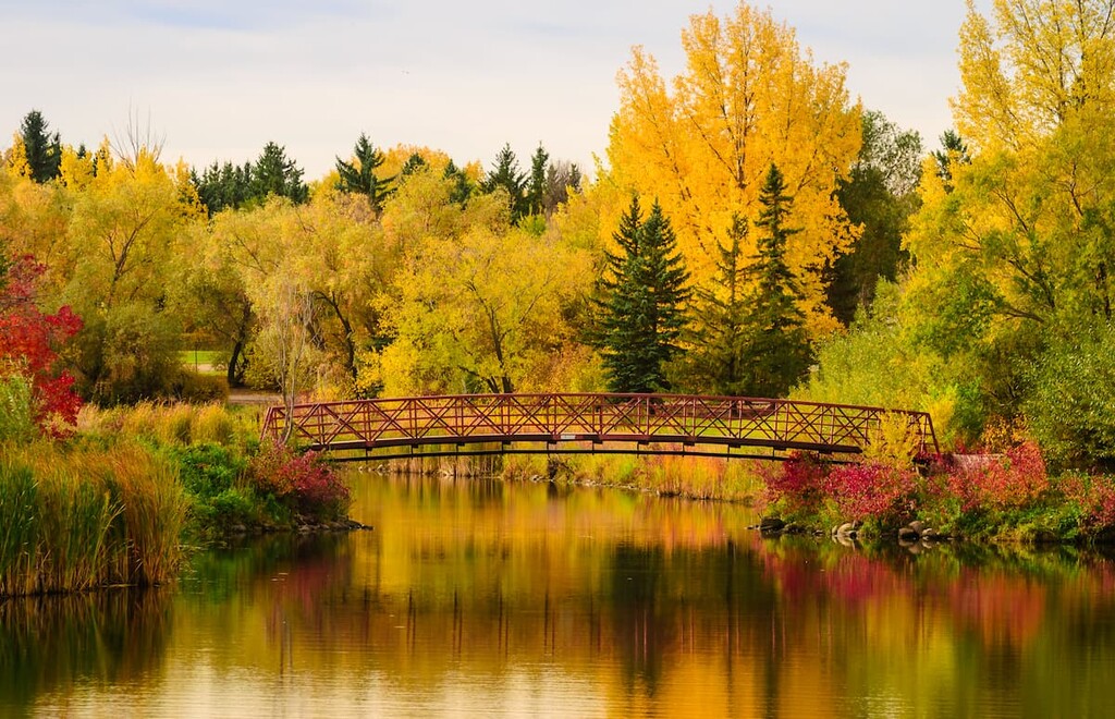
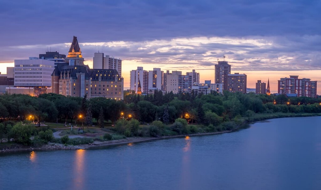
Saskatchewan’s largest city, Saskatoon is a vibrant city nestled along the southern Saskatchewan River. Saskatoon serves as both a cultural and economic hub of the central part of the province.
Tourist attractions include ‘Boomtown 1910,’ Wanuskewin Heritage Park, the Ukrainian Museum of Canada, and the Western Development Museum. Saskatoon is located along the Trans-Canada Yellowhead Highway and offers plenty of lodging and restaurant options to accommodate travelers.
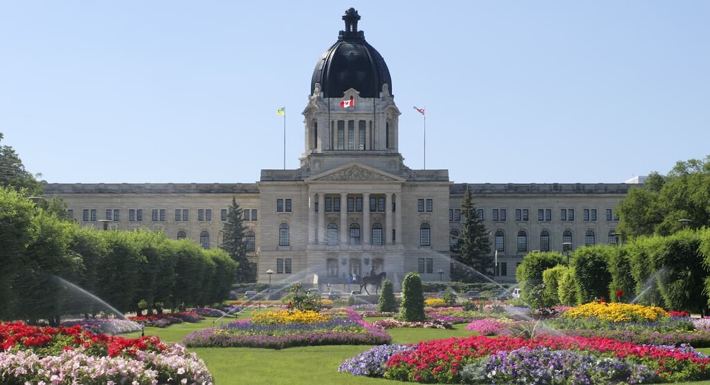
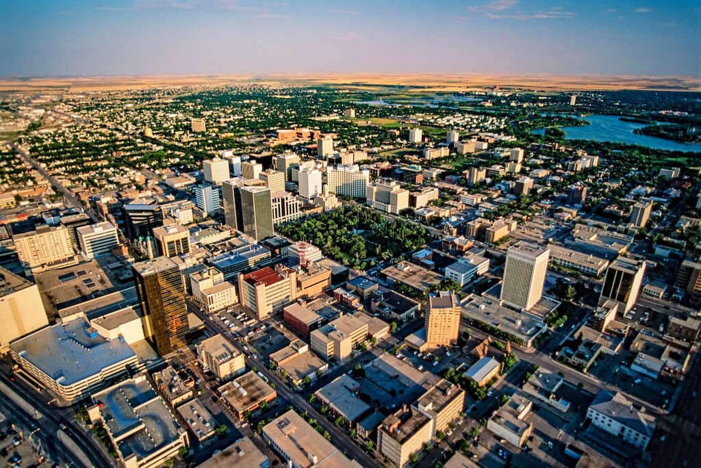
The capital of the province of Saskatchewan, the city of Regina is home to about 215,000 people who live in the southeastern part of the state. As the capital for the province, Regina is a hub for activity and commerce in the southern part of Saskatchewan.
Much of the city’s economy is dominated by mining and resource extraction though other industries, such as manufacturing and agriculture, are also major regional economic drivers.
Furthermore, the city contains quite a few popular parks and recreation areas, including the large Victoria Park. There are also many important museums and historic sites in the city, so it’s a good place to check out if you’d like to learn more about the province.
Saskatchewan’s third-largest city, Prince Albert, is located at the center of the province on the banks of the North Saskatchewan River. Known as the “Gateway to the North,” Prince Albert is a bustling resort town that offers unparalleled access to scenic northern Saskatchewan.
If you’re looking for a bit of outdoor adventure during your trip to the town, Prince Albert National Park lies just 32 miles north of the city and is packed with beautiful lakes, spruce bogs, and aspen-dotted uplands.
The fourth largest city in the province, Moose Jaw is a community of some 35,000 people located in the south-central part of Saskwatchewan. It is a short drive from nearby Regina and it is an important center for industry and agriculture in the province.
Moose Jaw is easy to get to, thanks to its location along the Trans Canada Highway. It boats a number of superb parks and attractions, including some geothermal spas and an assortment of annual festivals.
The Snowbirds, which is the Royal Canadian Air Force’s aerobatic flight demonstration team, is also based in Moose Jaw. So, lucky visitors to the town often have the chance to see an aerobatic flight demonstration during their stay.
The community of La Ronge is situated within the north-central part of Saskatchewan along the shores of Lac la Ronge. With a population of about 2,700 people, La Ronge is classified as a northern town, though it is also a hub for a much larger population center throughout the central part of northern Saskatchewan.
La Ronge is the gateway to some of the northernmost communities in Saskatchewan that are connected by road. It is also home to the Lac La Ronge First Nation. Much of the community’s economy is based on mining and agriculture, though it is also a hub for tourism, thanks to the nearby Lac La Ronge Provincial Park.


Yes. Saskatchewan has 137 named mountains. The highest is Highest Point in Saskatchewan at 1,392 m.
The highest mountain in Saskatchewan is Highest Point in Saskatchewan, at 1,392 m.
Saskatchewan has 137 named mountains.


