Get PeakVisor App
Sign In
Search by GPS coordinates
- Latitude
- ° ' ''
- Longitude
- ° ' ''
- Units of Length

Yes
Cancel
❤ Wishlist ×
Choose
Delete
Elk Island National Park is a federally protected area located in central Alberta, Canada. It is a fenced in park that contains 194 square kilometers (75 square miles) of land. The park features a “knob and kettle” terrain with one significant high point. The modest Tower Hill is the tallest point in the park with an elevation of 723 m (2,372 ft).
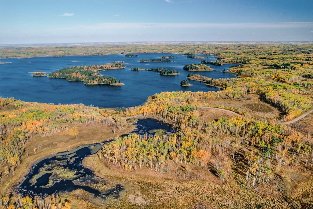
Located some 35 km (22 mi) to the east of Edmonton, Alberta, Canada, Elk Island National Park is a federally protected area that encompasses some 194 square kilometers (75 square miles) of land. The park is actually fully enclosed by fencing, with the exception of the Yellowhead Highway, which runs right through it.
The park is a refuge among the developed agricultural lands of central Alberta. It was originally created in 1906 to protect one of the last remaining elk herds in the area.
The name of the park comes from the namesake animal it was originally designed to protect. The word “island” in the park’s name was inspired by the islands of Astotin Lake, which is the largest of the many lakes in the park.
The following are some of the other protected areas that are located within driving distance of Elk Island Park:
For much of its recent geological history, central Alberta was covered by shallow seas that were usually connected to the oceans. After the mountain building events that created the western cordillera (which includes the western Canadian mountain ranges, such as the Coast, Columbia, and Rocky Mountains) the interior of North America rose above sea level.
The bedrock layer that underlies most of central Alberta is Cretaceous sandstone and shale, which accounts for the significant oil and gas reserves which are found under the province. Elk Island National Park is part of a geographic and geological area that’s referred to as both the Beaver Hills and by the name of its underlying geologic feature, the Cooking Lake Moraine.
The Cooking Lake Moraine was created during the Pleistocene through the advancement and retreat of ice sheets and glaciers through the region. A significant event in the geologic history of the region was the creation of Lake Edmonton, which was a glacial lake that once covered central Alberta.
The Cooking Lake Moraine is a plateau that sits about 20 m (65 ft) above the surrounding terrain. As such, glacial Lake Edmonton only briefly covered the plateau. While the glaciers deposited boulders and large rocks upon the hills, the lake left behind a vast deposit of sand and silt. These sediment deposits are the reason why fertile agricultural lands now surround Elk Island National Park.
These layers of till can be tracked to their origins, too. In fact, these layers of till deposition help scientists understand the glacial processes and geologic events that formed what is now Alberta.
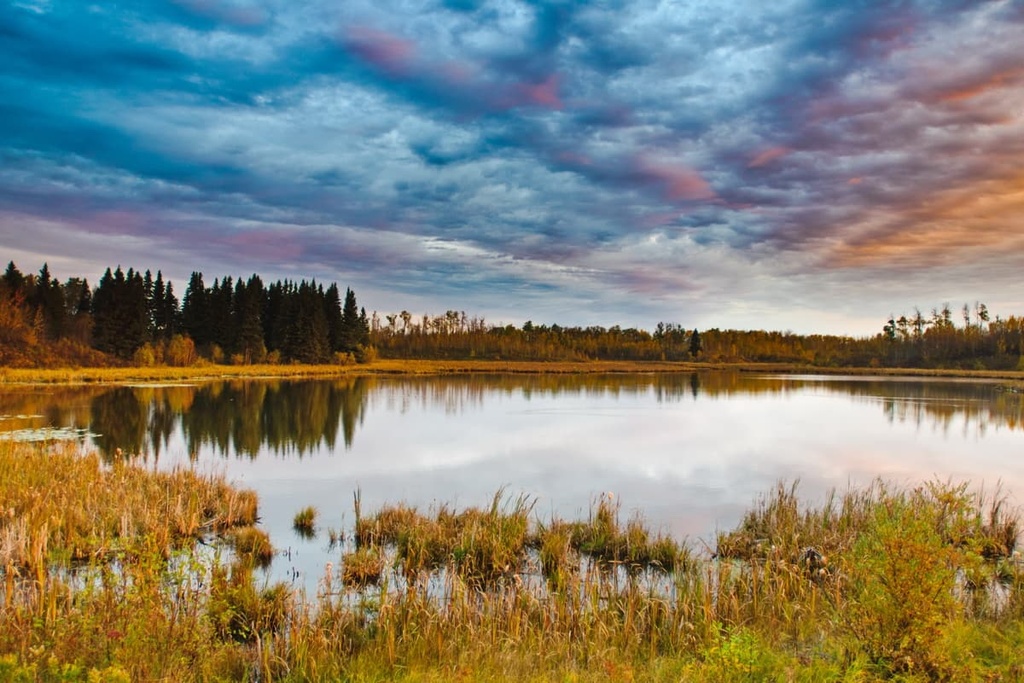
As a result of these studies, researchers believe that glaciation during the Pleistocene created a “knob and kettle” landscape. This refers to the topography of knobby hills surrounded by glacier-created kettle lakes that’s apparent throughout central Alberta today.
The fundamental system of the Canadian National Parks system is to preserve a representative sample of each of the 39 distinct National Park Natural Regions. These regions are defined by particular land and vegetation characteristics.
Elk Island National Park, as well as Riding Mountain and Prince Albert National Parks represent a portion of the Southern Boreal Plains and Plateau Natural Regions.

Furthermore, Elk Island National Park and the underlying Cooking Lake Moraine have a unique ecology compared to the surrounding plains, likely due to the higher elevation of the plateau. The Dry Mixedwood subregion of the Boreal Forest Natural Region dominates the plateau, which is surrounded by a vast expanse of the Parkland Natural Region.
A similar ecological difference occurs in Cypress Hills Interprovincial Park in southeast Alberta, where the Rocky Mountain Montane ecology covers the plateau and hills, while the Grassland Natural Region dominates the surrounding prairies. These isolated ecological differences demonstrate the effects of elevation on the ecology of an area.
While the vegetation of Elk Island National Park is a fascinating subject, the park is special because of the wildlife that inhabits it. The park is home to the densest population of ungulates in Canada and a variety of other animals.
Year-round residents include bison, moose, coyote, mule deer, white-tailed deer, beaver, elk, lynx, and porcupine. Black bears and timber wolves move through the area too. Additionally, there are over 250 bird species, including American bitterns, red-necked grebes, double-crested cormorants, American white pelicans, great blue herons, red-tailed hawks, and the trumpeter swans.
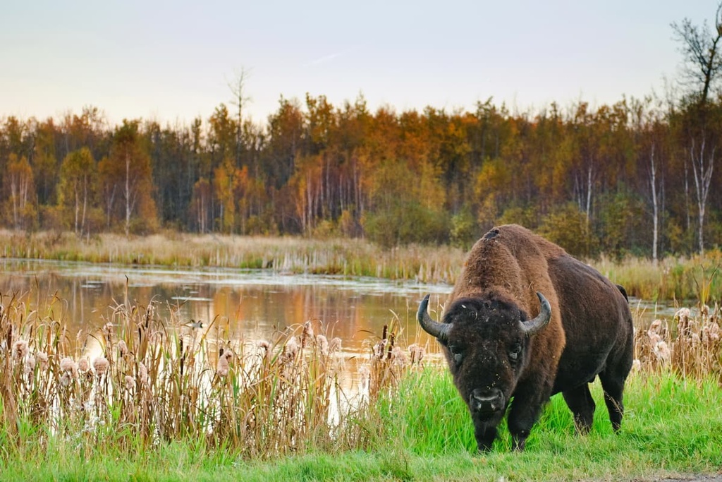
Wildlife conservation is a major role of Elk Island National Park. It is responsible for ungulate conservation and repopulation efforts across North America. A number of native species have been successfully reintroduced to the park, including wood and plains bison, beaver, and trumpeter swans.
The large diversity of mammals and birds within such a small area in Elk Island National Park also creates plenty of opportunities to see lots of wildlife relatively up close in their natural habitats.
The Beaver Hills have long been an important place for First Nations. Indeed, there are cultural sites in what is now Elk Island National Park that date back over 8,000 years.
The shelter of the region’s woodlands and its many lakes made the Beaver Hills an ideal place to stop during a seasonal migration. It has traditionally been a place where people could hunt, fish, and gather food after having spent time on the prairies before heading back to the foothills.
The hill- and lake-filled terrain in the region prevented the area from being developed as agricultural land. This ultimately prevented it from being ploughed over like the rest of the region.
Since the region was not cultivated and ploughed, archaeological evidence of the region’s original inhabitants was well-preserved. Over 200 cultural sites have been uncovered in Elk Island National Park, most of which are from camps and tool-making sites.
The Sarcee were the first known inhabitants of the Beaver Hills. They lived in the area until the late eighteenth century.
At the beginning of the nineteenth century, as European fur traders moved west, their Cree guides moved with them supplanting the local First Nations. The Cree had early access to horses and firearms, which gave them an advantage over the western First Nations in conflict at the beginning of the 1800s.
The displaced Sarcee moved from the hills to the plains and migrated south, ultimately ending up near the city of Calgary. The Cree called the region “Amiskwaciy,” which translates as “beaver hills,” a reference to the abundance of beaver in the region at the turn of the nineteenth century.
The fur trade and the popularity of Canadian beaver pelts extirpated the beavers from the region. It has been through modern supplantation that beavers now inhabit the Beaver Hills once again.
While the Cree also adopted buffalo hunting from the southern First Nations, the extirpation of local fur-bearing animals, including bison, forced the Cree to abandon the area as their permanent home.
The Beaver Hills are mentioned in English language texts as early as Peter Fidler’s sketches from 1793. They were also mentioned in David Thompson’s map from 1814, which depicts the hills as a place of refuge for Sarcee and Cree. Additionally, the area was reported during the Palliser Expedition of the 1850s and in the 1880s by Joseph B. Tyrell of the Geological Survey of Canada.
Members of the Cree First Nations entered into Treaty 6 with the Government of Canada in 1876. In 1906, a small national park was created within Treaty 6 territory.
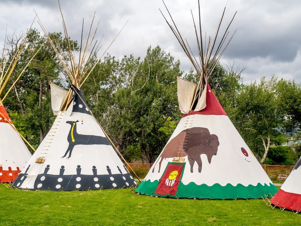
The park was imagined and originally funded by a group of five men from Fort Saskatchewan who petitioned the federal government to set up an elk sanctuary, calling it “Elk Park.” By 1913, the park had received federal protection, leading it to become Elk Island National Park in 1930.
Elk Island National Park was originally set up as an elk refuge and a small herd of plains bison were temporarily penned at Elk Park. However, some of the bison eluded capture and their offspring remain to this day. Additionally, wood bison were relocated to the park to establish a disease-free herd for future species recovery initiatives.
Elk, wood bison, and plains bison from Elk Island National park have been relocated across Canada, to some states of the United States, and to places as far away as Russia. The preservation of the plains bison, the establishment of a herd, and the worldwide distribution of the herd’s offspring is commemorated as a National Historic Event.
Beyond bison and elk, the park’s conservation efforts have reached several other species. Beavers were reintroduced into the park in 1941 after a 100 year absence. Trumpeter swans were also reintroduced in 1987, and fishers were reintroduced in 1990 and 1992.
Elk Island National Park is easily accessible from Edmonton, the capital city of Alberta. As such, there are many developed recreation opportunities and trails in the park. The following are some of the major attractions and hiking trails in Elk Island National Park:
Elk Island National Park has many trails that range from easy to difficult. These trails meander through the forests, meadows, and wetlands of the park.
The following are some of the popular and recommended trails in the park for adventures and wildlife watching:
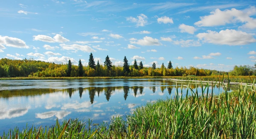
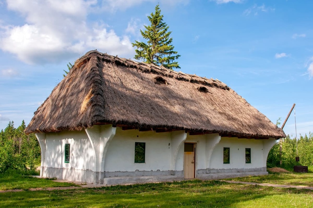
The following are some of the historical buildings to check out while in Elk Island National Park:
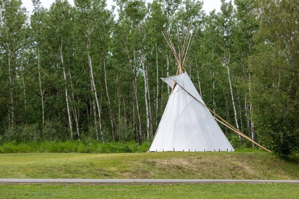
Elk Island National Park is a fully serviced national park with many facilities and other infrastructure. In addition to hiking, there are many more activities offered at the park.
Some of the popular activities include camping, cycling, paddling, sailing, bird watching, orienteering, geocaching, night sky viewing, snowshoeing, kiteboarding, and wildlife/bird watching.
Elk Island National Park is located close to Edmonton, the capital city of Alberta. It is in an area that has been heavily cultivated and settled since the turn of the twentieth century. The following are some of the major cities and towns near Elk Island National Park:
Located in the middle of Alberta, the city of Edmonton is situated about 40 km (24 mi) to the west of Elk Island National Park. It is the capital city of the province and one of the two major cities in Alberta. Edmonton is the northernmost metropolis in North America, and it serves as the gateway to Canada’s wild and adventurous boreal landscapes.
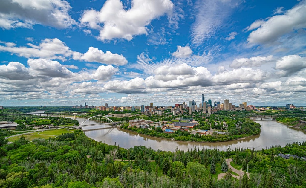
Edmonton is the political center of the province, and it is home to the Edmonton Oilers hockey team, a professional football team, the University of Alberta, and the giant West Edmonton Mall. Edmonton also has long summer days, over 50 annual festivals, spectacular views of the Northern Lights during the winter, and access to wild and rugged adventure.
Some of the popular hiking areas around Edmonton include Elk Island National Park and Jasper National Park. There are also many lovely trails in the valley of the North Saskatchewan River which runs through the middle of Edmonton.
The town of Jasper is located 400 km (240 mi) to the west of Elk Island National Park. It is the commercial center forJasper National Park. First established as a trading post for the North West Company and then the Hudson’s Bay Company, Jasper is a major part of the history of the fur trade in the west.
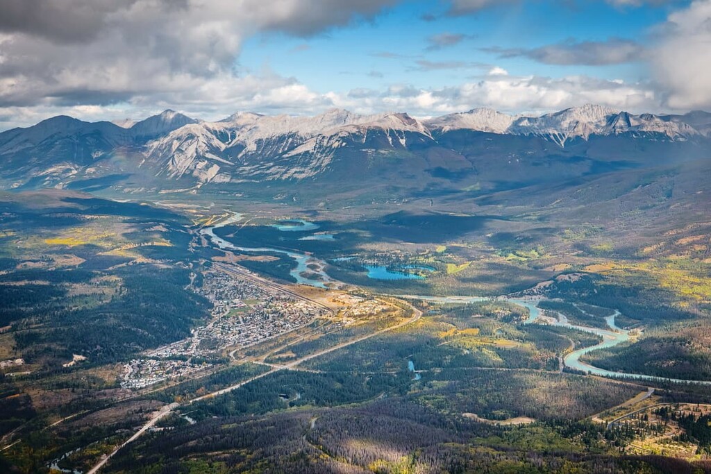
The town is in one of the most beautiful areas of Canada and there are many stunning attractions and hikes in the region.
Maligne Lake is a stunningly beautiful and picturesque lake to visit while in Jasper. Some of the other nearby hikes take you to see panoramic views from the Signal Mountain Fire Lookout and the summit of Pyramid Mountain. Alternatively, you might enjoy an easy stroll around the beautiful Edith Lake during your stay in Jasper.
Explore Elk Island National Park with the PeakVisor 3D Map and identify its summits.


