Scan the QR code and open PeakVisor on your phone
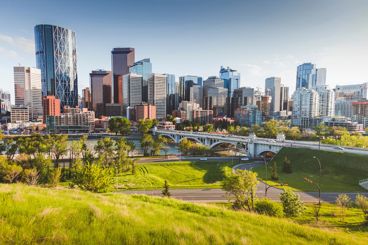
Located in southern Alberta, at the confluence of the Bow and Elbow Rivers, Calgary is western Canada’s most populated city. Calgary became a city in 1894. However, human inhabitants in the area have been traced back more than 11,000 years.
Originally named Fort Brisebois, present-day Calgary was once home to the North-West Mounted Police, a group that was assigned to protect the western plains from whiskey traders in the 1870s. In the 1880s, the Canadian Pacific Railway reached the area, linking Calgary to Vancouver, as well as central and eastern Canada. Dubbed ‘Cowtown,’ Calgary began seeing rapid growth in agriculture and cattle-ranching. The city’s farming community and railway connections made it an epicenter for the cattle industry.
Today, Calgary’s economic success is largely attributed to the petroleum industry. However, its fastest growing industry is tourism. Though the city still has strong ties to its ‘Wild West’ history, it’s known more as a youthful, vibrant, and contemporary town.
Calgary is located in a transitional zone between the Canadian Rockies foothills and the Canadian Prairies. This transitional zone is situated between two of Alberta’s largest natural regions: The Parkland Natural Region and the Grasslands Natural Region.
The Parkland Natural Region is Alberta’s most densely populated natural region. The foothills of the Parkland Natural Region are defined by rolling to hilly native grasslands, aspen woodlands, and willow shrublands. The Grasslands Natural Region is Alberta’s driest and warmest natural region and contains flat to gently rolling plain as well as a few major hill systems.
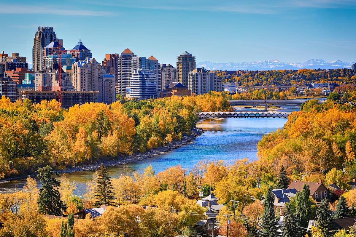
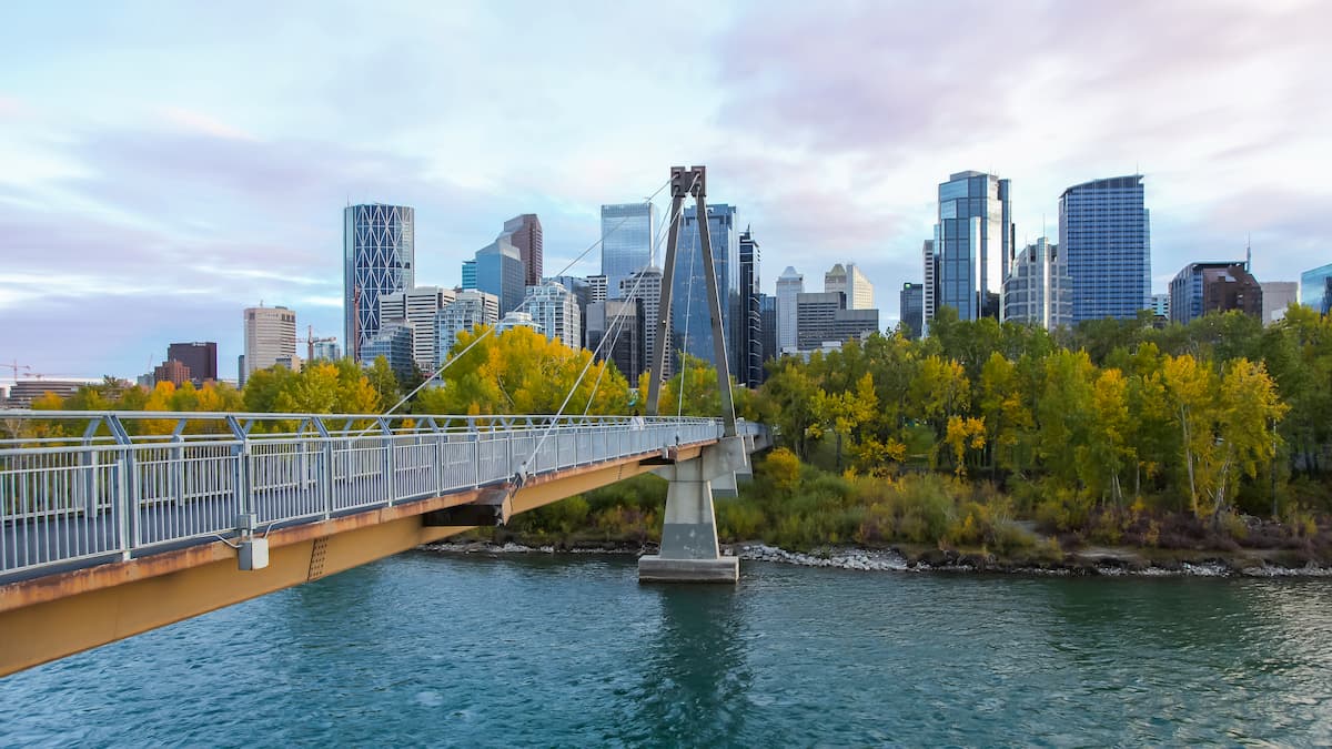
The Bow River Valley is Calgary’s central topographical feature. The Elbow River converges with the Bow River at the historic site of Fort Calgary, near downtown. The Bow River is one of the top trout streams in the world. Anglers travel to the city from around the world with hopes of pulling large brown trout from the Bow. The Nose and Fish Creeks also flow through the city into the Bow River, forming a series of scenic valleys and bluffs.
There are six named mountains in Calgary. Nose Hill Park, located in northwest Calgary, is one of the largest parks in North America and houses the city’s second-tallest hill, Nose Hill. Top Hill, the highest hill in the city, lies in the northwest corner of the city near the University of Calgary - Spy Hill Campus.
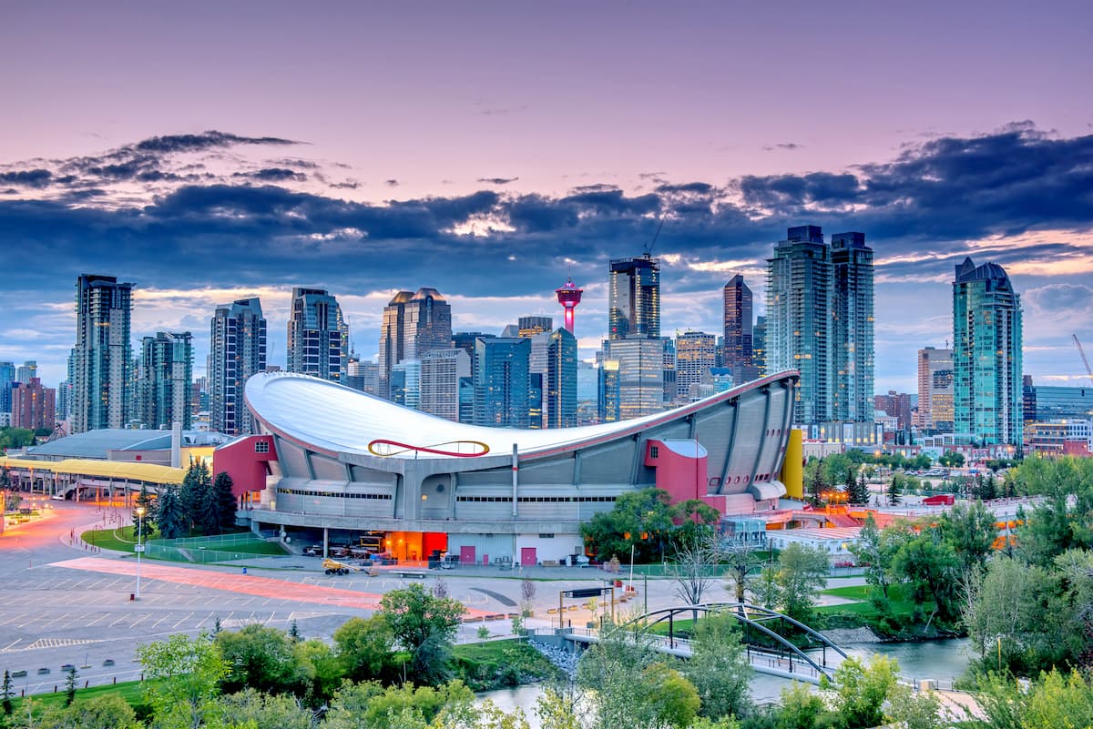
Calgary is home to roughly 1.4 million people and its residents enjoy more days of sunshine than any other major Canadian city. Ranked the most livable city in North America in both 2018 and 2019, Calgary residents are known to be very community minded. Despite its growing population, Calgary maintains a reputation as a city with small town spirit and big city entertainment.
Calgary’s backdrop is shaped by the illustrious Rocky Mountains and several plant and animal species can be found in and around the city. The city’s proximity to iconic mountain resort towns, like Banff, make it a popular destination for sightseeing and winter sports. Calgary also hosts a variety of major festivals, including the Calgary Stampede, the Folk Music Festival, the Lilac Festival, One World Festival, and Carifest, the second-largest Caribbean festival in the country.
The Bow River, which runs east-west through downtown Calgary, is lined with a series of scenic pedestrian and bicycle pathways known as the Bow River Pathway. This system of paths passes through a variety of delicious eateries, parks, and unique attractions. Visitors can pick a starting point and walk parallel to the Bow River all the way to Fort Calgary, periodically stopping at coffee shops, cafes, and bakeries along the way. Popular attractions along the Bow River Pathway include: The Peace Bridge, Prince’s Island Park, the historic Simmons Building, the George C. King Bridge, the Calgary Zoo, and Pearce Estate Wetland
Located at the northwest end of the city, Nose Hill Park is a natural environment park that covers over 2,700 acres. Visitors to Nose Hill can appreciate the Rough Fescue grassland, one of the most significant examples of this grassland ecosystem remaining in the Canadian prairies. The park also boasts several vistas of the Rocky Mountains, Bow River Valley, and vast plains to the east. Nose Hill also contains significant archaeological sites, including stone circles, or “tipi rings.”
Located in the south end of Calgary, Fish Creek Provincial Park is Canada’s second largest urban park. The park offers over 50 miles of mixed-use trails that can be used for hiking and biking. Most of the park remains in a natural, forested state, allowing visitors to escape the hustle and bustle of the city. Fish Creek flows throughout the length of the park and an artificial lake is available for swimming.
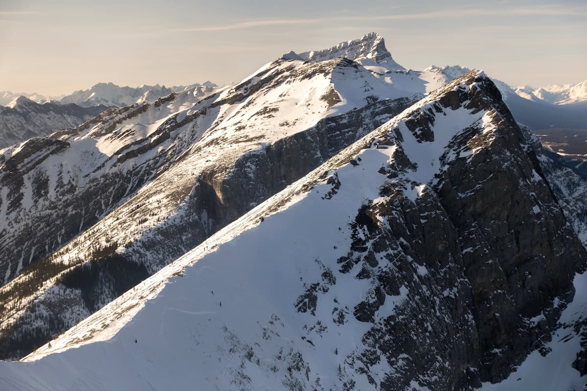
The 4.5-mile Ha Ling trail is a heavily trafficked footpath that leads to the summit of one of the most iconic landmarks in the Bow Valley – Ha Ling peak. The ascent to the summit of Ha Ling doesn’t require any special equipment, but the 2,400 feet of elevation gain shouldn’t be underestimated. The trail features incredible vistas of the East End of Rundle, Whiteman’s Pond, and almost the entire Spray Lake Valley.
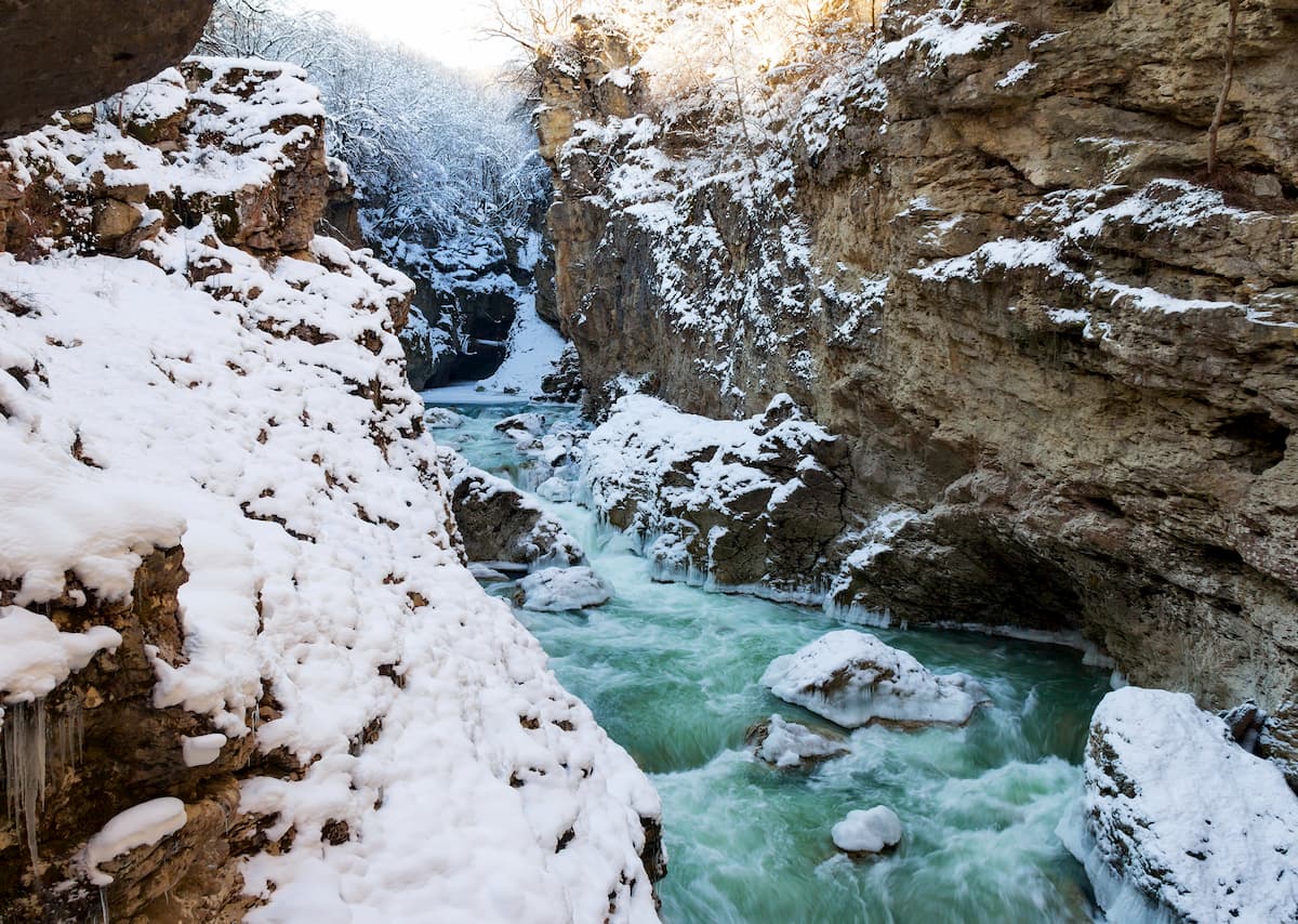
Located just a short distance from Canmore, the Grotto Canyon trail winds through a narrow-walled creek bed and a series of sheer, smooth limestone canyon walls. Shortly after entering the canyon, there are several Hopi pictographs that were painted between 500-1,000 years ago.
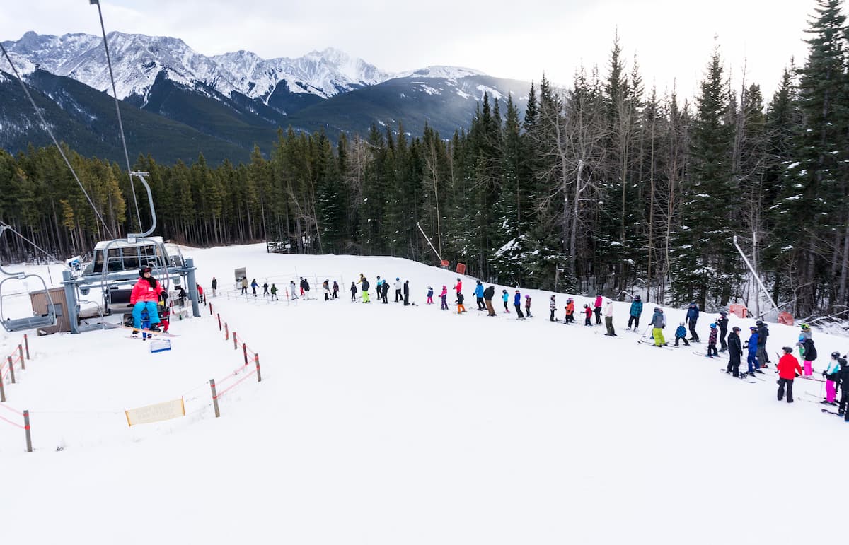
Known as ‘Calgary’s closest Mountain,’ Nakiska isn’t your everyday Canadian ski resort. This unique ski resort isn’t located in a stereotypical alpine town, and was built specifically for the 1988 Calgary Olympic Games’ Alpine Events. Today, the resort features Olympic-sized groomed runs and a state-of-the-art snowmaking system. Due to its location, Nakiska is a popular destination for Calgary and Canmore locals and offers plenty of options for lodging and dining.