
Scan the QR code and open PeakVisor on your phone
Riding Mountain National Park has 5 named peaks. The highest is Riding Mountain at 721 m. Other notable peaks include Bob Hill, Robinson Hill and Little Bald Hill.
Riding Mountain National Park is located in Manitoba, Canada in the western Manitoba uplands. The park covers 1,146 square miles across this region of Canada and was established back in 1933. There are 5 named mountains in Riding Mountain National Park. The highest and the most prominent mountain is Riding Mountain at 2,365 feet with 656 feet of prominence.
Before the region was named a national park, it was home to First Nation groups, including the Cree, Ojibway and the Assiniboine with the Ojibway people still inhabiting the region today. Europeans began exploring the region during the fur trade in the mid 1700s. A treaty, known as Treaty Number 2, was signed between the Ojibwe people and the Europeans in 1871. Before the park was established, the land was partially protected in 1895 as a lumber reserve. Then in 1933 the land officially became the Riding Mountain National Park. This made the park the first national park in all of Manitoba.
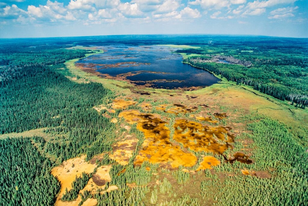
The park is situated above the farmlands of Manitoba. The climate in the park is often cool and moderate as it sits at a higher elevation. The summers can become quite hot while the winters are quite cold, similar to much of Canada. Today the park is home to a diverse range of wildlife. Beavers, elk, deer, moose, coyotes, cougars, Canada geese, and black bears, inhabit the land, along with many other species. Most notably, the park is home to one of the largest populations of black bears in all of North America. A herd of approximately 40 bison also roam the park. Summer wildflowers are a dominant feature of the landscape, along with aspen, birch, spruce, fir, pine, and elm trees.
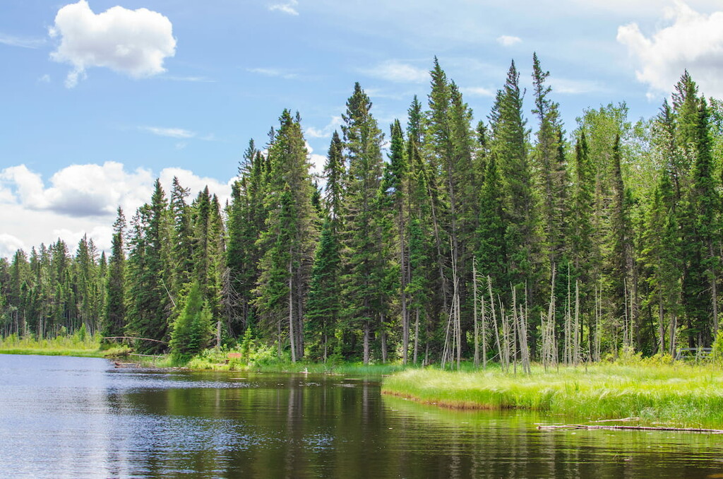
There are over 250 miles of trails throughout the park. While many are used for hiking during the summer months, a majority are open for cross-country skiing during the winter. Besides hiking trails, the park is also home to numerous lakes that are ideal for swimming and fishing during the summer months. Campgrounds are available throughout the park as well as in the backcountry. Within the park boundaries also lies the Clear Lake Golf Course.
Gorge Creek Trail: For one of the longer trails in the national park, hikers head to Gorge Creek Trail. The route totals 7.2 miles with 1,200 feet of elevation gain. The trail has a few steep sections but offers panoramic views of the forest hills of the gorge. The trail winds through the dense forest with viewpoints throughout, along with a few creek crossings. The park offers picnic tables about both ends of the out-and-back trail.
Brule Trail: Brule trail is one of the most popular hikes in the park and rated as easy. The trail is 2.6 miles roundtrip with just 340 feet of elevation gain. The trail winds through the forest without any major sections of elevation gain. Before reaching Kinosao Lake the trail crosses a boardwalk. Once at the lake, hikers can enjoy the pristine waters or sit to enjoy the views.
Kinosao Trail: This 4.5-mile trail follows some of the same path for the Brule Trail. The loop route spends more time winding through the forest before reaching the pristine lake. The lack of elevation gain throughout the loop makes the trail accessible throughout the year with opportunities to snowshoe and cross-country ski in the winter months. During the summer months, the pine and aspen trees are often full of wildflowers that the region is known for.
One of the nearest towns to Duck Mountain Provincial Park is Dauphin, located approximately one hour south. The city has a population of about 10,000 and is known as the “Garden Capital of Manitoba”. Much of the economy of the city is reliant on farming and outdoor recreation, within the greater Parkland region. Amongst the small downtown are local museums, restaurants, and cafes.
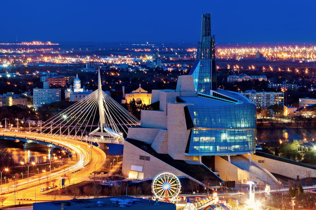
The city of Winnipeg lies four hours southeast of the Duck Mountain Provincial Park. Winnipeg has a population of nearly 800,000, making it the largest within the entire province of Manitoba,. Because of the size of the city, Winnipeg is a hub for transportation, festivals, and professional sports teams. Visitors to the city can explore the local museums, zoo, art galleries, local restaurants, or experience the Nordic spa. Within the city are also opportunities for tobogganing, skating, and ice hockey throughout the winter months.


The highest peak in Riding Mountain National Park is Riding Mountain, at 721 m.
Notable peaks in Riding Mountain National Park include Riding Mountain, Bob Hill, Robinson Hill, Little Bald Hill and Spruce Hill.


