Scan the QR code and open PeakVisor on your phone
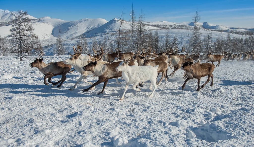
Where is the coldest place on the planet? It is here, in the Sakha Yakutia Republic of the Russian Federation, in the land of freely roaming deer, frozen fish sliced thinly to your delight, vast tundra, aeon-lasting permafrost, and rich gold mines. It easily becomes the land of the notorious White Walkers in winter when the temperatures can drop to the usual −50°C (-58F) or even −70°C (-94F) whilst summers can bring along the heatwaves of +30°C (86F) or more.
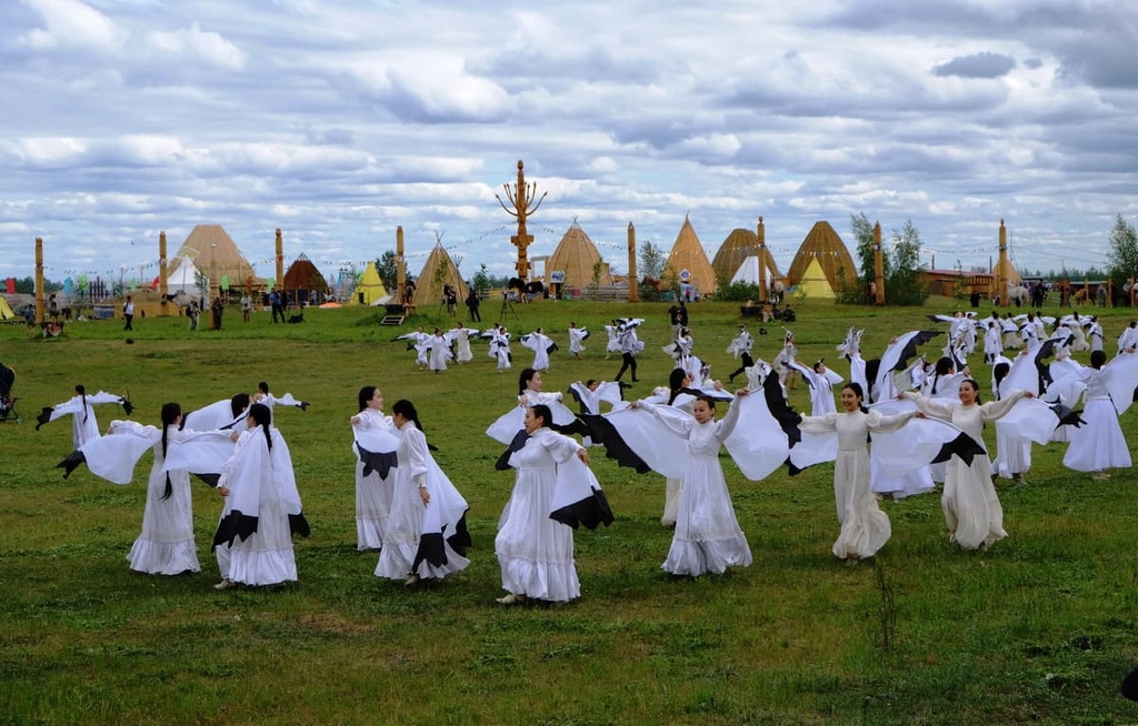
Welcome to the Sakha Yakutia Republic of Russia, a wild, uniquely bizarre land of stark contrasts. Just as the land is known by two names - Sakha and Yakutia, there seems to be only two seasons here: cold winter and hot summer with non-existent transitional spring and autumn. The republic can boast of a real desert lying next to the centuries-old permafrost. Yakutia enjoys a rich history dating back to the times when mammoths lived on our planet. It has inexhaustible natural resources and picturesque natural landscapes, pristine nature and fascinating culture, very peculiar local national cuisine based on venison, wild prey and frozen fish. The land is harsh to live in but people here are superbly hospitable.
Administratively, the Yakut Uyezd (a kind of Parish), which territory was almost equal to that of modern Yakutia, appeared back in 1638. And in 1991, the Yakut Soviet Socialist Republic received its present name - the Republic of Sakha (Yakutia). It is not only the largest subject of the Russian Federation, but also the largest administrative-territorial unit in the world by area, which is 3.083 million sq.km. It surpasses Argentina, the eighth largest country in the world by area. However, the population of the republic is less than one million (981,971 people in 2021, it is comparable to the population of Djibouti or Fiji), which makes it one of the most sparsely populated in Russia.
The Sakha Republic includes one city of republican significance (Yakutsk), 34 uluses or districts divided into their constituent rural districts called nasleghi (365), towns and urban-type settlements and villages.
The Sakha Yakutia Republic spreads over the northeastern continental part of Siberia and also has a number of islands: Novosibirsk, Bolshoy and Maly Begichev Islands, and the Medvezhye (Bear) Islands. Over 40% of the territory of the region lies beyond the Arctic Circle. In the west, Sakha borders the Krasnoyarsk Region, in the east it sides with the Chukotka Autonomous District and the Magadan Region, in the southeast it borders the Khabarovsk Region, in the south, the Transbaikal Region and the Amur Region, in the southwest, the Irkutsk Region, and in the north the natural boundaries of the Sakha Republic are formed by two seas - the Laptev Sea and the East Siberian Sea. The length of the republic from north to south is 2000 km, from west to east it stretches over 2500 km.
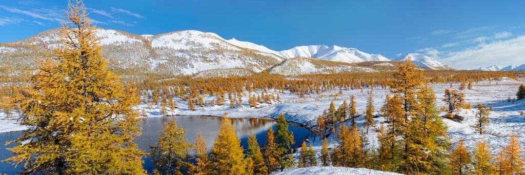
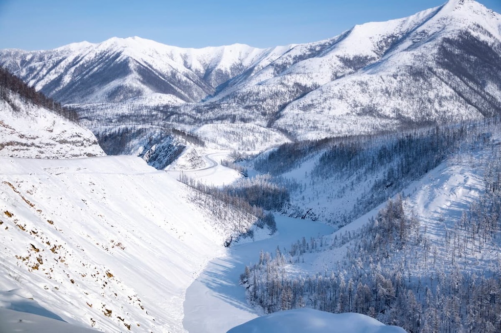
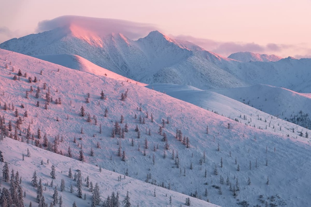
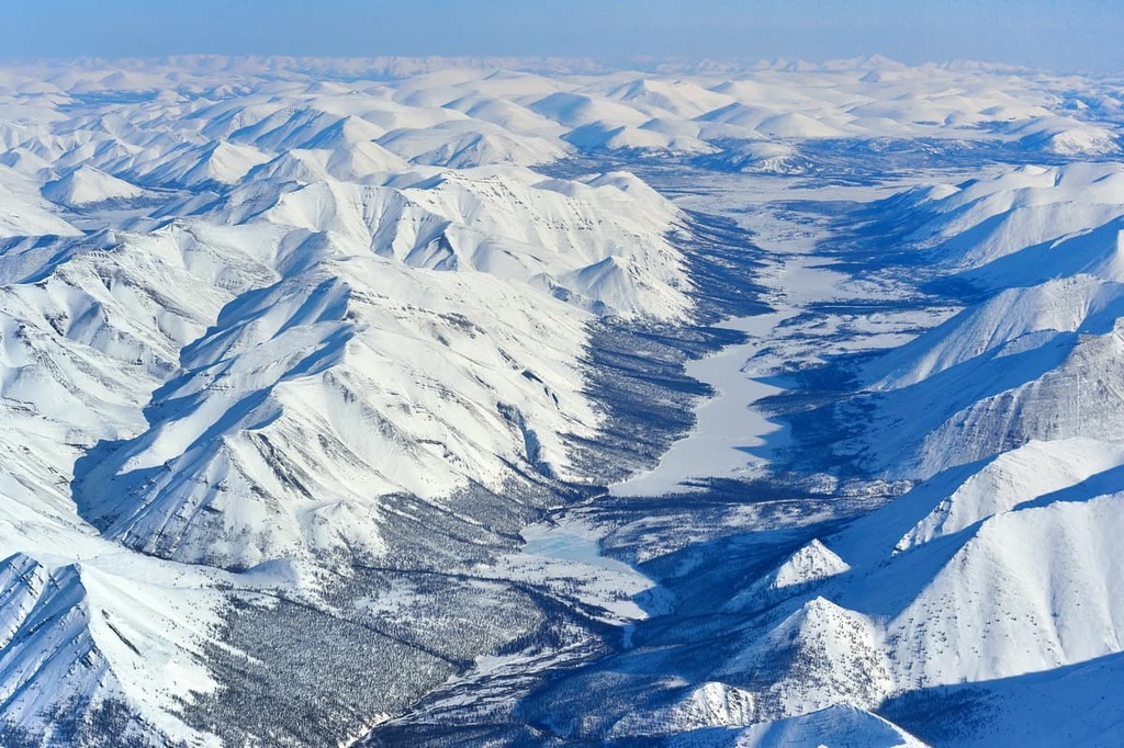
Looking at the vast territory of the region on the map, it would seem that this is predominantly flat land. But no, it is far from being flat! The eastern border with the Magadan Region features real mountains with their picturesque landscapes, they can even be compared to the Alps. There are 393 named mountains in Sakha-Yakutia, the highest among them is Pobeda Peak (3,003m).
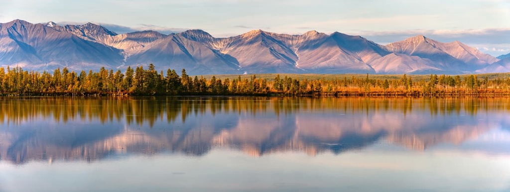
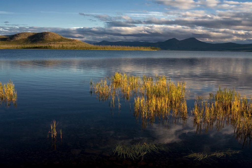
Sakha Yakutia is one of the most blessed river and lake regions of Russia. There are 700 thousand big and small rivers and over 800 thousand lakes. The largest navigable rivers are the Lena, Vilyui, Aldan, Olenek, Kolyma, Idigirka, Olyekma, Anabar and Yana. Of the largest lakes of the republic are Lake Busakh and Lake Labynkyr.
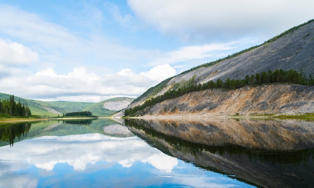
Most of Yakutia is in the middle taiga zone of Middle Taiga, which only to the north is replaced by pure tundra and forest tundra. About 4/5 of the territory is covered in forests, and river valleys are decorated with lush meadows. As to the vegetation, there prevail shrubby grasses and lichens often found on the banks of rivers and lakes, and on the mountain tops.
The Moma River and its banks fringed with lush vegetation

The fauna can boast polar bear, fox, reindeer, white hare, Arctic fox, sable, ermine, Siberian weasel, muskrat, American mink and many others.
In the mountains of the Eastern Yakutia lives the bighorn, in the mountain taiga, especially in the south and southeast of the republic, musk deer roam freely, and Manchurian wapiti (elk) live near the river Olyokma. In the twentieth century, the muskox was introduced to Yakutia; it adapted quite well. The first specimens of this animal caught in Taimyr were released in the delta of the Lena River.
There are about 50 species of fish, among which salmon and whitefish (ciscos) dominate.
This region is a nesting place for more than 250 species of birds. Among them, there are rare species included in the International Red Book: the pink gull, gyrfalcon (Falco rusticolus), white and black cranes and others.
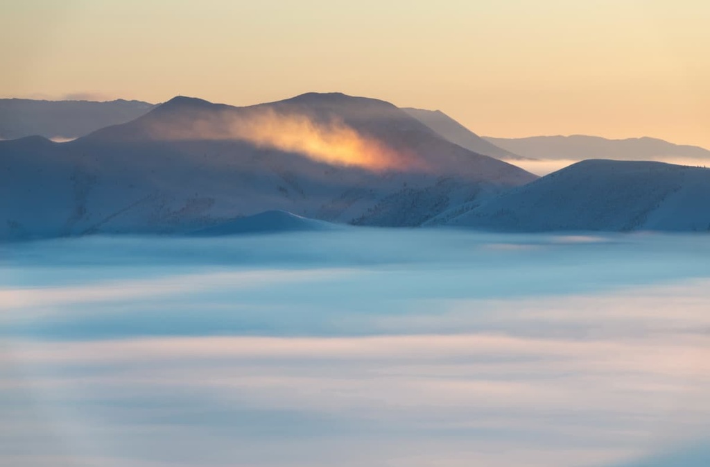
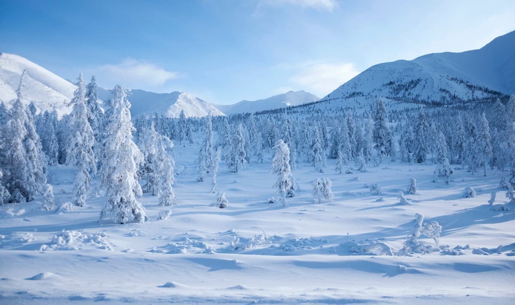
Sakha Yakutia is known for its extreme climatic conditions. Among all the regions of the world, winters are the coldest here, and this is only by the officially recorded statistics, there are unpopulated areas that might prove to be even colder.
The climate is sharply continental, with long winter and short summer periods. The months of April and October in Yakutia also belong to the winter season. The coldest month is January, temperatures drop to -50°C (-58F), and in the eastern mountains, hollows and depressions it can reach -70°C (-94F). The difference between the winter and summer temperatures is dramatic. In the warmest month, which is July, the heat can sometimes be as high as +30 °C (86 F).
By the absolute value of the minimum temperature, as well as by the total duration of the period with negative temperatures (from 6.5 to 9 months per year) the republic is matchless in the entire Northern Hemisphere.
The Republic of Sakha Yakutia is the only subject of the Russian Federation with three time zones - UTC+9,10 and 11. The difference with Moscow Time is +6/7/8 hours respectively.
Besides Russian and Yakut languages, the official languages in Sakha Yakutia include the languages of the local peoples, i.e. the Even, Evenki, Chukchi, Yukaghir, and Dolgan.
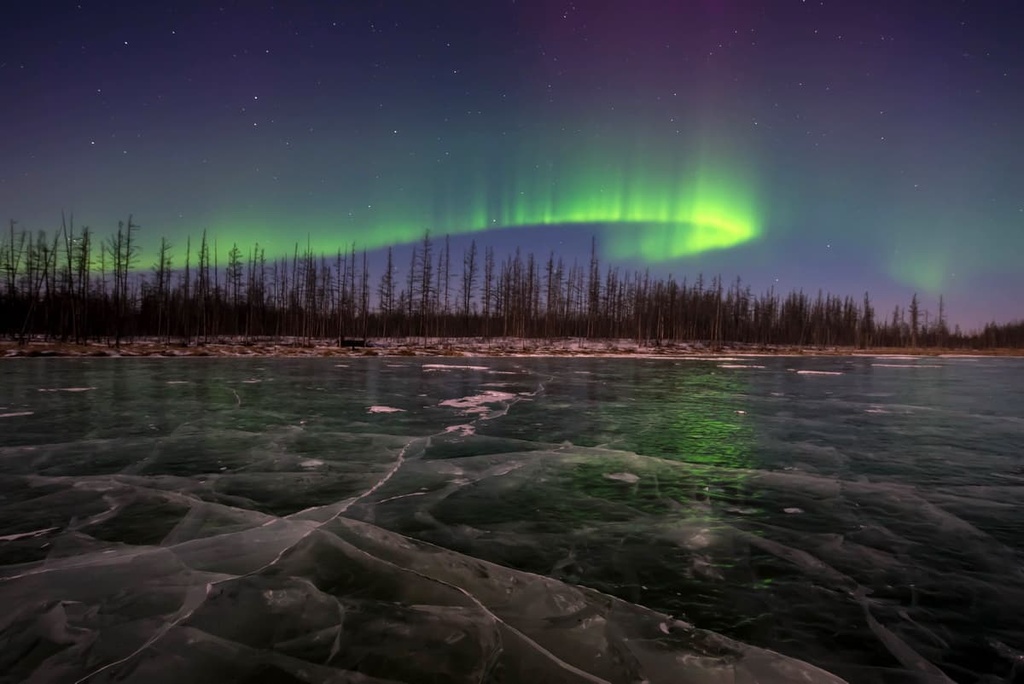
Yakutia is located in the polar region where long polar nights generate an amazingly beautiful phenomenon - the northern lights. The polar night in the village of Tiksi in Yakutia, located on the very edge of Taimyr, lasts 67 days. Taimyr, the most northern part of the Eurasian continent, is also called the Arctic desert. This is the realm of permafrost, eternal winter and eternal winds. The snow falls in September and stays on till May.
The Chersky Range is located in the north of Yakutia, stretching for 1,500km. Mount Pobeda (3,003 m) is the highest peak not only in the range, but also in the whole north-east of Russia. It is located almost 140 km to the south of the Arctic Circle and about 180 km to the north-east of Ust-Nera village. The nearest village is Samyr. It is here where mountaineers usually stop to check their gear and restock the supplies. The most favourable weather conditions for climbing Pobeda are in summer from July to August.
The Chersky Range

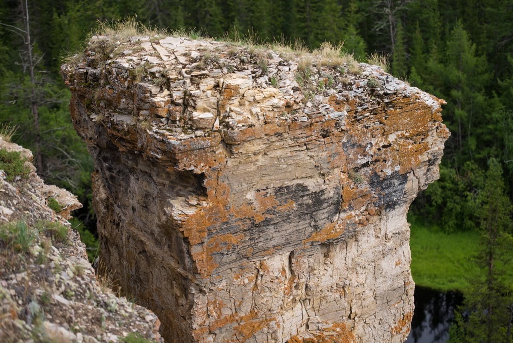
The Chersky Range has another interesting mountain called Yuryung Taastakh Khaya, which means a ‘mountain of white stones’ in Yakut language. The peak is better known as Marble Mountain, and the geologists know it as a mining site called Solnechny Deposit. The mountain is located on the bank of the Tirektakh River on the border with the Momsky National Nature Park. Marble Mountain itself is actually an array of many mountains consisting of marble rock. Its length is 500 km, width is 10 km. The lower part of the mountain is made of white marble, while the upper part alternates with layers of dark grey marbleized limestone. From the side, you can see beautiful rock outcrops of dazzling white and pale pink colour, sometimes with a warm beige hue.
Not so long ago, marble from the Carrara quarries in Italy was considered the best quality. It is from these quarries that most monuments and statues in the world are made. However, Yakutian marble surpasses the famous Italian marble in colour and translucency. Scientists have revealed its unique capacity to be translucent to a depth of 2 to 7 cm. Whereas Italian marble is translucent only up to 3 - 5 cm.
But it is not only the marble that Marble Mountain can surprise you with. In the midst of its picturesque landscape, you can enjoy the view of a wonderful waterfall.
Mammoth Mountain is a plateau of about 80m high. This unique natural object is included in the routes of international geological trips. The coastal outcrops of the mountain stretch along the banks of the Aldan River for as far as 5 km. They are located 310 km above the river mouth between the village of Krest-Khaldzhai and the place where the Tatta tributary flows into the river.
You can clearly see sand layers, pebbles, loams, and gravels here. From the outside, the mountain resembles a huge book written by the creator of this beauty - Nature itself. Geologists read this ‘book’ to see how the river valley developed, whereas palaeontologists read the remains of the mammals and try to figure out what the local flora and fauna millions of years ago were. Excavations on Mammoth Mountain can tell us a lot. For example, 15 million years ago the world of the Aldan River basin was bustling with more diverse and colourful life than now. The climate used to be much warmer, so lush vegetation dominated here.
In 2008, Russian and foreign scientists led by doctor of geological-mineralogical sciences, Professor A.V. Brushkov made a fascinating discovery: living microorganisms (bacilli) about 15 million years old capable of prolonging life were found in the sand sediments of Mammoth Mountain. Researchers suggest that their study will solve the mystery of ageing. Who knows, maybe thanks to these ancient organisms, people in the near future will increase their lifespan dramatically.
The Verkhoyansk Range is one of the largest mountain systems in northeast Asia. It extends along the banks of the river Lena for 1,200 km, the width varies from 100 to 250 km throughout the whole length. The tops of the ridge reach a height of 2,000 m. Most of the mountains consist of sandstone, limestone and shale, but deposits of gold, silver and tin have also been found here. One of the hollows of the range is notable for the village located which claims to be the Pole of Cold. This village is also considered to be a residence of Yakut Santa Claus who lives in the cave nearby.
The low mountain of Harama and its surroundings are part of the nature protected area. It is located on the coast of the Amga River and belongs to the Amga ulus (district). Many myths and legends are associated with the mountain, and the locals consider it sacred. The mountain is named in honour of the great pagan Yakut shamaness who is considered the mistress and keeper of the mountain. If you look closely, you can make out a human face silhouette on the mountain slope. She sometimes smiles, sometimes she is sad, and sometimes her image disappears.
The surroundings of the mountain are no less interesting. On the territory of the Amga ulus there are many archaeological monuments. In the upper reaches of the Amga River on the slopes of the mountains, there are ancient drawings. You can imagine what life our ancestors had, what their culture and beliefs were. In the area between the mouth of the river Borulakh and the stream Appa, researchers found 7 petroglyphs. The petroglyphs can be found in the mountains that stretch over 100 km. There is also a monument of wooden architecture of the 19th century in a place called Tankha (Khocho), a defensive granary is great evidence of the carpentry skills of our ancestors. Another historical monument is Korolenko Mountain. These lands are famous for strawberry meadows and a huge number of medicinal plants.
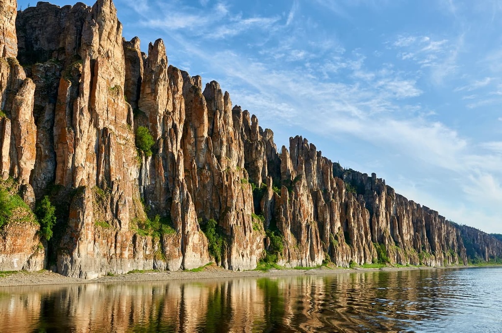
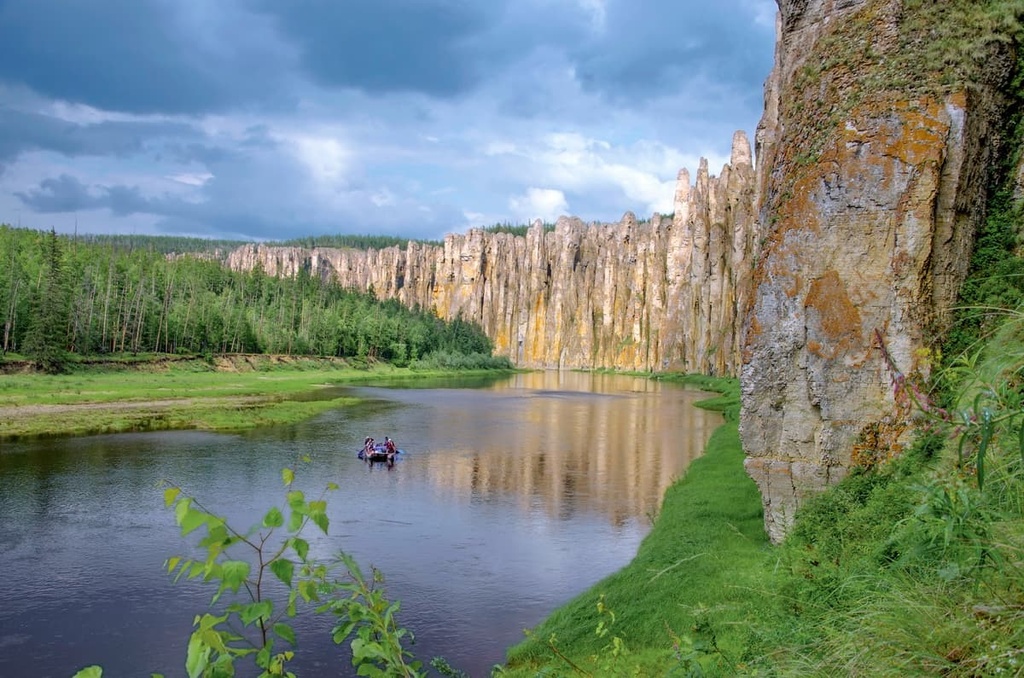
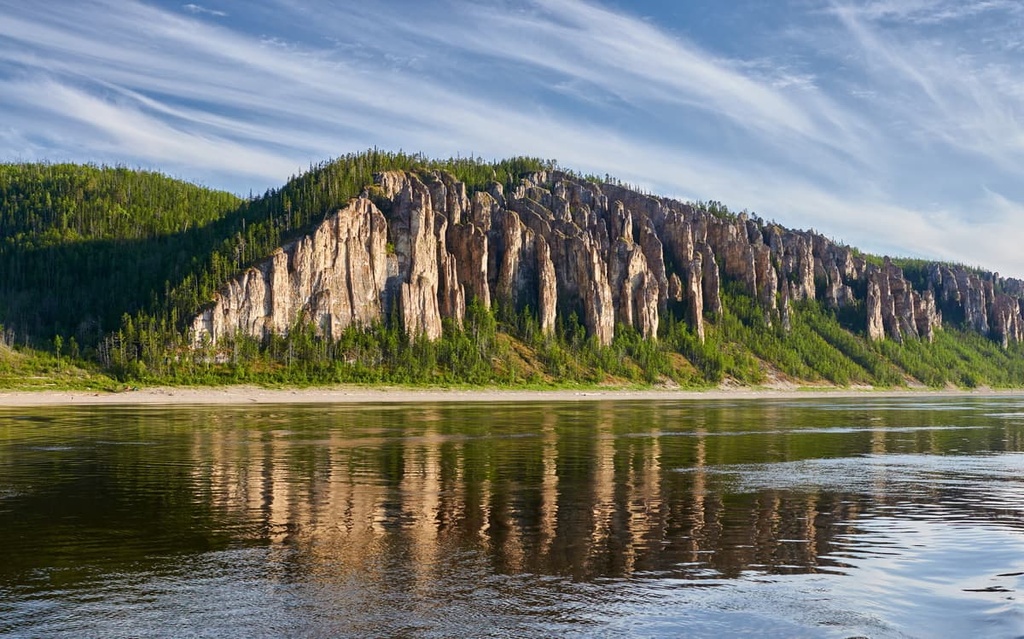
The Lena Pillars are a series of majestic steep cliffs proudly rising along the Lena River banks. The pillars are the guardians of Lena’s waters for more than 40 km. These compressed limestone rocks are 400 thousand years old. The amazingly beautiful natural pillars and the territories close to them form the Lena Pillars National Reserve.
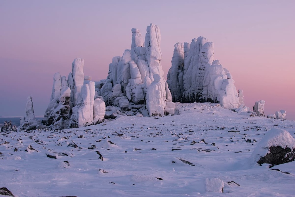
The Kisilyakh Mountains are picturesque pillar-shaped rocks. From afar, they resemble giant silhouettes of people that rise above the ground. The Yakut name Kisilaekh translates as "stone people". These rocks stretch for almost three dozen kilometres. Here you can find the Rock of Love, the Rocks of Continuation of Life and Trinity Rock. It's hard to believe that their shapes are not man-made, but created by wind, water, and temperature differences. This natural wonder is located in the Verkhoyanskiy district on the watershed of the Yana and Adycha rivers in the spurs of the Kisilyakh Ridge, which is part of the mountain system of the Chersky Range.

The locals consider this territory sacred. There is no other mountain in the whole of Yakutia that is so revered. There is a legend that in ancient times when trouble came, the Yakuts and the Evenks, who lived in the vicinity of the mountains, appealed to the higher powers living in the Kisilaekh mountains. Only shamans could ascend the sacred mountains. The Yakuts believe that the magical powers of the Upper Gods (Aar Aiyii) are crystallised in them and that this is where the Gates of Angels leading to the abodes of the Upper Deities are located. Each rock represents a particular Deity with its own individual power and mission.
Some people who are sensitive to more subtle energies and have been on pilgrimages to the Kisilyakh call the mountains the Northern Shambhala and the energy centre of the planet. But also ordinary people when visiting this place note a burst of energy and improvement of health. By mystery, arcanas and originality the Kisilyakh Moutnains are considered to be on a par with the Stonehenge and Easter Island!
By the way, just a few kilometres away from the Kisilyakh there are mountains which resemble giant truncated pyramids with perfectly smooth surfaces. Also here you can find a tourist base with all amenities on the banks of the Tuostaakh river that has crystal clear water.
Another natural wonder is Ulakhan-Sis. This is a stone city of towering stone sculptures located in the middle of the tundra in polar Yakutia, on the high ground between the Indigirka and Alazei rivers. Here it is possible to see a group and solitary rocks of different shapes and sizes. The material for these weathered pillars is granite and similar rocks.
The Buluus Glacier is an amazing natural wonder. It is a huge glacier of 1,000 hectares formed by underground sources of pure fresh water. In some places the thickness of the ice exceeds 3 metres. When the air temperature rises to +30°C (86F) and higher in summer, various cavities and intricate tunnels form in the glacier, so it starts resembling a labyrinth. The Buluus spring water is of a great quality, it contains all the microelements necessary for the human body. In order to preserve this unique object, the territory of the glacier is declared a nature reserve.

Not far from the famous Lena Pillars there are vertical steep cliffs called the Sinsky Pillars up to 100m high. They are not as famous as the Lena Pillars, but they are not inferior in their beauty. The Sinsky cliffs stretch along the coast of the river Siney (one of the tributaries of the river Lena) for 80 km. During the impressive time of their existence, which is about 400 thousand years, the natural sculptors - wind, rain, and water flowing down from the tops - have created rocks of intricate forms. Some resemble towers and palaces, others resemble arches and stone bridges.
Turuuk Haya Rock is another popular natural attraction among tourists. Turuuk Haya is in the middle of the Samartai Valley, it is a huge rock made of mountain limestone. On its slopeб you can find a natural crack and use it to climb to the top. There is a magnificent view of breathtaking landscapes opening up from the top of Turuuk Haya. You can see a dense pine forest, and the picturesque Lyutenga River flowing at the foot of the mountain; the Lyutenga is one of the tributaries of the Lena River.
Bottle Rock is located in the Neryungri ulus. The rock has a peculiar structure resembling pressed broken glass, which originated its name.
It is 100 km from the city and belongs to the Stanovy Range. From time immemorial, many beliefs have been associated with this rock. The simplest says that long contemplation of it can heal eye diseases. More romantic is that the beholder, if he looks in the right way, will see in the depths of the Rock the Bird of Destiny, which will reveal to him the secrets of the universe and the purpose of his own life. The main mineral of the rock is chrome-diopside, which means ‘stone that changes its appearance’ in Greek. And indeed, there are people who claim to see a bird inside the rock. Maybe it is a hallucination, maybe some kind of optical effect. Allegedly, the bird is man-made and placed inside by the legendary Master Soshnikov, who is the local equivalent of Danila the Master or Levsha from Tula. These guys are from Russian folklore tales, and the latter is a character from Leskov’s novels but based on the real dexterous guy.
It is not that easy to get to Bottle Rock. Cars can't get closer than 30 km - the forest starts to get dense. You have to hike. The Evenki’s joke is that this rock will either heal or kill you.
If you go to Chochur-Muran Hill, located almost 10 km away from Yakutsk, you can find yourself in the true lands of permafrost. The minus temperature inside the mountain remains the same during the whole year. In winter, even when it is -50°C (-58F) outside, it does not drop below -10°C (14F) inside, and in summer, even in hot weather, it does not rise above -4°C (24.8F). Chochur-Muran Hill is an iconic landmark of Yakutia, it represents the strength and power of the local permafrost.
There is a giant glacier inside the cave of Chochur-Muran Hill, and this glacier never melts! You can take a guided tour into the heart of the hill, walk through several halls, arches and corridors with original illumination. Here you can see various ice figures among which are the Lord of Cold called Chyskhaan, the Master of the North, and ancient animals of the Ice Age. The tour lasts about an hour. As it is really cold in the cave even in summer, the tourists are given special frost-proof clothes.
The Tukulany Dunes are hundred-metre-high sand dunes that rise in the middle of the green taiga in Yakutia. The word tukulan translates as "sands" from the Evenki language. In the summertime, the temperature on the dune crests rises above +40°C (104F), just like in the Sahara Desert. However, the difference from the deserts of the southern latitudes is still striking. It is impossible to die of thirst here because the dunes are surrounded by rivers, lakes and swamps. Another thing is the permafrost doesn't let water penetrate deep down, holding it in the upper layers of the Earth's surface. There is also vegetation near the water. Slender green pines and lonely bushes are part of the landscape of the Yakut deserts. You can find many animals here as well.

The most impressive in size is the Saamys-Kumaga Dune which is located at the mouth of the Diring-Yuryakh Creek. Large masses of sand that resemble the Karakum Barchans can also be found in the lower reaches of the Vilyuy River and along the valley of the Linde River.
There are several assumptions about the origin of the Yakut dunes. According to one version, the tukulans are sand drifts of the ancient Lena River, which probably flowed to the west of its current course tens of thousands of years ago. Another version says that the barchans were formed due to the sand blown by the wind from the foothills of the mountains, which used to be covered by the glaciers long ago. There is a version that the tukulans were formed due to the erosion of ancient sand strata which had risen due to vertical movements of the Earth's crust. The studies of the tukulans continue to this day. It is important for geologists, physical geographers, botanists, zoologists, builders, and experts in northern agriculture.
Nowadays, it is impossible to imagine a mountainous area with majestically towering peaks that would not be equipped with slopes for fans of mountain skiing and snowboarding.
In Sakha Yakutia, you can indulge in winter sports if you visit the following ski facilities:
The local resorts have unique natural features. The weather conditions here are quite severe. At the same time, the snow texture resembles sand. The air temperature during the winter often drops below -20˚C (-4F), but it is often sunny and not very windy. In the fall and spring the temperatures stay around -10-12˚C (10.4 - 14F), and the snow lies until May or even June. In general, the ski season lasts almost half a year and anyone can find a convenient time for a winter vacation.
Sakha Yakutia can boast of a whole system of specially protected natural territories. Some of them are of federal importance. These include:
Republican protected areas include
Finally, there are 90 specially protected nature areas under local and municipal governance.
International scientific research and monitoring of rare and endangered species are carried out in many protected areas. Bear Patrol deals with monitoring the population of the polar bears. Sterkh project handles white crane monitoring, as well as collaboration with the project called Cooperation of the Northern Zoos.
The most popular protected areas are: the Ust-Lensky Reserve, which is one of the largest nature reserves in Russia, the Momsky Nature Park that has the region's highest peak - Mount Pobeda - as well as the famous Marble Mountain and over 100 glaciers, the Pleistocene Park that runs a scientific experiment to create conditions and grazing areas for cohabitation of mammoth fauna - horses, bison, camels, musk oxen, big cats, deer, bears, the Olyokminsky Reserve, the Lena Pillars National Park, and the Kytalyk National Park.
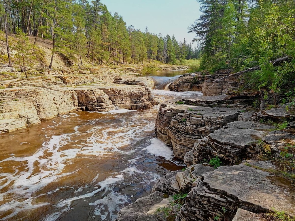
This small waterfall is located 80 km from Yakutsk on the river Mende. The nature surrounding it is fascinating, you can see a dense forest, a clear river with numerous rapids, and amazing multi-layered rocks. It is one of the favourite places for locals. In the summertime, you will find many facilities for a beach holiday here. The water is warm enough to swim, there is a sandy beach at the waterfall, benches, gazebos, and barbecues.
Lake Labynkyr is quite inaccessible and has a notoriously bad reputation to boot. This picturesque lake in the east of the region is rumoured to be a home to a huge and bloodthirsty monster that lives at the bottom of the lake. The locals call it the Labynkyr devil. The lake is situated in a deserted place not accessible by roads. The nearest settlement is 150 km away. The lake is inhabited by a large variety of fish, but still local fishermen prefer to avoid it. At the same time, the lake is laden with legends and attracts travellers in search of the traces of the northern dinosaurs. The tourist route leading to Lake Labynkyr begins in Tomtor village located on the left bank of the river Kuydyksun. The highway that connects the Republic of Sakha Yakutia and the Magadan Region passes through the village.
One could go on forever listing the natural sights of Sakha Yakutia. Yet, it is better to see them with your own eyes. In addition to mountains and rocks, there are many other interesting places in the region.

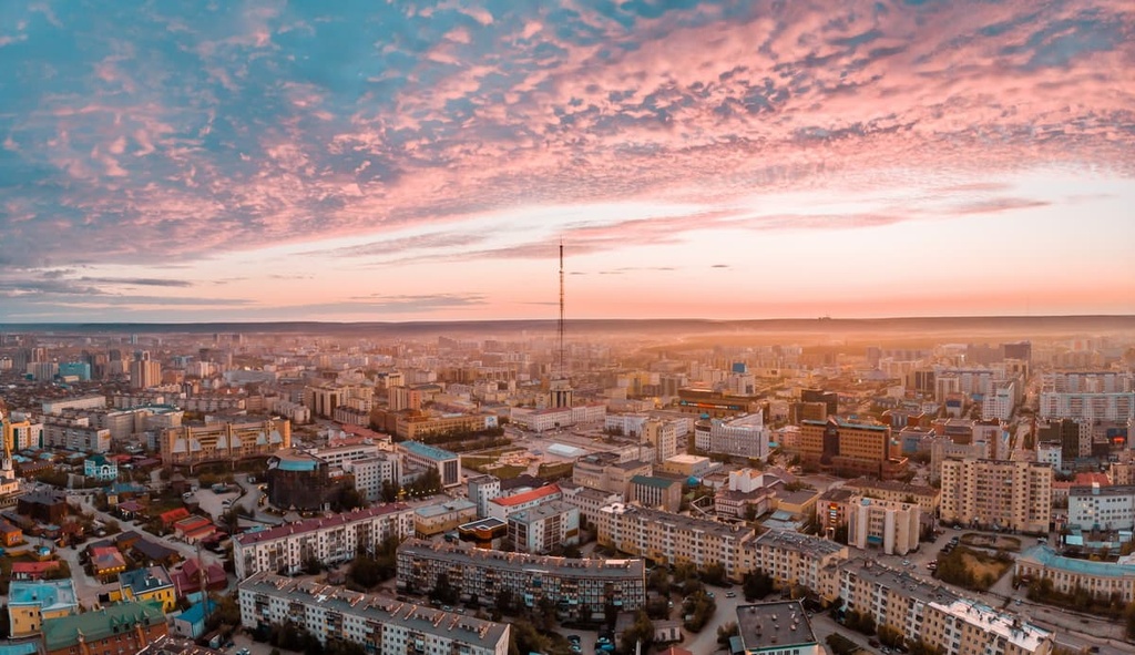
Yakutsk is the largest city in the world located in the permafrost zone. It lies in the Tuimaada Valley on the left bank of the Lena River. It is possible to reach Yakutsk in four ways - by plane, car, boat, or using a combined method (take the rail first and then a car). It is not yet possible to reach it by rail only - the railway station, located in the village of Verkhny Bestyakh, is still under construction and passenger service is not available yet.
Yakutsk was founded by the Cossacks in 1632 and was known by two names: either Lenskiy Ostrog or Yakutskiy Ostrog. Ostrog in Russian means ‘prison or fortified settlement. Later, it received the status of a town, and was renamed Yakutsk. In the middle of the city, there are many meandr lakes, the largest of which are: the Saisary, Beloye (White), Teploye (Warm), Taloye (Meltwater), Sergelyakh, and Khatyng-Yuryakh.
The harsh climate is not a hindrance for tourists, so this beautiful city is a popular destination. Yakutsk is rich in attractions. The cold capital of the republic offers plenty of opportunities for active outdoors and guided tours.
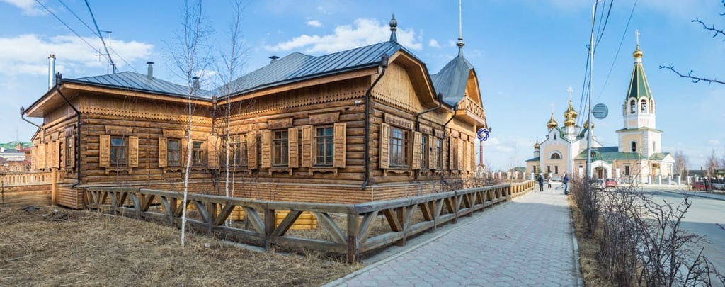
When you walk the streets of the Old Town in Yakutsk, you can feel as if time has turned back and you are in the 19th or even the 18th century. Despite the fact that the original old town was once destroyed by fire, restorers were able to reproduce an exact copy of it. Market rows, street roads, ancient architectural buildings immerse visitors into the atmosphere of the bygone times.
The historic district is surrounded by modern cafes and various stores. Among the modern amenities, a grandiose project of the Olympic champion free wrestler Pavel Pinigin stands out - the Triumph Sports Complex. It began its history in 2000. Currently, it is used for the training of Olympic athletes, its arena can house 3,000 people, it also has a hotel and living headquarters for sportsmen.
There are eight theatres and over a dozen museums in Yakutsk. Among the most popular is the Treasury of the Sakha Republic which is famous for its collection of diamonds, precious stones and jewellery. The Mammoth Museum keeps unique paleontological finds. The most famous are the mummies of the baby bison and moose, the approximate age of which scientists estimate at 8-9 thousand years. There is also a copy of the mammoth baby named Dima. There is also the National Art Museum of the Sakha Republic.
Yakutsk has the only museum in the world that is entirely devoted to khomus - a reed musical instrument used by shamans (the People’s Khomus Museum and Centre). You can hear this instrument in many Asian cultures, but it is here in the north of Siberia that it has the clearest sound.
50 km from Yakutsk, at the foot of a high mountain in the picturesque Erkeen Valley, there is a Yakut Orto-Doidu Zoo. It is inhabited by more than 180 animal species, including the Amur tiger, spotted deer, musk ox, Siberian spruce grouse, golden eagle and other rare animals of the planet. This is the only zoo in the world that is located in such harsh climatic conditions. In addition, the zoo is a centre for the injured, sick and orphaned animals. Here they receive medical care and treatment. They are then either released back into the wild or continue to live in the zoo.