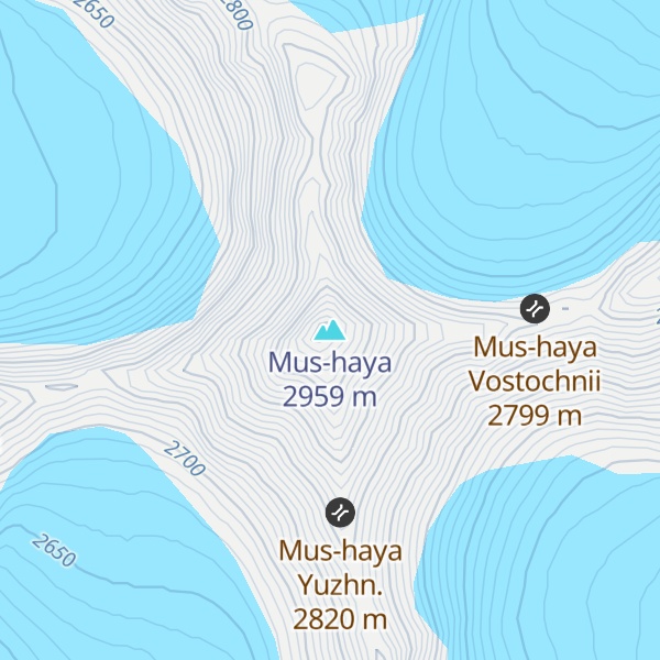
Mus-Khaya (Russian: Мус-Хая, Yakut: Муус Хайа) is a mountain in Sakha Republic, Russia and the highest point of the Suntar-Khayata Range with an elevation of 2,959 m (9,708 ft).
The mountain is located 485 km (301 mi) south of the Arctic Circle and 135 km (84 mi) southwest of Oymyakon.
Mus-Khaya means Icy Mountain in Sakha.
By elevation Mus-haya is
# 1 out of 1053 in the Verkhoyansk Range # 1 out of 27 in Oymyakonsky Ulus # 3 out of 393 in Sakha Republic
By prominence Mus-haya is
# 1 out of 1053 in the Verkhoyansk Range # 1 out of 27 in Oymyakonsky Ulus # 2 out of 393 in Sakha Republic # 23 out of 24823 in Russia
We use GPS information embedded into the photo when it is available.
3D mountains overlay
Adjust mountain panorama to perfectly match your photos because recorded by camera photo position might be imprecise.
Move tool
Rotate tool
Zoom
More customization
Choose which peak labels should make into the final photo and what photo title should be.
Next
Photo Location
Satellitte
Flat map
Relief map
Latitude
Longitude
Altitude
OR
Latitude
°'''
Longitude
°'''
Apply
Register Peak
Peak Name
Latitude
Longitude
Altitude
Register
Teleport
PeakVisor
This 3D model of Sagarmatha National Park in Nepal was made using the PeakVisor app topographic data. The mobile app features higher precision models worldwide, more topographic details, and works offline. Download PeakVisor maps today.
Download OBJ model
PeakVisor
The download should start shortly. If you find it useful please consider supporting the PeakVisor app.
PeakVisor for iOS and Android
Be a superhero of outdoor navigation with state-of-the-art 3D maps and mountain identification in the palm of your hand!