
Scan the QR code and open PeakVisor on your phone
Parc marin du Saguenay–Saint‑Laurent has 36 named peaks. The highest is Le Tableau at 342 m. Other notable peaks include Cap Éternité, Cap Noir and Cap Sainte-Marguerite.
Parc marin du Saguenay-Saint-Laurent (Saguenay St. Lawrence Marine Park) is a protected area located in the Canadian province of Quebec. It is the only national park of Quebec that protects a purely marine environment. At 342 m (1,122 ft) in elevation, Le Tableau is the highest point among the 36 named mountains that line the shores of parc marin du Saguenay-Saint-Laurent.
Parc marin du Saguenay-Saint-Laurent centers around the confluence of the Saguenay and St. Lawrence Rivers, which is located about 200 km (124 mi) to the northeast of Quebec City in the Canadian province of Quebec.
The town of Saguenay and parc national du Fjord-du-Saguenay (Saguenay Fjord National Park) lie to the north of the marine park while Lac-Témiscouata National Park is situated to the south. Further to the east, the St. Lawrence River opens into the Gulf of St. Lawrence and the North Atlantic Ocean.
Parc marin du Saguenay-Saint-Laurent is jointly managed by Parks Canada and the Quebec provincial government body Sépaq (Société des établissements de plein air du Québec/Quebec Outdoor Establishments Company). The park protects 1,245 sq. km (481 sq. mi) of critical marine habitat that’s home to several whale species and many other endangered mammals and fish.

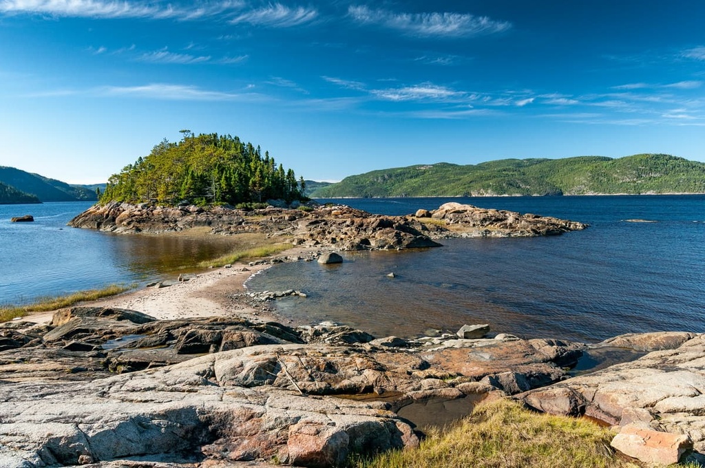
Two major formations contribute to the geological composition of parc marin du Saguenay-Saint-Laurent—the Canadian Shield and the Appalachians.
The Canadian Shield is a crystalline bedrock formation that is between 600 million and 4 billion years old. It is home to some of the oldest rocks on the planet. The Saguenay River and the north shore of the St. Lawrence River are located within a geomorphic and tectonic area called the Grenville Province, which is one of the younger parts of the Canadian Shield.
The St. Lawrence River’s southern shore and the islands within the river’s estuary are part of the westernmost extension of the Canadian Appalachians.
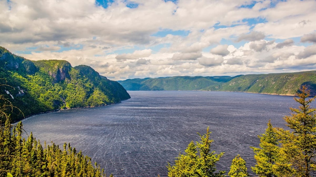
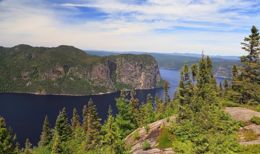
Despite its ancient origins, relatively recent geological events have sculpted the park into its current composition. Large ice sheets that once covered the region receded during the Pleistocene, grinding and carving the landscape into the fjords and valleys of the Saguenay and St. Lawrence Rivers.
Notable high points located along the perimeter of the marine park include Le Tableau, Cap Éternité, Cap Noir, and Cap Sainte-Marguerite.
The confluence of the two rivers in the park also serves as the confluence of different ecosystems. This meeting point of varied habitats and biozones contributes to the ecological riches that parc marin du Saguenay-Saint-Laurent is known for.
The marine park is the meeting point for waters from the Saguenay River, the Great Lakes, and the Atlantic Ocean. This mixing of fresh and saltwater creates an oceanographic process critical to the ecological diversity of the park.
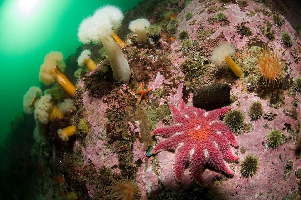
An upwelling of cold water transports nutrients and zooplankton to the surface and promotes oxygenation of the water, resulting in the rich tapestry of complex life that draws thousands of visitors to the park every year.
Three distinct ecosystems are found within the waters of the park: the upper estuary, the lower estuary, and the Saguenay Fjord. Although they are distinguished by varying temperatures, salinity levels, seabed composition, and depth, their boundaries remain less well defined than terrestrial ecosystems as water and marine life constantly shift between the three.
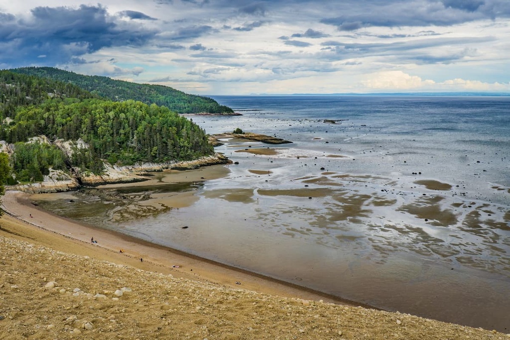
Dotted by wild islands and featuring pristine turquoise waters, the upper estuary of parc marin du Saguenay-Saint-Laurent is home to a wide diversity of marine life. Herring, capelin, seals, and beluga whales use the upper estuary for feeding, rest, and reproduction, hence its nickname as the “nursery of the park.”
The upper estuary composes 53 percent of the total protected area of the marine park.
The eastern side of the marine park beyond the mouth of the Saguenay River is known as the lower estuary.
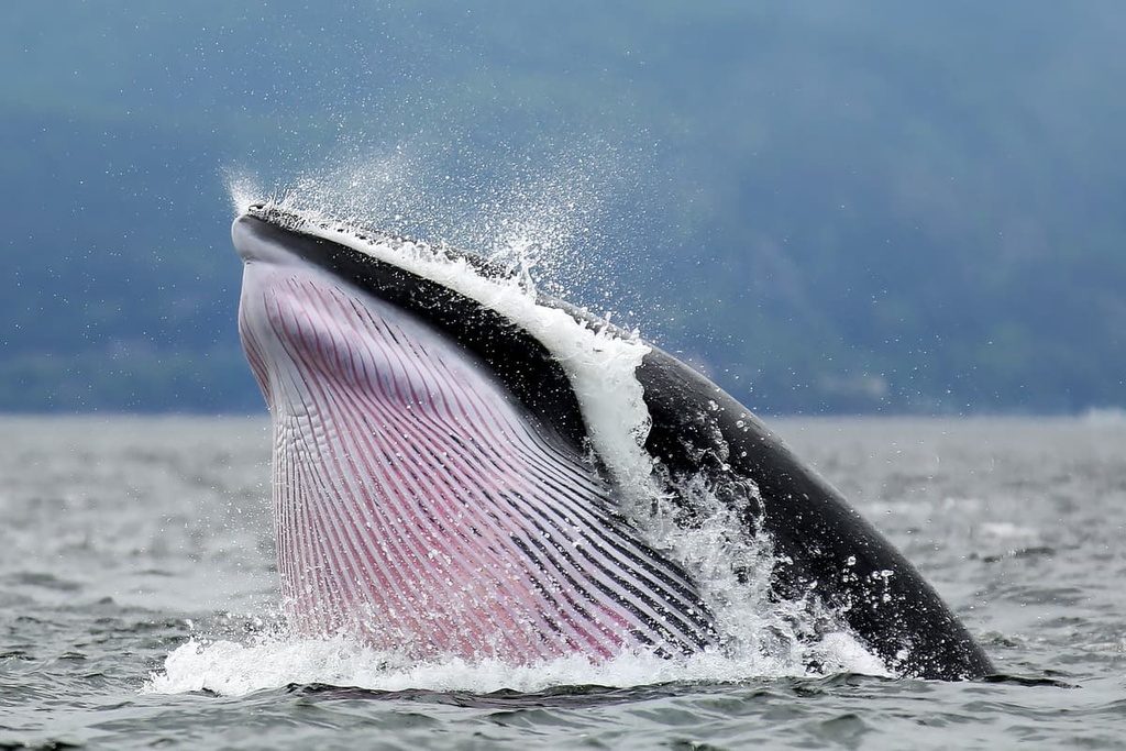
The deep, nutrient-rich waters of the estuary make it a prime feeding ground for whales, seals, and other large marine life throughout the summer. It is the most popular destination in the park for intrepid sea kayakers and whale watching tours.
Animals that frequent the lower estuary include minke whales, blue whales, St. Lawrence beluga whales, humpback whales, harbor porpoises, and multiple species of seals.
The dark waters and steep, glacially carved cliffs of the Saguenay Fjord are a powerful presence. At high tide, the cold, oxygen-rich saltwater from the upper and lower St. Lawrence estuaries flows into the fjord, filling it with nutrients and biological complexity.
Visitors to the region may get a chance to see beluga, minke, fin, and blue whales amidst the waters of the Saguenay. The fjord is also home to populations of Arctic cod, Atlantic salmon, and Greenland halibut.
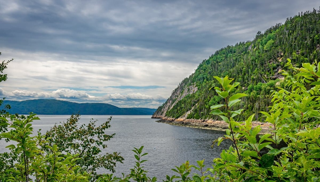
With a total length of over 105 km (65 mi), Saguenay Fjord is one of the longest such fjords in the world. Its shores within the marine park are protected by parc national du Fjord-du-Saguenay.
Humans have inhabited the shores surrounding parc marin du Saguenay-Saint-Laurent for over 8,000 years.
Archeological evidence suggests that Indigenous peoples, including the Nation Huronne-Wendat and their ancestors (among others), traditionally relied on the St. Lawrence estuary as a major source of sustenance where they could catch salmon, seals, and beluga whales. Islands in the estuary were used to process the fish that were caught before they were sent to larger settlements located further inland.
The abundance of marine life in the region is what also attracted early European sailors to the St. Lawrence River valley in the sixteenth century. Basque fishermen from what is now France and Spain came in great numbers to hunt the right whale and the bowhead whale. The blubber from these whales would then be processed into extremely valuable oil.
Parc marin du Saguenay-Saint-Laurent was the site of many historic exchanges. An alliance between several First Nations and the French was formed at the mouth of the Saguenay River in 1603. This pivotal moment allowed France to expand their colonial reach and initiate the fur trade across vast expanses of North America.
In the nineteenth century, intensive logging began in the areas surrounding the marine park. The opening of dozens of new sawmills promoted the establishment of new towns, setting the groundwork for the forestry and agriculture-based economy that continues to have a strong presence in the region to this day.
By the late twentieth century, increasing industrialization of the St. Lawrence River valley was threatening the biological integrity of the estuary. In 1988, the governments of Canada and Quebec proposed an action plan for the region, which culminated with the creation of parc marin du Saguenay-Saint-Laurent in 1998.
As the area holds national park status in Quebec, marine activities are now heavily regulated in the park.
The park serves to protect the more than 1,800 species that are found within its borders, including at-risk species like the beluga and blue whales. Additionally, the park is now a major tourist destination that attracts hundreds of thousands of kayakers, wildlife photographers, and sightseers each year.
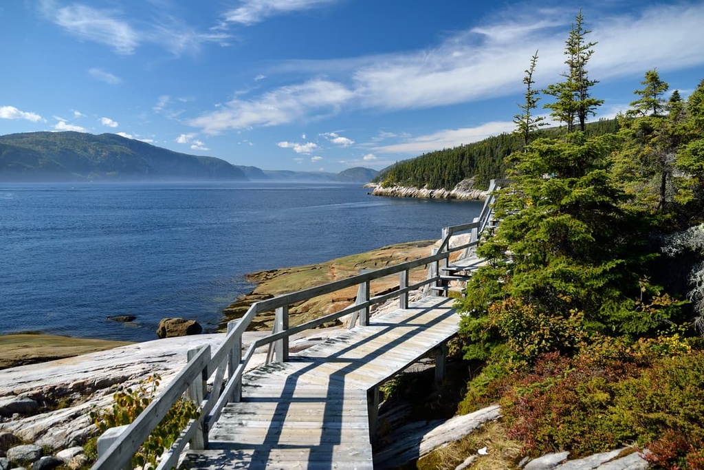
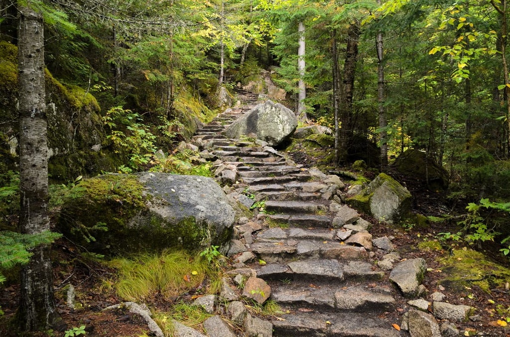
Although the park itself consists exclusively of marine habitat, visitors looking to explore parc marin du Saguenay-Saint-Laurent by foot can find many exciting hikes and scenic viewpoints along the shores of the Saguenay River and the St. Lawrence Estuary.
Here are some of the best hikes in the area around parc marin du Saguenay-Saint-Laurent to check out the next time you’re in the region.
Sentier de la Pinède (Pine Forest Path) is a 7.4 km (4.6 mi) long out-and-back trail that takes you along the western shore of the Saguenay River. The trail winds through a lush, moss-laden forest, gradually taking hikers up to a panoramic viewpoint of the marine park.
The Tadoussac Dunes Trail trail is a great option for families looking to spot wildlife near the mouth of the Saguenay River in the town of Tadoussac. This short, 1.4 km (0.9 mi) long path winds through forest and over towering sand dunes that were created by receding glaciers thousands of years ago.
Beginning alongside the St. Lawrence River in the town of Baie-Sainte-Catherine, the Lac Roger Trail is a 13.5 km (8.4 mi) loop route that offers breathtaking views of the St. Lawrence River valley.
Gaining 600 m (1,968 ft) of elevation along the way, hikers on this trail will pass waterfalls, lush pine forests, and the serene shores of Lac Roger before looping back down to Baie-Sainte-Catherine.
There are countless opportunities to explore the area on foot, but no trip to parc marin du Saguenay-Saint-Laurent is complete without getting offshore. There are several ways visitors can take to get out on the water where they can truly appreciate the magnificence of the marine park, including:
Looking for a place to stay near parc marin du Saguenay-Saint-Laurent? Here are some of the best nearby cities and towns to check out.
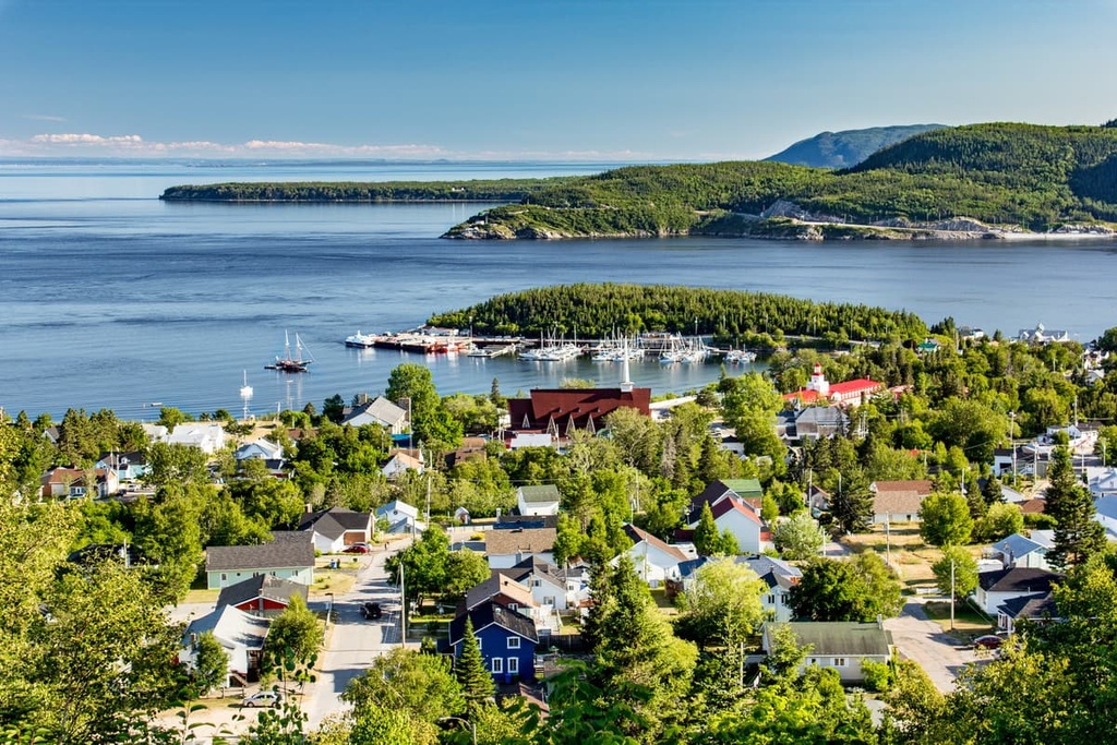
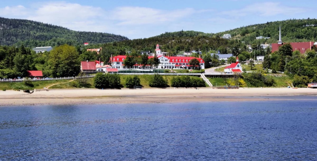
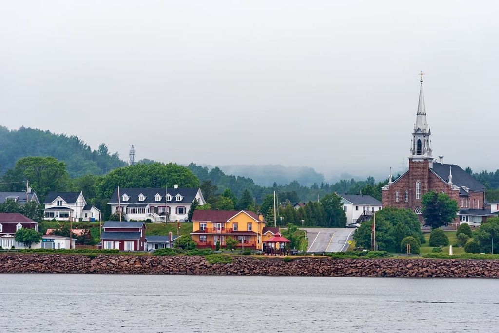
Tadoussac is a small town that sits at the confluence of the Saguenay and St. Lawrence Rivers. There are countless whale watching and boating operators based in the town due to its proximity to parc Marin du Saguenay-Saint-Laurent.
Located on the traditional land of the Innu First Nations, Tadoussac was among the first French settlements in North America. Though it is small, the town is surrounded by gorgeous views, and it features many wild rivers and forests to explore. It retains its historic charm through storied establishments like the La Galouïne Inn and Restaurant, where visitors can enjoy regional cuisine and cozy accommodations.
The picturesque town of Les Escoumins sits on the north shore of the St. Lawrence River near the lower estuary at the edge of the marine park. Hundreds of kilometers of rugged coastline extend in both directions from the town, making it a popular destination for kayaking and camping.
The town draws outdoor enthusiasts from around the world. Les Escoumins offers access to internationally renowned scuba diving sites and kayaking routes in the summer. Winter brings endless opportunities for adventure on the countless snowmobile and ski trails that are located throughout the north shore region.
Visitors to Les Escoumins can stay at Condo-Hôtels Natakam on the shores of the St. Lawrence River, right beside the Marine Environment Discovery Centre.
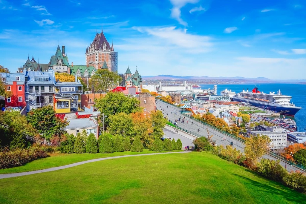
Quebec City is the provincial capital of Quebec. With a population of around 530,000 people, it is the second-largest city in the province, behind Montreal. The city is situated to the southeast of the marine park along the St. Lawrence River. Its international airport makes Quebec City the gateway for most visitors to this part of the province.
As it was settled by the French in 1608, Quebec City is one of the oldest European cities in North America. When touring Quebec City’s narrow, cobblestone streets, which are lined with bistros and boutique shops, it is easy to feel as though you are in Europe, not the middle of eastern Canada.


The highest peak in Parc marin du Saguenay–Saint‑Laurent is Le Tableau, at 342 m.
Notable peaks in Parc marin du Saguenay–Saint‑Laurent include Le Tableau, Cap Éternité, Cap Noir, Cap Sainte-Marguerite and Cap Blanc.


