Get PeakVisor App
Sign In
Search by GPS coordinates
- Latitude
- ° ' ''
- Longitude
- ° ' ''
- Units of Length

Yes
Cancel
❤ Wishlist ×
Choose
Delete
Welcome to Western Australia (WA), one of the last of planet Earth’s frontiers. WA is almost entirely Outback, where the deserts and mountains stretch to infinity. It’s the land of Jundamarra, the Bununa Aboriginal man who rebelled against the encroaching whites in defense of Country. And, in the 21st century, it’s become one of the world’s most productive mining regions, supplying iron ore, gold, diamonds, bauxite, and more, becoming Australia’s most affluent state per capita. There are 3624 named mountains in Western Australia. Mount Meharry (1,251 m / 4,104 ft) is the highest point. The most prominent mountain is Bluff Knoll (1,100 m / 3,609 ft).
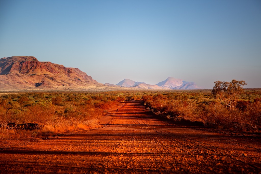
WA stretches across 2,527,013 square kilometers (975,685 sq mi), making it the largest of Australia’s states and larger than Western Europe. In fact, it would be the 10th largest country in the world if it were independent, after Kazakhstan. It shares a border with the Northern Territory (NT) and South Australia (SA).
Western Australia’s population is minuscule despite its size: just 2.8 million people live here, meaning a population density of 1.11 / km2 (2.9 / sq mi). However, with 2.4 million people living around the capital city of Perth, the true density of the Outback is far lower. The majority of WA’s territory is among the most remote on Earth.
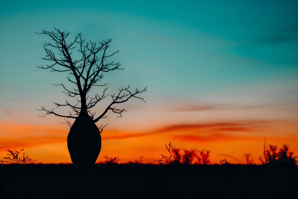
WA’s mountain ranges consist of older, eroded formations compared to many other parts of the world. The geography reflects extensive periods of tectonic stability, and the arid climate means that erosion also occurs over geologic time rather than mere human years. Change is elusive in this eternal landscape.
Here are a few of the most significant mountain ranges, though numerous other smaller ranges and formations exist.
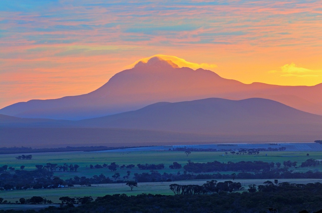
The Stirling Range is located in southwest WA, northeast of the town of Albany. The highest peak is Bluff Knoll at 1,099 meters (3,609 ft). The range stretches approximately 65 kilometers and is surrounded by low-lying plains and farmland. Its proximity to the Southern Ocean makes it the wettest of WA’s mountains, and its more southerly latitude means it’s the only one to receive snow.
The Darling Range (Darling Scarp) runs parallel to the coast, inland from Perth. It’s less rugged than the Stirling Range and is characterized by gently undulating plateaus. The range was originally covered in Karri forests, a type of Eucaplyt. Mount Cooke is the highest peak at 582 meters (1,909 ft).
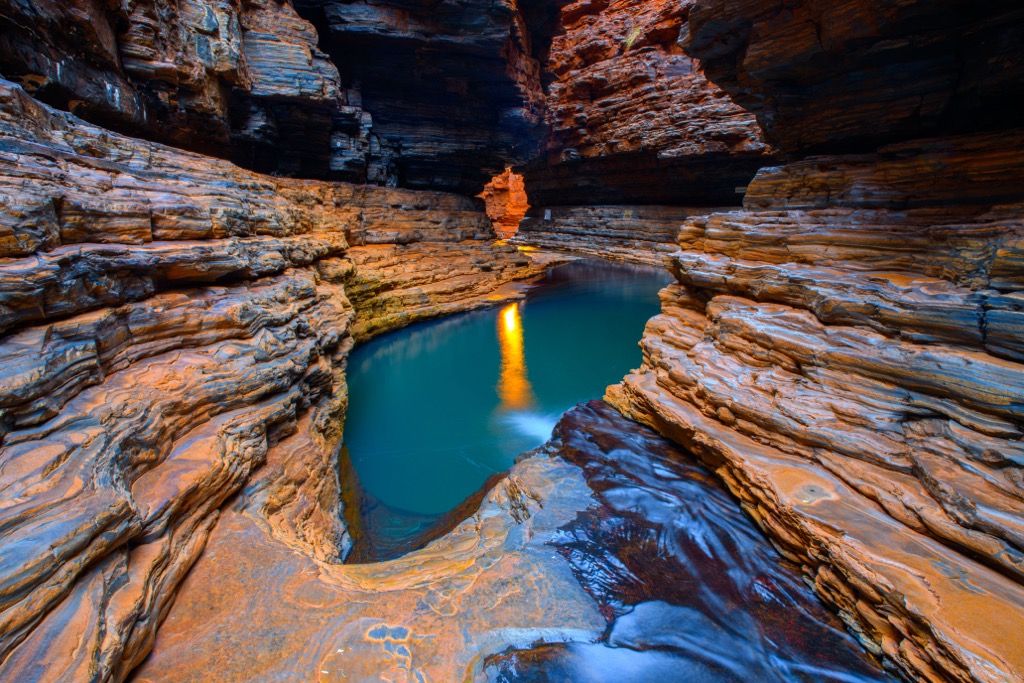
The Hamersley Range is located in the remote Pilbara region in central-west WA, spanning over 400 kilometers (250 miles). The range’s arid climate, iron-rich gorges, and sheer cliffs create striking contrasts between the red earth and sparse vegetation. This range is home to Karijini National Park, which showcases some of the most spectacular geological formations. The highest peak in WA, Mount Meharry (1,251 m / 4,104 ft), is in this range.
While not as mountainous in a traditional sense, this range in the Kimberley region is WA’s most unique, with its beehive-shaped sandstone formations. These striking, banded orange-and-black domes are among the world's best examples of sandstone tower karst. While Aboriginal Peoples have lived here for at least 20,000 years, white Australia didn’t even know about this region until at least 1982, and the Purnululu National Park wasn’t established until 1987. It’s now a UNESCO World Heritage Site.
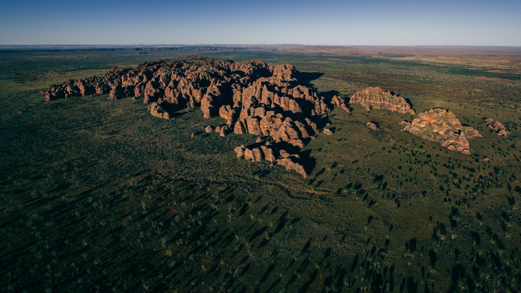
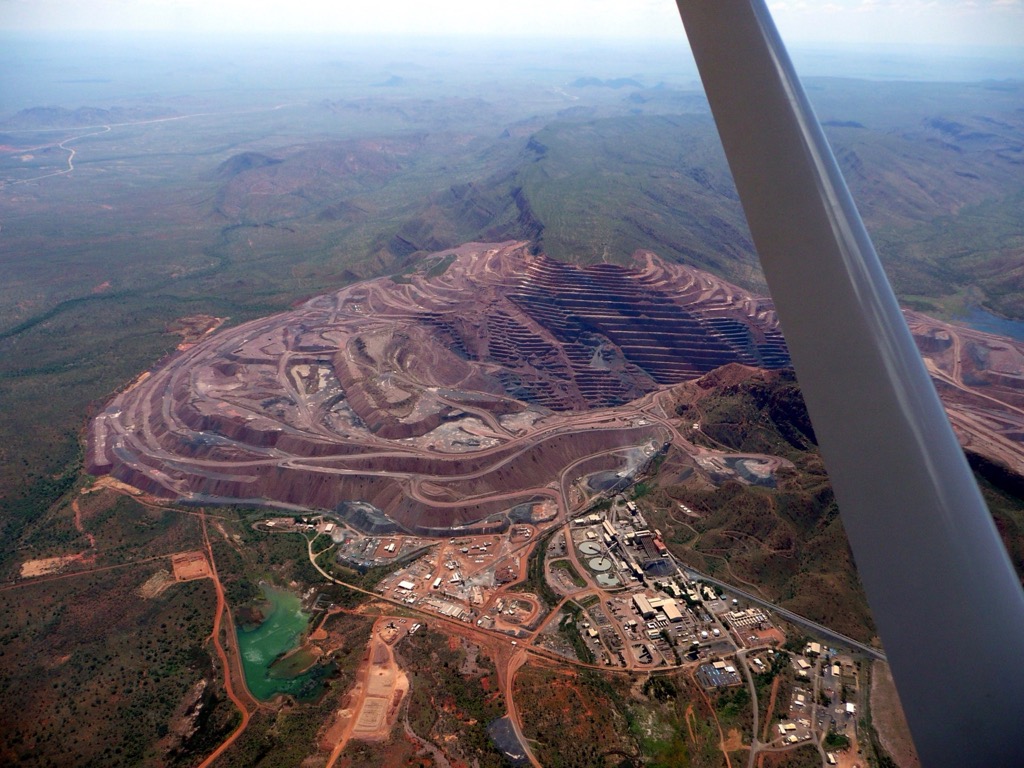
Western Australia features some of the oldest rock formations on Earth and a variety of geological landscapes, as well as massive deposits of a broad spectrum of minerals.
Much of WA’s natural beauty is derived from its spectacular geology.
Generally speaking, WA’s structural geology is the product of ancient tectonic events, such as the formation and fragmentation of the Rodinia and Gondwana supercontinents. These tectonic movements were responsible for mountain-building events like the Alice Springs Orogeny and the Paterson Orogeny.
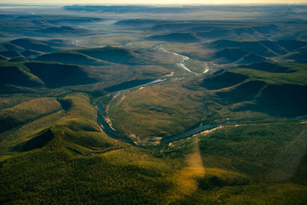
The uplift during these orogenies worked upon several sedimentary sequences that developed between 2.5 billion and 500 million years ago. Inland seas, vegetation, and winds gradually contributed to the deposition of sediments, which were slowly compacted into sedimentary rock layers. These sequences are the reason why WA has so much sandstone.
More recently, water has worked its magic on WA and produced the canyon features for which the state is famous. As a result, unique geological features are scattered throughout the state. Apart from the canyons, the Nullarbor Plain is home to extensive karst systems with limestone caves. Karst systems result from millions of years of rock dissolution—usually limestone or dolomite—caused by the movement of water.
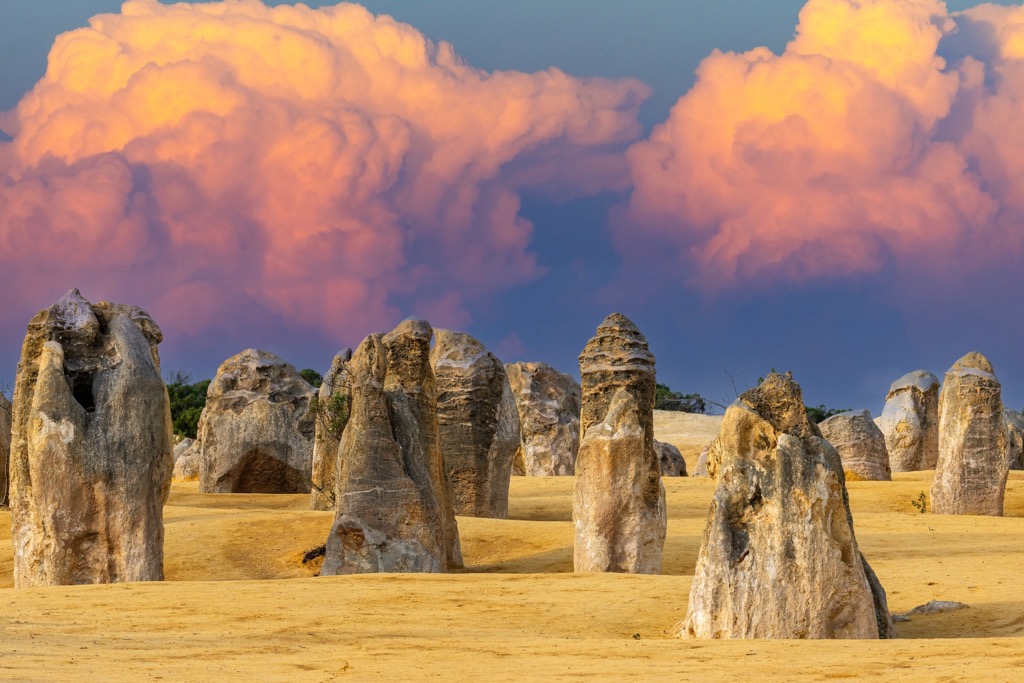
The state comprises several geological provinces, most notably the Pilbara and Yilgarn Cratons. Cratons are the oldest, most stable parts of the Earth's crust, forming the cores of continents. Cratons feature ancient, crystalline basement rocks that have remained relatively undisturbed by plate tectonics.
The Pilbara Craton, located in the northwest, is composed of rocks dating back over 3.5 billion years. The Yilgarn Craton, covering much of southern WA, features rocks aged between 2.7 and 3.6 billion years, rich in minerals like gold and nickel.
Kimberlite pipes are volcanic structures formed by the deep-seated, explosive eruptions of magma from within the Earth's mantle. In WA, the Kimberley region’s eponymous kimberlite pipes have produced rare pink diamonds.
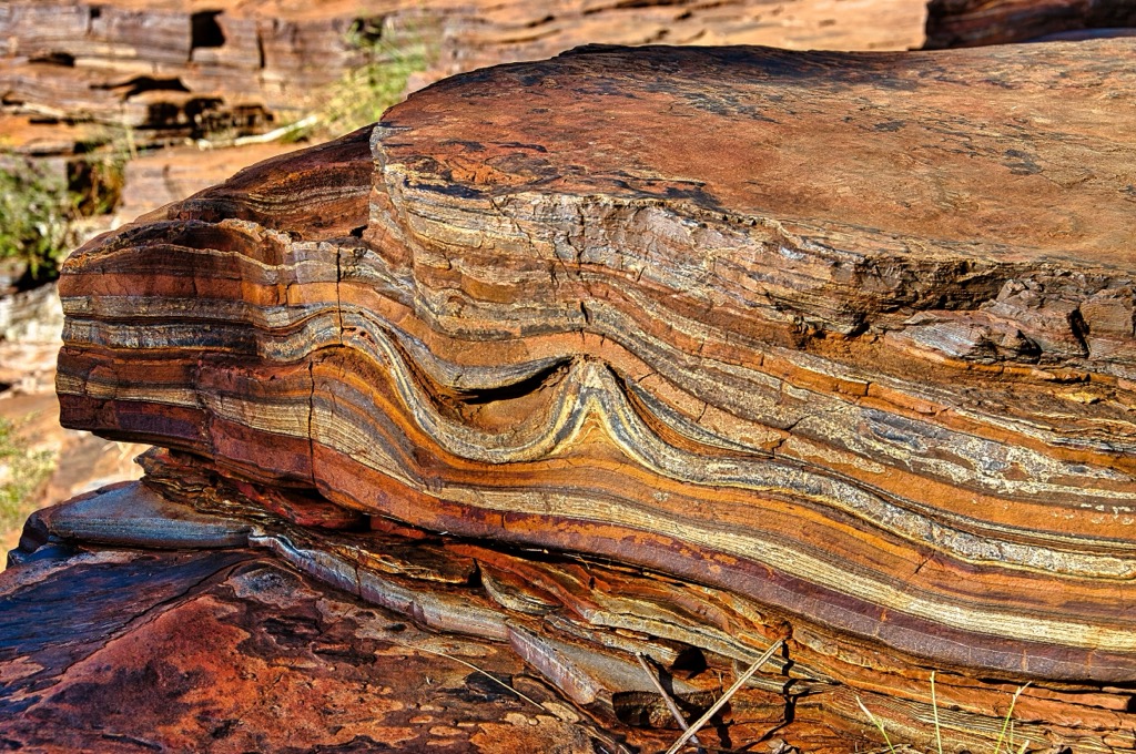
The Proterozoic basins are another essential feature of WA’s geology. The Hamersley Basin is part of the Pilbara, on the central-west coast, and contains the Hamersley Group, which hosts significant banded iron formations. The rocks here exhibit alternating layers of iron-rich minerals and silica, ancient iron-rich sedimentary deposits formed during periods of increased oxygenation in Earth's history and producing some of the world's largest iron ore reserves.
More recently, Western Australia has capitalized on substantial deposits of lithium, copper, cobalt, and rare earth elements due to the explosion of the renewable energy, technology, and battery industries.
The mountains of Western Australia host a range of ecosystems. They are host to many endemic species or those which are found nowhere else on Earth. Western Australia is so harsh that any and all species serve to showcase the adaptability of life. Let’s explore the varying ecology of WA from north to south.
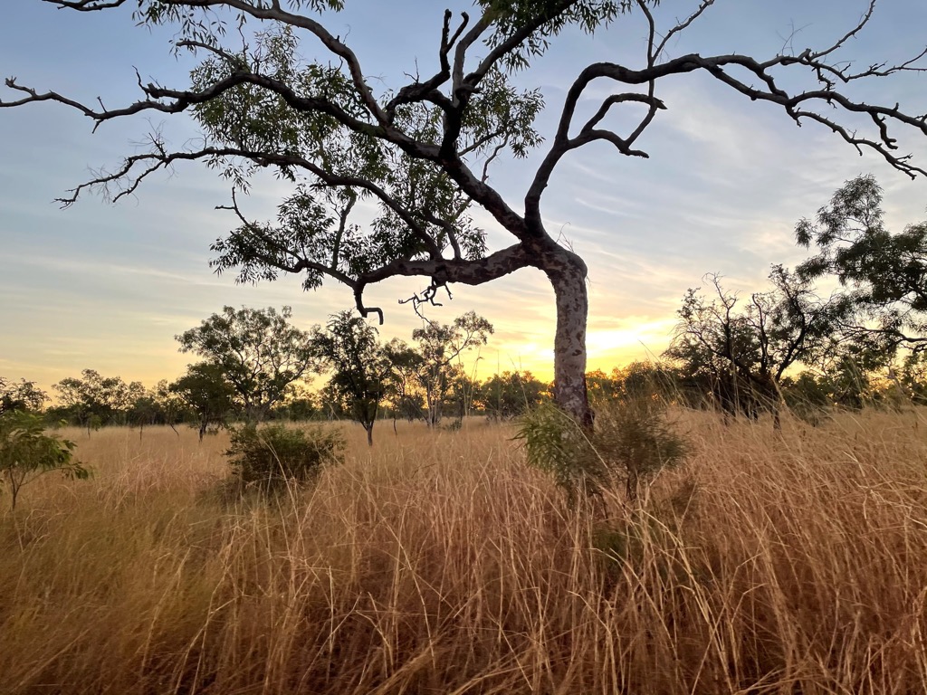
The far northern reaches of WA are subject to a tropical monsoon climate, meaning that they receive heavy rains during the wet season followed by a nearly rainless summer. Despite the dry summers, these are some of the wettest parts of the state, with up to 1.5 m (60 inches) of rain. The result is the tropical savanna ecosystem that characterizes much of northern Australia.
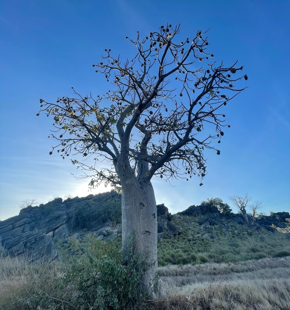
During the wet season, rivers and waterfalls surge, creating temporary wetlands that become critical habitat for migratory birds and crocodiles, among other species. Meanwhile, plants have adapted to withstand prolonged dry seasons, with boab trees and hardy spinifex grass being iconic drought-resistant species. Once upon a time, Aboriginal women would stick spinifex grass in their hair while foraging. After a while, the grassblades’ shadow would reach a certain point, and the women would know it was time to retrace their steps home.
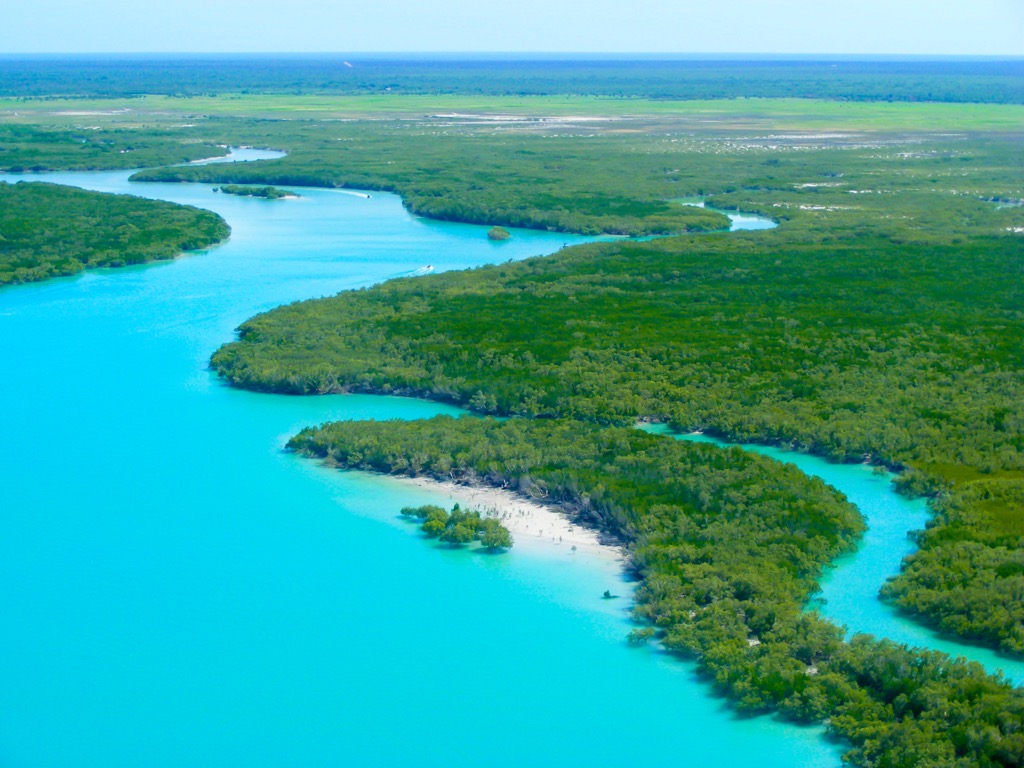
Though they aren’t part of the WA mountainscape, mangrove forests deserve an honorable mention. In WA, the most ecologically critical areas are along the coast, where some of the world’s most pristine mangrove forests grow in the brackish water along river mouths. Mangroves are a group of salt-tolerant trees that act as natural buffers along coastlines. Importantly, they also sequester carbon much more efficiently than most terrestrial forests.
Moving south to the Pilbara and the Hamersley Ranges, the ecology is adapted to a much harsher climate. The landscape is dominated by iron-rich red soils that possess few nutrients. The climate is also far more arid here than in the Kimberley region to the north.
The effect is a landscape of sparse vegetation. One exception to the norm is during rare rainfalls when ephemeral wildflowers bloom, creating a brief burst of life. Another exception is the riparian habitats within the region’s many canyons and gorges, like those of Karijini National Park, where lush vegetation can subsist year-round from rivers and a relatively high water table.
The fauna of the Hamersley Range includes animals well-suited to arid environments. Notably, the range is home to an array of reptiles, like geckos, skinks, and thorny devils, which have adapted to survive with minimal water. Meanwhile, the Wedge-tailed eagle soars above the rocky outcrops, taking advantage of strong thermal currents.
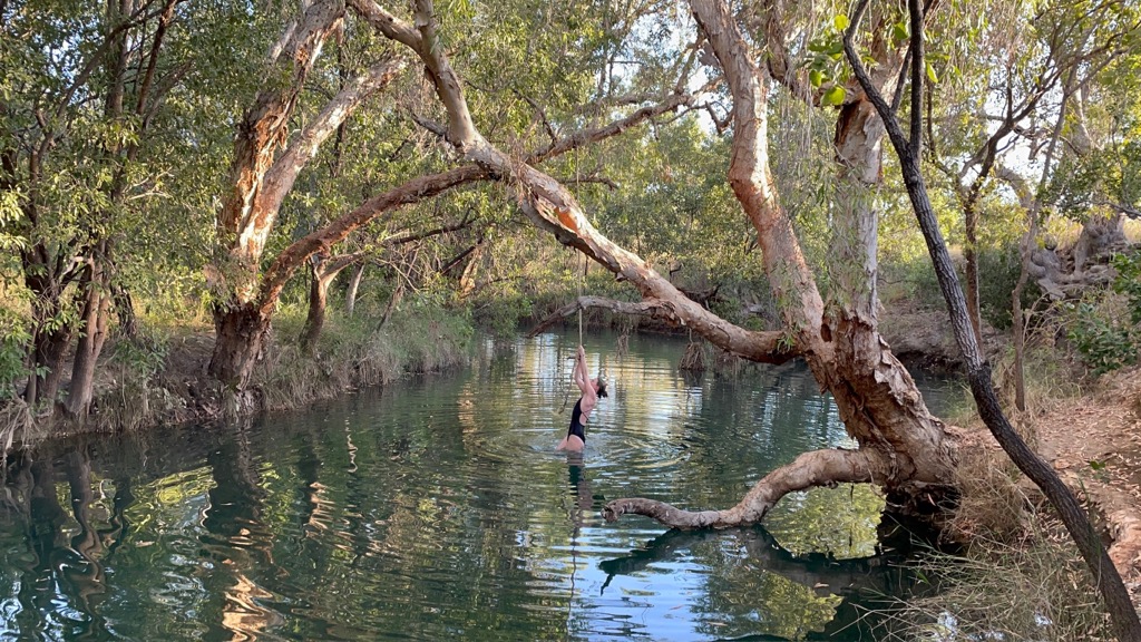
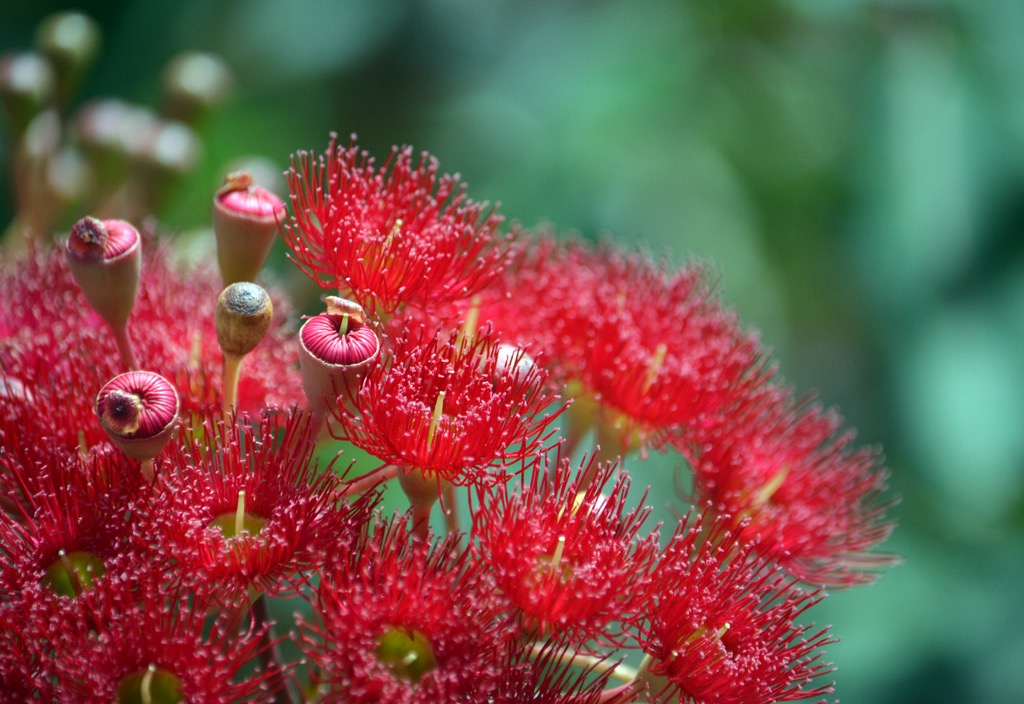
In southeastern WA, the Darling Scarp is characterized by eucalypt forests and pockets of heathland, thriving in what is generally a Mediterranean climate. This range is home to forests dominated by Jarrah (Eucalyptus marginata) and Marri (Corymbia calophylla) trees, two of the six “forest giants” found in Australia. A third, the Karri (Eucalyptus diversicolor), is found only in the high rainfall zone to the south of these mountains. The Karri can reach heights of 90 m (300 ft), making it one of the world’s tallest trees.
The range supports fauna like kangaroos and bandicoots. Bird species include the Red-capped Parrot and the Splendid Fairy-wren. The Canning and Helena Rivers are home to species such as the Gilgie, a type of freshwater crayfish.
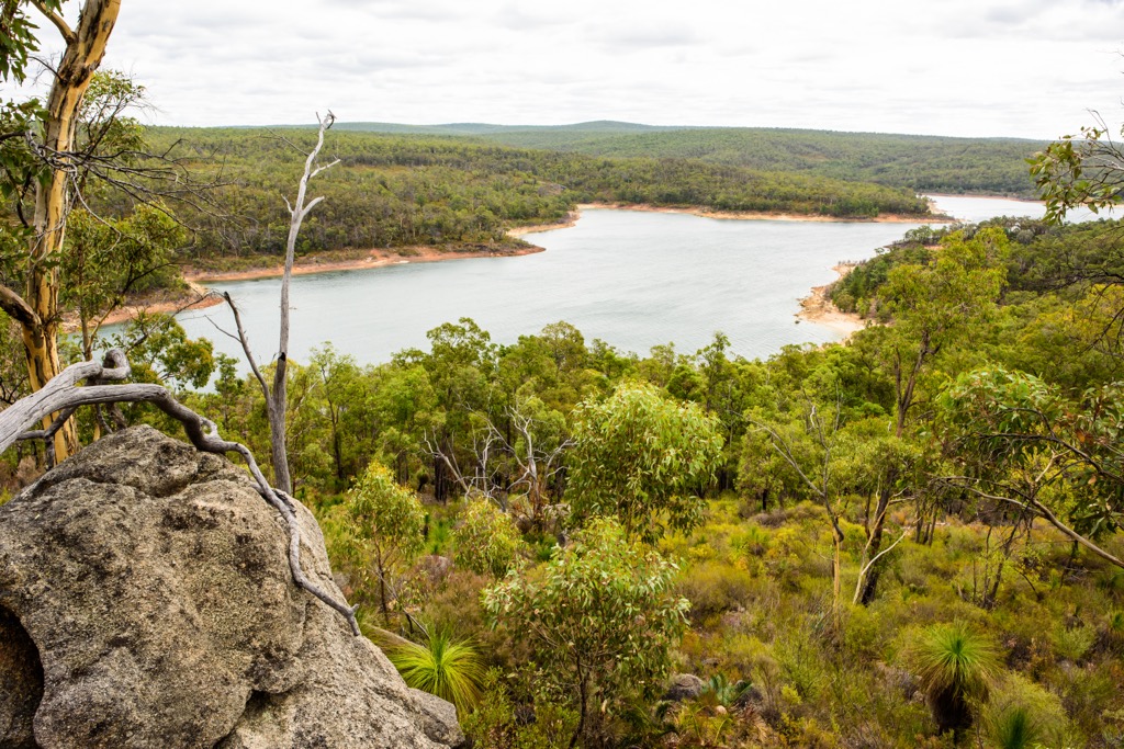
The Stirling Range is located along the southwestern elbow of Western Australia, not far from the coast. The range receives relatively consistent rainfall compared to the rest of the state and is much cooler due to its coastal proximity and more southerly latitude.
The Mediterranean climate contributes to the range’s status as a biodiversity hotspot, at least by the standards of WA. Over 1,500 plant species can be found amongst the heathland, from the many species of wildflowers and orchids to the Stirling Range Banksia.
Fauna includes the Western Brush Wallaby and the increasingly vulnerable quokka, a small marsupial whose range is limited to the southwestern tip of WA. Birdlife is abundant and includes species such as the Western Spinebill and the Carnaby’s Black-Cockatoo.
South Australia’s human history is a tale stretching through 65,000 years of Aboriginal heritage, followed by the resource extraction and colonial ambition of Western newcomers. Australia is still reconciling its role as the perpetrator of one of the most devastating colonization episodes in history, similar to North America.
Long before Europeans showed up with their thirst for riches, WA was home to a rich tapestry of Aboriginal cultures. For example, the Noongar people inhabit the southwest, while the Yamatji, Martu, Wongutha, and Nyungar groups have historically lived in the central and northern regions.
Aboriginal people arrived in Australia approximately 65,000 years ago; their closest lineage is ancient Asian peoples. Subsequently, their gene pool diverges. For tens of thousands of years, Aboriginal communities lived in relative harmony with the land, managing its resources through sophisticated practices like controlled burning—the original bushfire management.
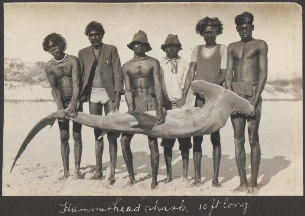
Like the existence of other indigenous societies, theirs was subsistence-oriented. In much of their homelands, resources were relatively abundant, and people often worked only a few hours a day. This left plenty of time for the development of languages (over 500 distinct forms), spirituality, and complex community and familial hierarchies, structures, and laws.
One of the developments of Aboriginal societies was the oral tradition of Dreamtime stories, which are foundational narratives for the origins of people, animals, the land, and the Earth, among other things. The stories served as more than just religious myths; they had relevance in law and governance, as well as spirituality. Dreamtime stories vary across cultures and language groups; some of this diversity has been lost in tandem with the diminishing connection of language.
WA is a relatively harsh environment, especially moving away from the coast. Aboriginals were well adapted to survive in the desert, though they subsisted in lower numbers than the coastal regions. Today, most aboriginals live in the Kimberley region, which makes up the northern tip of WA.
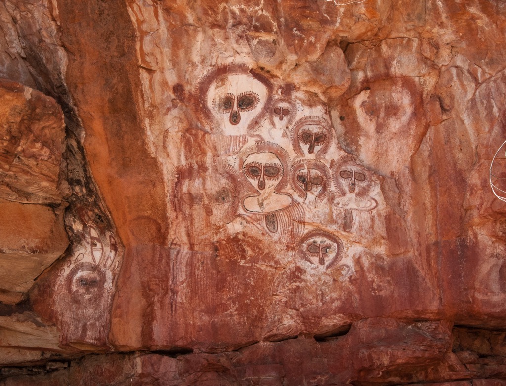
Jandamarra is an Aboriginal Bunuba outlaw who has come to symbolize Indigenous resistance against European colonization. Born in the late 19th century in the Kimberley region of Western Australia, Jandamarra grew up as a traditional Bunuba, then as a servant to white stockmen who had begun to establish ranches in the Kimberley.
The whites would often force Aboriginals to work for them, especially if they were caught trespassing or stealing cattle. Seeing as they were dispossessed from their lands and hunting grounds, many Aborignals resorted to taking the white men’s cattle. Jandamarra was ultimately recruited as a tracker for the police force, usually to track down his fellow Aboriginals when cattle went missing.
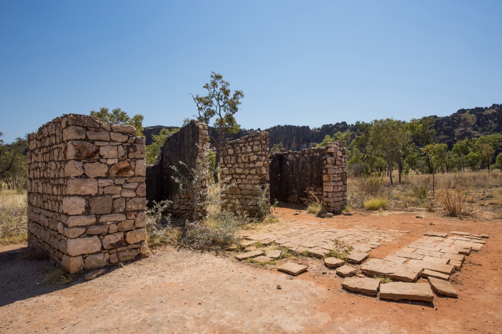
The turning point came when he was ordered to help capture a group of Bunuba people, including his uncle and other Bunuba family. Jandamarra was working with Bill Richardson, one of the police officers on the frontier around modern-day Derby, WA. The pair would track down Aborginals accused of stealing and became one of Australia's most formidable “law-enforcement” teams. Jandamarra was said to have formed a genuinely strong friendship with Richardson. However, after initially complying and bringing the Bunuba group into custody, he turned on Richardson, murdering him in his sleep and releasing his Aboriginal family.
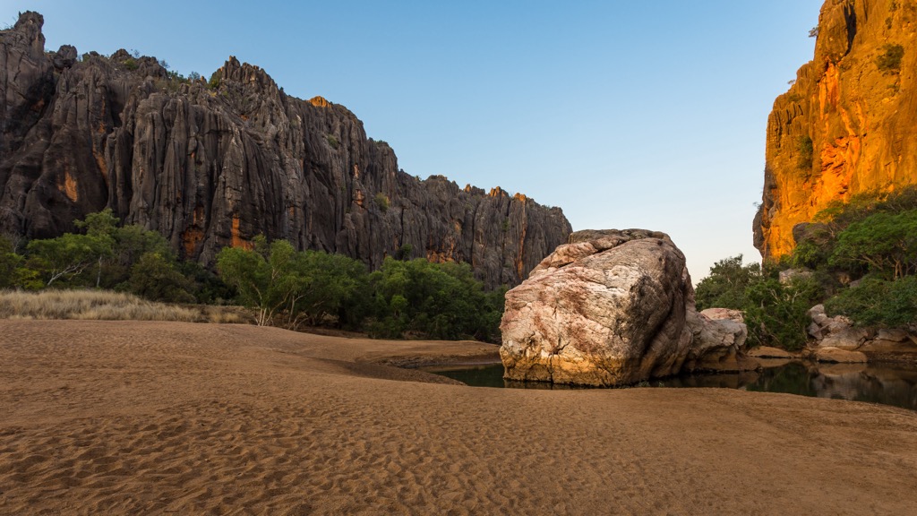
For the three years following his defection, Jandamarra successfully evaded capture and wreaked havoc on local police. He quickly became a living legend, said to appear and disappear without a trace. Jandamarra and other fights would hide out around Tunnel Creek and Windjana Gorge, but no white man could track him down; many were led into traps.
Eventually, Jandamarra was tracked and killed by a fellow Aboriginal tracker employed by the whites, as he himself had been just a few years earlier. Since then, his story has come to symbolize the greater battle that Aboriginals have waged for their culture and way of life in a modern world.
Colonization in Western Australia began when the British established an outpost at modern-day Albany to prevent French claims (Cape Le Grand National Park—and Frenchmans’ Peak within the park—are examples of the original French influence).
In typical fashion, the colonists gradually drove the Aboriginals from their lands and set up farms and ranches. There were a few gold rushes here and there, but the economy of WA didn’t explode until the 1960s, which ushered in the start of one of the largest resource extraction booms in history.
Mining has poured rocket fuel on the state’s economy but has also caused a cost-of-living crisis, particularly with housing along the coasts (and if you’ve been to WA, you’ll understand that you don’t want to live too far from the coast).
WA has also invested heavily in conservation, with over 100 national parks in the state. The initiatives have been recent, too; twenty-eight of these parks were created in 2004 alone.
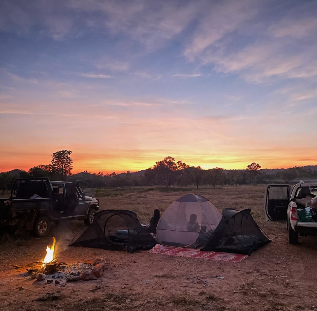
WA is a vast state with hundreds of parks and very few people. There are thousands of hiking trails, from the 1,000 km (600 miles) Bibbulmun Track to the Valley of the Giants Tree Top Walk in Walpole-Nornalup National Park. Here are a few of the most famous hikes to keep on your radar.
At PeakVisor, we love information. That’s why we write articles like this one.
For even more information on thousands of additional hikes across WA, check out the PeakVisor App. In fact, we’ve compiled information on all publicly maintained walking tracks across the country, formatted onto our 3D maps.
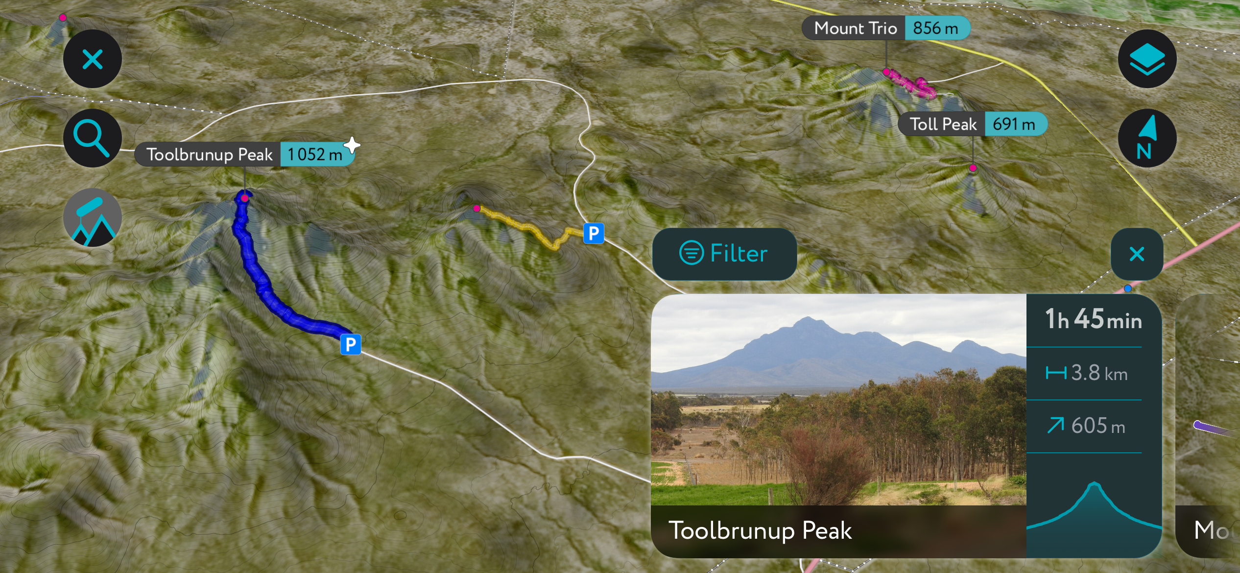
You can track your hikes directly on the app, upload pictures for other users, and keep a diary of all your outdoor adventures.
Most recently, the PeakVisor App has included up-to-date weather reports at any destination. Plus, we've been hard at work adding the details of hundreds of mountain huts and camping options.
You can also use our Hiking Map on your desktop to create .GPX files for routes to follow later on the app.
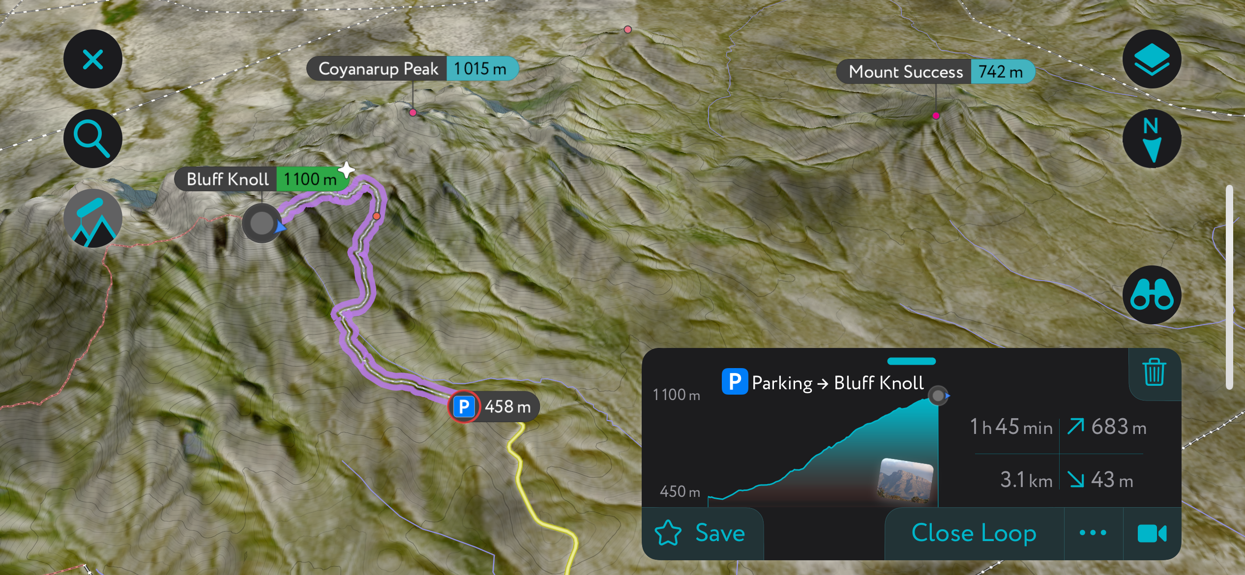
Bluff Knoll (1,100 m / 3,609 ft) is the most prominent peak in Western Australia. The Stirling Ranges are a must-visit locale in WA, and Bluff Knoll is the go-to summit for ambitious visitors. In fact, Bluff Knoll is one of the few places in WA that occasionally receives snow!
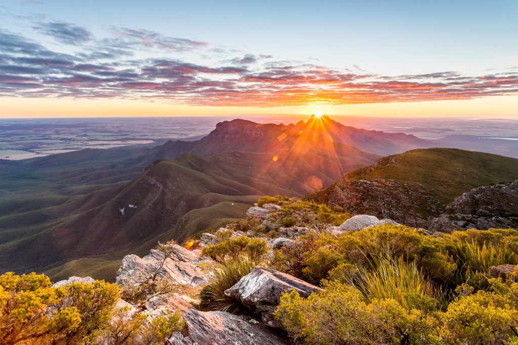
The summit is accessible via a challenging but rewarding 6-kilometer (3.8 mile) round-trip hike. The trail traverses through the idyllic Mediterranean heathland of the Stirling Ranges, culminating in breathtaking 360-degree views of the mountains and patchwork of surrounding farmland.
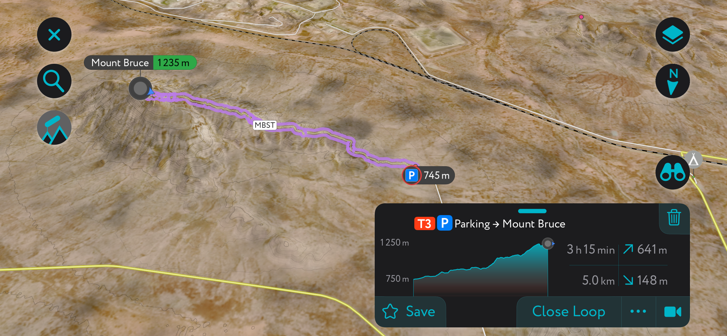
Mount Bruce (1,235 m / 4,052 ft) is the second-highest peak in Western Australia. It’s located in the Hamersley Range within Karijini National Park, another of WA’s must-visit locales for mountain lovers.
The approximately 10-kilometer (6-mile) round-trip hike takes trekkers through the rugged desert of the remote Pilbara region. The temperatures soar to near-boiling in the summer; this hike is best undertaken in the winter, which is also the dry season. Mount Bruce is relatively isolated, and the summit offers excellent, unobstructed views.
Kitty’s Gorge is one of the best trails near the Perth metro area. It’s perched up in the Darling Scarp just east of the city.
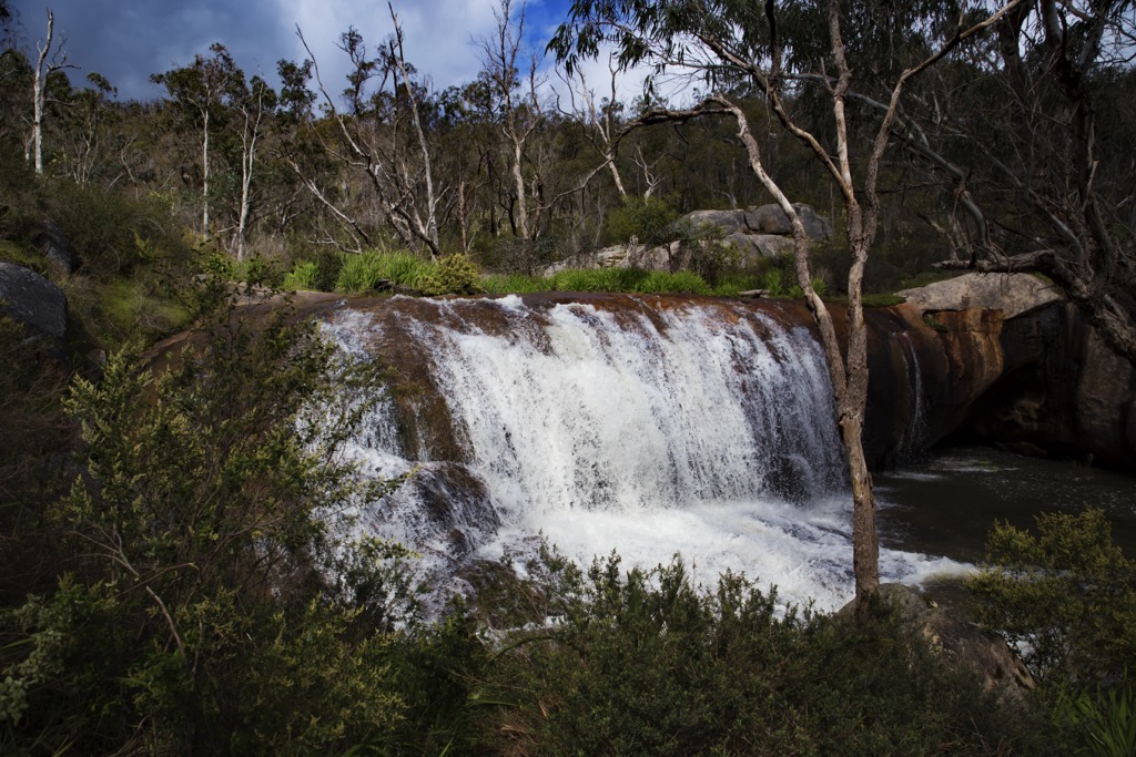
The trail traverses through Serpentine National Park, named after the Serpentine River—one of the main attractions of this hike is Serpentine Falls. The hike offers a substantial elevation gain of over 400 meters (1,300 ft) and, at nearly 16 km (10 miles) out and back, is considered moderately challenging. You’ll see plenty of ‘roos and wallabies (and hopefully not too many other people). The waterfalls usually only flow in the cooler, wetter months of April to October, and that’s also when the temperatures will be most comfortable for hiking.
There’s a fee if you enter for just Serpentine Falls, but parking and hiking from the Jarrahdale lot is free.
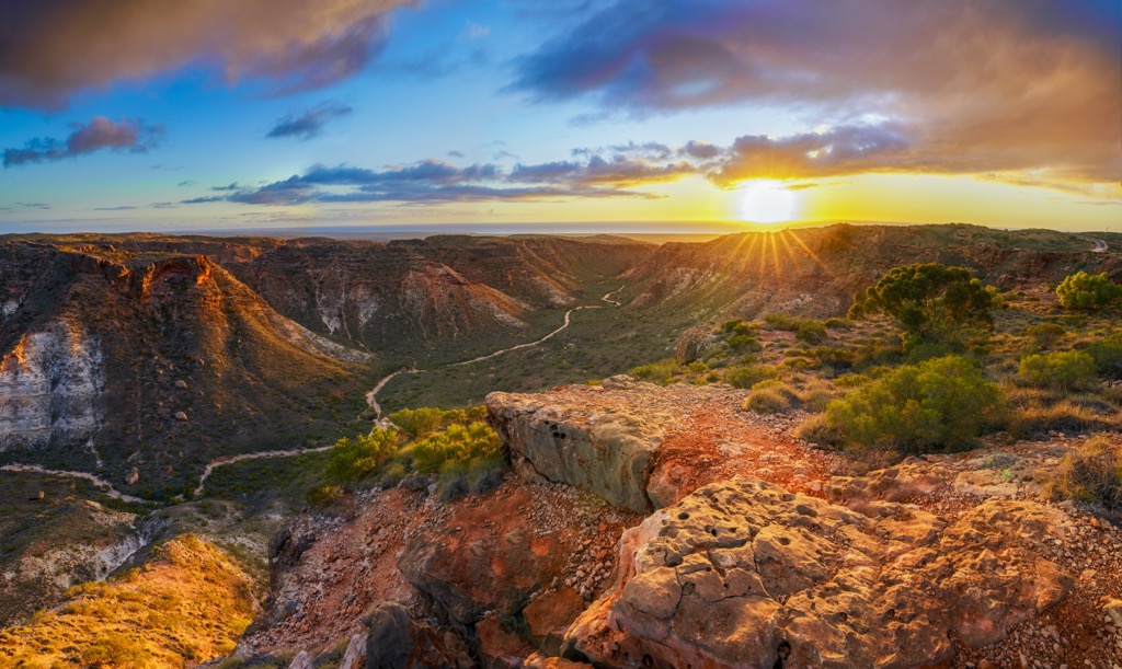
Cape Range National Park (not to be confused with the equally fantastic Cape Le Grand NP) is a fabulous destination along the northwestern coast near the town of Exmouth on the North West Cape Peninsula. There are a number of smaller hikes you can do here, like the Yardie Creek Gorge and the Mandu Mandu Gorge, and longer hikes like Shothole Canyon.
There’s also plenty of kayaking within these gorges and on the coast. One of the factors making this a great choice is the weather; the Pacific heavily moderates the climate, which is far less extreme than in the Pilbara. In the winter, Exmouth is a gateway to the greater Pilbara Region, one of the splendors of Australia.
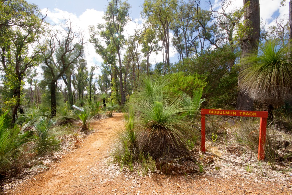
Looking to through-hike Western Australia? Look no further than the Bibbulmun Track, a 1000-km (600-mile) trail from the suburbs of Perth to the town of Albany on the southern coast. The trail is named after the Aboriginal Bibbulmun people. The entire hike takes a couple of months, but it’s divided into numerous smaller sections that can be tackled as day hikes or shorter through-hikes.
The route passes along jarrah and karri forests, coastal heathlands, river valleys, and lovely towns like Denmark (see “Best Towns and Cities” for more details).
The best time to hike is during the cooler months of spring (September to November) and autumn (March to May), when the weather is milder and the wildflowers are in bloom.
Perth is the capital and only real city of Western Australia. It’s one of the world’s most remote cities, thousands of kilometers from the nearest large city. Culturally, Perth is known for its surfing and coastal lifestyle, though it’s also become a resource-extraction capital in recent years. For this reason, Perth is getting quite expensive. In fact, all of coastal WA is in a housing crisis; the economy’s development has outpaced the state’s ability to build new homes. It’s an issue, and I’m sure the locals will tell you about it.
Geographically, Perth straddles the banks of the Swan River and faces the Indian Ocean, offering a metropolitan core with easy access to beaches, parks, and bushland. Kings Park and Botanic Garden is one of the largest inner-city parks in the world. Perth’s climate is warm and Mediterranean, characterized by hot, dry summers and mild, relatively wet winters.
It’s also just a few kilometers from the Darling Scarp, a series of forested hills just outside city limits. Helena National Park and several nearby state forests protect these mountains. You can hike, bike, or watch for wildlife with the family.
Passing these hills and descending inland, the climate completely changes. It’s much drier and hotter, and the terrain becomes an endless expanse of flat farmland. It makes you appreciate Perth and its coastal influence.

Broome (pop. 14,500) is a small coastal town in the Kimberley region toward the northern tip of WA. It’s the largest town in Kimberley, which is impressive when you understand just how big Kimberley is. The town is both a gateway to the Kimberley region's numerous adventures and a worthy destination in its own right.
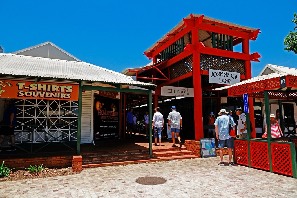
Broome is famous for Cable Beach, a 22-kilometer stretch of pristine white sands and turquoise waters celebrated for its breathtaking, west-facing sunsets. The town's history is that of the pearling industry in the late 19th and early 20th centuries. Pearling brought a multicultural influence, thus, the historic Chinatown district.
As far as the Kimberley region goes, Broome offers opportunities to explore nearby attractions like the dramatic red cliffs of Gantheaume Point or the town of Derby, near where Jandamarra took his revenge for whites’ crimes against the Aboriginals.
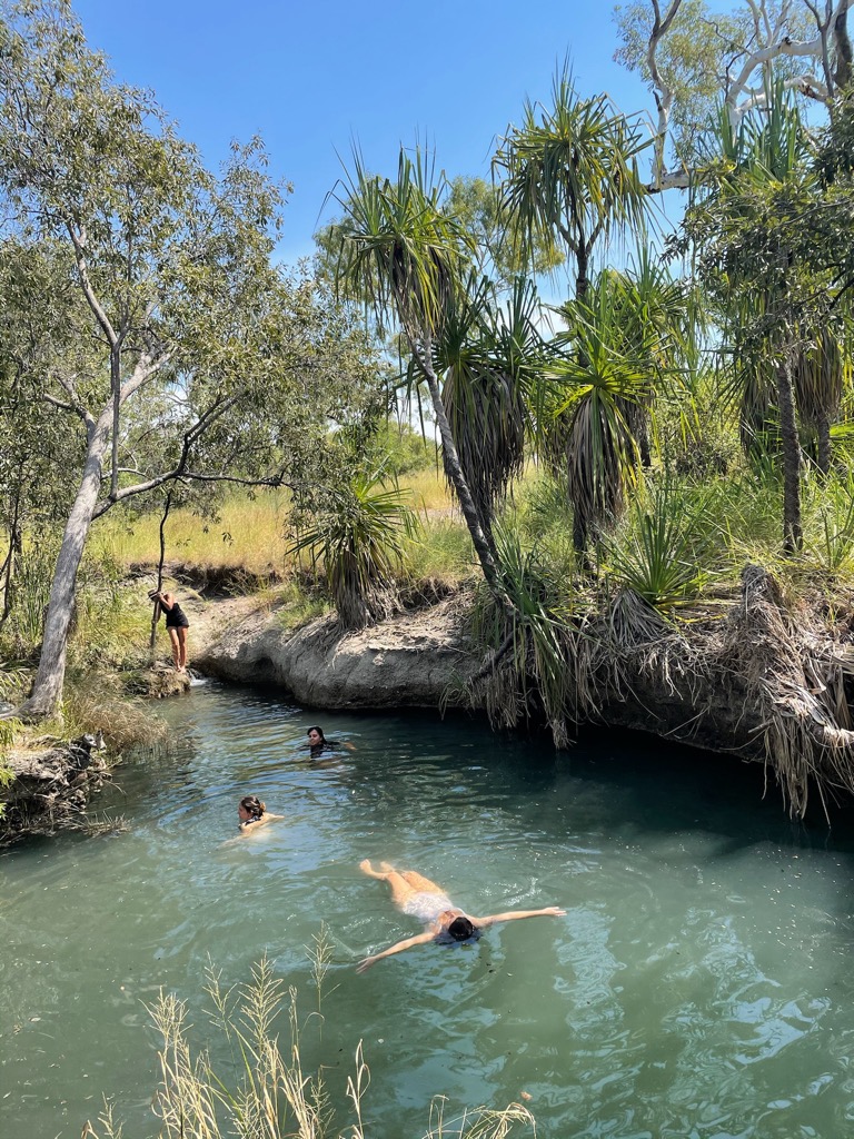
Exmouth is on the northwest coast of WA, several hours south along the coast from Broome. Exmouth is a decent gateway to the sights of the Pilbara region, like the Hamersley Ranges. It’s famously adjacent to the Ningaloo Reef, a UNESCO World Heritage-listed reef that is one of the world’s longest fringing reefs.
Exmouth itself is a laid-back coastal town that offers visitors activities ranging from snorkeling and scuba diving to exploring the nearby Cape Range National Park. The park features rugged limestone gorges, canyons, west-facing sunsets, and wildlife like rock wallabies and emus.
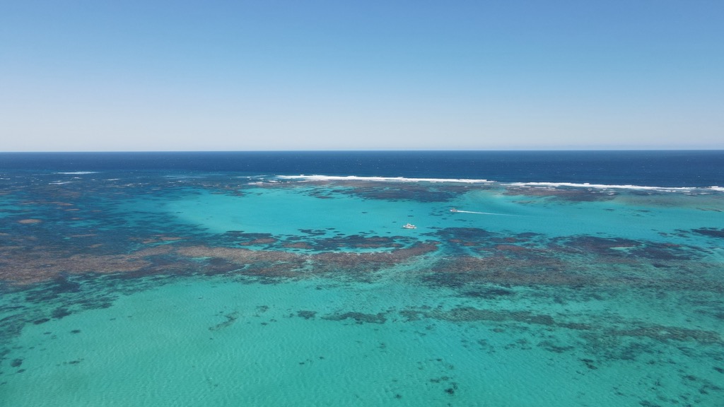
Denmark is in the Great Southern region, along the southwestern tip of WA. It’s a charming town nestled between towering karri forests, rolling hills, and a rugged coastline. The town is the best gateway to the Stirling Range, which is just to the north.
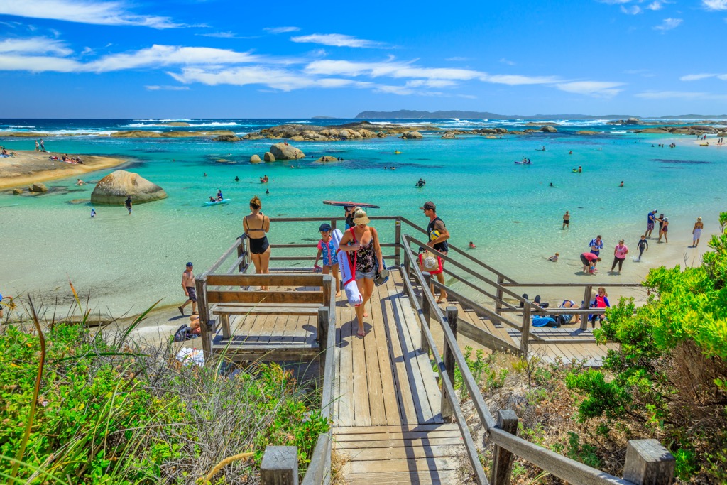
Natural attractions in Denmark include Green’s Pool and Elephant Rocks, where protected, turquoise waters offer swimming amongst massive granite boulders. Meanwhile, the Tree Top Walk is an elevated walkway that allows visitors to explore the canopy of ancient karri and tingle trees—it’s like scaffolding in the tree tops. Denmark’s cool Mediterranean climate is also perfect for wine production, and the town boasts a range of boutique wineries.
Explore Western Australia with the PeakVisor 3D Map and identify its summits.


