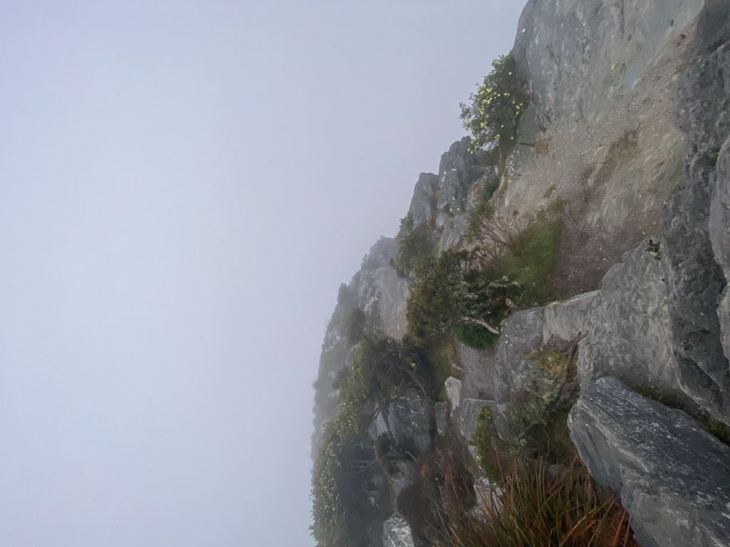
Bluff Knoll is the highest peak of the Stirling Range in the Great Southern region of Western Australia (WA). It is 1,099 metres (3,606 ft) above sea level, with a prominence of 650 metres (2,130 ft). The local Aboriginal people, the Mineng and Koreng/Goreng sub-groups of the Noongar Nation, call the mountain Boola Miyel or Pualaar Miial, meaning 'great many-faced hill' or 'many eyes', as the peak has rock formations that resemble eyes looking out across the valley.
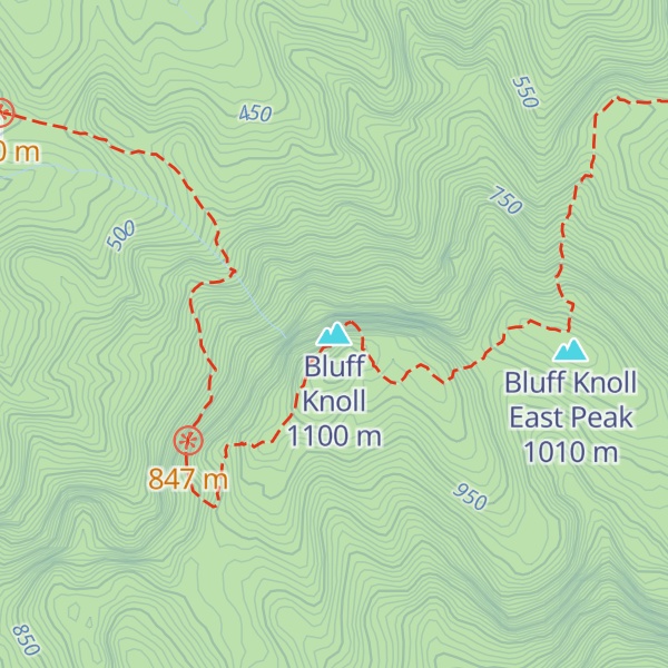
The Bluff Knoll trail is a round trip of about 6 kilometres (4 mi) taking three to four hours, and has a grade 4 rating of climbing difficulty, with some steep and rough steps. In 2020 many parts of the trail were destroyed in the Black Summer bushfires, and has since been upgraded and improved. The view from the summit encompasses the Stirling and Porongurup mountain ranges, as well as the coast near Albany.
Due to its elevation, Bluff Knoll and the surrounding peaks of the Stirling Ranges are some of only a few places to experience regular snowfalls in Western Australia. When snow is forecast by the Bureau of Meteorology it attracts hikers from all over the southwest region to experience it.
The peak was given its name by Governor James Stirling as the highest point in the Stirling Range. Although Bluff Knoll is sometimes claimed to be the highest point in Western Australia, the highest peak is actually Mount Meharry in Karijini National Park in the Hamersley Range, which is 1,249 metres (4,098 ft) above sea level.
There's a trail leading to the summit.
By elevation Bluff Knoll is
# 21 out of 3619 in Western Australia # 1 out of 43 in Stirling Range National Park
By prominence Bluff Knoll is
# 1 out of 3619 in Western Australia # 1 out of 43 in Stirling Range National Park # 30 out of 21731 in Australia
We use GPS information embedded into the photo when it is available.
3D mountains overlay
Adjust mountain panorama to perfectly match your photos because recorded by camera photo position might be imprecise.
Move tool
Rotate tool
Zoom
More customization
Choose which peak labels should make into the final photo and what photo title should be.
Next
Photo Location
Satellitte
Flat map
Relief map
Latitude
Longitude
Altitude
OR
Latitude
°'''
Longitude
°'''
Apply
Register Peak
Peak Name
Latitude
Longitude
Altitude
Register
Teleport
PeakVisor
This 3D model of Sagarmatha National Park in Nepal was made using the PeakVisor app topographic data. The mobile app features higher precision models worldwide, more topographic details, and works offline. Download PeakVisor maps today.
Download OBJ model
PeakVisor
The download should start shortly. If you find it useful please consider supporting the PeakVisor app.
PeakVisor for iOS and Android
Be a superhero of outdoor navigation with state-of-the-art 3D maps and mountain identification in the palm of your hand!