
Scan the QR code and open PeakVisor on your phone
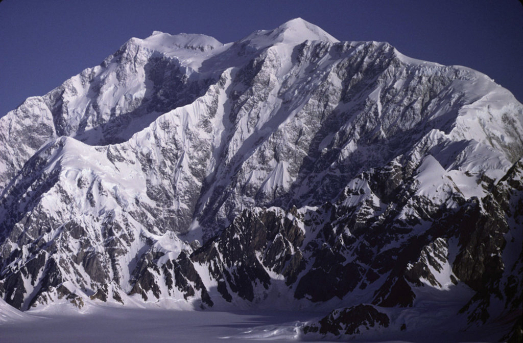
Yukon is home to 1,331 named mountains, including 4 fourteeners. The highest is Mount Logan at 5,959 m.
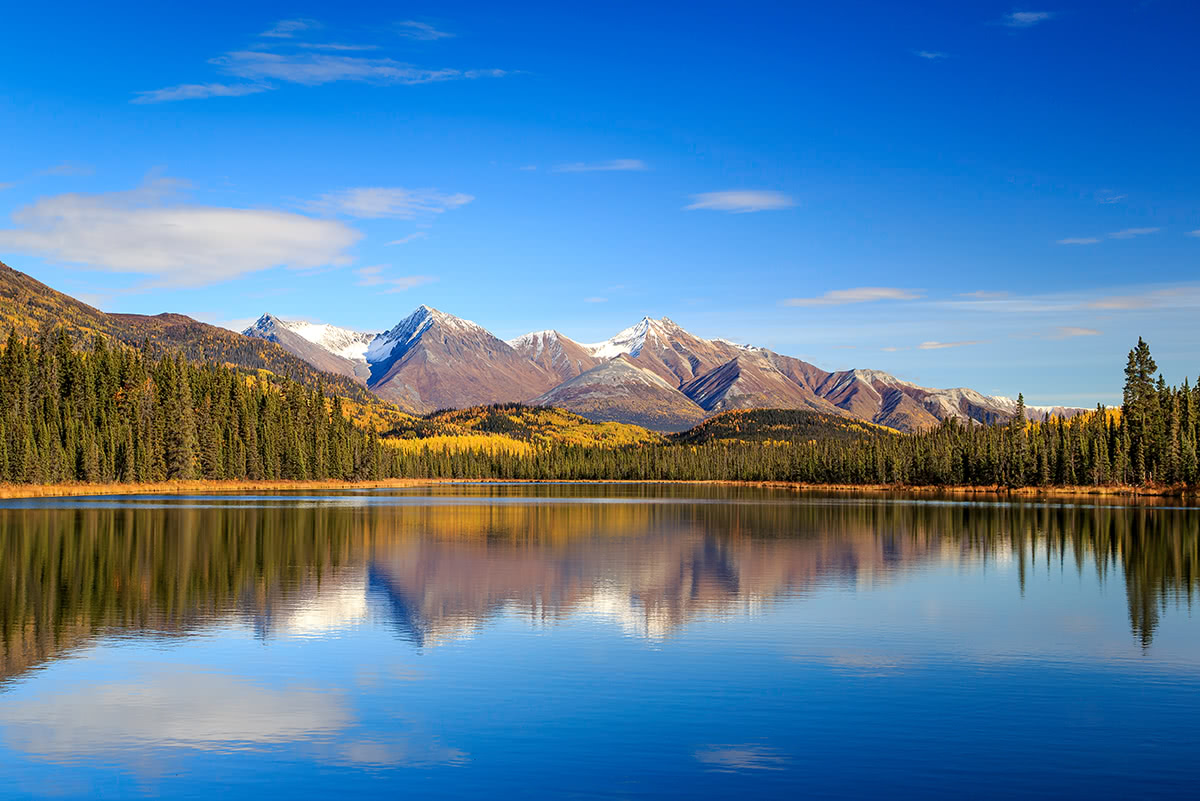
Just 40,000 people live in Canada’s smallest and westernmost federal territory, Yukon. Generally referred to as the Yukon, this territory spans over 183,000 sq. miles and encompasses 1,368 mountains. The Yukon is known as the last frontier of Canada and contains some of the most majestic, snow-capped summits, alpine tundra, and subalpine lakes in the country.
The Yukon is located in the northwest region of Canada and borders Alaska to the west, the Northwest Territories to the east, the Beaufort Sea to the north, and British Columbia to the south. Most of this region has a subarctic climate, so brief warm summers and long, bitterly cold winters are the norm.
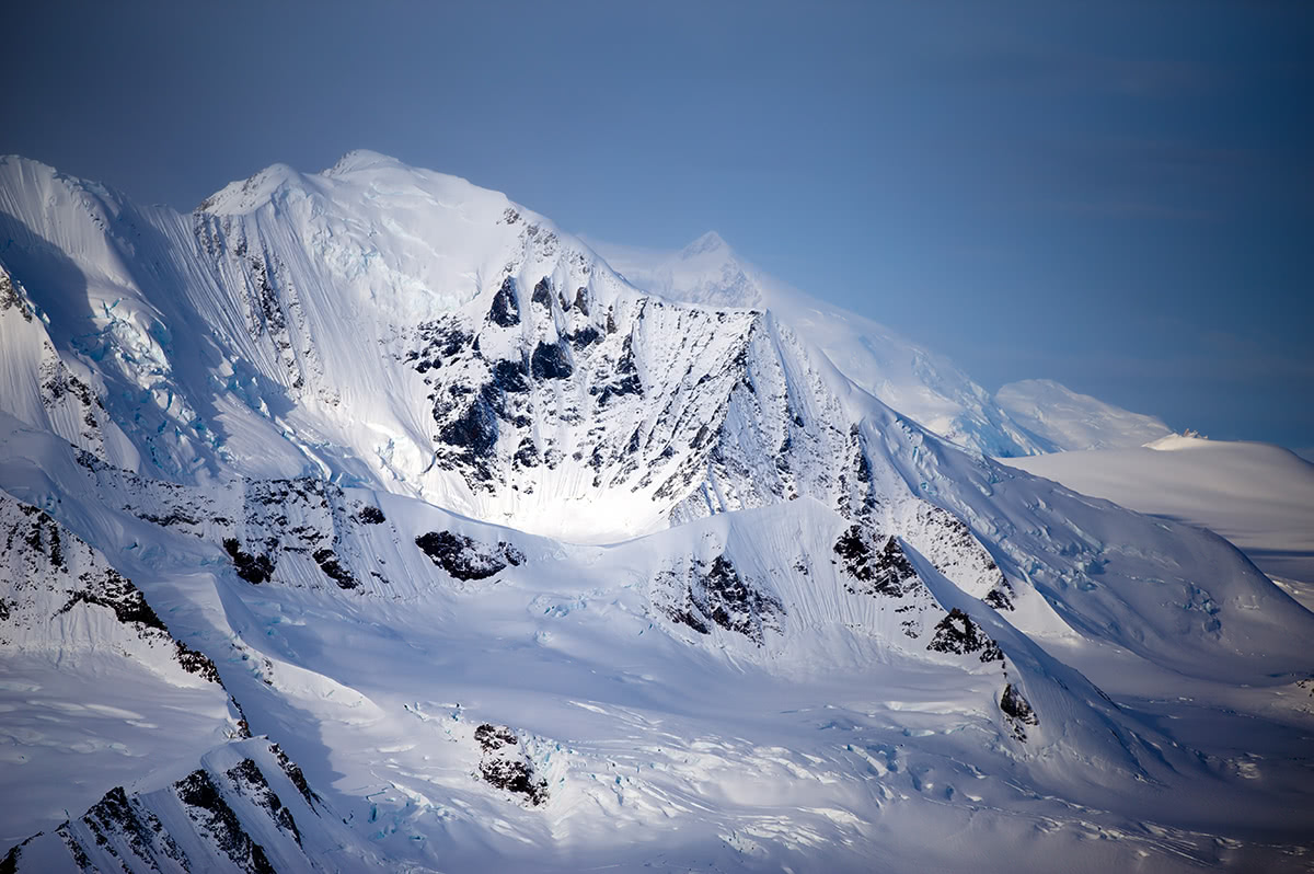
The most recognizable mountain range in the Yukon is the Saint Elias mountains, the highest coastal mountain range on Earth. The St. Elias Mountains are a subrange of the much larger Coast Mountains and stretch from southwestern Yukon to the northwestern edge of British Columbia. The St. Elias Mountains are known for their presence and prominence in three well-known, but somewhat isolated national parks - Wrangell-St. Elias and Glacier Bay in Alaska, and Kluane National Park and Reserve, which is located in the Yukon.
Kluane National Park and Reserve, the most popular area for outdoor recreation in the Yukon, is part of the Kluane/Wrangell-St. Elias/Glacier Bay/Tatshenshini-Alsek UNESCO World Heritage site, which forms the largest area managed by the National Park Service. The Yukon’s tallest peaks and over 13 million acres of pristine wilderness are protected within this international park system.
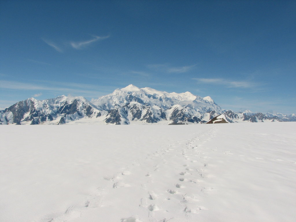
The Yukon is home to some of Canada’s highest mountains, including Mount Logan, the highest peak in Canada and the second highest in North America. Mount Logan is located in Kluane National Park and Reserve and sits within the St. Elias Mountains. Additional prominent peaks in the Yukon include Mount Saint Elias, Mount Lucania, King Peak, Mount Steele, Mount Wood, Mount Slaggard, Mount Macaulay, and Mount Hubbard - all of which exceed 14,000 feet in elevation.
Although volcanoes may seem non-existent in Canada, Western Canada, including the Yukon, also lies along the “Pacific Ring of Fire” and contains several active volcanoes. In fact, there have been over 45 volcanic eruptions in British Columbia and the Yukon Territory during the last 10,000 years.
There are several volcanic fields in or near the Yukon that house both eroded and active volcanoes. These volcanic fields include the Selkirk Volcanic Field, Wrangell Volcanic Belt, and Alligator Lake Volcanic Complex. Major Yukon volcanoes include Volcano Mountain, which is the youngest volcano in this region, Felsite Peak, which sits just outside of Snowshoe Peak and Pinnacle Peak, Ibex Mountain, which is a young cinder cone, and Mount McNeil, a rhyolite lava dome.
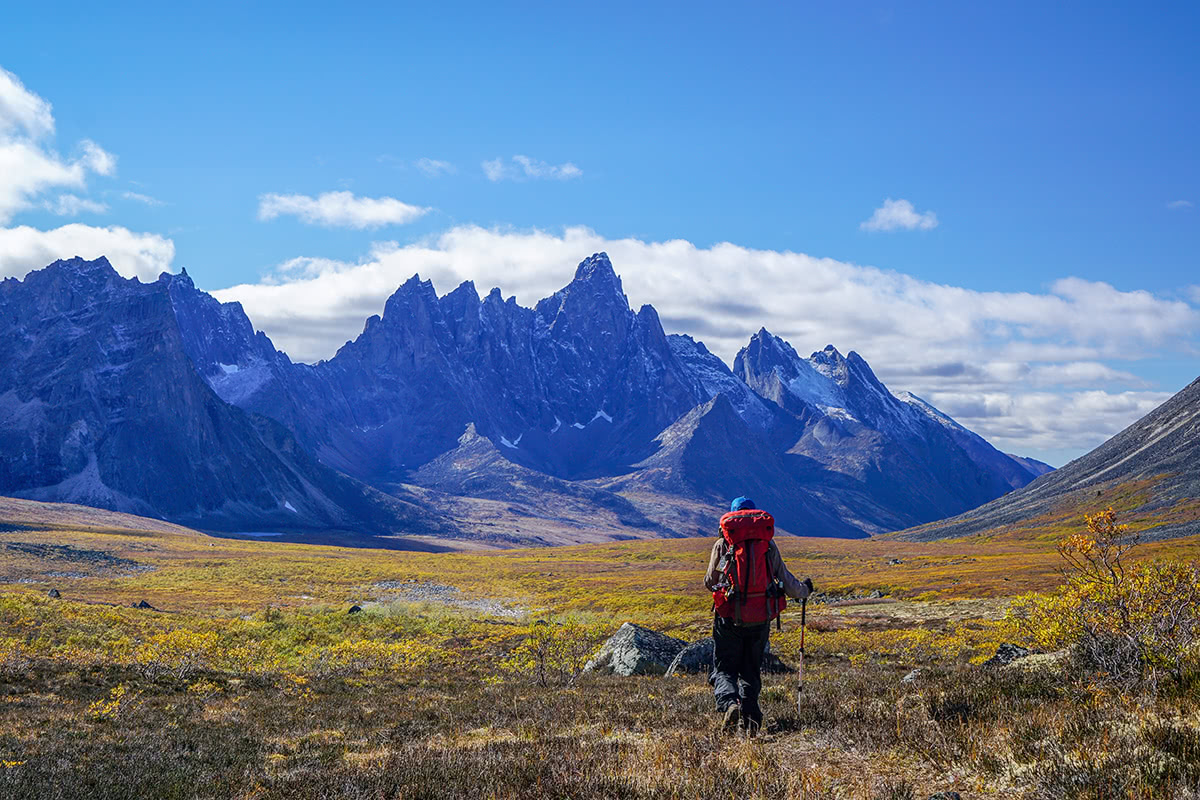
The Yukon is nature’s playground and an ideal destination for outdoor enthusiasts. In addition to plenty of hiking trails, there are trails for biking, snowshoeing, and cross-country skiing, lakes and rivers to canoe, kayak or raft, as well as ample winter recreation potential including snowmobiling and dog sledding.
Located high in the mountains of southwest Yukon, Kluane National Park and Reserve is known to be the land of extremes. Kluane National Park is not only home to Canada’s highest peak, it also contains 17 of Canada’s tallest 20 mountains. Not to mention, Kluane National Park is infamous for protecting the largest non-polar icefields in the world and supporting the most genetically diverse grizzly population.
Visitors will often travel two two-lane highway to take advantage of spectacular roadside views and view wildlife. However, the park offers plenty of hiking trails that venture into the wilderness for visitors looking to explore more of the area. Opportunities range from short strolls to multi-day route-finding adventures, so whether you’re looking to get out for an hour, a day, or a week, there plenty to see and do in Kluane.
Popular trails include short treks like Soldier’s Summit and Rock Glacier, modest trails like King’s Throne, Shorty Creek, and St. Elias Lake, or tougher trails like Cottonwood, the longest trail in the park.
Located in central Yukon, Tombstone Territorial Park protects over 850 square miles of rugged peaks, permafrost landforms, and sections of the Blackstone Uplands and the Ogilvie Mountains. The park’s name may sound intimidating, but the Yukon Tombstone Mountains have often been nicknamed the “Patagonia of the North” for their rocky black-granite peaks and talus fields. This area is known to be geologically unique and ecologically diverse, housing an array of wildlife and vegetation. Several epic hiking trails, like the Grizzly Lake Trail, Goldensides, Surfbird Mountain, Pilot’s Peak, Grizzly Ridge, and AngelCome Peak will take visitors of varying abilities through the heart of the Tombstone Mountains to experience the vast, diverse landscape of the Yukon.
Located near Whitehorse, Miles Canyon was once the formidable site where gold seekers tried and failed to cross the Yukon River and canyon. Today, visitors are treated to a much calmer river and incredible views of the canyon below. A suspension bridge was built in 1922 to connect the narrowest and most dramatic portion of the canyon. So, if you’re not afraid of heights, you can know what it feels to walk between two 50-foot canyon walls. Two roads make reaching Miles Canyon an easy endeavor. The Miles Canyon Road, on the south side, is paved and will take you to a parking area right at the canyon’s edge. The Chadburn Lake Road, on the north side, is gravel but will take you to a series of trails that lead to the canyon. Aside from the canyon trail, there is an extensive network of trails in the Miles Canyon area that can be used year-round. This area is also nearby downtown Whitehorse, so after you’ve spent the day exploring you can head into town for a bite to eat.
For skiing and snowboarding enthusiasts, there are two ski resorts in Yukon, which are located in the south of the region.
The largest ski resort in Yukon is Mount Sima with more than 10 km (6 mi) of slopes and more than 3 ski lifts. Another area for skiing in Yukon with more than 10 km (6 mi) of slopes and more than 2 ski lifts is Mount Maichen. These are also the main ski resorts near Whitehorse, the capital and the largest city in Yukon.
Check the Yukon ski resorts map on the larger Canada ski resorts map in the World Mountain Lifts section of the site. It includes information about open ski lifts / slopes in Yukon in real-time with opening dates and hours. There are also year-round cable cars, funiculars, cog railways, aerial tramways, and all other types of mountain lifts.
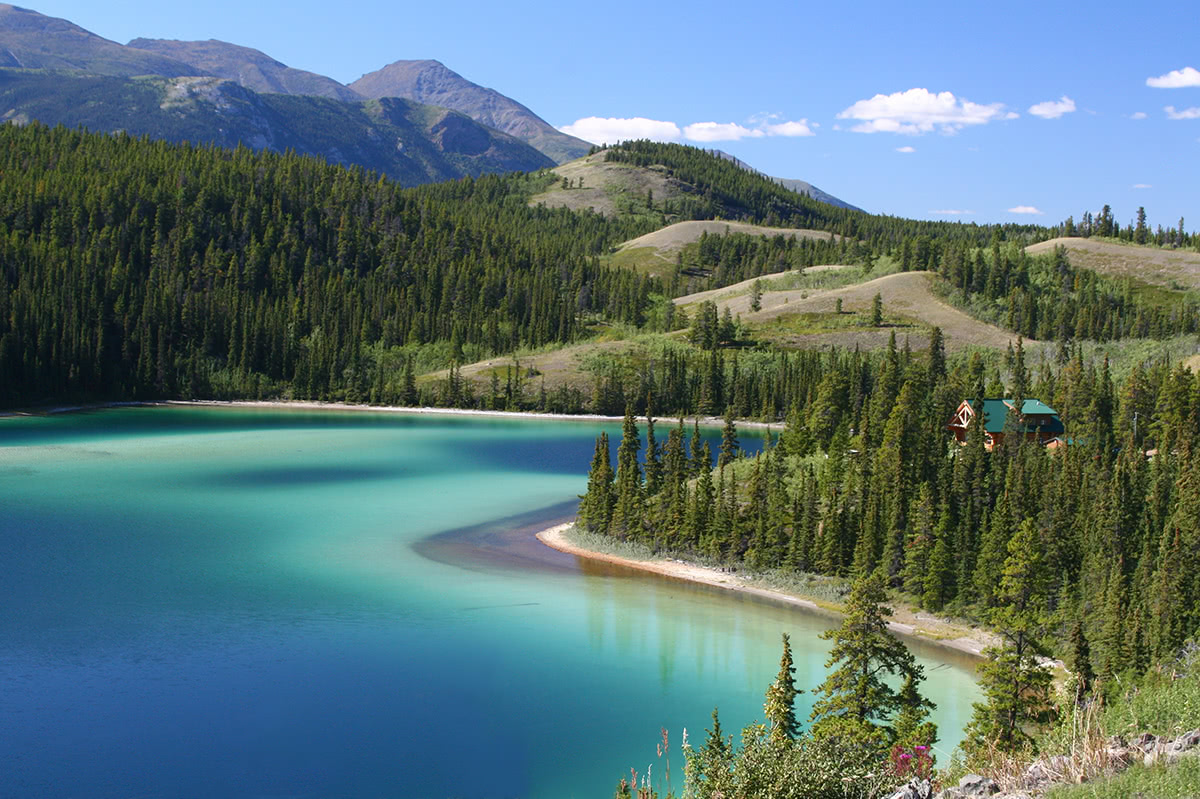
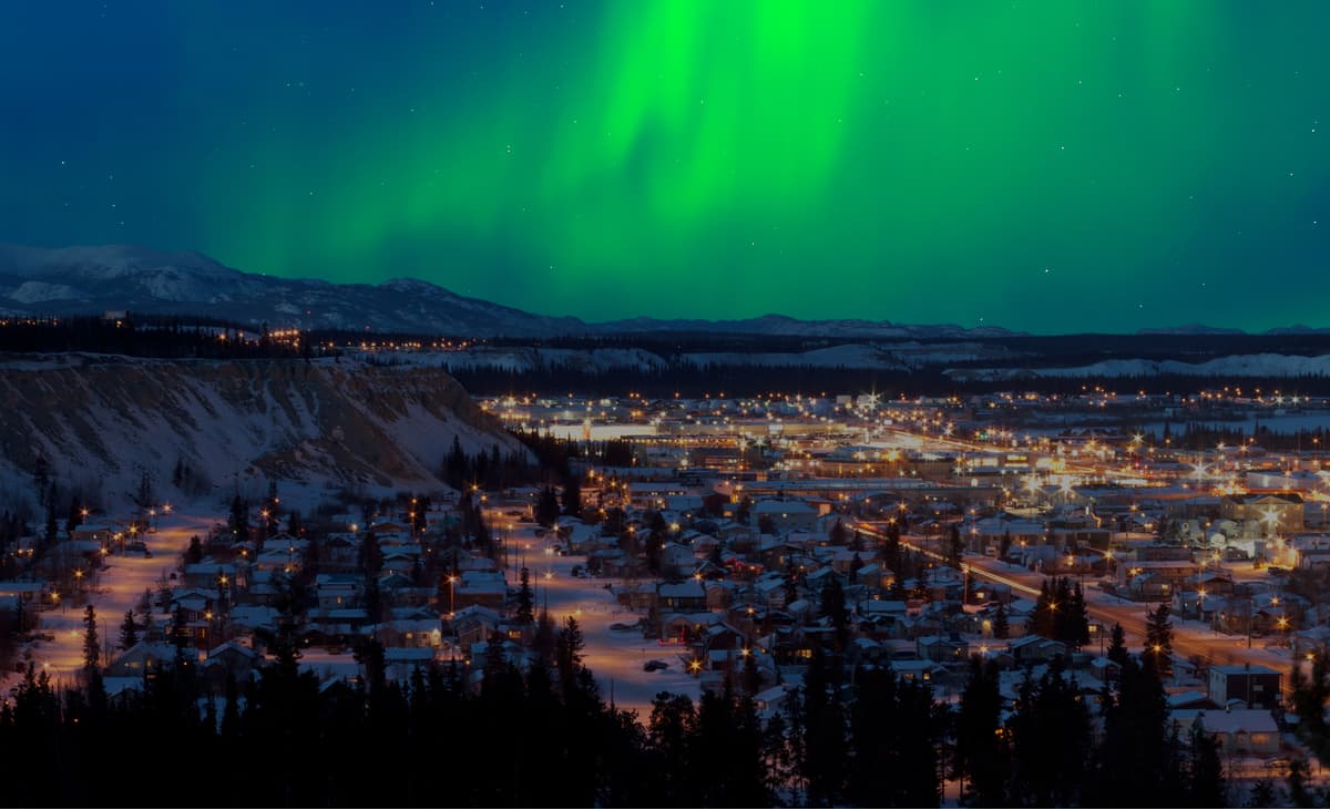
Whitehorse is the most popular basecamp for adventure in the Yukon. Mostly because it’s the only major city in the territory and the capital. In addition to housing a variety of amenities and accommodations, Whitehorse is less than an hour from major attractions like the Yukon Wildlife Preserve and Emerald Lake.
The city offers 85 kilometers of world-class groomed cross-country ski trails that traverse the snowy scenery of Mount McIntyre. Nearby, Mount Sima offers equally amazing views of the surrounding mountains and the Whitehorse and Watson Lake ski hills provide less crowded, backcountry terrain for those looking to ski in solitude.
Hundreds of kilometers of trail can be found in and around the Whitehorse region including trails just outside of town like Mount McIntyre, Fish Lake, and Valerie Lake. Not to mention, two striking mountains can be seen right from downtown Whitehorse, Grey Mountain and Golden Horn - both of which offer ample hiking opportunities and incredible panoramic vistas.


ultra
4000ers-canada
canada-sampler
yukon-ultras
14er
ultra
glacier
4000ers-canada
alaska-13ers
fred-beckey-great-peaks
canada-sampler
alaska-ultras
yukon-ultras
ultra
4000ers-canada
canada-sampler
yukon-ultras
14er
ultra
4000ers-canada
alaska-13ers
alaska-ultras
yukon-ultras
14er
ultra
4000ers-canada
alaska-13ers
alaska-ultras
yukon-ultras
ultra
4000ers-canada
canada-sampler
yukon-ultras
14er
ultra
glacier
4000ers-canada
alaska-13ers
fred-beckey-great-peaks
canada-sampler
alaska-ultras
yukon-ultras
ultra
4000ers-canada
canada-sampler
yukon-ultras
14er
ultra
4000ers-canada
alaska-13ers
alaska-ultras
yukon-ultras
14er
ultra
4000ers-canada
alaska-13ers
alaska-ultras
yukon-ultras
13er
ultra
4000ers-canada
alaska-13ers
alaska-ultras
yukon-ultras
Yes. Yukon has 1,331 named mountains. The highest is Mount Logan at 5,959 m.
The highest mountain in Yukon is Mount Logan, at 5,959 m.
Yukon has 1,331 named mountains.
Yukon has 4 fourteeners — peaks above 14,000 ft (4,267 m).


