Scan the QR code and open PeakVisor on your phone
Tombstone Territorial Park is a protected area that covers 2,200 km (1,367 mi) of incredible wilderness in the remote reaches of Yukon—Canada’s westernmost territory. There are 48 named mountains in Tombstone Territorial Park, the highest and the most prominent of which is Mount Frank Rae (2,344 m/7,690 ft).

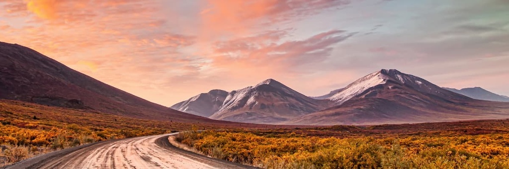
The grandeur of western Yukon’s Tombstone Territorial Park is equaled only by its remoteness. Access to the park is limited to the Dempster Highway—the only road in Canada that traverses the Arctic Circle.
There are no food, gas, phone, or Wi-Fi services in Tombstone. The nearest services are located in Dawson City, some 110 km (68 mi) to the south, and Eagle Plains, which is situated approximately 369 km (229 mi) to the north.
The Dempster Highway begins 40 km (25 mi) from Dawson City and is the only road that leads to and travels within the park. Tombstone Territorial Park lies between kilometer 50 and kilometer 120 on the highway.
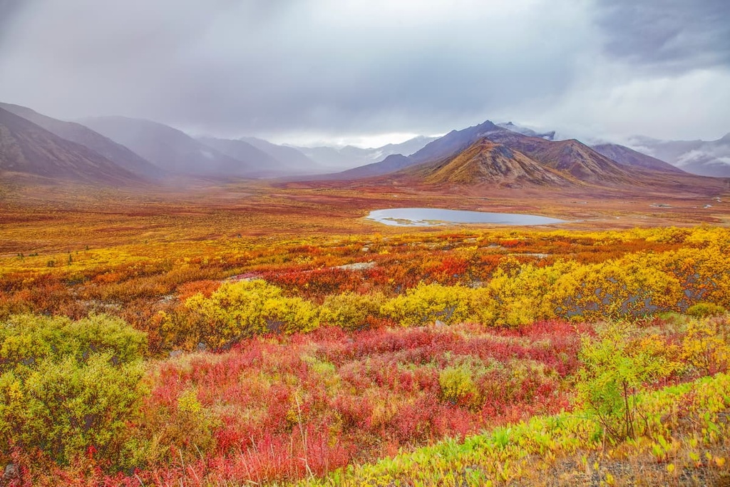
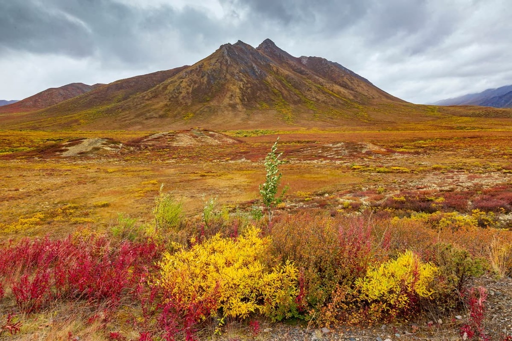
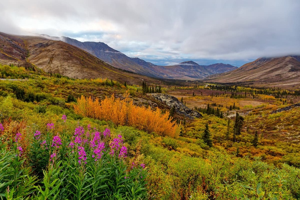
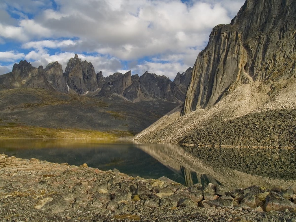
Despite the dedication required to reach Tombstone, it is a popular hiking destination—a testament to the singular beauty and diversity of landscapes found within the park. Home to Arctic tundra, jagged peaks, tranquil alpine lakes, and abundant wildlife, the park protects some of the most unique and fragile landforms in northern Canada.
Only 48 peaks in Tombstone bear a name, but countless more remain unnamed and unclimbed. The park encompasses multiple mountain ranges, including the Tombstone Range, Cloudy Range, Blackstone Range, Seela Range, and Patrol Range.
Infrastructure in Tombstone is limited to one frontcountry campground, a visitor center, and a handful of established trails and backcountry campsites concentrated near the North Klondike River Basin, which is located to the south of the park.
Although Tombstone Territorial Park is located in a remote region of Yukon, it’s situated relatively close to a number of other protected areas, such as the Ni'iinlii Njik (Fishing Branch) Territorial Park to the north and the Yukon-Charley Rivers National Preserve to the west in the US state of Alaska. However, travel between these different parks is challenging due to the lack of road access in the region.
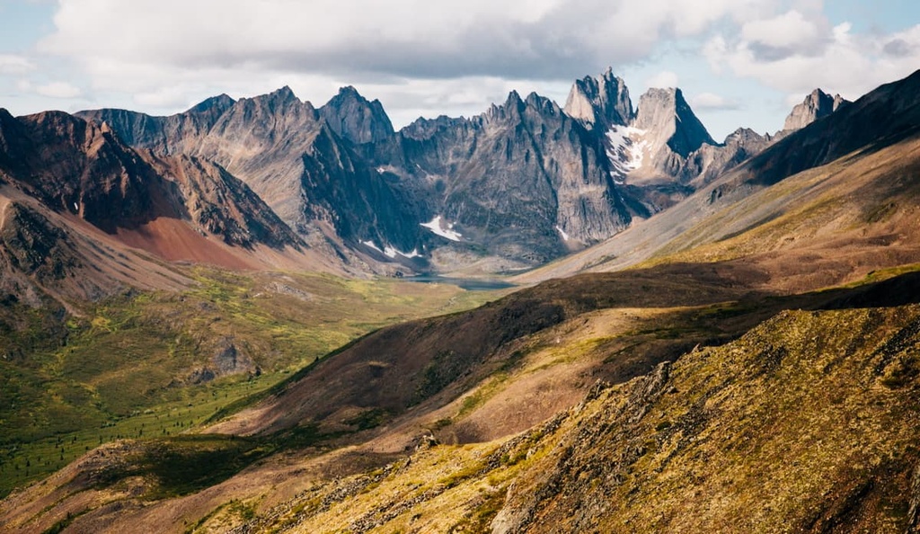
The mountains of Tombstone Territorial Park represent the heart of the Ogilvie Range, a subrange of the Yukon Intermountain Ranges.
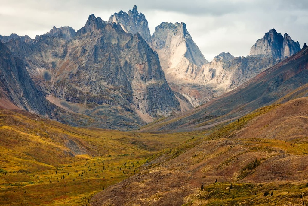
These mountains have a fascinating geological history. Granitic and syenitic intrusions cut through the park and northward to Fairbanks, Alaska. Called the Cretaceous Tombstone Suite, these intrusions are responsible for creating the dramatic, jagged cliffs that make the mountains of Tombstone so visually striking.
This belt of intrusions also created mineral deposits of gold, silver, and copper in the region, which resulted in significant mineral exploration in and around Tombstone before its designation as a protected park in 2000.
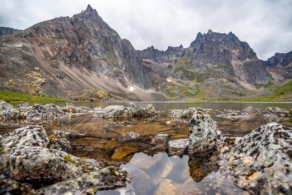
Eastern portions of Tombstone were also sculpted by multiple glaciations. As a result, the park is filled with an incredible density of tarns, moraines, and cirques that is unmatched nearly anywhere else in Canada. Permafrost landforms in the park, which include pingos, ice-wedge polygons, and frost mounds, dominate in the park’s north and west, particularly on the margins of past glaciation events.
Tombstone is even bisected by the Continental Divide. Waters from the southern regions of the park flow into the Yukon River and into the Bering Sea. In the northern part of the park, tributaries lead to the Mackenzie River and they eventually reach the Beaufort Sea
The park sits on one of the world’s largest ecological borders, where the boreal forest meets the Arctic tundra. This meeting of ecozones, combined with the diversity of Arctic, subarctic, and permafrost landforms in the region creates an incredible diversity of flora and fauna that is unique among the northern latitudes.
The southern end of Tombstone is filled with dense boreal forests and deep river valleys. The boreal begins to thin further to the north in the park, giving way to treeless Arctic tundra ecosystems that are characteristic of the low Arctic. However, this ecosystem typically begins several hundred kilometers further north than it does here.
An unusually high density of large mammals inhabits Tombstone, including porcupine caribou, Dall sheep, moose, wolves, grizzly bears, and black bears. Collared pikas, Arctic ground squirrels, and marmots are also found throughout the boulder-strewn alpine regions of the park.
Tributaries on the Yukon River side of the Continental Divide host important salmon spawning grounds. Healthy populations of Dolly Varden and grayling are found on the Mackenzie River side of the divide, too.
Tombstone is also a bucket list destination for birdwatchers. Nearly 150 bird species can be found in the park, including rare species like the gyrfalcons, long-tailed jaegers, golden plovers, surfbirds, northern wheatear, and smith’s longspur.
The park is home to dozens of Beringian plants and insects that are found nowhere else on earth, like the Ogilvie range whitlow-grass. In August, the alpine meadows in the park also blaze to life in flourishes of orange, yellow, and crimson as wildflowers make the most of the weeks-long summer in the region’s low Arctic ecosystem.
Tombstone Territorial Park has been inhabited by humans for at least 8,000 years. The area shows evidence of continued occupancy since the early Holocene. The ecological diversity of Tombstone means that the area has remained a vital source of food and raw materials for First Nations for millennia. The traditional territories of the Han, Tukudh, and Teetl’it Gwich’in peoples all intersected in the park.
Many historic human movement corridors criss-cross Tombstone Territorial Park, including North Fork Pass, North Klondike River, Hart Pass, and Chandindu-Seela Pass. They have been used by First Nations for thousands of years, and continue to be used today. The Chandindu Seela Pass is recognized as a heritage route in the Tr’ondëk Hwëch’in Final Agreement that helped bring the creation of Tombstone Territorial Park to fruition.
European travelers did not come to the region until the late 1800s. They initially came to the area to establish fur trading outposts, but they started to arrive in greater numbers following the discovery of massive gold deposits. To meet water demands created by gold mining efforts in the region, the Yukon Ditch was built in 1909 to divert water from the Tombstone River to the Klondike Gold Fields.
The Dempster Highway was completed in 1979, which initiated the potential for tourism in the region. Research in the late twentieth century also identified the Tombstone area as carrying “exceptional” biological importance.
In a collaborative effort with the Tr’ondëk Hwëch’in First Nation, the Yukon government established Tombstone Territorial Park in 2000 to protect the unique and fragile landscapes found within the park.
The park is located entirely within the lands of the Tr'ondëk Hwëch'in First Nation. The land is still used by Tr’ondëk Hwëch’in and Tr’ondëk Huch’in peoples for subsistence hunting, fishing, trapping, berry picking, and foraging.
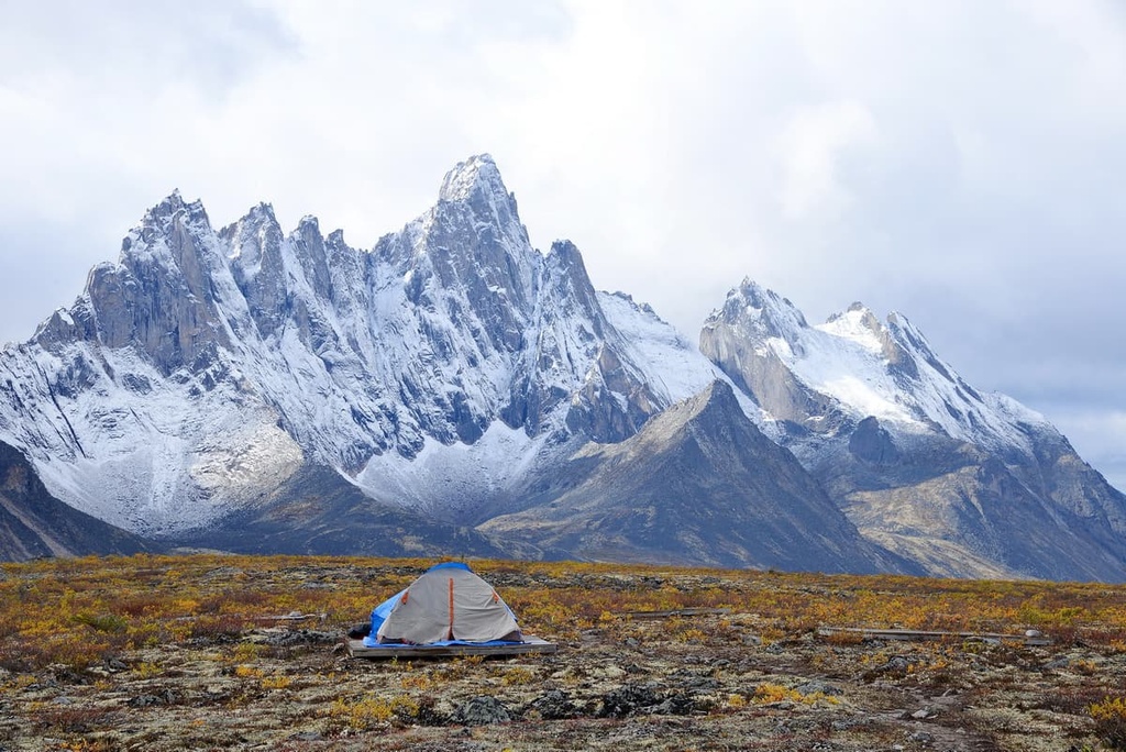
Due to its remote nature, the number of established trails in Tombstone Territorial Park is limited. But any lack of official trails in the region is more than compensated for by the otherworldly landscapes that await you in the park. Here are the top trails to check out on your next trip to the Tombstone area.
This short but stout 6 km (3.7 mi) hike on the Grizzly Trail takes you through ancient boreal forests before vaulting upwards through dense willows and dwarf birches to an astounding, panoramic view of Mount Monolith.
Hikers on this trail have the option to turn back at the lookout or carry on along Grizzly Ridge for another 1.5 km (1 mi). Doing so provides impressive views of the Grizzly Valley to the south and the Cairnes Valley to the north.

The North Klondike Trail (3.2 km/2 mi) makes for a great family-friendly adventure. It starts right from your campsite at the only frontcountry campground in Tombstone.
Beginning between sites 18 and 19 at Tombstone Mountain Campground, the North Klondike Trail winds through poplars alongside the North Klondike River before rising above the treeline, offering unobstructed views of the river valley and the surrounding peaks of the Cloudy Range.
The 5 km (3.1 mi) long Goldensides Trail is one of the most popular hikes in Tombstone. The trail departs just to the north of the Tombstone Mountain Campground.
After ascending a ridge, you will be greeted by one of the best viewpoints in the park. Tombstone Mountain, Mount Chester Henderson, and Mount Monolith all dominate the horizon from the ridgeline, as do the inspiring vistas of the North Klondike Valley.
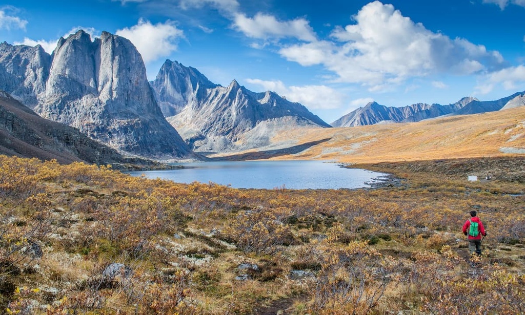
The route from the Grizzly Trailhead to Talus Lake is Tombstone’s premier trail and it features the park’s only established backcountry campgrounds.
Hiking the entire trail to Talus Lake is a 48 km (30 mi) round trip that’s usually done over three to five days. Filled with alpine lakes, waterfalls, lush meadows, towering peaks, and surreal permafrost landscapes, this hike is a trip of a lifetime.
There are backcountry campsites available on this trail at Grizzly Lake (11 km/6.8 mi), Divide Lake (17 km/10.6 mi), and Talus Lake (24 km/14.9 mi). Endless variations and side trips exist for hikers looking to do only part of the trail, too.
The section of the trail to Grizzly Lake is often done as a day hike. You can also choose to spend a night or two at the campground there, using it as a home base to take on other hikes, including the trails to Mount Monolith, Grizzly Pass, and the Twin Lakes viewpoint. You could also push on to Divide Lake and take on Axelman Lakes or Mount Frank Rae for unsurpassed views of the Tombstone Range.
Due to the fact that all of the other lodging options in the region are located quite a long distance away, most visitors to Tombstone spend some time camping in the park. Here are the options for camping accommodations within the park’s boundaries.
Tombstone Mountain Campground, which is located at kilometer 72 of the Dempster Highway, is the only option for car camping in Tombstone. The campground features a mix of tent, trailer, walk-in, and group campsites, along with outhouses, access to creek water, and bear-proof lockers and food hangs.
Many of the established trails in the park start at or near the campground. The Tombstone Interpretive Centre is also located nearby. Sites are available on a first-come, first-serve basis, and they typically fill up in the summer, so be ready to arrive early.
The only established backcountry campsites in Tombstone are located on the Grizzy Trailhead to Talus Lake route. However, a unique feature of Tombstone is that backcountry camping is permitted anywhere within the park. This gives experienced hikers the freedom to plan their own adventures and objectives in the region.
Whether you plan to stay at the campgrounds at Grizzly, Talus, and Divide lakes or elsewhere in Tombstone, you will have to register your trip at the Tombstone Interpretive Centre and receive a permit.
Due to the park's large bear population and lack of backcountry infrastructure, you will also be required to store your food in a hard-shelled, bear-resistant food canister, which can be purchased or rented at outdoor stores in Whitehorse or Dawson City. All hikers in the park should also carry bear spray and know how to use it.
Looking for a place to stay in the region around Tombstone Territorial Park? Here are some of the best cities and resorts to visit near the park.
Located 90 km (56 mi) to the southwest of the park, Dawson City is the closest settlement to Tombstone Territorial Park.
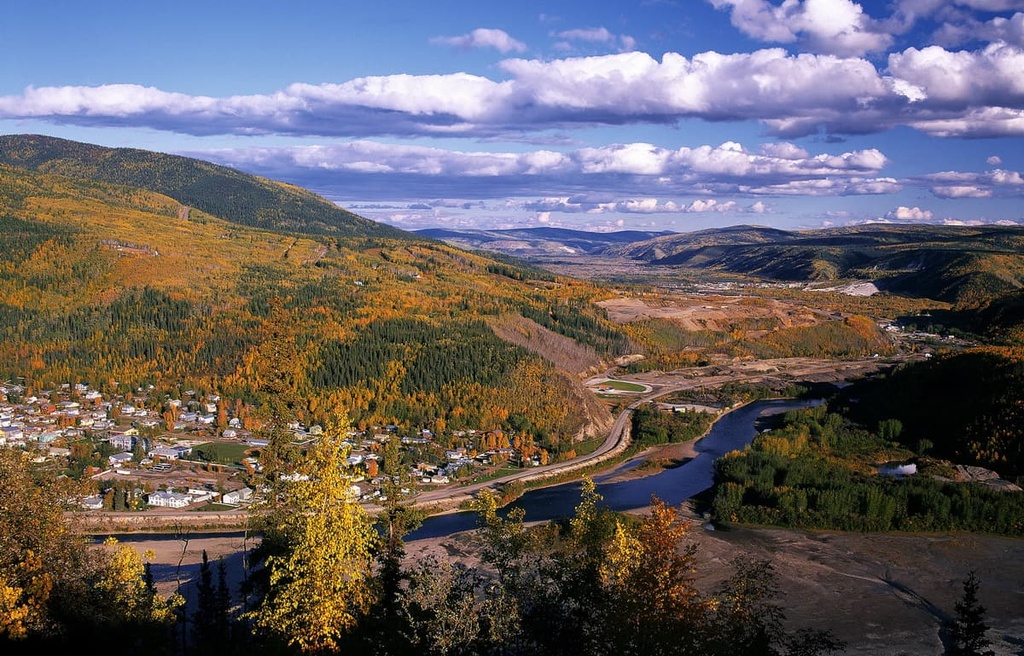
This town of 1,300 people sits at the confluence of the Klondike and Yukon Rivers. It has a rich history as it served as a major frontier town during the Klondike Gold Rush. In the 1890s, Dawson City’s population swelled to 40,000 people, making it the second-largest Canadian city to the west of Winnipeg at the time.
Visitors to Dawson City can stay in historic, frontier-style accommodations like the Downtown and the Bunkhouse Hotel. There are also many campgrounds located near the city, and Dawson City itself is surrounded by a lifetime’s worth of excellent hiking, canoeing, and fishing opportunities.
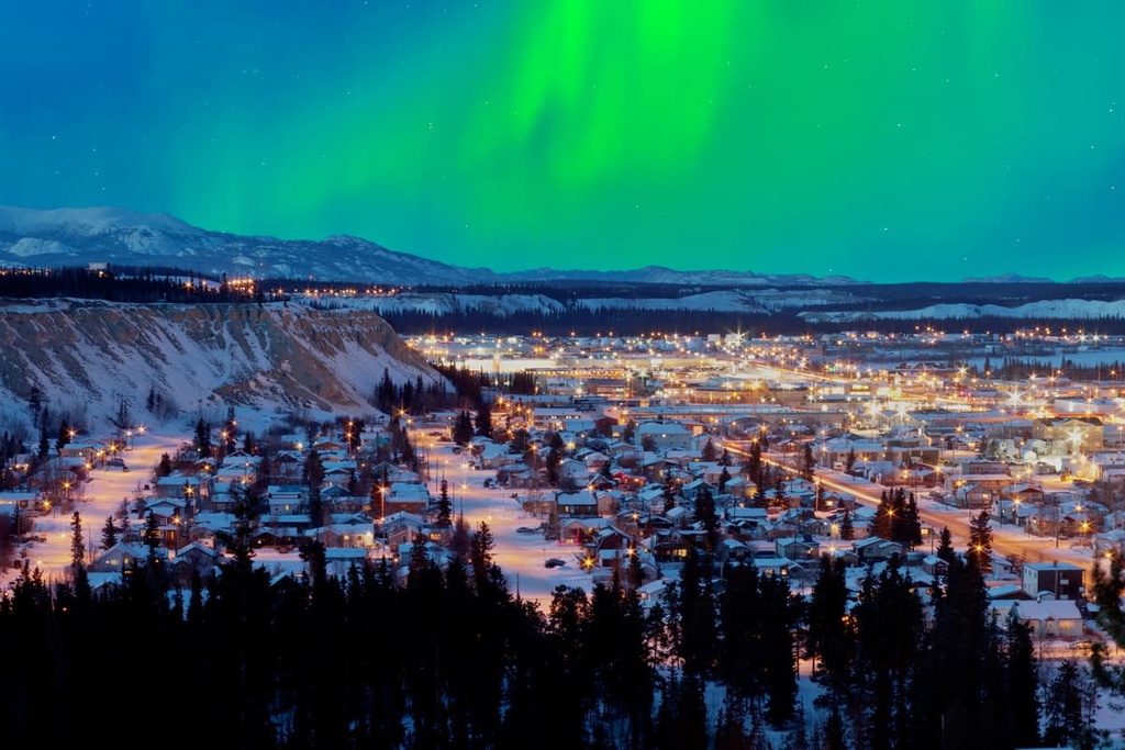
Whitehorse is the capital of Yukon and by far the largest city in the territory, with a population of 25,000 people.
It has an airport with direct flights to some of the larger Canadian cities, along with service to Dawson City’s small regional airport. This is a great option if you are looking to visit Tombstone but would like to avoid the seven-hour drive from Whitehorse to Dawson.
Whitehorse sits on the Alaska Highway, making it a major stop for motorists on their way to Alaska or to nearby Kluane National Park.
Eagle Plains is a small outpost that’s located 369 km (229 mi) to the north of Tombstone and about 36 km (22 mi) to the south of the Arctic Circle. While Eagle Plains isn’t a very large community (it has a population of fewer than 10 people), it does have a hotel and a gas station.
It’s also home to the only services along the Dempster Highway. This makes it a famous stop for travelers driving the highway all the way to its terminus in Inuvik on the Arctic Ocean, so it’s a must-visit if you’re in the region.