Scan the QR code and open PeakVisor on your phone
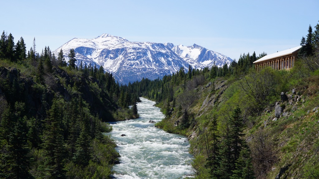
Solitude and adventure await visitors of Yukon-Charley Rivers National Preserve. Located in Interior Alaska, USA, the largely untouched landscape invites visitors to float the Yukon River, paddle the whitewater of Charley River, and explore this beautiful part of the immense Alaskan wilderness.
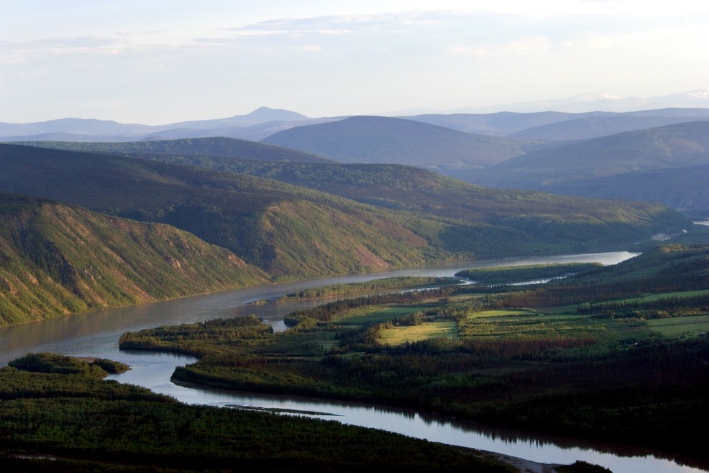
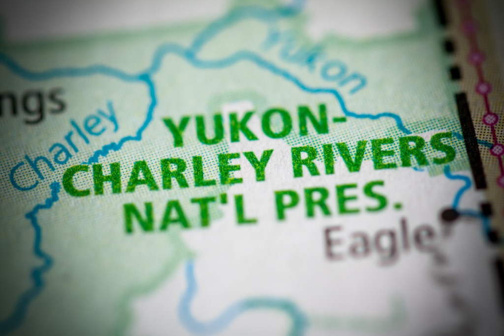
The Yukon-Charley Rivers National Preserve encompasses 130 miles (208 km) of the Yukon River and the entire Charley River basin in the interior of Alaska, USA.
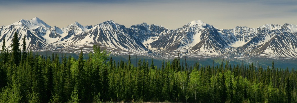
Situated between the Alaska Range to the south and the Brooks Range to the north, the national preserve has 10 named peaks that overlook the stunning river valleys.
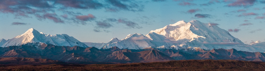
Cut Mountain is the tallest and most prominent of the preserve’s ten peaks, with 6,424 ft (1,958 m) of elevation and 2,851 ft (869 m) of prominence. Cut Mountain is the final resting place of Iceberg Inez, a B-24 bomber that crashed during a test flight on December 21, 1943.
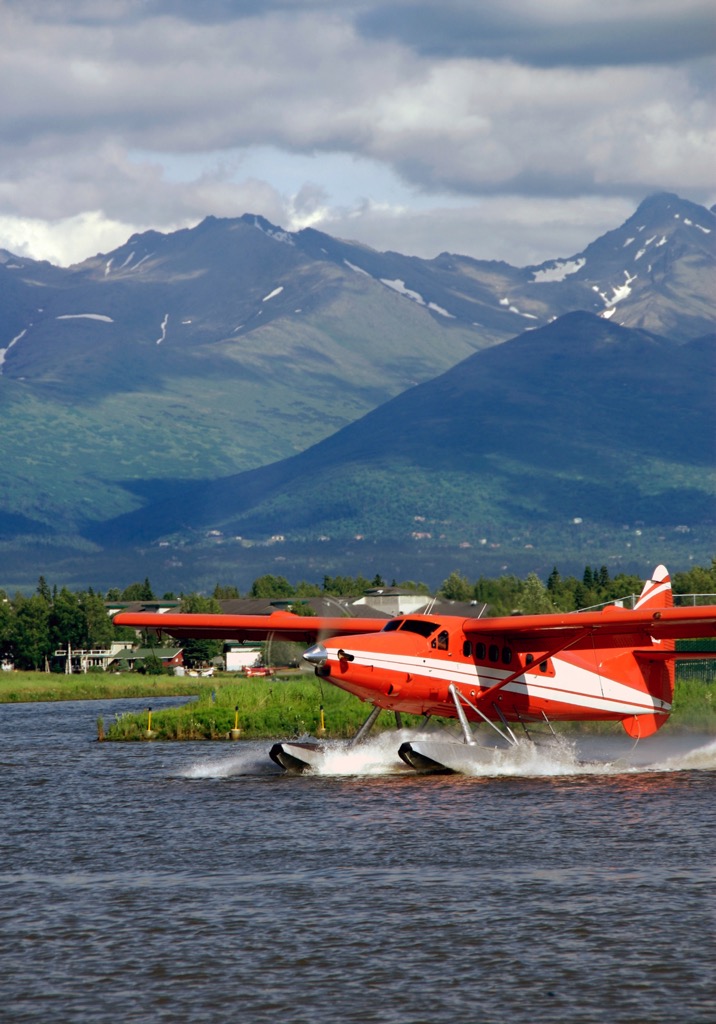
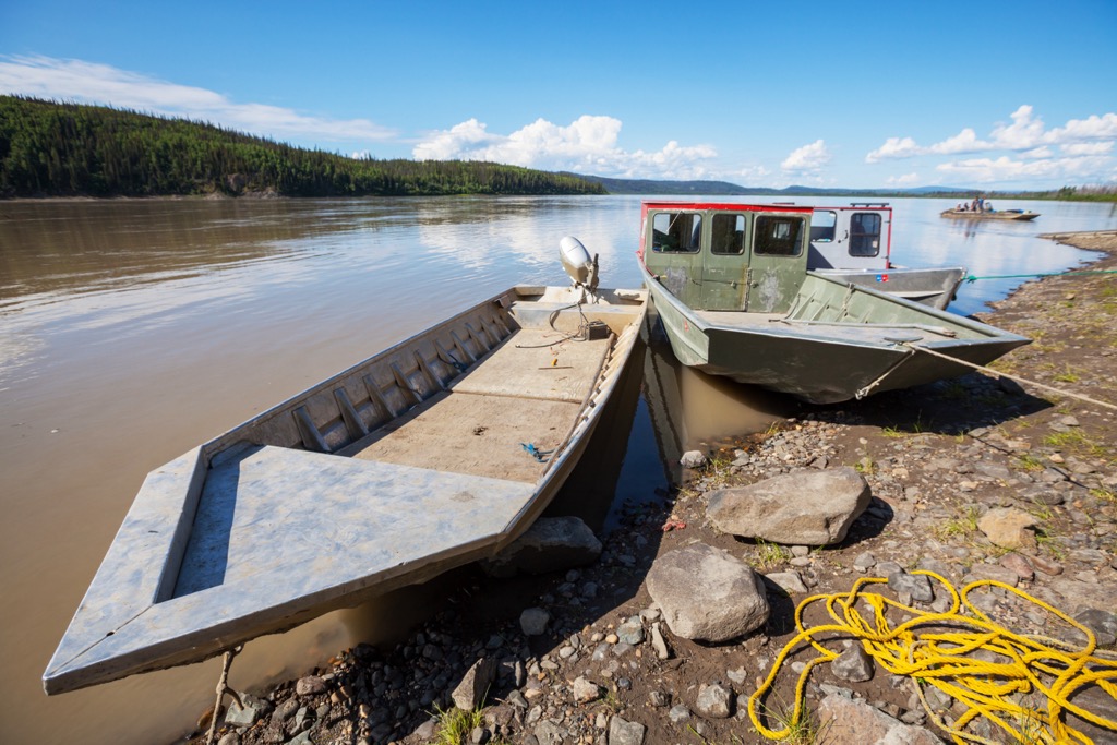
There is no road access into Yukon-Charley Rivers National Preserve. The closest roads arrive at the villages of Eagle, which is southeast of the preserve, and Circle, which is northwest of the preserve. Visitors will often take an air taxi or boat from those communities into the preserve, where there are several bush landing fields across the park.
Yukon-Charley Rivers National Preserve is one of many wilderness areas in the region. The following are some of the nearby parks, preserves, and conservation areas.
Yukon-Charley Rivers National Preserve has a fascinating geology. Some of the major geological features of the preserve are the 600-million-year record of geological and paleontological resources, a speculated relatively unaltered portion of the North American plate, and one of the major fault systems of western North America.
In general, Alaska is a geological jigsaw puzzle of terranes that have come together through tectonic movement and volcanic processes. Most of Alaska’s bedrock has been metamorphosed and deformed from the heat and pressure of being buried beneath the Earth’s surface. Most of Alaska’s oldest rocks are about a billion years old; however, part of Yukon-Charley Rivers National Preserve is speculated to be over 2 billion years old.

The area between the Nation, Kandik, and Yukon rivers, which is the east side of the park, adjacent to the Canadian border is speculated to be part of the original North American plate and could be upwards of 2 billion years old.
This section of the park contains unmetamorphosed sedimentary rocks that date from the Precambrian to the Mississippian period of the Paleozoic. The rocks in this region of the park contain some of the oldest microfossils from northwestern North America.
It is thought that the rocks in this area were once part of the ancient continental margin of North America. The fossil record from this section of the park contains a record of the evolution of marine life, including fossils of ammonites, trilobites, brachiopods, and corals.
West of the segment of the speculated original North American continent are rocks that were formed in a variety of ways. There are metamorphosed marine and marginal sedimentary rocks, carbonate platforms, ocean crust rocks, and volcanic rocks. These rocks are all north of the Tintina Fault, which is one of the geological dividing lines in Yukon-Charley Rivers National Preserve.
The Tintina Fault is a strike-slip fault that runs parallel to the Yukon River, roughly 10 miles (16 km) south of the river. A slip-strike fault is when sections of the Earth’s crust fracture and move laterally past each other. The fault was caused by horizontal compression and the rocks released their energy by moving almost parallel to the compressional force.
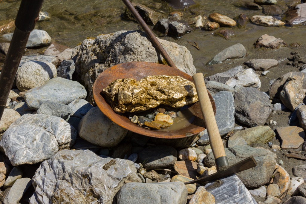
The Tintina Fault extends about 600 miles (1,000 km) from northeastern British Columbia to Alaska and is one of the major fault systems of western North America. The Tintina fault is the cause of the major gold deposits and was the reason for the famous Klondike Gold Rush.
Millions of years ago, the Earth’s crust cracked, and the separate plates shifted along the Tintina fault, allowing super-heated water a passage towards the surface. As the water neared the surface it began to cool and precipitate out soluble minerals, like silica and gold. The silica started to form quartz and gold became concentrated as impurities in the quartz.
There were pockets of gold throughout the fault system that were torn from the quartz by erosion and sent down the mountain streams. As the water continued to erode gold from the rocks and push it downstream, the relatively heavy gold would settle as placer deposits. Placer mining was used to recover the gold from this area before the gold rush brought more invasive mining techniques to the region.
The southern section of the park, which includes the area south of the Yukon River and the Charley River basin are metamorphosed rocks that were once part of the continental margin. These are mostly marine sedimentary rocks that were adjacent to ancestral North America and have since been altered by the pressure and heat of tectonic events, such as the orogenic events that formed the region’s mountain ranges.
Yukon-Charley Rivers National Preserve is one of the few locations in the world that contains an uninterrupted paleontological record of major parts of Earth’s history. Areas of the preserve have incredible sequences of fossil-bearing sedimentary rocks from 620 million to 70 million years ago which give amazing scientific insight into the evolution of early organisms.
The preserve encompasses a special area that includes valleys that remained unglaciated during the Pleistocene as well as areas that were glaciated. The sediments in the bluffs along the Yukon River span about 700,000 years of geological history and show the evolution of the river system through some of the glacial episodes of the Pleistocene.
With some rocks as old as North America itself, Yukon-Charley Rivers National Preserve is a geologically important location. Geological features have preserved a nearly continuous record of the plants, animals, and tectonic history of Alaska. The incredibly preserved fossil and sedimentary record also helps scientists understand the changes that were occurring in and upon the earth millions of years ago.
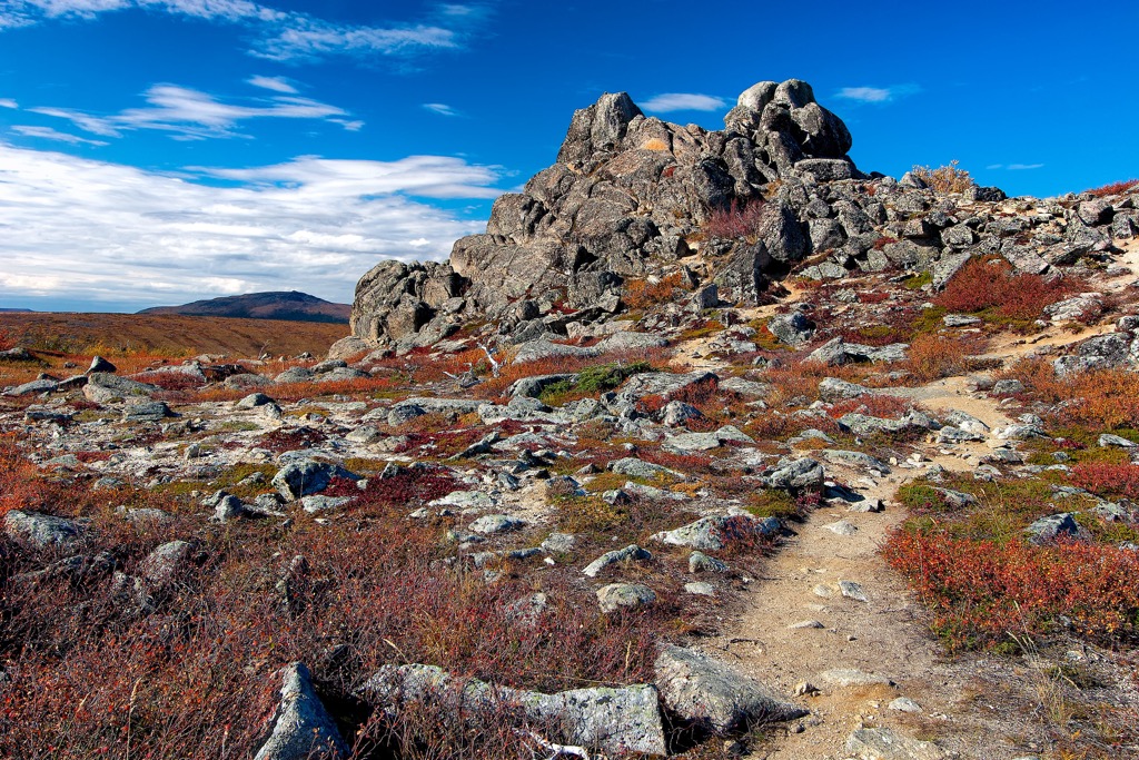
Boreal forests cover the lowland of Yukon-Charley Rivers National Preserve, and the higher elevations have the sparse and low-lying vegetation that is common to arctic tundra. The preserve is in an area where the valleys remained unglaciated throughout most of the Pleistocene which has allowed remnant vegetation species to grow and give insight into the early populations of Alaska.
The forests are primarily black spruce and white spruce with stands of alder, willow, birch, cottonwood, and poplar. While the higher elevations have vast expanses of shrubland and grasses that defy the cold temperature. The diversity and overall health of the preserve’s ecosystem is dependent upon regular lightning-caused fires, which create a mosaic of burned and unburned lands in the preserve.
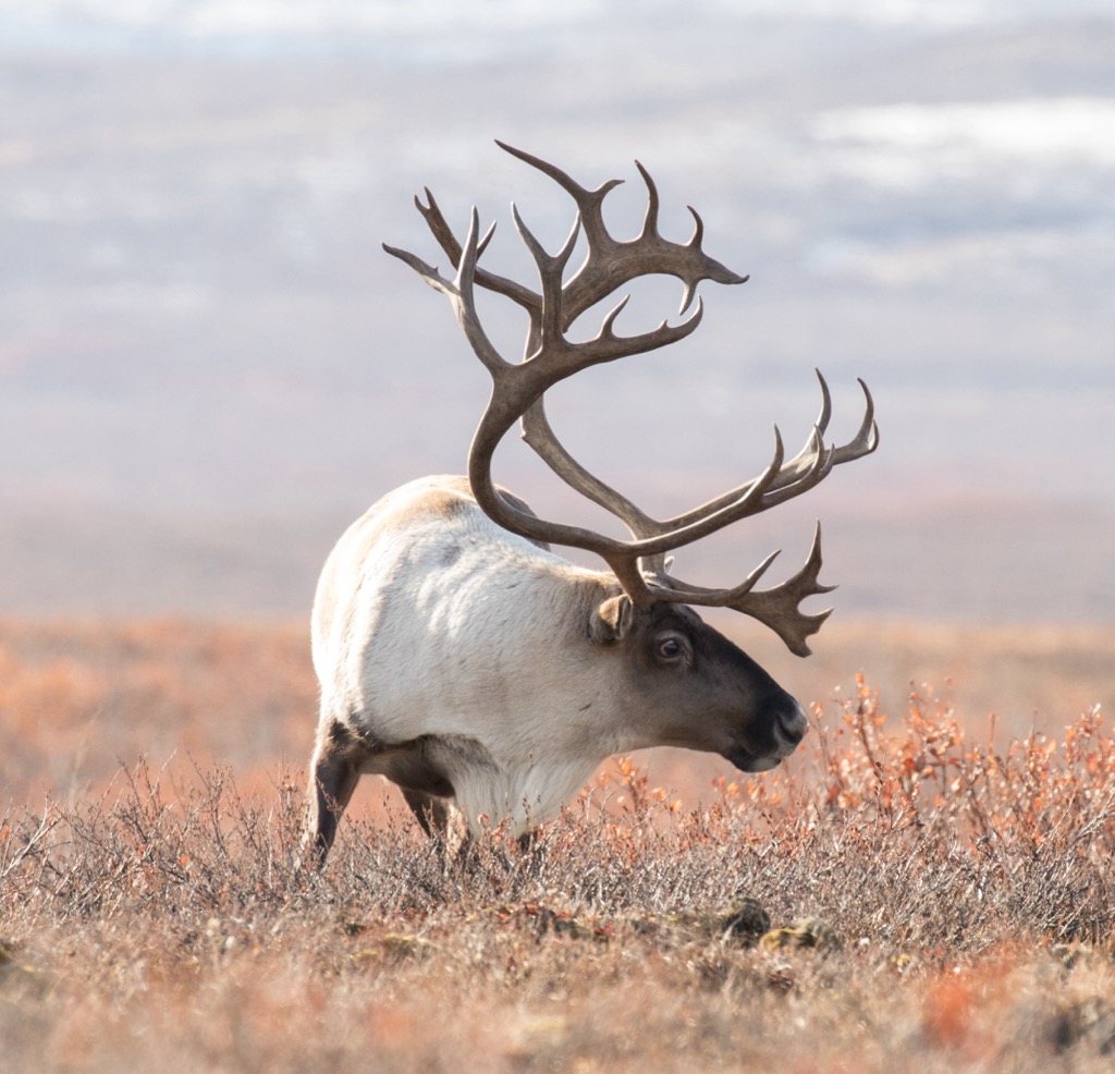
Dall sheep, caribou, moose, and grizzly are common throughout the park, as are black bear, and wolf.
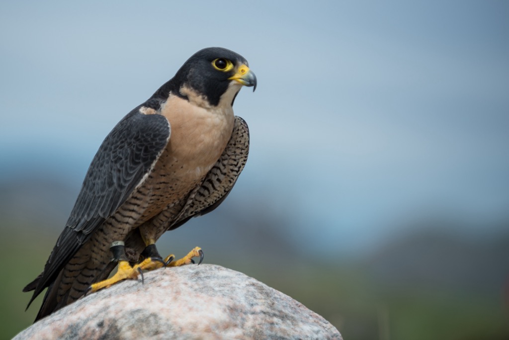
The rivers and their tributaries are home to chinook, chum, and coho salmon, and other species such as Arctic grayling, northern pike, whitefish, burbot, and sheefish. Furthermore, the preserve has one of the largest breeding populations of peregrine falcons in North America.
There is an extensive record of human use and habitation of the area that is now part of Yukon-Charley Rivers National Preserve. There is evidence of prehistoric occupation of the region which is relevant to the initial settlement of North America, village sites from the Han First Nation, mines from the Klondike Gold Rush era, and contemporary habitation and use of the rivers and region.
With only a small percentage of the preserve’s nearly 4,000 square miles (10,100 square kilometers) surveyed, archeologists have still managed to discover and document nearly 700 sites that pertain to the expansive human history of the preserve.
Some of the earliest records of human use and habitation are sites that pertain to the prehistoric hunters in the region. Many of the prehistoric sites are upon alpine ridges, where the ancient hunters could watch and wait for the caribou to pass nearby.
These ancient sites are typically discovered when the archeological teams or hikers, happenstance upon stone tool artifacts laying upon the surface of the ground. Artifacts can lay relatively undisturbed by weather for thousands of years on the Alaskan tundra.
More recent sites pertain to the occupation of the area by the Han, who are known as the “People of the River”, referring to the Yukon River.
The Han were one of the last Northern Athabascan groups to have contact with Europeans. In 1851, Robert Campbell, who worked for Hudson’s Bay Company, was the first known non-indigenous person to enter the territory of the Han people.
The first trading posts weren’t established in the region until 1873, after the United States had purchased Alaska. By the late nineteenth century, the Han economy had shifted from fishing and hunting to rely heavily upon fur-trapping as they grew dependent upon European guns, clothing, and canvas.
One of the important archeological sites from more recent history pertains to the Han village site that was at the confluence of the Kandik River and Yukon River. Until 1914, an important village occupied the site, which was the historical home of Chief Charley, who the Charley River was named for, and his Han Gwich’in Athabaskan followers.
Unfortunately, high water levels during the spring breakup of 1914 washed away the remaining houses of the village. While the village site has been deteriorating due to its proximity to the river, people have collected and studied the stories of the people that once lived in the village which now give us insight into what it was like to live in Interior Alaska at the turn of the twentieth century.
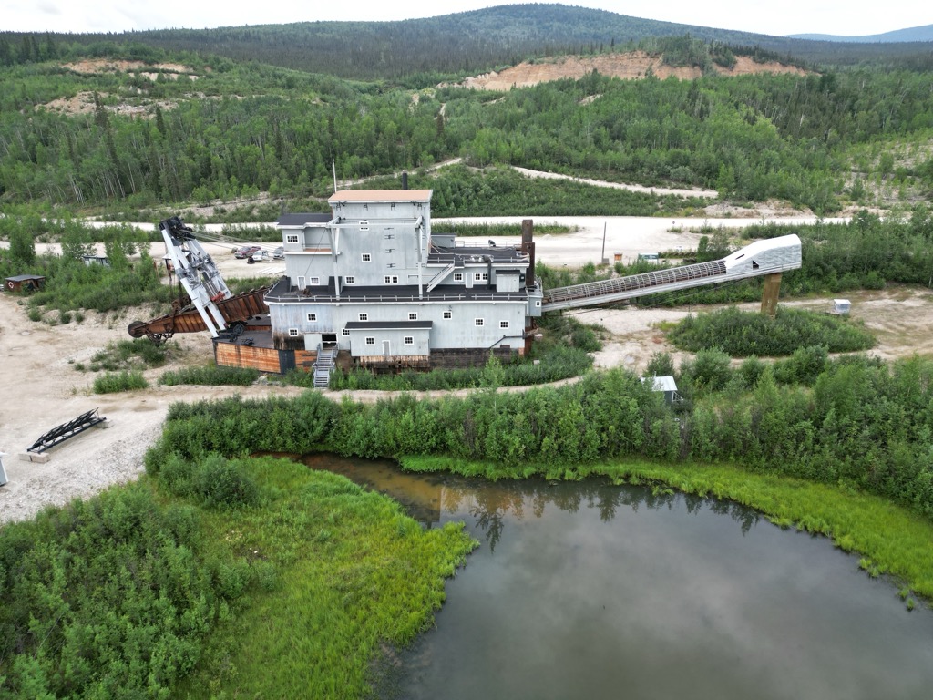
There are also many archeological sites that are contemporary to the village site which pertain to the Klondike Gold Rush. In part, Yukon-Charley River National Preserve was created to protect and interpret the history of the Klondike-Alaska Gold Rush and placer mining in the region.
Along the banks of the Yukon River visitors may notice evidence of prospectors’ cabins, mining camps, sluice boxes, tailing piles, hydraulic pipe, steam boilers, drilling rigs, and earth moving equipment. There are also dredges and their tailing piles that can be seen sitting along Coal Creek and Woodchopper Creek.
Along with the artifacts that were left behind, there are many stories of the people that lived and visited the area of the Yukon and Charley Rivers. Some of the stories relate to Sadie and Arthur Reynolds who moved to a cabin along Sam Creek in 1906. Other stories relate the antics of Clarence O. Prest who found himself stranded in the Alaskan wilderness while attempting to fly to Russia.
During the gold rush, roadhouses were built along the Yukon River every 30 miles (50 km) or so. Clarence Prest happened upon one of the roadhouses when he was trying to make his way out of the wilderness, and it likely saved his life. One of the more popular and well-preserved roadhouses in the preserve is the Slaven Roadhouse.
Having built cabins and mines in other locations, Frank Slaven found himself among the first to find gold along Coal Creek and Woodchopper Creek. After having mined for decades, Slaven decided to build a roadhouse in 1932 to compete with the Woodchopper establishment. Slaven hired men to help cut trees to build the roadhouse and got additional lumber from the decommissioned army base, Ft. Egbert, in Eagle.
In 1935, a mining company called Gold Placers purchased Slaven’s claim and those of other miners along Coal Creek. Slaven began wintering in Seattle and he eventually died in 1942; however, his roadhouse was occupied on and off over the decades until the National Parks Service renovated the historic roadhouse in 1994.
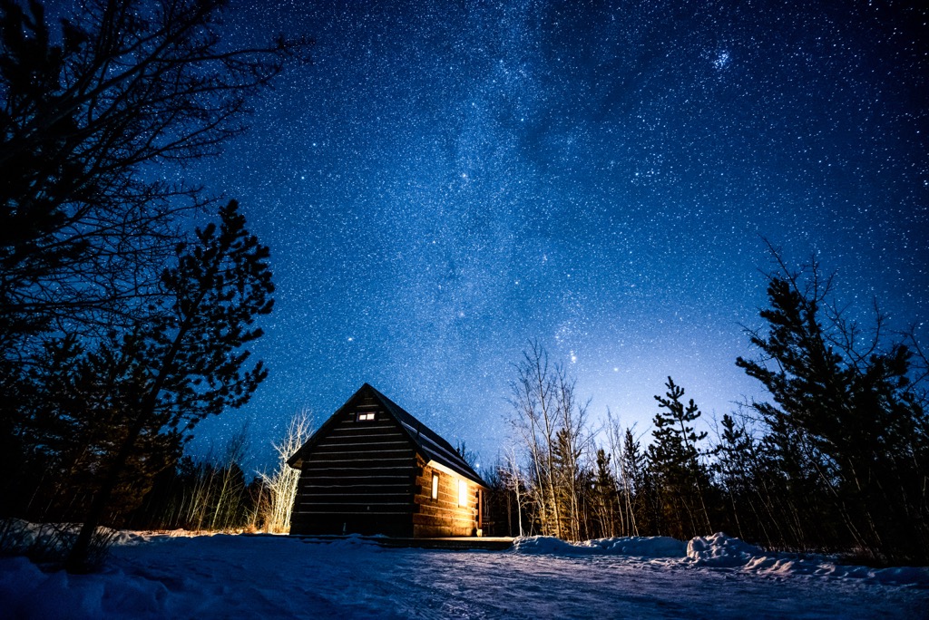
The Slaven Roadhouse is one of the many public cabins where visitors can spend the night while traveling through Yukon-Charley Rivers National Preserve.
The park is currently open to locals for subsistence living needs, such as fishing, hunting, and gathering. The Subsistence legislation allows local indigenous and non-indigenous Alaskans access to the preserve’s resources for their personal benefit.
Finally, the park is regularly visited by what are called the summer floaters and the winter mushers. Floating the Yukon River and paddling the Charley River are popular summer activities and the winter is when the preserve is visited by mushers and their dog sleds, who are following in the century old tradition of traveling the frozen river corridor.
Yukon-Charley Rivers National Preserve is a remote wilderness area that is wilder than it was a century ago. While the past inhabitants came in search of subsistence and gold, most of the modern-day visitors come for adventure. The following are the major activities and attractions of Yukon-Charley National Preserve.
Most of the annual visitors to the preserve arrive during the summer with the intention to float or paddle the Yukon and Charley Rivers. The popular float trip from Eagle to Circle is over 150 miles (240 km) and can be completed in five days or so. Trip length is dependent upon how much exploring visitors do compared to time on the river.
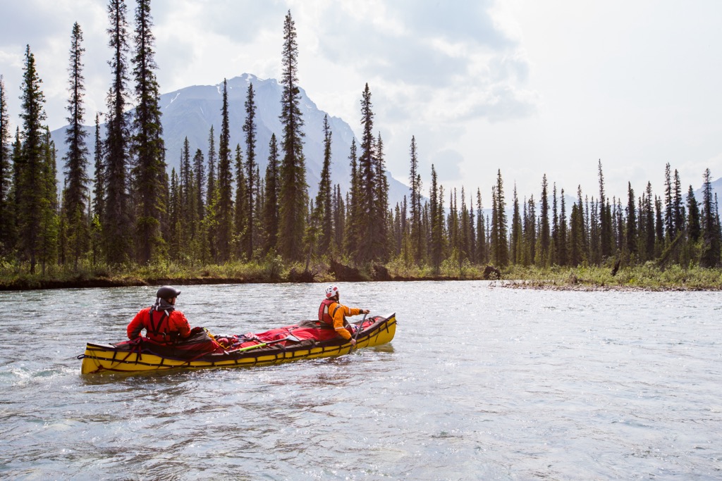
Visitors can camp along the river banks or make their way to one of the many public use cabins along the river. Camping along the gravel bars is recommended because they can be breezy which deters the many mosquitoes and other insects. Visitors must be self-sufficient as there are no developments in the park and emergency assistance may take several days.
For over a hundred years, one of the main forms of transport along the Yukon River has been the use of dog sleds. Miners would use teams of dogs to access their sites and even the mail was delivered to the remote region via dogsled.
Visitors can still follow the route along the frozen river and stay at the public use cabin along the way, even the famous Slaven Roadhouse.
Furthermore, Yukon-Charley Rivers National Preserve is part of the world-famous Yukon Quest International Sled Dog Race.
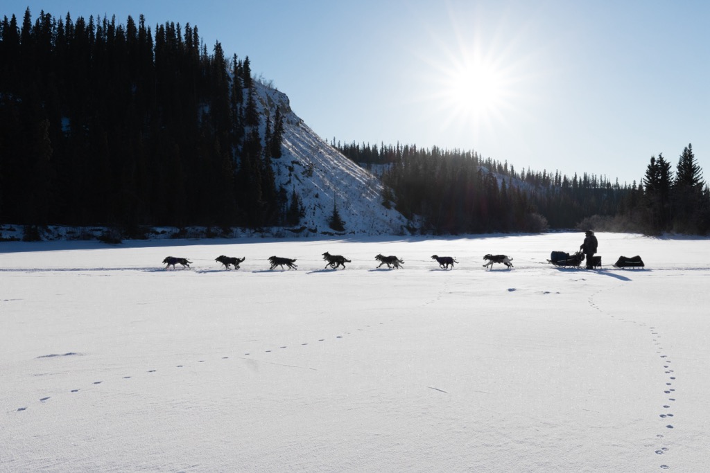
Every February mushers brave the elements and terrain as they race between Whitehorse in Yukon and Fairbanks, Alaska. Slaven’s Roadhouse is one of three official dog drop locations along the 1,000-mile (1,600 km) route that the teams travel.
If visitors are looking for more recent historical sites, they can fly and hike to the WWII B-24 crash site on the northern slopes of Cut Mountain. The carcass of “Iceberg Inez”, the bomber that crashed December 21, 1943, during a test flight, is one of many crash sites across Alaska; however, despite four crewmen perishing in the crash, one man did survive.
Co-pilot 1st Lt. Leon Crane was the sole survivor of the crash and after 81 days, he finally made it out of the Alaskan wilderness. In his ordeal he survived the minus 40-degree weather with two packs of matches, a boy scout knife, and his parachute which he used as a sleeping bag.
Having survived in the open wilderness for over a week following the crash, Crane came upon one of the cabins that were built and stocked by local trappers. Crane stayed in the cabin until early February when he made his final attempt to get out of the wilderness.
With great fortune, Crane was found by one of the local trappers who took him to Woodchopper roadhouse, where he boarded the next plane back to Fairbanks.
The following are the closest communities to Yukon-Charley Rivers National Preserve and the accommodations that are found within the preserve.
Eagle is a small community located at the east side of Yukon-Charley Rivers National Preserve and is the primary access point for visitors who are floating down the Yukon River. The community has a basic general store, a restaurant, a small hotel, a bed & breakfast, and gas, propane, and diesel are available in town.
Having been home to indigenous people for thousands of years, the first permanent non-indigenous structure was a trading post built in 1874. Eagle was an important supply and trading center during the gold rush era and was home to over 1,700 people at the end of the nineteenth century. The population is now closer to 200 people and is typically visited by people entering the adjacent national preserve.
Some of the events and attractions of the community is its status as a checkpoint in the Yukon Quest and it is a major access point to the wilderness of Yukon-Charley Rivers National Preserve. While in town visitors are urged to visit the Eagle Historic District, which is a National Historic Landmark.
Circle is located near the northwest corner of Yukon-Charley Rivers National Preserve and is on the downstream side of the preserve. The community has limited facilities which include a general store and fuel.
From Circle, visitors can take a powerboat up the Yukon River to enter Yukon-Charley Rivers National Preserve. For most visitors, Circle is the endpoint to the wilderness adventure that typically included a trip down the Yukon River.
Especially if entering the preserve from Circle, it is recommended that visitors bring all necessary camping gear and supplies. It should be noted that visitors must be self-sufficient since there are no developed areas between Eagle and Circle and it may take days for any emergency assistance to reach you.
Like Eagle, Circle was established when gold was discovered in the late nineteenth century. The community was named by miners who thought they were along the Arctic Circle; however, they are about 50 mi (80 km) south of the Arctic Circle. Circle was a distribution point where supplies shipped up the Yukon River from the Bering Sea were unloaded and shipped overland to the mines.
While the community reached a population of about 700 people, miners soon left for richer ground when gold was discovered in the Klondike and Nome. Circle is one of the checkpoints along the Yukon Quest route and there are also some historical buildings that visitors can visit while in the community.
First constructed in the 1930’s, Slaven’s Roadhouse is one of the many cabins and roadhouses that were constructed along the Yukon River and throughout the Charley River basin. Prospectors, miners, and trappers have constructed cabins throughout the park since the late nineteenth century.
While many of the historic cabins are rundown, there are several that are standing strong and host visitors throughout the year. Slaven’s is among the best kept because it was renovated by the Park’s Service in 1994. Staying in the roadhouses is free of charge; however, it is based on first-come-first-served, so travelers should have alternative plans for nightly shelter in case the cabin is full.