Scan the QR code and open PeakVisor on your phone
The Yukon Flats National Wildlife Refuge covers approximately 11,000 square miles (28,490 square kilometers) between the Brooks Range and White Mountains of eastern Alaska, USA. Standing above the 40,000 lakes that fill the basin along the Yukon River, there are 19 named peaks, the tallest and most prominent of which is Mount Schwatka (4,170 ft/ 1,271 m), with 2,316 ft (706 m) of prominence.
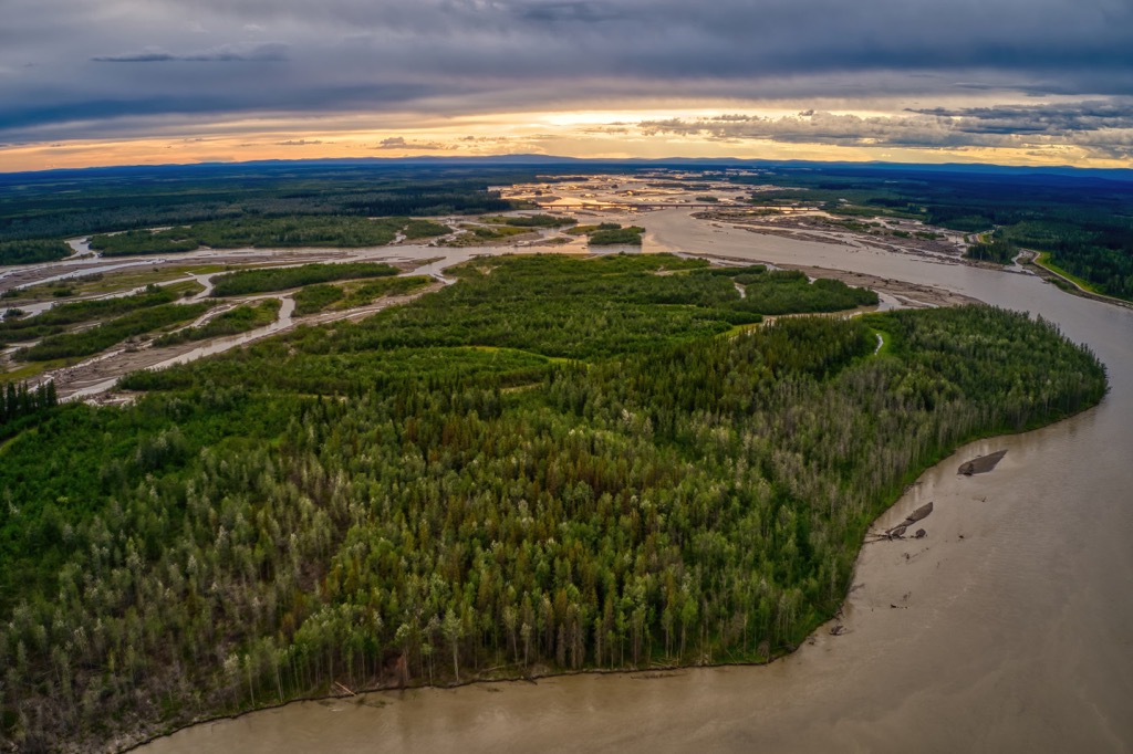
Located in eastern Alaska, USA, the Yukon Flats National Wildlife Refuge extends west along the Yukon River from the Yukon, Canada border. The refuge encompasses approximately 11,000 square miles (28,490 square kilometers) of wetlands, forest, bog, and low-lying ground that is centered upon the confluence of the Yukon, Porcupine, and T’eedriinjk (Chandalar) Rivers.
Sitting between the Brooks Range to the north and the White Mountains to the south, the refuge is the third largest wildlife refuge in the USA. The refuge extends above the arctic circle where there is 24 hours of light in the summer and 24 hours of darkness in the winter.
While the highpoints and peaks of the refuge don’t reach the dramatic heights of the bordering ranges, there are still 19 named peaks within the refuge. Mount Schwatka is 4,170 ft (1,271 m) tall with 2,316 ft (706 m) of prominence, making it the tallest and most prominent peak in the refuge.
There is no road access to the dozen or so villages in the Yukon Flats or to the refuge itself. Most visitors come in by private or chartered plane; however, boat access to the refuge is possible via Beaver Creek, and the Yukon, Porcupine, and Sheenjek Rivers.
Alaska is home to many vast expanses of wilderness that is protected in various forms of refuges, parks, and wilderness areas. The following are some of the wilderness areas near and adjacent to Yukon Flats National Wildlife Refuge:
About 150 million years ago a tectonic plate drifted from Asia to collide with the Arctic Basin, which pushed up the deep layers of limestone and shale upon the ancient beach sand to form the Brooks Range, to the north of Yukon Flats. Millions of years later, as the tectonic plate continued to drift west, the White Mountains formed to the south of Yukon Flats National Wildlife Refuge.
However, while the Brooks Range formed to the north and the White Mountains formed to the south, the Yukon Flats remained a relatively flat area and is geologically known as the Yukon Flats Basin. The basin is filled with as much as 5 mi (8 km) of Cretaceous and Cenozoic non-marine sedimentary and volcanic rocks.
The sedimentary rocks include sandstone, mudstone, shale, coal, and basalt to rhyolite volcanic rocks. While the origins of the basin are yet to be determined, the popular theories hypothesize it was created during an early Tertiary extension of the Tintina Fault, which lies along the southern edge of the basin, or a mid-Paleocene to early Eocene crustal extension.
Either way, while the rocks of the basin and surrounding ranges are hundreds of millions of years old, the creation of the basin is geologically quite recent.
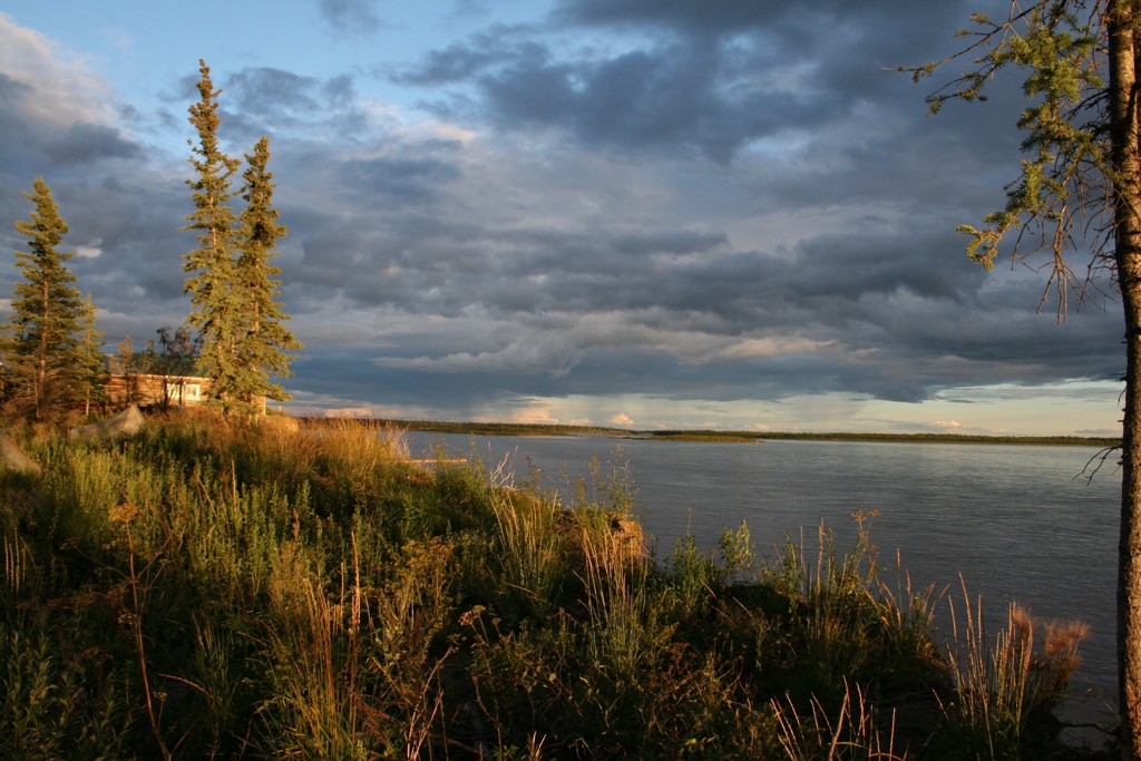
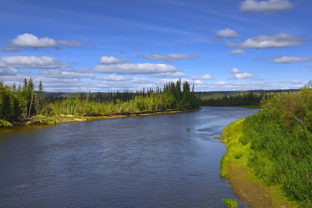
Over 6.5 million acres (2.6 million hectares) of Yukon Flats National Wildlife Refuge sits in the Yukon Flats with the remainder of the refuge located along the slopes of the Brooks Range and White Mountains. The Yukon Flats are an immense basin that includes wetlands, forests, marshes, bogs, over 300 miles (480 km) of the Yukon River, tens of thousands of lakes, and countless creeks and streams.
The refuge has a continental subarctic climate that has considerable seasonal extremes in temperature and daylight. While winter days can pass in complete darkness and temperature may reach -70o F (-56o C), the summer days will have 24 hours of daylight and may reach 100o F (37o C).
The refuge has only 13 resident bird species, such as chickadees, spruce grouse, and great gray owls However, the immense riparian areas attract over 130 migratory species of birds, including over one million ducks that arrive annually from across the world.
The lakes, streams, and rivers are also home to 18 fish species, including coho, chum, and chinook salmon which travel 2,000 mi (3,200 km) from the ocean to their spawning areas. Other species include burbot, Arctic grayling, northern pike, and whitefish.
River otters, beavers, and muskrats also inhabit the waters of the Yukon National Wildlife Refuge. Grizzly and black bears, moose, mule deer, caribou, Dall sheep, wolves are found across the flats, in the forests, and upon the mountains. The Dall’s sheep are only a relatively small herd of about 400 sheep that live in the White Mountains.
The refuge contains wetland, forest, river, and meadow habitats for the flora and fauna. The forests of the refuge are primarily composed of spruce, birch, and aspen carpet the slopes and line the shores of the wetlands.
The Yukon Flats National Wildlife Refuge is in the traditional territory of the Gwich’in, who have had a long presence in the region. The Gwich’in are an Athabaskan speaking people whose territory encompasses eastern Alaska and parts of Yukon and Northwest Territories in Canada.
While most of the indigenous population of the Yukon Flats region live in the towns and cities, there are still many that live a subsistence lifestyle out in the Alaskan wilderness. Gwich’in are known for their intricate beadwork, snowshoes, birchbark canoes, and their two-way sled. Even though many of the Gwich’in live in settlements, their economy still includes hunting and fishing.
Occupation of Alaska may have been among the first occupations of North America, with paleolithic people arriving between 40,000 and 15,000 years ago. The first people to inhabit the northern reaches of North America are believed to have traveled across the Bering Land Bridge that was exposed at the end of the Pleistocene.
It is believed that the ancestors of the Athabaskan were among the first to arrive in North America, as much as 40,000 years ago. The Navajo and Apache of the southwest United States are part of the Athabaskan language group despite their immense geographical separation from their cousins in Alaska.
The Alaskan Athabaskan people had originally settled west of their current territory, along the coast; however, the Tlingit pushed them west in prehistoric times. The Athabaskan people expanded east into the territory of the Inuit, to lay claim to the subarctic interior of Alaska.
The ancestors of the Gwich’in were traditionally a nomadic people that traveled through their territory as part of a seasonal round. The seasonal round was a predictable route that led the indigenous people through seasonal hunting grounds, fishing areas, and areas to gather other food and resources in preparation for the winter in their semi-permanent winter villages.
The Russians were the first to encounter the indigenous population of Alaska during their quests of exploration and the fur trade. The 1700 and 1800s were a time of European expansion and exploration into Alaska. During this time many atrocities were committed against and by the native populations, such as pandemics, enslavement, and massacres.
In 1847, Alexander Murray established the first major settlement upon the Yukon Flats that still exists. Fort Yukon was established as a trading post for the Hudson’s Bay Company. The Hudson’s Bay Traders continued to trade at the fort until 1869, when they were expelled following the Alaska Purchase, and the Alaska Commercial Company took over the fort.
There are still several hundred people that live in the wilderness areas in and around the Yukon Flats National Wildlife Refuge. Furthermore, Fort Yukon, which is adjacent to the protected areas of the refuge has become a minor tourist destination form where excursions into the vast Yukon Flats can begin.
There is no road access to Yukon Flats Wildlife Refuge and most visitors take commercial flights from Fairbanks to one of the six villages within the reserve, with Yukon Flats being the largest and most central. Charter services are also available to access remote areas of the park from Fairbanks and Fort Yukon.
There are no public facilities or public use cabins in the refuge; however, the vast wilderness is open to backcountry camping. Boaters can also access the park via the Yukon River, Porcupine River, Sheenjek River, and Beaver Creek. Float trips are one of the most popular ways to explore the wildlife refuge.
A popular float follows Upper Beaver Creek from a put in spot off of Nome Creek Road and the 110 mi (176 km) trip ends at the refuge boundary at Victoria Creek. This route typically takes 7-10 days; however, the trip can be extended another week or two and 268 mi (428 km) by connecting with the Yukon River and taking out at the Dalton Highway Bridge.
Other popular activities in the refuge are camping, fishing, hiking, hunting, gold panning, wildlife viewing, and photography. The refuge is a massive wilderness area and visitors need to be self-sufficient and prepared to handle their own emergencies.
In addition to Fairbanks, which is about 150 mi (250 km) south of the refuge, Yukon Flats National Wildlife Refuge encompasses several small communities that provide basic services to visitors of the area. The following are descriptions of the major cities of the region.
Fort Yukon was established in 1847 by the Hudson’s Bay Company as the British Company expanded their trade to the west. In 1869, two years after the Alaska Purchase, Fort Yukon was determined to be in American territory and the Hudson’s Bay Company was evicted and the Alaska Commercial Company took over operation of the fort and settlement.
The current population of the community is around 600 people, who are primarily of Athabaskan heritage. Since its establishment, the remote northern community has been part of the fur trade, a whaling boom on the Arctic coast, and the Klondike gold rush. Many of the inhabitants of the city are still reliant on the fur trade for their livelihoods.
Access to the city is primarily by commercial aircraft from Fairbanks; however, the Yukon River provides popular summer access to the community. The city is the most popular of the region’s communities for their guiding and outfitting services.
From Fort Yukon you may take a charter flight to the remote corners of the refuge for hunting, fishing, or backpacking. Air taxi operators also offer flightseeing tours of the refuge to spot caribou and admire the northern landscape.
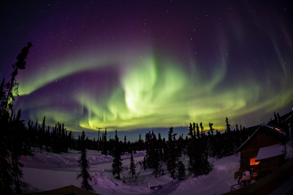
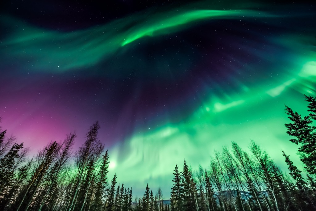
With its proximity to Fairbanks, many people take a day trip to Fort Yukon so that they may cross the Arctic Circle. The open terrain surrounding the city also makes it a wonderful location to view the northern lights. Other attractions in the city include the Episcopal Church which was built in 1899 and a replica of the original fort built by Hudson’s Bay Company.
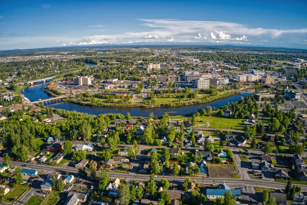
Fairbanks is the second largest city population center in Alaska with over 100,000 people inhabiting the city and area. The city is renowned for the northern lights and the midnight sun as well as being the basecamp for Denali National Park and Preserve and other locations in the interior and Arctic.
Being located so far in the north, winter is more a lifestyle than a season, and the locals have many winter related activities. Some of the winter activities include viewing the aurora borealis, skiing, snowmobiling, snowshoeing, dog sledding, ice fishing, sledding and tubing, ice hockey, and skating.
Other activities around the city include gold panning, visiting the museums, birding and wildlife viewing, canoeing and kayaking, and fishing. There are also several annual events that may coincide with your visit, such as Golden Day, Tanana Valley State Fair, World Ice Art Championships, Yukon Quest International Sled Dog Race, and many summer solstice events that take advantage of the midnight sun.
There is a metropolitan downtown in Fairbanks that offers many cultural experiences; however, most visitors seem to come to the city to explore further into the arctic wilderness. There are snowmobiling and dog sledding tours that take visitors into the wilderness. Other popular adventures include flying above the Arctic Circle on a flightseeing tour.
Some of the nearby wilderness areas that are more easily accessible are the Chena Hot Springs, Chena River State Recreation Area, and Denali National Park and Preserve. Yukon Flats National Wildlife Refuge is 145 mi (232 km) north of Fairbanks and Arctic National Wildlife Refuge is a little further north.