Scan the QR code and open PeakVisor on your phone
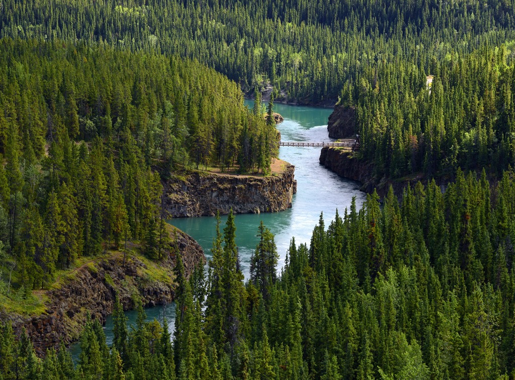
Vuntut National Park is in the northwestern corner of Yukon, Canada. The park encompasses 4,345 square kilometers (1,667 square miles) of rolling hills and internationally significant wetlands. There are 5 named peaks in the park of which Ammerman Mountain (1,045 m/3,428 ft) is the tallest and Mount Clement (962 m/3,156 ft) is the most prominent.
Situated in the northwest corner of Yukon, Canada, Vuntut National Park preserves 4,345 square kilometers (1,667 square miles) of the traditional territory of the Vuntut Gwitchin First Nation. The park is part of the Old Crow Flats Special Management Area which is Yukon’s most significant wetlands and they also have international significance.
Vuntut National Park is divided between the wetlands of the Old Crow Flats in the south and the rolling hills of the north. Of the five named peaks in the park Ammerman Mountain (1,045 m/3,428 ft) is the tallest and Mount Clement (962 m/3,156 ft) is the most prominent with 481 m (1,578 ft) of prominence.
The park shares borders with Ivvavik National Park to the north and the Arctic National Wildlife Refuge to the west in Alaska, USA. The following are some of the nearby significant parks and wilderness areas:
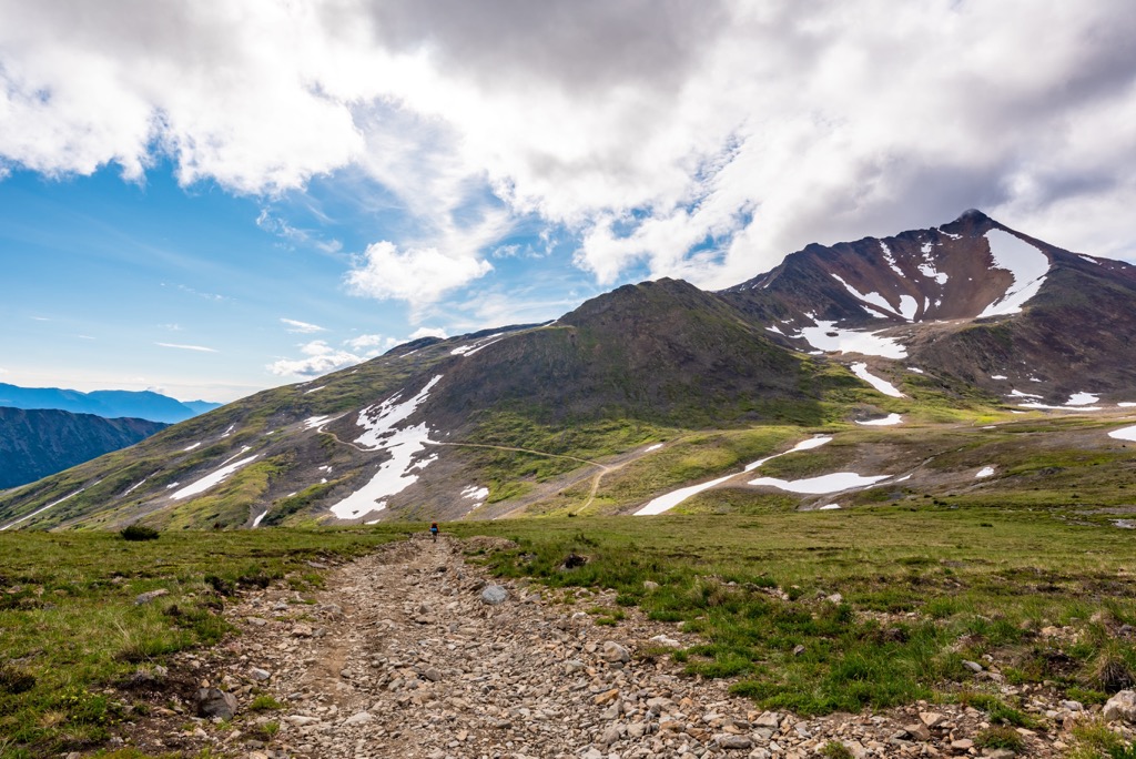
The British Mountains are the primary mountain range of the park which are considered to be part of the Brooks Range that spans northern Alaska and Yukon. The Old Crow Range is adjacent to the southern border of the park and the Romanzof Mountains are located to the west.
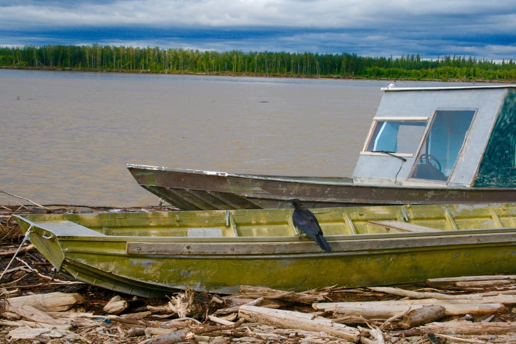
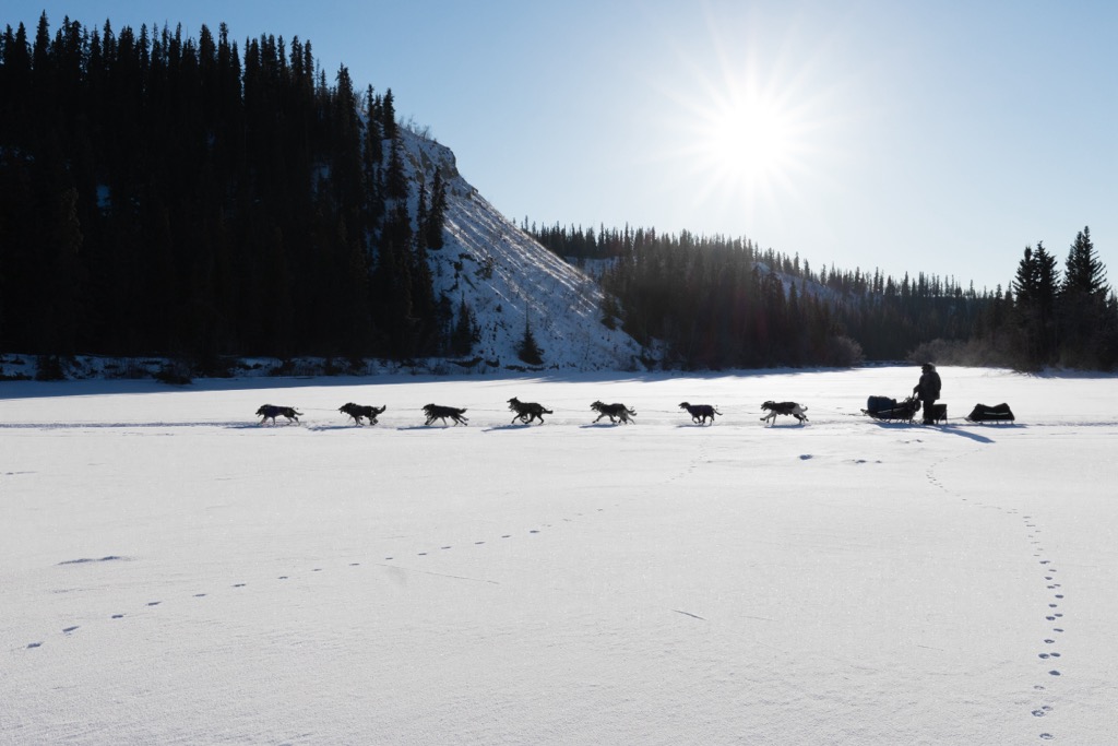
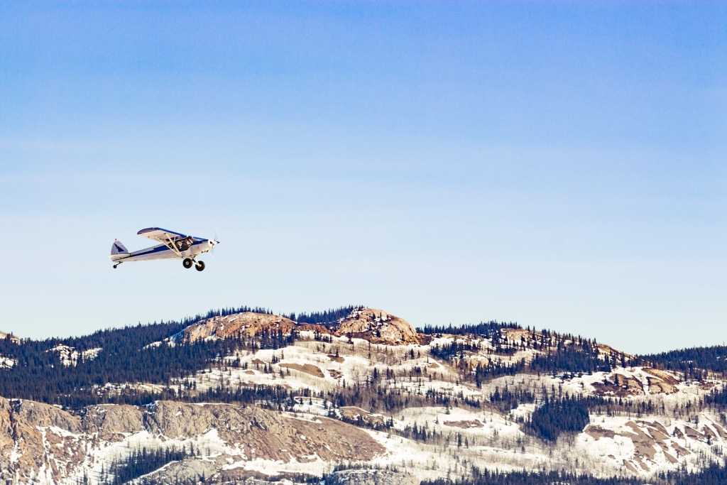
The park is difficult to reach and may receive only 25 official visitors per year. Most visitors arrive in the park by boat or plane in the summer and in the winter by plane or overland transport such as dog sleds or snow machines.
There are no facilities or official trails in the park. The park is open year-round and visitors must obtain a permit for backcountry camping.
Vuntut National Park is made of two contrasting regions which are the Old Crow Flats and wetlands and the foothills and peaks of the British Mountains. The wetland covers the southern third of the park while the foothills and mountains cover the northern area of the park.
The British Mountains, which rise above the Old Crow Flats, are the eastern extension of Alaska’s Brooks Range. Mainly composed of sediments that accumulated along the continental margin, the bedrock is part of the Arctic-Alaska terrane.

The mountains are mainly composed of layers of limestone and sandstone which settled along the continental margin from marine and terrestrial sources. The mountains contain many folded and faulted structural blocks that likely uplifted during the early Cenozoic.
While the park is near the Arctic Circle, the British Mountains are unique for their nearly glacier free peaks. The topography of most of the mountains of southern Canada was created by glaciers and the Pleistocene ice sheet that covered most of Canada; however, the British Mountains were unaffected by the Laurentide Ice Sheet that covered most of Canada.
The maximum extent of the ice sheet is some kilometers south of the park at McDougall Pass in the Richardson Mountains. Aside from the cirques found at local glacier sites, the topography of the park was largely formed through the erosional forces of wind, rain, and water. Additional features are created by the permafrost and the frost shattering of surface rocks.
The Old Crow Flats were also not glaciated during the Wisconsin glacial stage; however, the Laurentide Ice Sheet blocked the drainage of the area several times, creating Glacial Lake Old Crow. Glacial Lake Old Crow existed at several times during the Pleistocene and is responsible for depositing over 10 m (30 ft) of silts and clays over the basin’s layers of thick sands and silts.
The glacial lake finally drained to the west about 15,000 years ago, creating the current drainage of the Porcupine River. It is believed that some of the present-day lakes that dot Old Crow Flats are remnants of Glacial Lake Old Crow; however, most of the lakes are more modern Holocene aged thermokarst lakes.
There are over 2,500 thermokarst lakes in Old Crow Flats, with many of them in the borders of Vuntut National Park. Thermokarst lakes form as ice-rich permafrost thaws which leads to the subsequent settling of the ground and a depression where water accumulates.
The wetlands of the Old Crow Flats are always changing because thermokarst lakes have a cycle of expansion and drainage followed by permafrost recovery and finally the formation of new lakes. Drained lake basins are a feature of the park and when they have deeply incised outlets, it is suggested that a rather sudden and catastrophic drainage occurred.
As previously mentioned, Vuntut National Park is divided into the foothills and peaks of the British Mountains in the north and the wetlands of Old Crow Flats in the south. While adjacent to each other and sharing some flora and fauna, these ecosystems are quite distinct.
Rocky tundra dominates the higher elevations and grassy tundra sweeps across the broad slopes and valleys. Sparse forests dot the landscape, and they are typically open stands of white spruce with ground cover of dwarf birch, willow, cotton grass, lichen, moss, black spruce, and tamarack. Wetlands filled with shallow lakes and creeks dominate the lowest elevations along the southern part of the park.
In general, Old Crow Flats is in the forest-tundra transition of northern Yukon and there is a mosaic of water, forest, and tundra. The landscape is incised by the meandering rivers and the region has long been a refuge for Arctic wildlife.
Indeed, the Old Crow Flats have supported many diverse wildlife since the Pleistocene. There is fossil evidence of short-faced skunks, hyena, giant moose, American lions, mammoths, mastodons, giant beavers, ground sloths, large camels, giant pica, horses, giant bison, short-faced bears, and many other prehistoric animals in and near the flats. Some of these finds were considered highly unusual for such a northerly location.
In modern times, the Old Crow Flats are recognized as an internationally important wetland and area for birds. An estimated 500,000 waterfowl use the wetlands annually as a place to breed, molt, and stage their fall migrations. Peregrine falcons, gyrfalcons, and golden eagles are some of the larger and noteworthy birds that inhabit the park.
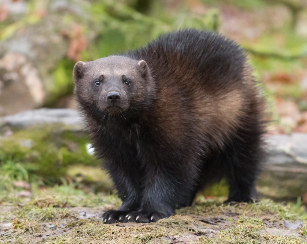
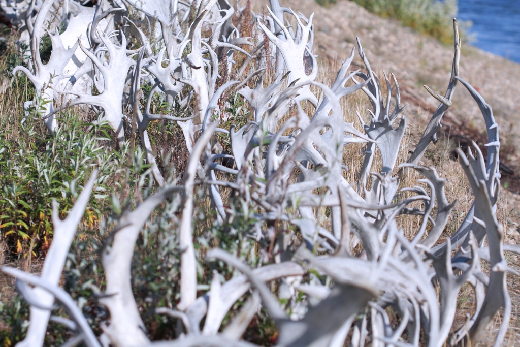
The flats and park are also inhabited by muskrats, moose, black bears, grizzly bears, muskoxen, martens, minks, wolverines, lynx, foxes, and wolves. The flats and park are also part of the range of the Porcupine Caribou Herd and grizzly bears, wolves, and wolverines tend to closely follow the herd.
Yukon is home to some of the earliest evidence of human habitation in Canada and North America. South of Vuntut National Park and the community of Old Crow are the Bluefish Caves which have evidence of human habitation and occupation as early as 24,000 years ago.
Furthermore, in Old Crow Flats mammoth bones may indicate human presence as early as 25,000 to 40,000 years ago. Researchers have discovered mammoth bones in the flats that are broken in distinctive ways that may be from human butchery and tool production. Some of these bones were radiocarbon dated to be as old as 40,000 years and may be among the oldest artifacts in Canada.
Significant evidence indicates human occupation and habitation of the area in and around Vuntut National Park indicates a significant human presence after 12,000 years ago, which also coincides with the final draining of Glacial Lake Old Crow.
There are over 120 formally recorded archaeological sites in the park which consist of stone-tool manufacturing sites, seasonal campsites, game lookouts, and caribou fences. The caribou fences are of particular cultural value to the Vuntut Gwitchin First Nation.
The fences were used by specific family groups from Old Crow and represent technology and an economy that was once common throughout the western subarctic. Parks Canada maintains a small collection of artifacts from the park and the University of Alberta manages a larger collection of artifacts for study.
Vuntut National Park is part of the traditional homeland of the Vuntut Gwitchin, where it is believed they have lived in and utilized the resources of the area for thousands of years. They traditionally followed a seasonal round of hunting and gathering across the region.
During the spring the Vuntut Gwitchin harvested muskrats in Van tat and hunted caribou along the Porcupine River. The summer was typically filled with fishing along the Old Crow River and its many tributaries. Autumn saw the caribou fences used for their final hunts before they made way to their settlements in the sheltered valleys south of the park.
The land and resources of Vuntut National Park, and especially the Old Crow Flats are still used by the Vuntut Gwitchin. Most families have access to a camp or cabin outside of town from where they hunt moose, caribou, waterfowl, and small animals. Berry picking, gathering other plants for food and cultural purposes, and gathering firewood are common activities for the Vuntut Gwitchin.
Vuntut National Park was established in 1995 as part of the Vuntut Gwitchin First Nation Final Agreement. The park is cooperatively managed by the Vuntut Gwitchin Government, Parks Canada, and the North Yukon Renewable Resources Council.
The park was created to conserve, protect, and present a portion of the North Yukon Natural Region. It was also created to recognize Vuntut Gwitchin history and culture of the area, and to protect the current traditional use of the park by the Vuntut Gwitchin. Indeed, regular visits to Van Tat and Old Crow Flats are a priority for many families and the local schools.
The Vuntut Gwitchin have been inextricably tied to the land for generations and have worked to maintain a balance between their needs and the maintenance of the land and resources. The Vuntut Gwitchin Government and individuals remain committed to maintaining the health of the land while they continue to practice subsistence harvesting and their cultural practices.
Aside from the locals that live in and around the community of Old Crow, there are very few visitors to Vuntut National Park. Mainly due to the difficulty of arriving at the park, the region remains much in the same state as it has for over 10,000 years.
While the Vuntut Gwitchin can hunt and gather from their traditional lands, which are part of the park, those are activities that are reserved for them according to their traditional rights. Most visitors to the park go for the hiking, camping, canoeing, kayaking, dog-sledding, wildlife viewing, and photography opportunities that are available.
Motorized access is by air, guided snowmobile trips, or bots, which can reach the park at times of high water. Park staff are continuing to scout the park for landing sites for fixed-wing airplanes along the foothills and northern section of the park to make it more accessible for hikers.
Permits are required for all overnight visits to the park and visitors must register their arrival in the park and deregister when they leave. Such permits are are required required for all backcountry visits to the northern parks, which also includes Auyuittuq, Ivvavik, Nahanni, Aulavik, Quttinirpaaq, Sirmilik, and Tuktut Nogait, as the typical National Parks Pass is only valid for the southern parks.
There are no facilities in the park and visitors are required to submit their anticipated travel routes through the park to aid with search and rescue efforts.
Once visitors arrive at the park, they are in the traditional lands of the Vuntut Gwitchin. Whether paddling, hiking, cross-country skiing, or dogsledding, visitors to this park have a unique opportunity to connect with this remote wilderness and adventure where very few people have ever traveled.
Located in the north end of Yukon, Vuntut National Park is one of Canada’s remote northern parks. The park typically receives very few visitors; however, those that make the effort are rewarded with an experience of a lifetime. The following are the major cities and nearby communities to Vuntut National Park.
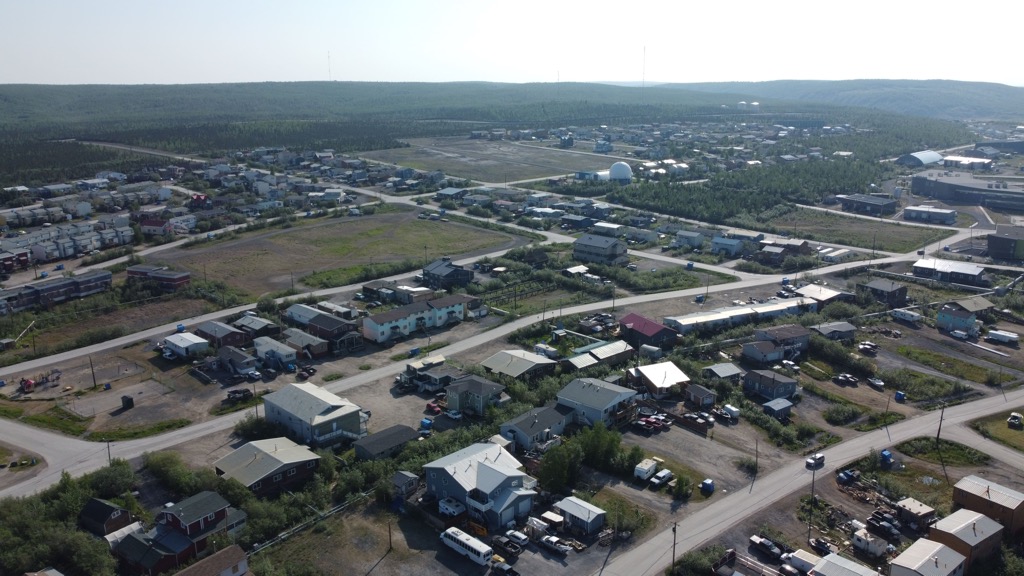
Old Crow is the closest community to Vuntut National Park, about 50 km (30 mi) by plane or 190 km (114 mi) by river. Many families from Old Crow have camps or cabins in or near the park where they visit annually to participate in traditional activities like hunting, trapping, fishing, and berry picking.
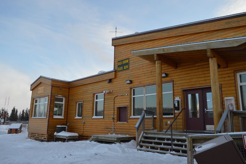
There are about 300 people that inhabit Old Crow, which is the most northerly and the most isolated community in Yukon. The community has interpretive displays pertaining to Vuntut National Park which can be found at the John Tizya Centre.
Visitors to Vuntut National Park are encouraged to supply themselves before arriving at Old Crow, as there are limited resources in the town. The community does have a general store and there are several options for accommodation; however, it should be noted that some of these are seasonal.
Until 2017, Inuvik was the most northerly town in Canada you could drive to when the road to nearby Tuktoyaktuk opened. The community was established in 1953 as an administrative center for the surrounding region.
The community is located in Northwest Territories about 250 km (150 mi) east of Vuntut National Park. Inuvik is connected to the rest of Canada by the famous Dempster Highway and there is a regional airport that receives flights from surrounding major cities and where scheduled flights leave for Old Crow, where most Vuntut excursions begin.
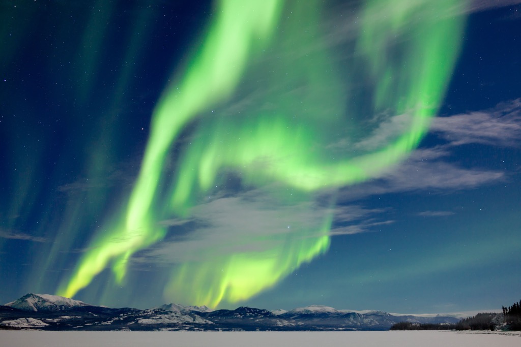
Located above the Arctic Circle, the community has some unique opportunities such as golfing 24 hours a day in the summer or watching the incredible aurora borealis in the winter. Other activities include hiking the Boot Lake Trail, skiing at the Ski Club, or fishing the Mackenzie River by boat or ice.
Inuvik is the gateway to the mountainous Ivvavik National Park, Aulavik National Park on Banks Island, as well as Tuktut Nogait National Park on the coast of the western Arctic. These parks see very few visitors; however, they provide for an incredible experience in the northern wilderness.