
Scan the QR code and open PeakVisor on your phone
Ivvavik National Park is in the northwest corner of Yukon, Canada. The remote, northern park is the first national park in Canada to be created as a result of an Indigenous land claim agreement. It has 8 named peaks, of which the tallest and most prominent is Arthur Laing Peak (1,764 m/5,787 ft).
Within the Inuvialuit Settlement Region (Inuvialuit Nunangit Sannaiqtuaq), Ivvavik National Park is in the homeland of the Inuvialuit. While the Inuvialuit homeland encompasses the Arctic coast and islands of the Northwest Territories and Yukon in northwestern Canada, Ivvavik National Park is located in the northwest corner of Yukon.
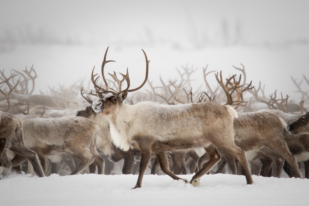
Originally named Northern Yukon National Park, the name of the park was changed in 1992 to Ivvavik National Park. In Inuvialuktun, Ivvavik means “birthplace” or “nursery” in reference to the important calving area for porcupine caribou it encompasses.
The tallest mountain in the region is Arthur Laing Peak at 1,764 m (5,787 ft) in elevation, which is part of the British Mountains. The British Mountains are a subrange of the Brooks Range, which covers the northern tip of Yukon and the northern part of Alaska.
Vuntut National Park borders the south end of Ivvavik National Park and the following are some of the other notable, nearby wilderness areas:
The majority of Ivvavik National Park is within the British Mountains, which are the eastern extension of Alaska’s Brooks Range. The bedrock is part of the Arctic-Alaska terrane and is mainly composed of sediments that accumulated along the continental margin.
The mountains contain many folded and faulted structural blocks that likely uplifted during the early Cenozoic. The mountains are mainly composed of layers of limestone and sandstone.
While the park is near the Arctic Circle, the British Mountains are unique for their nearly glacier free peaks. In general, the British Mountains appear to have been unaffected by the Laurentide Ice Sheet that covered most of Canada. The maximum extent of the ice sheet is some kilometers south of the park at McDougall Pass in the Richardson Mountains.
Most of the Canadian mountain ranges were scoured by the continental and cordilleran ice sheets during the Pleistocene, creating their current topography. However, the British Mountains of Ivvavik National Park only had localized glaciers which were formed at the headwater of Malcolm River.
Aside from the cirques found at local glacier sites, the topography of the park was largely formed through the erosional forces of wind, rain, and water. Additional features are created by the permafrost and the frost shattering of surface rocks.
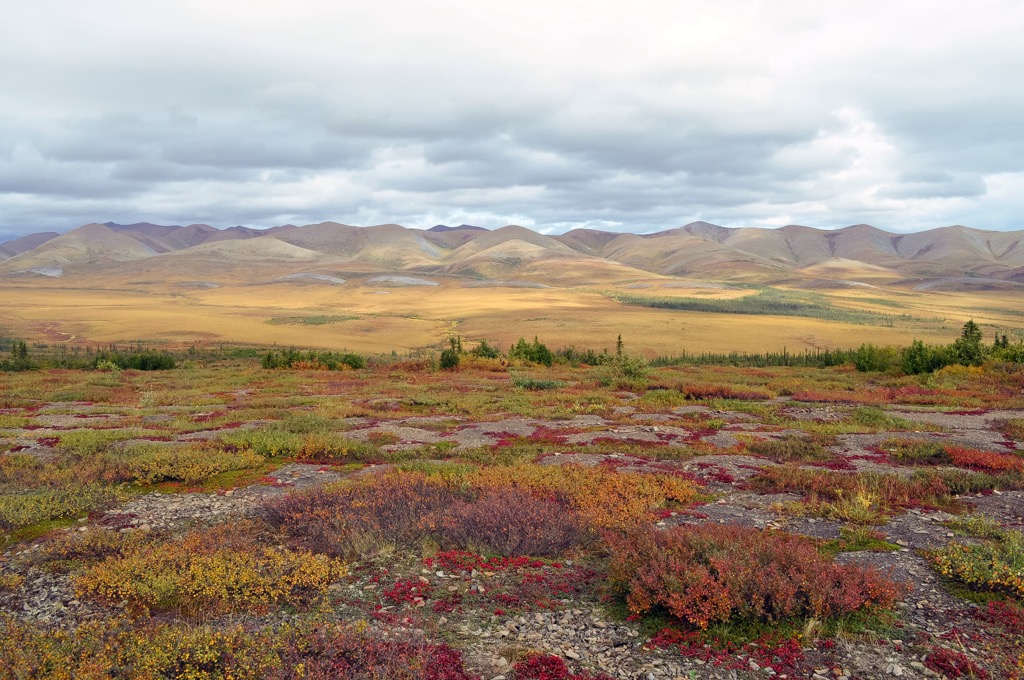
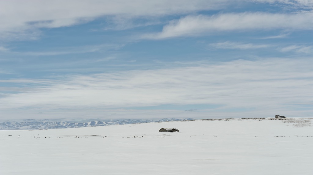
Shrub tundra dominate Ivvavik National Park, with the tree line in the north end of the park not exceeding 300 m (984 ft). While the park may seem bleak and expansive, there is a great diversity of flora and fauna that make their home in these far northern reaches.
Dwarf willow and lichen cling to ridges where there is otherwise sparse vegetation. Low shrub and heath tundra dominate the upper and middle slopes of the park while communities of sedge tussock grow on the lower slopes.
Along creeks and rivers, thickets of shrubs are common; however, trees are limited to the slopes of low river valleys that have favorable aspects.
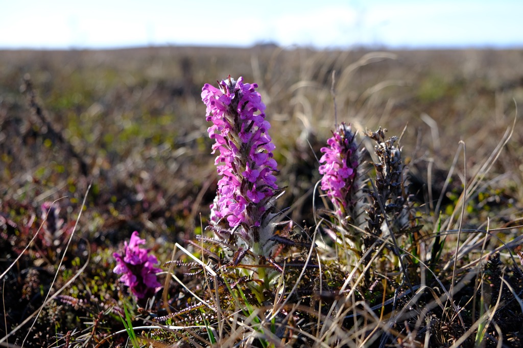
Of interesting note, since most of the area was not glaciated, the vegetation is reflective of the underlying soils and bedrock. For example, shrub willow typically grows on shale and sandstone; whereas, wildflowers, and a dryas-sedge community is more typical on calcareous rocks such as limestone.
One of the main purposes of the park is to preserve the calving grounds for the Porcupine barren-ground caribou. Caribou use the windy mountain ridges to gain relief from the many biting insects that inhabit the tundra.
Some of the other mammals present in the park are Dall Sheep which are at their northern limit, seasonal moose that keep to the low-lying riparian areas, grizzly bears, and wolverines which are dependent upon caribou for their food. Some other notable mammals to look for are singing vole colonies and varying lemmings.
The barren uplands are used by many birds as a primary breeding ground. Some of the birds that you may see while visiting the park are the surfbird, Baird’s sandpipers, hoary redpolls, horned larks, northern wheatears, and gray-crowned rosy finch.
Rock ptarmigan, whimbrel, long-tailed Jaeger are some of the birds that live among the sedge tussock. While the shrubby tundra is preferred by common redpoll, northern shrike, willow ptarmigan, and many more.
The scattered forests provide habitat for gray jay, Townsend’s Solitaire, the fox sparrow and several others. The cliffs and canyon walls are inhabited by raptors such as the golden eagle, peregrine falcon, the gyrfalcon, and others while harlequin ducks, warblers, red-throated swan, tundra swan and other prefer the lakes and waterways.
The human history of Ivvavik National Park possibly extends back into the Pleistocene when glaciers covered most of North America. However, the British Mountains remained unglaciated as part of the Beringia corridor.
The ancient Beringia corridor is speculated as one of the routes that people took from Asia to populate parts of North America. The park is part of the traditional territory of the Inuvialuit, who have hunted, fished, and traded in the region for thousands of years.
However, the Inuvialuit were likely not the first inhabitants of the Canadian north. Sites like the Engigstciak site show evidence of a long and nearly continuous occupation of the north and includes artifacts that are likely from the original paleo-Eskimos that first traveled the north coast.
Furthermore, Ivvavik National Park contains other archeological sites, such as the first sites where Thule Eskimo remains were found and ancient caribou fences that were once used for hunting. The Inuvialuit are descendants of the Thule, who migrated from the region from what is now the state of Alaska.
By the eighteenth century, the Inuvialuit were divided into eight territorial groups that were each associated with a primary winter village. At the winter village, the Inuvialuit lived in sod-driftwood houses and were sustained by their winter stores until they could leave for whaling, caribou hunting, fishing, and other harvesting activities during the summer months.
After the arrival of Europeans during the nineteenth and twentieth centuries, the Inuvialuit were active in the fur trade economy. Many Inuvialuit trapped and traded Arctic foxes with the Hudson’s Bay Company. Later, American whaling in the region stimulated an influx of people to the Yukon North Slope until the market for bowhead baleen whales crashed in 1907.
As was the case with many of Indigenous communities across Canada and the United States, the European fur trade and whaling industries that brought economic prosperity also brought epidemics of measles and smallpox as well as violence, forced labor, and forced assimilation in residential schools. All of this has led to the loss of life and language among many Inuvialuit as well as intergenerational trauma in many Inuit, First Nations, and Métis communities.
The fur trade was particularly prosperous in the North and many Inuvialuit trappers made a good living by trading with the furs of Arctic fox, muskrat, and mink. The trade continued until about the 1930s when the fur trade collapsed during the Great Depression.
That said, the many Inuvialuit are still active in the fur trade today. However, the establishment of residential schools, restrictions on the fur trade, and the advent of Arctic oil and gas expiration in recent decades, have fundamentally changed life in the North.
The Inuvialuit Settlement Region was designated in 1984 with the signing of the Inuvialuit Final Agreement by the Inuvialuit and the Government of Canada. At the same time, the Inuvialuit Regional Corporation was established to manage the lands and financial compensation owed to the Inuvialuit as part of the agreement.
Ivvavik National Park is the result of the Final Agreement and while there are very few visitors to the park it is still an important cultural area where traditional pursuits like hunting, fishing, gathering with family, and berry picking take place.
The remote northern park, which is centered upon the Firth River, is home to incredible scenery, culture, and adventure.
Ivvavik National Park is located along the Arctic coast of Yukon, in Canada’s north. The park contains the peaks of the British Mountains, which merge into Alaska’s Brooks Range. The Firth River, which is the oldest river in Canada, flows through mountains, canyons, and tundra of the park toward the Arctic Ocean.
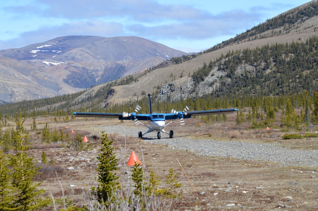
The park is remote and access is limited to air transport from Inuvik. From here, you can venture to “base camp,” which has outfitters tents and catering at the cook tent.
Some of the activities in the park include backpacking through the vast Arctic landscape, hiking one of the seven routes from the basecamp, rafting the Firth River to the Arctic Ocean, and meeting and speaking with locals to learn their history and the history of the land.
The Firth River is considered one of the world’s greatest rafting rivers. The headwaters pour from aufeis formations and flow through incredible canyons before forming a massive delta as it enters the Beaufort Sea.
The following are the major communities located near Ivvavik National Park.
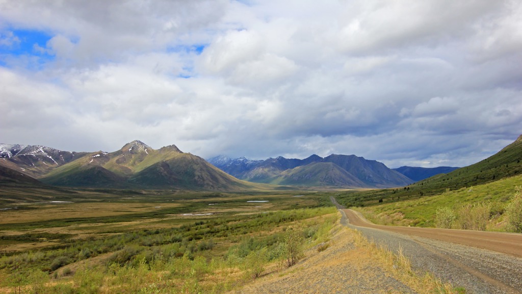
Created in 1953 as an administrative center for the surrounding region, Inuvik was the most northerly town in Canada you could drive to until 2017 when the road to nearby Tuktoyaktuk opened. Inuvik is about 250 km (150 mi) east of Ivvavik National Park and is the base of most charter planer operations into the park
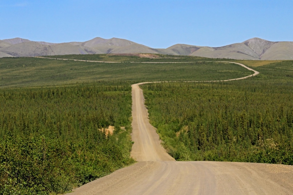
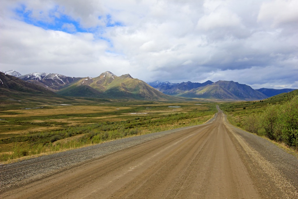
The community is located in the northwest of the Northwest Territories and it is connected to the rest of Canada by the famous Dempster Highway. Inuvik also has a regional airport that receives flights from surrounding major cities.
Some of the primary activities in and around Inuvik include hiking the Boot Lake Trail, skiing at the Ski Club, fishing the Mackenzie River by boat or ice, or golfing 24 hours a day under the midnight sun. Inuvik is the gateway to the mountainous Ivvavik National Park, Aulavik National Park on Banks Island, as well as Tuktut Nogait National Park on the coast of the western Arctic.
Tuktoyaktuk is located on the shores of Kugmallit Bay, near the Mackenzie River Delta. The town is situated at the Arctic tree line and is the most northerly town in Canada that you can drive to on a four-season road. The community is about 250 km (150 mi) east of Ivvavik National Park.
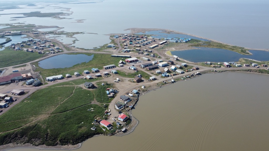
Usually referred to as ‘Tuk,’ the area has been occupied since time immemorial by the Inuit and has the historical distinction of being the first place in Canada to revert to an Indigenous name. The village is small and many people who live in the community are subsistence hunters and anglers, though many community members work in tourism or transportation, too.
Some of the attractions around Tuktoyaktuk include viewing the pingos, dipping a foot into the chilly Arctic Ocean, visiting the Lady of Lourdes ship, and learning about this link to the rest of the world and the role it played in local history. Tuk is not on the way to Ivvavik; however, if you’ve made it to Yukon and Northwest Territories, it would be a shame to not tick this one off your bucket list.


