
Scan the QR code and open PeakVisor on your phone
Arctic National Wildlife Refuge has 89 named peaks. The highest is Mount Chamberlin at 2,749 m. Other notable peaks include Mount Isto, Mount Michelson and Mount Hubley.
The Arctic National Wildlife Refuge is a protected region located in the northeastern part of the US state of Alaska. It is the largest national wildlife refuge in the entire country. There are 89 named peaks in the Arctic National Wildlife Refuge. The highest and most prominent of which is Mount Chamberlin (9,019 ft/2,749 m).
The Arctic National Wildlife Refuge is situated in northeastern Alaska and spans 19.6 million acres (7,921,800 ha), making it the biggest contiguous publicly owned area of land in the country.
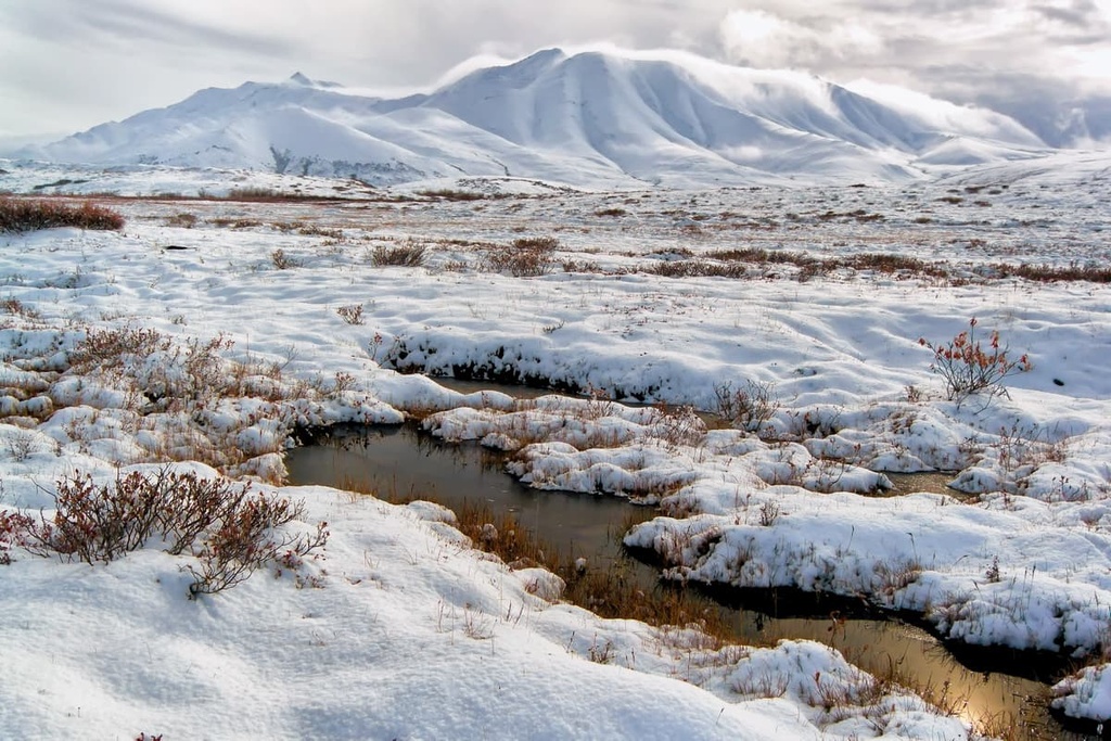
This rugged and remote wildlife refuge features a diverse array of landscapes. The northern stretches of the refuge include the barrier islands, river deltas, salt marshes, and coastal lagoons. These landscapes are all part of the Arctic coastal tundra region.
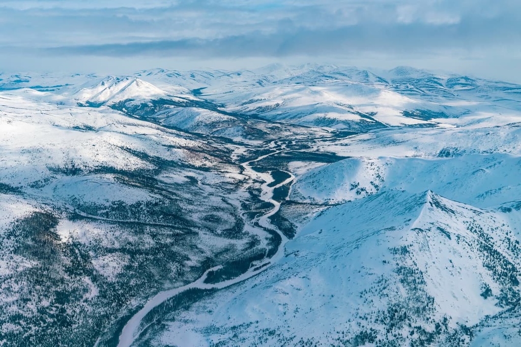
Here, this rather barren landscape travels inward until it reaches the foothills of the Brooks Range. These gentle foothills feature rolling slopes and numerous rivers that flow north into the ocean, along with seemingly countless small lakes.
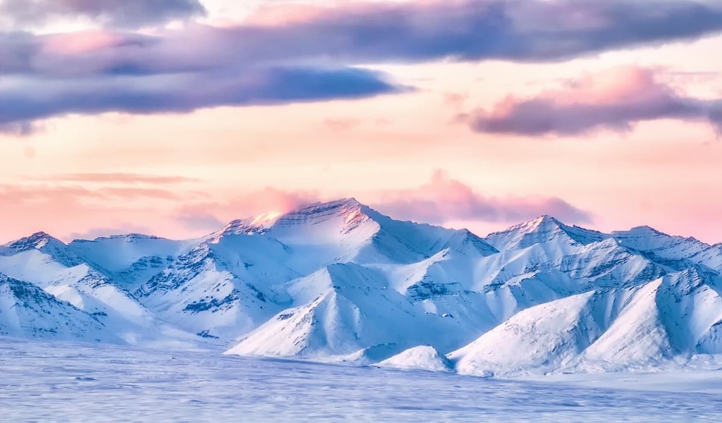
The Brooks Range runs through the bulk of refuge, which lies entirely above the Arctic Circle. Within the range, the peaks rise steeply from the foothills up to the tallest peak, Mount Chamberlin. These rugged and remote peaks mark the northernmost stretches of the Rocky Mountains.
Deep river valleys cut across the mountainous landscape of the refuge, and they serve as the headwaters for numerous rivers. Some rivers from the Brooks Range flow northward into the Arctic Ocean while others flow south to join the Yukon River.
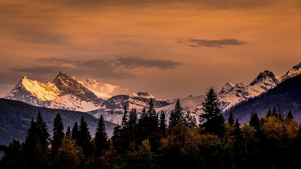
The southern region of the refuge is home to a boreal forest, which is part of the larger Interior Alaska–Yukon lowland taiga. In the north, the region’s thin forest becomes denser as it travels south toward the Yukon River. The forested region features wetlands and south-flowing rivers.
The Arctic National Wildlife Refuge is located near numerous other forests and protected regions. These include the rest of the Gates of the Arctic National Preserve and Wilderness, which lie to the west, the Yukon Flats National Wildlife Refuge to the south, and the Ivvavik and Vuntut National Parks to the east in Canada.
The Brooks Range cuts across the center of the Arctic National Wildlife Refuge in an east to west fashion. These peaks are the northernmost subrange of the greater Rocky Mountains. The range includes land outside of the refuge, too, as it runs for about 700 miles (1,100 km) throughout Alaska and into Canada’s Yukon Territory.
The towering peaks of the Brooks Range were once part of an ancient seabed, and marine fossils can still be found in the range. The central Brooks Range, in the western portion of the refuge, has fossils dating back to the Cambrian.
The central portion of the refuge lies along a fold and thrust belt, which formed the peaks during the Mesozoic. The peaks in the Brooks Range were uplifted when the Arctic Alaska terrane collided with the oceanic Angayucham terrain. Igneous and metamorphic rock from the Precambrian can be found throughout the refuge and much of northern Alaska.
The polar desert that lies to the north of the Brooks Range began forming around 66 million years ago. Over the course of millions of years, the terrain was shaped into desolate sand dunes.
Additionally, the Brooks Range was covered in glaciers numerous times over the past few million years. Glacial retreat further carved out the landscape, leaving behind the river valleys and glacial cirques that we see today.
Major peaks found within the Arctic National Wildlife Refuge include Mount Chamberlin, Mount Isto, Cloud Peak, Mount Salisbury, Mount Greenough, and Weasel Point.
A majority of the plant life can be found in the southern stretches of the refuge. Here, you can find a boreal forest consisting of both black and white spruce trees. However, the steep Brooks Range features minimal flora. Flora to the north of the range consists of mosses, sedges, and shrubs.
The Arctic National Wildlife Refuge is home to the most diverse collection of flora and fauna of all the protected areas above the Arctic Circle. In fact, six different ecoregions can be found in the refuge.
The coastal area in the north of the refuge is home to various migratory birds such as geese, swans, and sea ducks. This region is also home to populations of caribou, polar bears, muskoxen, and seals.
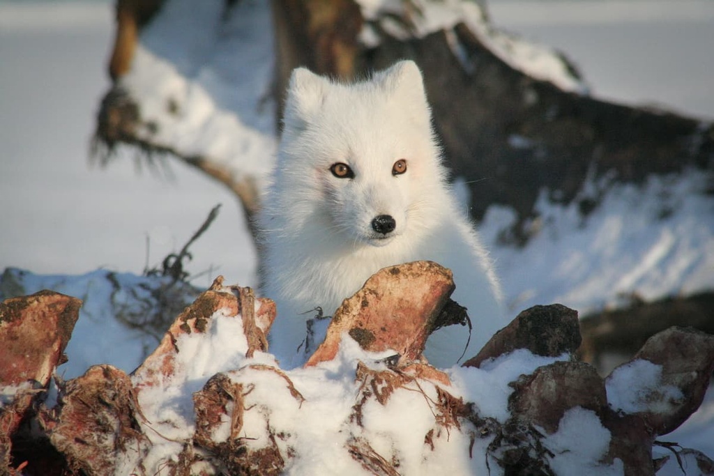
The mountainous portion of the refuge provides the ideal habitat for Dall sheep, Alaskan tundra wolves (Canis lupus tundrarum), grizzly bears, and muskoxen. To the south of the Brooks Range live populations of moose, red foxes, caribou, polar foxes, river otters, Canadian lynxes, beavers, black bears, wolverines, and minks.
Common bird species found in the refuge include golden eagles, gyrfalcons, peregrine falcons, red-breasted mergansers, and harlequin ducks.
Humans have inhabited the Arctic National Wildlife Refuge for thousands of years. Remnants of human settlements dating back 12,500 years lie just to the west of the refuge. Traces of the people of the Arctic Small Tool tradition (ASTt) can a;sp be found throughout much of the region.
Archaeological evidence shows that the towns within the refuge were settled as early as 4500 BCE. The region is part of the ancestral homelands of the Gwich’in people who call the region Iizhik Gwats’an Gwandaii Goodlit, which translates to “The Sacred Place Where Life Begins.”
The land that is now referred to as Northern Alaska is also part of the homelands of the Iñupiat and Inuit. These widespread communities have long relied on hunting caribou and whales to sustain themselves throughout the year. Though remote, this region has provided sustenance and nourishment to the people who have called the area home since time immemorial.
The National Wildlife Refuge System was established in 1903 by President Theodore Roosevelt. Shortly afterward, the Migratory Bird Treaty Act of 1918 was signed in order to further protect the wildlife of Alaska.
This region became a federally protected area in 1960. Since the creation of the wildlife refuge, whether or not to drill for oil in the region has been a political topic. Those against drilling want to further protect the rugged and remote ecosystems as well as the Indigenous people who call the area home.
Today, around 8 million acres (32,000 sq. km) are designated wilderness and there are currently no roads within, or leading to, the refuge. Two small communities are located in the area: the Iñupiat village of Kaktovik and the Gwich’in settlement of Arctic Village.
Beginning in the early twenty-first century, Kaktovik became a small tourist attraction for those wishing to see polar bears in their natural habitat
There are no designated trails within the Arctic National Wildlife Refuge. Those visiting the region may notice the seemingly endless network of game trails that cut across the landscape. Experienced hikers who explore the region often aim to try and hike around 6 miles (9.7 km) each day as the terrain is often quite challenging to cross.
Backpacking is the most common way to travel through the refuge, with multiple companies offering guiding trips for those wanting to visit.
Rafting is another common way to travel through the region, and many rafters float along the Kongakut, Hulahula, Jago, Okpilak, Aichilik, Canning, Marsh Fork, Atigun and Saganavirtok Rivers. These rivers range in difficulty and should only be attempted by experienced rafters.
Packrafting combines both backpacking and rafting, allowing visitors to explore the region both by boat and on foot. For those wanting to complete day hikes, basecamp hiking is a popular option, often setting up basecamps near the small airstrips within the refuge.
Looking for a place to stay near the Arctic National Wildlife Refuge?
Visitors to the region should note that the small settlements within the park are not there for tourist purposes as they are very small, very remote, and primarily Indigenous communities. These communities generally don’t have the infrastructure and resources to support tourists, so anyone traveling to the area needs to be self-sufficient.
With that in mind, here are some of the best cities and villages to check out before or after you travel to the Arctic National Wildlife Refuge:
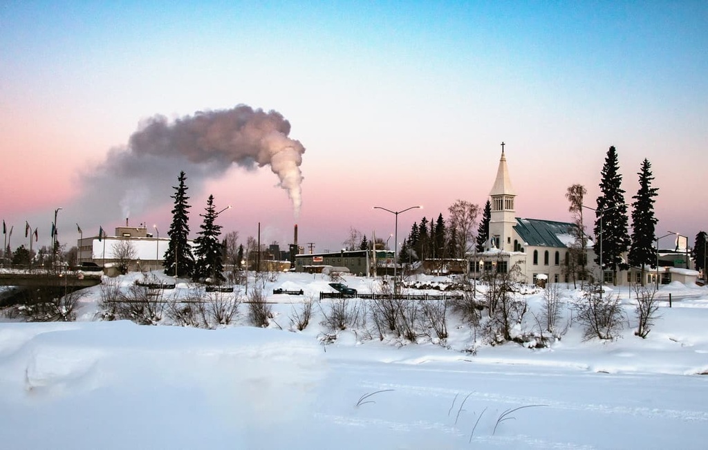
The main access point for those looking to travel to the refuge is the city of Fairbanks. Situated near the center of the state, Fairbanks is home to 32,000 residents, making it the largest city in Alaska’s Interior and the second largest city in Alaska.
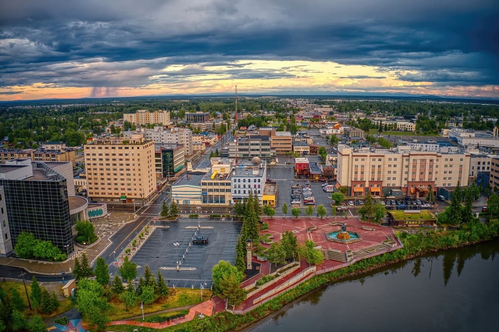
The quaint city is situated along the Chena River and surrounded by the stunning beauty that defines the entire state. Lush forested hillsides, rugged peaks, and breathtaking waterways are all just a step away from the downtown.
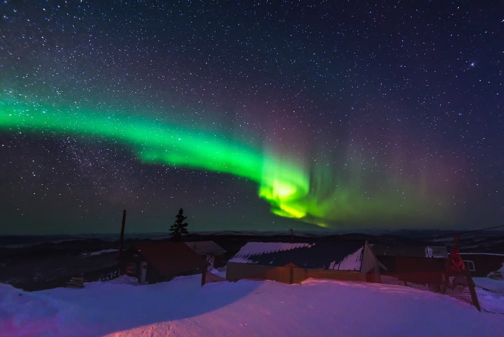
On clear dark winter nights, visitors and locals alike can often spot the northern lights. Plus, downtown Fairbanks is full of local shops and restaurants along with historic sites and museums that showcase the region’s history.
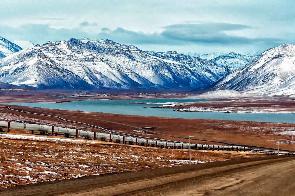
Deadhorse is a small community that’s located on the shores of the Arctic Ocean in northern Alaska. It is technically primarily a support town for the Prudhoe Bay Oil Field, but it is one of the few northern Alaska towns that is accessible by both road (the Dalton Highway) and air.
The town of Deadhorse has very few services available for visitors, but it does have a handful of hotels and there are some commercial flights available in the summer months. From Deadhorse, you may be able to charter a bush plane into the refuge or you can hike over land, though the rugged nature of the terrain makes this difficult.
From Fairbanks, visitors have three main ways of accessing the refuge.
Visitors can drive north on the Dalton Highway to get to the refuge. The closest access point on the road to the refuge is between Atigun Pass and Atigun Gorge. Hikers can backpack from here to get to the park.
Charter flights also provide visitors with easier access into the refuge. Various companies such as Yukon Air, Coyote Air, and Wright Air Service’s Charter all fly to good landing areas in the refuge where you can start your journey.
Finally, there are flights from Fairbanks to the two communities that are located within the refuge. From either the Arctic Village or Kaktovik, visitors can walk or boat into the refuge. However, taking a charter flight into the area from one of the larger communities is generally the better option.


The highest peak in Arctic National Wildlife Refuge is Mount Chamberlin, at 2,749 m.
Notable peaks in Arctic National Wildlife Refuge include Mount Chamberlin, Mount Isto, Mount Michelson, Mount Hubley and Wolverine Crags.


