
Scan the QR code and open PeakVisor on your phone
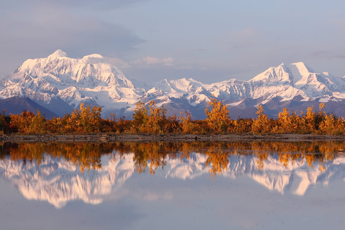
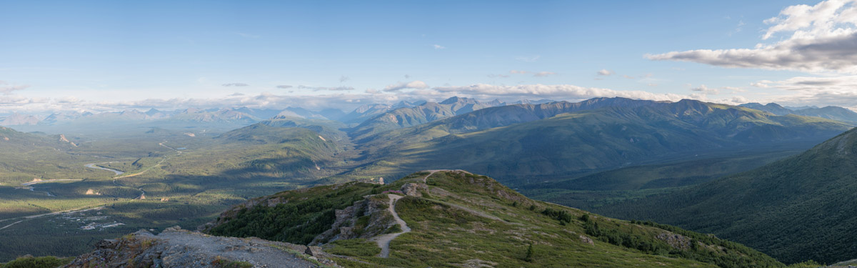
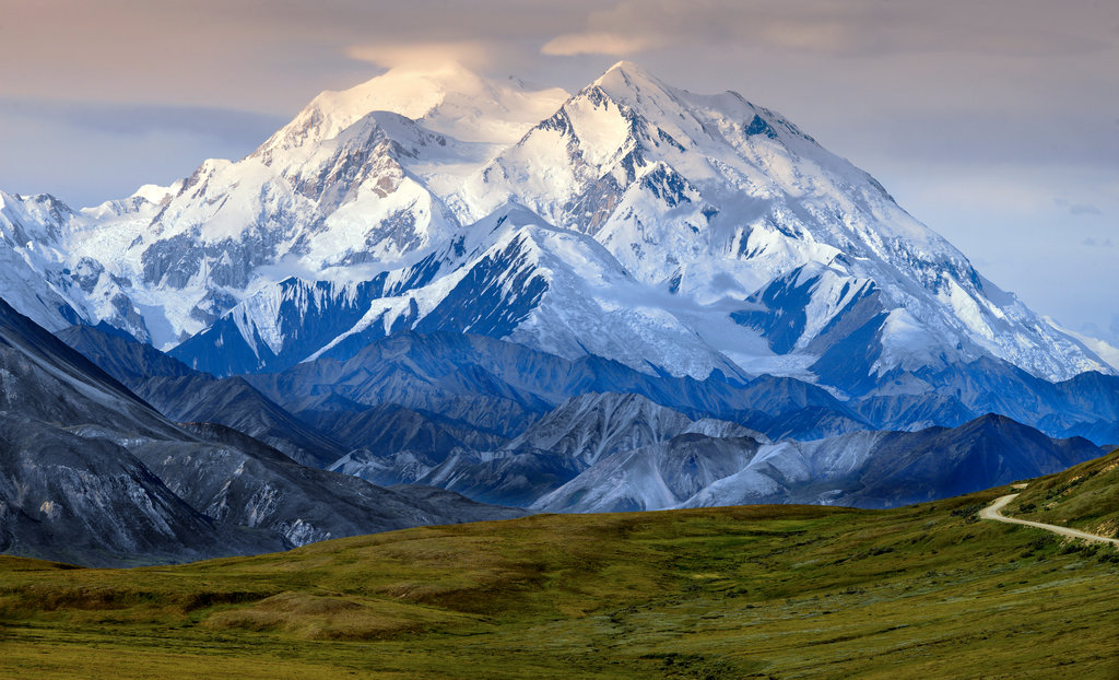
Home to Denali, the tallest peak in North America, Denali National Park and Preserve is a must-visit destination for tourists and outdoor enthusiasts alike. Situated in the central interior region of the state of Alaska, Denali National Park and Preserve encompasses over 6 million acres (24,464 sq. km) of wildland, giving it a total area larger than the state of New Hampshire. The park contains 98 named mountains, the highest and most prominent of which is the park’s namesake, Denali.
Denali National Park and Preserve was established on February 26, 1917 when then US president, Woodrow Wilson, signed a bill creating what was then known as Mount McKinley National Park. While the area in the park was first formally protected in 1917, the land has seen human habitation for at least the last 11,000 years, with documented archeological sites along some of the region’s major rivers.
The land that is now Denali National Park is the traditional territory of the Athabaskan peoples, who have called the region home for at least the last 1,500 years, but likely more. Other groups in the area over the last 500 years include the Koyukon, Tanana, and Dena’ina people.
These days, the area is managed as a national park and preserve, dedicating to protecting the region’s beautiful mountain landscapes and diverse wildlife population. In 1980, Mount McKinley National Park was actually combined with the Denali National Monument as a result of the Alaska National Interest Lands Conservation Act (ANILCA), which defined the land that is now the Denali National Park and Preserve.
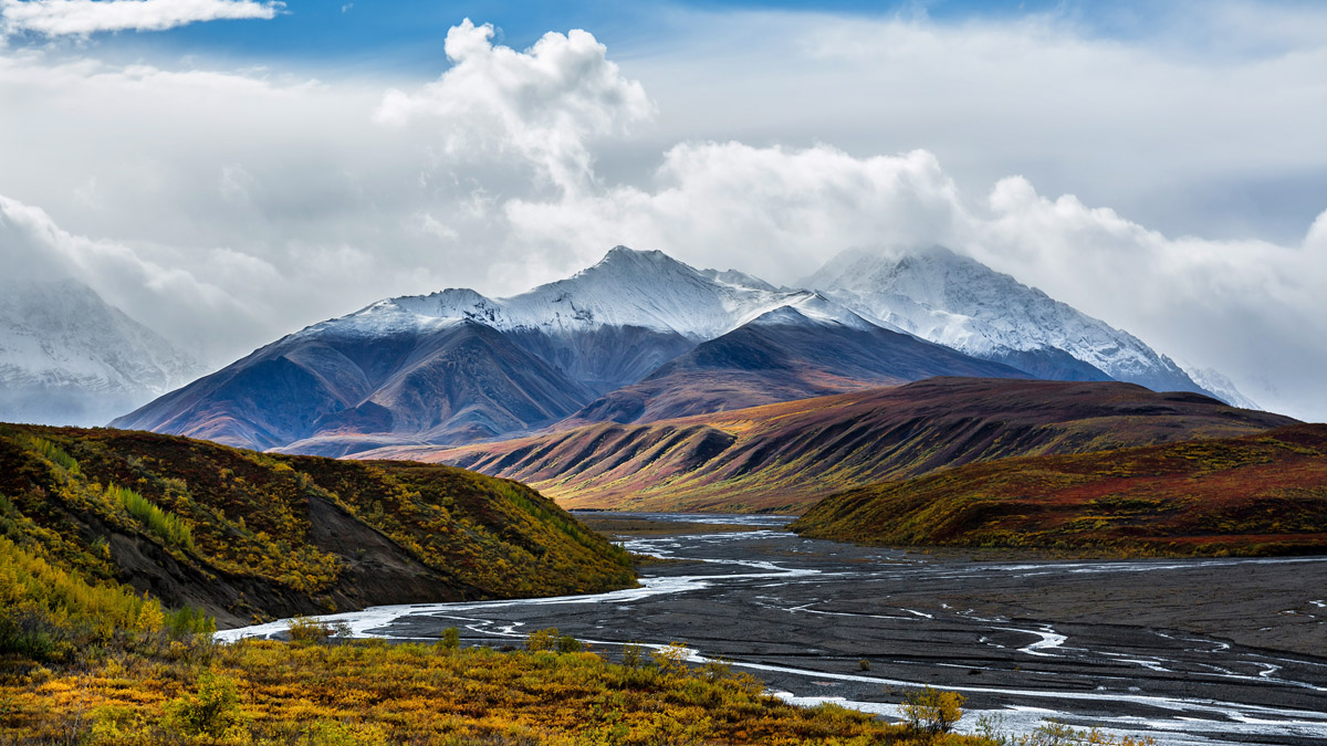
The park’s boundaries include the highest section of the central Alaska Range, as well as many of the glacier and huge glacial valleys that drain the southern part of the range. The McKinley, Toklat, and Foraker River valleys are also included within the park’s boundaries.
The eastern edge of the park is bordered by the George Parks Highway, which runs from mile 35 of the Glenn Highway near the town of Palmer north to Fairbanks, Alaska. The highway is now a vital motor transportation link to the park and between the two cities as it parallels the historic Alaska Railroad for the vast majority of its route.
Before the highway’s establishment, the only way into Denali National Park and Preserve was the Alaska Railroad, which was a critical aspect of the region’s coal mining industry in the early 1900s. From the Parks Highway, vehicles can drive along the 91-mile (146 km) long Denali Park Road to its terminus at the small town of Kantishna. However, the majority of the road is unpaved and private vehicles are only allowed on the first 15 miles (24 km) of the road, after which only authorized buses allow visitors access to the rest of the road and the park.
Currently, National Park land is located on the eastern portion of the Denali National Park and Preserve, with the preserve portion accounting for the western part of the area. The main difference between the park and preserve lands is that sport hunting is allowed on the preserve while only subsistence hunting by local residents is allowed in the national park.
The Denali Wilderness is a large wilderness area within the park and preserve, which was designed to protect the highest elevation sections of the Alaska Range, including Denali and its surrounding peaks. The Wilderness accounts for about one-third of the entire national park and preserve, almost completely corresponding with the park’s former boundaries between 1917 and 1980.
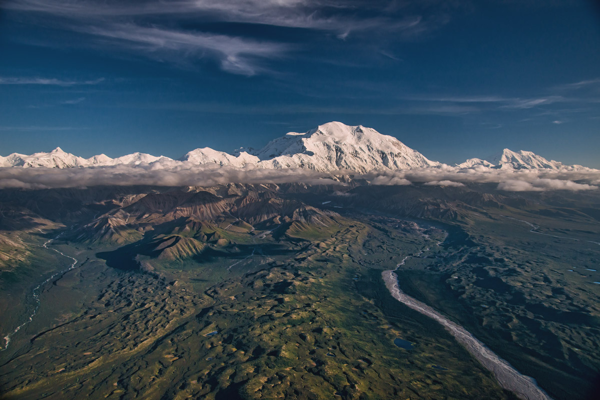
Geologically, the mountains in Denali National Park and Preserve are of interest because they are actually still gaining about 1 millimeter in height each year, thanks to the continued convergence of the Pacific and North American Plates. The 600 mile (970 km) Alaska Range is made primarily of granite, much of which exhibits exceptional amounts of vertical relief. For example, Denali, with an elevation of 20,310 feet (6191 m) has a vertical relief of 18,000 feet (5500) has one of the most drastic prominences of all of the world’s mountains.
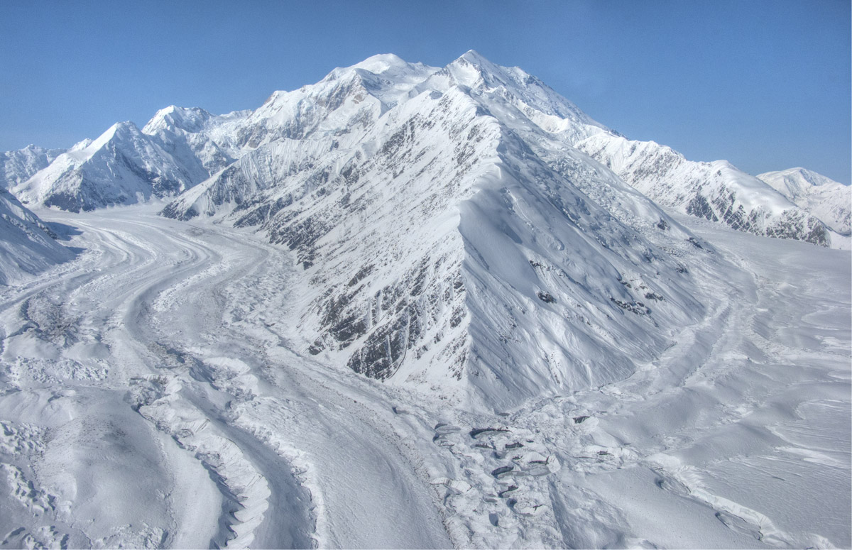
Additionally, the park is heavily glaciated, with about 16% of the park’s total land area covered by permanent ice. The most extensive glaciation is on the southeastern side of the Alaska Range, due to the rainshadow effect caused by orographic uplift in the area over the large mountain chain. Interestingly, however, the largest glacier - the Muldrow Glacier (32 miles/51 km) - is located on the northern side of the range.
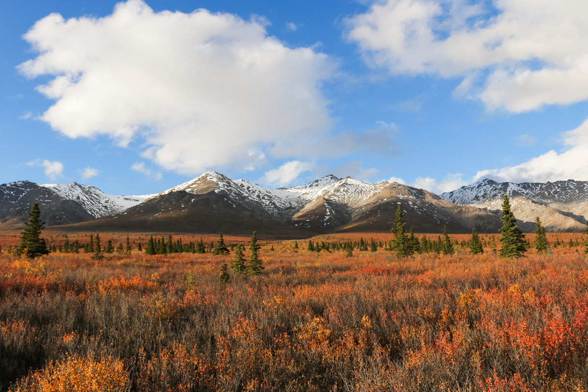
These days, visitors to Denali National Park and Preserve can experience and enjoy all of the region’s stunning natural scenery and abundant wildlife, such as brown and black bears, moose, wolves, caribou, and Dall sheep. The park is an outdoor enthusiast’s paradise with plentiful hiking and climbing options, especially if you’re willing to head off of the beaten path.
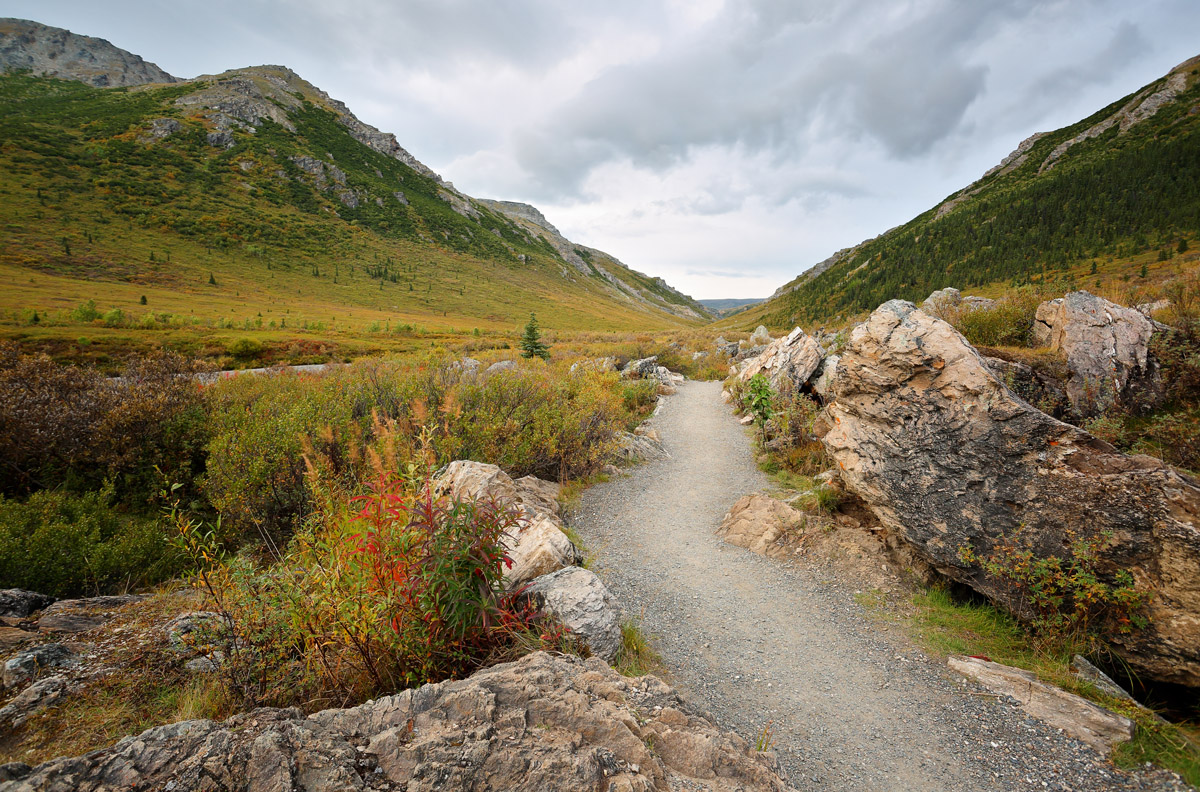
As one of the United States’ largest wilderness areas, Denali National Park and Preserve is a hiker’s paradise, especially if you’re willing to break away from the crowds. Although off-trail hiking in the park is near-limitless, here are some of the best hiking trails in the area for you to explore:
The hike up Mount Healy is one of the most popular in the park. The Mount Healy Overlook Trail is maintained by the park service and originates on the Taiga Trail near the Denali Visitor Center. This 2.7 mile (one way) hike takes about three to four hours in total for the average hiker.
Upon starting out on the trail, you’ll rise quickly up and out of a spruce forest as you make your way up switchbacks to a beautiful area above treeline. The trail officially ends at a large open area with fantastic views to the south, but more experienced hikers can continue onward up Mount Healy’s ridges to the true summit. However, the route beyond the trail is inherently dangerous, so it should only be undertaken by experienced outdoor recreationalists.
A nice, family-friendly hike, the Savage River Loop Trail is a 1.7 mile long walk with minimal uphill that travels along the banks of the Savage River. The trail follows the river as it makes its way through a large canyon between Mount Margaret and Healy Ridge.
Thanks to the trail’s short distance and negligible elevation change, this is a great walk for anyone looking for a quick jaunt into the backcountry during a brief visit to Denali National Park and Preserve. Parking is available at the Savage River trailhead, though there is also a free Savage River Shuttle from the park entrance to the trail during the summer months to help alleviate congestion on the park road.
Beginning right off of Mile 1 on the Denali Park Road, the Horseshoe Lake Trail is a popular walk to the stunning Horseshoe Lake. Soon after leaving the trailhead, you’ll head up a short, steep hill to an overlook. After the overlook, the trail drops down steeply to the lake itself, where it then forms a loop around the water.
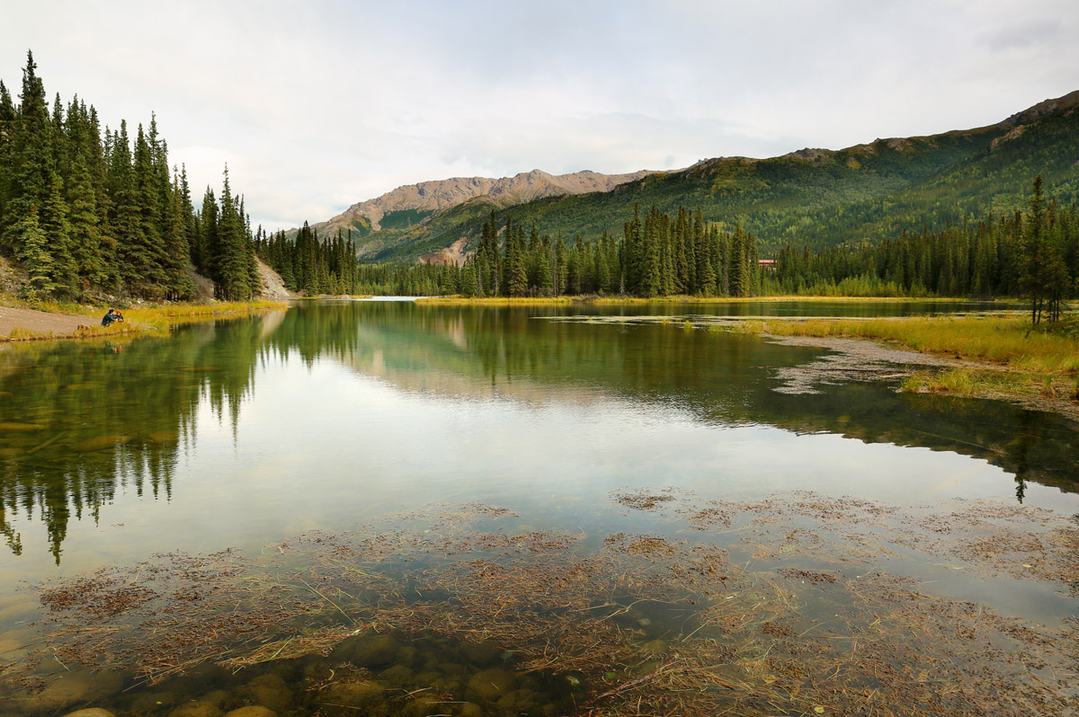
The trail itself isn’t terribly challenging, though several steep sections getting to the lake can pose a challenge to inexperienced hikers. But, the hike is very scenic, making it a good option for people with limited time in the park.
This trail follows 2.5 miles of the historic route that climbers used to take on their approach to climb Denali. Although the trail has fallen out of favor for climbers, who mostly fly in to the mountain these days, there is a small trail from the Wonder Lake Campground that takes you to the McKinley River.
The trail is fairly simple, with negligible elevation change and gorgeous spruce forest scenery along the way. A hike down the McKinley River Bar Trail offers a great chance to see waterfowl and a landscape that is fairly unique within the park. Just don’t forget your mosquito head net!
Denali National Park is quite sizeable and is fairly remote, so there are minimal opportunities for non-camping, affordable accommodation within the park boundaries. However, there are plenty of small towns nearby that offer a good place to rest and acquire supplies before a trip into the park. Here’s where to stay:
The closest community to Denali National Park and Preserve, Healy is just 11 miles north of the park entrance and is home to some 1,000 people. Although Healy originated as a coal mining town, many people now work in the tourism industry, running hotels, bed and breakfasts, and restaurants. Due to its proximity to the national park, many people choose to stay in Healy and do day trips into the surrounding wilderness.
The small town of Talkeetna is home to less than 1,000 people who live in the foothills of the Alaska Range at the confluence of the Susitna, Chulitna, and Talkeetna Rivers. Originally a district headquarters for the Alaska Railroad, the town’s economy is now dominated by tourism, especially flightseeing, hiking, and fishing.
Talkeetna is just a two and a half hour drive from Anchorage, making it a great place to stop on your way to Denali. Although the town is small, it is home to some good outdoor shops, as well as a great craft brewery, so it’s a popular place to stay near Denali.
Located near the origin of the Parks Highway in the Matanuska-Susitna valley, the city of Palmer is one of the only large communities between Anchorage and Fairbanks. Although it’s just an hour north of Anchorage, Palmer can be a great place to stop and refuel before heading into Denali National Park. You can find nearly anything you need for an adventure in the mountains in Palmer, so it’s a worthy stopping point for a Denali trip.


14er
ultra
glacier
alaska-13ers
fred-beckey-great-peaks
alaska-ultras
14er
ultra
alaska-13ers
alaska-ultras
14er
ultra
glacier
alaska-13ers
fred-beckey-great-peaks
alaska-ultras
14er
ultra
alaska-13ers
alaska-ultras


