Scan the QR code and open PeakVisor on your phone
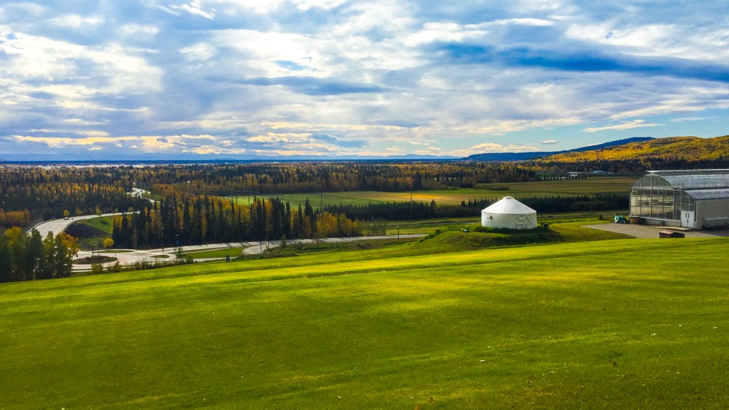
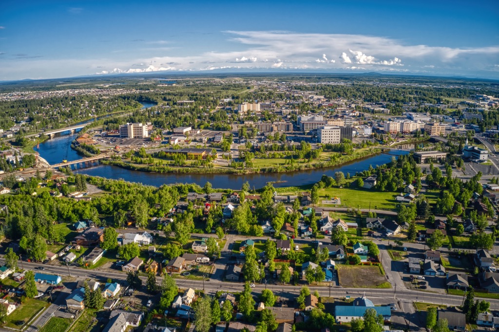
The Borough of Fairbanks North Star is centered on the city of Fairbanks in the interior of Alaska, USA and encompasses 7,444 square miles (19,280 square kilometers) of wilderness along the Tanana and Chena rivers. Situated between the White Mountains and the Alaska Range, the borough has 31 named mountains, the tallest and most prominent being West Point (5,902 ft/ 1,799 m).
Fairbanks North Star is one of the nineteen boroughs in Alaska, USA, where boroughs are used to describe geographical areas that other states call counties. The borough encompasses 7,444 square miles (19,280 square kilometers) of eastern-central Alaska.
The borough is centered around the confluence of the Chena and Tanana rivers, and it includes the Tanana Flats which are south of the Tanana River and the rugged terrain between the flats and the White Mountains.
The Alaska Range is south of the Borough and the White Mountains are north of the borough, and the rugged terrain of Fairbanks North Star is part of the Alaska Intermountain Ranges. There are 31 named peaks in the borough, of which West Point (5,902 ft/ 1,799 m) is the tallest peak and with 2,894 ft (882 m) of prominence, it is also the most prominent.
The borough of Fairbanks North Star is the second most populous borough and contains the second most populous metropolitan area in Alaska, after Anchorage. Of the nearly 100,000 residents of Fairbanks North Star, about a third of those live in the city of Fairbanks.
Chena River State Recreation Site is the largest protected area in the borough. Adjacent to the borough are Steese National Conservation Area located along the northern border of the borough and Yukon-Charley Rivers National Preserve which is located along the eastern border.
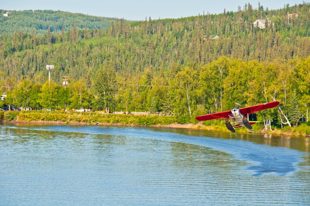
Highway 3 and Highway 2 are the major roads into and through the borough and the region is also serviced by the Fairbanks International Airport. The Alaska Railroad still services the region, with the regional section being built as the Tanana Mines Railroad in 1905. The miners wanted railroads to help haul their supplies to the mountains from the steamboat docks upon the Chena River.
In general, the geology of Alaska is quite complicated as many exotic terranes were accreted to the continental margin of North America which created significant volcanic events. Fairbanks North Star is in a geographical area called the Yukon-Tanana Uplands and is geologically part of the Yukon-Tanana Terrane.
The simplest area to describe geologically in the borough is the Tanana Flats, which lie south of the Tanana River. The flats are underlain by what is called Unconsolidated Quaternary Cover. That is to say, the flats are underlain by river deposits of sand, gravel, silt, and clay that were likely deposited within the past 3 million years.
The geology of the rugged terrain that covers the rest of the borough is much more complicated. The Yukon-Tanana terrane is believed to have been formed as a volcanic-plutonic assemblage during the mid-Paleozoic. This terrane is believed to be one of the first accreted terranes along the continental margin and is the innermost terrane of the western Canadian Cordillera.
The Yukon-Tanana terrane accreted to the western continental margin as its tectonic plate subducted beneath the continental tectonic plate. The continued subduction of the oceanic plate and additional accretions of exotic terranes affected the landscape and underlying rocks.
The major results of the tectonic activity were the metamorphosis of the underlying rocks in the borough of Fairbanks North Star, and the upheaval which created the mountainous terrain. Furthermore, the geological events created deposits of base metals, platinum, gold, silver, and copper which have been mined throughout the region.
An interesting note about Fairbanks North Star and the interior of Alaska was not covered like the rest of the state and continent were. Indeed, while ice sheets which reached over a mile in depth covered the rest of the continent, Fairbanks and the Tanana Grasslands were a green oasis.
There are a couple major factors that prevented the ice sheet from covering Fairbanks North Star. The first factor was that since significant amounts of water were locked on the continents as ice, making the sea level was significantly lower. The low sea level meant that interior Alaska was even further from the coast, which added to the relatively dry and warm “continental” climate of the region.
The second major factor that prevented the ice sheets from covering Fairbanks North Star was the Alaska Range which towers south of the borough. As the warm coastal air rises over the range, it cools and condenses which makes it drop most of its moisture as precipitation in the mountains.
As such, the Alaska Range prevents significant precipitation from dropping on Fairbanks North Star. The nearby Yukon Flats National Wildlife Refuge only receives 6 inches (120 mm) of annual precipitation.
There are two major ecological regions in Fairbanks North Star which are divided by the Tanana River. First are the Tanana-Kuskokwim Lowlands which are found south of the Tanana River, and second are the Tanana Uplands which consist of the hilly and rugged terrain north of the Tanana River.
The Tanana Flats area, in the southwest corner of Fairbanks North Star, is part of the greater Tanana-Kuskokwim Lowlands which stretches north from the Alaska Range and the Lime Hills. In general, this region is a sloping alluvial plain with many rivers that drain into the Tanana or Kuskokwim rivers.
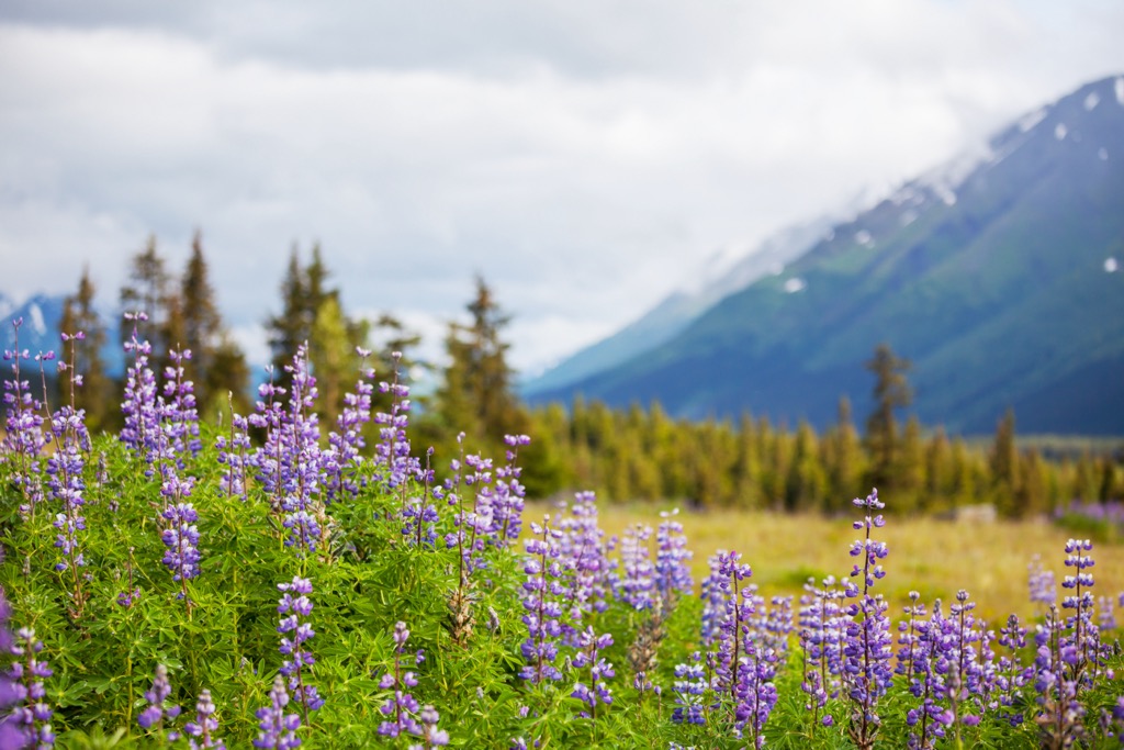
The plains are covered with bogs, marshes, fens, and in general have high surface moisture. There are also many lakes across the area. The general wetness of the area, despite being in the rain shadow of the Alaska Range, offers prime conditions for a productive boreal forest.
The bogs are typically filled with black spruce, while white spruce and poplar are common along rivers. Sedge and birch shrubs grow upon the wet flatlands which are underlain with permafrost and stands of tall willow, birch, and alder shrubs are also found across the flats. Southern facing slopes may also be populated by forests of white spruce, white birch, and trembling aspen.
This ecoregion provides habitat for many diverse species. The streams and rivers are home to pike, whitefish, chum salmon, king salmon, and sheefish while the forests along the shores are filled with ruffed grouse, alder flycatchers, and belted kingfishers.
The wetlands provide breeding grounds for horned grebes, red-necked grebes, common loons, common goldeneyes, and trumpeter swans. Great gray owls, rusty blackbirds, boreal owls, olive-sided flycatchers, and blackpoll warblers are some of the other common birds in the flats.
Mink, marten, muskrat, moose, and river otter have prime habitat among the Tanana Flats and other, smaller mammals that live in the region are red squirrels, northern bog lemmings, and yellow-cheeked voles, to name a few.
There are also several caribou herds and populations of black bear that range across the lowlands.
The uplands are northeast of the Tanana River and cover about 75% of Fairbanks North Star. The uplands are a hilly and mountainous region of the borough which has elevations up to 5,902 ft (1,799 m) at the summit of West Point.
Rivers cut deep, narrow, V-shaped valleys through the uplands and the valleys are where small lakes sometimes occur. The small lakes typically occur in valleys where the drainage has been blocked.
Black spruce forests are found upon the chilly northern slopes and in the bogs and sedge tussocks of the valley bottoms. The warmer south facing slopes are often filled with forests of white spruce, birch, and aspen. Upon the better-drained areas of any floodplains of the uplands are stands and forests of white spruce, balsam poplar, alder, and willow.
The peaks are typically rocky and the tallest peaks in the borough are barren; however, the lower alpine area typically has short birch-ericaceous shrubs and lichen.
The uplands have many habitats which are home to many diverse wildlife species. Like the lowlands, the uplands are home to moose, caribou, mink, and marten. The uplands are also home to Dall sheep, hoary marmots, and arctic ground squirrels which prefer the rocky peaks and cliffs in the uplands.
Black and brown bears, gray wolves, and wolverines are the top predators in the uplands, and smaller predators include Canada lynx, short-tail weasels, and least weasels.
Many fish, such as chinook, chum, and coho salmon spawn in the clear headwaters in the region and the lakes and rivers contain northern pike, whitefish, burbot, and Arctic grayling. While the mixed conifer and deciduous forests are filled with a variety of birds, such as gray jays, boreal chickadees, northern flickers, and boreal owls.
There is evidence suggesting that the occupation of Alaska likely began with paleolithic people arriving between 40,000 and 15,000 years ago. It’s possible that Alaska was among the first parts of North America that were inhabited by people and it is believed that ancient people traveled across the Bering Land Bridge that was exposed at the end of the Pleistocene.
There is evidence found just south of Fairbanks North Star, at Swan Point, of human occupation in the region as far back as 14,000 years ago. The Swan Point site is on a hill overlooking Shaw Creek Flats and there are hearths and faunal remains from about 14,000 years ago.
The site is a good location for hunting parties who used the site for thousands of years, as there is evidence that members of the Athabaskan culture camped there between 1040 and 1260. At this time, it was likely ancestors of the modern Tanana First Nation who camped at this site.
The site gives evidence that a small hunting band camped at the location with a campfire, butchered game, cached food in a pit, and repaired weapons. The Tanana Athabascans, whose traditional territory includes Swan Point and Fairbanks North Star were a semi-nomadic people who lived in semi-permanent villages in the lowlands and followed a seasonal hunting cycle through their territory.
The Tanana would travel seasonally within their territory to harvest fish, birds, mammals, berries, and other renewable resources. Caribou, moose, and wild sheep were the primary hunting targets and caribou were the most important of them. The hunters would create fences to corral and snare their prey during their summer hunt which was critical to their survival.
The arrival and settlement of non-indigenous people changed the living patterns and economy of the local Tanana people who now often live as part of a mixed cash-subsistence economy. Many people hunt, forage, and gather natural resources to supply their basic needs, and when something more is desired, then their wild resources are often sold or traded to supply their additional needs and wants.
It was only in 1901 that the namesake community of Fairbanks was founded by Captain E. T. Barnette. While on his way to Tanacross on a steamboat, Barnette was forced to disembark early, when the steamboat ran aground. After disembarking, a couple of gold prospectors convinced Barnette of the potential of the location and Barnette set up his trading post along the shores of the Chena River.
The Alaskan gold rush brought many prospectors and miners to the newly established Fairbanks, where they built mines and searched for gold. Furthermore, the Tanana Valley was an important agricultural center during the early settlement of the interior. The nearly endless days of summer sunshine allow for plants to grow to tremendous sizes.
The military arrived near Fairbanks in 1939 when they constructed the Ladd Army Airfield. As the US government installed infrastructure across Alaska as part of the New Deal and World War II, Fairbanks was the beneficiary of a population and economic boom which continued beyond the end of the war.
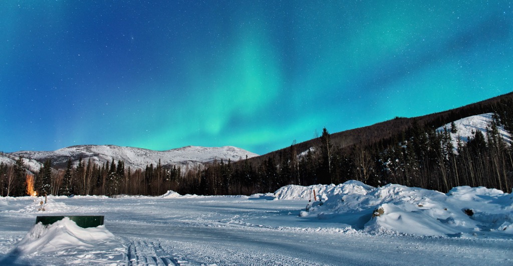
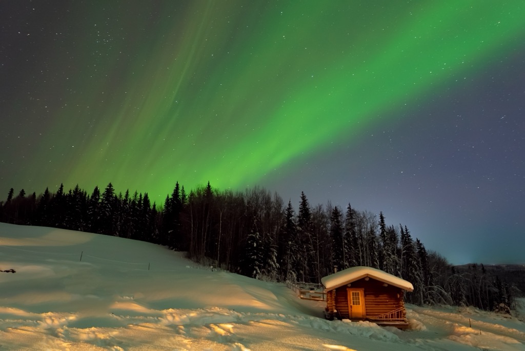
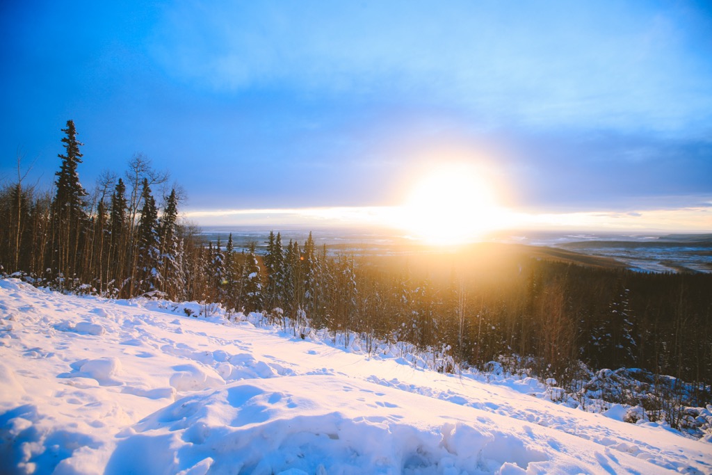
In the borough of Fairbanks North Star, visitors can enjoy viewing the stunning aurora borealis in the winter or continue playing outdoors all night when the midnight sun reigns in the sky. There are incredible mountain areas, stunning rivers and lakes, abundant wildlife, and a rich Alaskan culture.
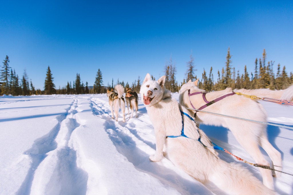
The region has many activities that include wildlife viewing, hiking, snowshoeing, cross country skiing, dog sledding, snowmobiling, backpacking and camping, fishing, boating, and many more outdoor activities.
Some of the regional recreation areas include Chena River State Recreation Area, Chena River Lakes Recreation Area, Birch Hill Recreation Area, Creamer’s Field Migratory Waterfowl Refuge, and Isberg Recreation Area.
While the smaller recreation areas have wonderful opportunities for shorter outings, there are many trails in the uplands that are great for multi-day excursions. The Granite Tors Loop, the Chena Dome Trail, and the Angel Creek Trail are several of the longer routes in the region that make for a great excursion.
On foot, ski, snowshoe, dogsled, or just driving, there are many ways to experience Fairbanks North Star. After traveling through the Alaskan wilderness, visitors can stay at and relax in the Chena River hot springs or enjoy one of the many of the fine dining and local cuisine establishments in Fairbanks and other communities.
Fairbanks North Star is centered upon the confluence of the Chena and Tanana rivers where the aurora rules the sky in the winter and the sun barely rests in the summer. The borough is filled with incredible wilderness that is wild and untamed. The following are the major communities in Fairbanks North Star.
With around 100,000 people inhabiting the city and surrounding area, Fairbanks is the second largest city in Alaska. The city is a popular basecamp for excursions to Denali National Park and Preserve and other locations in the interior and Arctic.
Some of the winter activities include viewing the aurora borealis, skiing, snowmobiling, snowshoeing, dog sledding, ice fishing, sledding and tubing, ice hockey, and skating. Being this close to the Arctic Circle, winter activities can be enjoyed for nearly half the year.
The city also has some fun activities when the weather is warmer, such as gold panning, visiting the museums, birding and wildlife viewing, canoeing and kayaking, and fishing. Furthermore, your visit may coincide with one of the major festivals or events like Golden Day, Tanana Valley State Fair, World Ice Art Championships, or the Yukon Quest International Sled Dog Race.
Fairbanks has a metropolitan downtown and there are many opportunities to experience culture and class close to the Arctic Circle. However, most visitors seem to come to the city to explore further into the arctic wilderness.
Some of the nearby and easily accessible wilderness are the Chena Hot Springs, Chena River State Recreation Area, and Denali National Park and Preserve. Northern locations such as Yukon Flats National Wildlife Refuge and Arctic National Wildlife Refuge are north of the city and typically accessed by plane.
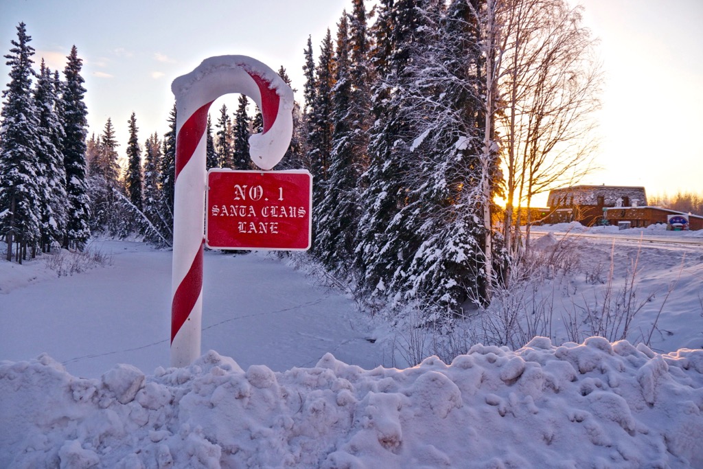
The community of North Pole is a major tourist attraction for visitors to Fairbanks and travelers along the Richardson Highway. The biggest attraction in the community is Santa Claus House, which is the modern incarnation of the town’s trading post which was established earlier in the town’s history.
A small herd of domestic reindeer can be seen outside Santa Claus House alongside the world’s largest fiberglass statue of Santa Claus. Many of the street names are Christmas themed and hundreds of thousands of letters to Santa Claus arrive in the town annually. North Pole is certainly a unique location and worth visiting while up north.