
Scan the QR code and open PeakVisor on your phone
The Alaska Intermountain Ranges include 642 named peaks. The highest is Mount Harper at 1,988 m. Other notable peaks include Cut Mountain, Coldbar Mountain and Copper Mountain.
The Alaska Intermountain Ranges extend through the middle of Alaska, USA, from the Bering Sea to Yukon, Canada. There are 642 named peaks in these ranges, of which Mount Harper (6,522 ft/ 1,988 m) is the tallest.

Located in Alaska, USA, the Alaska Intermountain Ranges extend from the Bering Sea and include mountains along the Yukon, Canada border. There are over 600 named peaks among these remote ranges, of which Mount Harper (6,522 ft/ 1,988 m) is the tallest.
The Alaska Intermountain Ranges include many subranges, such as the Seward Peninsula Ranges, Kobuk-Koyukuk Ranges, Nulato Hills, Kuskokwim Mountains, Yukon-Koyukuk Ranges, the White Mountains, and the Glacier Mountains. The Brooks Range borders the north of the Alaska Intermountain Ranges, and the Alaska Range and Wrangell Mountains are located to the south.
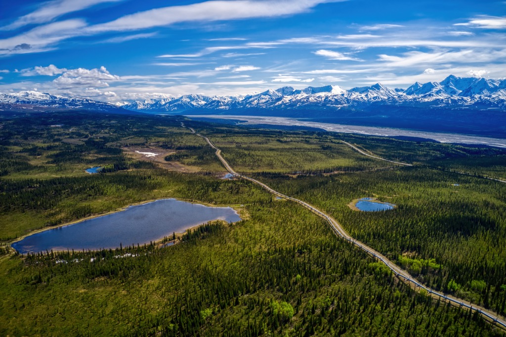
The ranges include parts of the boroughs of Fairbanks North Star, Northwest Arctic, and the Yukon-Koyukuk, Nome, Kusilvak, Bethel, and Dillingham census areas of the Unorganized Borough. Fairbanks is the largest city in the Alaska Intermountain Ranges, while some other communities include Bethel, Dillingham, Hooper Bay, and Nome.
Alaska is packed with conservation areas and wildlife refuges. The following are the major parks and conservation areas in the Alaska Intermountain Ranges:
Until about 200 million years ago, the western limit of North America was along the line of the present-day Rocky Mountains. At this time, the supercontinent of Pangea was breaking apart, opening the Atlantic Ocean. The rifts in the Atlantic were pushing North America west, where the continental tectonic plate would collide with the tectonic plates of the Pacific Ocean.
The tectonic plates under the Pacific subducted beneath the continental plate; however, many sizeable volcanic island arcs and terranes (fragments of crust on tectonic plates) had formed upon the oceanic plates. During subduction, the buoyant terranes collided with the continent's edge and became stuck, beginning the new continental margin.
For over 100 million years, new land was added to North America's west coast, ultimately creating the state of Alaska in the USA and the province of British Columbia in Canada. For the next 100 million years until the present, new terranes were added as their tectonic plate was subducted. The subduction of the oceanic plates was also the cause of the regional orogenies, or mountain formation events.
Many different rock types are found across the province, relating to how the terranes were formed and accreted to the mainland. The ranges are filled with various sedimentary and igneous rocks, many of which have undergone some form of metamorphosis.
Much of the limestone, mudstone, and sandstone of the ancient Yukon-Tanana terrane was transformed into muscovite-quartz schist, mica quartzite, and graphite schist. The intense volcanism along the coast created the metasedimentary gneiss found on the Seward Peninsula.
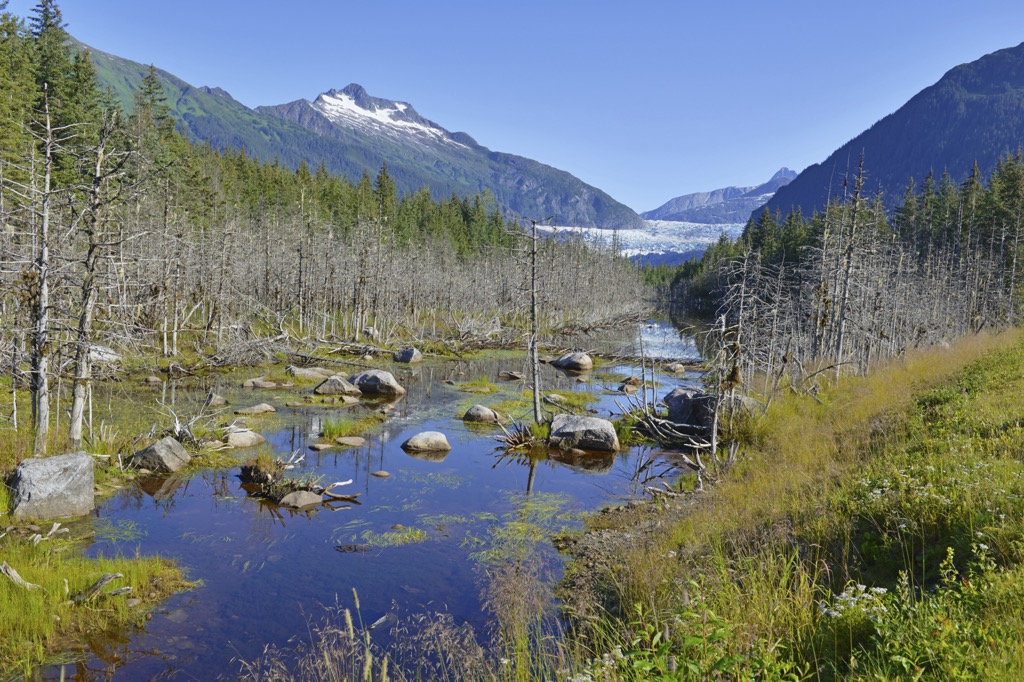
Glaciers began forming in the mountains of Alaska between 10 and 13 million years ago. An estimated six glacial events affected parts of the Alaska Intermountain Ranges. Where the glaciers formed, they flowed down the mountains, carving out cirques and valleys.
However, the glaciers and ice did not penetrate the state's center. While glaciers were forming along the coast, in the Alaska Range, Brooks Range, and Yukon-Tanana Uplands, the interior had a dry, continental climate that resisted the ice engulfing the rest of the continent.
A relatively brief cold period in Alaska began about 3,000 years ago, which caused the glaciers to advance and reach new maximums. However, by about 1750, the glaciers were again in retreat.
Alaska is still experiencing ongoing collisions with exotic terranes, and mountains are still being formed. The Saint Elias Mountains in the south of the state are still experiencing uplift while deep subterranean volcanic events continue to form granite batholiths.
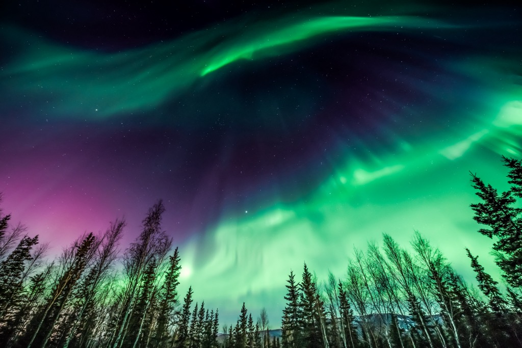
Reaching from the Bering Sea to the Canadian border, the Alaska Intermountain Ranges encompass a vast and remote wilderness. The ranges can generally be divided into two primary ecoregions: the Subarctic Tundra along the coast and the Beringia Boreal, covering the interior of Alaska.
A lack of trees is the defining characteristic of tundra. “Tundra” comes from the Finnish tunturi, meaning “treeless heights.” The short growing season, persistent winds, permafrost, and cold soils prevent trees from growing, creating tundra. However, despite the lack of trees, Alaska’s subarctic is not a barren wasteland but is full of hardy life.
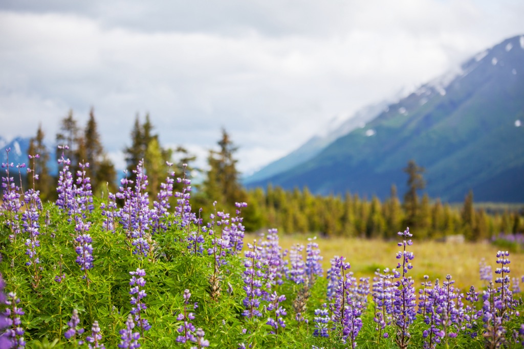
Across the ranges, low shrubs, mosses, sedges, and lichens cover the broad plains and mountainsides. Heath-scrub communities are mixed with grass meadows and herbaceous flowers along the west coast. When in bloom, the abundant wildflowers are stunning. Some common heath species are crowberry, bog blueberry, mountain cranberry, and alpine azalea.
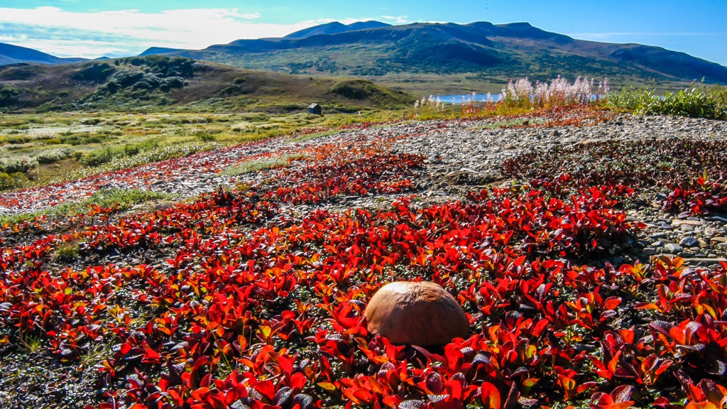
While the tundra along the coast, which covers the western end of the Alaska Intermountain Ranges, gets very little precipitation and is sometimes called a “cold desert.” However, despite the lack of rainfall, one of the significant features of this area is the vast wetlands. Indeed, Alaska’s subarctic tundra is a complex mosaic of dry and wet areas.
The permafrost acts as a barrier, preventing moisture from draining through the soils, trapping water near the surface, and creating wetlands. These wetlands are full of life and essential to the Alaskan ecosystems; they are the most biologically productive ecosystems in the region.
While moose, bears, wolves, and other mammals inhabit and travel through the tundra, birds are the region’s most abundant wildlife. Some endemic bird species are McKay’s bunting, the gray-crowned rosy finch, and the winter wren. Other species include the rock sandpiper, Pacific loon, Thule white-fronted goose, and several species of eider, including the spectacled eider, Steller’s eider, and the king eider.
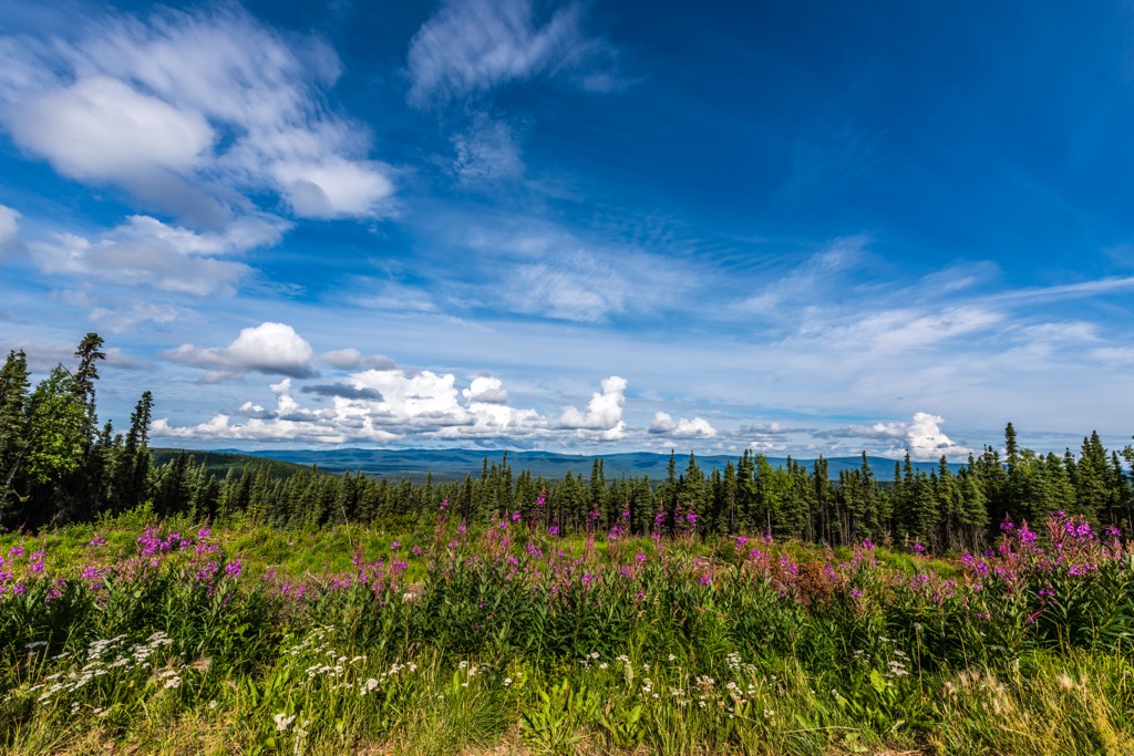
While it is often perceived as a monotonous blanket of evergreens covering valleys and mountains, the Alaskan boreal forest is far more complex. These boreal forests are a complex mosaic of spruce bogs, meadows, aspen groves, marshes, rivers, and lakes. Long winters, permafrost, and forest fires contribute to their diverse constitution.
White and black spruce are the most abundant tree species in the boreal forest. However, balsam poplar, paper birch, and aspen are found along south faces, especially among river beds and recently burned areas.
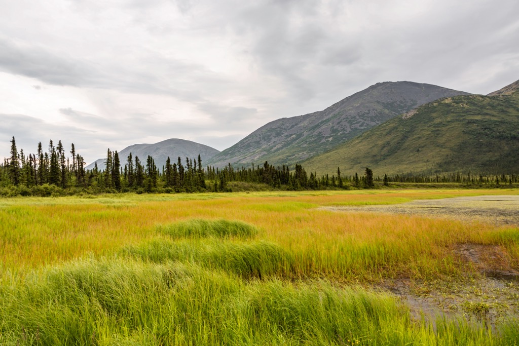
The boreal forests are dense, and there is a significant understory; even the meadows and open areas are filled with plants. Common shrubs include Willow, highbush cranberry, alder, rose, Labrador tea, and blueberry, while typical ground cover consists of mosses, lichens, sedges, grasses, horsetail, and lowbush cranberry.
The birds of the boreal forest are different from species that thrive along the subarctic coast. Some of the common birds are the black-backed woodpecker, northern flicker, northern hawk owl, great gray owl, and the great horned owl. Although many mammal species occupy this ecosystem, the Kenai red squirrel and brown bear are the principal mammals associated with the Alaskan boreal forests.
With the Alaska Intermountain Ranges bordering the Bering Sea, the human history of the Alaska Intermountain Ranges is connected to the habitation of North America in general. During the last glacial maximum from about 24,000 to 15,000 years ago, glaciers utilized so much of the planet’s water that sea levels were at least 120 meters (400 ft) lower than today. The first people to inhabit the northern reaches of North America traveled from Asia across the Bering Land Bridge, exposed by the lower seas.
Paleolithic people first arrived in modern-day Alaska between 15,000 and 12,000 years ago. The forebears of Alaska Natives came to the region through at least two distinct migration waves. An additional third migration wave may have occurred, during which individuals established communities in only northern North America. Alaska Natives now encompass various indigenous groups of northern Canada and Alaska, including the Iñupiat, Denendeh, Yupik, Aleut, Eyak, Tlingit, Haida, and Tsimshian.
The two major groups currently inhabiting the Alaska Intermountain Ranges are the Yupik and the Denendeh. The Denendeh are the Athabaskan people who were among the first known to inhabit Alaska, while the Aleuts are the descendants of the Thule, who were likely the last people to migrate from Asia.
The Tanana, Koyukon, Deg Xit’an, and Upper Kuskokwim people represent the Dene. These indigenous people were traditionally hunters and gatherers who have inhabited the northern forests for thousands of years. The Dene were semi-nomadic and moved seasonally to harvest fish, birds, mammals, berries, and other renewable resources. They would commonly hunt animals such as Dall sheep, caribou, black bear, grizzly bear, and moose. Fishing was often done near the village sites, which were typically situated along rivers or creeks, which were used for food and as highways.
The Yupik are the regional descendants of the Thule people who migrated to North America around 3,000 years ago and are related to the Inuit who inhabit the northern areas of Canada and Greenland. The Yupik speak the Eskimo-Aleut languages, and they are proficient boat builders who typically spend part of their time fishing or hunting from their hand-crafted kayaks. Families would typically spend the spring and summer with their close families at fish camp, and during the winter, they joined others at established winter villages. Pacific salmon and seal were staples of their diet.
Most of the Alaska Intermountain Ranges are part of the Unorganized Borough of Alaska, with only a few small communities. Many of the current residents of the region still live off the land in a subsistence lifestyle, hunting and gathering for much of their needs.
The Alaska Intermountain Ranges are a vast, remote, and relatively uninhabited wilderness in central and interior Alaska. There are many opportunities for hiking, canoeing, and backcountry exploration. The following are some of the major wilderness parks in the Alaska Intermountain Ranges.
Encompassing the confluence of the Yukon, Porcupine, and T’eedriinjk river, Yukon Flats National Wildlife Refuge is a vast wilderness area filled with wetlands, forests, and bogs. There are no roads into the park, so visitors can charter float planes or take a boat from one of the nearby communities.
Visitors to Yukon Flats Wildlife Refuge can enjoy camping, fishing, hiking, hunting, gold panning, wildlife viewing, and boating. One of the popular activities is floating Beaver Creek and the Yukon River over the course of a week or so.
The Yukon-Charley Rivers National Preserve is centered around the Yukon and Charley Rivers. Rivers played a vital role in the region's history as major transportation routes, first for the indigenous groups and then for the miners and settlers.
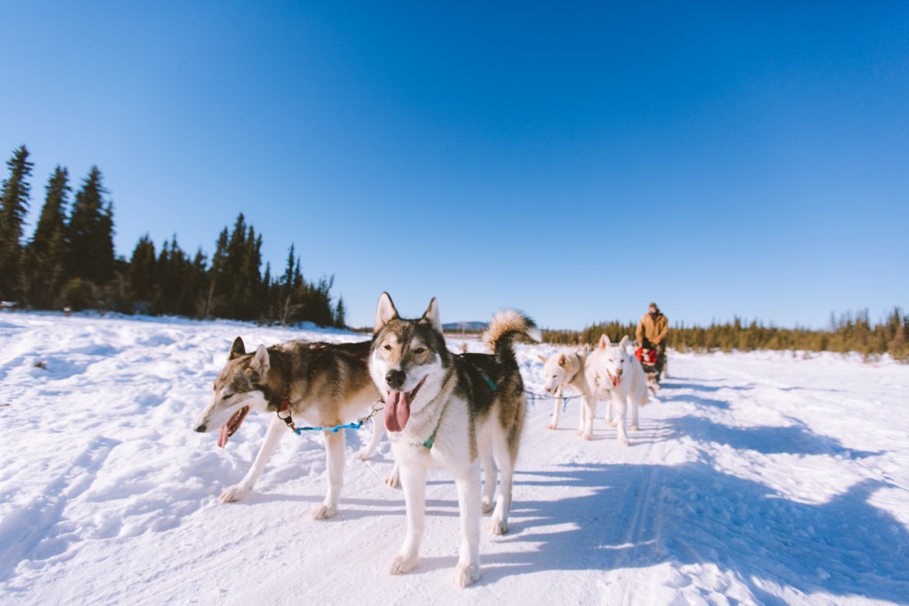
During the summer, floating and paddling the Yukon and Charley Rivers are the most popular activities in the preserve. During the winter, the same rivers are traveled by teams of dog sleds. Many historical sites exist along these waterways, most of which pertain to the gold rush that filled the region with rugged prospectors and miners during the 19th century.
The Bering Land Bridge National Preserve is located on the Seward Peninsula and contains incredible natural and historical significance. Like most preserves in Alaska, there are no roads, so bush planes and boats bring visitors in the summer, while ski planes, dog sleds, and snowmobiles make the trip possible in the winter.
The preserve protects a remnant of the Bering Land Bridge, which connected North America to Asia about 13,000 years ago; however, most of this ancient highway now lies under the Bering and Chukchi seas.
In addition to the area's historical significance, the preserve is filled with many incredible natural features. Many are related to the volcanic activity in the region, such as the extensive maar lakes and the hot springs. Some of the most popular destinations in the preserve are the Serpentine Hot Springs, the Trail Creek Caves, Devil Mountain Lakes, and the Lost Jim Lava Flow.
Most of the Alaska Intermountain Ranges are uninhabited and vast wilderness; however, several communities exist. The following are the major communities of Alaska's interior and central regions:
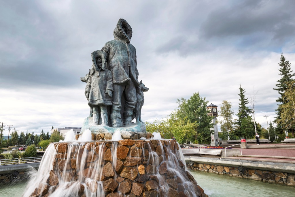
Fairbanks is the second largest city in Alaska and by far the largest community in the Alaska Intermountain Ranges. With a population of about 100,000 people, Fairbanks is a major city with all the amenities and services visitors need while exploring the north.
Skiing, snowmobiling, snowshoeing, dog sledding, ice fishing, sledding and tubing, ice hockey, and skating are popular, especially since winter conditions persist for about half the year. Gold panning, visiting the museums, birding and wildlife viewing, canoeing and kayaking, and fishing are some of the city’s summer activities.
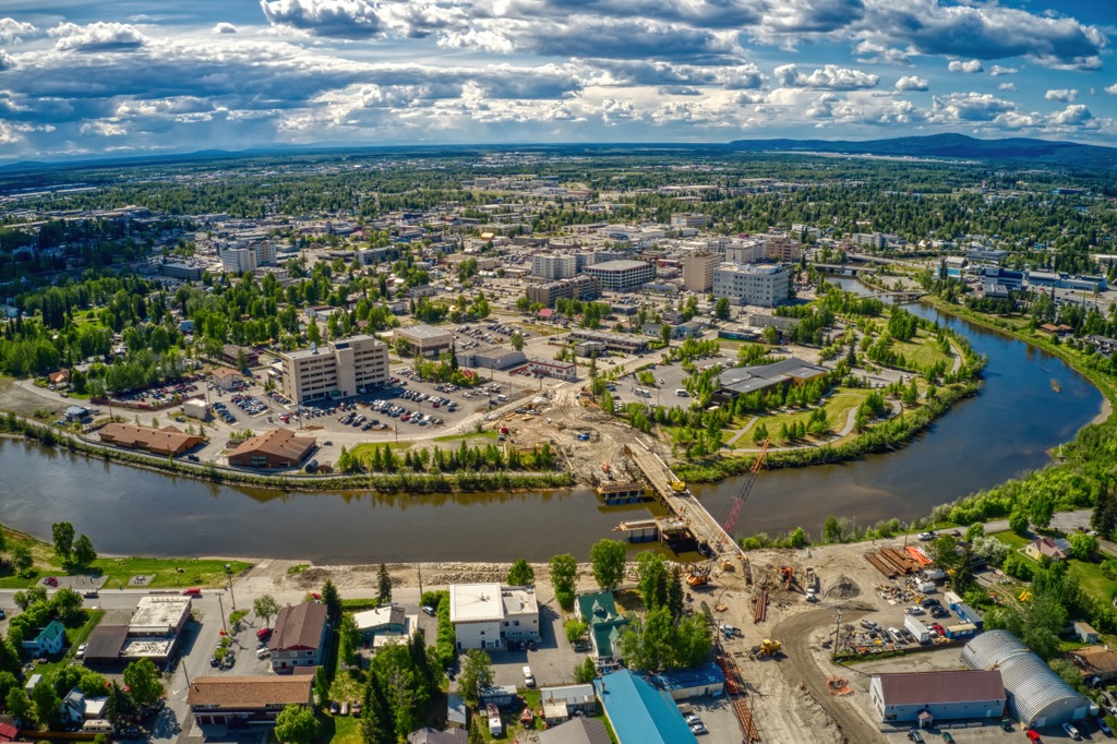
Many visitors will stop through Fairbanks on their way to Alaska’s northern wilderness areas, such as Denali National Park and Preserve, Yukon-Charley Rivers National Preserve, and Gates of the Arctic National Park and Preserve.
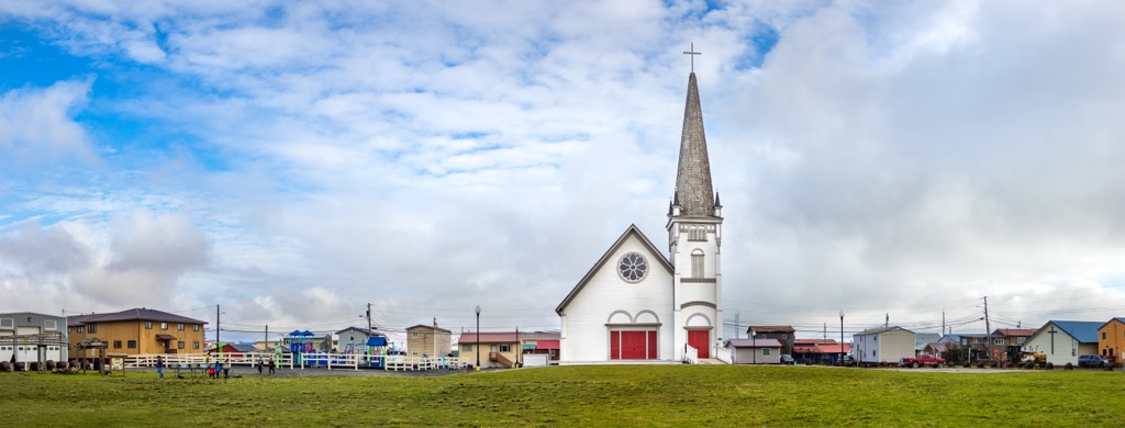
Located upon the Seward Peninsula, Nome is the most famous gold rush town in Alaska, drawing hopeful miners from across the world in the early 1900s. However, before gold was discovered, the townsite and region were home to the Inupiat, who hunted game along the Alaskan coast.
With a population of around 3,000, the remote community of Nome has made an indelible mark in the history books. Aside from the gold rush and associated activities, Nome is also famous for a 1925 diphtheria outbreak in which dog sleds were used to transport the antitoxin serum to the community through incredibly harsh conditions.
While in Nome, visitors can visit cultural centers and museums to understand the history of the community and the region and even see Cold War-era radar installations. Furthermore, the wilderness and wildlife around Nome are stunning. Visitors can fish, take wildlife viewing excursions or visit nearby wilderness areas, such as the Bering Land Bridge National Preserve.


The highest peak in the Alaska Intermountain Ranges is Mount Harper, at 1,988 m.
The Alaska Intermountain Ranges have 642 named peaks.


