
Scan the QR code and open PeakVisor on your phone
The Togiak Wilderness is a remote protected region situated in the southwestern part of the US state of Alaska. The region helps protect various watersheds and marks the tenth largest wilderness area in the US. The tallest peak is Mount Oratia at 4,580 feet (1,396 m) tall with Pistuk Peak being the most prominent with 3,005 feet (916 m) of prominence.
The Togiak Wilderness is located in the southwestern stretches of the US state of Alaska. It lies within the Togiak National Wildlife Refuge which covers a total of 4.2 million acres (1.7 million ha). The wilderness is located in the southern half of the refuge, spanning nearly 2.3 million acres (931,000 ha).
Togiak Wilderness marks the tenth largest wilderness area in the country. A majority of the wilderness is dominated by the Ahklun Mountains which give way to tundra and coastal plains in the southern stretches of the wilderness.
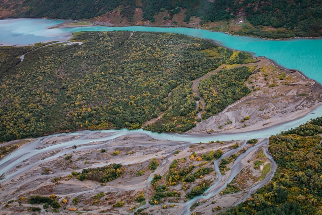
Three major river systems run through the wilderness. Together the Togiak, Kanektok, and Goodnews rivers feature over 1,500 miles (2,414 km) of water in the wilderness, while also extending further into the surrounding wildlife refuge.
These rivers provide important spawning grounds for native salmon, making them popular for fishing. The Togiak River flows wide and gently through the landscape while the Kanektok and Goodnews are marked by faster moving water.
The Ahklun Mountains dominate much of the wilderness, supporting the only glaciers found in western Alaska. Amidst the rugged peaks lie a plethora of alpine lakes with some reaching over 1,000 feet (305 m) in depth. Major lakes in the wilderness include Togiak Lake, Kanuktik Lake, Nagugun Lake, Goodnews Lake, Gechiak Lake, Pungokepuk Lake, and High Lake.
Various creeks and streams cut across the alpine landscape, connecting the major rivers, lakes, and glaciers of the region. Rolling grassy foothills and met with forested patches and steep cliffs throughout the wilderness.
The Togiak Wilderness is located within the Togiak National Wildlife Refuge. The Yukon Delta National Wildlife Refuge, which marks the second largest wildlife refuge in the country, lies directly north of the wilderness. Wood-Tikchik State Park is the largest state park in the country and is located northeast of the wilderness. Southeast of the wilderness lies the Aniakchak National Preserve and Monument, Alaska Peninsula National Wildlife Refuge and Katmai National Park.
The peaks within and surrounding the Togiak Wilderness are part of the Ahklun Mountains. This range is known for being the highest range located west of the Alaska Range, extending towards the Bering Sea.
This range spans from the Kanektok and Narogurum Rivers towards the coast, ending by the Hagemeister Strait and Kuskokwim Bay. The range contains the only glaciers found in all of western Alaska.
Bedrock in the region includes folded sections of sediment rock from the Paleozoic and Mesozoic periods along with volcanic rock from the Cenozoic. Volcanic intrusions found in the range have formed over the past 66 million years.
The Ahklun Mountains are part of the western highlands of Alaska, marking the largest formerly glaciated region in all of central and western Alaska. As the glaciers retreated, they further carved out the landscape leaving behind rugged ridgelines, sweeping basins, and glacier lakes.
Major peaks found within the Togiak Wilderness include Mount Oratia, Pistuk Peak, Atshichlut Mountain, and Nuklunek Mountain.
A majority of the wilderness is marked by alpine tundra along with heath. The highest peaks are often free of flora with the exception of some lichen and low growing grasses. Sweeping valley floors often feature sedge-tussock meadows.
Forested patches in the wilderness are predominantly covered by black spruce. Foothills in the wilderness are more likely to feature alder, white spruce, and paper birch, with these trees also being found near the various streams and rivers.
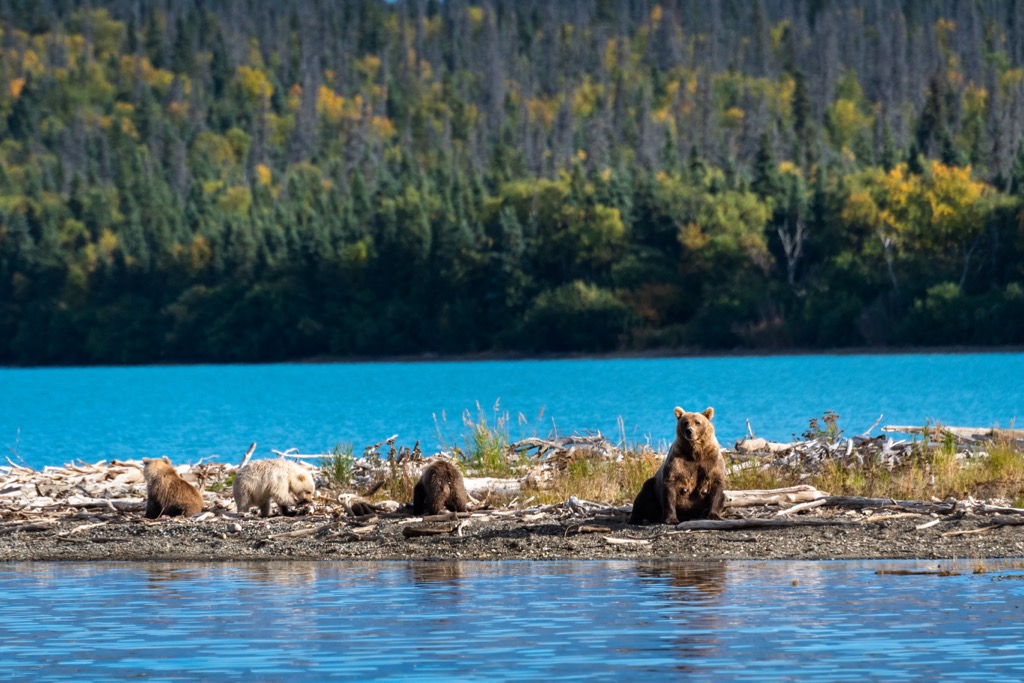
Waterways of the region provide the ideal habitat for beaver, sockeye salmon, silver salmon, king salmon, chum salmon, and rainbow trout. This plethora of fish attracts a population of both brown and black bears.
Other animals found in the surrounding national wildlife refuge include wolf, moose, marmot, red fox, muskrat, wolverine, coyote, Arctic fox, Canadian lynx, and porcupine among others. The coastline of the refuge, located outside of the wilderness, is home to walrus, seals, sea lions, and various species of whales.
The isolated wilderness is home to seven species of owls along with peregrine falcons. Various species of raptors, songbirds, waterfowl, shorebirds, and seabirds also inhabit this region.
Humans have inhabited present-day western Alaska for thousands of years, long before the arrival of European colonizers. This portion of land marks part of the ancestral lands of the Yup’ik and Cup’ik peoples, named after the two different dialects of the Yup’ik language.
These Indigenous peoples inhabited land from the Norton Sound along the coast of the Bering Sea, as far south as the Alaska Peninsula. The Yupiit people speak the Yup’ik language, which is part of the Eskimo-Aleut language group.
The common ancestors of both the Yupiit and Aleut peoples are thought to have originated in eastern Siberia. Between 20,000 and 8,000 years ago, during periods of glaciation, the Bering land bridge was exposed, providing a causeway for these ancestors to arrive in present-day Alaska as well as Canada and the contiguous US.
By around 3,000 years ago, the Yupitt people had settled along the western coast of present-day Alaska. The nearby rivers acted as a migratory route for these people who traveled throughout western and central Alaska.
The traditional way of life was centered around hunting sea animals such as sea lions, seals, and walruses. Families lived in small communities during the summer months and often larger groups in the winter to withstand the harsh living conditions.
Russian colonization of the region lasted from 1732 to 1867, drastically altering the Indigenous peoples traditional way of life. Russia went on to establish numerous trading posts in northwestern present-day Alaska before extending down along the western coast of the region. In an effort to avoid battles and conflict with the growing presence of Russian hunters, the Indigenous peoples would often pay taxes in the form of beaver and seal furs.
Attacks on Kodiak Island in 1784, located in southern present-day Alaska, were led by the Russians in what would later be known as the Awa’uq Massacre with an estimated 2,000 Alutiiq being killed.
The US purchased Alaska from the Russian Empire in 1867, originally designating the reigon as the Department of Alaska. The region later became the District of Alaska in 1884 followed by the Territory of Alaska in 1912 and eventually the State of Alaska in 1959.
During the 1930s the federal government began to establish missions and schools that aimed to eradicate the traditional way of life of the Indigenous peoples. Over the following decades the region was, and still is, continually exploited for its natural resources. In 1971 the Alaska Native Claims Settlement Act was signed which has shaped the current economic, political, and cultural structures of present-day Alaska.
The Togiak Refuge was established in 1969 and later expanded in 1980 to become the Togiak National Wildlife Refuge. There are no established trails, roads, or campgrounds within the wilderness and refuge.
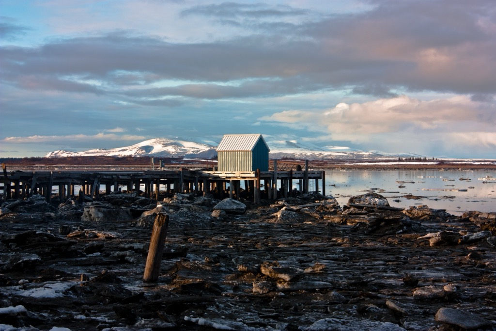
There are no designated trails within the Togiak Wilderness and no designated roads leading into the region.
Those visiting the region often travel to the wilderness and refuge by air or boat charter from Dillingham, Bethel, or King Salmon. The closest airport is located in Dillingham, west of the refuge, while all three communities can be reached by commercial flights from Anchorage.
Once in the wilderness, visitors can follow the ‘game trails’ that have been established by the wildlife of the region. There are opportunities for hiking, backpacking, canoeing, hunting, fishing, and wildlife viewing.
Those visiting can enjoy seemingly endless amounts of backcountry hiking and camping. The mountainous region, alpine tundra, and alpine lakes are often noted as one of the most remote and beautiful regions in the state of Alaska.
Anyone entering this region should be well equipped with emergency equipment, communication devices, and knowledge of remote backcountry travel and what to do in case of encountering the wildlife of the region.
Looking for a place to stay near the Togiak Wilderness? Below are a few local spots that provide the easiest access to the region:
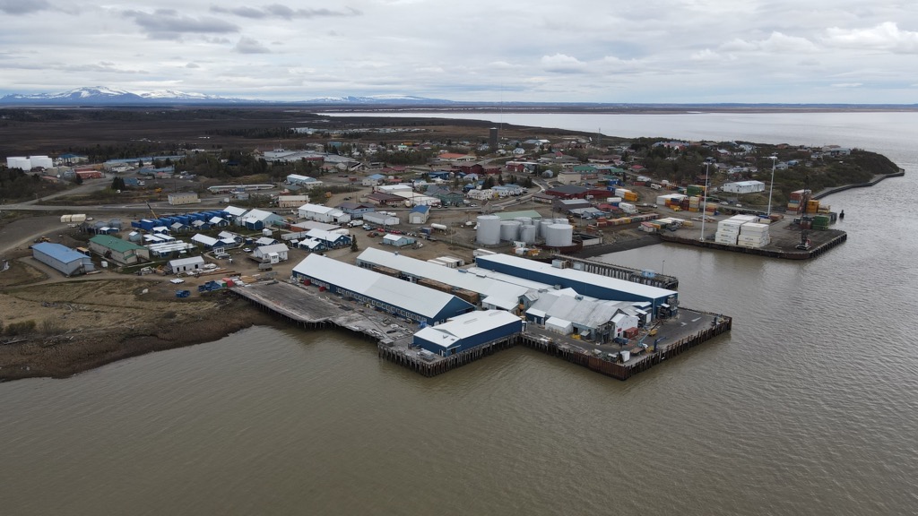
The city of Dillingham (Central Yupik: Curyung), is located west of the refuge on Nushagak Bay. Home to around 2,200 residents, Dillingham has become an important commercial fishing port and is often visited by tourists during the summer months.
Nushagak Bay marks an inlet of the larger Bristol Bay of the Bering Sea. Dillingham is situated on the edge of Wood-Tikchik State Park, the largest state park in the country. The surrounding rivers and lakes are home to all five species of Pacific salmon along with various other species of fish.
Those visiting this small community can also explore nearby Lake Aleknagik State Recreation Site, and Walrus Islands State Game Sanctuary. Dillingham also marks the closest airport with access to the Togiak Wilderness.
Anchorage is situated along the south central coast of the state, marking the closest major city to the wilderness and refuge. Flights from Anchorage can take visitors to the community of Dillingham from which an air charter goes to the Togiak National Wildlife Refuge.
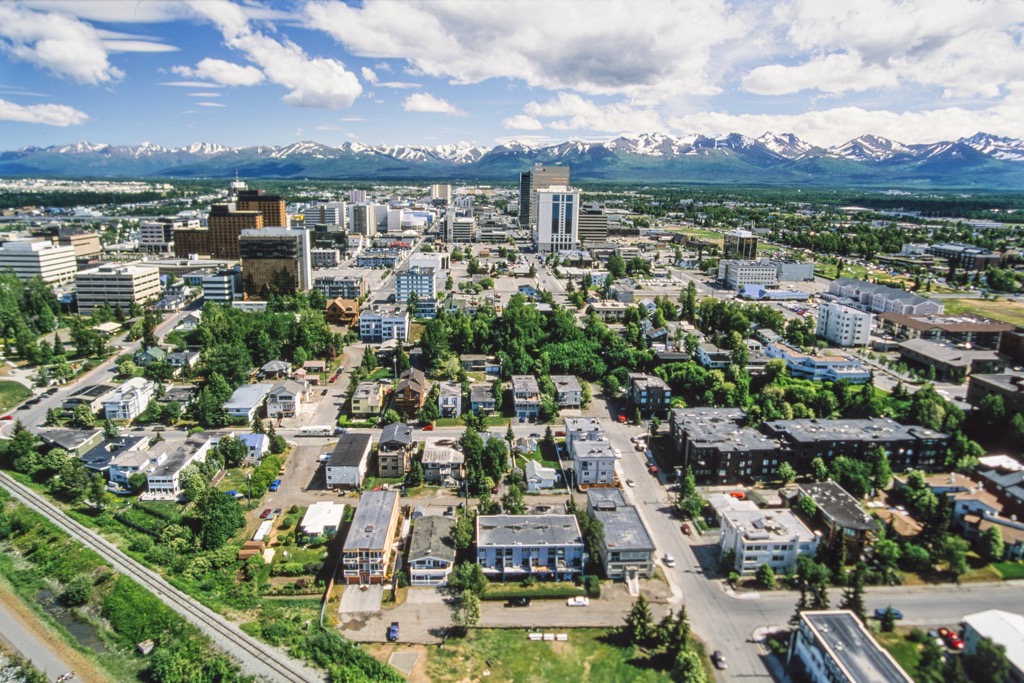
Home to roughly 292,000 residents, Anchorage marks the most populous city in the state, containing roughly 40% of the state’s population. Situated along the Cook Inlet, the city often acts as a refueling spot for international cargo flights.
Despite its relatively large population, Anchorage is surrounded by the expansive frontier that defines Alaska. The Chugach State Park lies east of the city while the Kenai National Wildlife Refuge is to the south. The Denali Wilderness is situated to the north while Lake Clark National Park and Preserve to the west.
Along with seemingly endless opportunities for outdoor recreation, Anchorage is also home to numerous museums. Visitors can check out the Alaska Native Heritage Center and the Alaska Museum of Natural History on their next visit.


